Perry-Castañeda Library
Map Collection
Botswana Maps
The following maps were produced by the U.S. Central Intelligence Agency, unless otherwise indicated.
Country Maps- Botswana (Political) 2005 (344K)
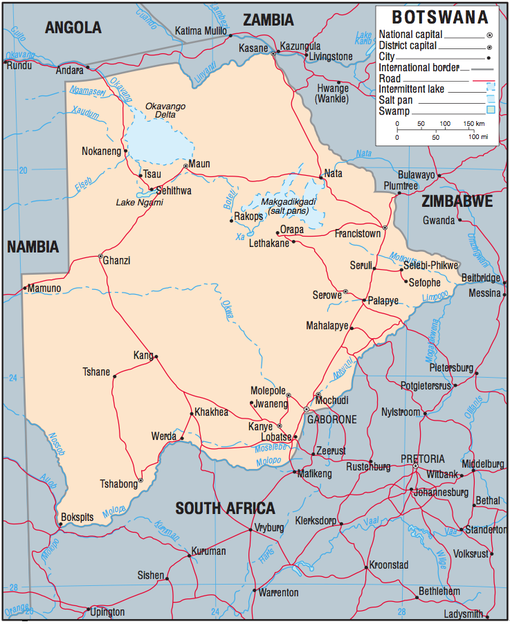
- Botswana (Political) 1995 (385K) and pdf format (388K)
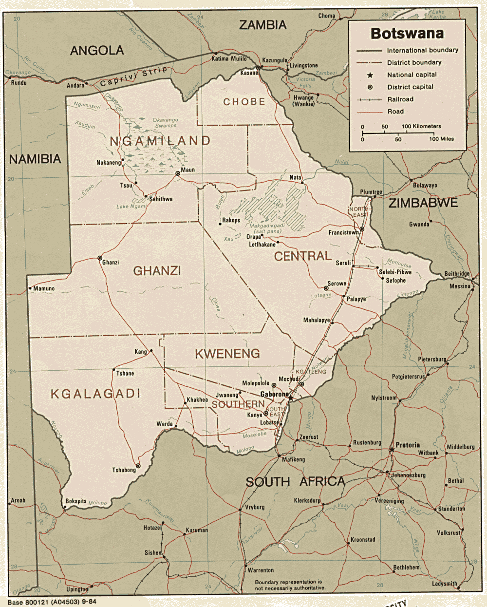
- Botswana (Political) 1984 (277K) and pdf format (304K)
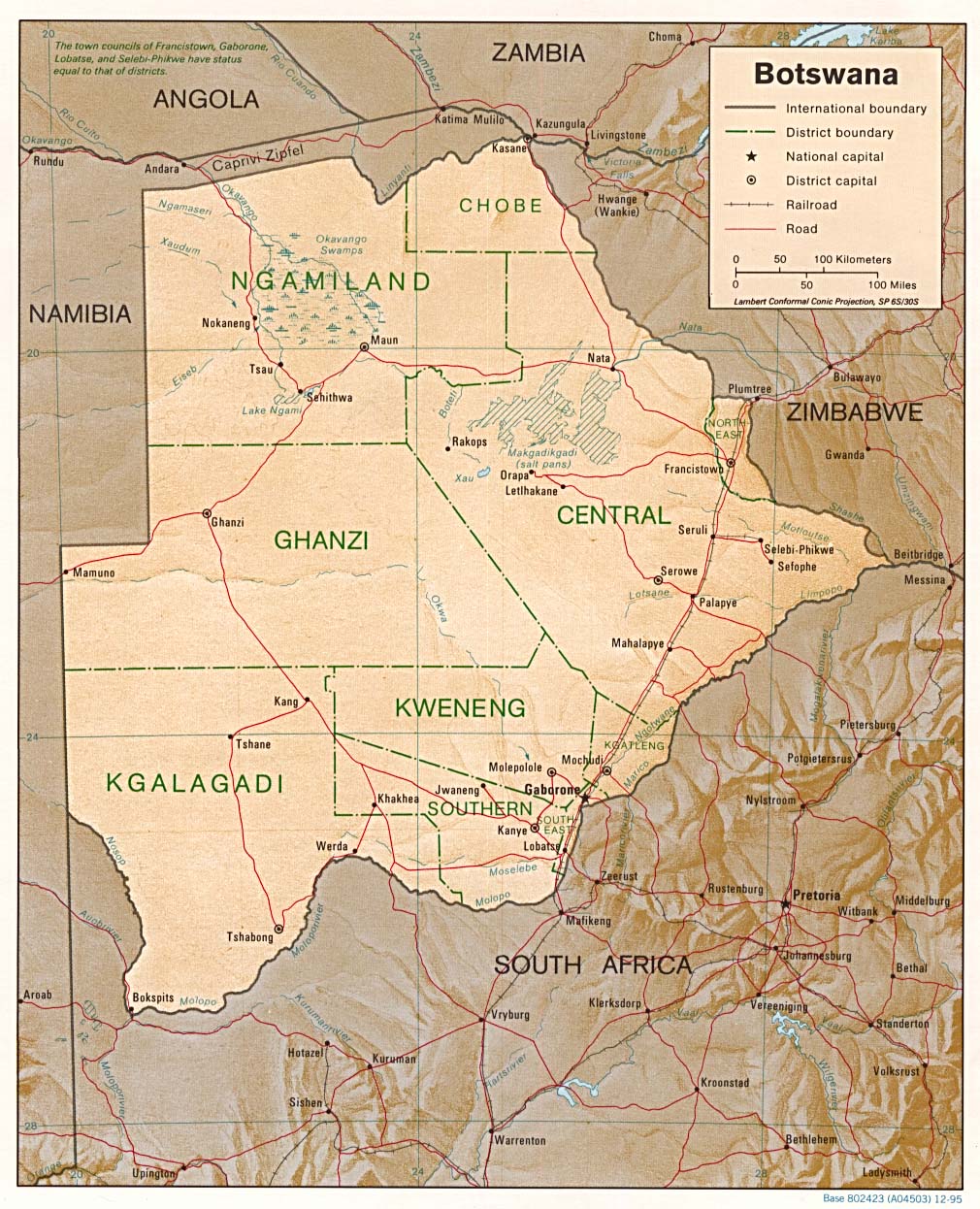
- Botswana (Shaded Relief) 1995 (285K) and pdf format (288K)
- Botswana (Small Map) 2016 (27.2K)
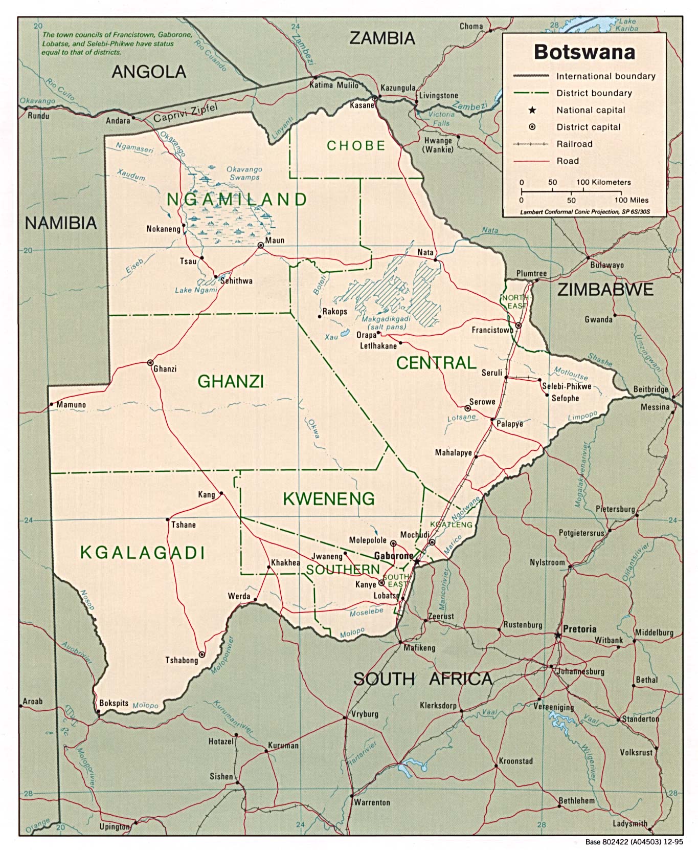
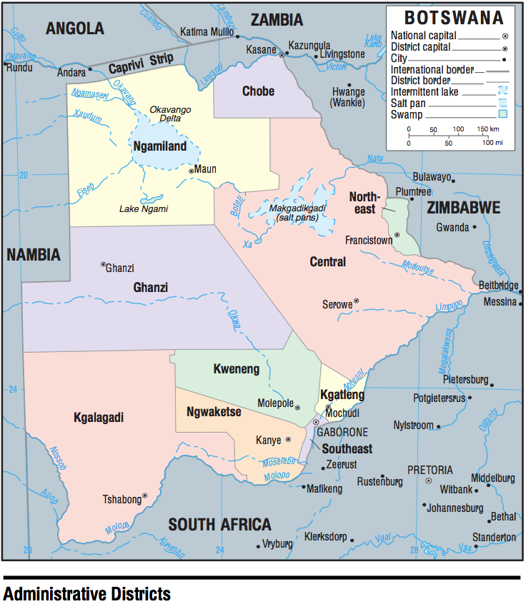
- Botswana (Administrative Districts) 2005 (242K)
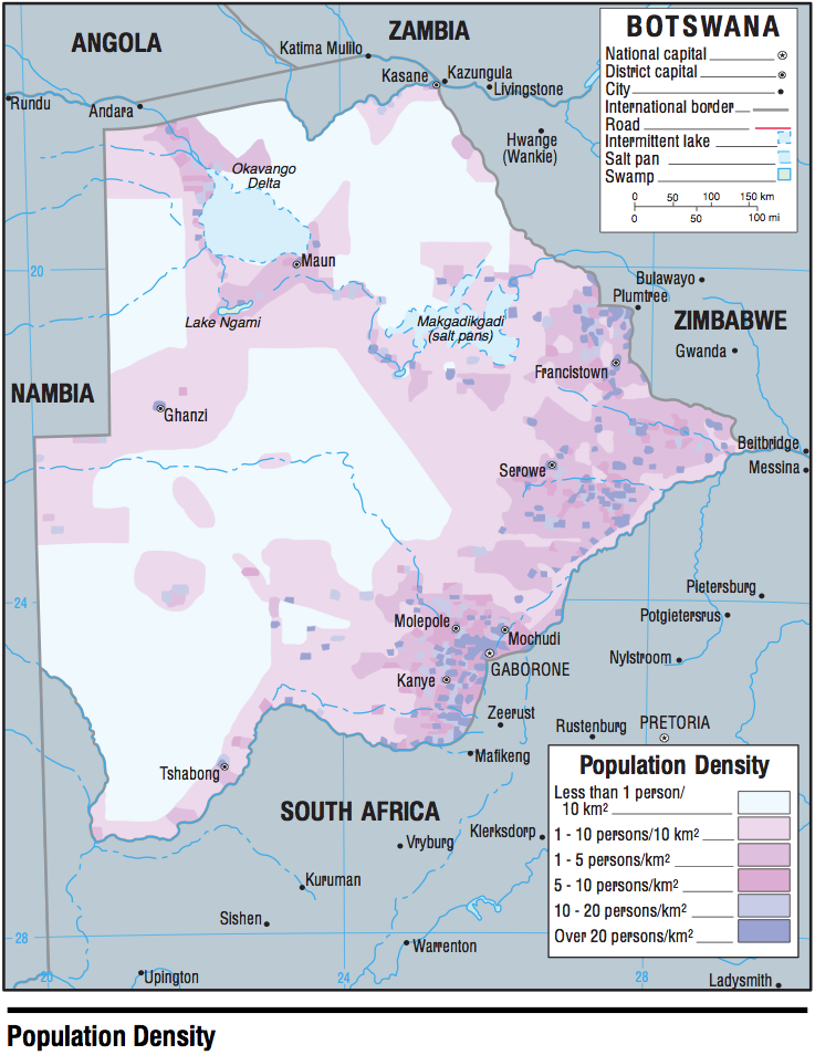
- Botswana - Population Density 2005 (268K)
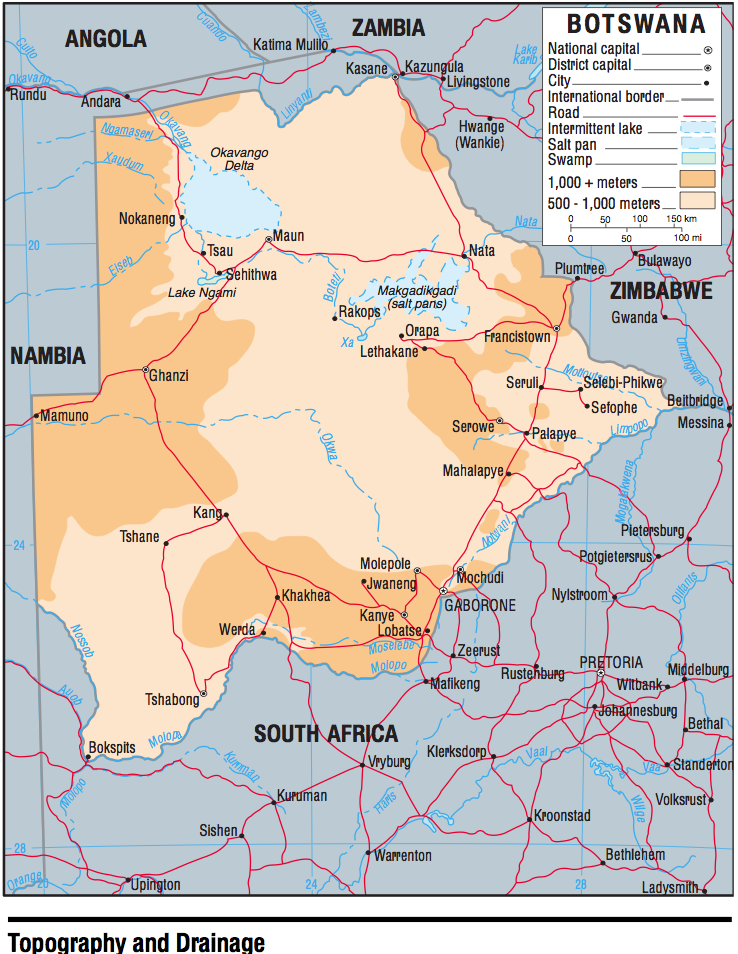
- Botswana - Topography and Drainage 2005 (365K)
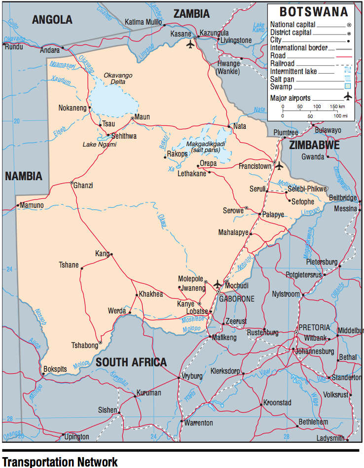
- Botswana - Transportation 2005 (374K)
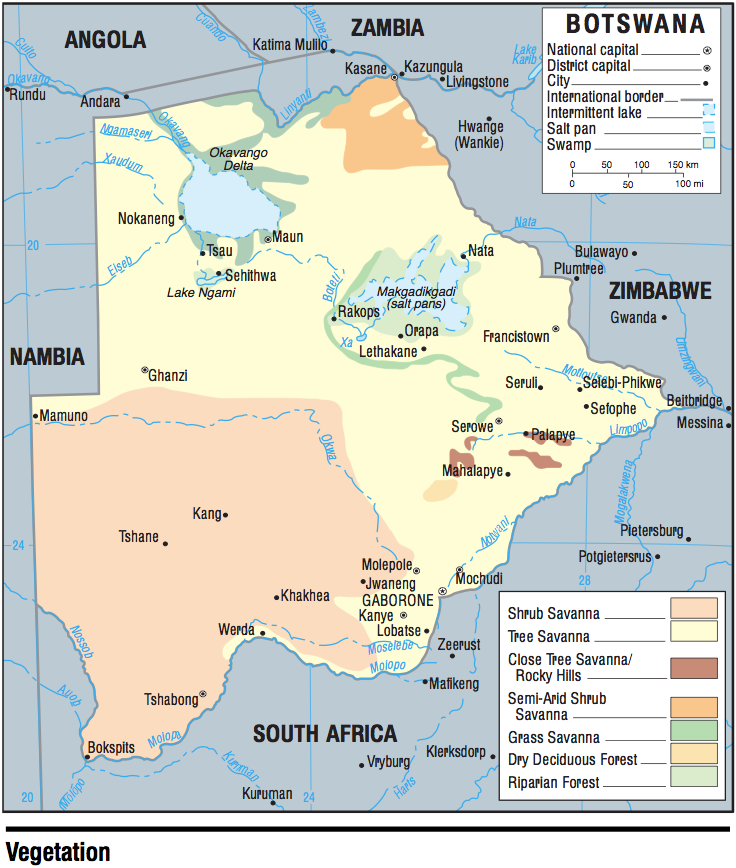
- Botswana - Vegetation 2005 (258K)
- 1:2,000,000 - Africa Topographic Maps U.S. Army Map Service
- Sheets 30, 33 and 34 cover Botswana
- 1:1,000,000 - Operational Navigation Chart Series U.S. Defense Mapping Agency Aerospace Center. Not for navigational use
- Sheets P-4, Q-4 and Q-5 cover all of Botswana
- 1:1,000,000 - International Map of the World U.S. Army Map Service
- Sheets SE 35 and SG 35 cover southeastern Botswana. Clickable map
- 1:500,000 - Tactical Pilotage Charts U.S. National Imagery and Mapping Agency. Not for navigational use
- This series covers part of northern Botswana
- 1:250,000 - Joint Operations Graphic, Southern Africa
- Sheets SG 35-2 (Gaborone) and SE 34-14 (Tsumkwe) cover parts of Botswana
- Sheets 30, 33 and 34 cover Botswana
Maps on Other Web Sites