Perry-Castañeda Library
Map Collection
Republic of the Congo / Congo (Brazzaville) Maps
The following maps were produced by the U.S. Central Intelligence Agency, unless otherwise indicated.
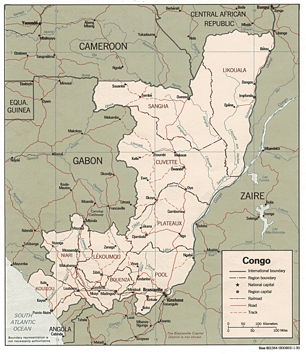
Country Maps- Congo, Republic of the (Political) 1990 (310K) and pdf format (337K)
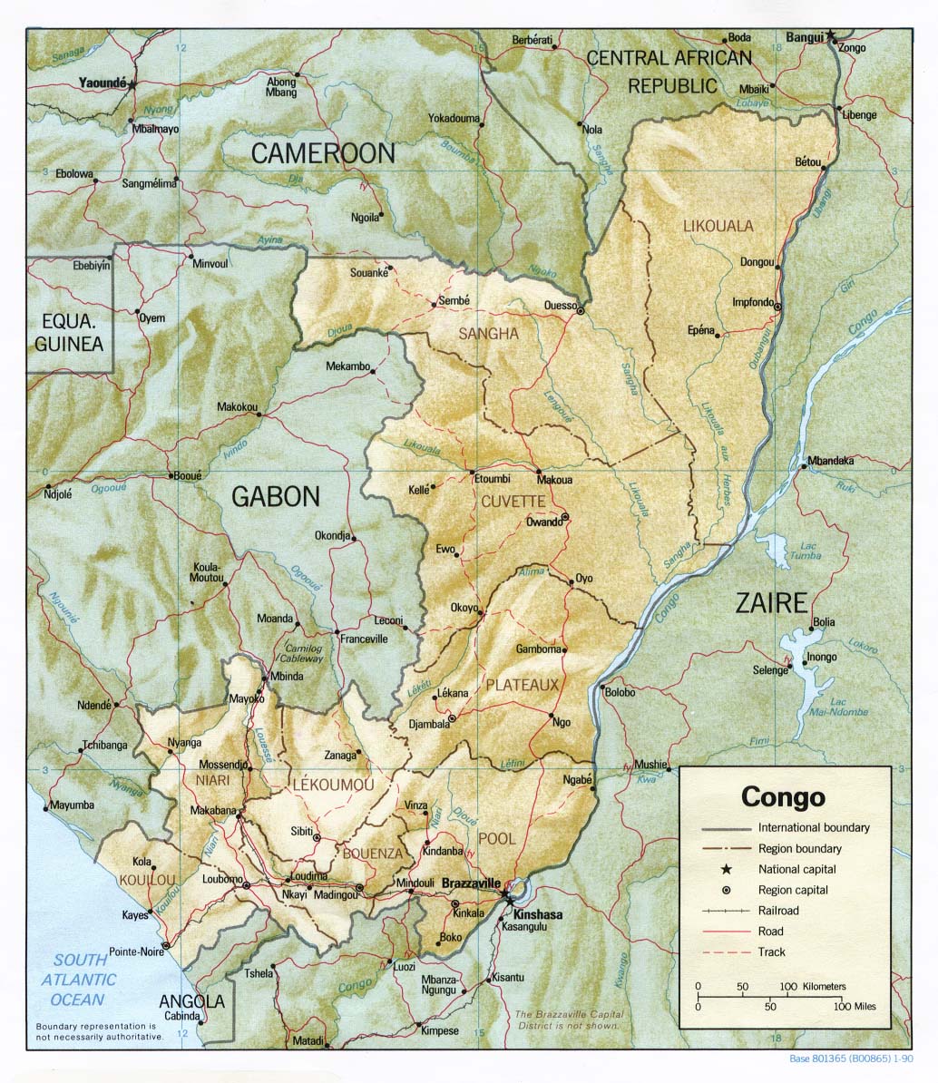
- Congo, Republic of the (Shaded Relief) 1990 (265K) and pdf format (274K)
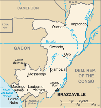
- Congo, Republic of the (Small Map) 2016 (24.3k)
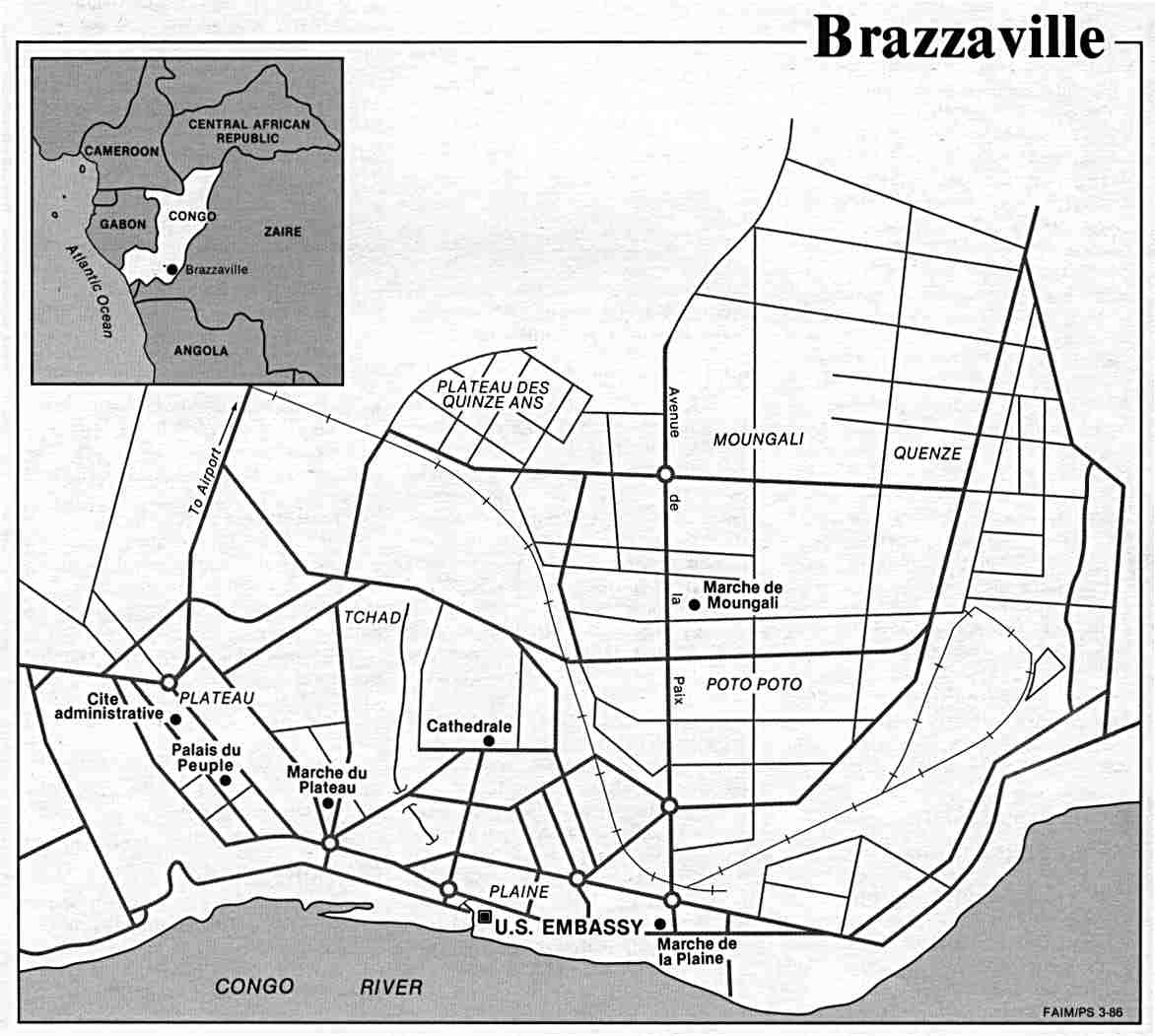
- Brazzaville U.S. Department of State, 1986 (73K)
- 1:2,000,000 - Africa Topographic Maps, Series 2201 U.S. Army Map Service Sheets 22, 23 and 26 cover the Republic of the Congo
- 1:1,000,000 - Operational Navigation Chart Series U.S. Defense Mapping Agency Aerospace Center. Not for navigational use
- Sheets L-3, L-4 and M-3 cover all of Congo
- 1:1,000,000 - International Map of the World U.S. Army Map Service. Includes most of the Republic of the Congo. Clickable index map
- 1:500,000 - Tactical Pilotage Charts U.S. National Imagery and Mapping Agency. Not for navigational use
- This series covers southern portion of Congo
- 1:250,000 - Joint Operations Graphic (Air) Series 1501, U.S. Defense Intelligence Agency Not for navigational use
- Includes much of the Republic of Congo. Courtesy of T. R. Smith Map Collection, University of Kansas Libraries
- Sheets L-3, L-4 and M-3 cover all of Congo
Related Maps on Other Web Sites