Perry-Castañeda Library
Map Collection
Djibouti Maps
The following maps were produced by the U.S. Central Intelligence Agency, unless otherwise indicated.
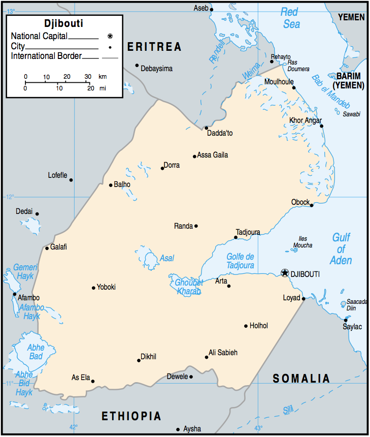
Country Maps- Djibouti (Political) 2002 (176K)
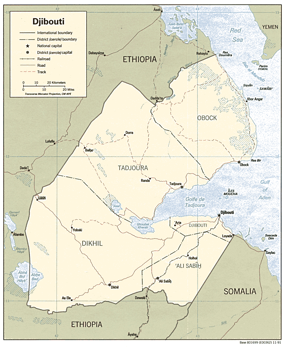
- Djibouti (Political) 1991 (240K)and pdf format (259K)
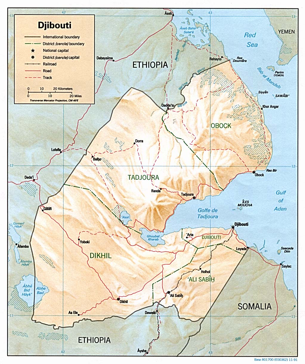
- Djibouti (Shaded Relief) 1991 (250K)and pdf format (254K)
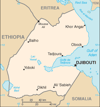
- Djibouti (Small Map) 2016 (8.3K)
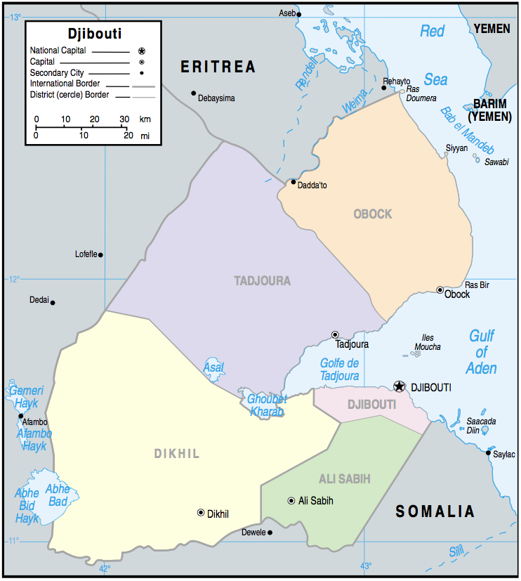
- Djibouti (Administrative Districts) 2002 (156K)
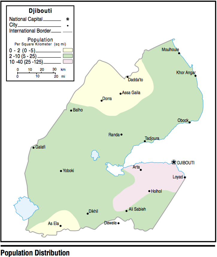
- Djibouti - Population 2002 (99K)
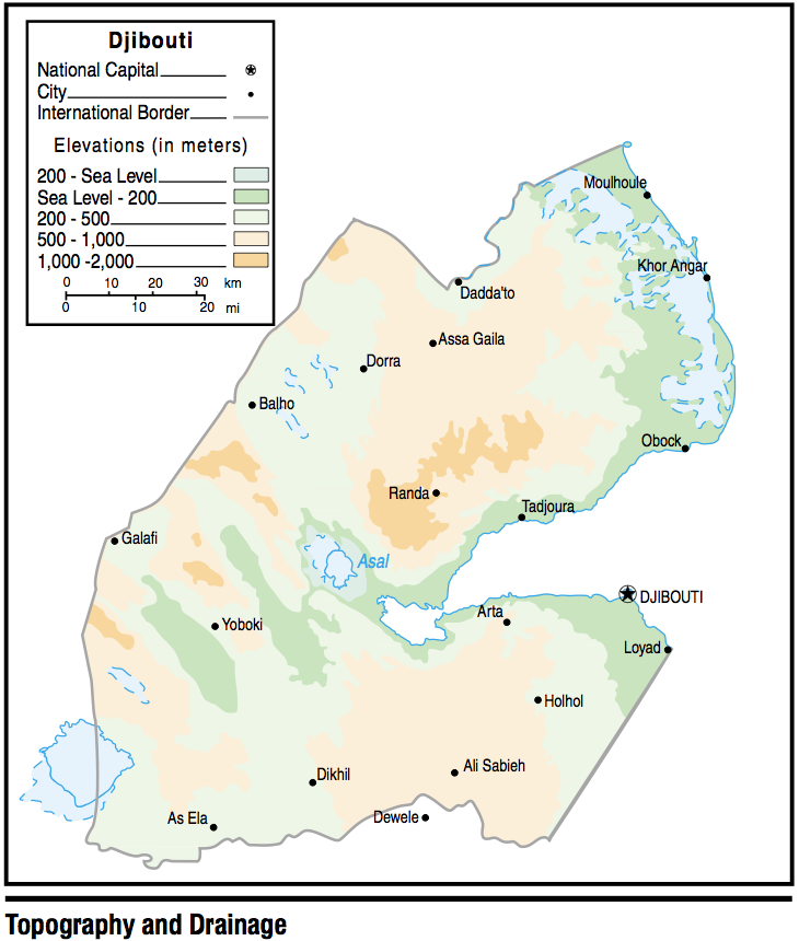
- Djibouti - Topography and Drainage 2002 (158K)
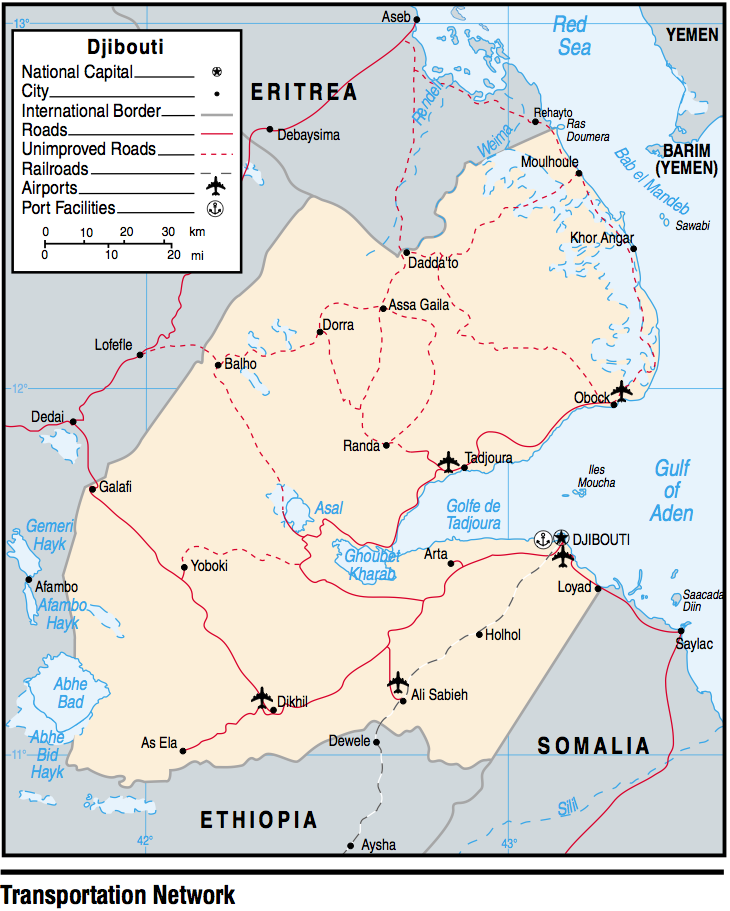
- Djibouti - Transportation 2002 (237K)
- 1:2,000,000 - Africa Topographic Maps U.S. Defense Mapping Agency
- This series covers all of Djibouti
- 1:2,000,000 - Northern Somalia [covers most of Djibouti] (1.75MB) and map key and scale (345K).
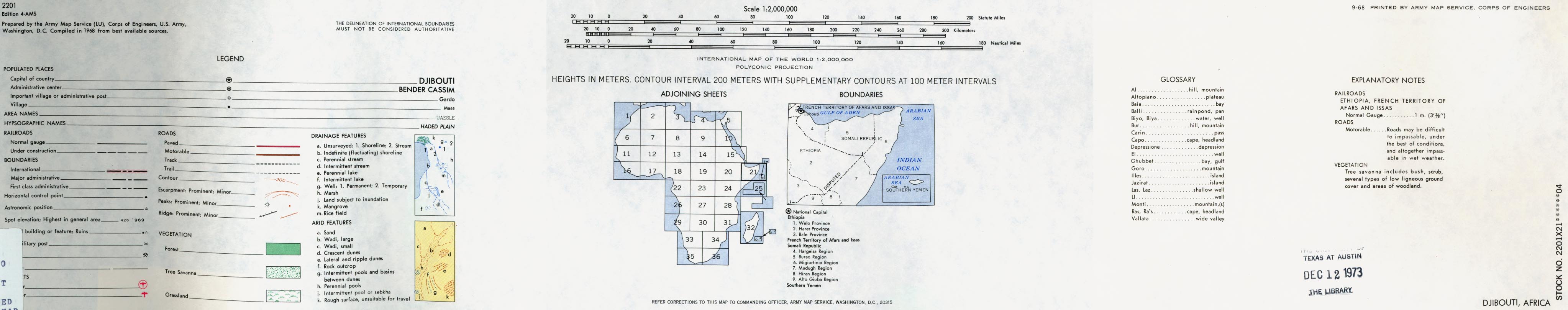
- Portion of AMS Series 2201, Sheet 21 "Djibouti". Published by the U.S. Army Map Service, 1968. See link above for entire series
- 1:1,000,000 - Operational Navigation Chart Series U.S. Defense Mapping Agency Aerospace Center. Not for navigational use
- Sheets K-5 and K-6 include all of Djibouti
- 1:1,000,000 - International Map of the World U.S. Army Map Service
- This series covers much of Djibouti. Clickable map
- 1:500,000 - Tactical Pilotage Charts U.S. National Imagery and Mapping Agency. Not for navigational use
- This series covers Djibouti
- 1:500,000 - East Africa Topographic Maps Series Y401 (GSGS 4335), U.S. Army Map Service, 1958-
- This series covers all of Djibouti
- 1:500,000 - World Series 1404, Great Britain. War Office and Air Ministry. 1958-
- This series covers all of Djibouti
- 1:250,000 - East Africa Series Y502, U.S. Army Map Service. Not for navigational use
- This series covers Djibouti
- This series covers all of Djibouti
![1:2,000,000 - Northern Somalia [covers most of Djibouti]](africa/djibouti_1968.jpg)
Maps on Other Web Sites