Perry-Castañeda Library
Map Collection
Gabon Maps
The following maps were produced by the U.S. Central Intelligence Agency, unless otherwise indicated.
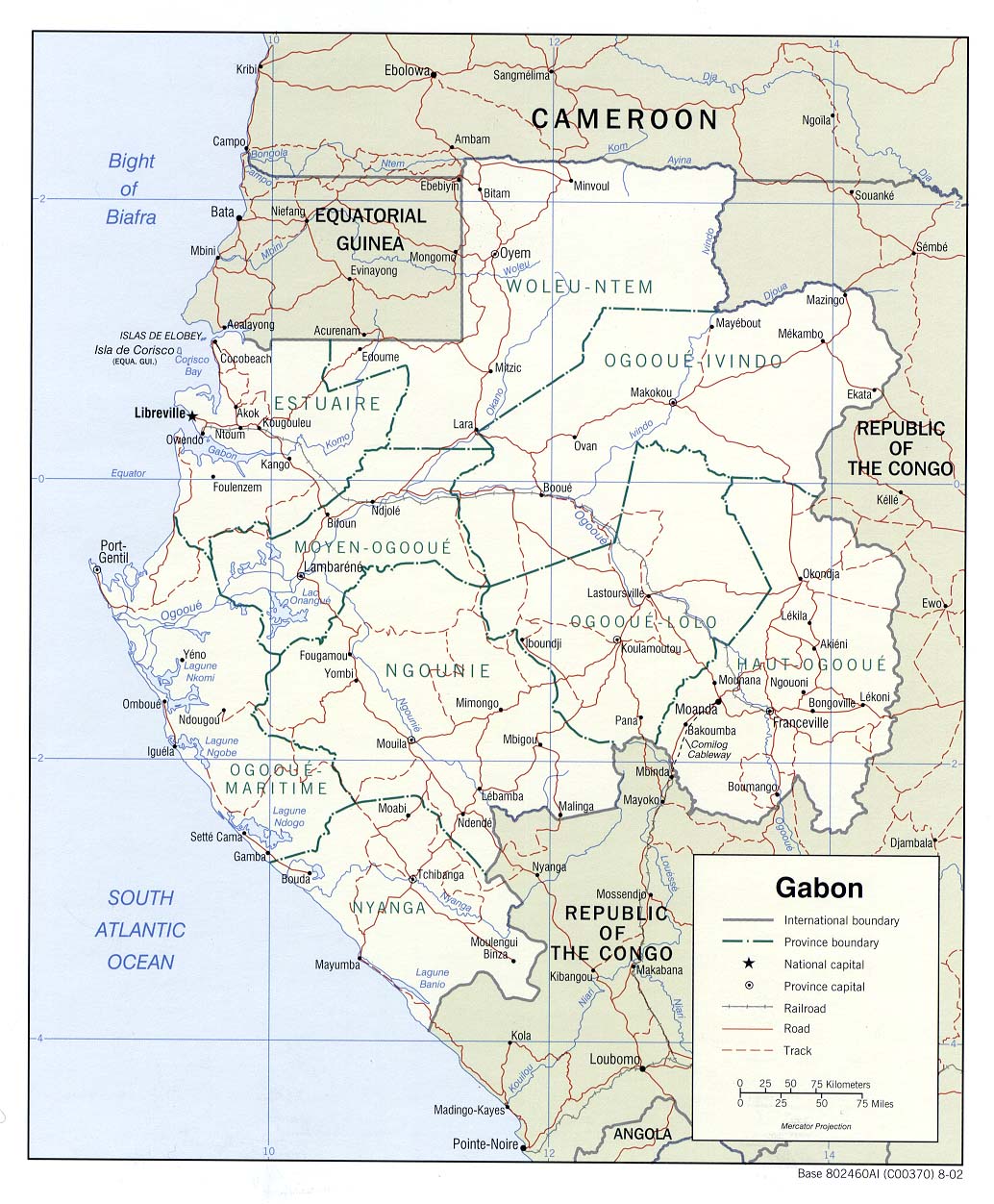
Country Maps- Gabon (Political) 2002 (256K) and pdf format (264K)
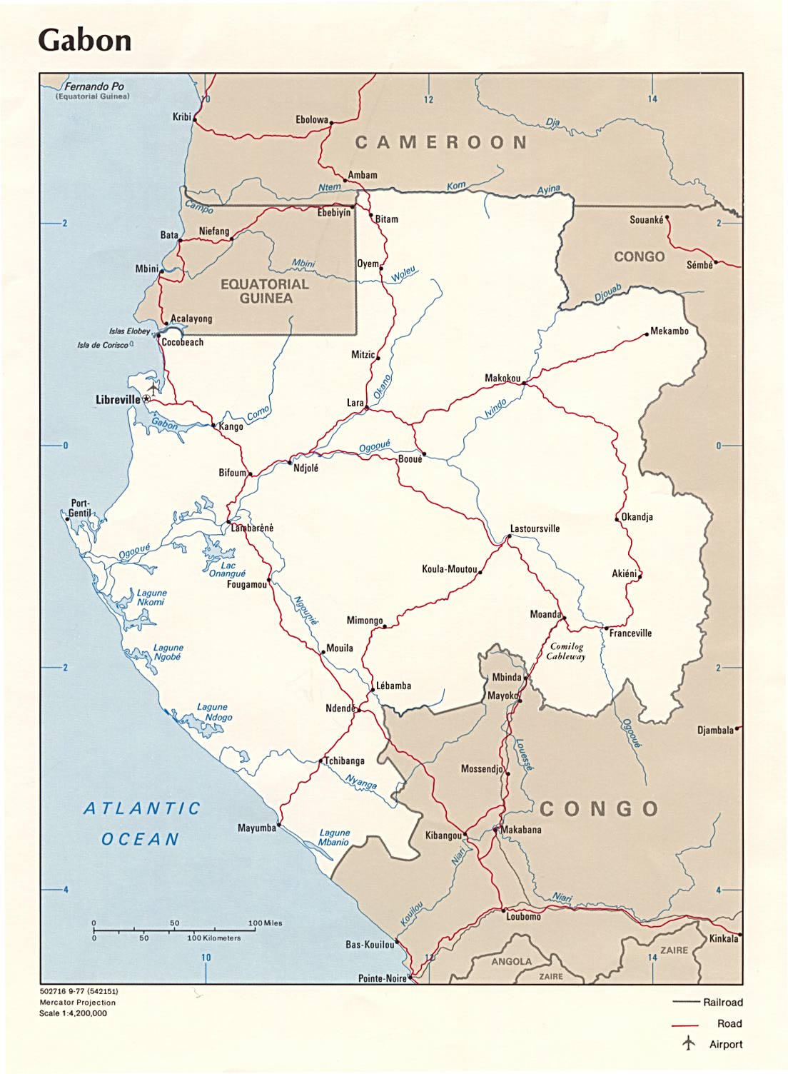
- Gabon (Political) 1977 (164K) and pdf format (183K)
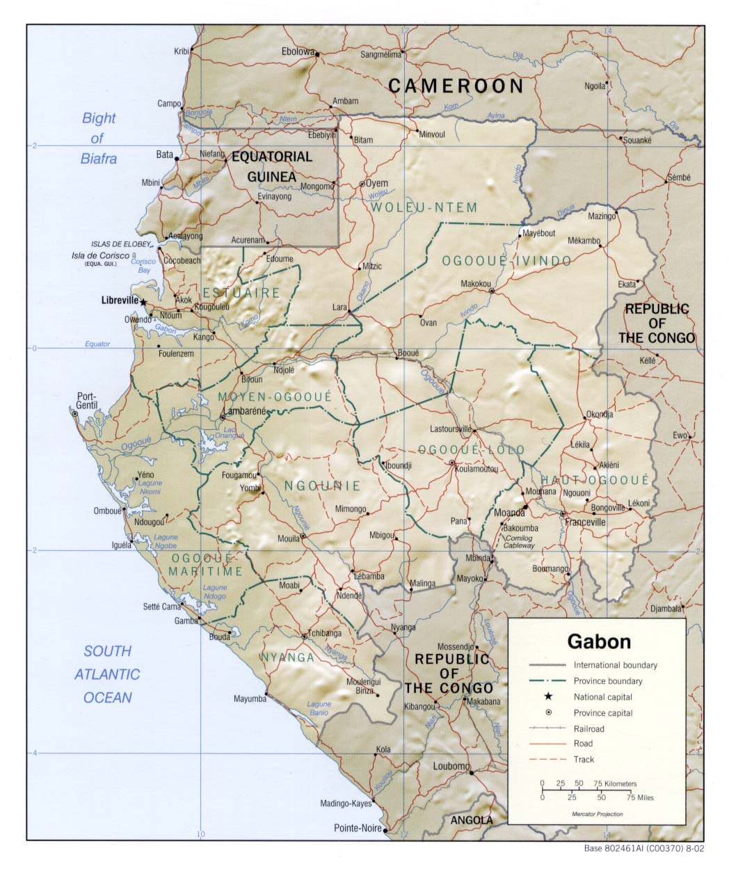
- Gabon (Shaded Relief) 2002 (196K) and pdf format (203K)
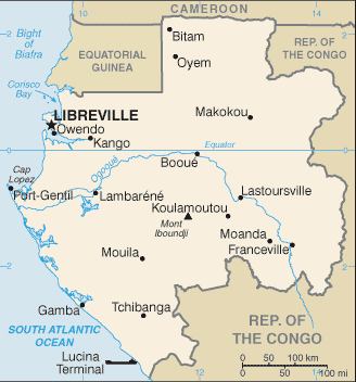
- Gabon (Small Map) 2016 (8.5K)
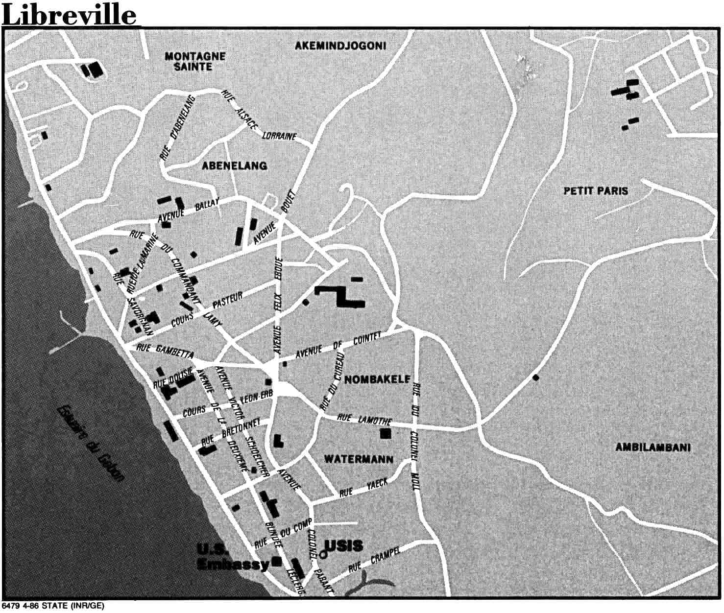
- Libreville U.S. Dept. of State 1986 (226K)
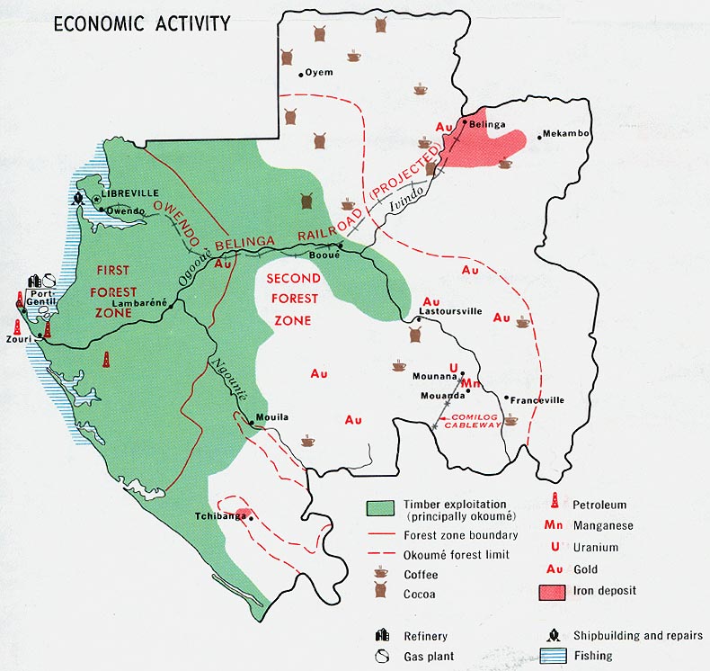
- Gabon - Economic Activity from Map No. 56867 1968 (136K)
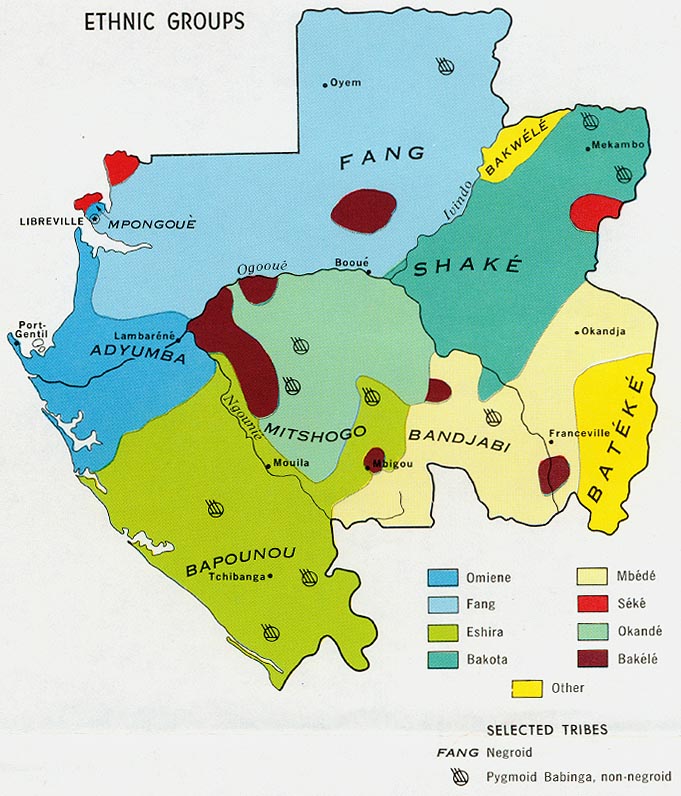
- Gabon - Ethnic Groups from Map No. 56867 1968 (135K)
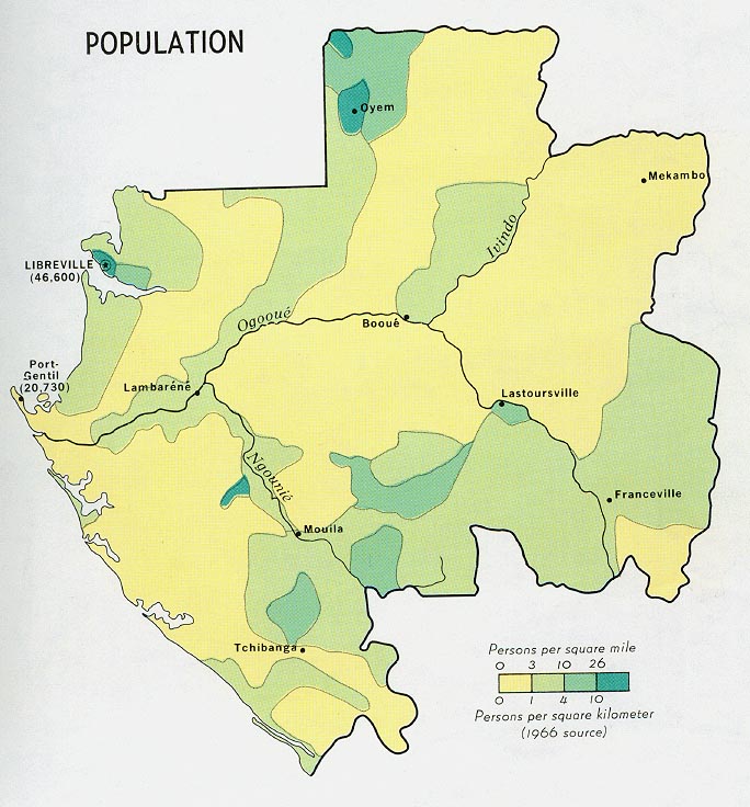
- Gabon - Population from Map No. 56867 1968 (118K)
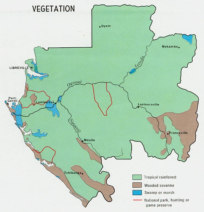
- Gabon - Vegetation from Map No. 56867 1968 (122K)
- 1:2,000,000 - Africa Topographic Maps U.S. Army Map Service
- Sheet 22 includes Gabon
- 1:1,000,000 - Operational Navigation Chart Series U.S. Defense Mapping Agency Aerospace Center. Not for navigational use
- Sheets L-3 and M-3 include all of Gabon
- 1:1,000,000 - International Map of the World U.S. Army Map Service
- This series includes part of Gabon
- 1:500,000 - Tactical Pilotage Charts U.S. National Imagery and Mapping Agency. Not for navigational use
- This series covers part of Gabon
- 1:250,000 - Joint Operations Graphic - Central Africa Series 1501, U.S. Defense Intelligence Agency Not for navigational use
- Five maps cover part of the southern border region of Gabon. The three maps listed below are in the same series.
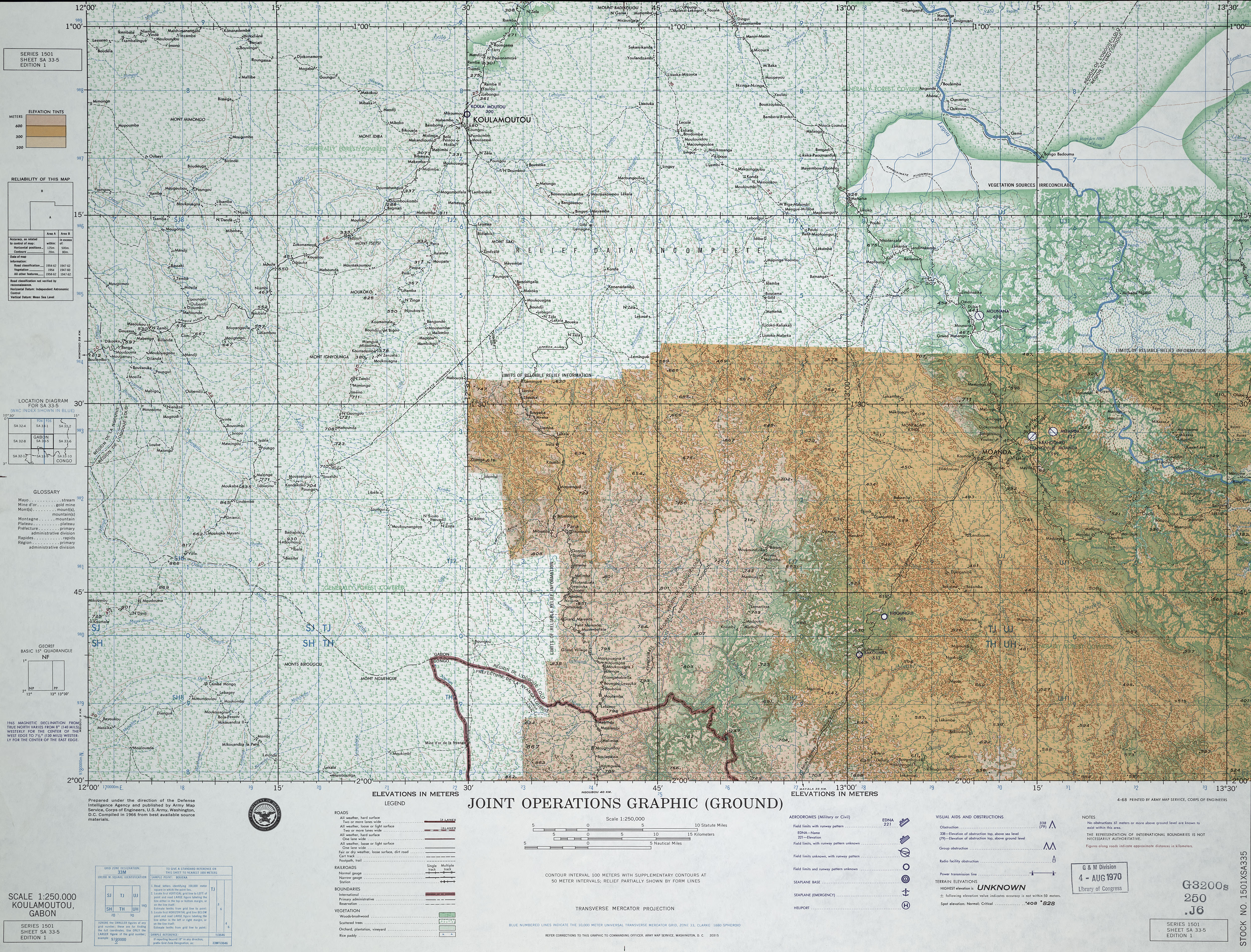
- 1:250,000 - Koulamoutou (Joint Operations Graphic) U.S. Army Map Service, Sheet SA 33-5 Koulamoutou, Gabon (6.4MB) This map is from the collection of the Library of Congress, Geography and Map Division Not for navigational use
- 1:250,000 - Libreville (Joint Operations Graphic) U.S. National Geospatial-Intelligence Agency, Sheet NA 32-15 Libreville, Gabon; Equatorial Guinea, 1975 [GeoPDF] (10.8MB) Not for navigational use
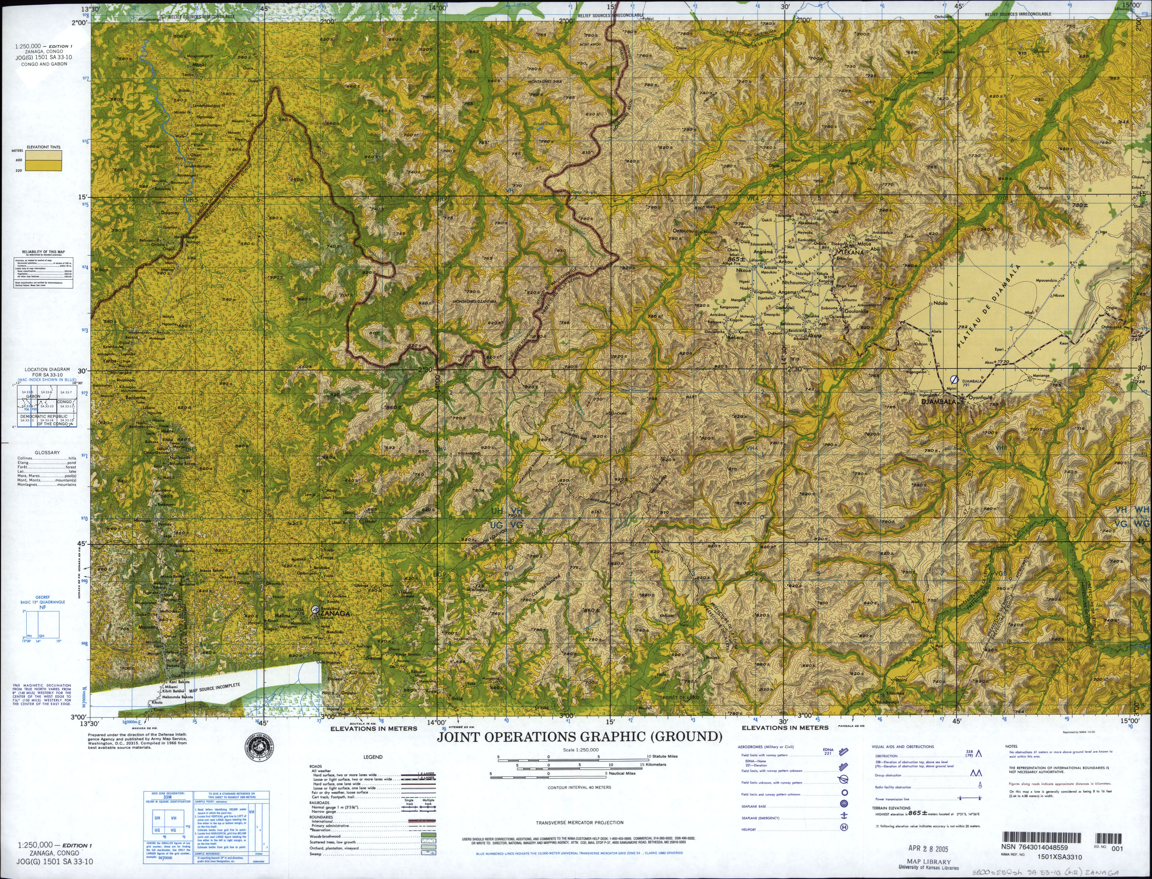
- 1:250,000 - Zanaga (Joint Operations Graphic) U.S. National Imagery and Mapping Agency, Sheet SA 33-10 Zanaga, Congo; Gabon (3.9 MB) Not for navigational use
- Sheet 22 includes Gabon
Maps on Other Web Sites