Perry-Castañeda Library
Map Collection
Maldives Maps
The following maps were produced by the U.S. Central Intelligence Agency, unless otherwise indicated.
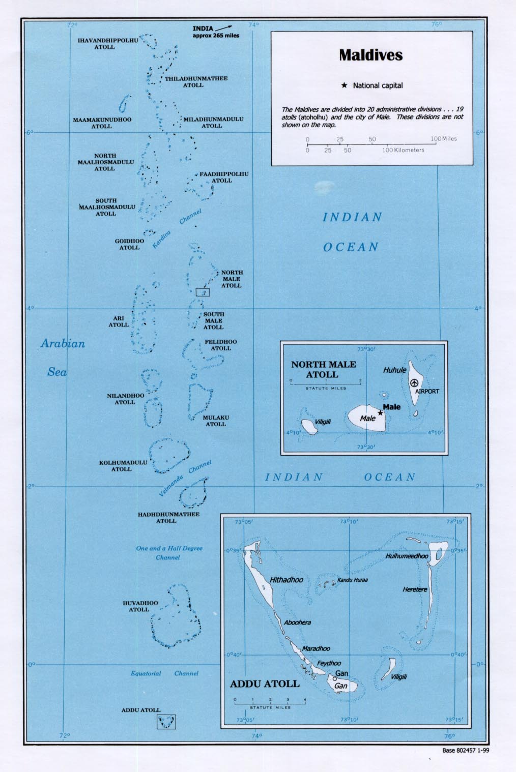
Country Maps- Maldives (Political) 1999 (258K) and pdf format (173K)
- Maldives from Indian Ocean Atlas, 1976 (166K)
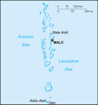
- Maldives (Small Map) 2016 (5K)
- Maldives - Addu Atoll from Indian Ocean Atlas, 1976 (56K)
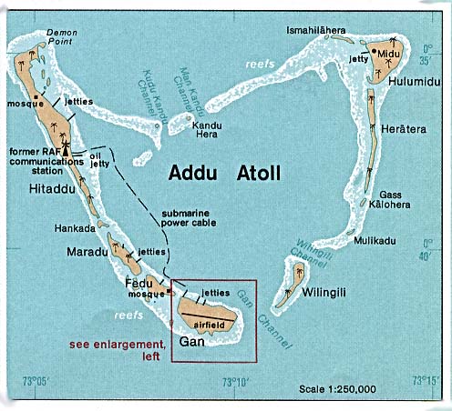
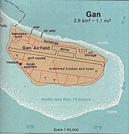
- Maldives - Gan from Indian Ocean Atlas, 1976 (38K)
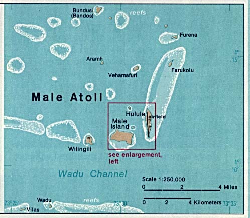
- Maldives - Male Atoll from Indian Ocean Atlas, 1976 (44K)
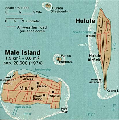
- Maldives - Male Island and Hulule from Indian Ocean Atlas, 1976 (37K)
- 1:1,000,000 - Operational Navigation Chart Series U.S. Defense Mapping Agency Aerospace Center. Sheets L-8 and M-8 include all of Maldives. Not for navigational use
- 1:500,000 - Tactical Pilotage Charts U.S. National Imagery and Mapping Agency. Not for navigational use
- This series covers Maldives
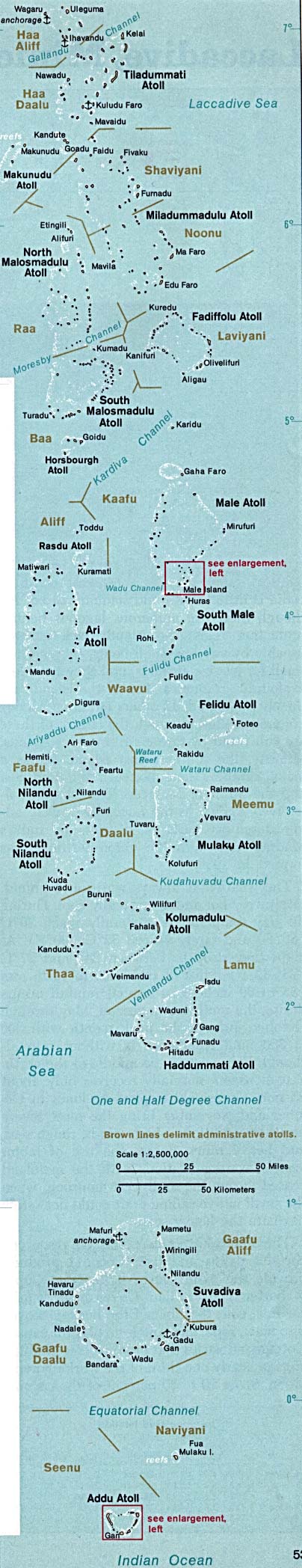
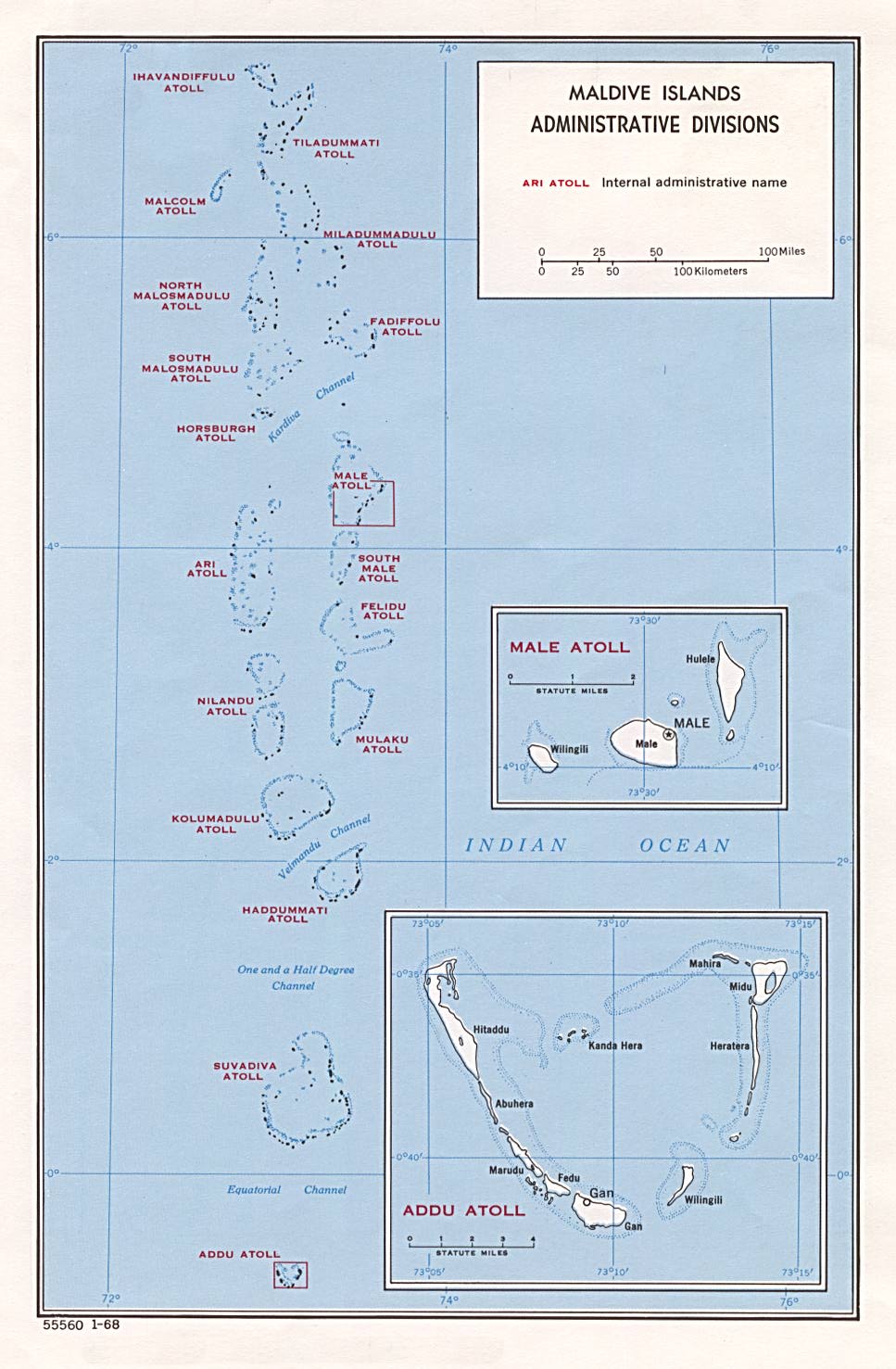
- Maldives (Administrative Divisions) 1968 (172K)
Maps on Other Web Sites