Perry-Castañeda Library
Map Collection
Montenegro Maps
The following maps were produced by the U.S. Central Intelligence Agency unless otherwise indicated.
Note: Montenegro declared independence on June 3, 2006.
Country Maps
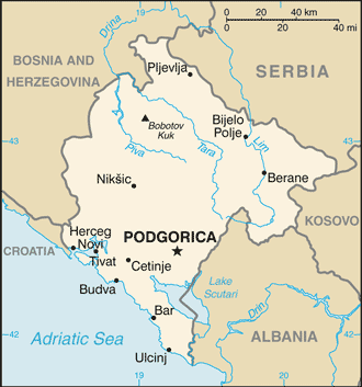
- Montenegro (Small Map) 2016 (18.9K)
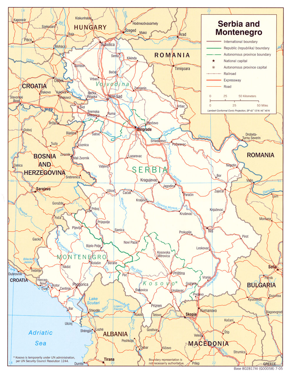
- Serbia and Montenegro (Political) 2005 (598K) and pdf format (701K)
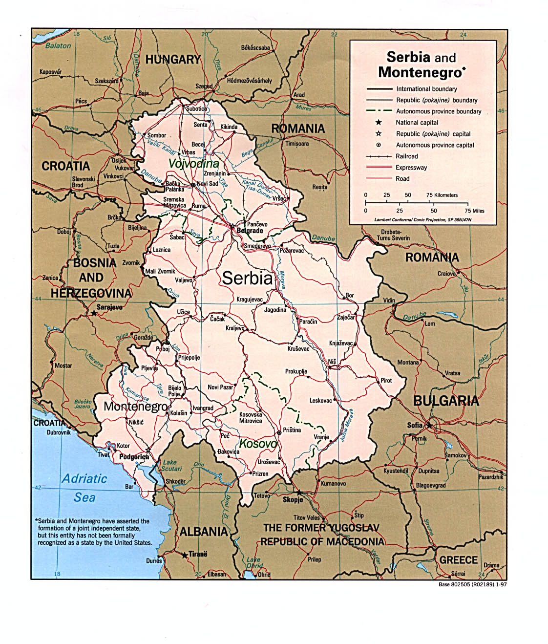
- Serbia and Montenegro (Political) 1997 (349K) and pdf format (330K)
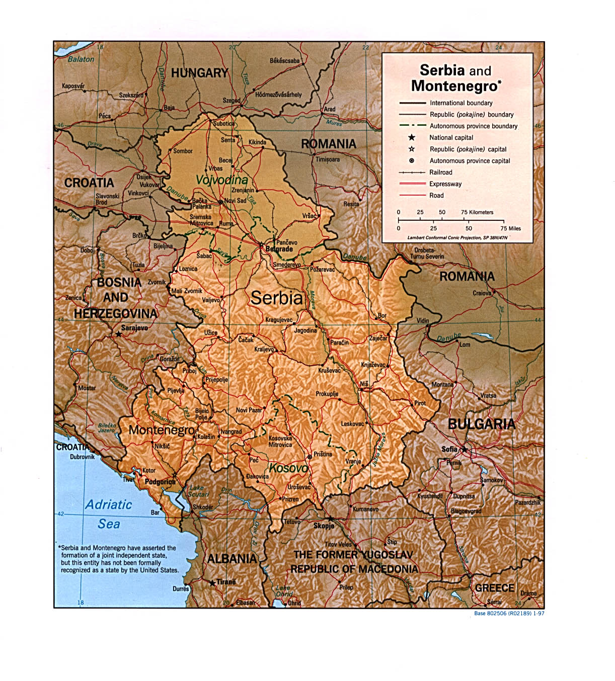
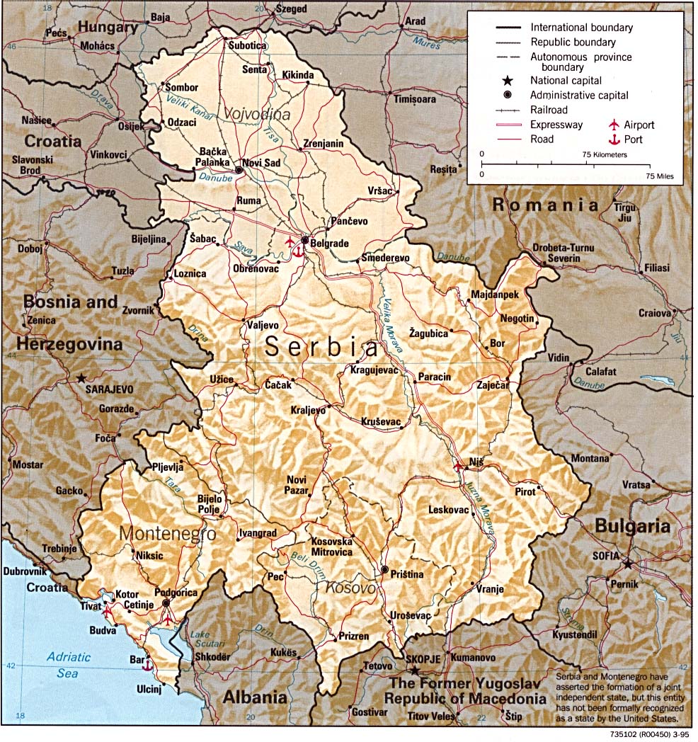
- Serbia and Montenegro (Shaded Relief) 1997 (391K) and pdf format (371K)
- Serbia and Montenegro (Shaded Relief) 1995 (306K)and pdf format (302K)
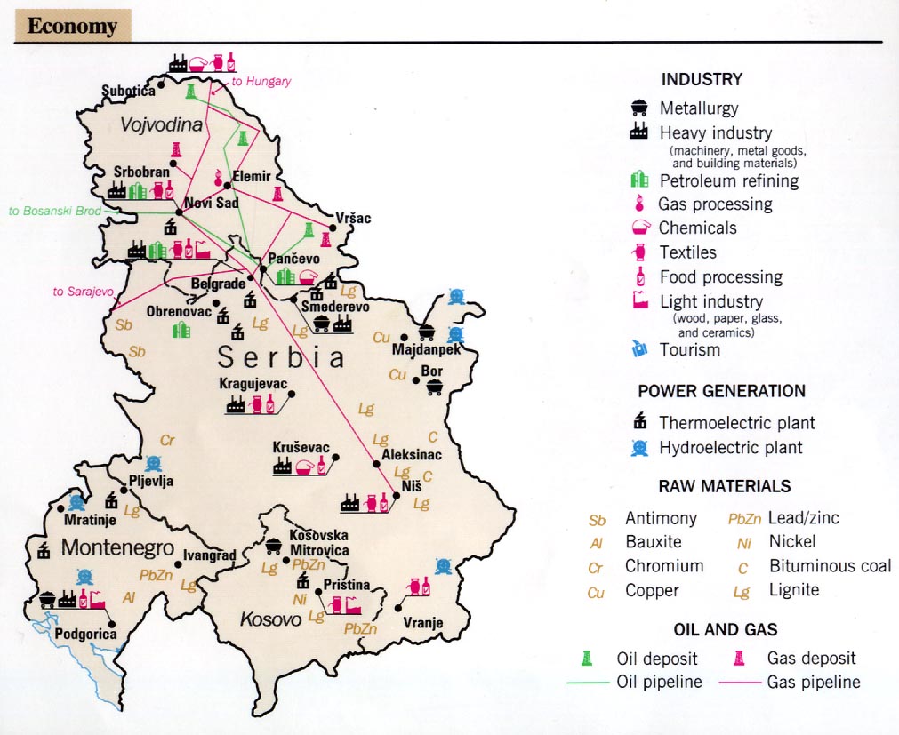
- Serbia and Montenegro - Economy From Former Yugoslavia: A Map Folio, 1992 (143K)
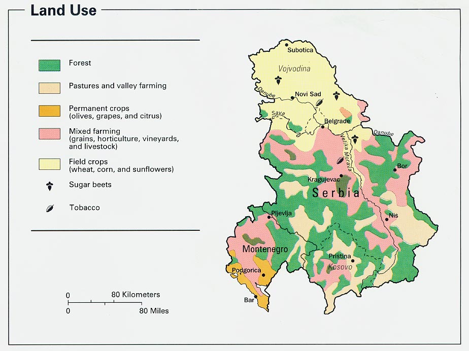
- Serbia and Montenegro - Land Use From Former Yugoslavia: A Map Folio, 1992 (133K)
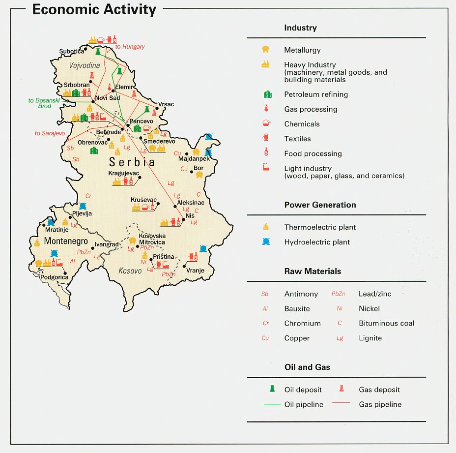
- Serbia and Montenegro - Economic Activity from Map No. 802165 1993 (154K)
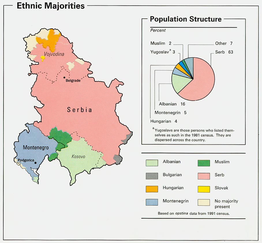
- Serbia and Montenegro - Ethnic Majorities from Map No. 802165 1993 (136K)
- Serbia and Montenegro - Land Use from Map No. 802165 1993 (129K)
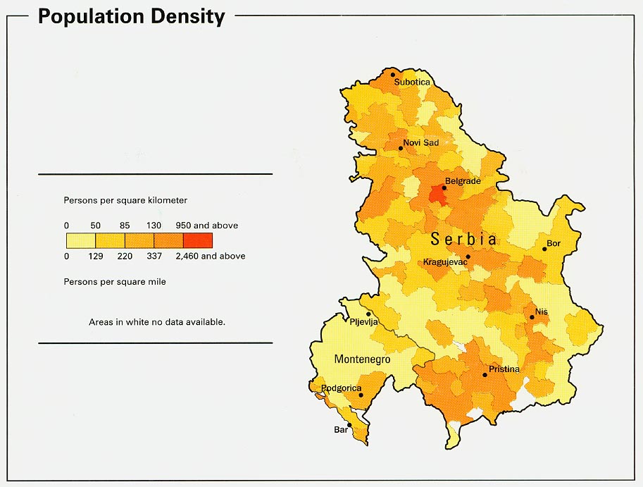
- Serbia and Montenegro - Population Density from Map No. 802165 1993 (115K)
- 1:1,000,000 - Operational Navigation Chart U.S. Defense Mapping Agency Aerospace Center, [Not for navigational use]
- Sheets F-2 and F-3 include Montenegro
- 1:500,000 - Tactical Pilotage Charts U.S. National Imagery and Mapping Agency. Not for navigational use
- This series covers Montenegro
- 1:250,000 - Western Europe Series M501, U.S. Army Map Service, 1959-
- This series includes all of Montenegro
- 1:50,000 - Former Yugoslavia Topographic Maps Series M709, U.S. Defense Mapping Agency
- This series includes all of Montenegro
- Sheets F-2 and F-3 include Montenegro
- Former Yugoslavia (Political) 1996 (162K)
- Former Yugoslavia (Political) 1995 (131K)
- Former Yugoslavia (Political) 1993 (146K)
- Former Yugoslavia (Shaded Relief) 1996 (1237K)
- Former Yugoslavia: A Map Folio
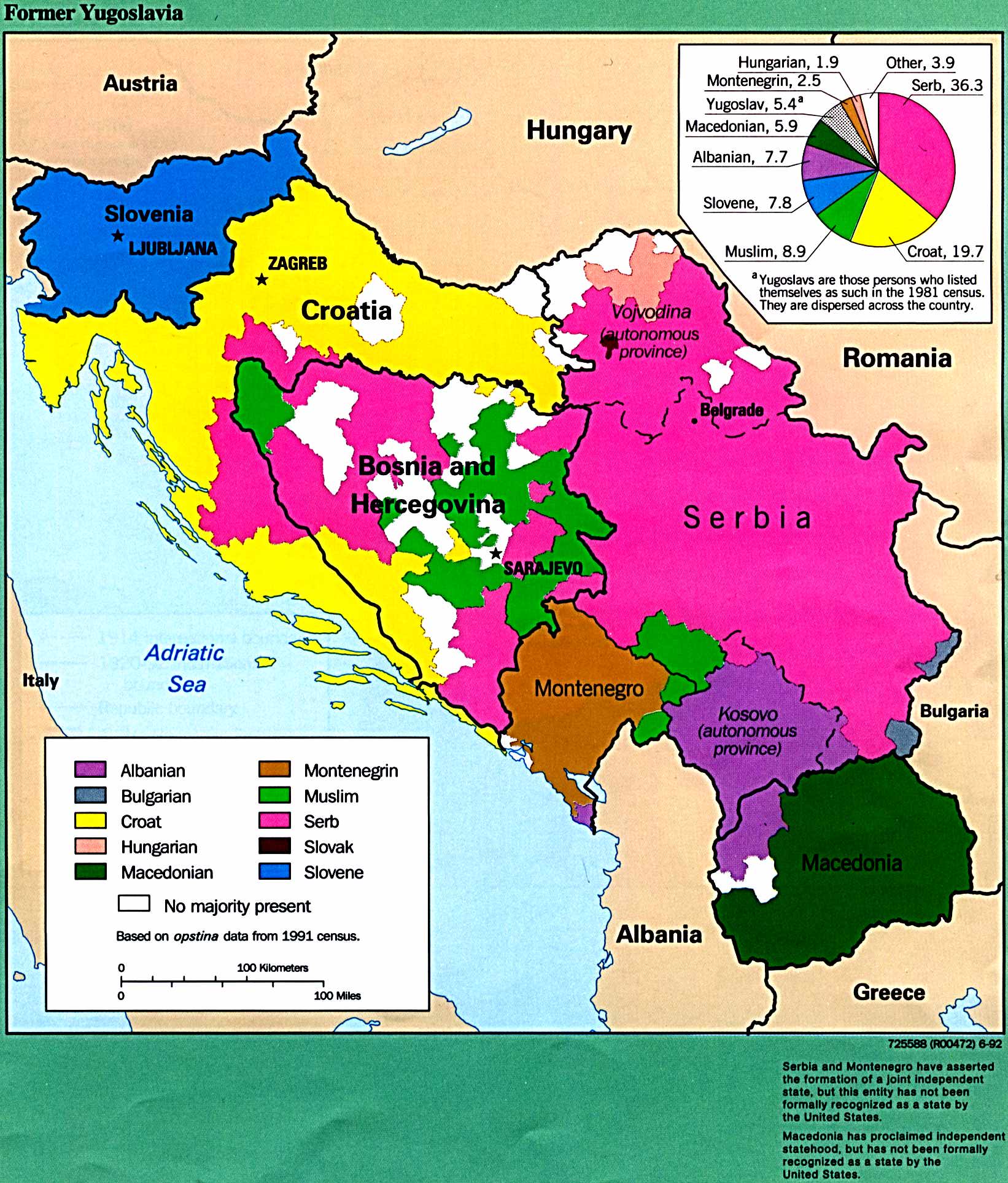
- Former Yugoslavia - Ethnic Majorities From Former Yugoslavia: A Map Folio, 1992 (412K)
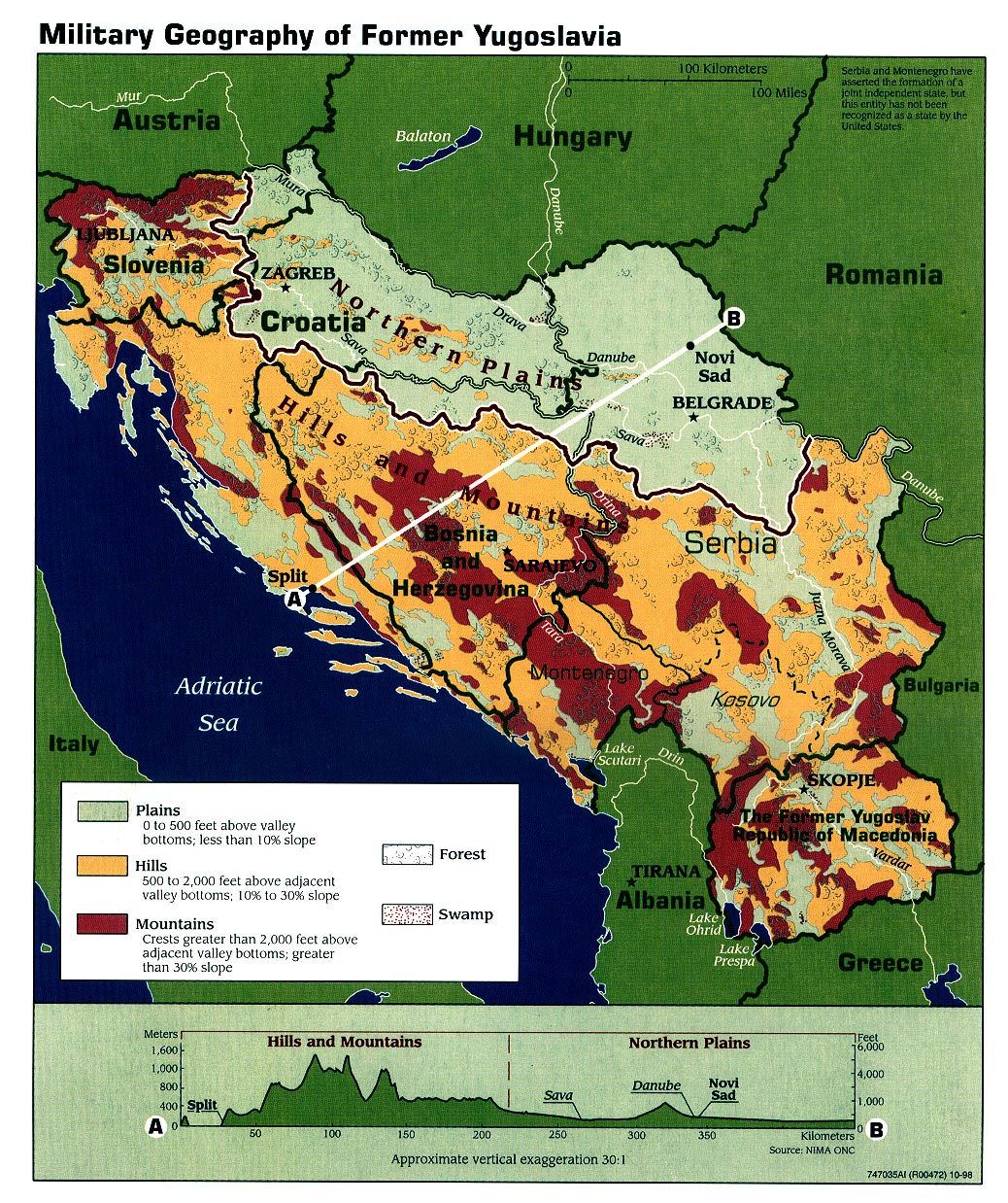
- Former Yugoslavia - Military Geography 1998 (581K)
Maps on Other Web Sites