Perry-Castañeda Library
Map Collection
Alabama Maps
State Maps
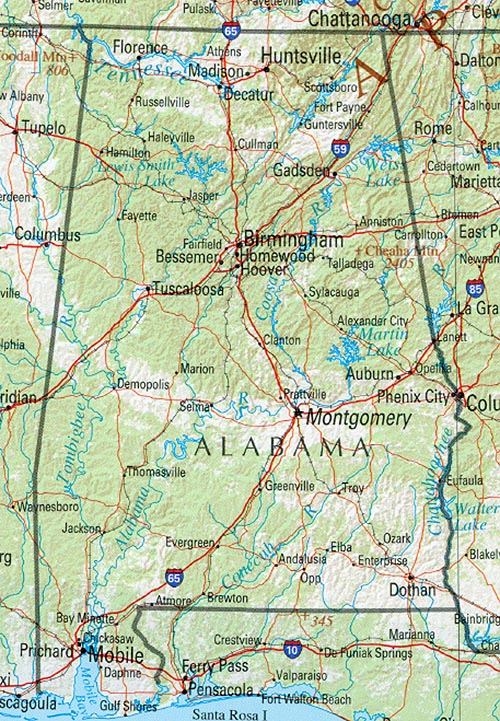
- Alabama (base map) JPEG format (451K) County boundaries and names, county seats, rivers. Original scale 1:2,500,000 U.S. Geological Survey, 1972 limited update 1990
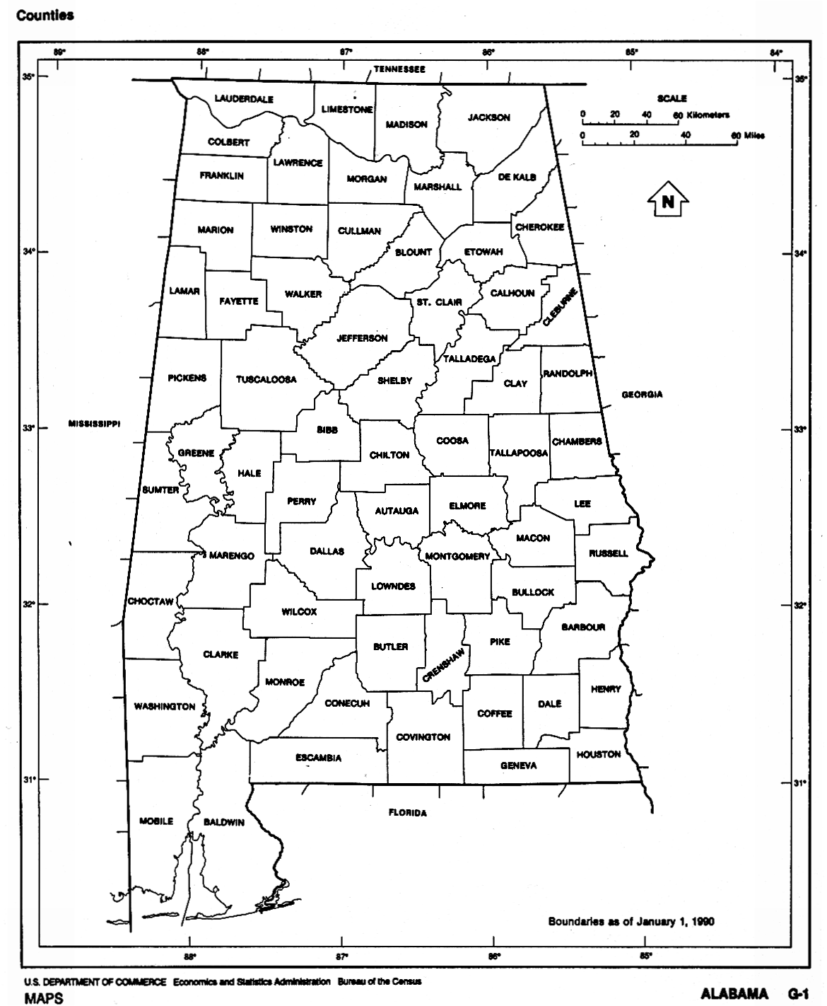
- Alabama (outline map) JPEG format (205K) County boundaries and names. U.S. Bureau of the Census, 1990
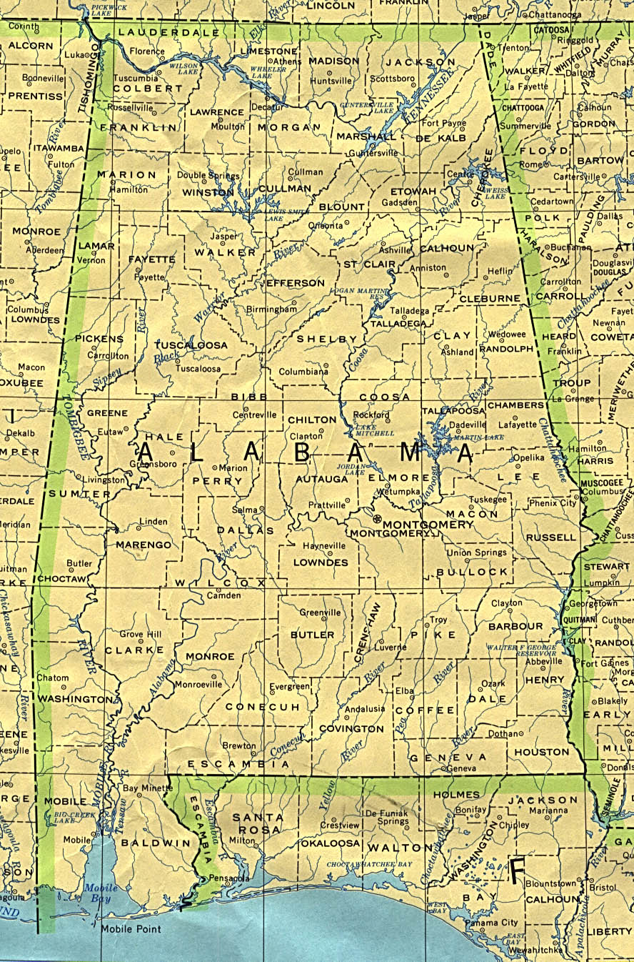
- Alabama (reference map) JPEG format (268K) Shaded relief map with state boundaries, forest cover, place names, major highways. Portion of "The National Atlas of the United States of America. General Reference", compiled by U.S. Geological Survey 2001, printed 2002
- Alabama (reference map) PDF format (212K) Shaded relief map with state boundaries, forest cover, place names, major highways. Portion of "The National Atlas of the United States of America. General Reference", compiled by U.S. Geological Survey 2001, printed 2002
- Alabama - Federal Lands and Indian Reservations PDF format (602K) The National Atlas of the United States of America, U.S. Geological Survey, 2003
Topographic Maps
- Alabama Topographic Maps
- Pre-1945 maps, Coastal regions 1:24,000 (2005); 1:250,000 series (all editions)
City Maps
- Albertville (topographic) original scale 1:24,000 U.S.G.S. 1983 (655K)
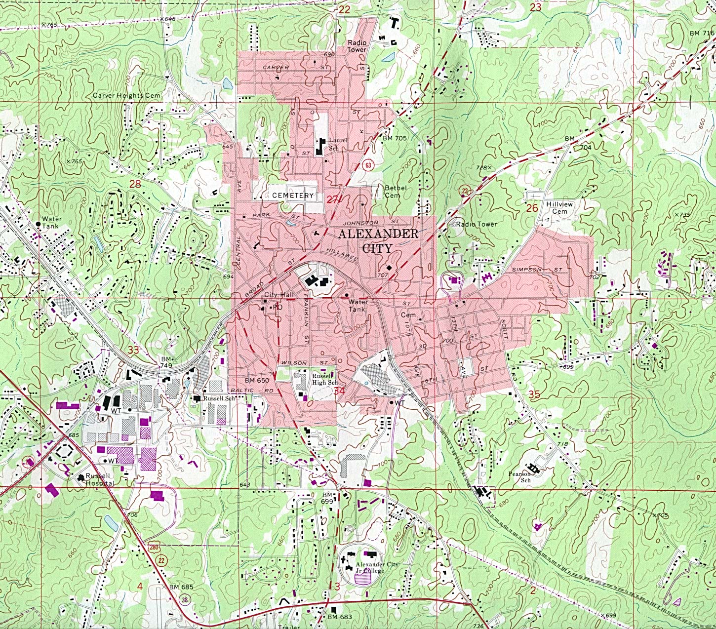
- Alexander City (topographic) original scale 1:24,000 U.S.G.S. 1971 photorevised 1983 (621K)
- Andalusia (topographic) original scale 1:24,000 U.S.G.S. 1971 photorevised 1986 (723K)
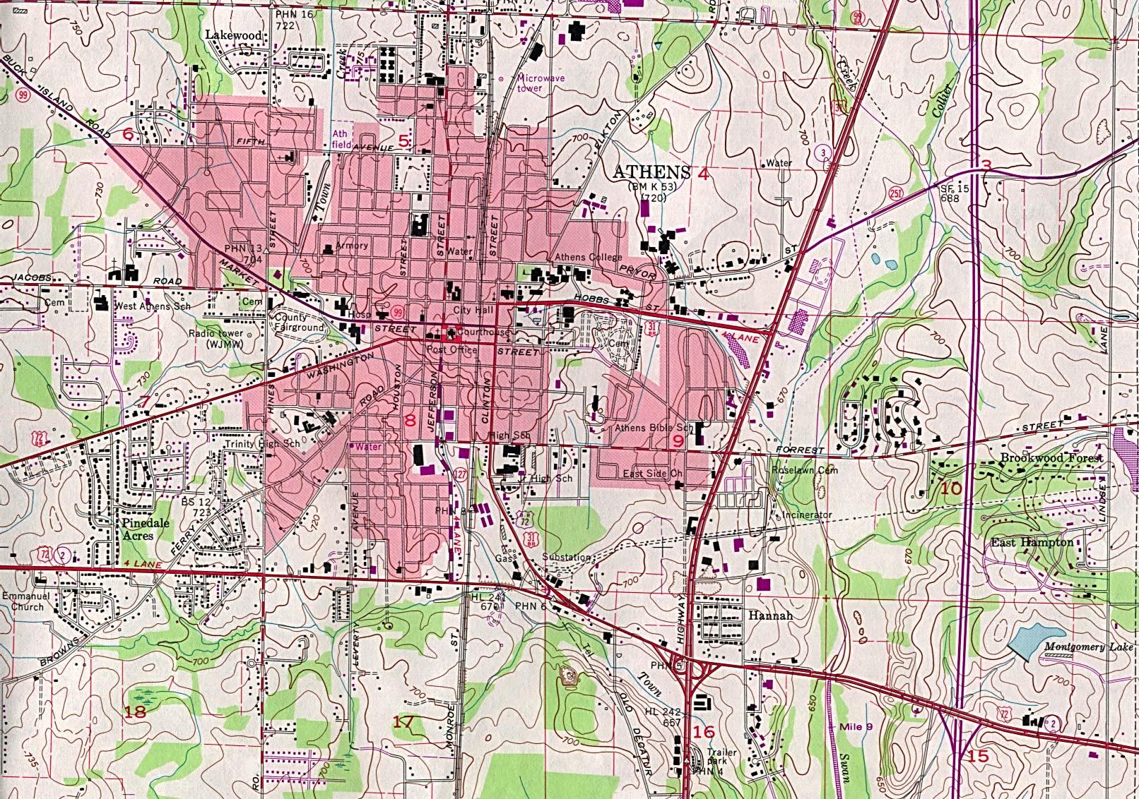
- Athens (topographic) original scale 1:24,000 U.S.G.S. 1967 photorevised 1982 (663K)
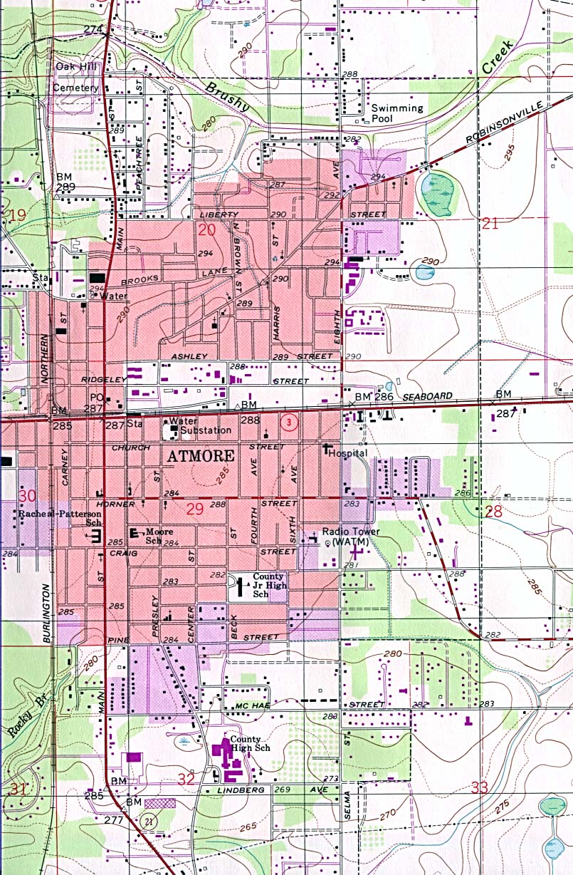
- Atmore (topographic) original scale 1:24,000 U.S.G.S. 1960 photorevised 1986 (323K)
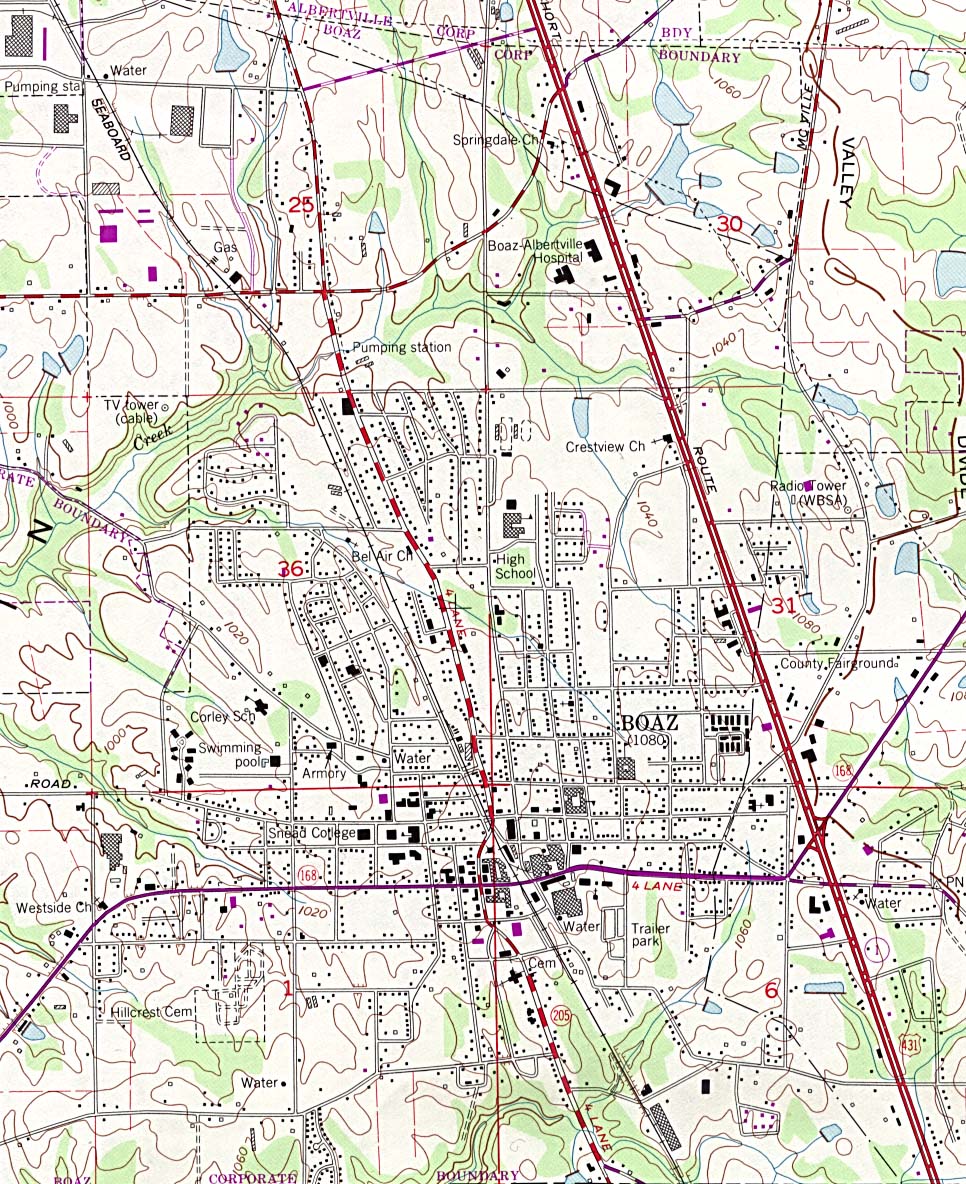
- Boaz (topographic) original scale 1:24,000 U.S.G.S. 1983 (434K)
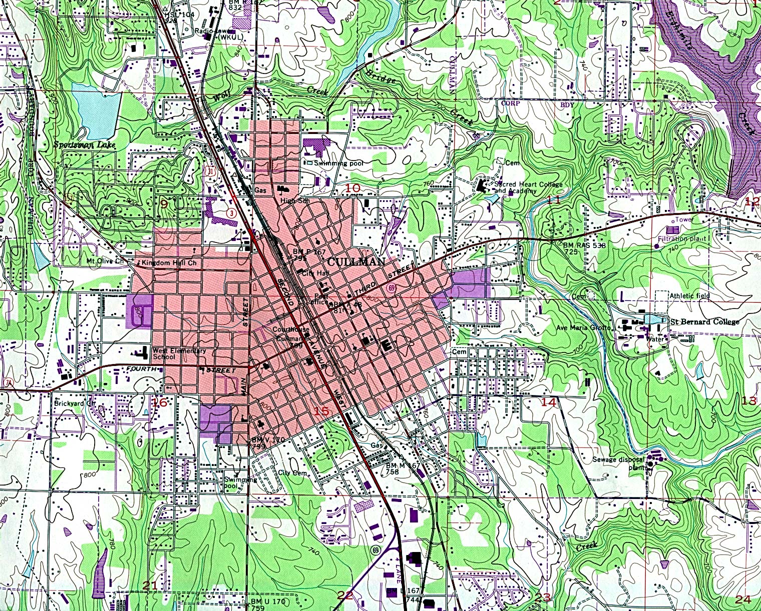
- Cullman (topographic) original scale 1:24,000 U.S.G.S. 1957 photorevised 1983 (850K)
- [Biloxi, Mississippi to Dauphin Island, Alabama] Biloxi Sheet, Metric Topographic Map 30088-A1-TM-100, U.S.G.S., 1982 (3.4MB)
![[Biloxi, Mississippi to Dauphin Island, Alabama]](united_states/biloxi_1982.jpg)
Historical City Maps
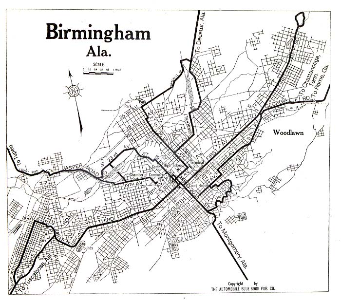
- Birmingham 1919 Automobile Blue Book, Volume 6, 1919 (130K)
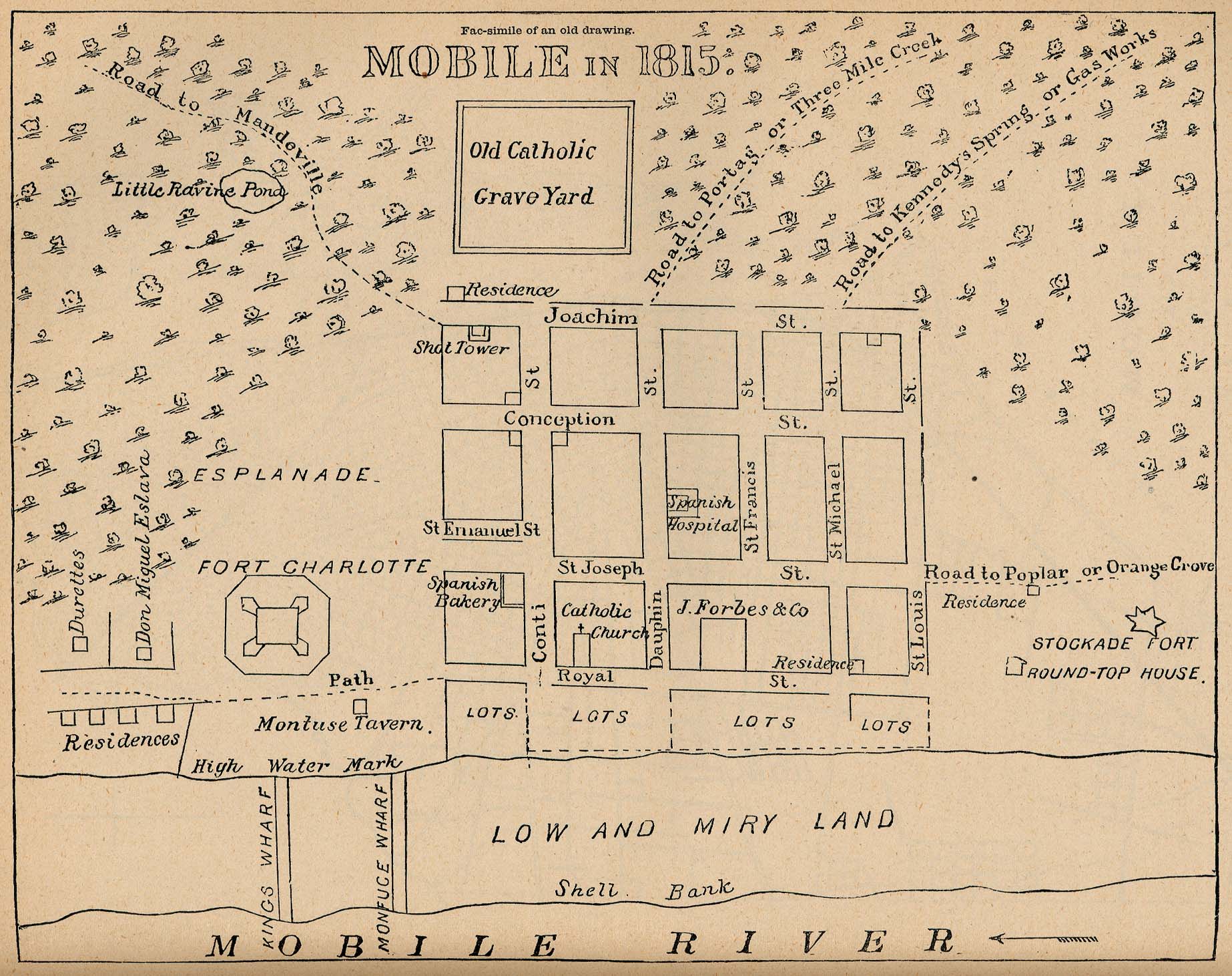
- Mobile 1815 "Mobile in 1815" From Report on the Social Statistics of Cities, Compiled by George E. Waring, Jr., United States. Census Office, Part II, 1886. (419K)
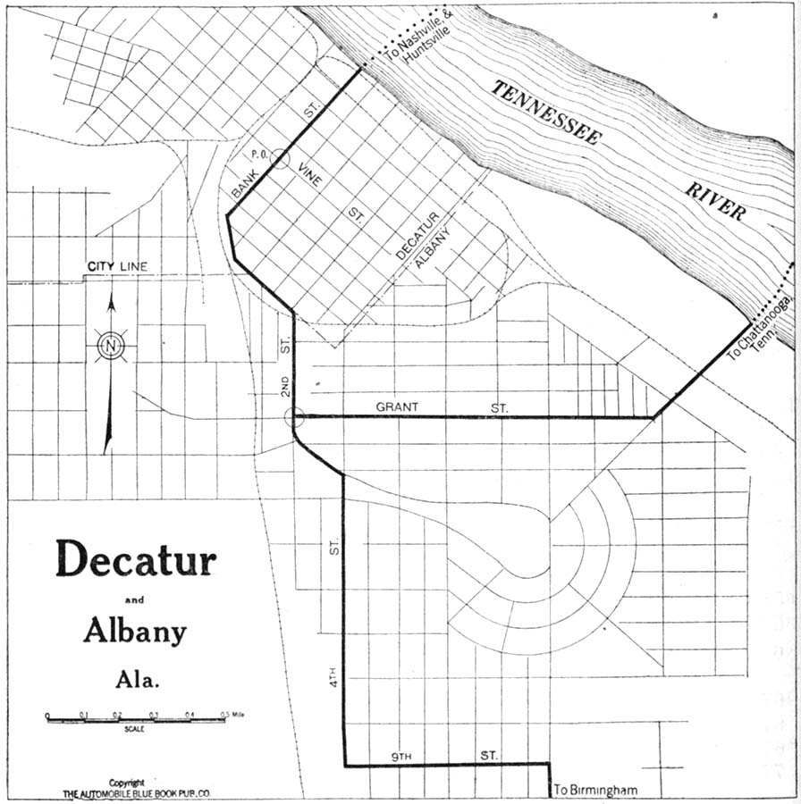
- Decatur 1919 Automobile Blue Book, 1919, Vol. 6 (142K)
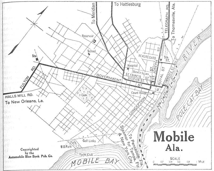
- Mobile 1919 Automobile Blue Book, 1919, Vol. 6 (161K)
- Montgomery 1920 Automobile Blue Book (137K)
Historical Topographic Maps
- Alabama Historical Topographic Maps
- Pre-1945 maps, Coastal regions 1:24,000 (2005); 1:250,000 series (all editions)
Maps of National Parks, Monuments, and Historic Sites
The following maps were produced by the U.S. National Park Service unless otherwise noted.
- Gulf Islands National Seashore [Mississippi, Alabama, and Florida] (Detail and Park Maps) 1999 (387K) (PDF Format)
- Gulf of Mexico [Mississippi, Alabama, and Florida] (Area Features) 1994 (351K)
- Horseshoe Bend National Military Park (Creek Land Cessions 1733-1832 Map) (23K)
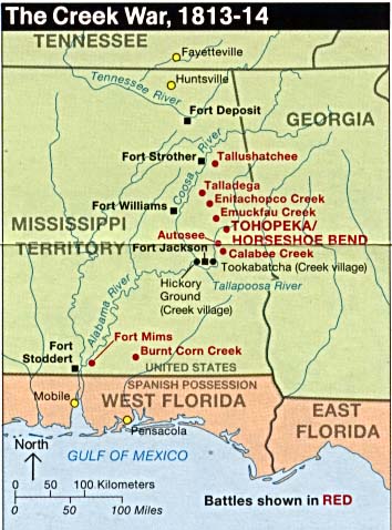
- Horseshoe Bend National Military Park (The Creek War 1813-1814) (46K)
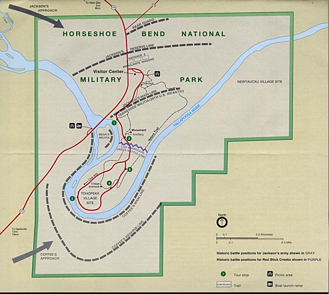
- Horseshoe Bend National Military Park (Park Map) (230K)
- Horseshoe Bend National Military Park (Park Map) (65K) (PDF Format)
- Natchez Trace Parkway National Scenic Trail [Mississippi, Alabama, and Tennessee] (Area Map) 1999 (65K) (PDF Format)
- Natchez Trace Parkway National Scenic Trail [Mississippi, Alabama, and Tennessee] (Park Map) 1999 (516K) (PDF Format)
- Natchez Trace Parkway National Scenic Trail [Mississippi, Alabama, and Tennessee] (Natchez to Jackson, Mississippi) 1997 (387K)
- Natchez Trace Parkway National Scenic Trail [Mississippi, Alabama, and Tennessee] (Jackson to Dancy, Mississippi) 1997 (323K)
- Natchez Trace Parkway National Scenic Trail [Mississippi, Alabama, and Tennessee] (Dancy, Mississippi to Rock Spring, Alabama) 1997 (387K)
- Natchez Trace Parkway National Scenic Trail [Mississippi, Alabama, and Tennessee] (Rock Spring, Alabama to Nashville, Tennessee) 1997 (452K)
- Russell Cave National Monument (Area Map) 1995 (65K) (PDF Format)
![Gulf of Mexico [Mississippi, Alabama, and Florida]](national_parks/gulf94.jpg)
![Natchez Trace Parkway National Scenic Trail [Mississippi, Alabama, and Tennessee]](national_parks/traceparkway4_97.jpg)
![Natchez Trace Parkway National Scenic Trail [Mississippi, Alabama, and Tennessee]](national_parks/traceparkway3_97.jpg)
![Natchez Trace Parkway National Scenic Trail [Mississippi, Alabama, and Tennessee]](national_parks/traceparkway2_97.jpg)
![Natchez Trace Parkway National Scenic Trail [Mississippi, Alabama, and Tennessee]](national_parks/traceparkway1_97.jpg)
Maps on Other Web Sites