Tokyo City Plans 1:12,500
U.S. Army Map Service, 1945-1946
Use the Tokyo Index Map to find the map you need, then select it below.
These maps are also listed on the Japan City Plans page under their individual names.
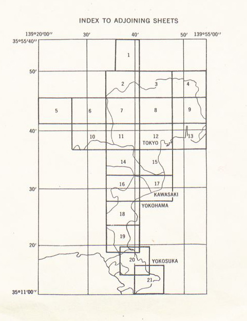
- Tokyo Index Map (98 K)
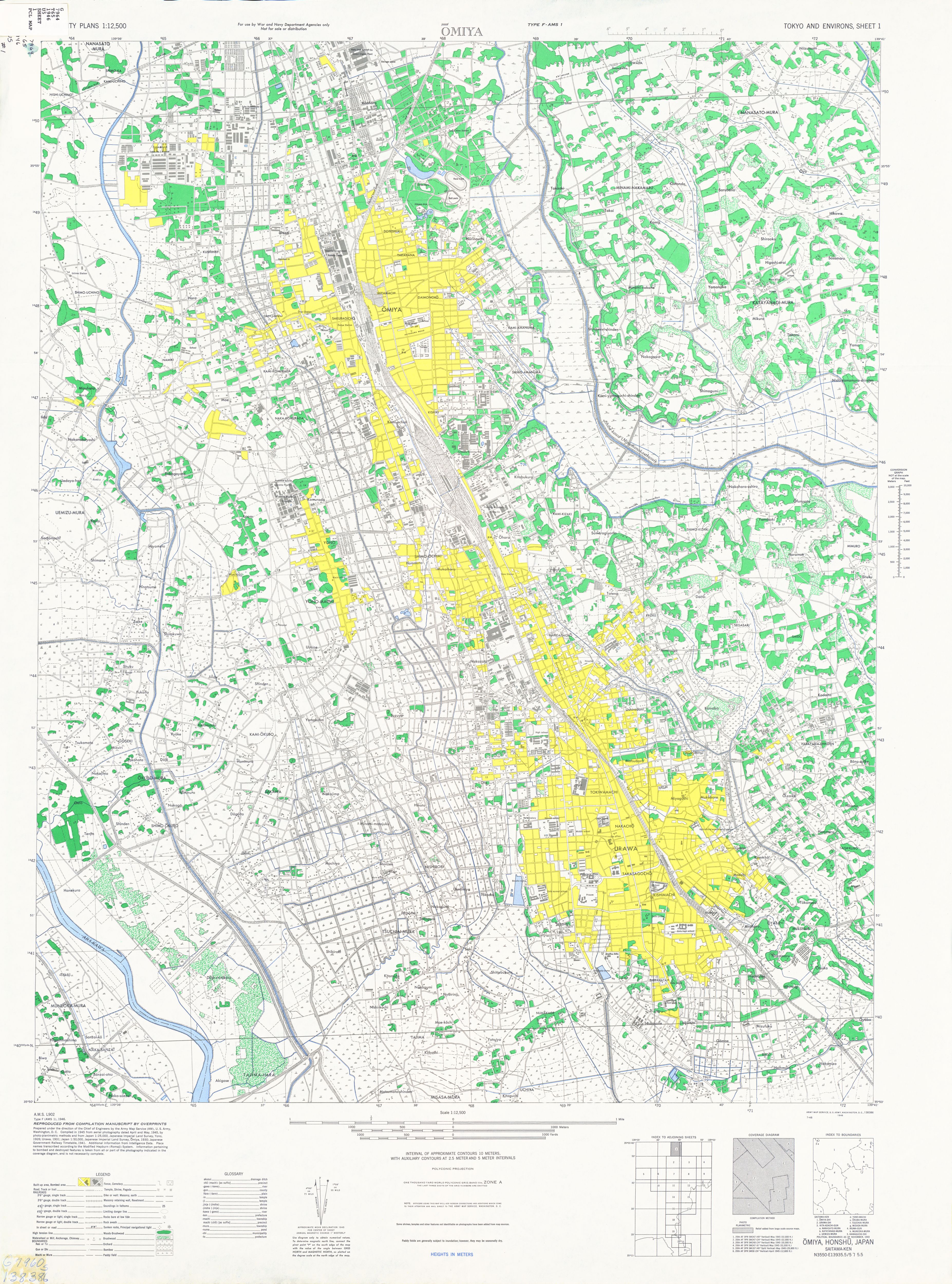
- Sheet 1 - Omiya (4.0 MB)
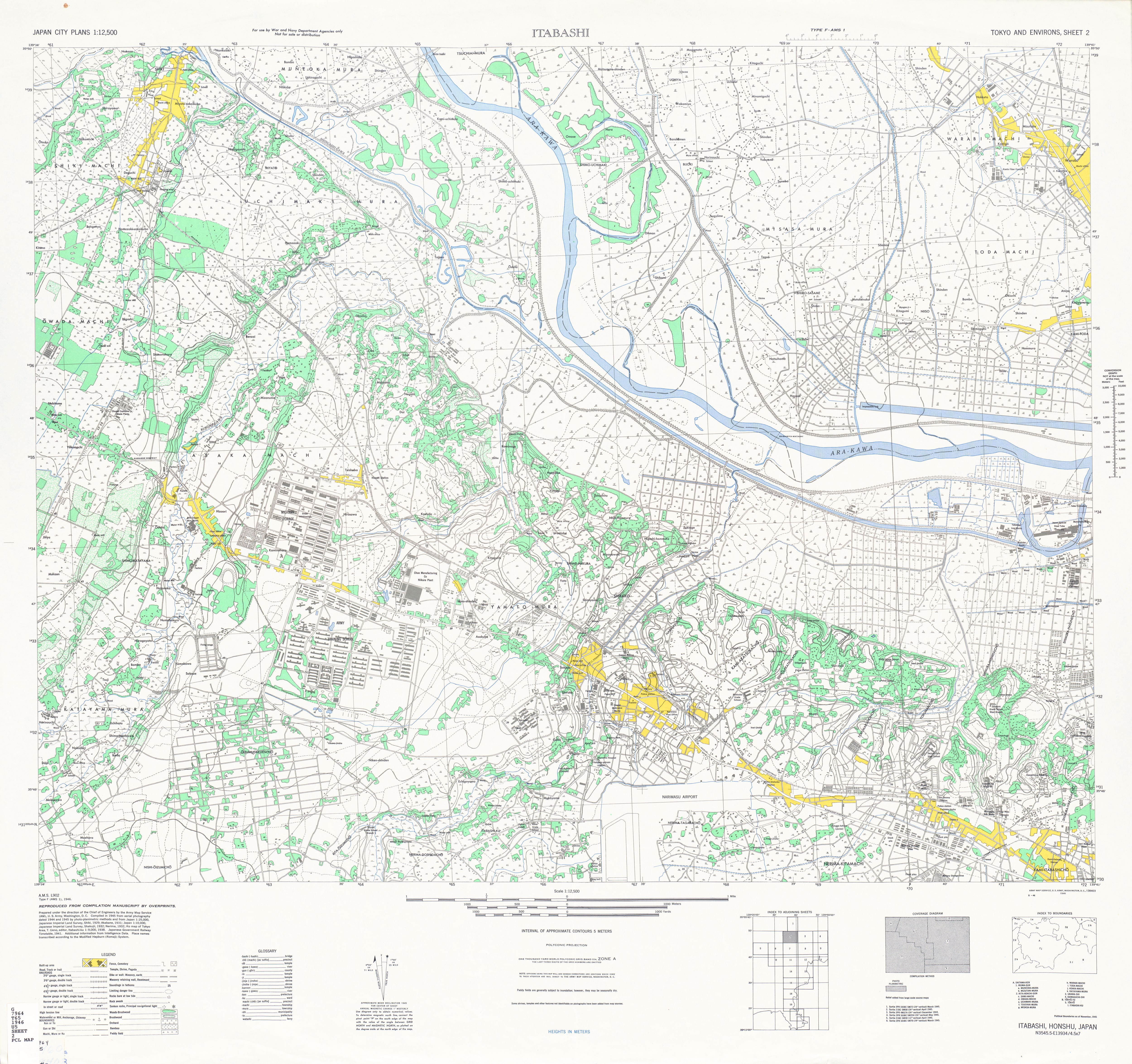
- Sheet 2 - Itabashi (4.5 MB)
- Sheet 3 - Kawaguchi (4.1 MB)
- Sheet 4 - Matsudo (3.8 MB)
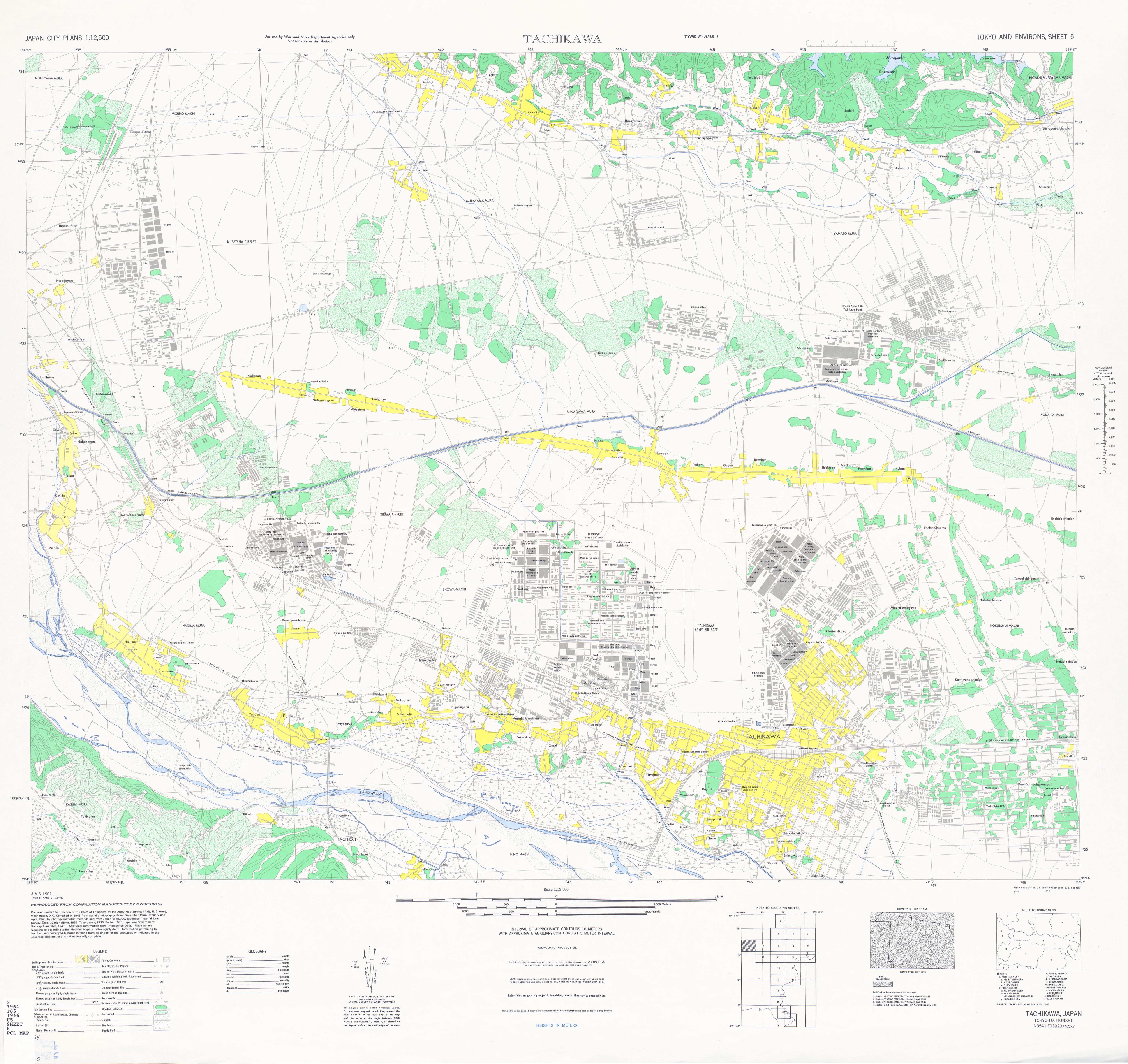
- Sheet 5 - Tachikawa (3.3 MB)
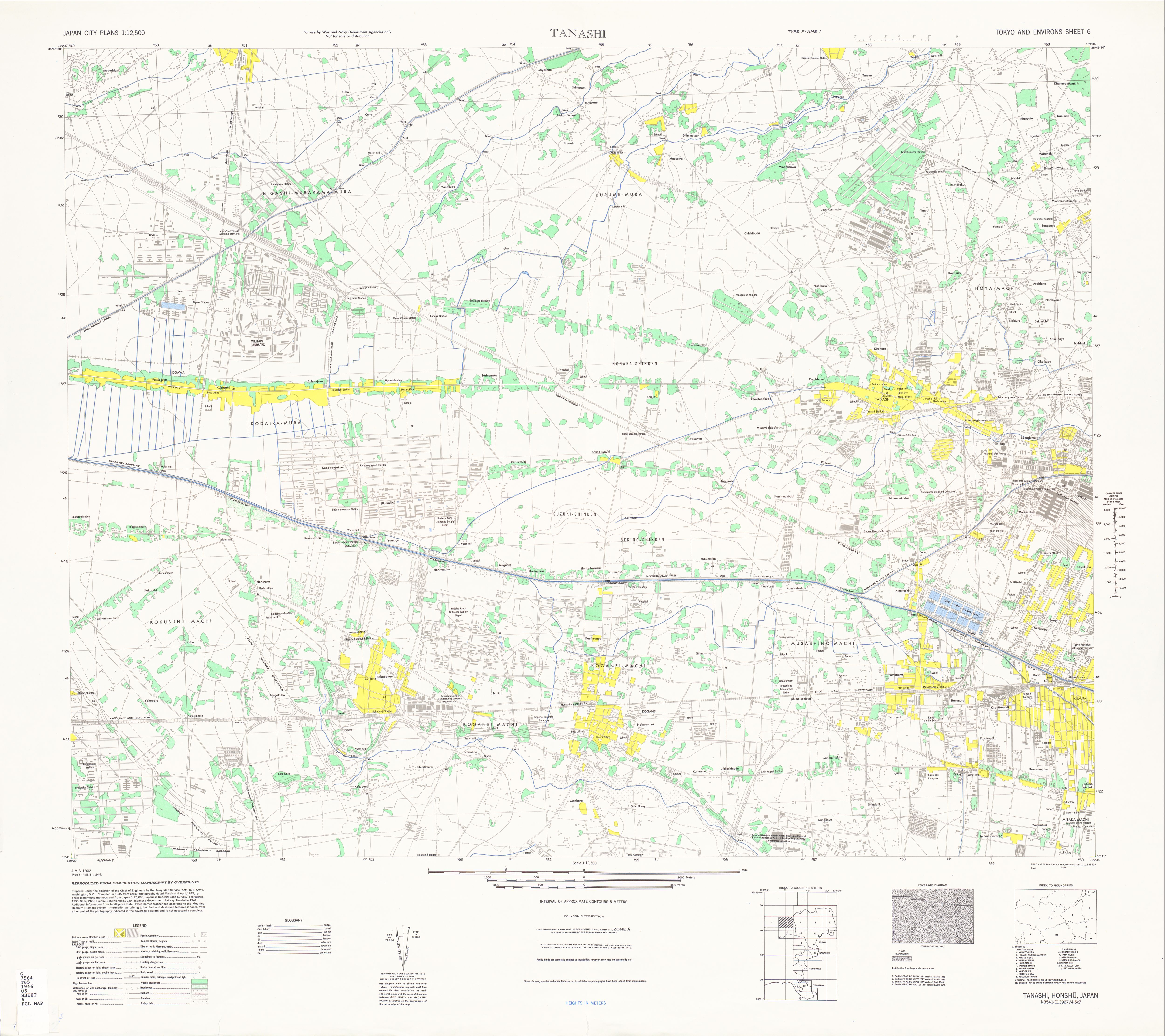
- Sheet 6 - Tanashi (3.0 MB)
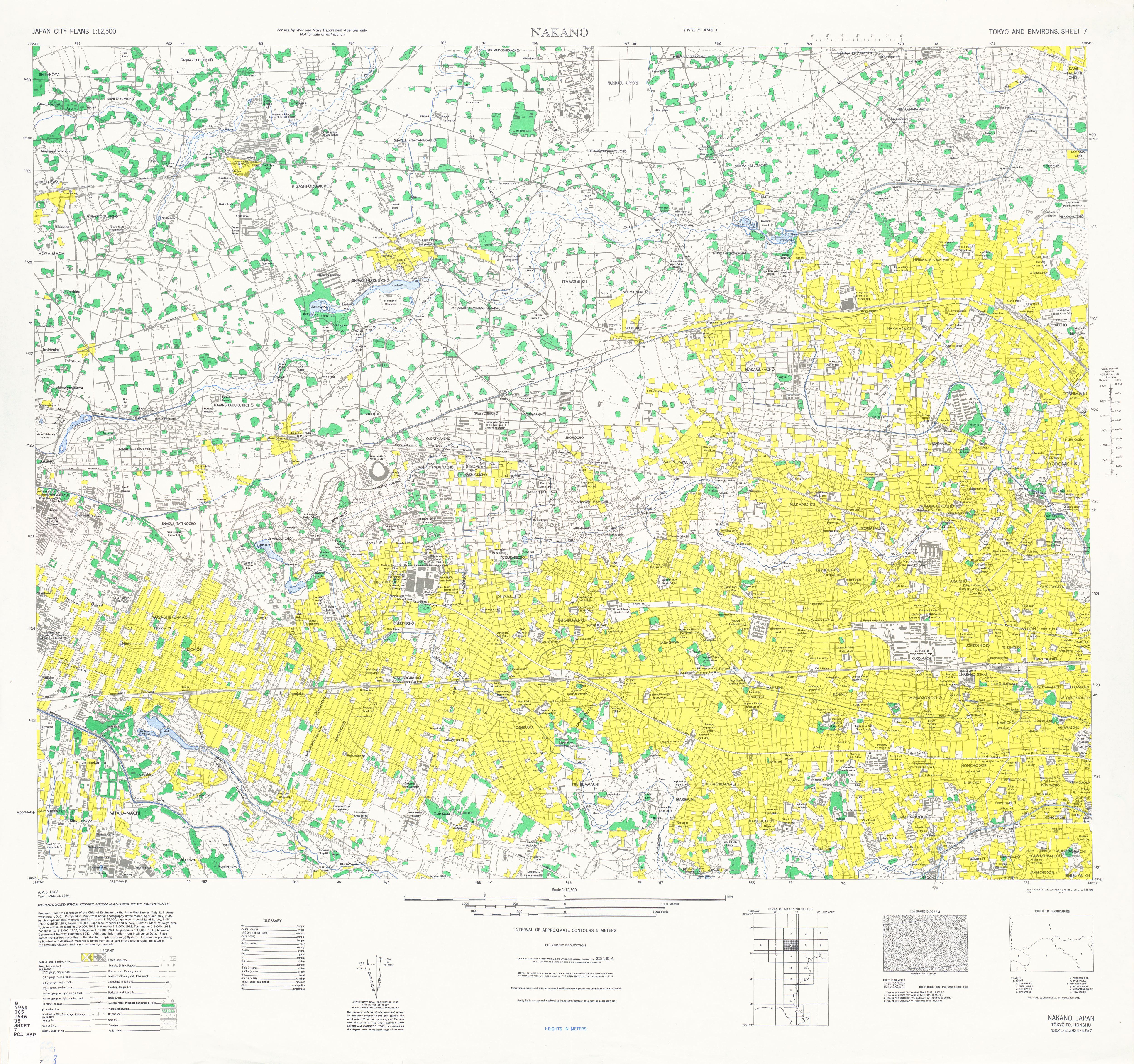
- Sheet 7 - Nakano (4.9 MB)
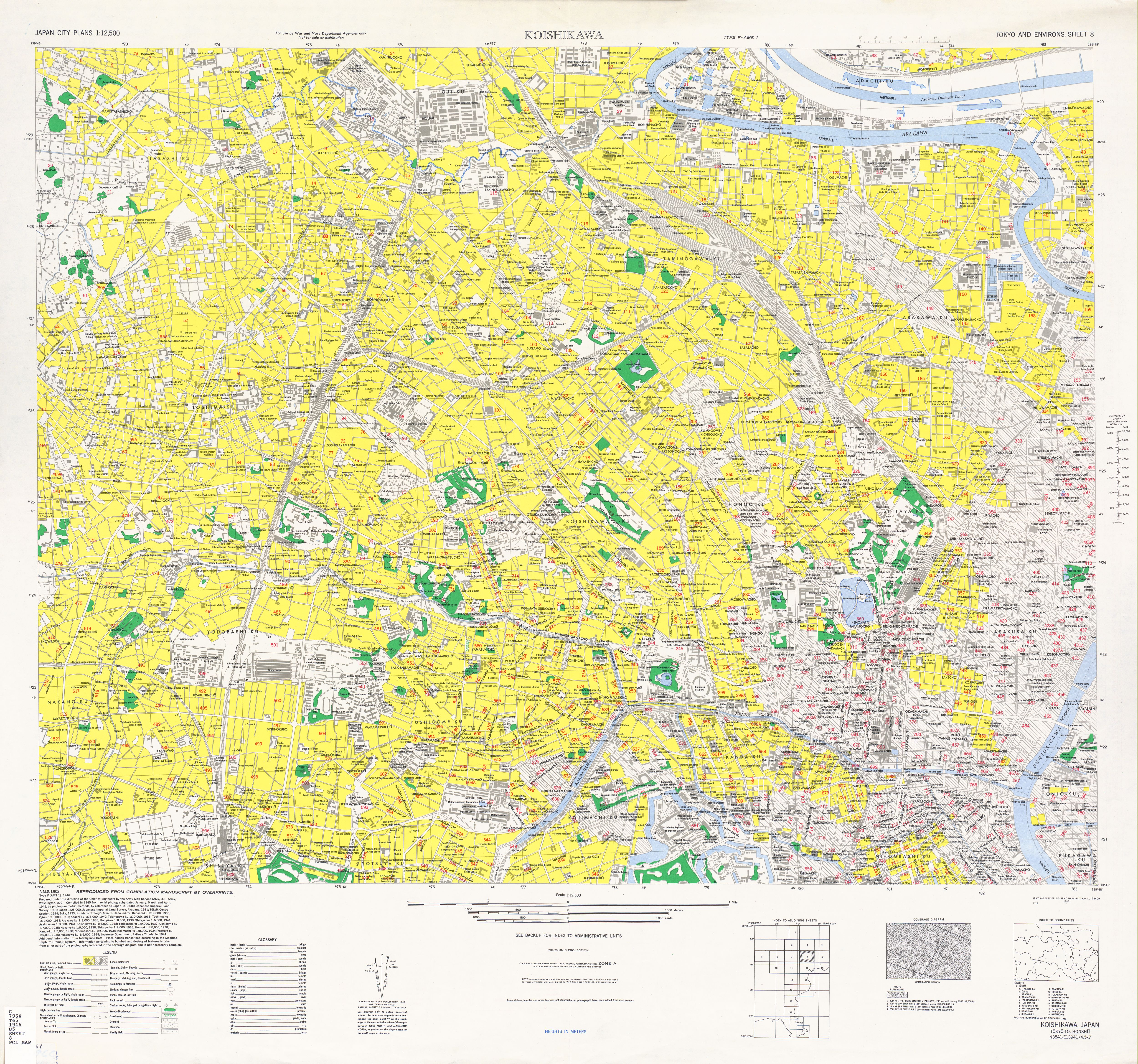
- Sheet 8 - Koishikawa (5.7 MB)
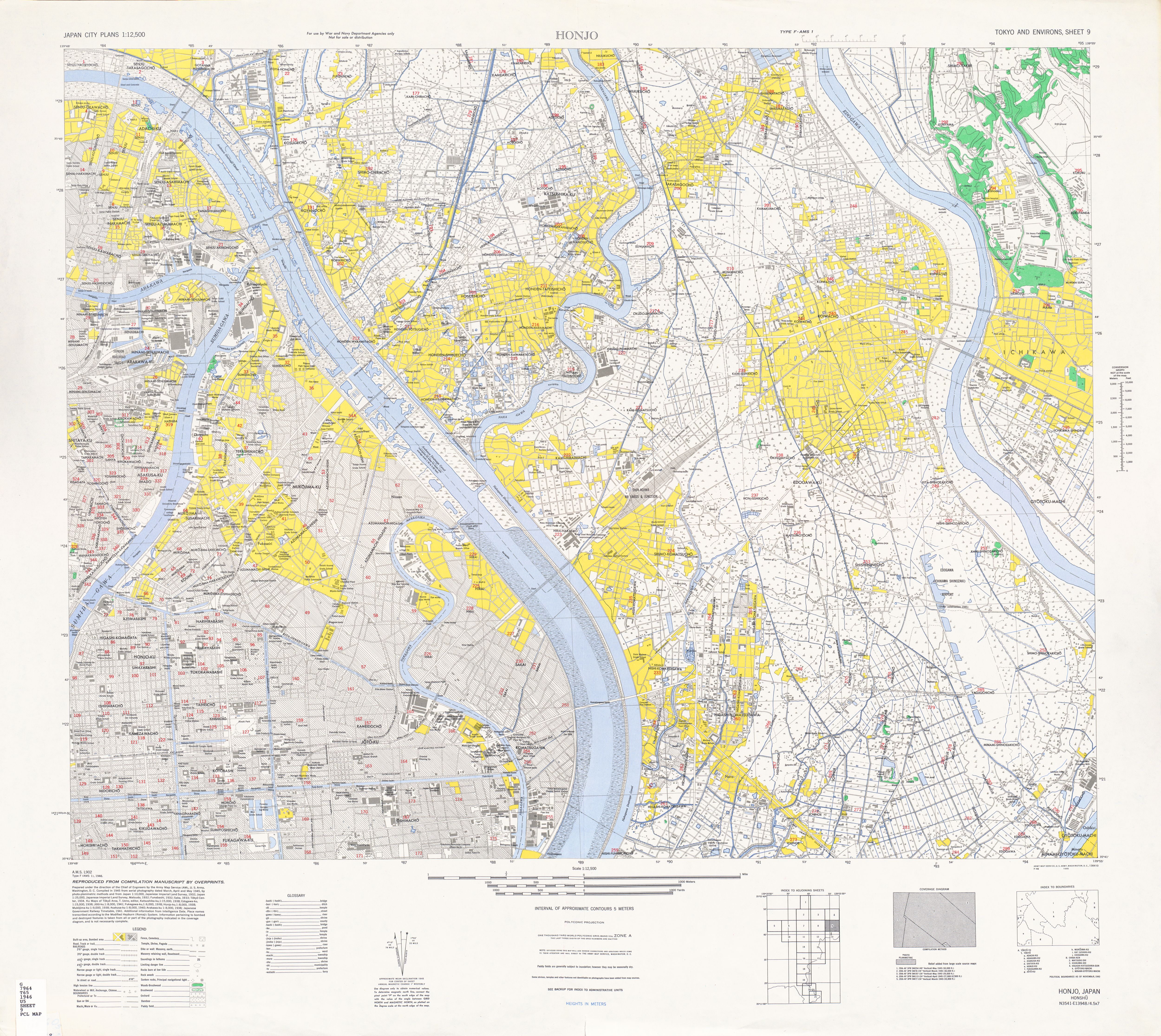
- Sheet 9 - Honjo (5.1 MB)
- Sheet 9 - Honjo [verso] Administrative Unit Names (1.4 MB)
- Sheet 10 - Chofu (3.5 MB)
- Sheet 11 - Setagaya (4.1 MB)
- Sheet 11 - Setagaya [verso] Administrative Unit Names (989 K)
- Sheet 12 - Nihombashi (5.2 MB) Includes Imperial Palace, Ginza
- Sheet 12 - Nihombashi [verso] Administrative Unit Names (2.6 MB)
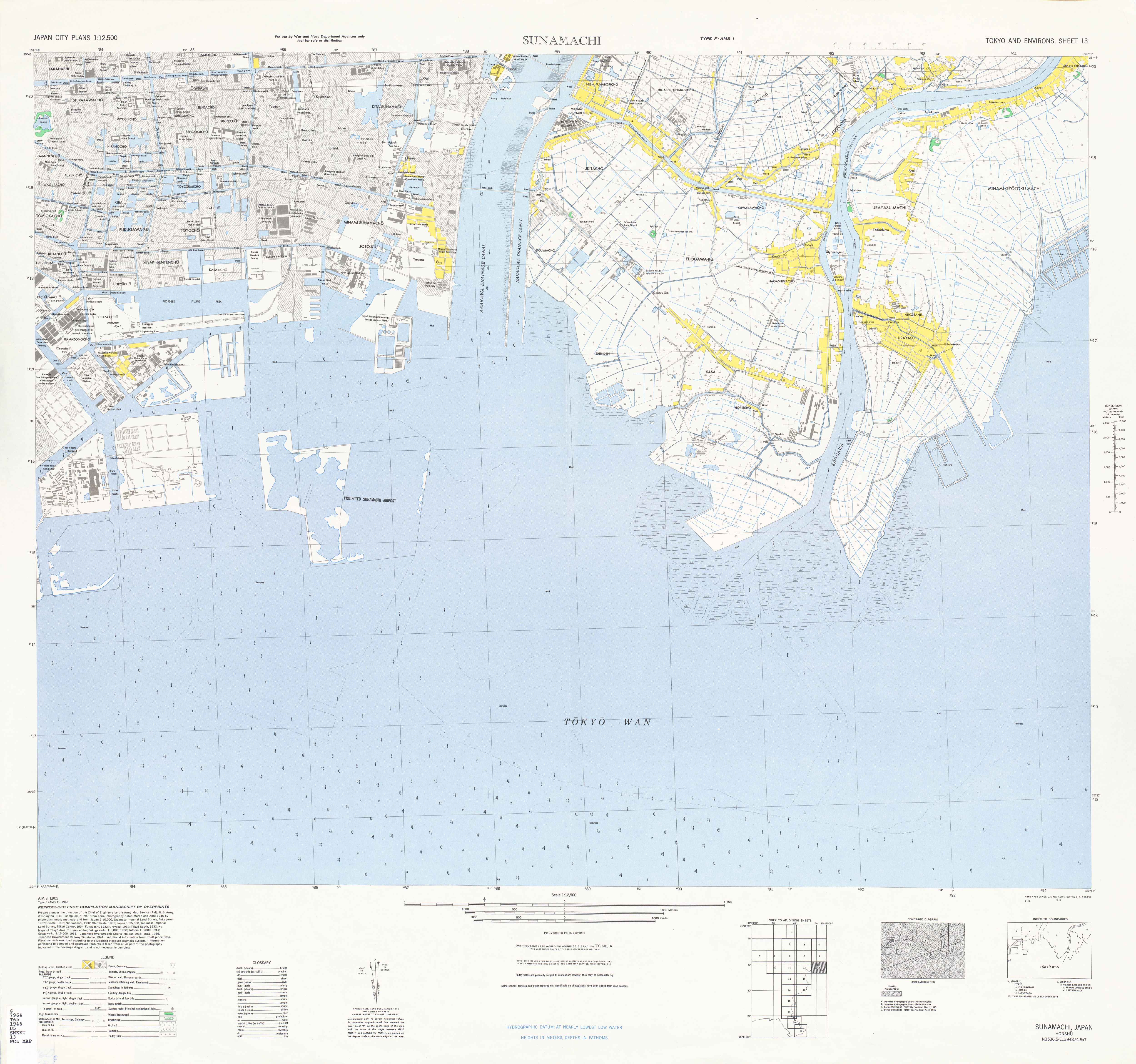
- Sheet 13 - Sunamachi (3.8 MB)
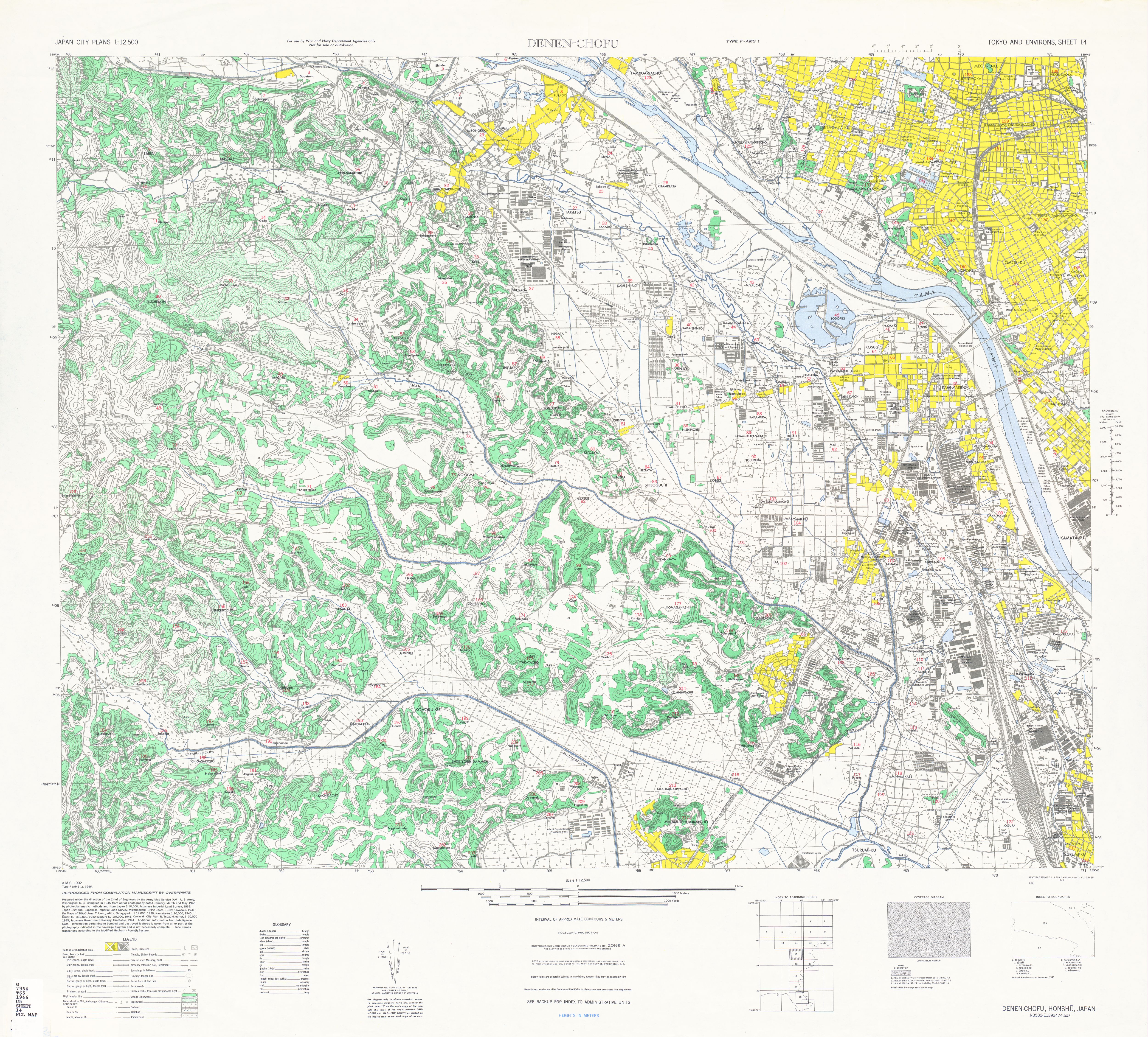
- Sheet 14 - Denen-Chofu (5.0 MB)
- Sheet 14 - Denen-Chofu [verso] Administrative Unit Names (1.3 MB)
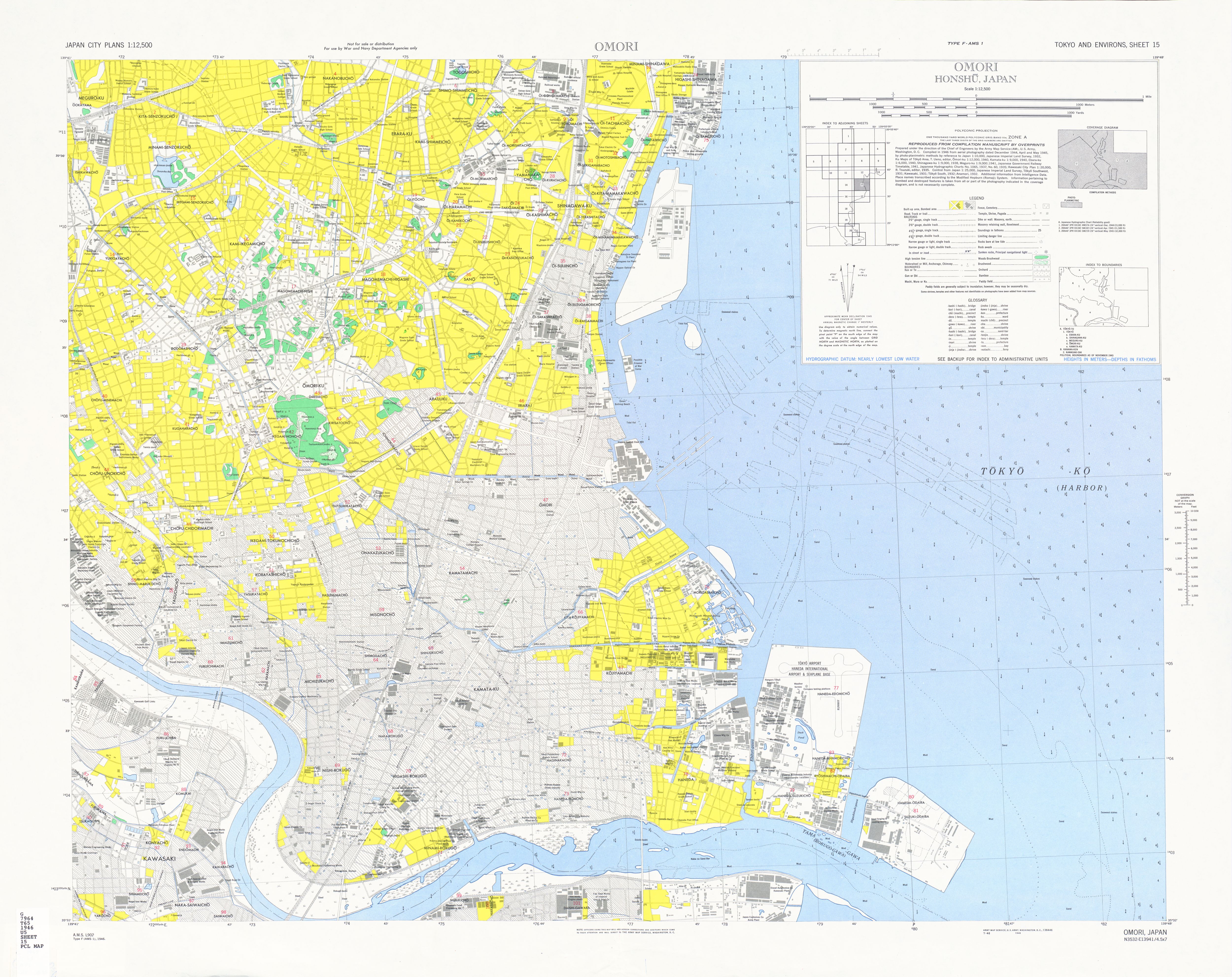
- Sheet 15 - Omori (3.7 MB)
- Sheet 15 - Omori [verso] Administrative Unit Names (904 K)
- Sheet 16 - not issued
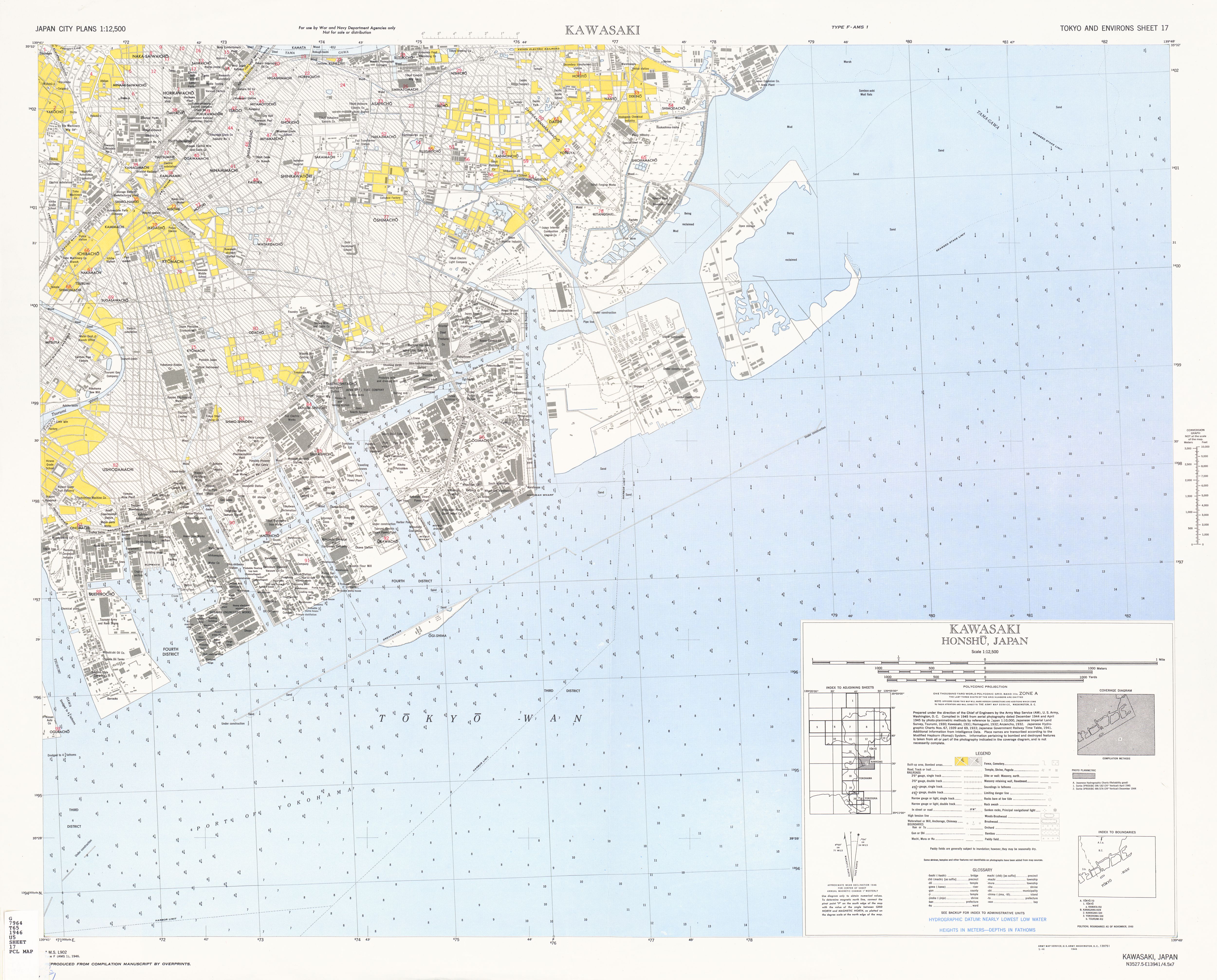
- Sheet 17 - Kawasaki (3.3 MB)
- Sheet 17 - Kawasaki [verso] Administrative Unit Names (737 K)
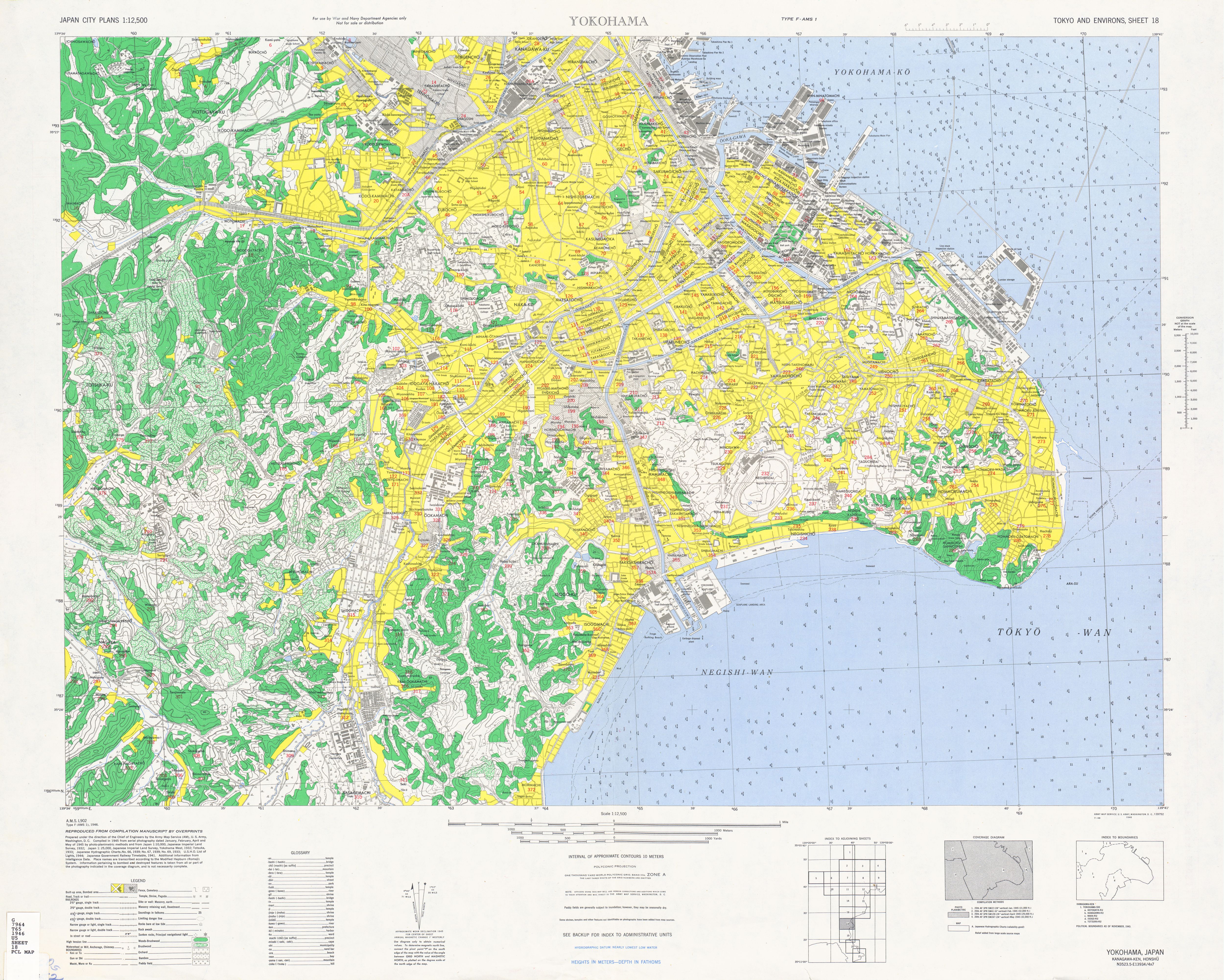
- Sheet 18 - Yokohama (4.6 MB)
- Sheet 18 - Yokohama [verso] Administrative Unit Names (2.3 MB)
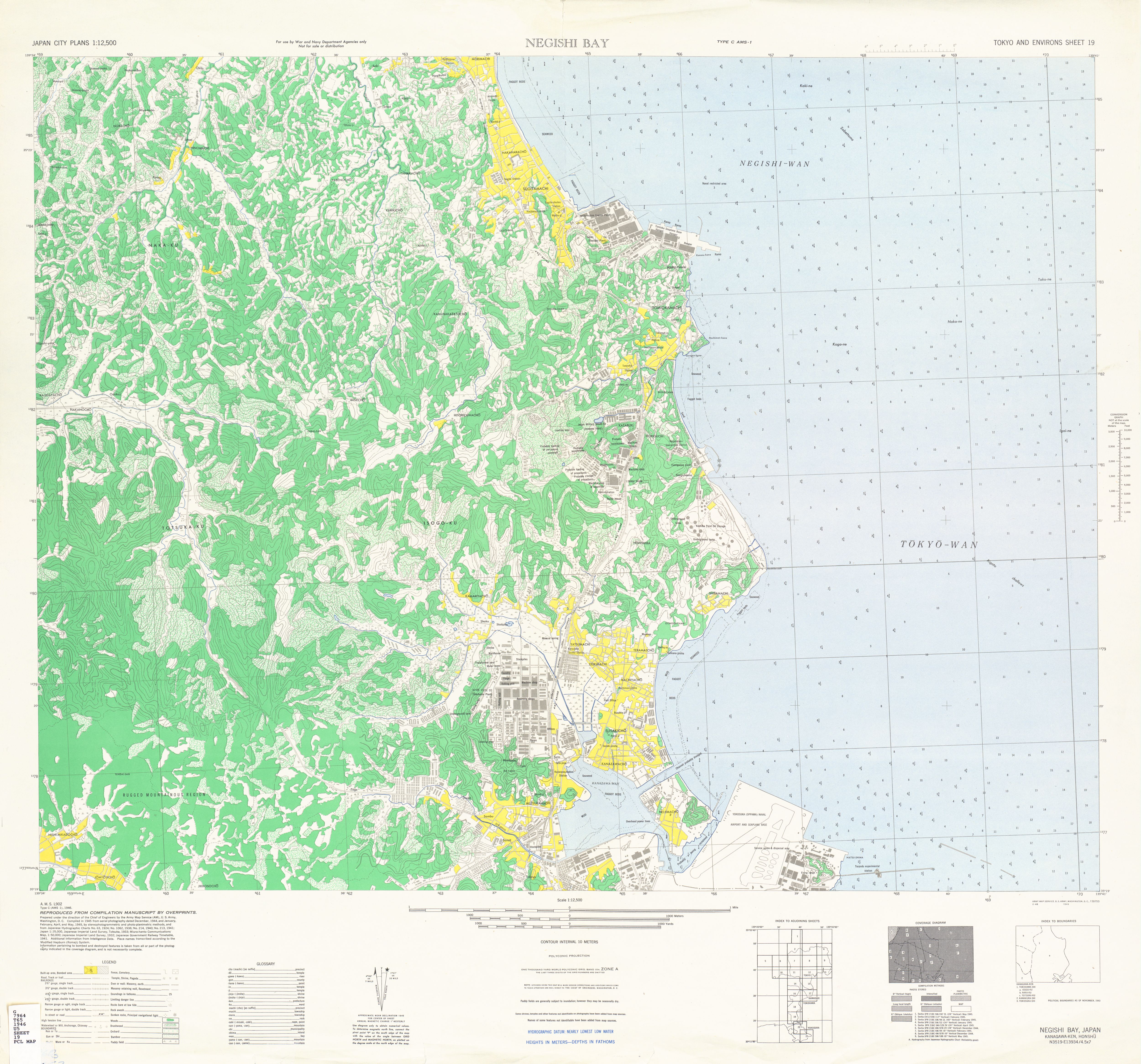
- Sheet 19 - Negishi Bay (4.1 MB)
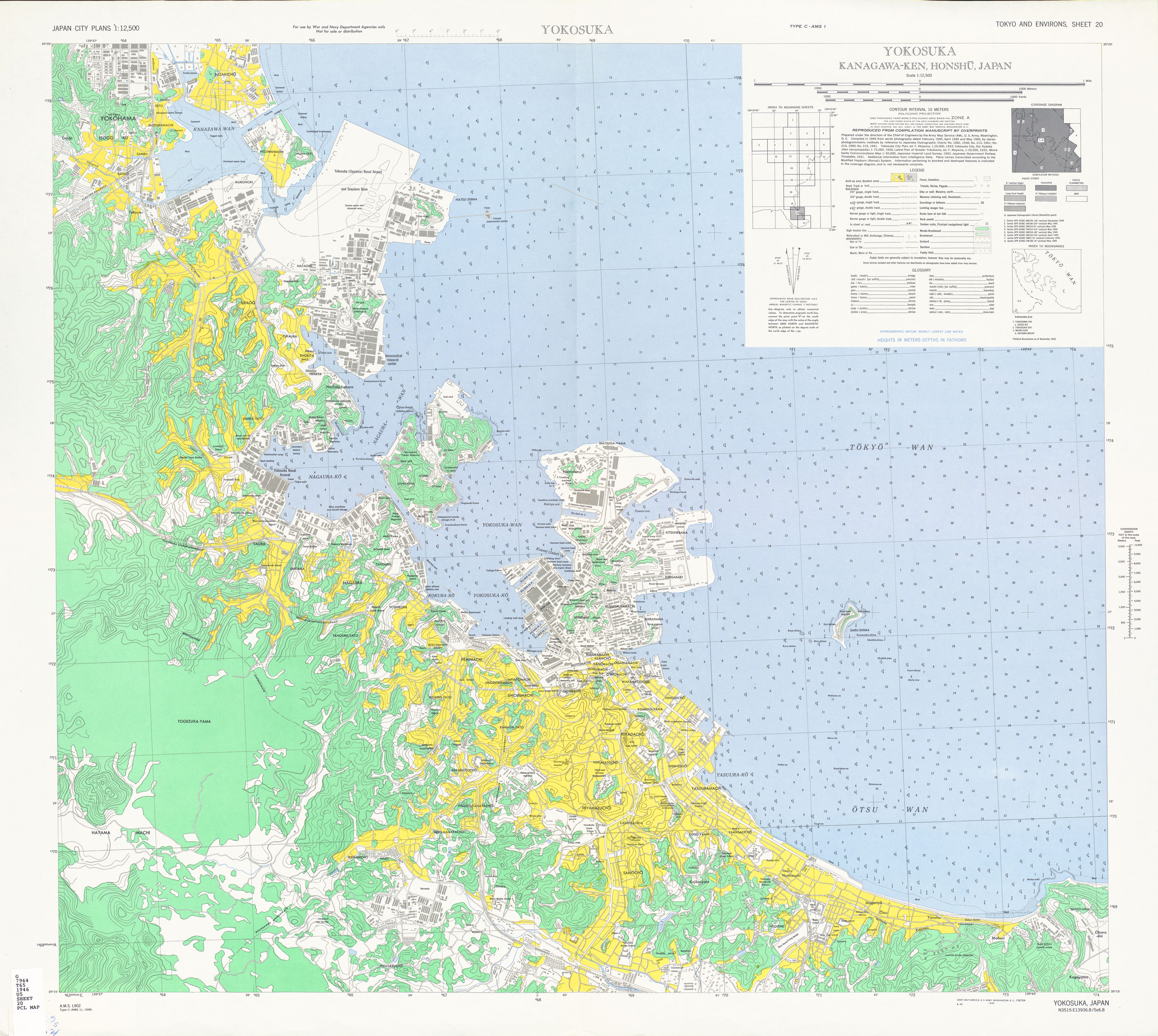
- Sheet 20 - Yokosuka (4.4 MB)
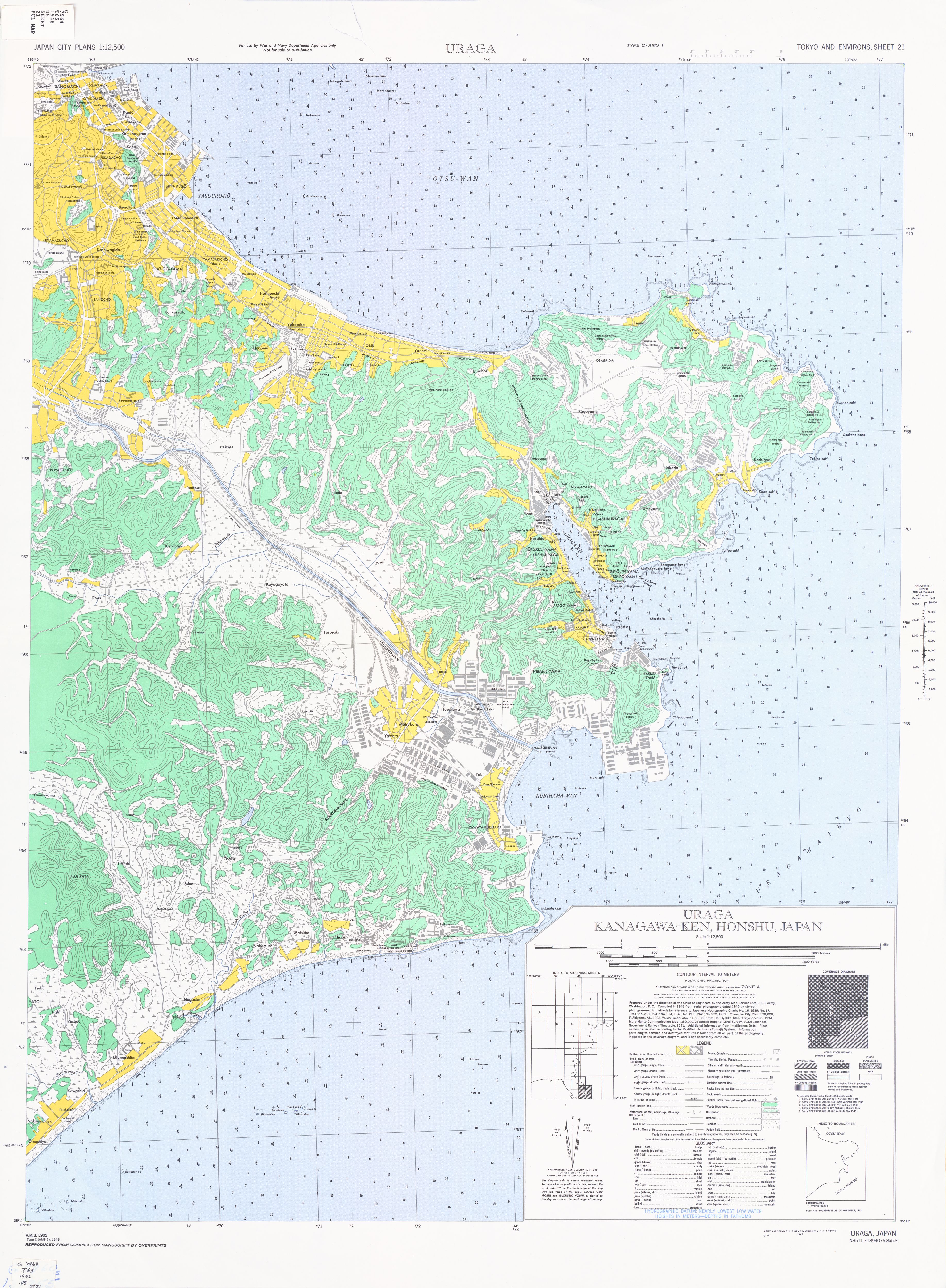
- Sheet 21 - Uraga (3.2 MB)
- Sheet 1 - Omiya (4.0 MB)
![Sheet 9 - Honjo [verso] Administrative Unit Names](http://maps.lib.utexas.edu/maps/ams/japan_city_plans/txu-oclc-6549645-09a.jpg)
![Sheet 11 - Setagaya [verso] Administrative Unit Names](http://maps.lib.utexas.edu/maps/ams/japan_city_plans/txu-oclc-6549645-11a.jpg)
![Sheet 12 - Nihombashi [verso] Administrative Unit Names](http://maps.lib.utexas.edu/maps/ams/japan_city_plans/txu-oclc-6549645-12a.jpg)
![Sheet 14 - Denen-Chofu [verso] Administrative Unit Names](http://maps.lib.utexas.edu/maps/ams/japan_city_plans/txu-oclc-6549645-14a.jpg)
![Sheet 15 - Omori [verso] Administrative Unit Names](http://maps.lib.utexas.edu/maps/ams/japan_city_plans/txu-oclc-6549645-15a.jpg)
![Sheet 17 - Kawasaki [verso] Administrative Unit Names](http://maps.lib.utexas.edu/maps/ams/japan_city_plans/txu-oclc-6549645-17a.jpg)
![Sheet 18 - Yokohama [verso] Administrative Unit Names](http://maps.lib.utexas.edu/maps/ams/japan_city_plans/txu-oclc-6549645-18a.jpg)