Perry-Castañeda Library
Map Collection
Arizona Maps
State Maps
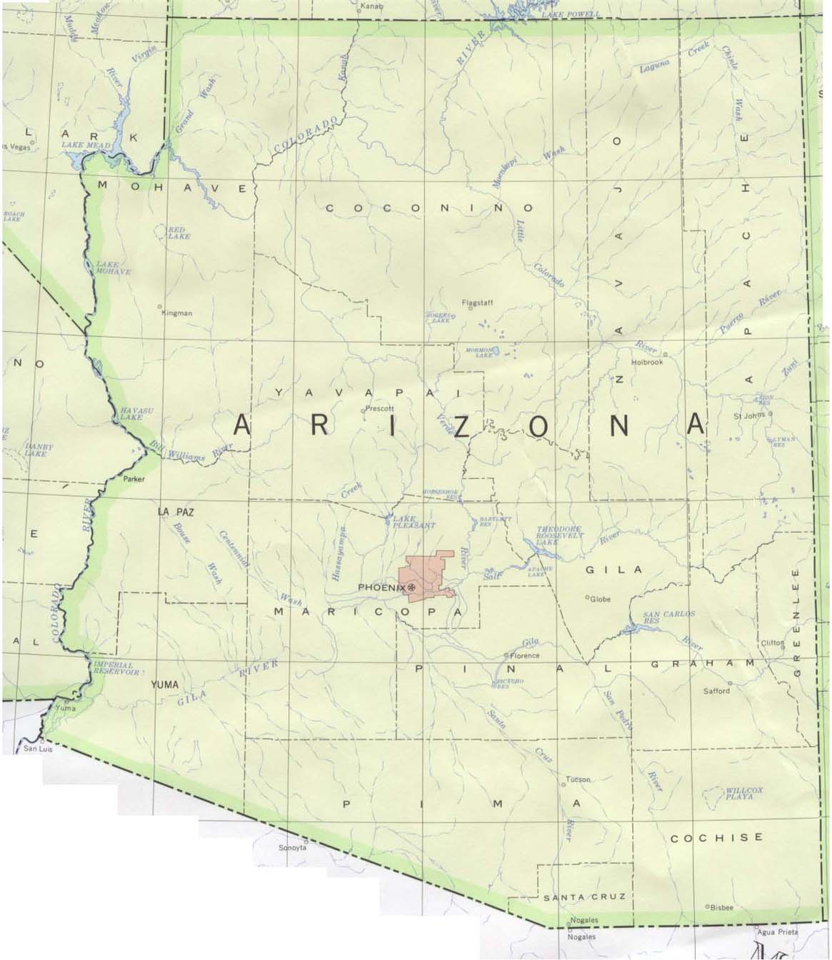
- Arizona (base map) JPEG format (175K) County boundaries and names, county seats, rivers. Original scale 1:2,500,000 U.S. Geological Survey, 1972 limited update 1990
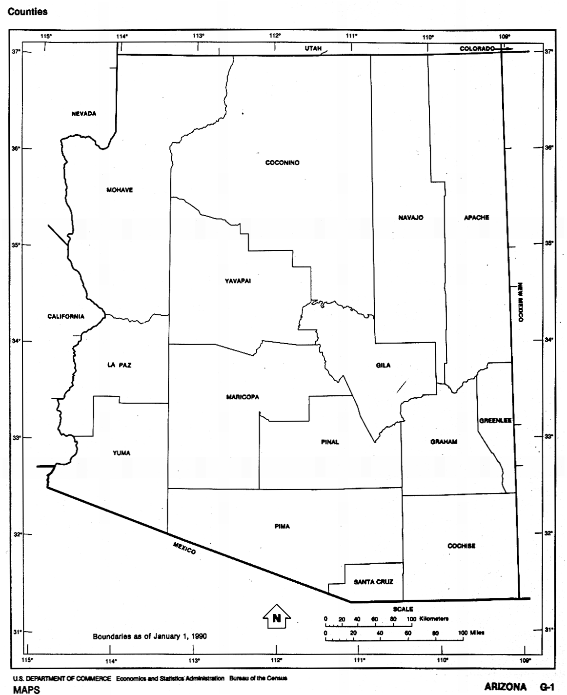
- Arizona (outline map) JPEG format (174K) County boundaries and names. U.S. Bureau of the Census, 1990
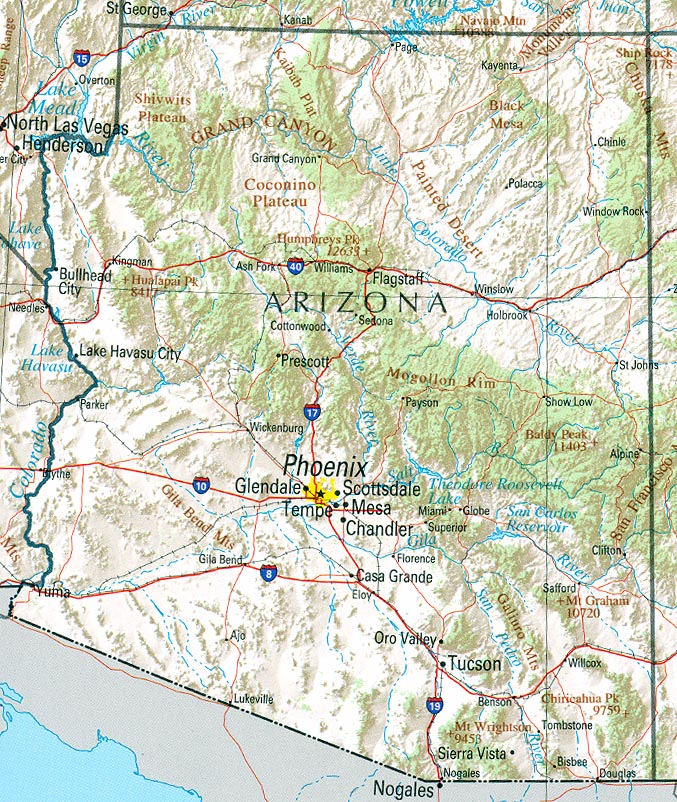
- Arizona (reference map) JPEG format (283K) Shaded relief map with state boundaries, forest cover, place names, major highways. Portion of "The National Atlas of the United States of America. General Reference", compiled by U.S. Geological Survey 2001, printed 2002
- Arizona (reference map) PDF format (285K) Shaded relief map with state boundaries, forest cover, place names, major highways. Portion of "The National Atlas of the United States of America. General Reference", compiled by U.S. Geological Survey 2001, printed 2002
- Arizona - Federal Lands and Indian Reservations PDF format (1.1MB) The National Atlas of the United States of America, U.S. Geological Survey, 2003
City Maps
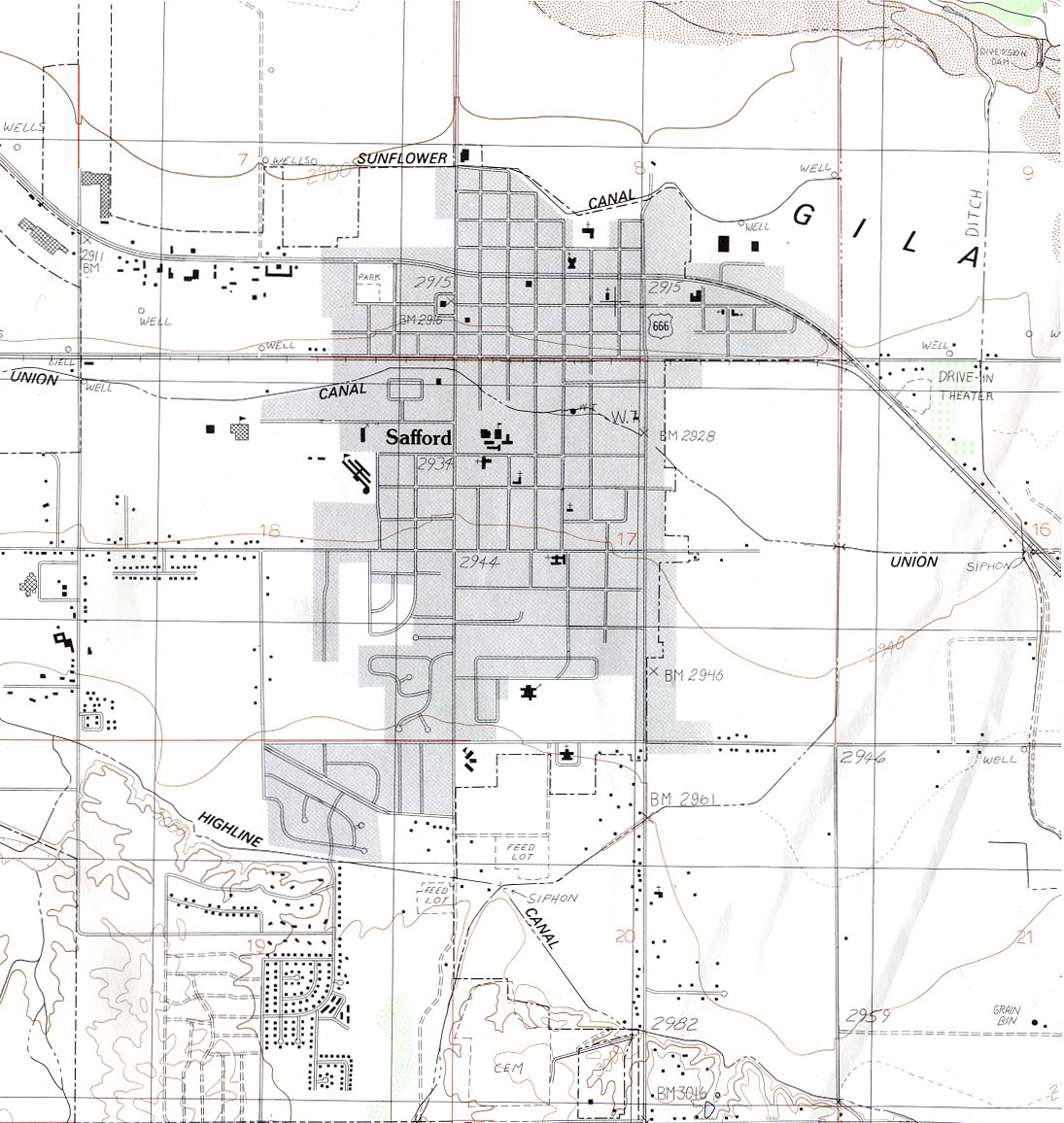
- Safford (topographic) 1:24,000 U.S.G.S. 1985 (218K)
Historical City Maps
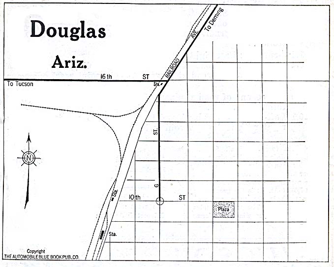
- Douglas 1920 Automobile Blue Book (78K)
- Phoenix 1952 Original Scale 1:62,500 U.S. Geological Survey 1952 (839K)
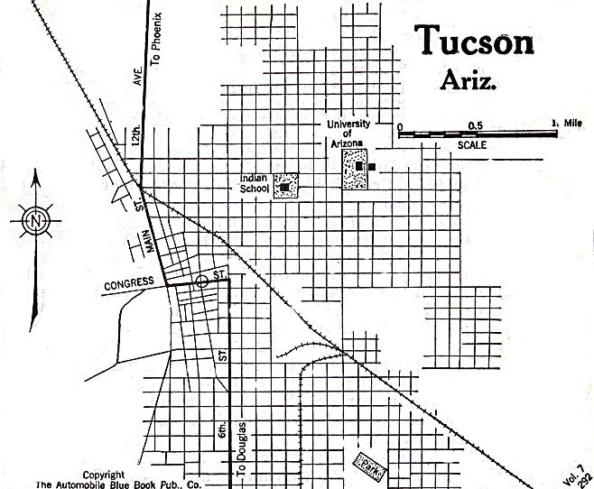
- Tucson 1920 Automobile Blue Book (117K)
Historical Topographic Maps
- Arizona Historical Topographic Maps (U.S. Geological Survey)
- Pre-1945 maps, scales 1:62,500, 1:125,000, 1:250,000 and special sheets
Maps of National Parks, Monuments, and Historic Sites
The following maps were produced by the U.S. National Park Service unless otherwise noted.
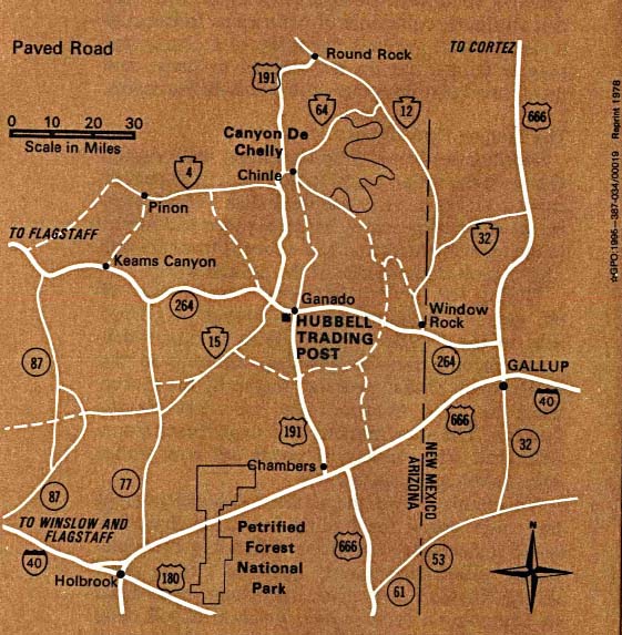
- Canyon de Chelly National Monument (Park Map) 1997 (323K) (PDF Format)
- Chiricahua National Monument (Area Map) 1999 (65K) (PDF Format)
- Chiricahua National Monument (Park Map) 1999 (129K) (PDF Format)
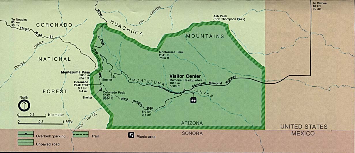
- Coronado National Memorial (Area Map) (100K)
- Coronado National Memorial [Southwest United States] (Historic Route Map) (135K)
- Coronado National Memorial (Park Map) 1997 (65K) (PDF Format)
- Fort Bowie National Historic Site (Area Map) 1995 (65K) (PDF Format)
- Fort Bowie National Historic Site (Park Map) 1995 (65K) (PDF Format)
- Glen Canyon National Recreation Area [Arizona / Utah] (Park Map / Shaded Relief) 1995 (1.8MB)
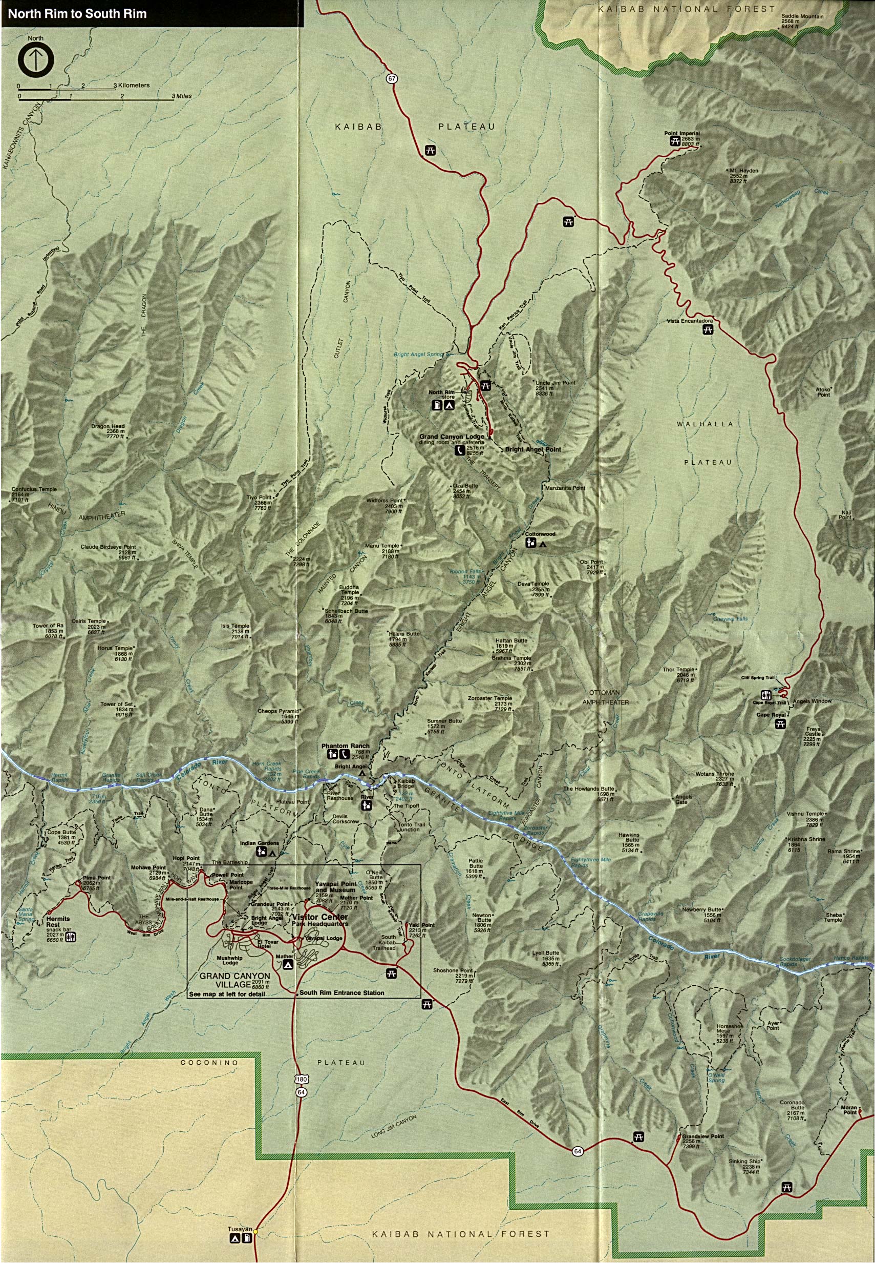
- Grand Canyon National Park (Area Map) (113K)
- Grand Canyon National Park (Park Map) 1997 (194K) (PDF Format)
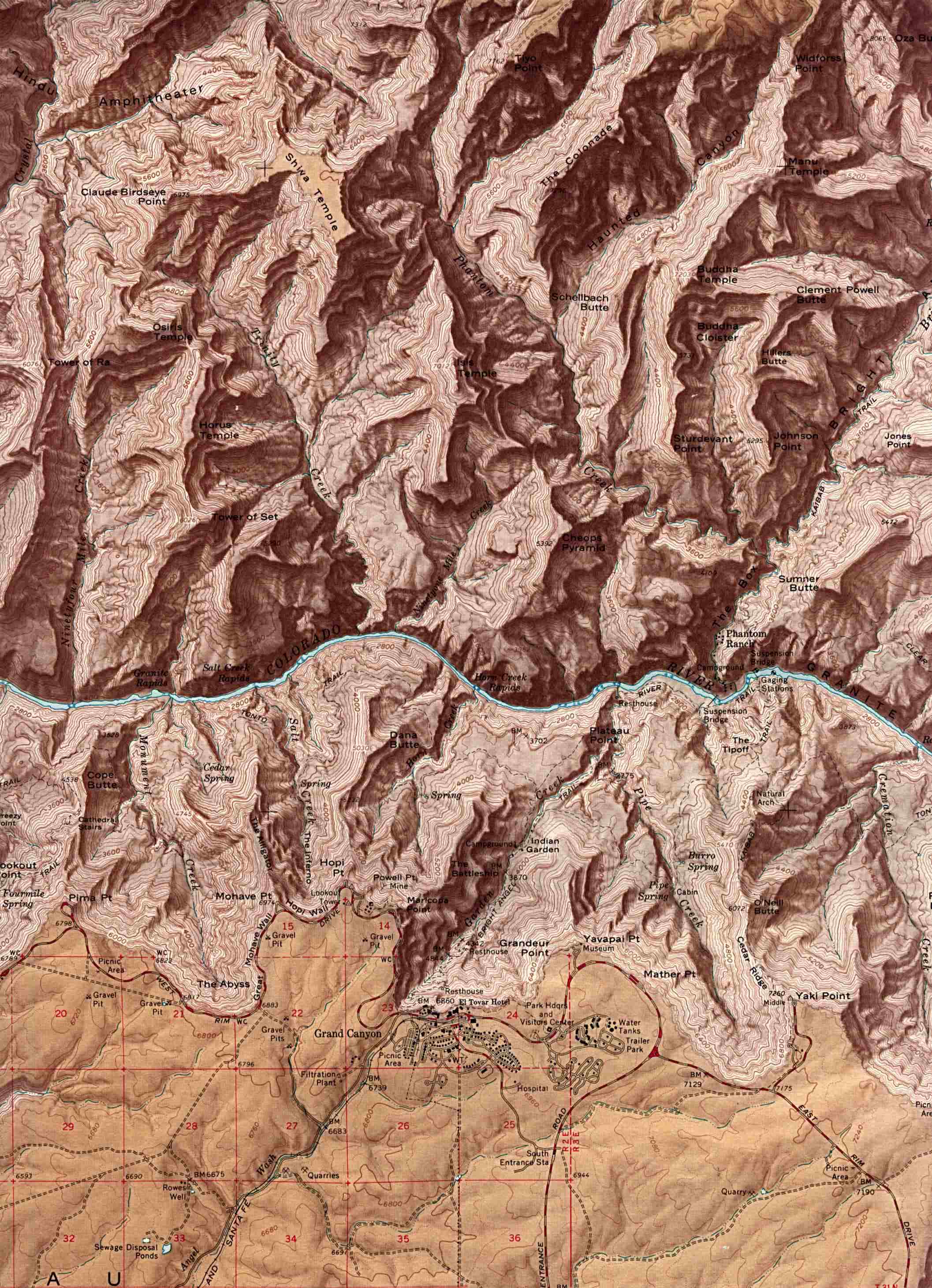
- Grand Canyon National Park (Shaded Relief Map) 1:62:500 U.S.G.S. (519K)
- Grand Canyon National Park - Eastern Area (Shaded Relief Map) (886K)
- Grand Canyon National Park - Western Area (Shaded Relief Map) (1MB)
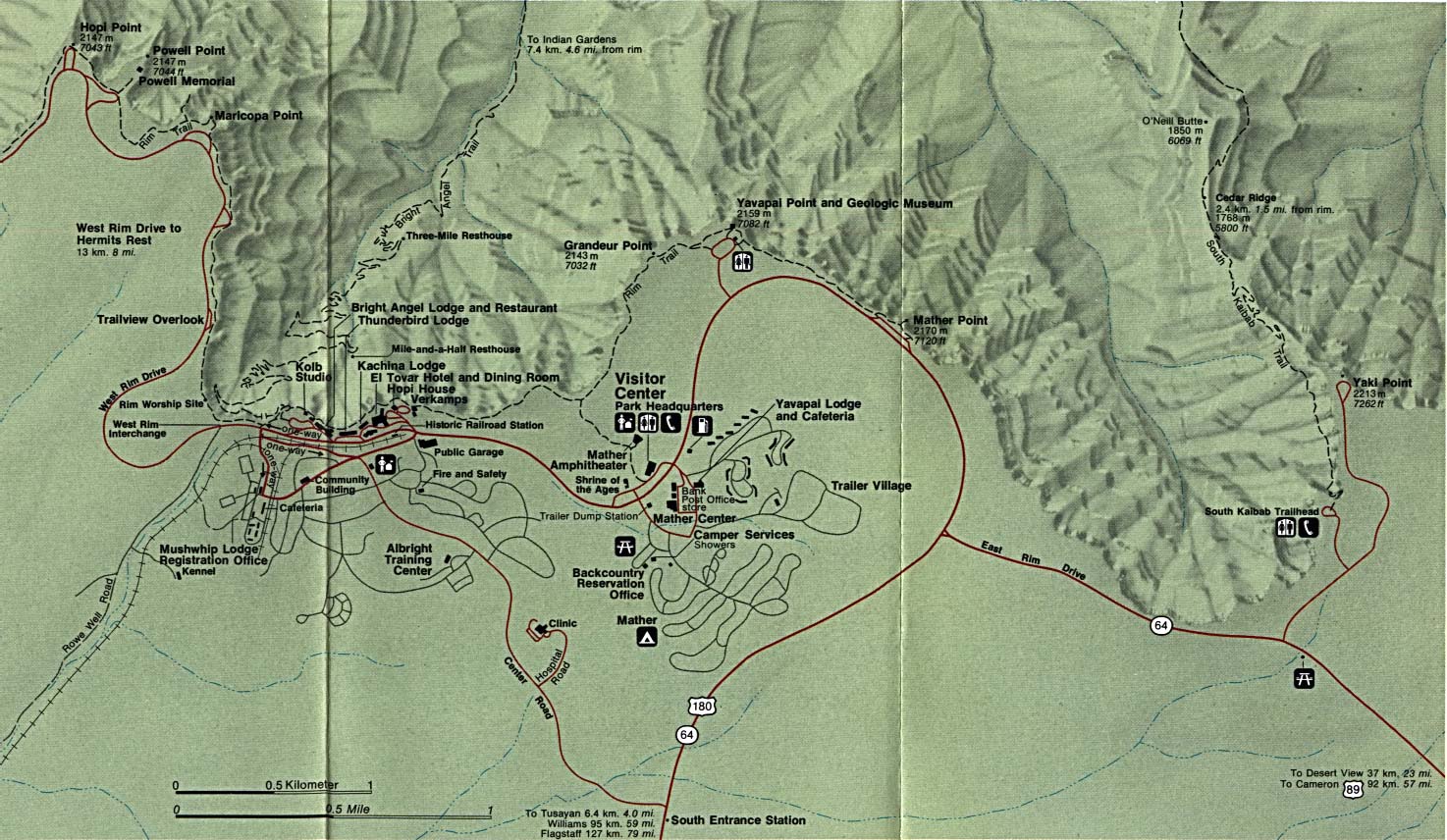
- Grand Canyon National Park - Grand Canyon Village (Detail Map) (281K)
- Grand Canyon National Park - Phantom Ranch Topographic Map USGS 2009 (13.6 MB) (PDF)
- Hubbell Trading Post National Historic Site (Area Map) 1995 (111K)
- Hubbell Trading Post National Historic Site (Park Map) 1997 (65K) (PDF Format)
- Organ Pipe Cactus National Monument (Campsite Map) 1999 (65K) (PDF Format)
- Organ Pipe Cactus National Monument (Park Map) 1999 (129K) (PDF Format)
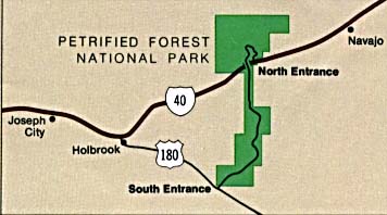
- Petrified Forest National Park (Area Map) (16K)
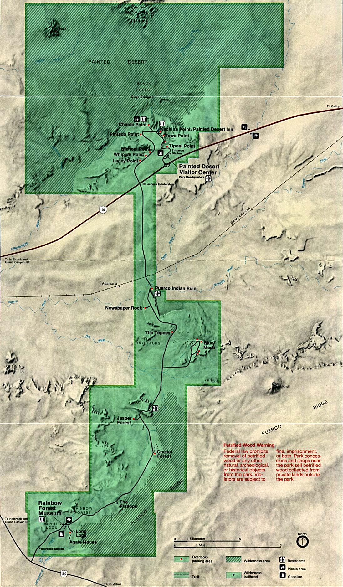
- Petrified Forest National Park (Park Map) (485K)
- Petrified Forest National Park (Park Map) 1999 (129K) (PDF Format)
- Pipe Spring National Monument (Tour Map) 1999 (65K) (PDF Format)
- Rainbow Bridge National Monument (Park Map) 1997 (258K) (PDF Format)
- Saguaro National Park (Area Map) 1997 (65K) (PDF Format)
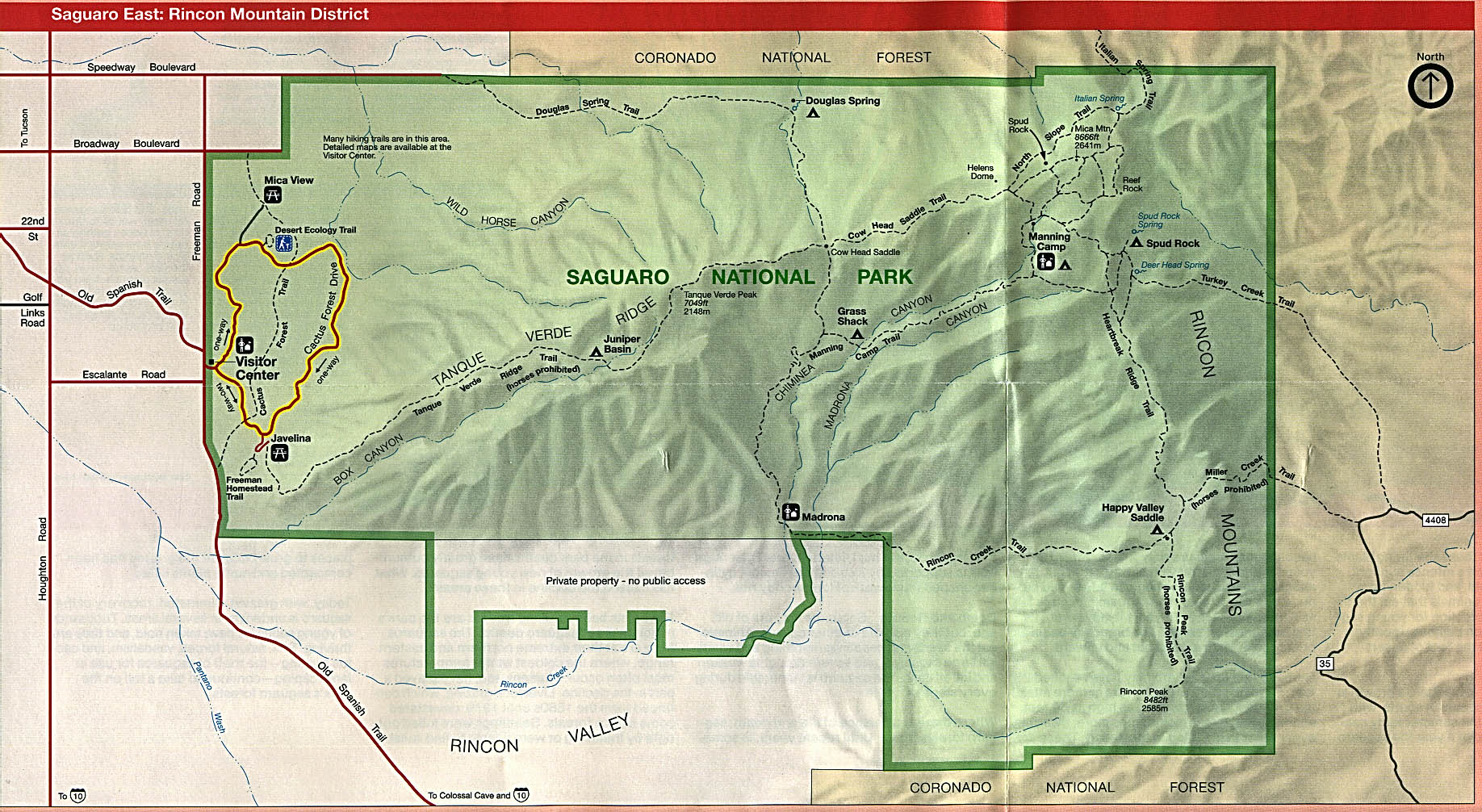
- Saguaro National Park (East: Rincon Mountain District) (Park Map) 1996 (425K)
- Saguaro National Park (East: Rincon Mountain District) (Park Map) 1997 (65K) (PDF Format)
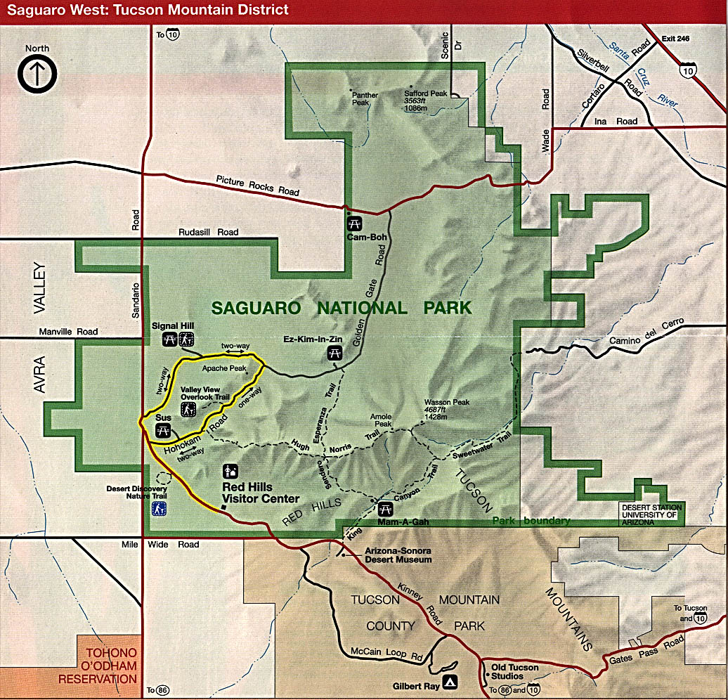
- Saguaro National Park (West: Tucson Mountain District) (Park Map) 1996 (349K)
- Saguaro National Park (West: Tucson Mountain District) (Park Map) 1997 (65K) (PDF Format)
- Wupatki National Monument (Park Map) 1998 (65K) (PDF Format)
![Coronado National Memorial [Southwest United States]](national_parks/coronado_expedition.jpg)
![Glen Canyon National Recreation Area [Arizona / Utah]](national_parks/glen95.jpg)
Maps on Other Web Sites