Maps
Maps FAQ

Map Room Guide
World
Africa
Americas
Asia
Australia/Pacific
Europe
Middle East
Polar/Oceans
Russia/Republics
U.S.
Texas
Historical
Thematic
Topographic
Other Map Sites
Map Sites
Map Dealers
Cartographic Reference
City Map Sites
Country Map Sites
Historical Map Sites
Outline Map Sites
Route Planning Sites
State Map Sites
Weather Map Sites
Topical Map Sites
Avian Influenza
Oil and Gas Maps
More Topical Maps
Perry-Castañeda Library
Note: These maps are from the Atlas of Eastern Europe, published by the U.S. Central Intelligence Agency in August 1990. More recent political and shaded relief maps are available on our Europe Maps page.
Maps FAQ
Map Room Guide
World
Africa
Americas
Asia
Australia/Pacific
Europe
Middle East
Polar/Oceans
Russia/Republics
U.S.
Texas
Historical
Thematic
Topographic
Other Map Sites
Map Sites
Map Dealers
Cartographic Reference
City Map Sites
Country Map Sites
Historical Map Sites
Outline Map Sites
Route Planning Sites
State Map Sites
Weather Map Sites
Topical Map Sites
Avian Influenza
Oil and Gas Maps
More Topical Maps
Perry-Castañeda Library
Map Collection
Atlas of Eastern Europe
Note: These maps are from the Atlas of Eastern Europe, published by the U.S. Central Intelligence Agency in August 1990. More recent political and shaded relief maps are available on our Europe Maps page.
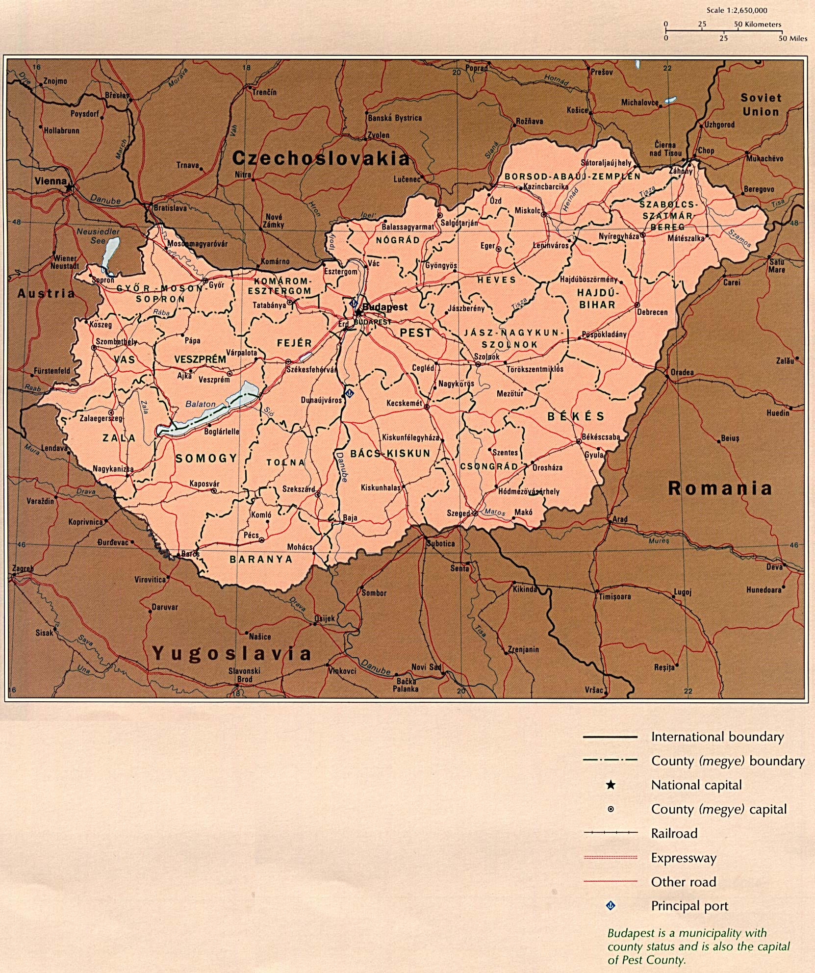
-
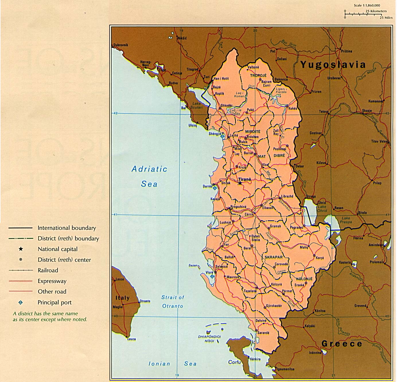
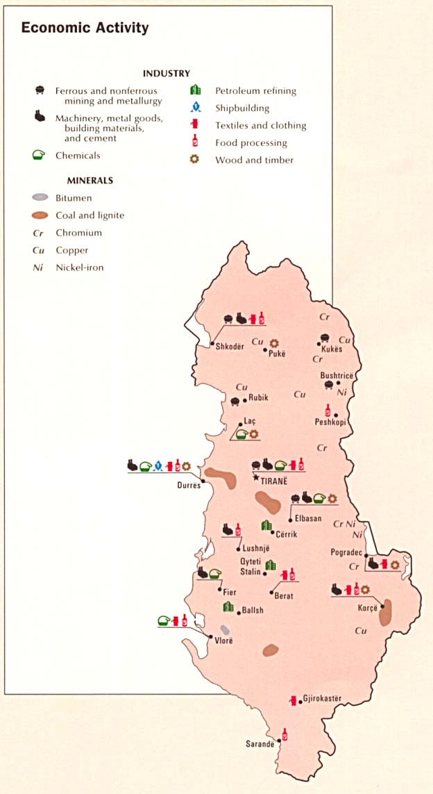
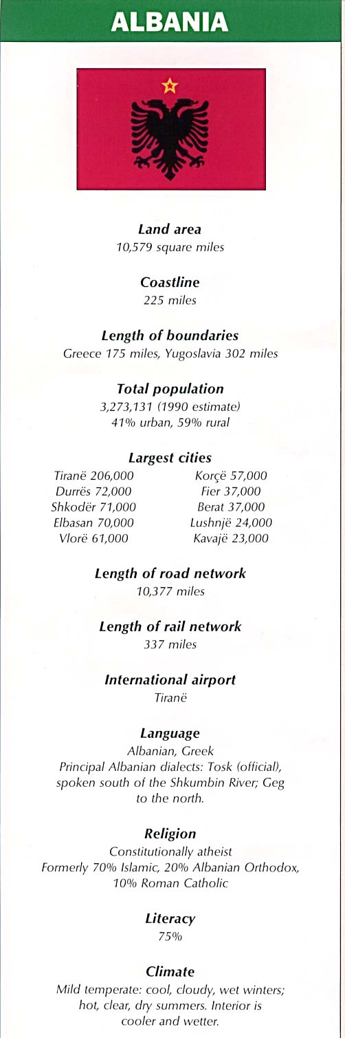
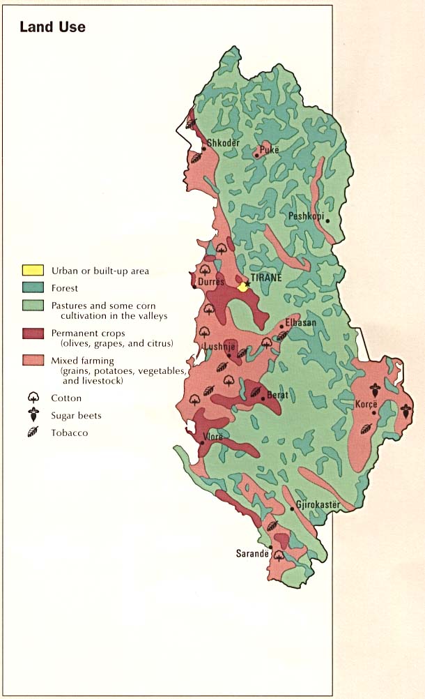
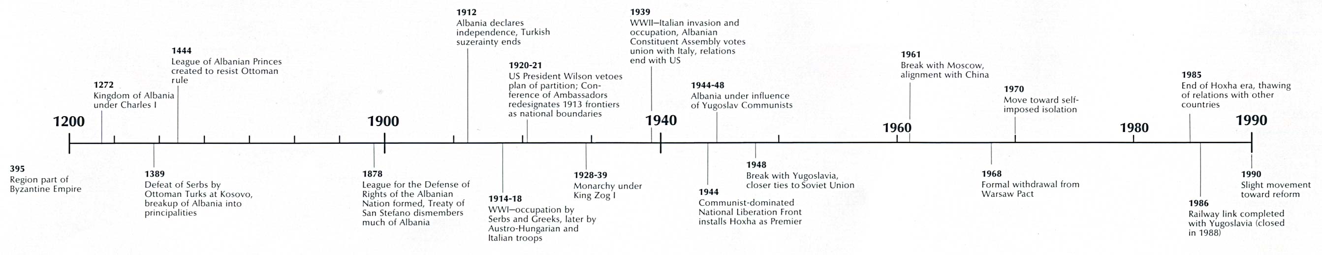
Albania
- Country Map (359K)
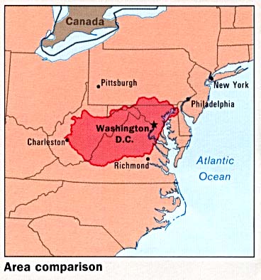
- Area Comparison (34K)
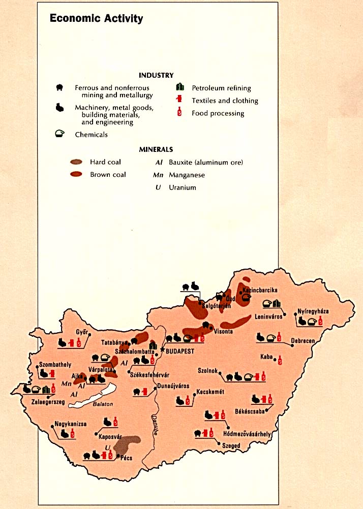
- Economic Activity (63K)
- Country Information (87K)
- Land Use (74K)
- Population Density (117K)
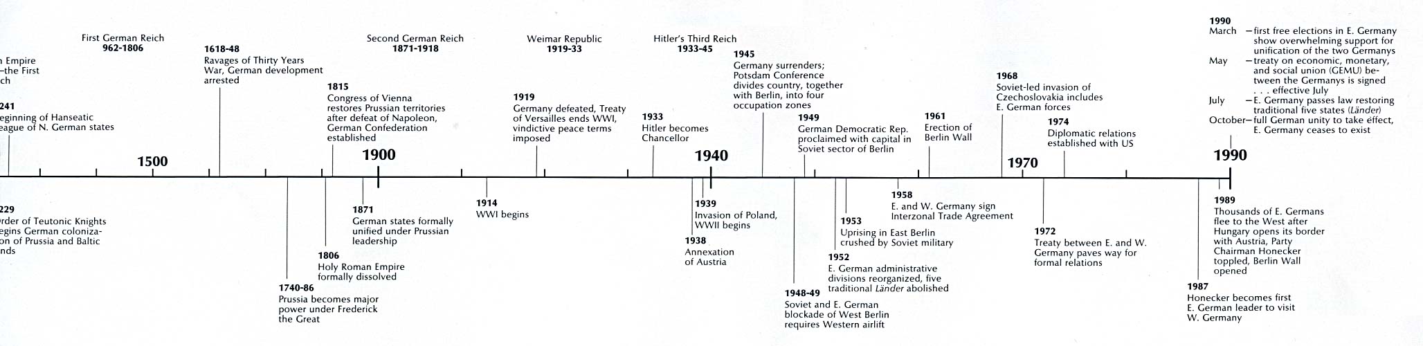
- Time Line (124K)
- Country Map (295K)
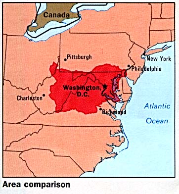
- Area Comparison (37K)
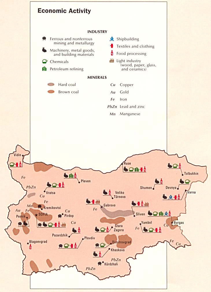
- Economic Activity (84K)
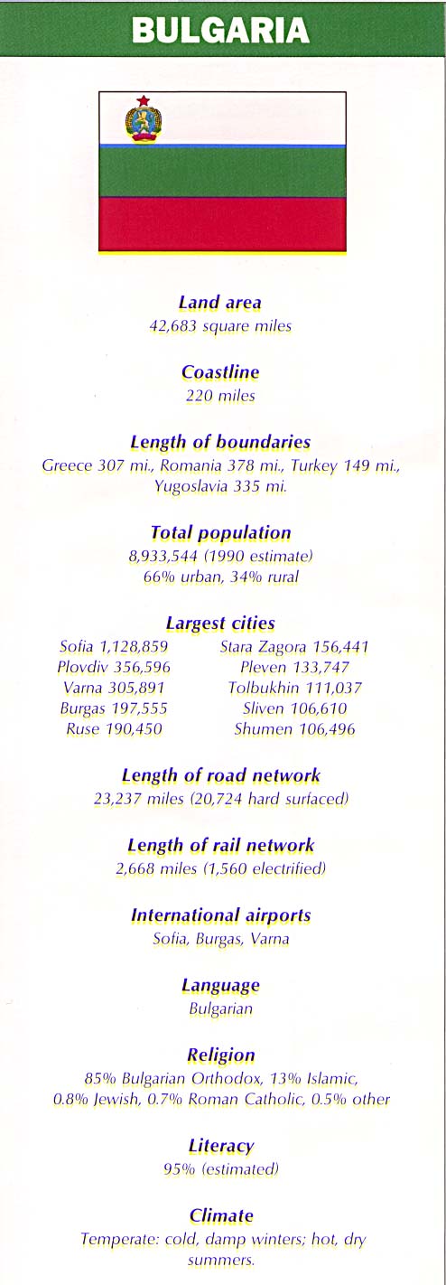
- Country Information (90K)
- Land Use (85K)
- Population Density (115K)
- Time Line (124K)
- Country Map (577K)
- Area Comparison (33K)
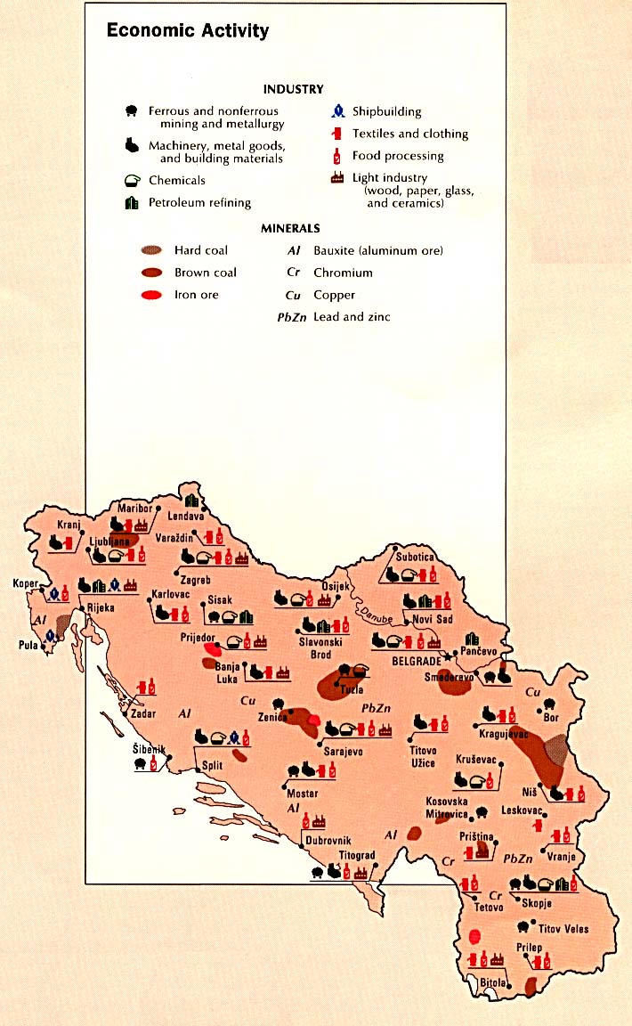
- Economic Activity (120K)
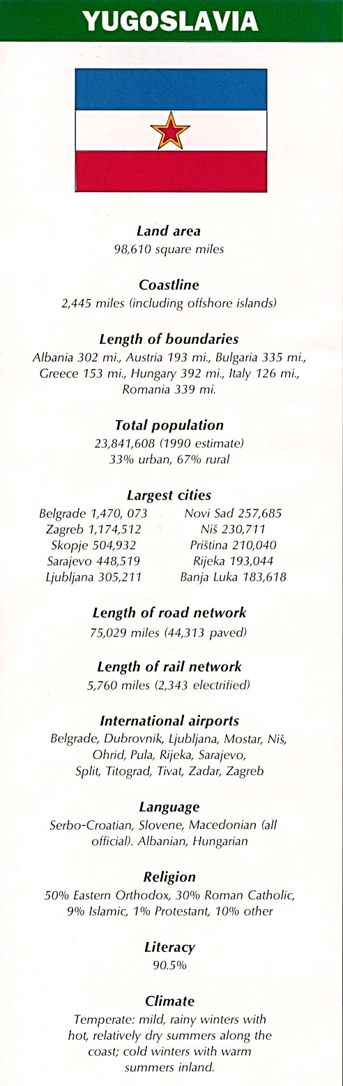
- Country Information (89K)
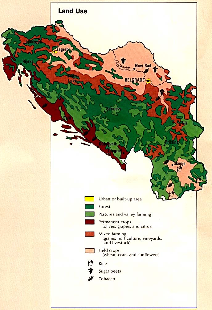
- Land Use (109K)
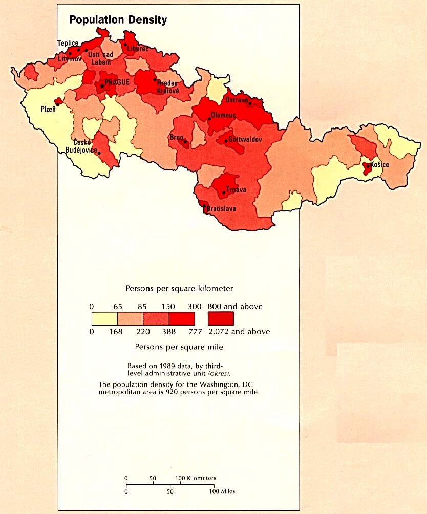
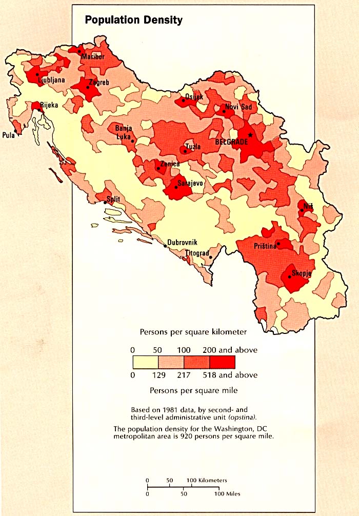
- Population Density (104K)
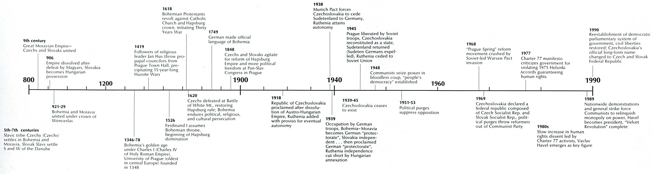
- Time Line (160K)
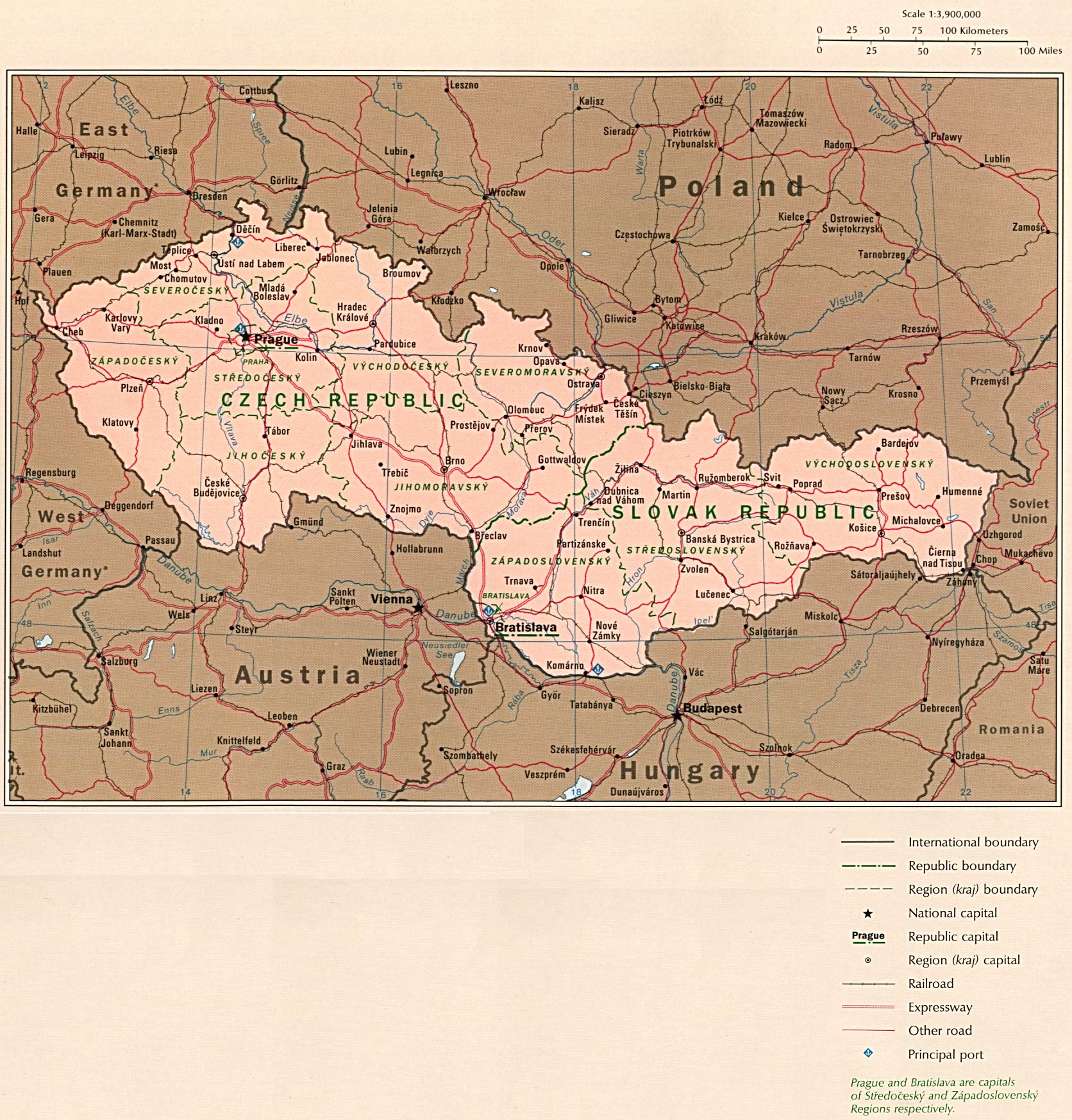
- Country Map (409K)
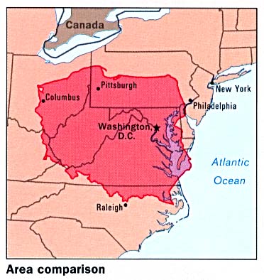
- Area Comparison (35K)
- Administrative Divisions (40K)
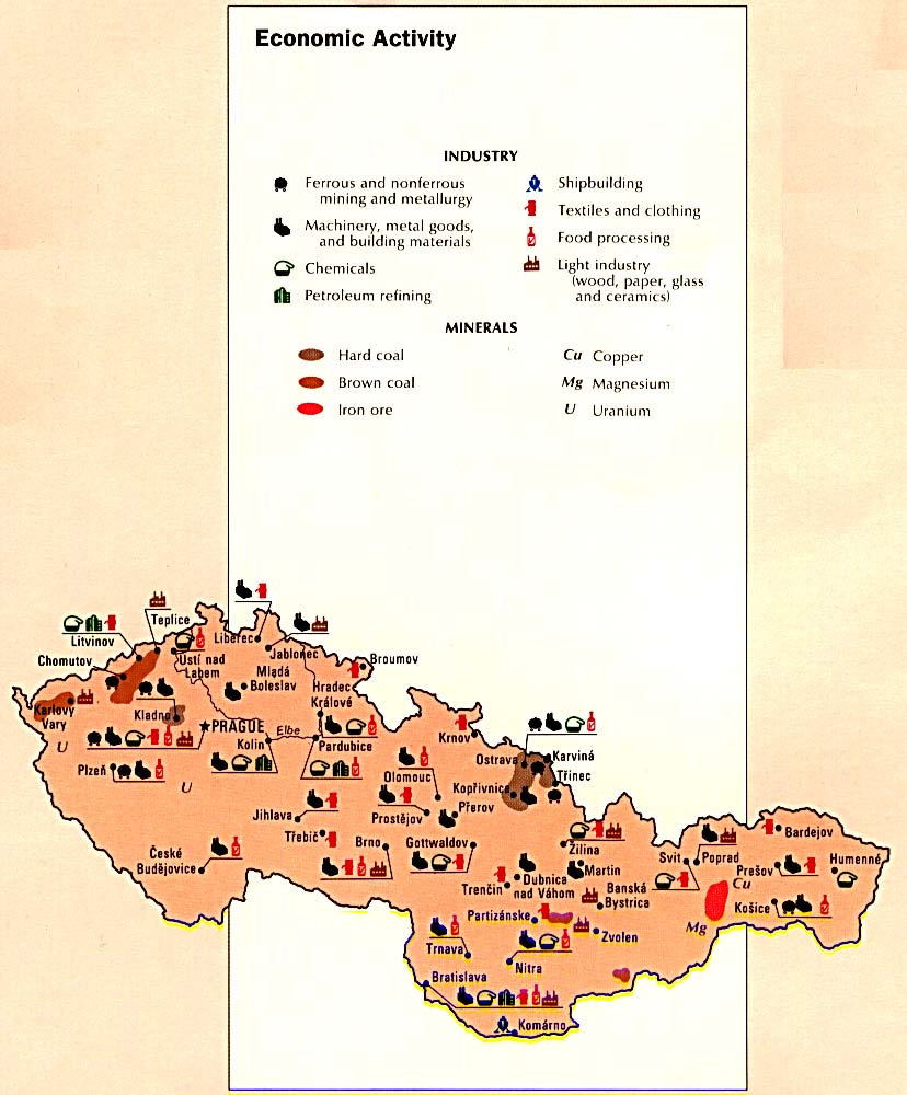
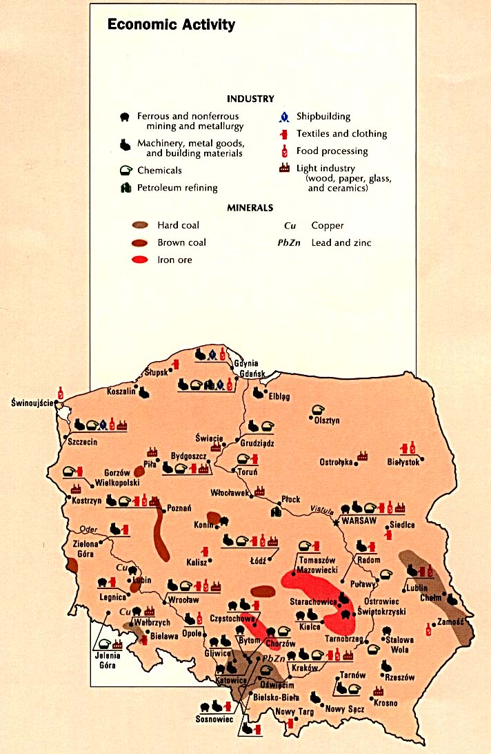
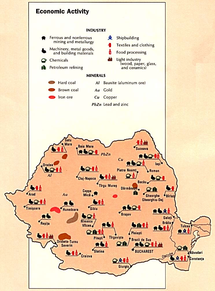
- Economic Activity (133K)
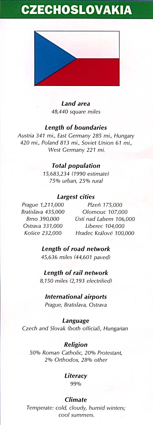
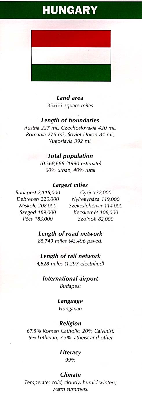
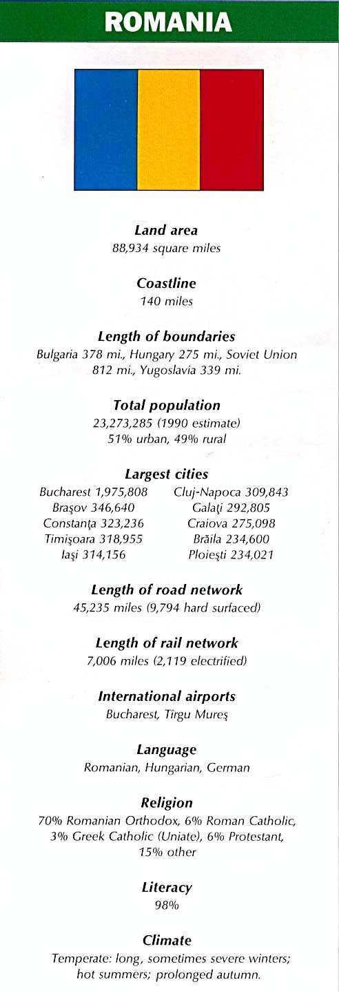
- Country Information (84K)
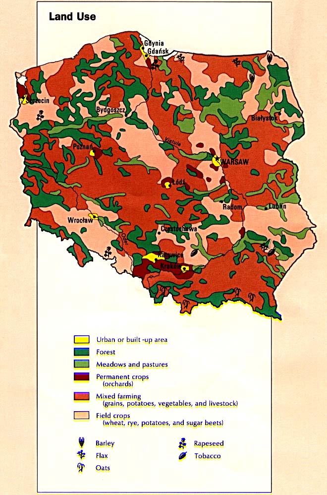
- Land Use (137K)
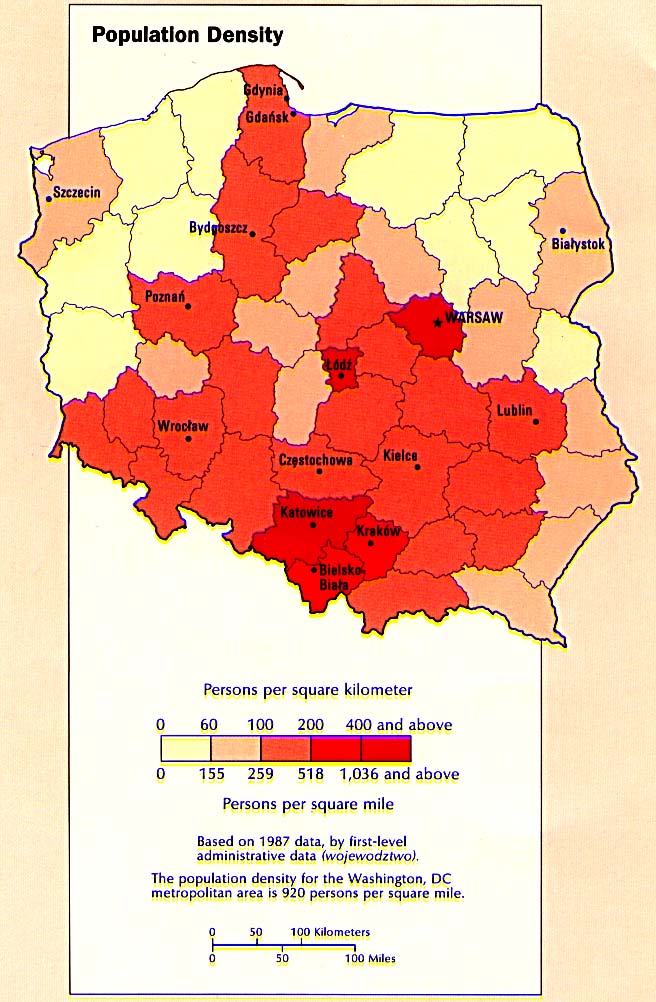
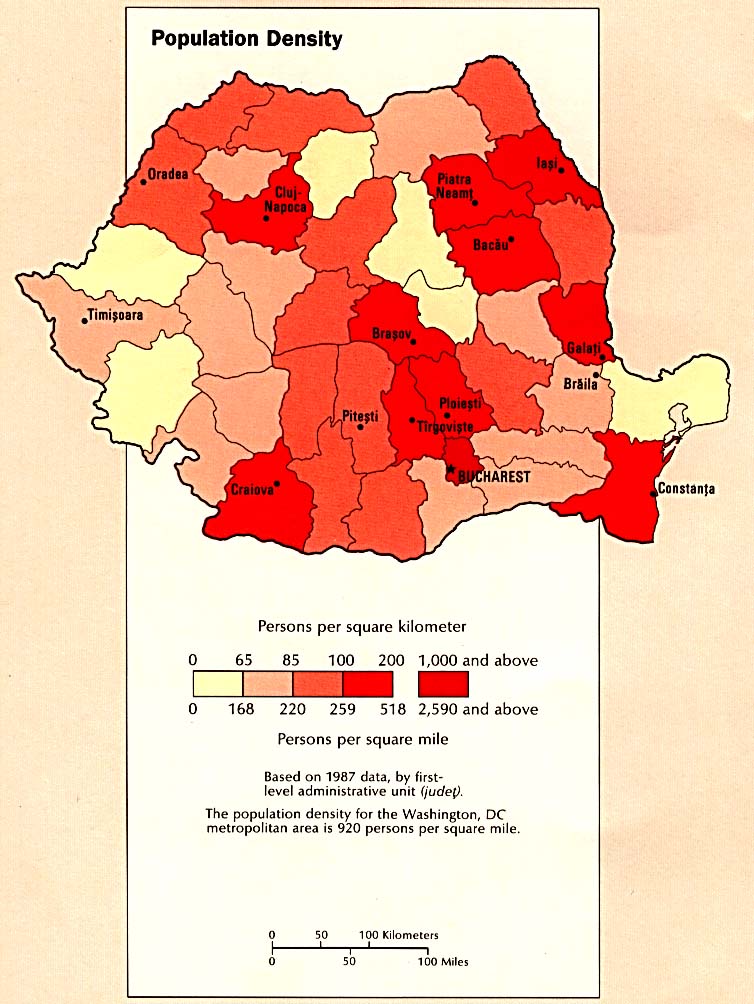
- Population Density (115K)
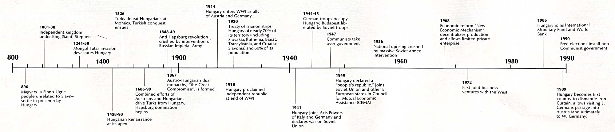
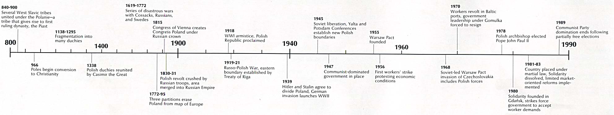
- Time Line (140K)
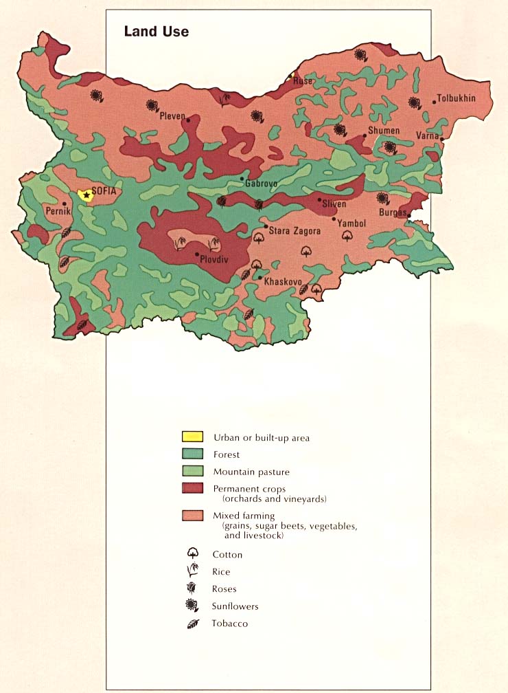
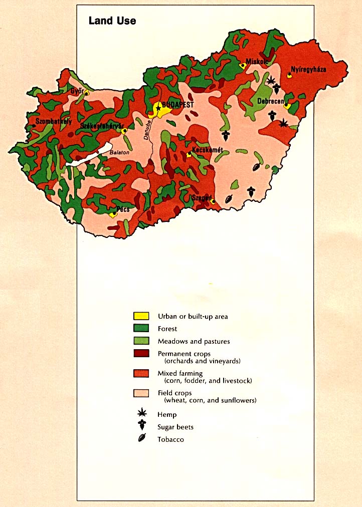
- Land Use (125K)
- Country Map (780K)
- Area Comparison (340K)
- Economic Activity (106K)
- Country Information (84K)
- Land Use (111K)
- Population Density (127K)
- Time Line (126K)
- Country Map (782K)
- Area Comparison (33K)
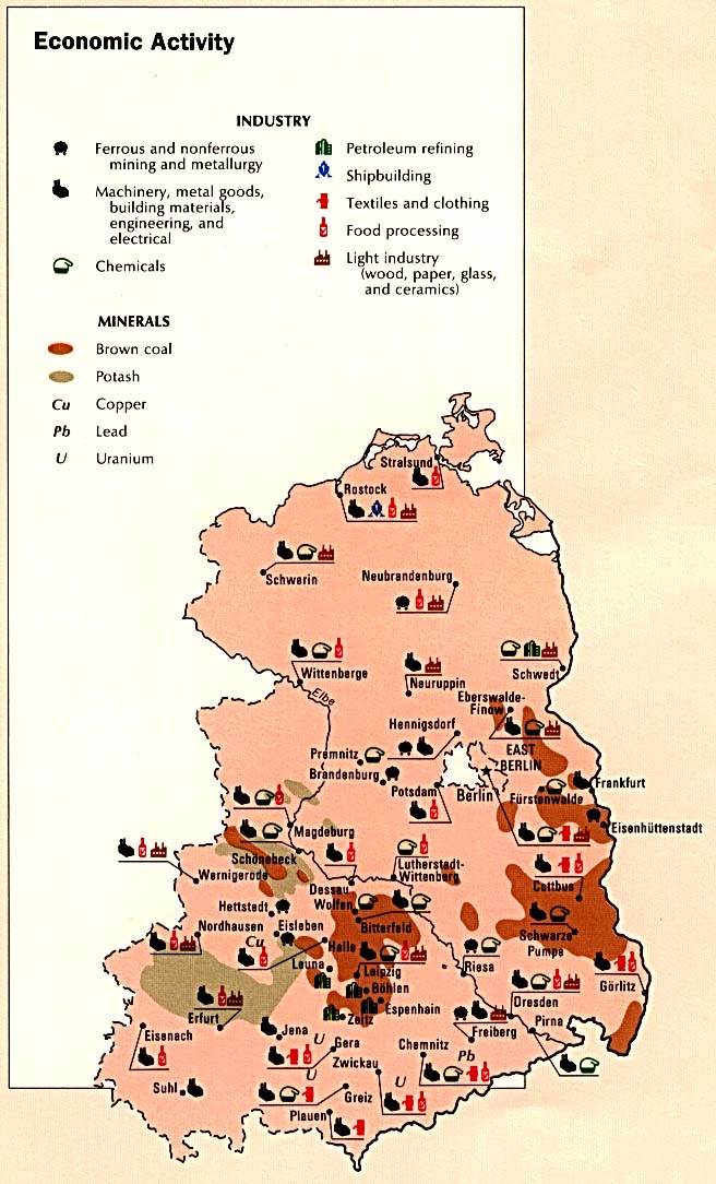
- Economic Activity (141K)
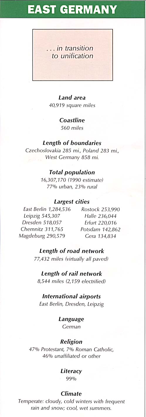
- Country Information (83K)
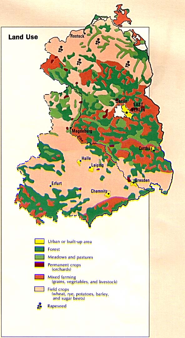
- Land Use (138K)
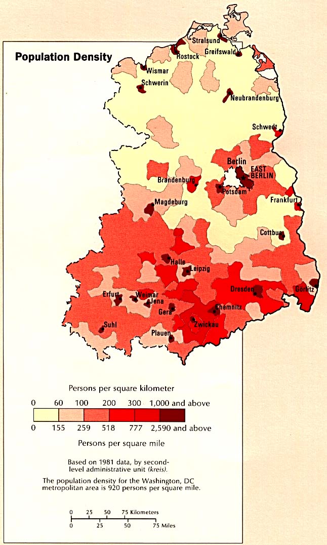
- Population Density (123K)
- Time Line (102K)
- Country Map (629K)
- Area Comparison (31K)
- Economic Activity (127K)
- Country Information (83K)
- Land Use (135K)
- Population Density (116K)
- Time Line (179K)
- Country Map (713K)
- Area Comparison (36K)
- Economic Activity (114K)
- Country Information (104K)
- Land Use (121K)
- Population Density (124K)
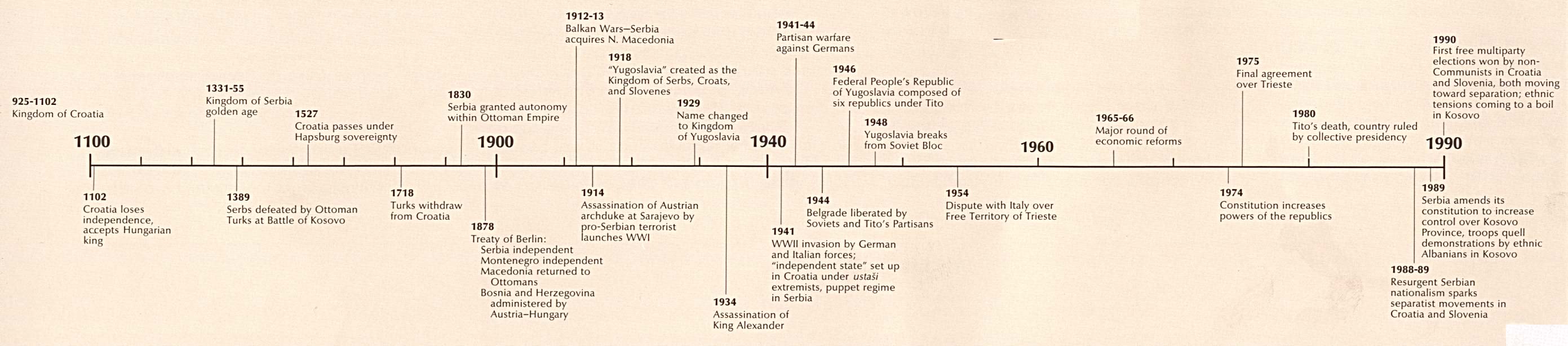
- Time Line (213K)
Bulgaria
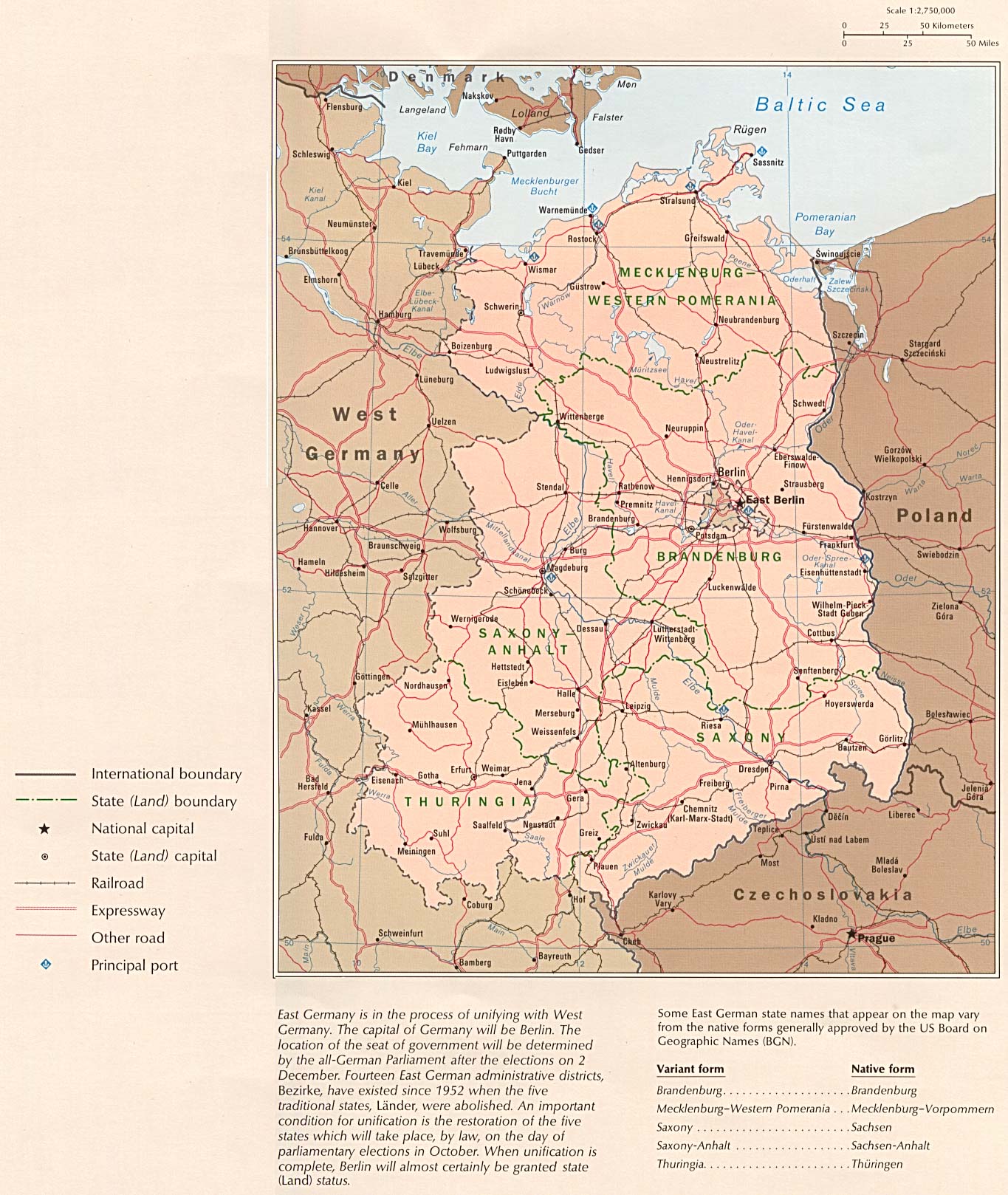
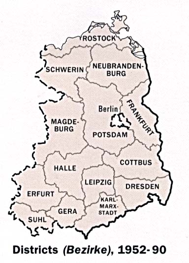
East Germany
Yugoslavia