Perry-Castañeda Library
Map Collection
Bhutan Maps
The following maps were produced by the U.S. Central Intelligence Agency, unless otherwise indicated.
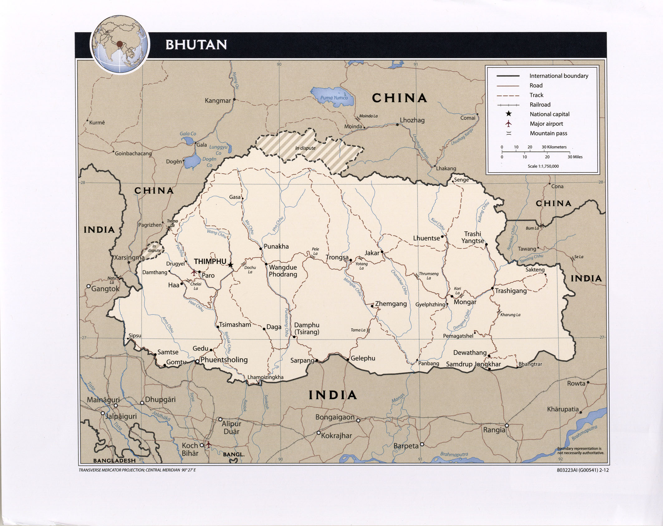
Country Maps- Bhutan (Political) 2012 (568K)
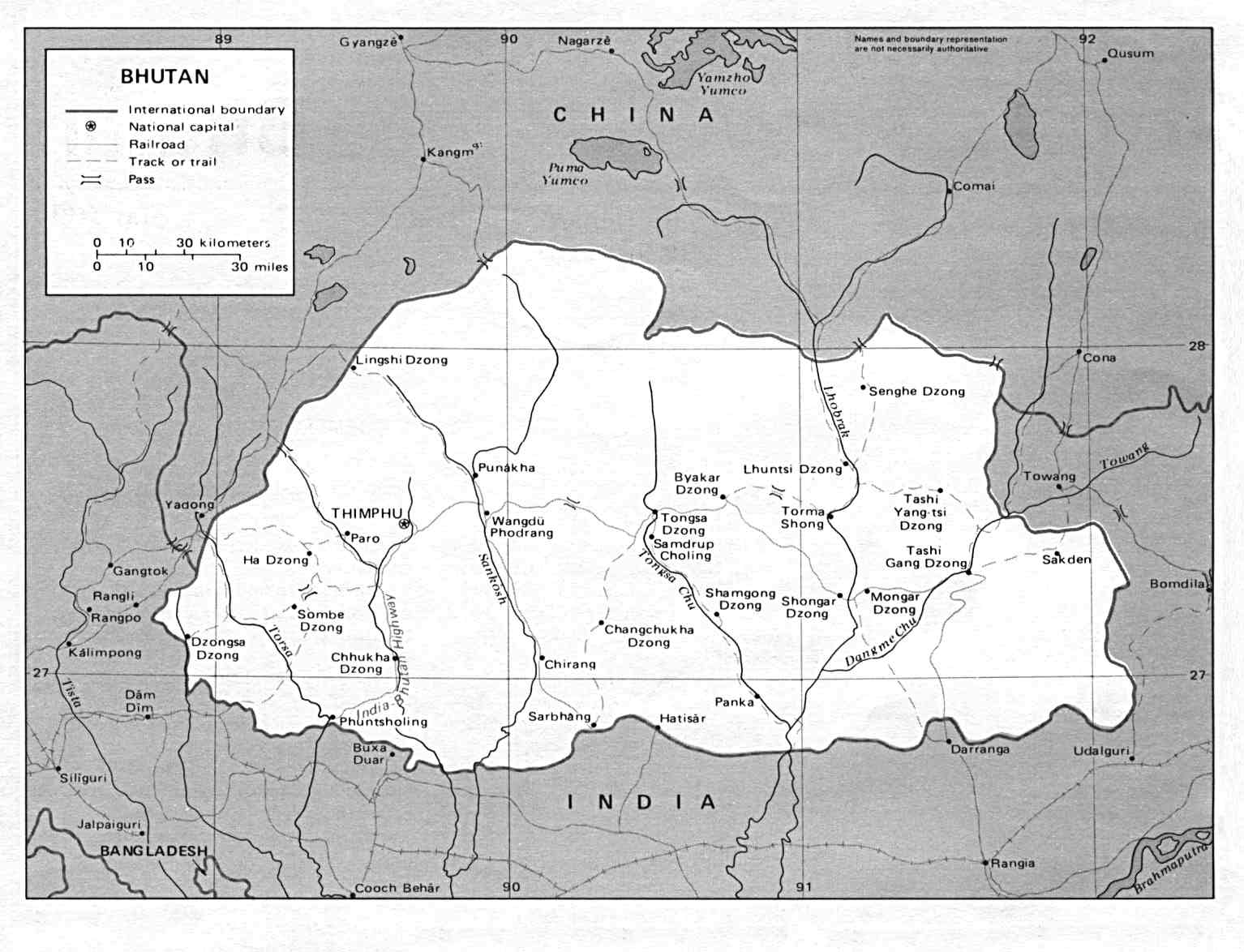
- Bhutan (Political) U.S. Department of State 1990 (125K)
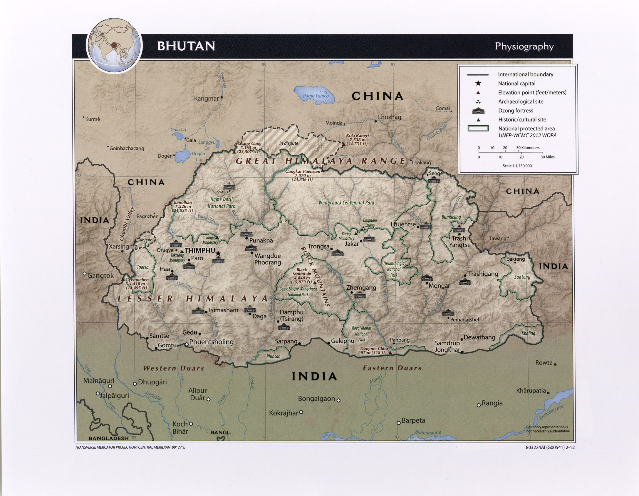
- Bhutan (Physiographic) 2012 (644K) and pdf format (921K)
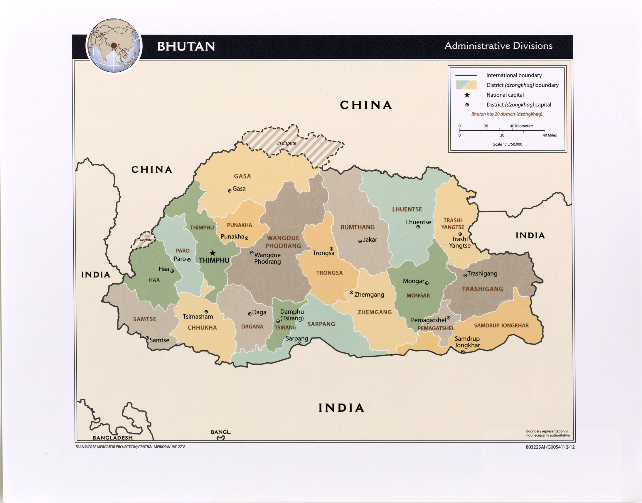
- Bhutan (Administrative Divisions) 2012 (419K) and pdf format (515K)
- Bhutan (Small Map) 2016 (22.5K)
- Bhutan (Transportation) 2012 (568K) and pdf format (705K)
- 1:1,000,000 - Operational Navigation Chart Series U.S. Defense Mapping Agency Aerospace Center Not for navigational use
- Sheets H-9 and H-10 include Bhutan
- 1:1,000,000 - International Map of the World
- This series includes most of Bhutan
- 1:500,000 - Tactical Pilotage Charts U.S. National Imagery and Mapping Agency. Not for navigational use
- This series covers part of northern Bhutan
- 1:250,000 - India and Pakistan - Topographic Maps Series U502, U.S. Army Map Service, 1955-
- This map series includes most of Bhutan. The extreme north is covered by China - Series L500 at the same scale.
- 1:250,000 - India Joint Operations Graphic Series U.S. National Imagery and Mapping Agency, 1981- Not for navigational use
- Sheet NG45-8 covers part of Southwest Bhutan
- Sheets H-9 and H-10 include Bhutan
Maps at Other Web Sites