Perry-Castañeda Library
Map Collection
Colorado Maps
State Maps
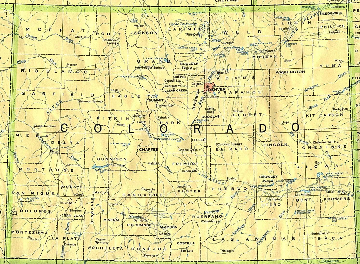
- Colorado (base map) JPEG format (519K) County boundaries and names, county seats, rivers. Original scale 1:2,500,000 U.S. Geological Survey, 1972 limited update 1990
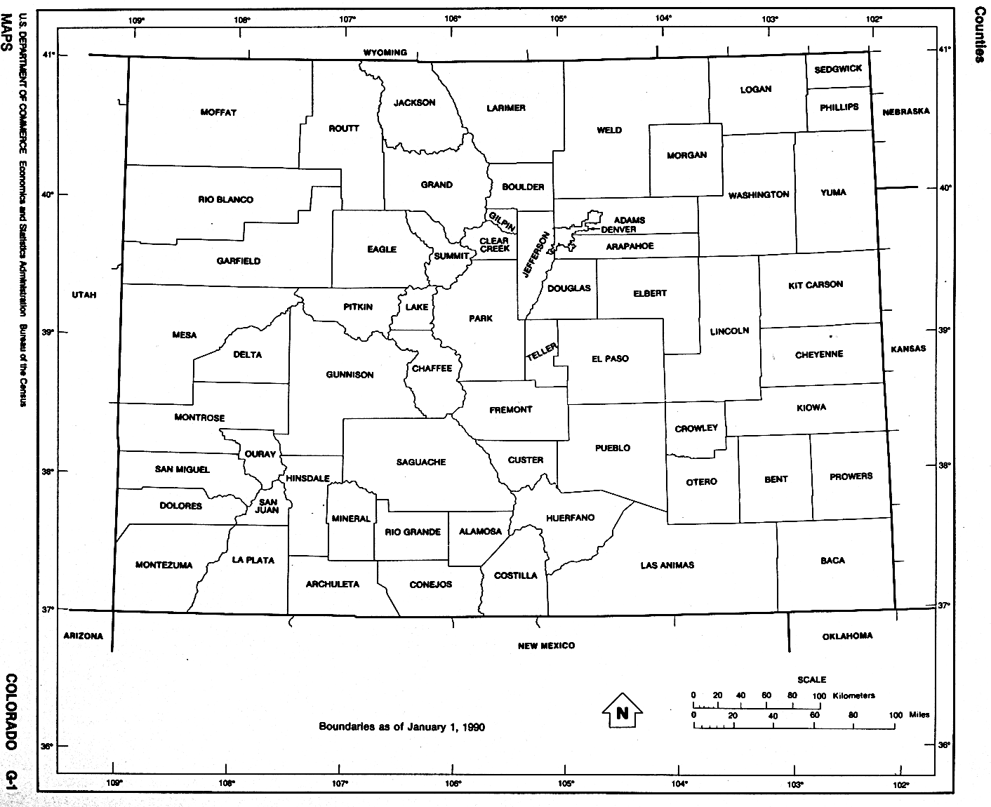
- Colorado (outline map) JPEG format (90K) County boundaries and names. U.S. Bureau of the Census, 1990
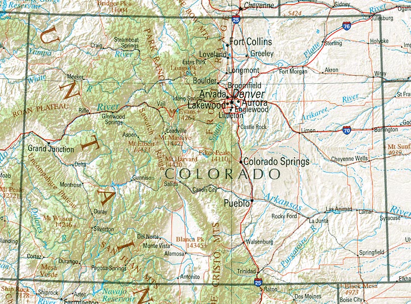
- Colorado (reference map) JPEG format (265K) Shaded relief map with state boundaries, forest cover, place names, major highways. Portion of "The National Atlas of the United States of America. General Reference", compiled by U.S. Geological Survey 2001, printed 2002
- Colorado (reference map) PDF format (268K) Shaded relief map with state boundaries, forest cover, place names, major highways. Portion of "The National Atlas of the United States of America. General Reference", compiled by U.S. Geological Survey 2001, printed 2002
- Colorado - Federal Lands and Indian Reservations PDF format (1MB) The National Atlas of the United States of America, U.S. Geological Survey, 2003
City Maps
- Aspen (topographic) original scale 1:24,000 U.S.G.S. 1987 (340K)
- Cortez (topographic) original scale 1:24,000 U.S.G.S. 1965 (476K)
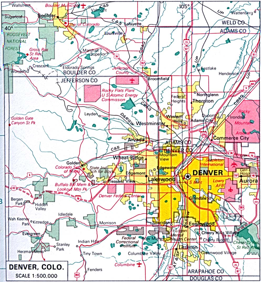
- Denver original scale 1:500,000 U.S. National Atlas 1970 (303K)
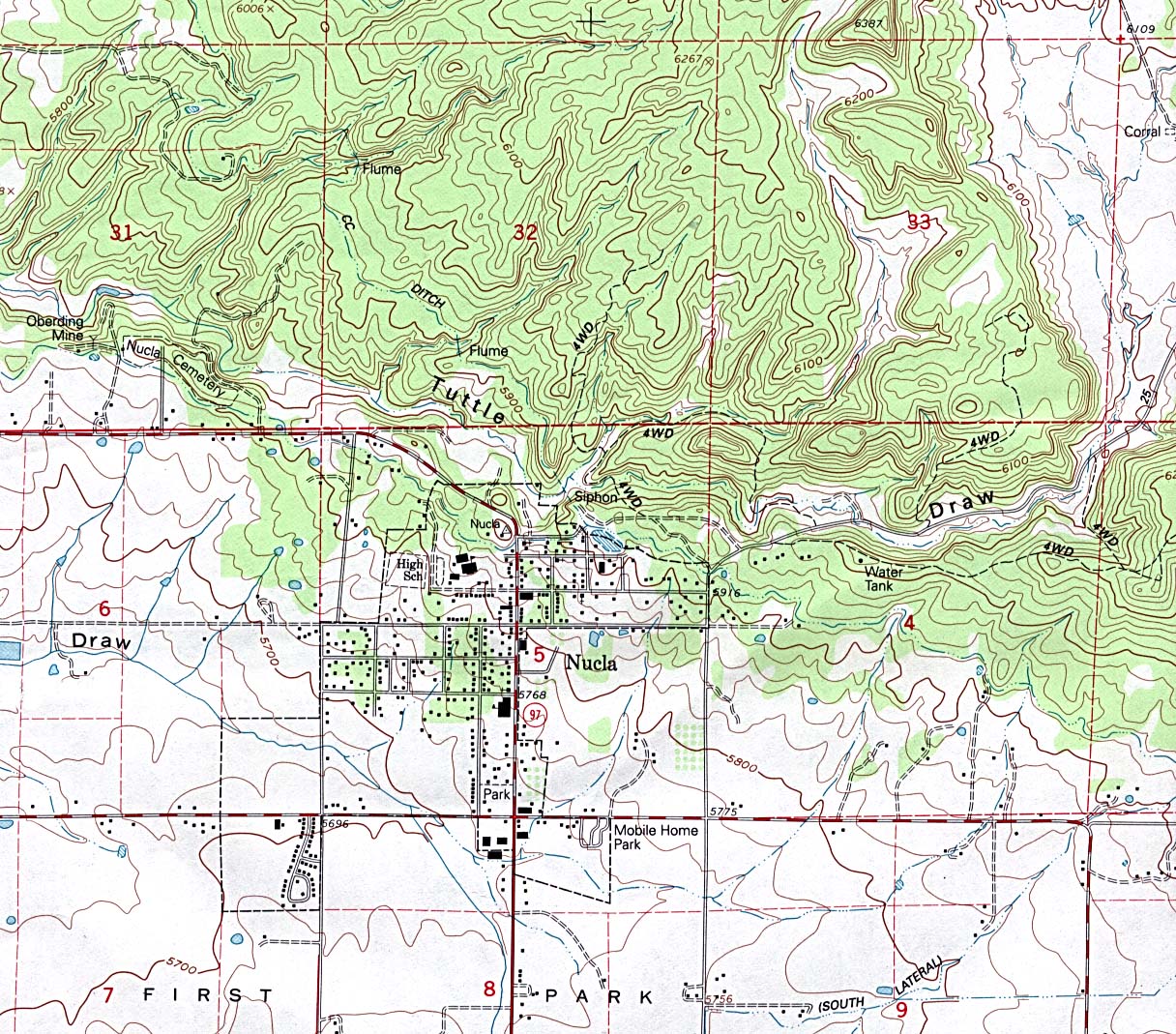
- Nucla (topographic) original scale 1:24,000 U.S.G.S. 1994 (468K)
Historical City Maps
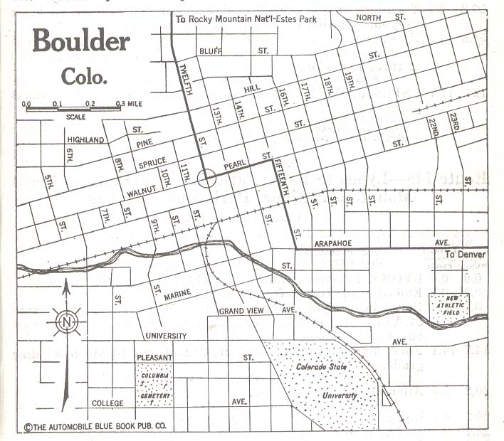
- Boulder 1920 Automobile Blue Book 1920, Vol. 7 (258K)
- Colorado Springs 1920 Automobile Blue Book, 1920, Vol. 7 (221K)
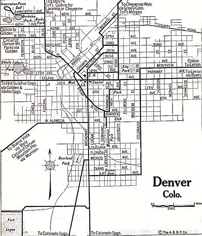
- Denver 1917 Automobile Blue Book, 1917, Vol. 8 (90K)
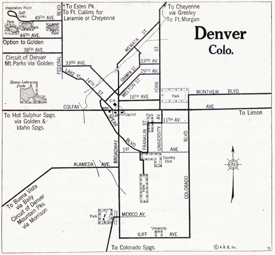
- Denver 1920 Automobile Blue Book, 1920, Vol. 7 (179K)
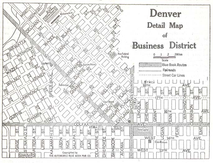
- Denver - Business District 1920 Automobile Blue Book, 1920, Vol. 7 (90K)
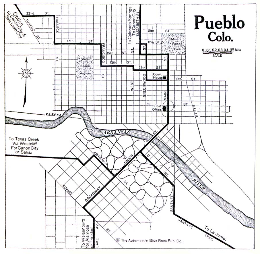
- Pueblo 1920 Automobile Blue Book, 1920, Vol. 7 (176K)
Historical Topographic Maps
- Colorado Historical Topographic Maps (U.S. Geological Survey)
- Pre-1945 maps, scales 1:62,500 and 1:125,000
Historic Trail Maps Series
- Historic Trail Maps of Eastern Colorado and Northeastern New Mexico by Glenn R. Scott [Boxed Set] - Pamphlet USGS, 2004 (45MB) [PDF]
- Historic Trail Map of Denver 1 Degree by 2 Degrees Quadrangle, Central Colorado - Main Map USGS, 1999 (11MB) [PDF]
- Historic Trail Map of Denver 1 Degree by 2 Degrees Quadrangle, Central Colorado - Northwest Inset USGS, 1999 (10.9MB) [PDF]
- Historic Trail Map of Denver 1 Degree by 2 Degrees Quadrangle, Central Colorado - Explanatory Pamphlet USGS, 1999 (1.7MB) [PDF]
- Historic Trail Map of the Greater Denver Area USGS, 1976 (58MB) [PDF]
- Historic Trail Map of Greeley 1 Degree by 2 Degrees Quadrangle, Colorado and Wyoming - Map USGS, 1993 (1.2MB) [PDF]
- Historic Trail Map of Greeley 1 Degree by 2 Degrees Quadrangle, Colorado and Wyoming - Pamphlet USGS, 1993 (20.4MB) [PDF]
- Historic Trail Map of the La Junta 1 Degree by 2 Degree Quadrangle, Southeastern Colorado and Western Kansas - Poster/Map USGS, 2008 (95.4MB) [PDF]
- Historic Trail Map of the La Junta 1 Degree Quadrangle, Southeastern Colorado and Western Kansas - Pamphlet USGS, 2008 (50.4MB) [PDF]
- Historic Trail Map of the La Junta 2 Degree Quadrangle, Southeastern Colorado and Western Kansas - Map USGS, 2008 (2.4MB) [PDF]
- Historic Trail Map of the Leadville 1 Degree by 2 Degrees Quadrangle, Central Colorado - Map USGS, 2004 (3.7MB) [PDF]
- Historic Trail Map of the Leadville 1 Degree by 2 Degrees Quadrangle, Central Colorado - Pamphlet USGS, 2004 (88.4MB) [PDF]
- Historic Trail Map of the Pueblo 1 by 2 Quadrangle, Colorado - Trail Map and Routes of Early Travelers Map USGS, 1975 (37.2MB) [PDF]
- Historic Trail map of the Raton and Springer 30 by 60 Minute Quadrangle Map, New Mexico and Colorado - Sheet 1 USGS, 1986 (8.3MB) [PDF]
- Historic Trail Map of the Raton and Springer 20 by 60 Minute Quadrangle Map, New Mexico and Colorado - Sheet 2 USGS, 1986 (7.5MB) [PDF]
- Historic Trail Map of the Raton and Springer 20 by 60 Minute Quadrangles, New Mexico and Colorado - Report USGS, 1986 (548K) [PDF]
- Historic Trail Map of Trinidad 1 Degree by 2 Degrees Quadrangle, Southern Colorado - Map/Poster USGS, 2001 (15.2MB) [PDF]
- Historic Trail Map of the Trinidad 1 Degree by 2 Degrees Quadrangle, Southern Colorado - Pamphlet USGS, 2001 (1.1MB) [PDF]
- Historic Trail Map of the Trinidad 1 Degree by 2 Degrees Quadrangle, Southern Colorado - Report USGS, 2001 (25.1MB) [PDF]
- Historic Trail Maps of the Sterling 1 Degree by 2 Degrees Quadrangle, Northeastern Colorado - Explanatory Pamphlet USGS, 1989 (619K) [PDF]
Maps of National Parks, Monuments, and Historic Sites
The following maps were produced by the U.S. National Park Service unless otherwise noted.
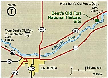
- Bent's Old Fort National Historic Site (Area Map) 1994 (327K)
- Bent's Old Fort National Historic Site (Area Map) 1995 (65K) (PDF Format)
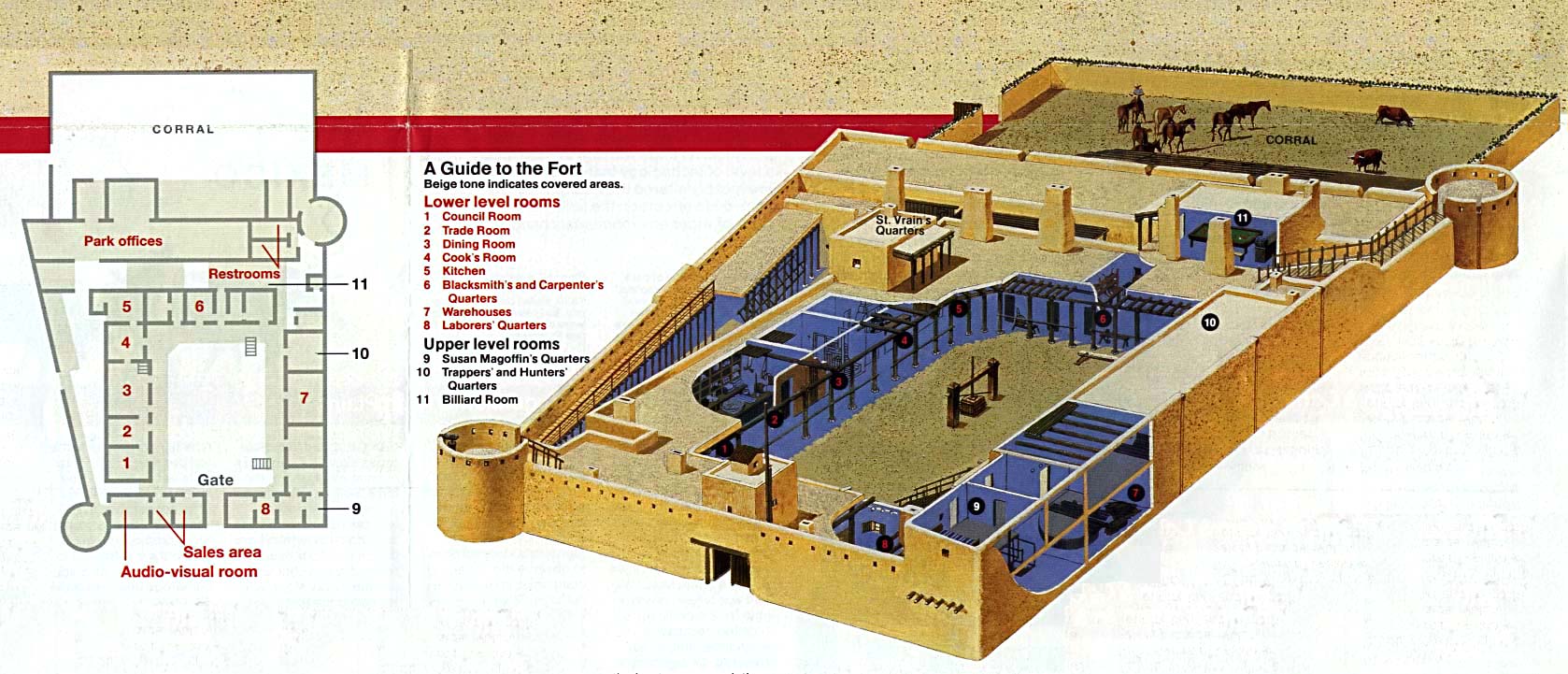
- Bent's Old Fort National Historic Site (Floor Plan) 1995 (65K) (PDF Format)
- Bent's Old Fort National Historic Site (Schematic and Floor Plan) 1994 (241K)
- Black Canyon of the Gunnison National Park (Area Map) 1995 (129K) (PDF Format)
- Black Canyon of the Gunnison National Park (Park Map) 1996 (323K) (PDF Format)
- Black Canyon of the Gunnison National Park (Profile Map) 1996 (65K) (PDF Format)
- Black Canyon of the Gunnison National Park (Area Map) 1995 (129K) (PDF Format)
- Black Canyon of the Gunnison National Park (Park Map) 1996 (323K) (PDF Format)
- Black Canyon of the Gunnison National Park (Profile Map) 1996 (65K) (PDF Format)
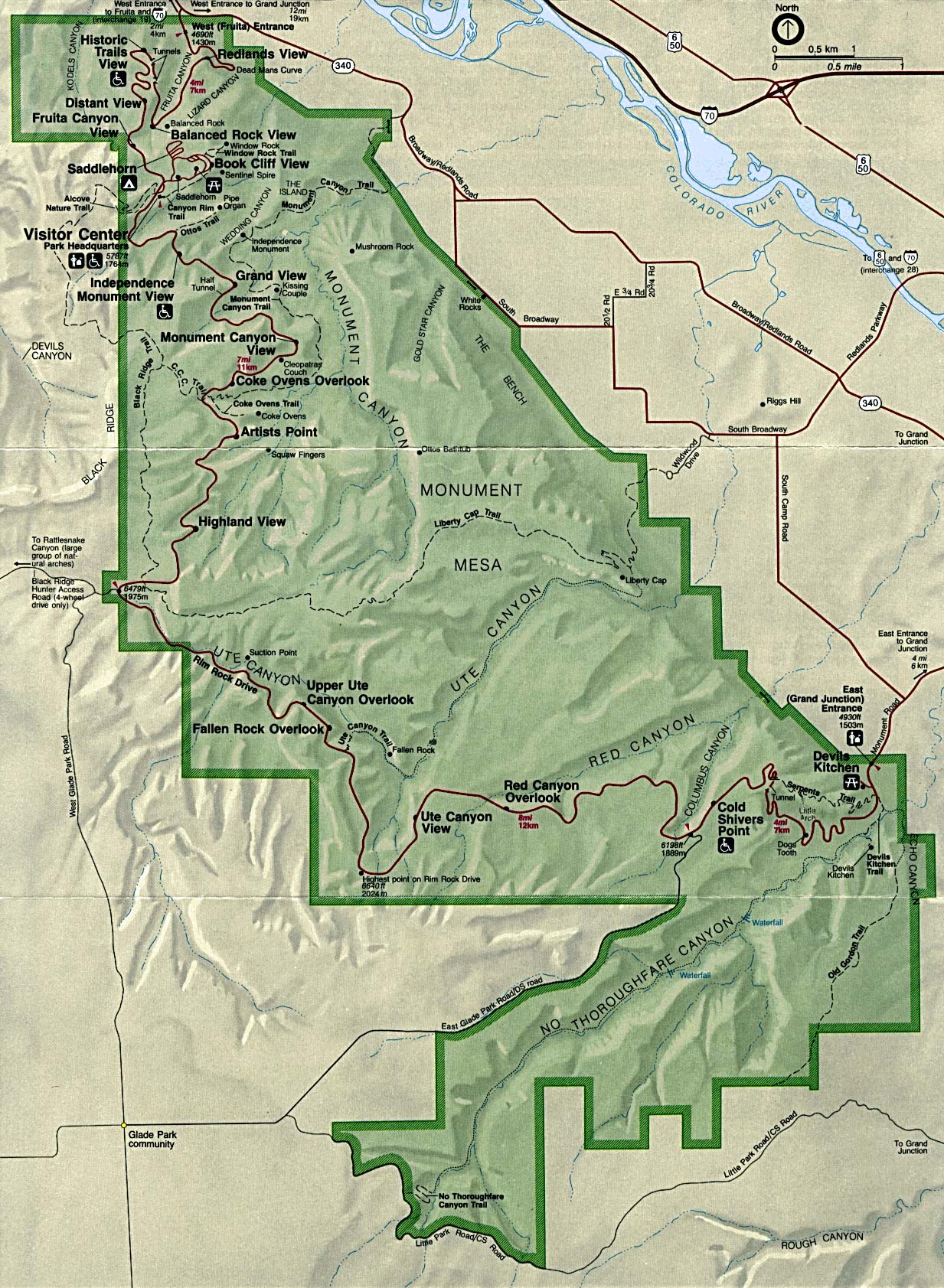
- Colorado National Monument (Park Map) 1994 (546K)
- Dinosaur National Monument [Colorado / Utah] (Area Map) 1999 (65K) (PDF Format)
- Dinosaur National Monument [Colorado / Utah] (Park Map) 1999 (258K) (PDF Format)
- Florissant Fossil Beds National Monument (Park Map) 1999 (65K) (PDF Format)
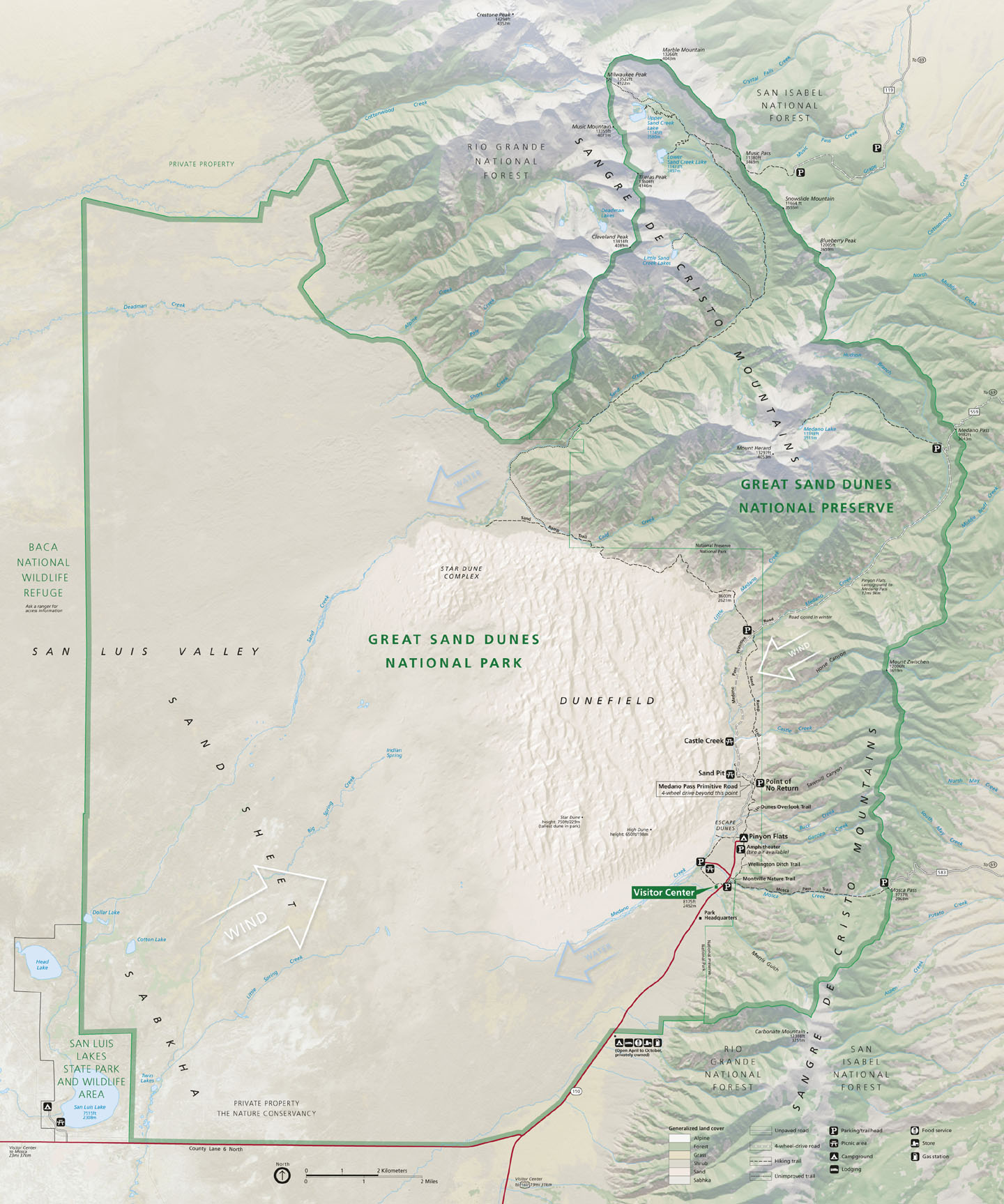
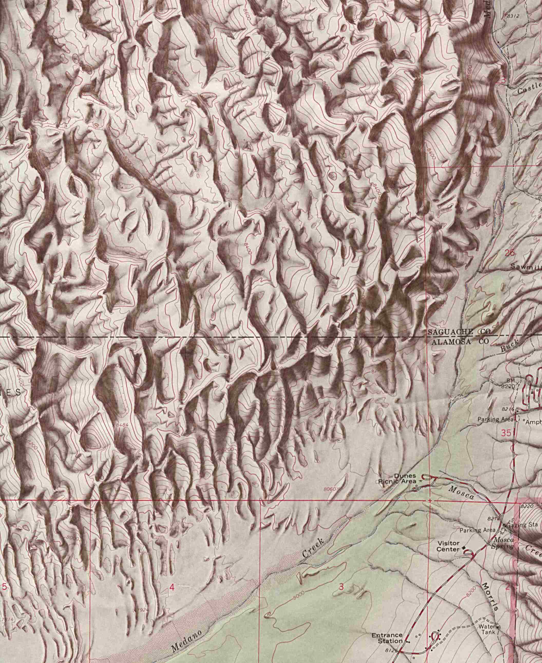
- Great Sand Dunes National Park and Preserve (Park Map / Shaded Relief) 2007 (416K)
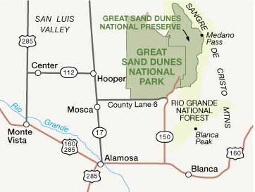
- Great Sand Dunes National Park and Preserve (Area Map) 2007 (15K)
Older maps of Great Sand Dunes:
- Great Sand Dunes National Monument (Area Map) 1994 (77K)
- Great Sand Dunes National Monument (Area Map) 1999 (65K) (PDF Format)
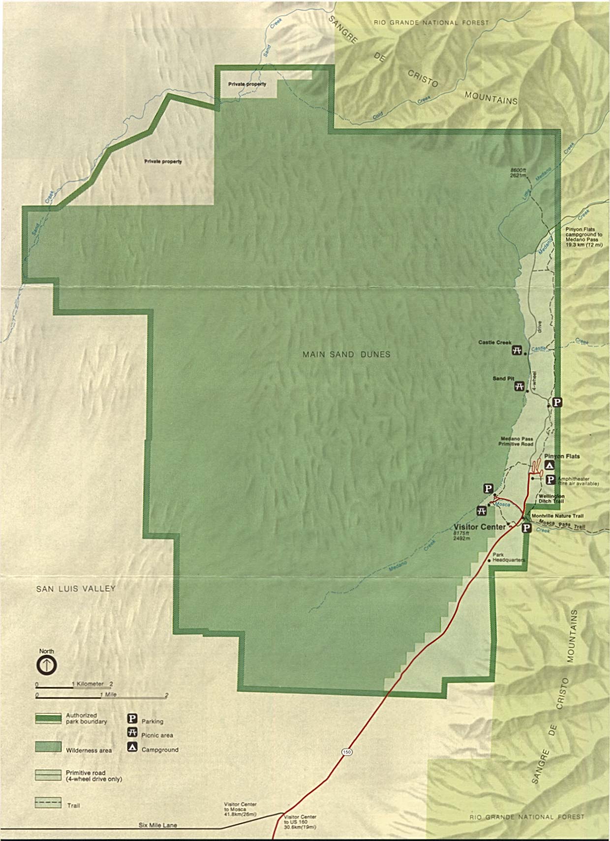
- Great Sand Dunes National Monument (Park Map / Shaded Relief) 1994 (254K)
- Great Sand Dunes National Monument (Park Map) 1999 (65K) (PDF Format)
- Great Sand Dunes National Monument (Shaded Relief Map) 1:24,000 U.S.G.S. 1967 (349K)
- Hovenweep National Monument (Park Map) 1998 (194K) (PDF Format)
- Mesa Verde National Park (Park Map) (1MB)
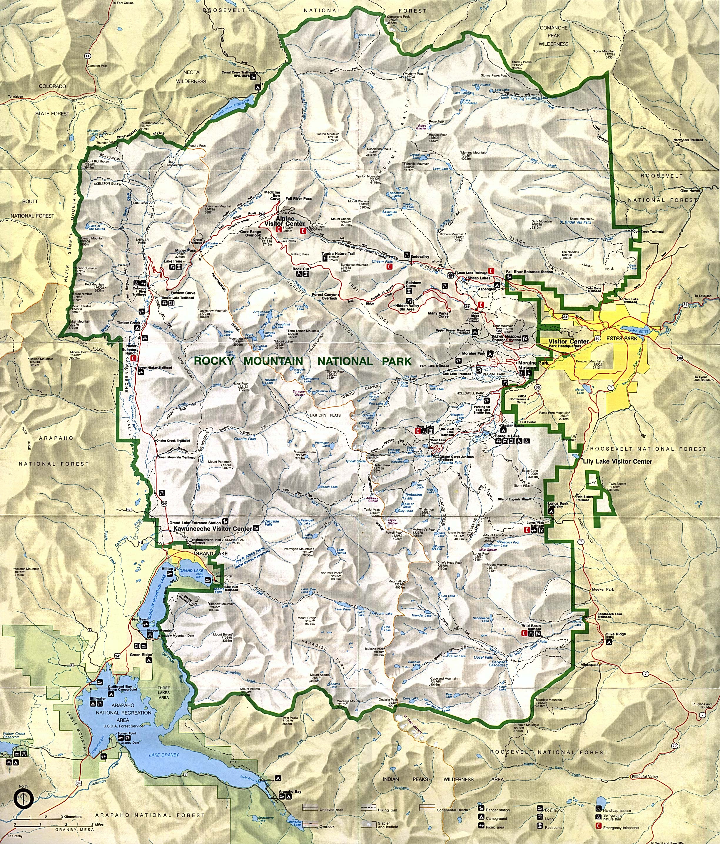
- Rocky Mountain National Park (Park Map) (1MB)
- Rocky Mountain National Park (Park Map) 1999 (710K) (PDF Format)
Maps on Other Web Sites