Perry-Castañeda Library
Map Collection
Ecuador Maps
Country Maps
The following maps were produced by the U.S. Central Intelligence Agency.
- Ecuador (Political) 2011 (1.6MB) and pdf format (1.6MB)
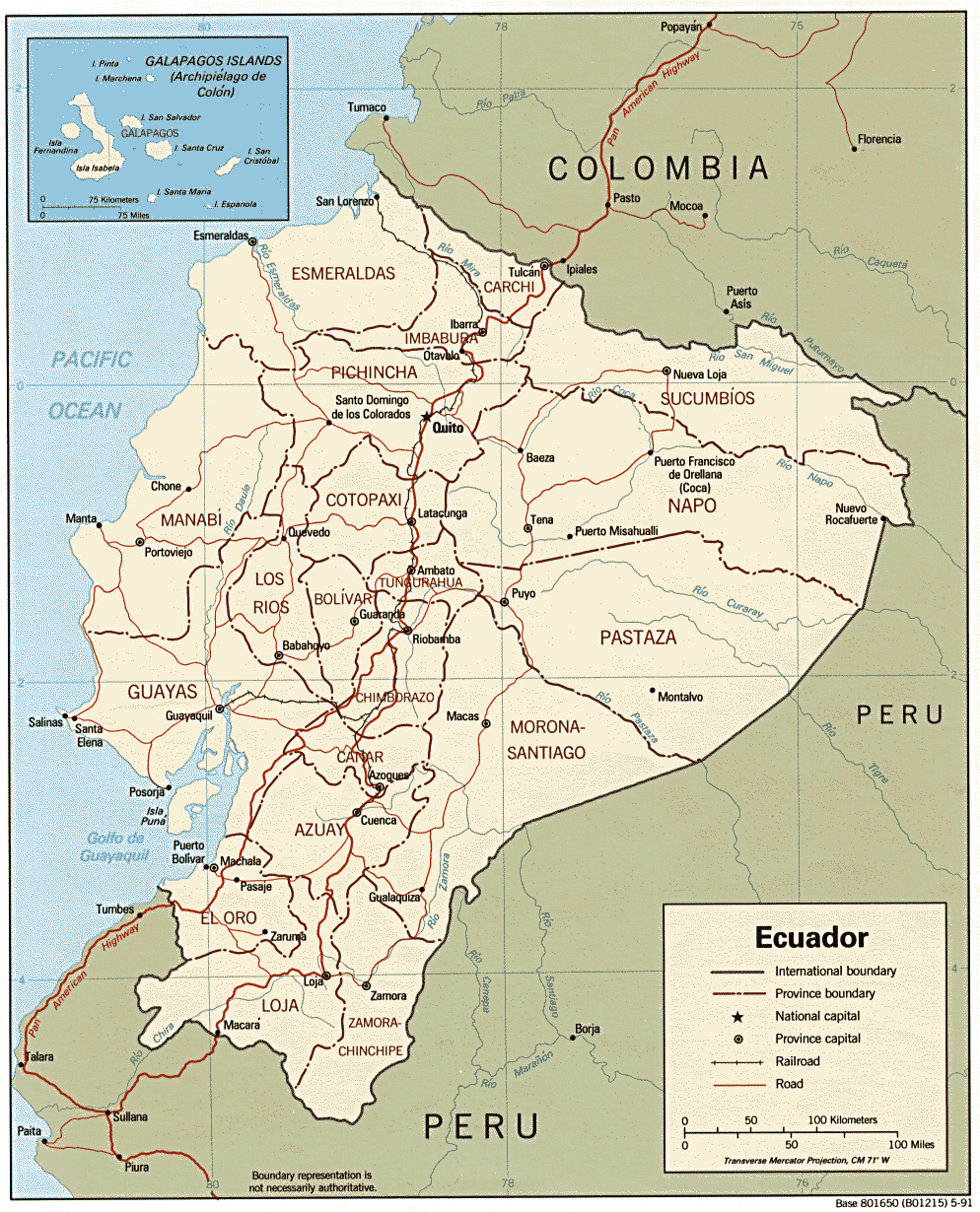
- Ecuador (Political) 1991 (274K) and pdf format (262K)
- Ecuador (Physiography) 2011 (1.7MB) and pdf format (1.7MB)
- Ecuador (Shaded Relief) 1991 (259K)
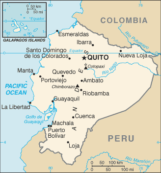
- Ecuador (Small Map) 2016 (15.8K)
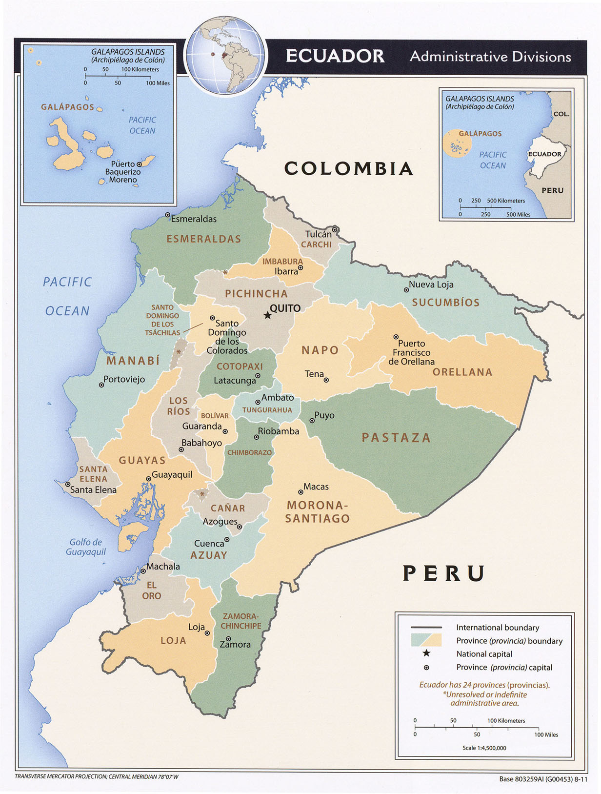
- Ecuador (Administrative Divisions) 2011 (1.2MB) and pdf format (672K)
- Guayaquil, Ecuador U.S. Department of State 1986 (141K)
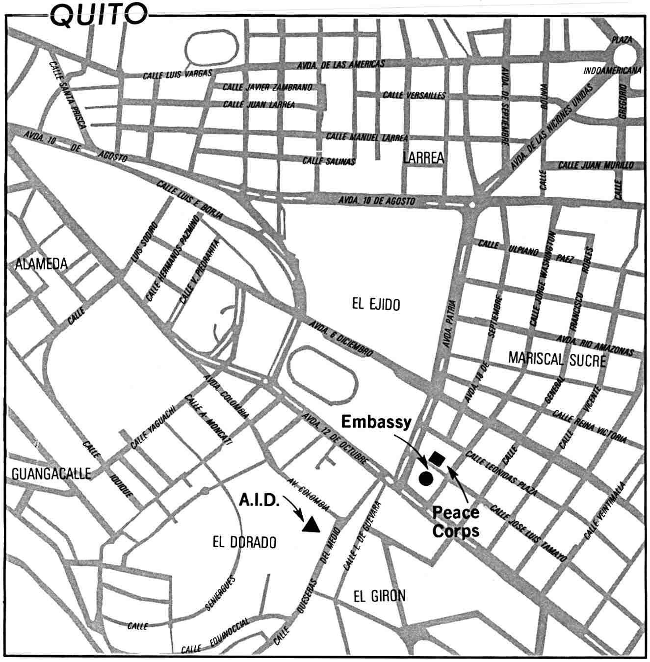
- Quito, Ecuador U.S. Department of State 1986 (109K)
- 1:1,000,000 - Latin America (aeronautical charts) Operational Navigation Chart Series, U.S. Defense Mapping Agency (dates vary) clickable index map for this series Not for navigational use
- This series covers all of Ecuador
- 1:500,000 - Tactical Pilotage Charts U.S. National Imagery and Mapping Agency. Not for navigational use
- This series covers Ecuador
- 1:250,000 - Latin America (aeronautical charts) Joint Operations Graphic, U.S. National Imagery and Mapping Agency (dates vary) Not for navigational use
- This series covers parts of Ecuador
- 1:50,000 - Ecuador (topographic maps) U.S. National Imagery and Mapping Agency, Series J721.
- This series covers most of Ecuador
- This series covers all of Ecuador
- Ecuador - Economic Activity from Map No. 501177 1973 (109K)
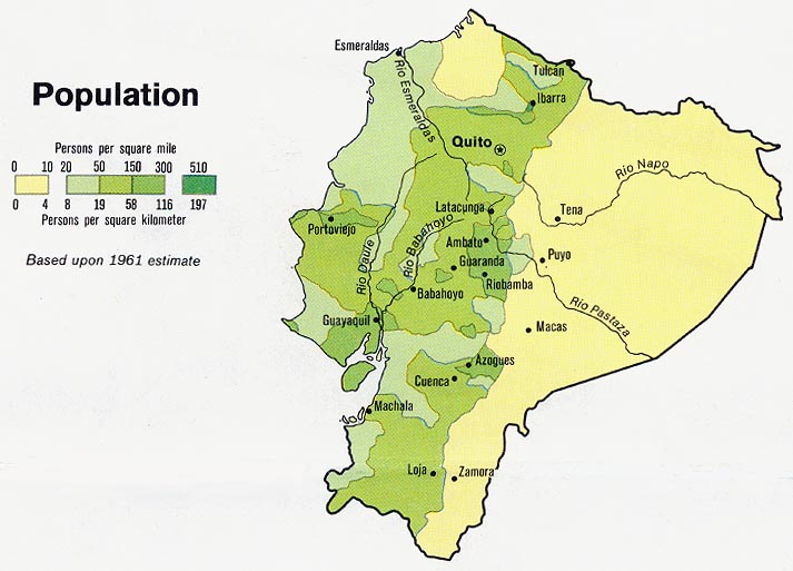
- Ecuador - Population from Map No. 501177 1973 (85K)
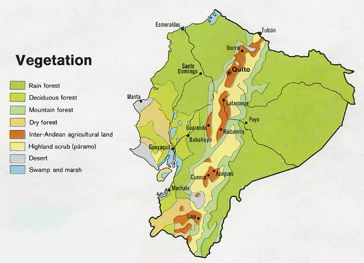
- Ecuador - Vegetation from Map No. 501177 1973 (100K)
- Peru-Ecuador (Area of Boundary Dispute) 1981 (288K)
Maps on Other Web Sites