Perry-Castañeda Library
Map Collection
Georgia Maps
State Maps
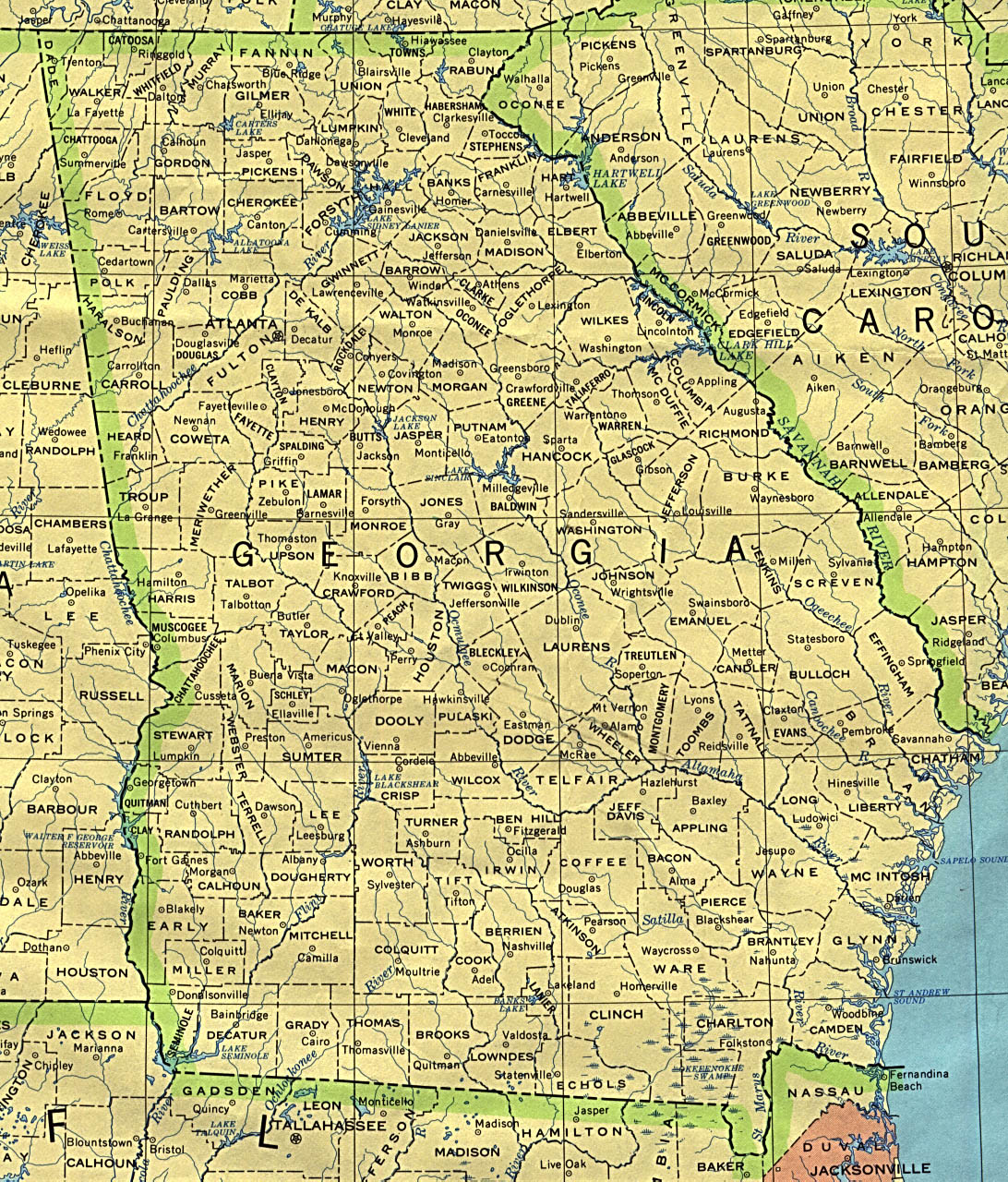
- Georgia (base map) JPEG format (536K) County boundaries and names, county seats, rivers. Original scale 1:2,500,000 U.S. Geological Survey, 1972 limited update 1990
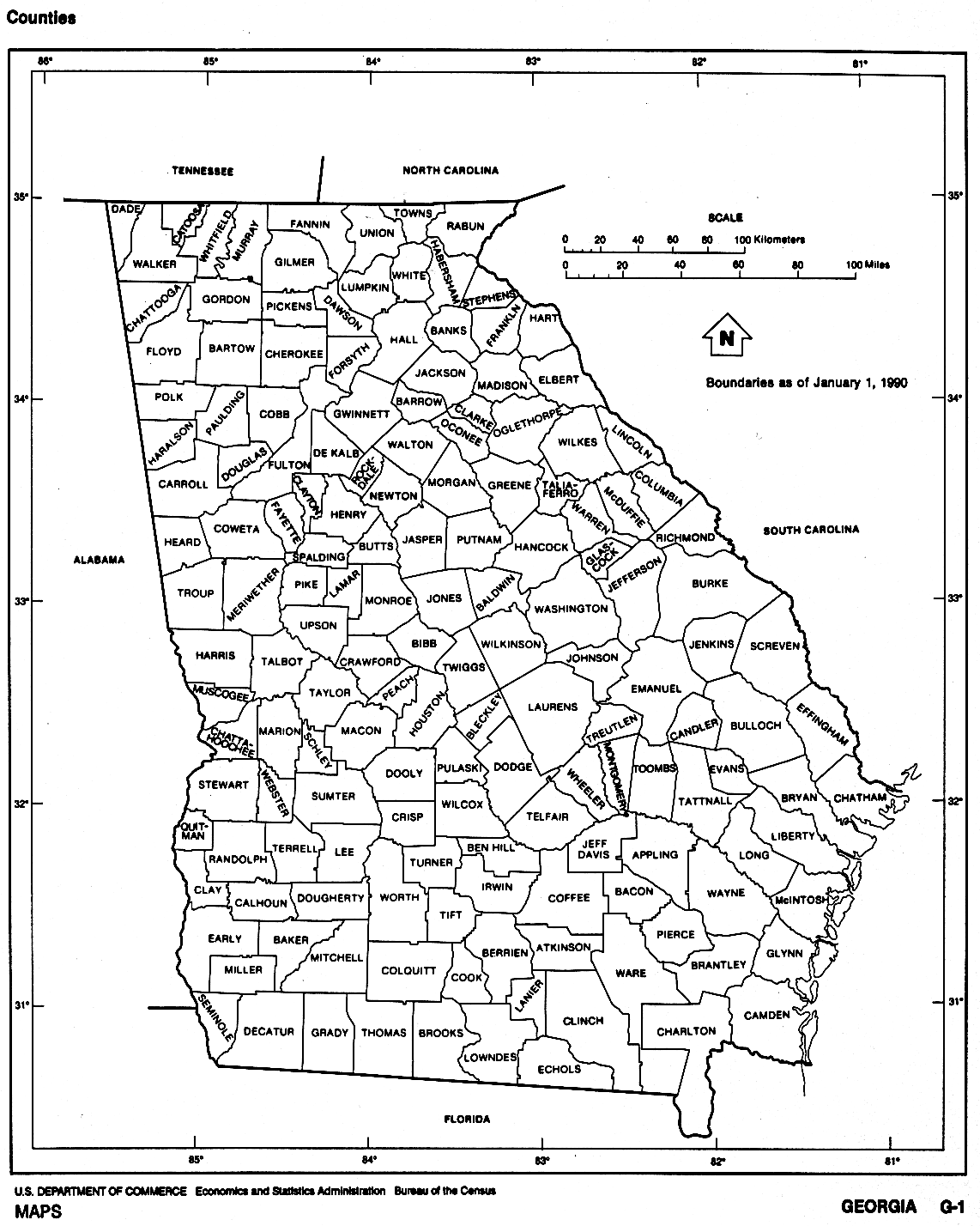
- Georgia (outline map) JPEG format (174K) County boundaries and names. U.S. Bureau of the Census, 1990
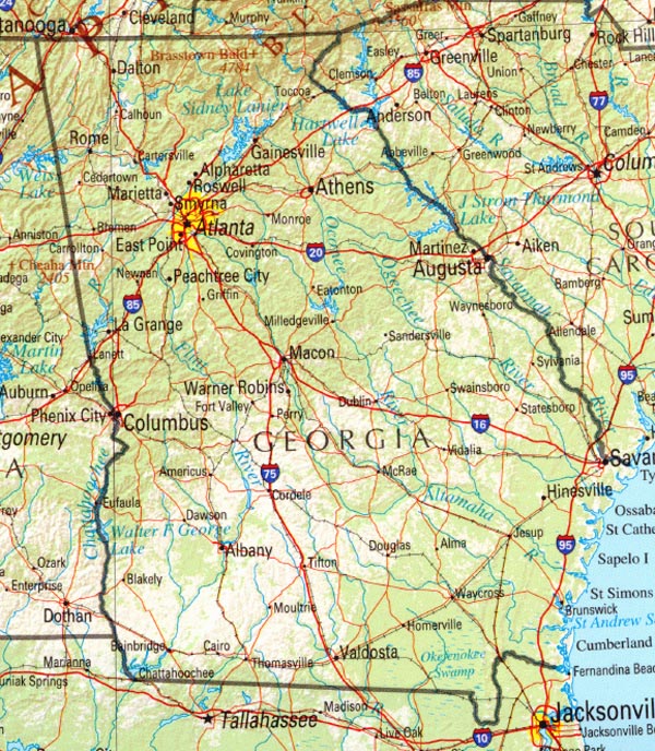
- Georgia (reference map) JPEG format (292K) Shaded relief map with state boundaries, forest cover, place names, major highways. Portion of "The National Atlas of the United States of America. General Reference", compiled by U.S. Geological Survey 2001, printed 2002
- Georgia (reference map) PDF format (220K) Shaded relief map with state boundaries, forest cover, place names, major highways. Portion of "The National Atlas of the United States of America. General Reference", compiled by U.S. Geological Survey 2001, printed 2002
- Georgia - Federal Lands and Indian Reservations PDF format (1MB) The National Atlas of the United States of America, U.S. Geological Survey, 2003
City Maps
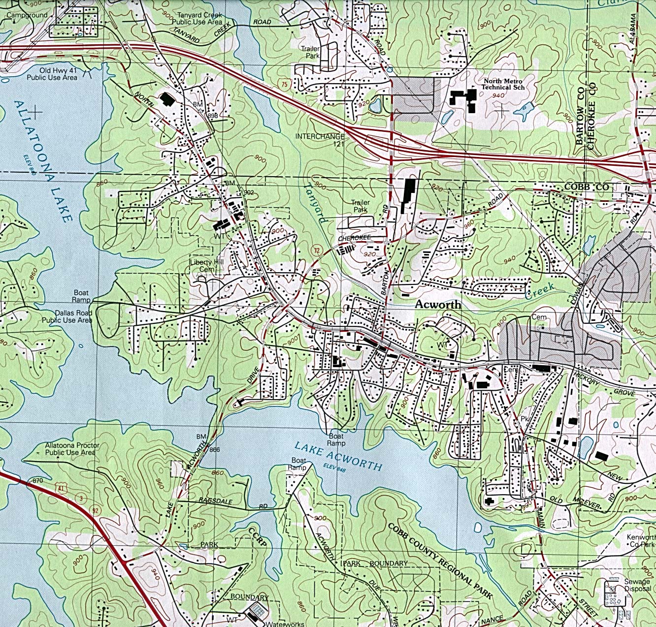
- Acworth original scale 1:24,000 U.S.G.S. 1992 (597K)
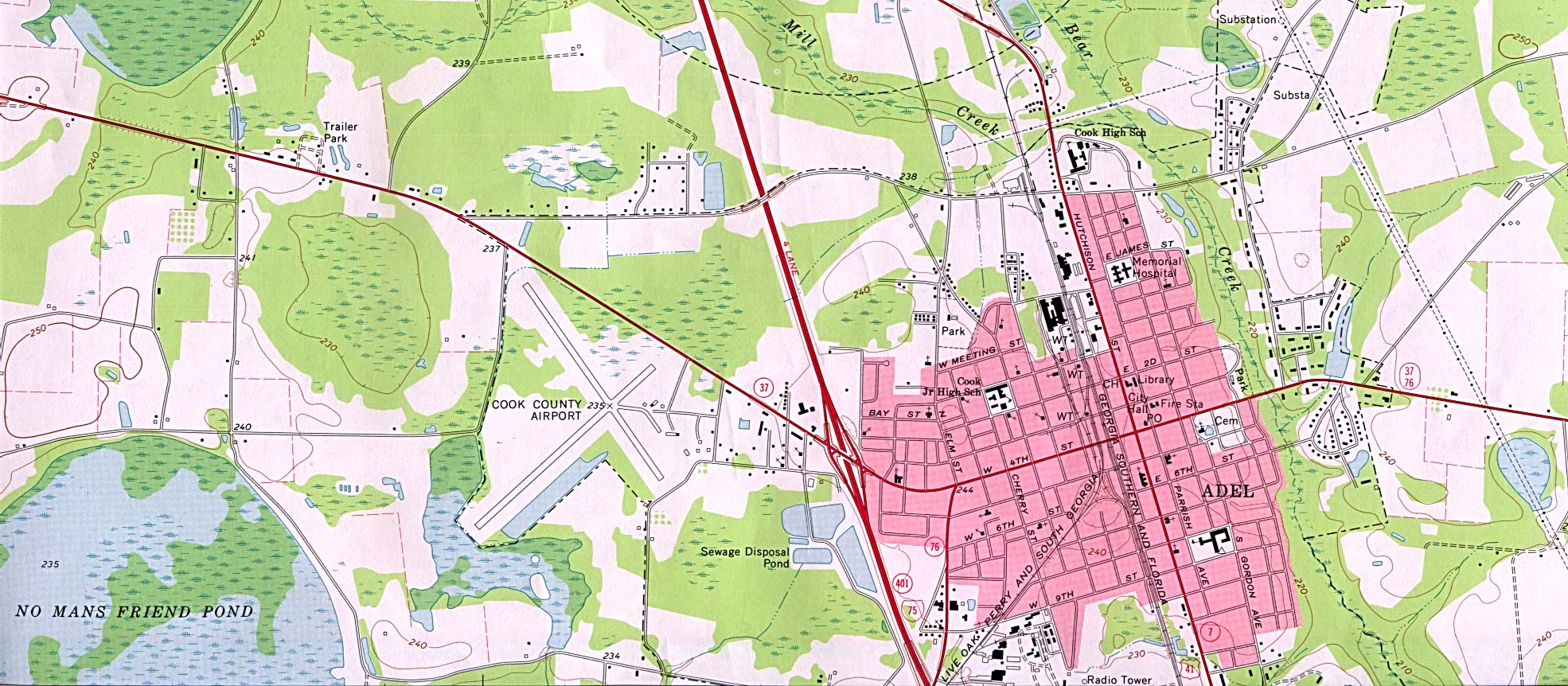
- Adel original scale 1:24,000 U.S.G.S. 1973 (413K)
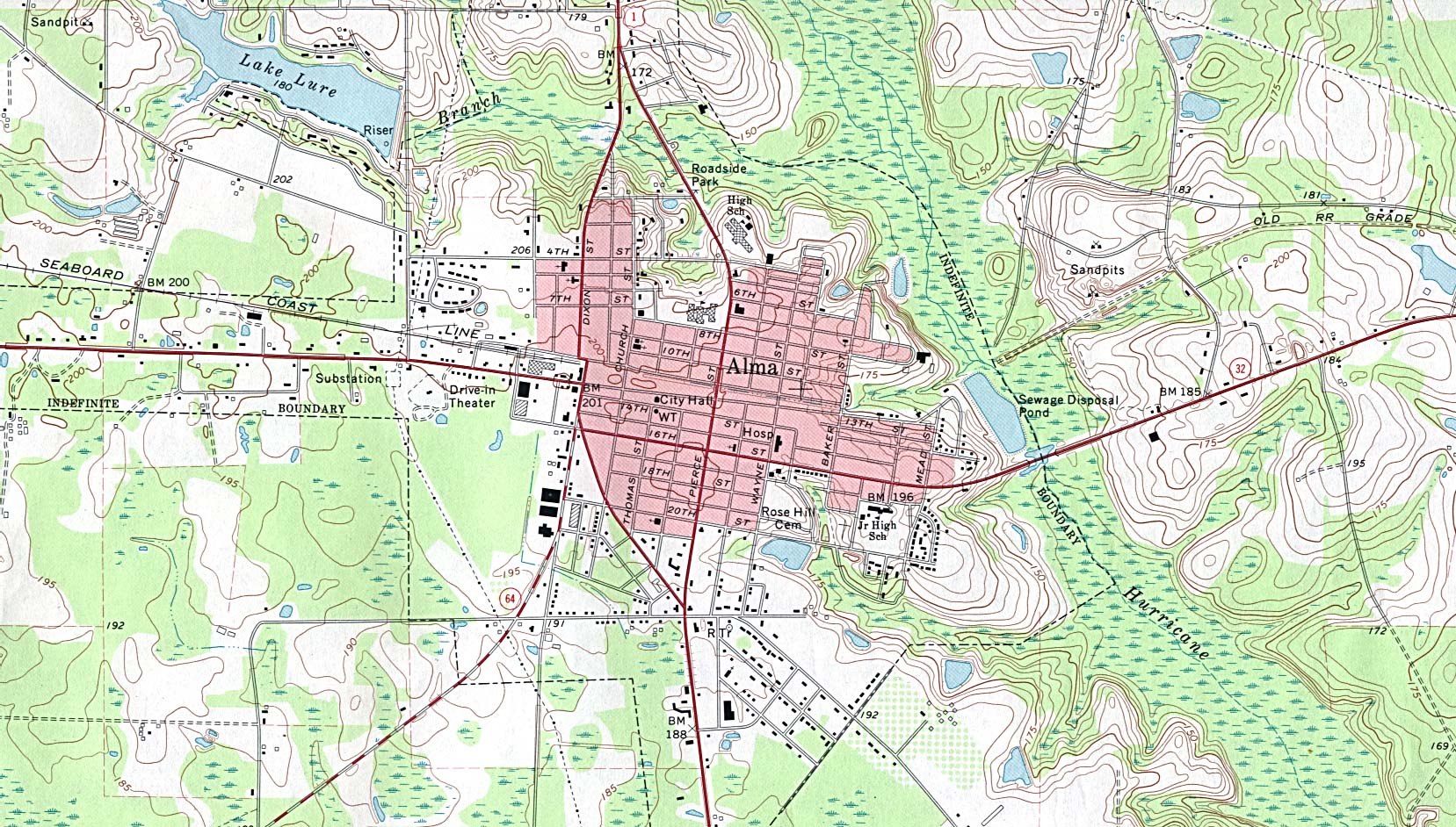
- Alma original scale 1:24,000 U.S.G.S. 1971, photorevised 1985 (515K)
- Americus original scale 1:24,000 U.S.G.S. 1973, photorevised 1985 (792K)
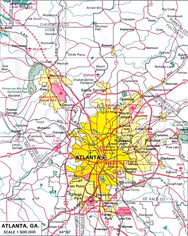
- Atlanta original scale 1:500,000 U.S. National Atlas 1970 (183K)
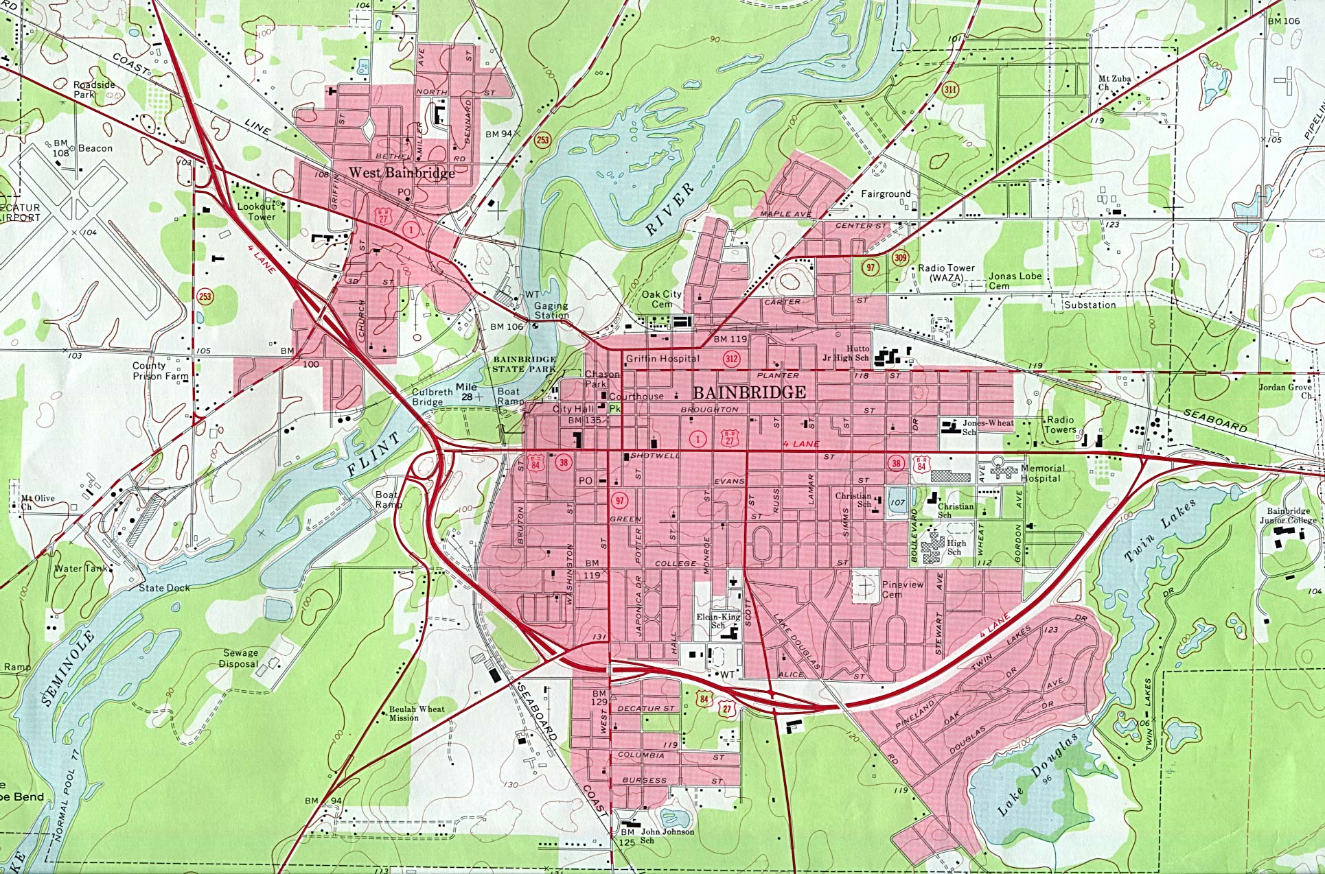
- Bainbridge original scale 1:24,000 U.S.G.S. 1974 (615K)
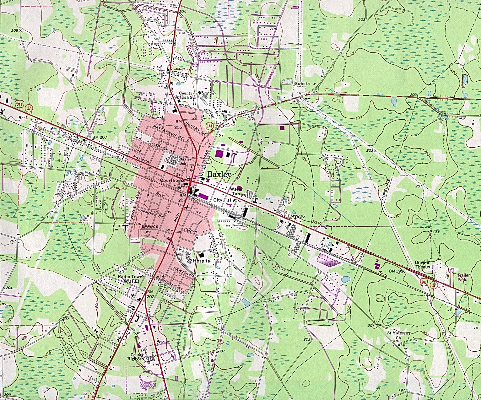
- Baxley original scale 1:24,000 U.S.G.S. 1970, photorevised 1988 (624K)
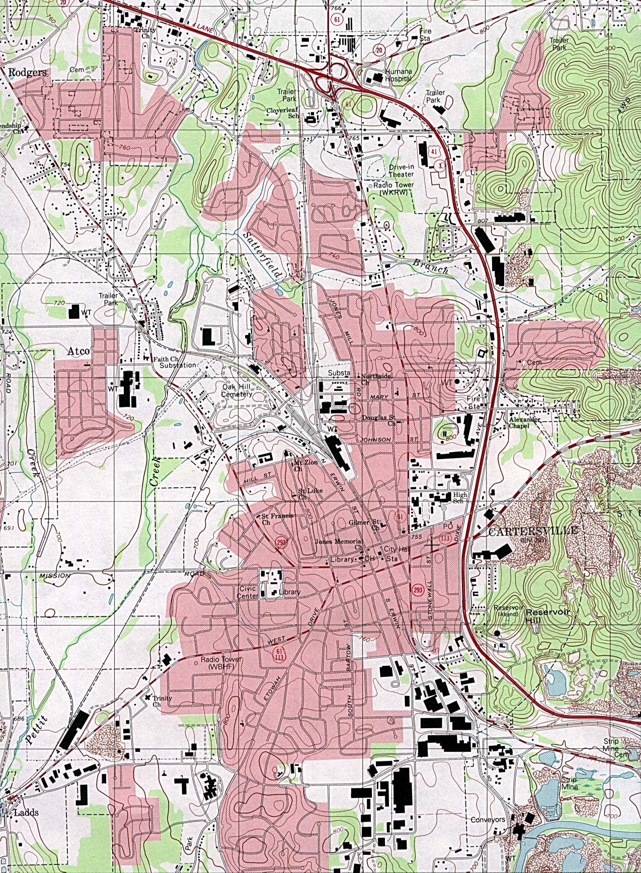
- Cartersville original scale 1:24,000 U.S.G.S. 1992 (789K)
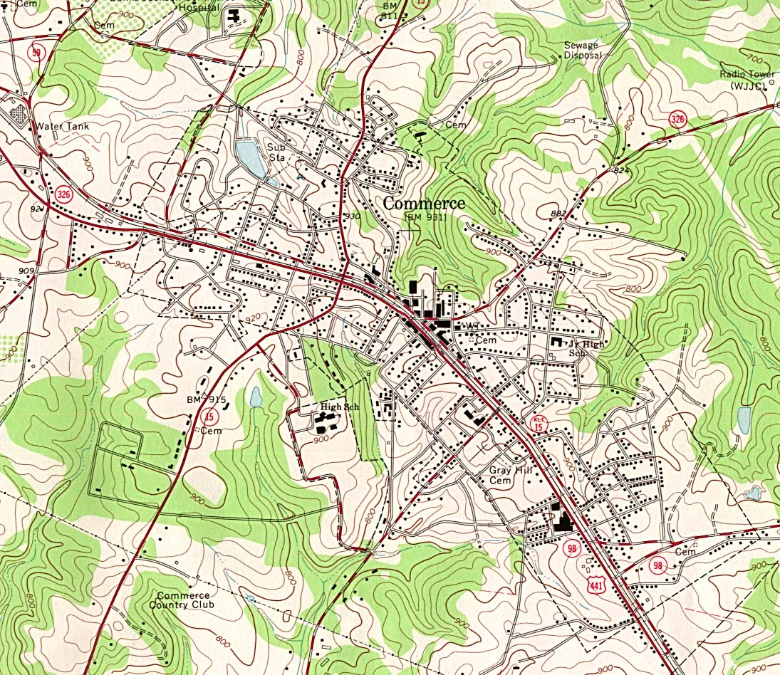
- Commerce original scale 1:24,000 U.S.G.S. 1964, photo inspected 1976 (397K)
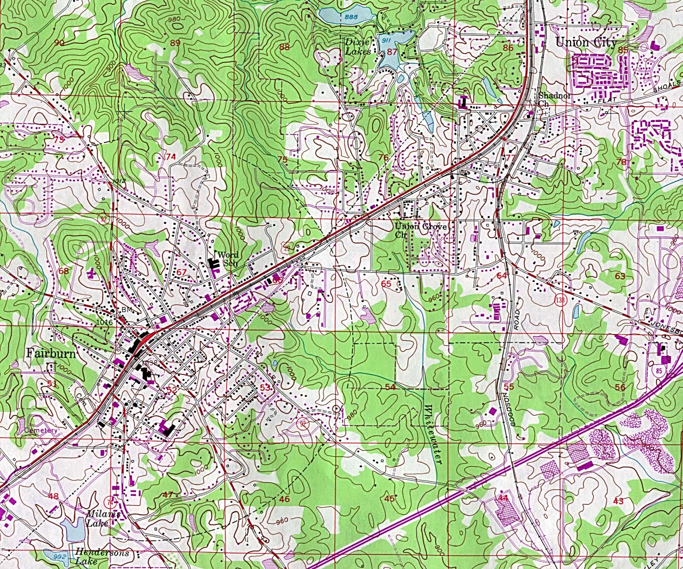
- Fairburn original scale 1:24,000 U.S.G.S. 1954, photorevised 1982 (608K)
- Quitman original scale 1:24,000 U.S.G.S. 1974, photorevised 1987 (528K)
- Social Circle original scale 1:24,000 U.S.G.S. 1981 (321K)
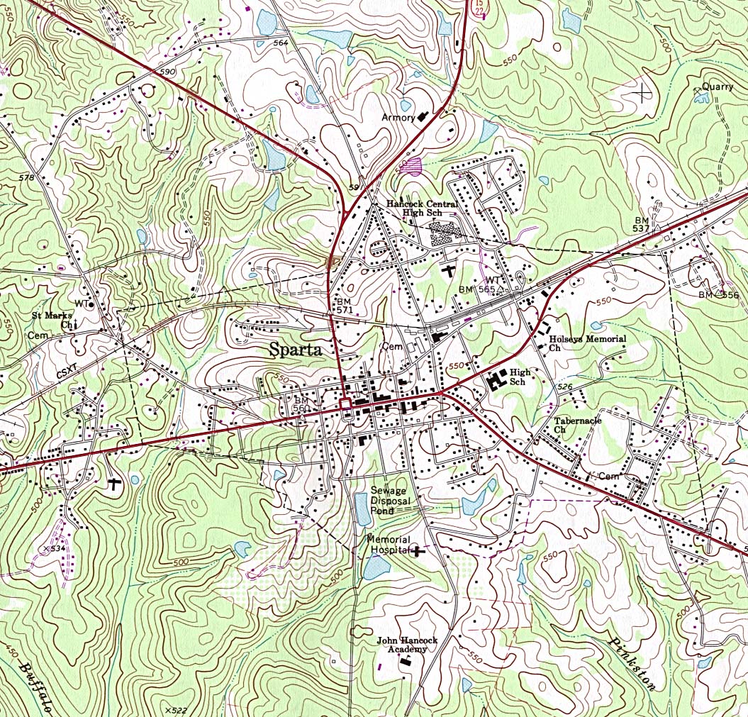
- Sparta original scale 1:24,000 U.S.G.S. 1972, photorevised 1987 (420K)
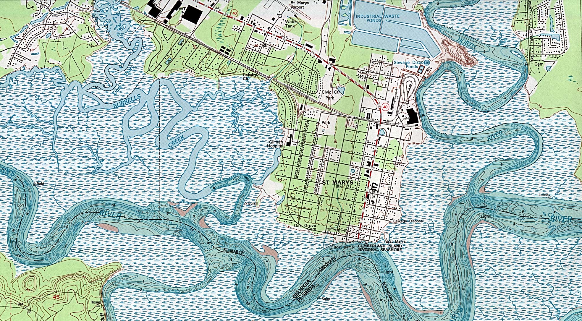
- St. Marys original scale 1:24,000 U.S.G.S. 1993 (921K)
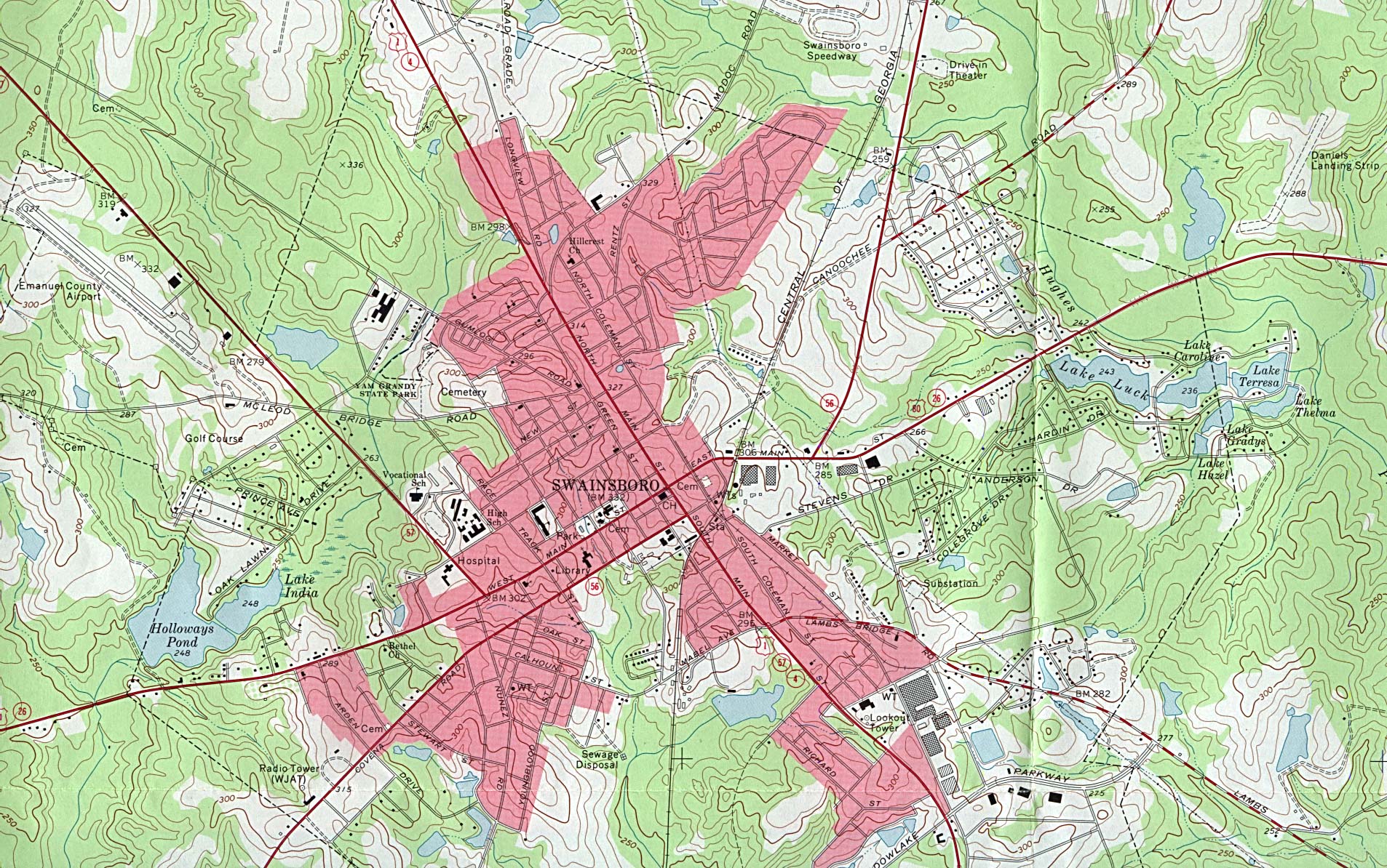
- Swainsboro original scale 1:24,000 U.S.G.S. 1971 (740K)
Historical City Maps
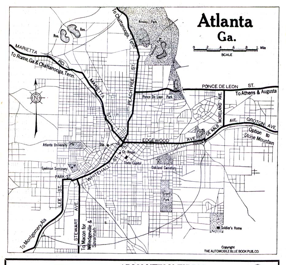
- Atlanta 1919 Automobile Blue Book (258K)
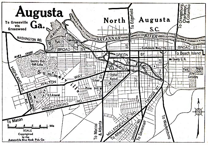
- Augusta 1920 Automobile Blue Book (156K)
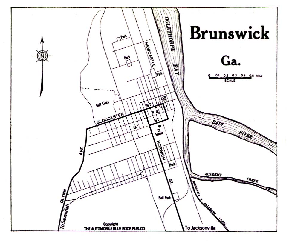
- Brunswick 1919 Automobile Blue Book (194K)
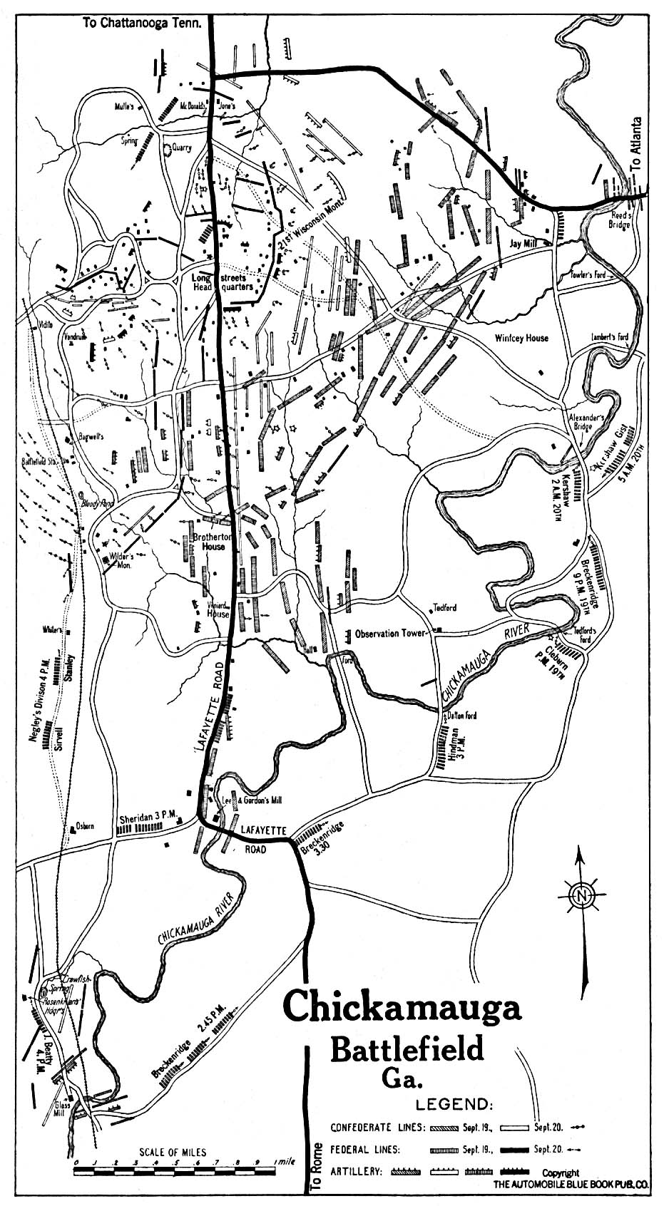
- Chickamauga 1919 Automobile Blue Book (387K)
- Columbus 1919 Automobile Blue Book, 1919, Vol. 6 (71K)
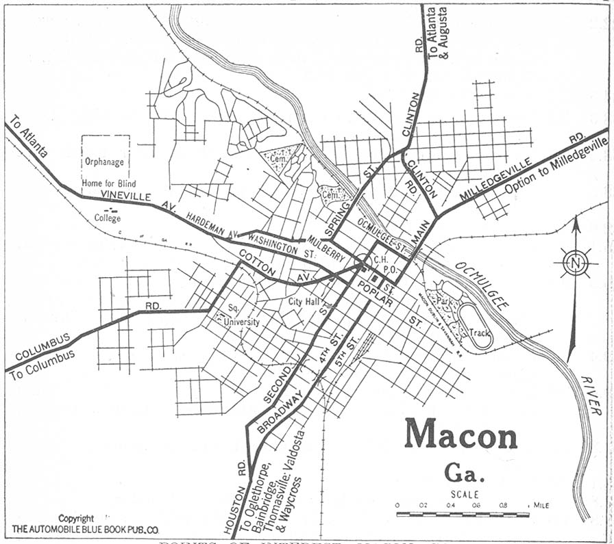
- Macon 1919 Automobile Blue Book, 1919, Vol. 6 (145K)
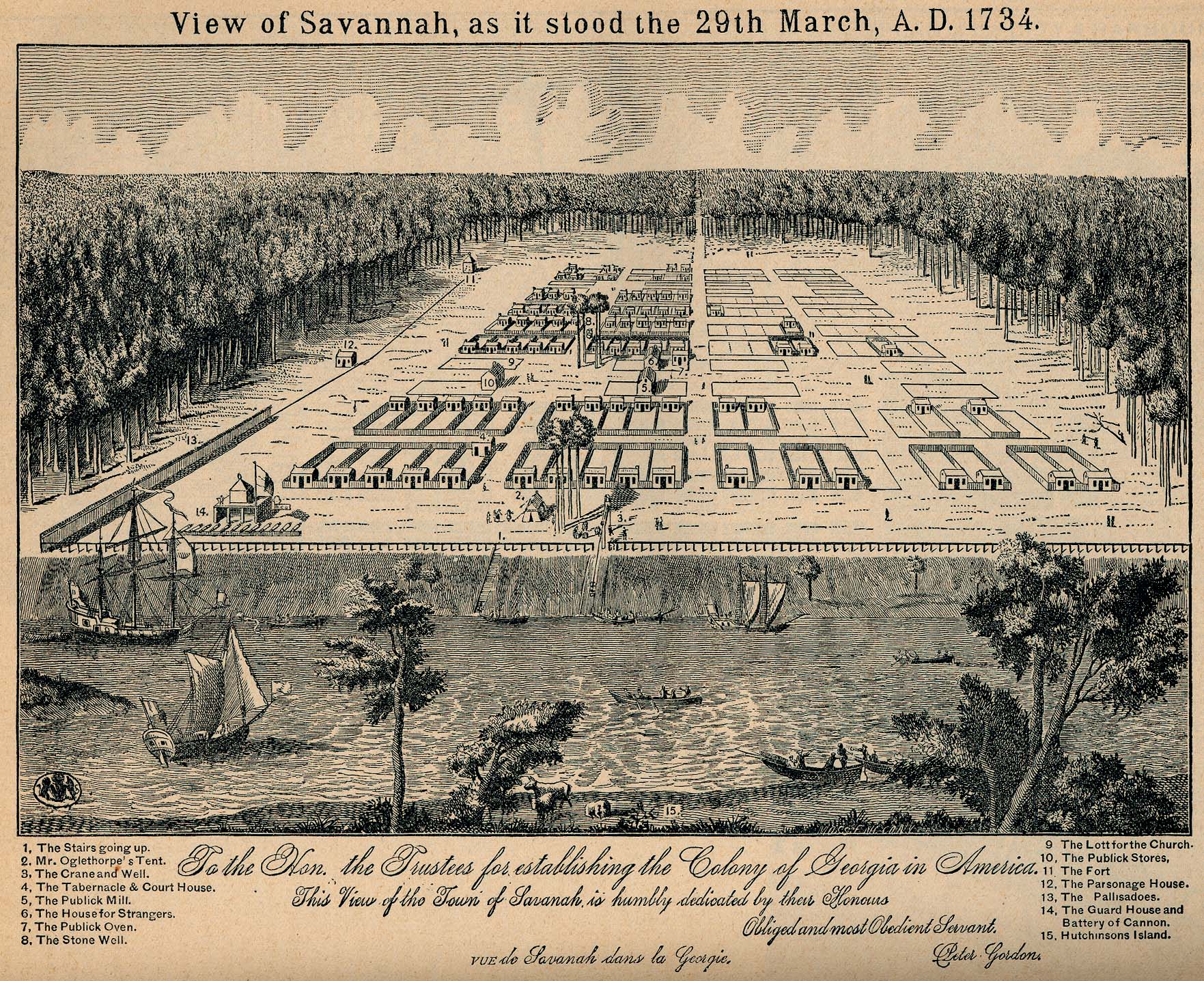
- Savannah 1734 "View of Savannah, as it stood the 29th March, A.D. 1734." From Report on the Social Statistics of Cities, Compiled by George E. Waring, Jr., United States. Census Office, Part II, 1886. (940K)
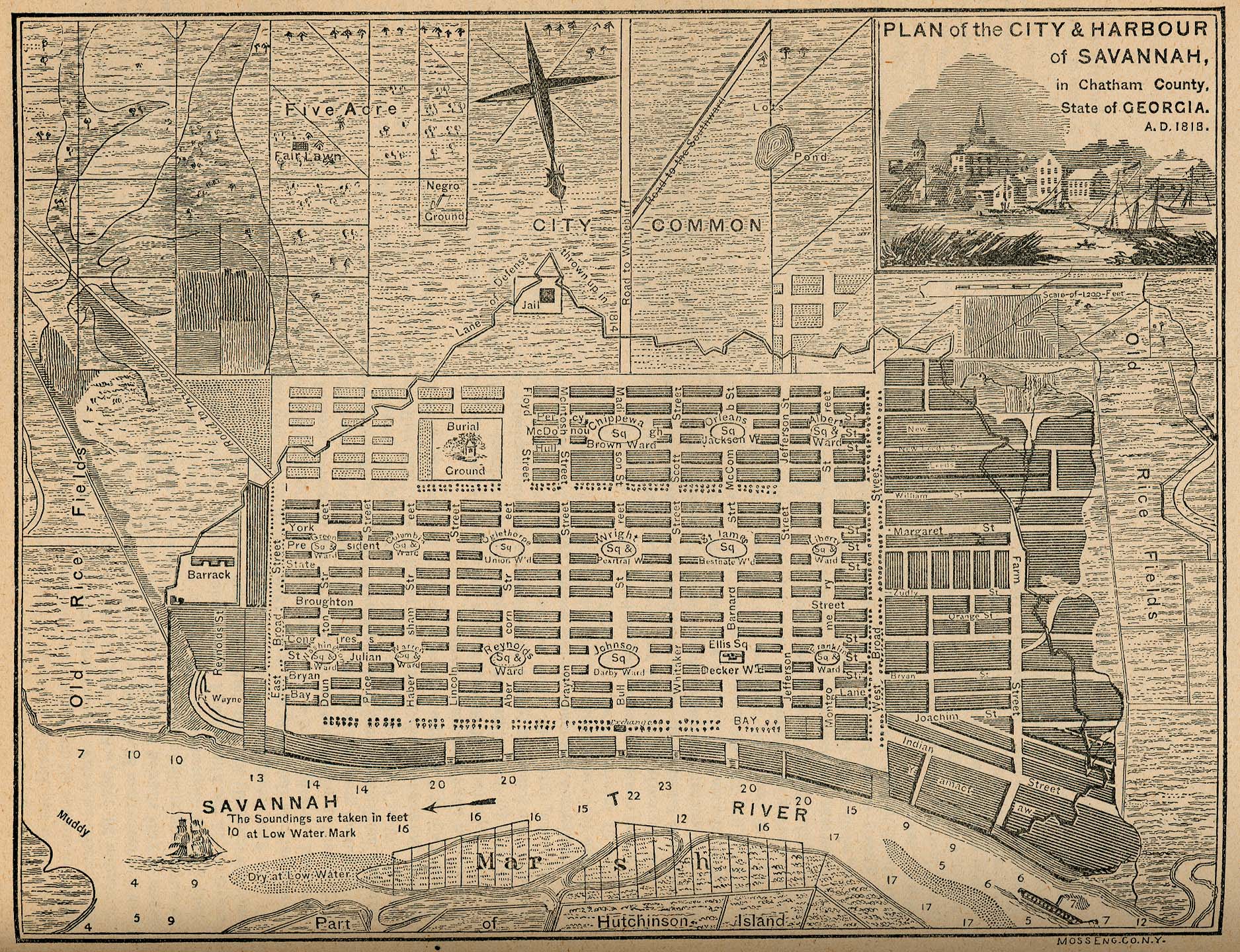
- Savannah 1818 "Plan of the City & Harbour of Savannah, in Chatham County. State of Georgia. A.D. 1818." From Report on the Social Statistics of Cities, Compiled by George E. Waring, Jr., United States. Census Office, Part II, 1886. (897K)
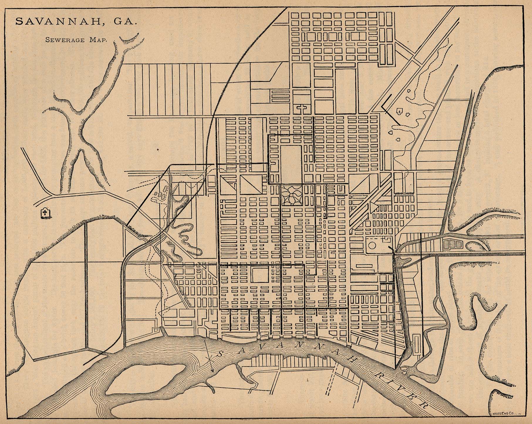
- Savannah 1880 "Savannah, Ga. Sewerage Map." From Report on the Social Statistics of Cities, Compiled by George E. Waring, Jr., United States. Census Office, Part II, 1886. (523K)
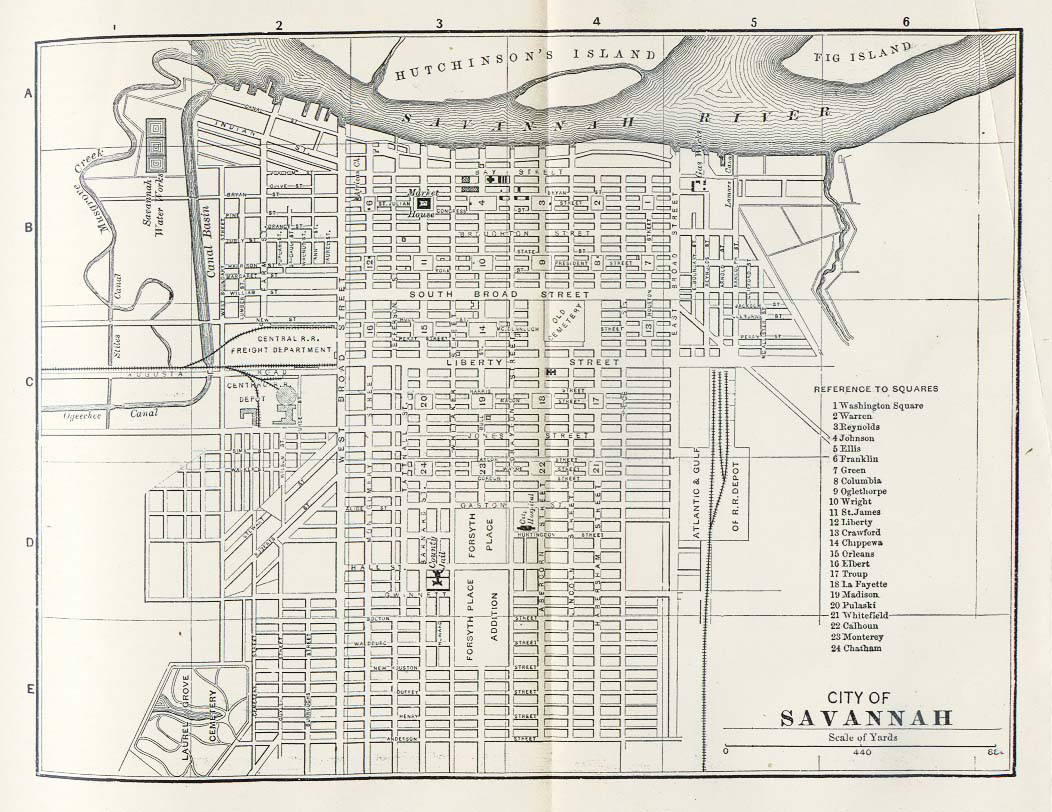
- Savannah 1885 Appletons' General Guide to the United States and Canada. Part II. Western and Southern States. New York: D. Appleton and Company. 1885 (206K)
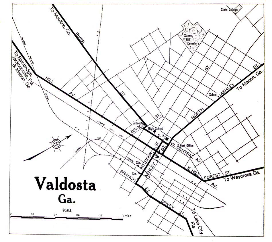
- Valdosta 1919 Automobile Blue Book (258K)
Historical State Map
- Georgia 1895 (385K)
- From Georgia: Her Resources and Possibilities, with inset maps of Atlanta and Savannah, by R.T. Nesbitt. Franklin Printing and Publishing Co. 1895.
Historical Topographic Maps
- Georgia Historical Topographic Maps (U.S. Geological Survey)
- Pre-1945 maps, scales 1:62,500, 1:125,000 and special sheets
Maps of National Parks, Monuments, and Historic Sites
The following maps were produced by the U.S. National Park Service unless otherwise noted.
- Andersonville National Historic Site (Area Map) 1997 (65K) (PDF Format)
- Andersonville National Historic Site (Park Map) 1999 (65K) (PDF Format)
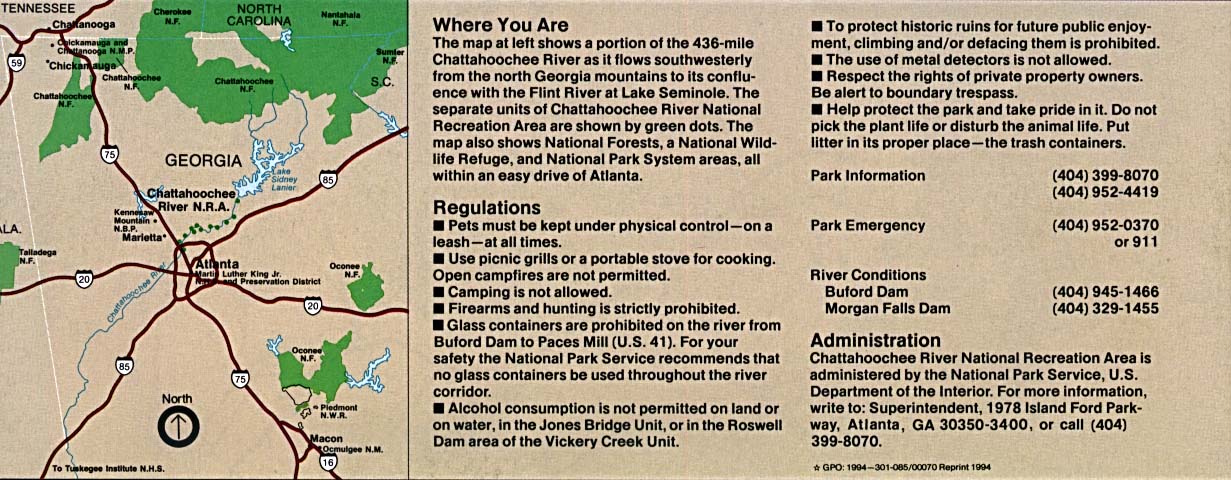
- Chattahoochee River National Recreation Area (Area Map) 1994 (195K)
- Chattahoochee River National Recreation Area (Area Map) 1997 (129K) (PDF Format)
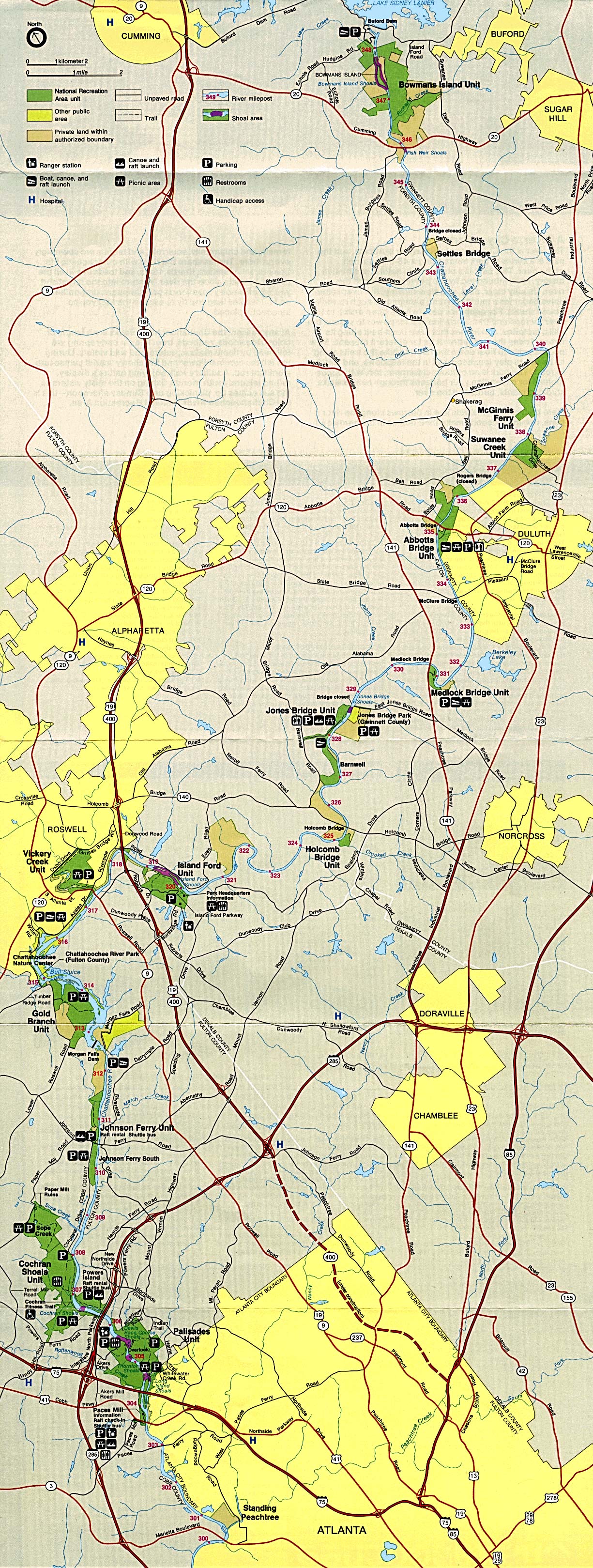
- Chattahoochee River National Recreation Area (Park Map) 1994 (1.1MB)
- Chattahoochee River National Recreation Area (Park Map) 1997 (129K) (PDF Format)
- Chickamauga and Chattanooga National Military Park [Georgia/tennnesee] (Area Map) (267K)
- Chickamauga and Chattanooga National Military Park [Georgia/tennnesee] (Battle Map) 1999 (129K) (PDF Format)
- Chickamauga and Chattanooga National Military Park [Georgia/tennnesee] (Park Map) (371K)
- Chickamauga and Chattanooga National Military Park [Georgia/tennnesee] (Park Map) 1999 (194K) (PDF Format)
- Chickamauga and Chattanooga National Military Park - Lookout Mountain [Georgia/tennnesee] (Detail Map) (326K)
- Chickamauga and Chattanooga National Military Park - Lookout Mountain [Georgia/tennnesee] (Detail Map) 1999 (194K) (PDF Format)
- Cumberland Island National Seashore (Park Map) 1999 (194K) (PDF Format)
- Jimmy Carter National Historic Site (Park Map) 1997 (258K) (PDF Format)
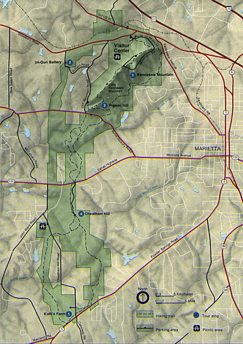
- Kennesaw Mountain National Battlefield Park (Park Map) (226K)
- Kennesaw Mountain National Battlefield Park (Park Map) 1998 (129K) (PDF Format)
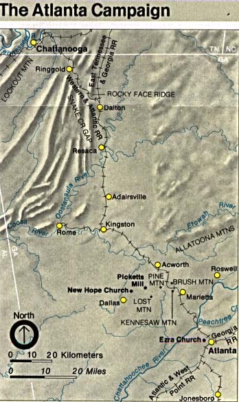
- Kennesaw Mountain National Battlefield Park (The Atlanta Campaign) (61K)
- Martin Luther King Jr. National Historic Site (Park Map) 1997 (65K) (PDF Format)
![Chickamauga and Chattanooga National Military Park [Georgia/tennnesee]](national_parks/chickamauga_chattanooga_map.jpg)
![Chickamauga and Chattanooga National Military Park [Georgia/tennnesee]](national_parks/chickamauga_battlefield.jpg)
![Chickamauga and Chattanooga National Military Park - Lookout Mountain [Georgia/tennnesee]](national_parks/chickamauga_lookout_mt.jpg)
Maps on Other Web Sites