Perry-Castañeda Library
Map Collection
D-Day (June 6, 1944) - Maps
These maps are included in the Perry-Castañeda Library map collection site courtesy of http://www.ww2dday.com and Mr. Tim Roop.
Information about these maps is available on the web site above and in the National Geographic article "Untold Stories of D-Day", by Thomas B. Allen, June 2002.
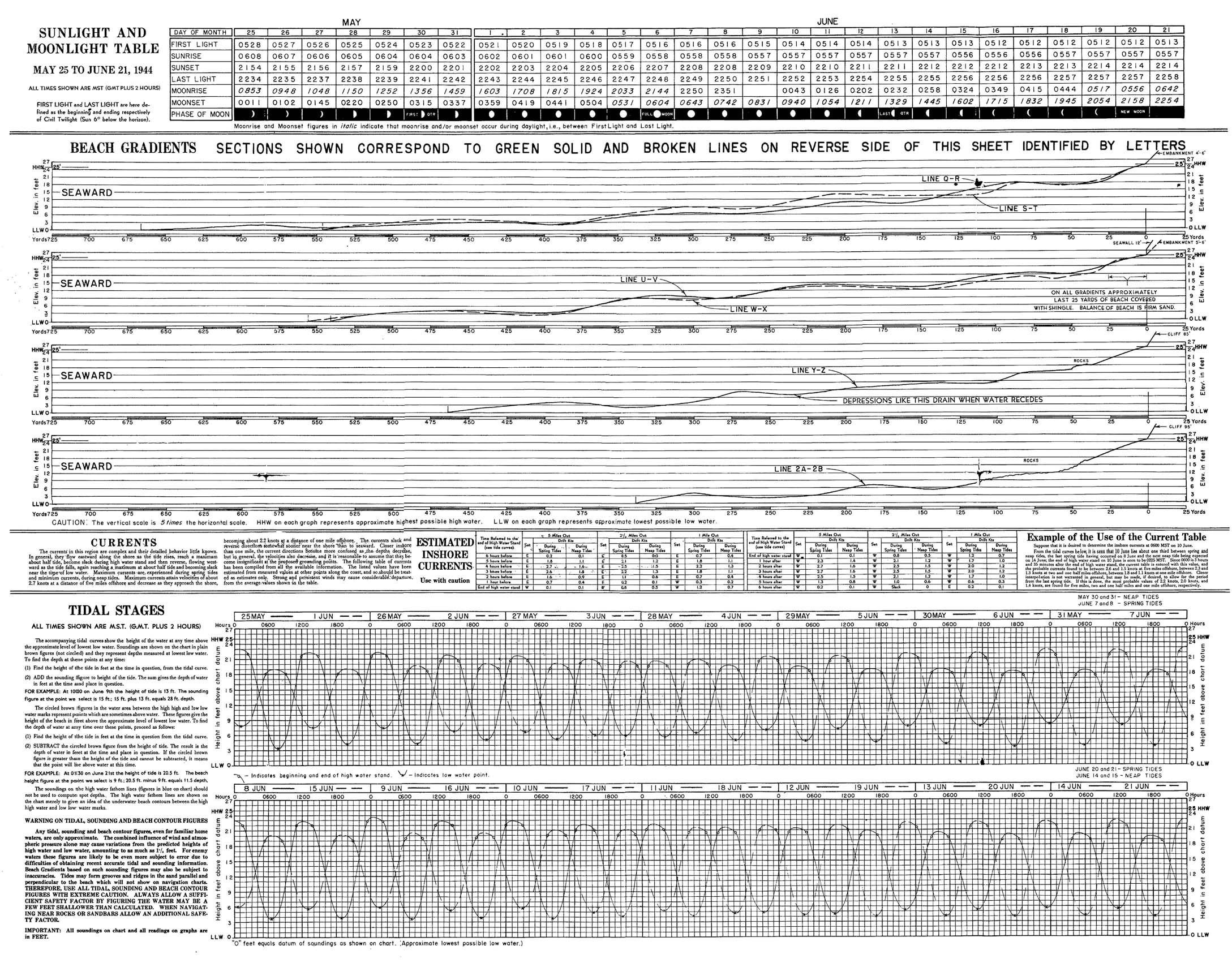
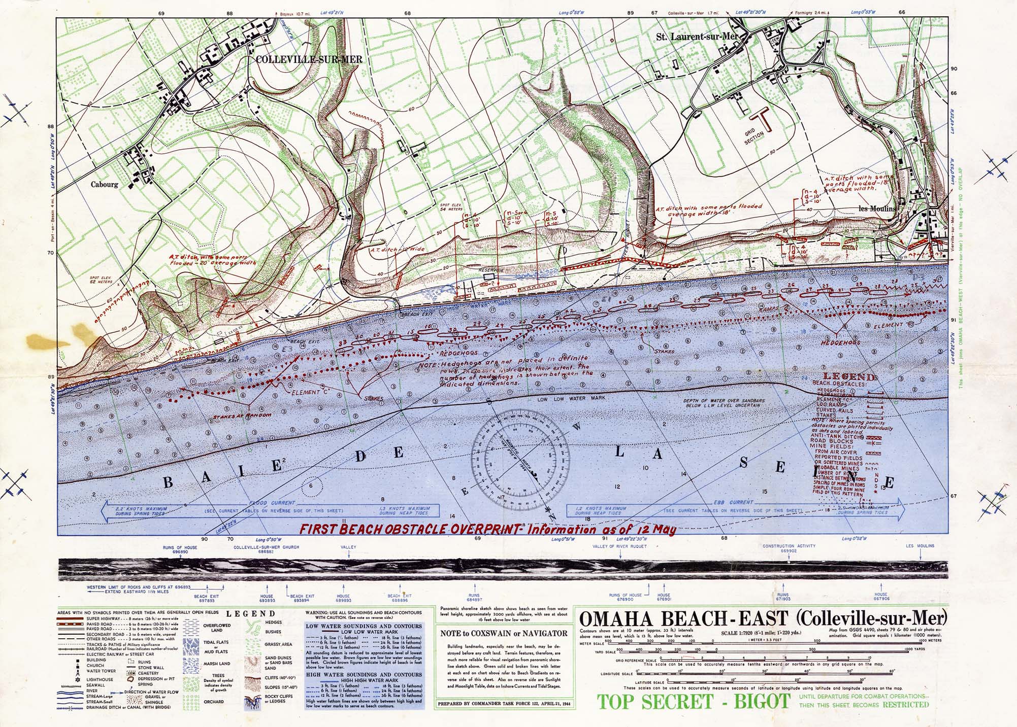
- Omaha Beach - East (Colleville-sur-Mer) (655K)
- Prepared by the Commander Task Force 122, April 21, 1944. "Map from GSGS 4490 Sheets 79 and 80 and air photo examination. Grid square equals 1 kilometer (1000 meters)." Original scale 1:7,920. "TOP SECRET - BIGOT Until Departure for Combat Operations -- Then This Sheet Becomes RESTRICTED".
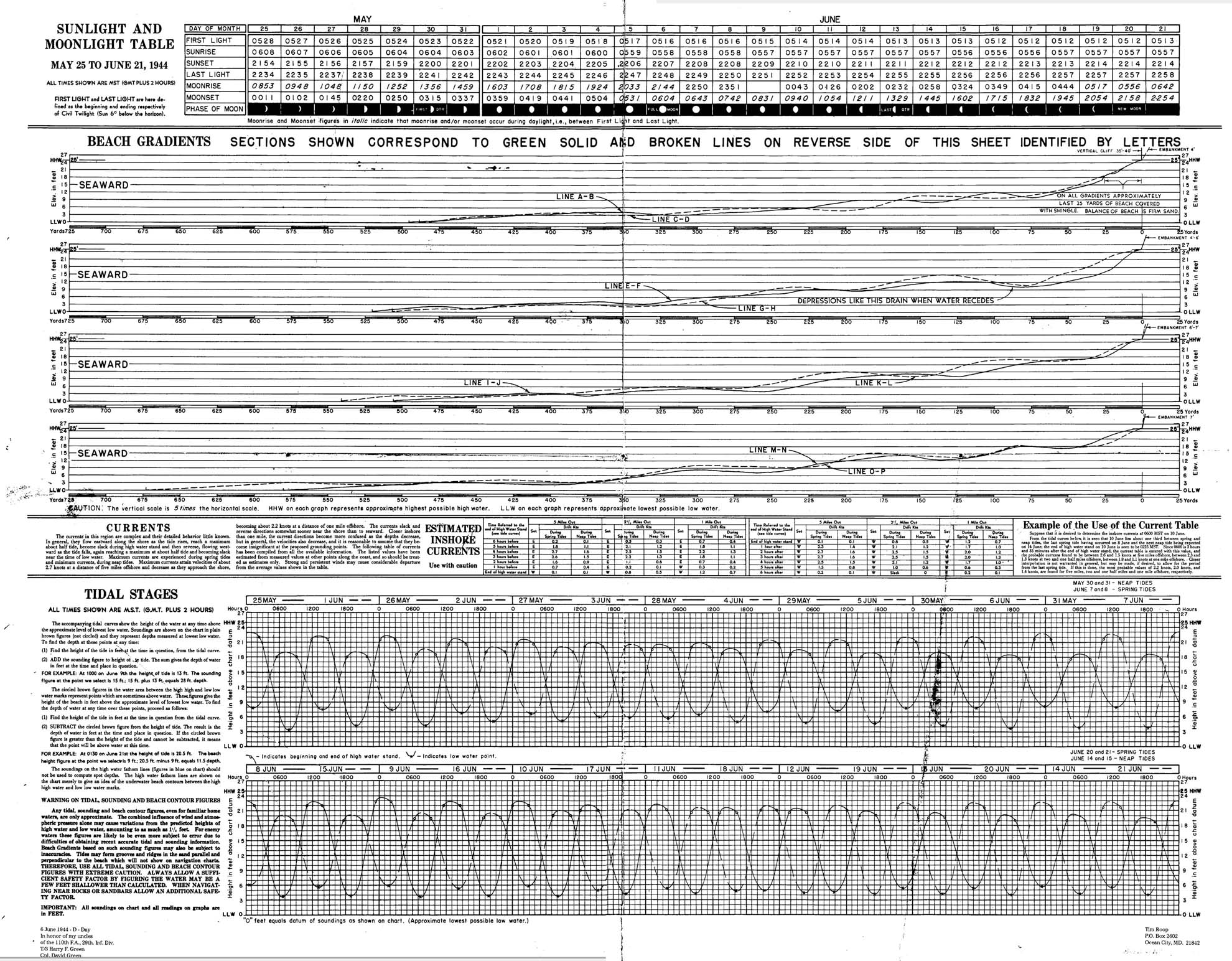
- Omaha Beach - West (Vierville-sur-Mer) (614K)
- Prepared by the Commander Task Force 122, April 21, 1944. "Map from GSGS 4490 Sheets 79 and 80 and air photo examination. Grid square equals 1 kilometer (1000 meters)." Original scale 1:7,920. "TOP SECRET - BIGOT Until Departure for Combat Operations -- Then This Sheet Becomes RESTRICTED".