Sudan, Joint Operations Graphic 1:250,000 [Not for navigational use]
U.S. Defense Mapping Agency
Complete list of map images in this collection:
- Index Map (172KB)
- ND 34-7 Guereda, Chad; Sudan (9.4MB) [GeoPDF]
- ND 34-11 Adre, Chad; Sudan (8.9MB) [GeoPDF]
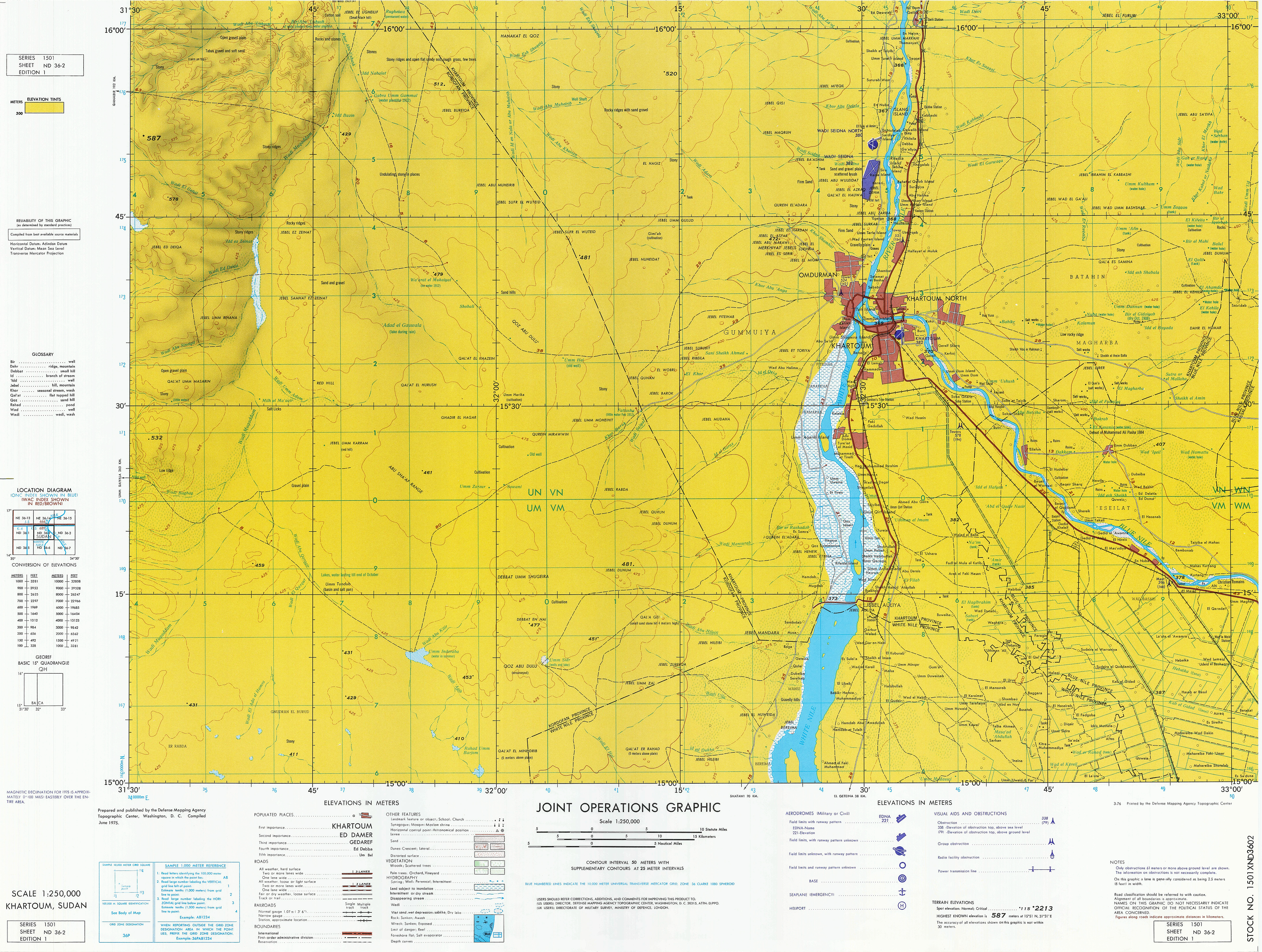
- ND 36-2 Khartoum, Sudan (25MB)
- ND 36-3 Al Kamilin, Sudan (9.7MB) [GeoPDF]
- NE 34-8 Agoza, Chad; Sudan (10.0MB)
- NE 34-4 Erdi Fochini, Chad; Libya; Sudan (8.9MB)
- NE 36-3 Abu Hamed, Sudan (3.6MB) This map is from the collection of the Library of Congress, Geography and Map Division
- NE 36-7 Berber, Sudan (4.1MB) This map is from the collection of the Library of Congress, Geography and Map Division
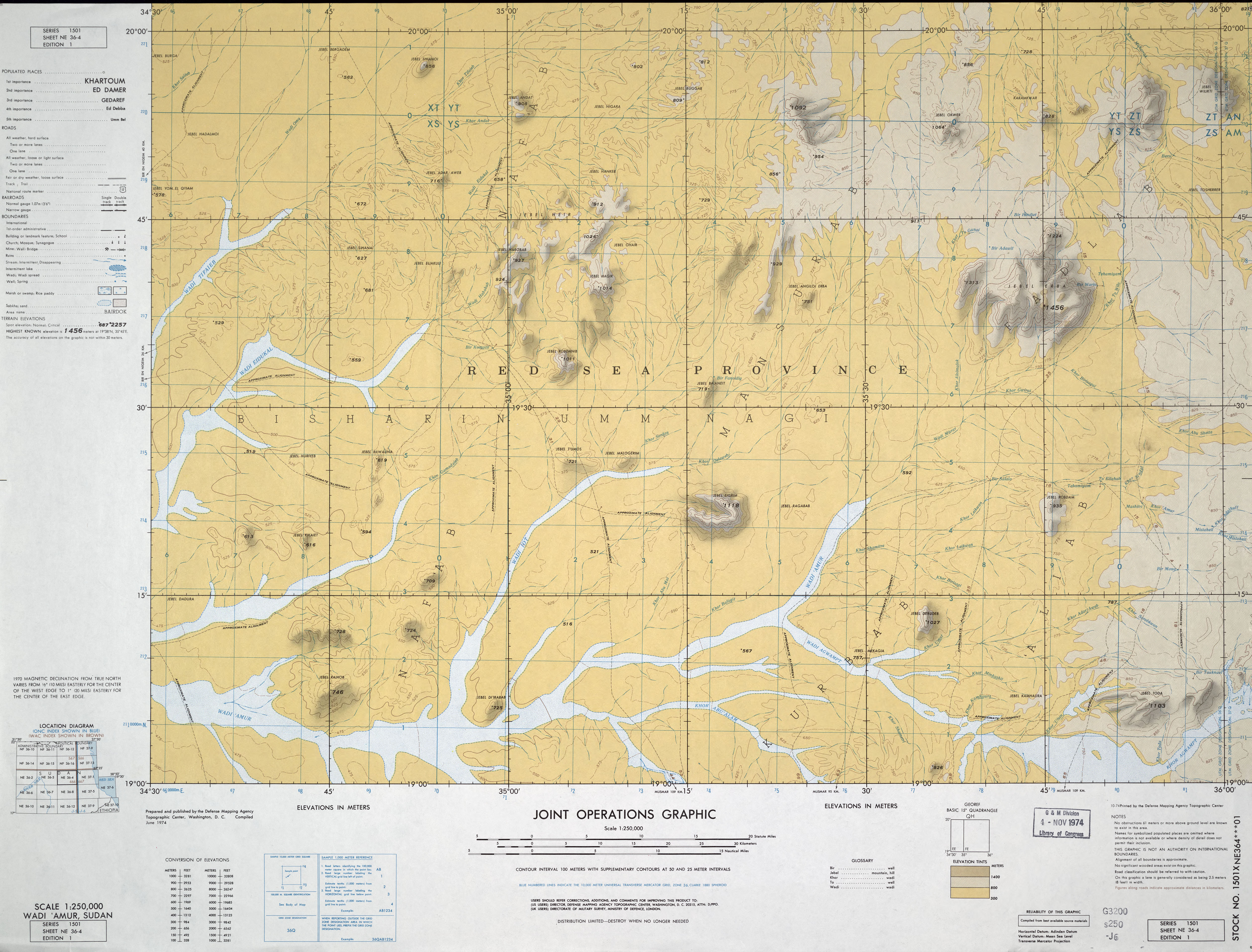
- NE 36-4 Wadi Amur, Sudan (4.1MB) This map is from the collection of the Library of Congress, Geography and Map Division
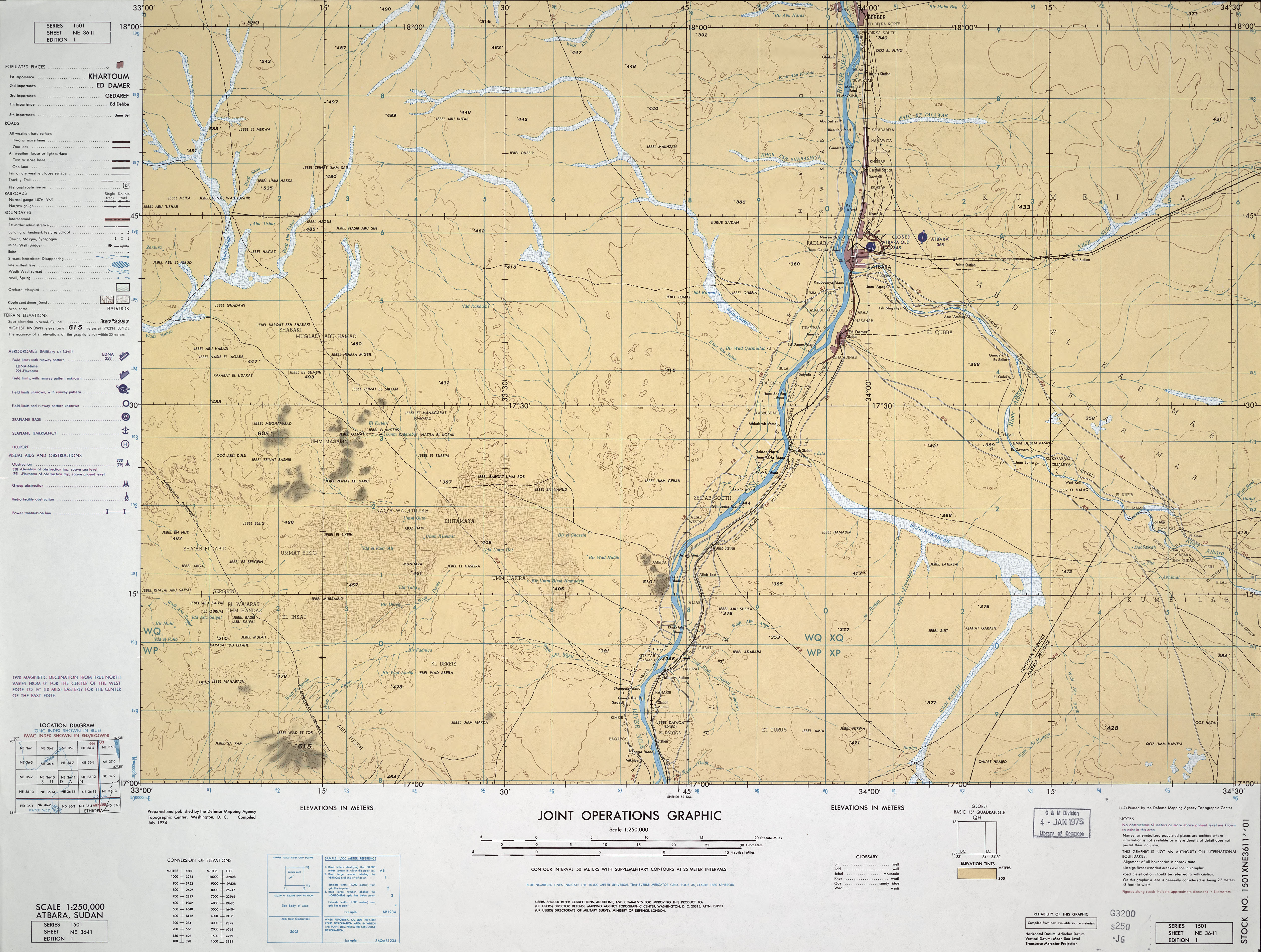
- NE 36-11 Atbara, Sudan (4.1MB) This map is from the collection of the Library of Congress, Geography and Map Division
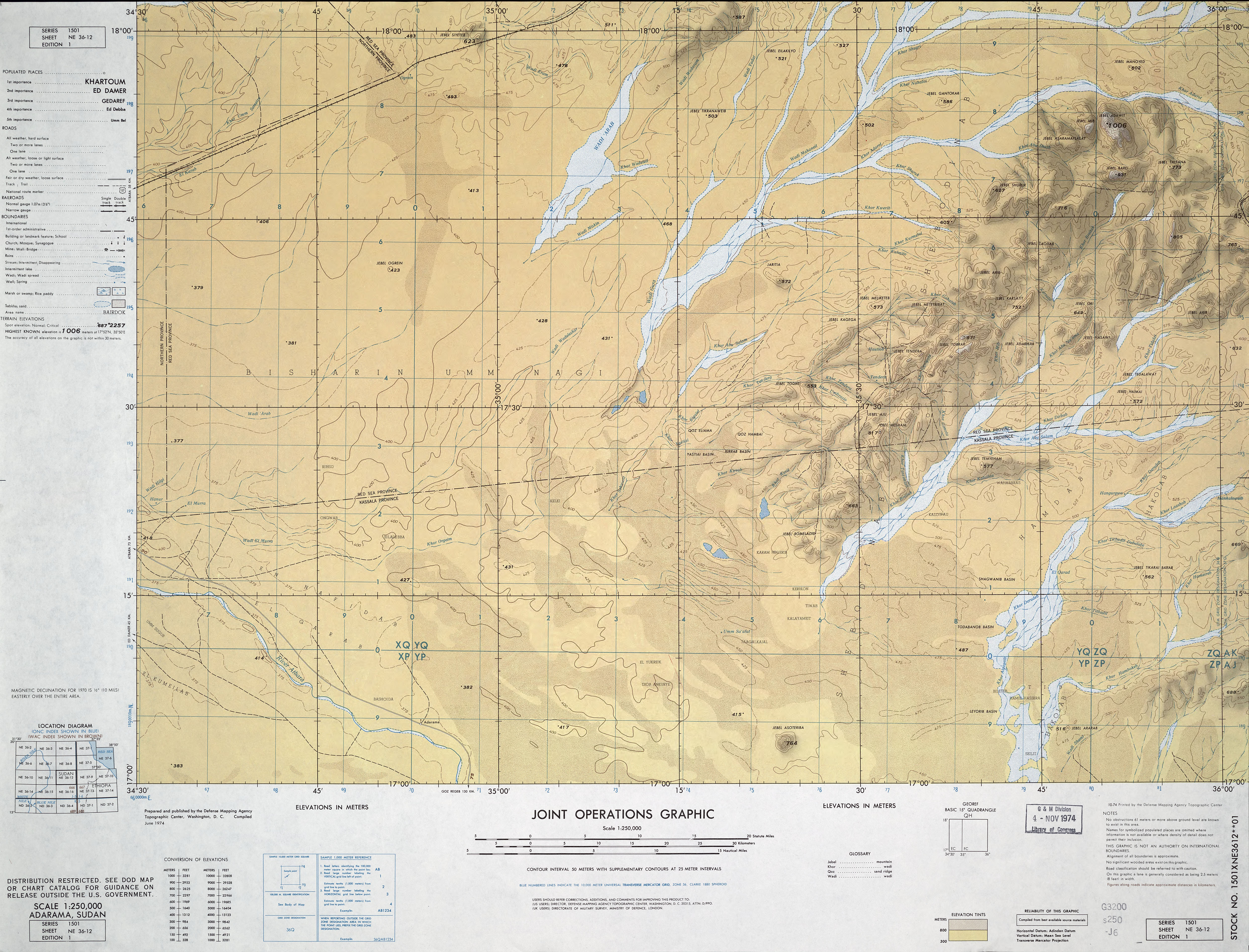
- NE 36-12 Adarama, Sudan (4.9MB) This map is from the collection of the Library of Congress, Geography and Map Division
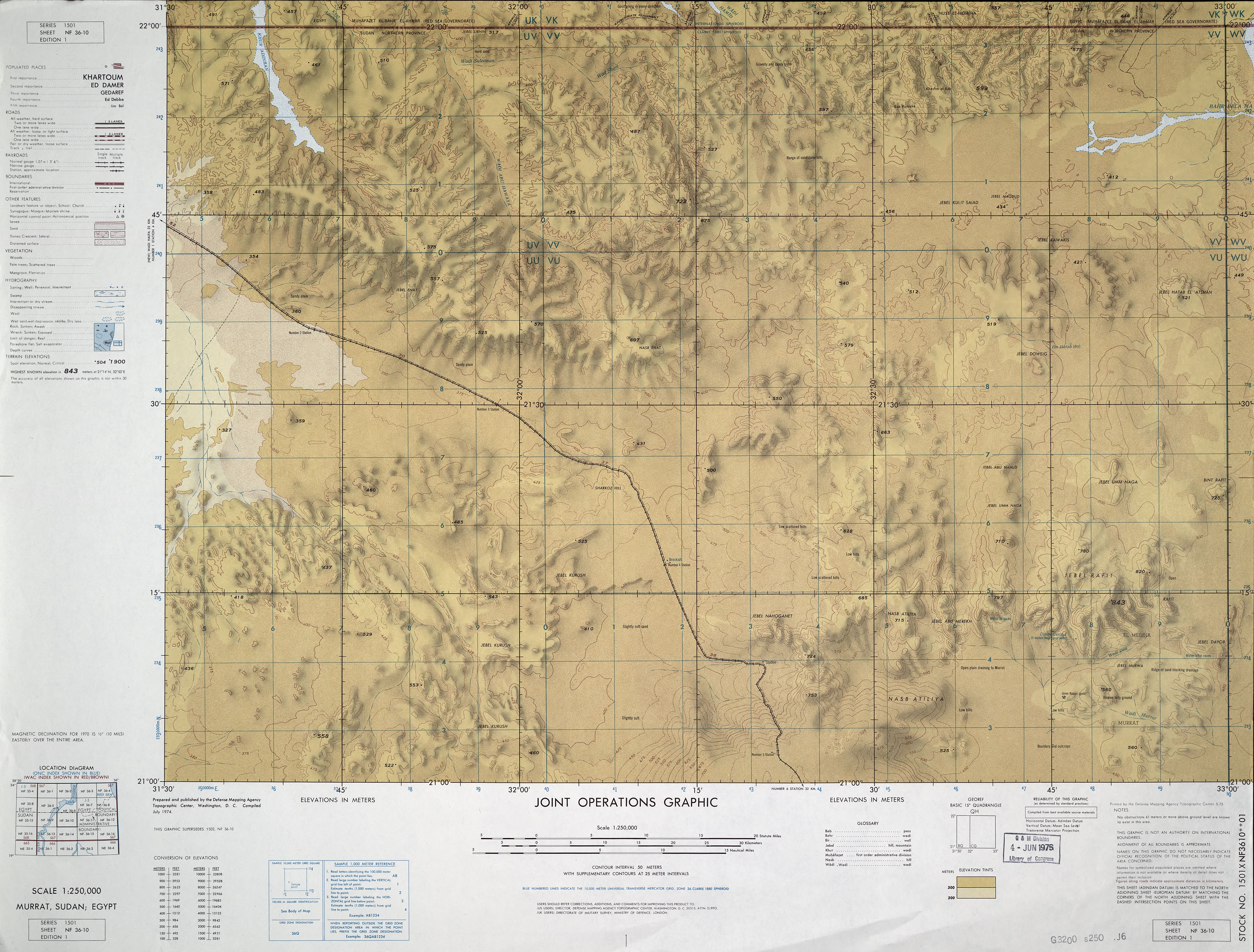
- NF 36-10 Murrat, Sudan; Egypt (6.0MB) This map is from the collection of the Library of Congress, Geography and Map Division
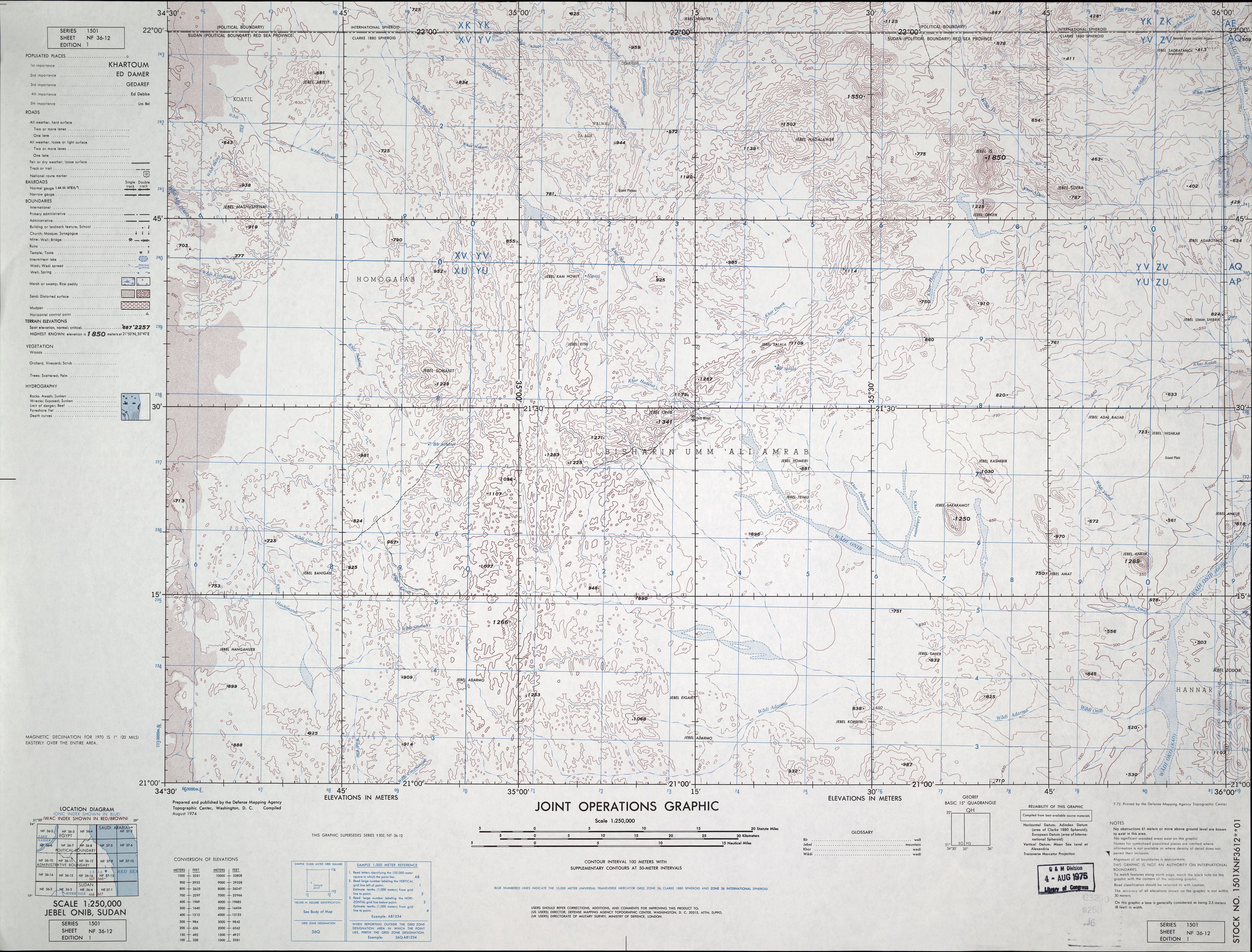
- NF 36-12 Jebel Onib, Sudan (4.3MB) This map is from the collection of the Library of Congress, Geography and Map Division
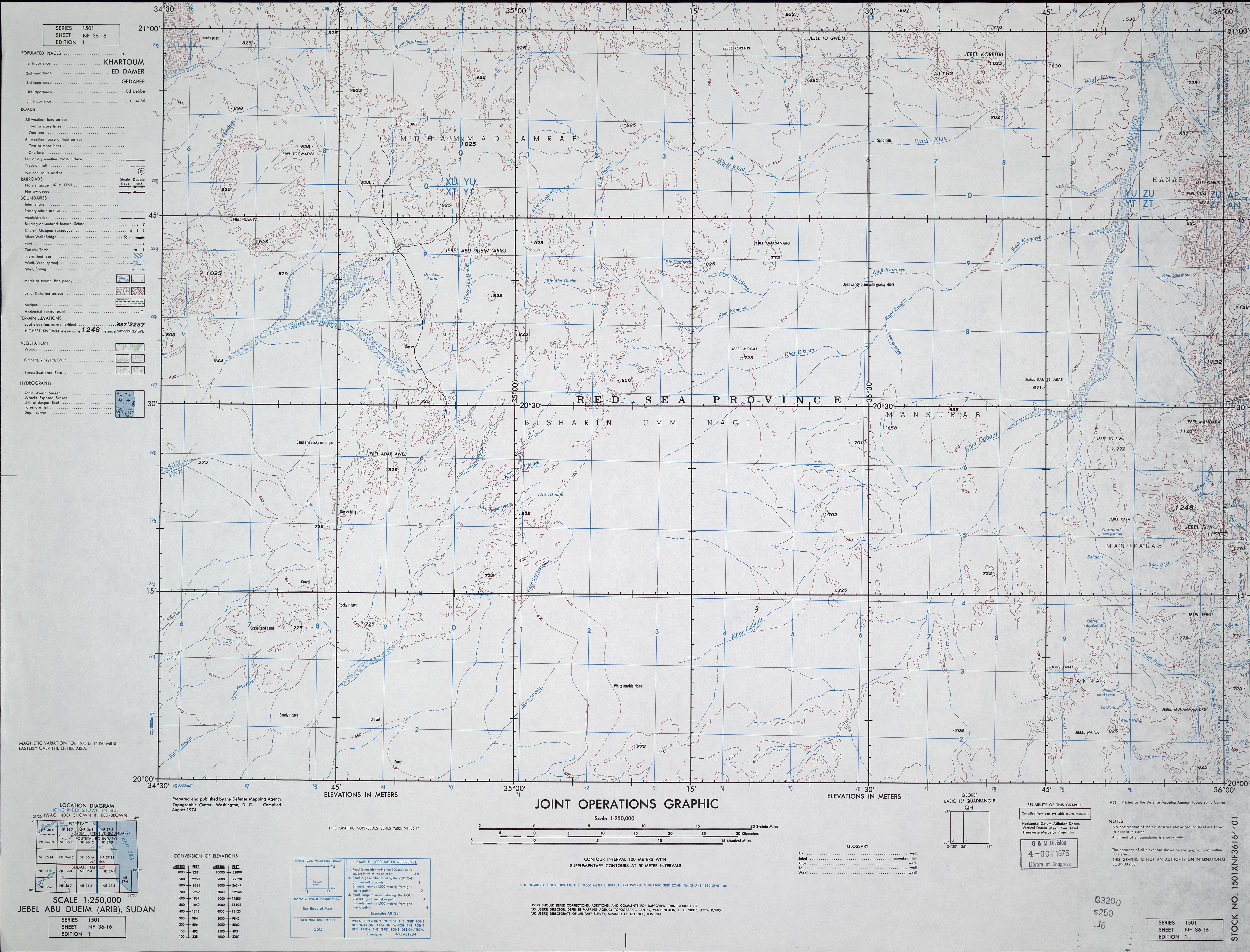
- NF 36-16 Jebel Abu Dueim (Arib), Sudan (3.6MB) This map is from the collection of the Library of Congress, Geography and Map Division