Perry-Castañeda Library
Map Collection
Kashmir Maps
The following maps were produced by the U.S. Central Intelligence Agency, unless otherwise indicated.
Kashmir Maps- The Disputed Area of Kashmir 2003 (310K) and pdf format (313K)
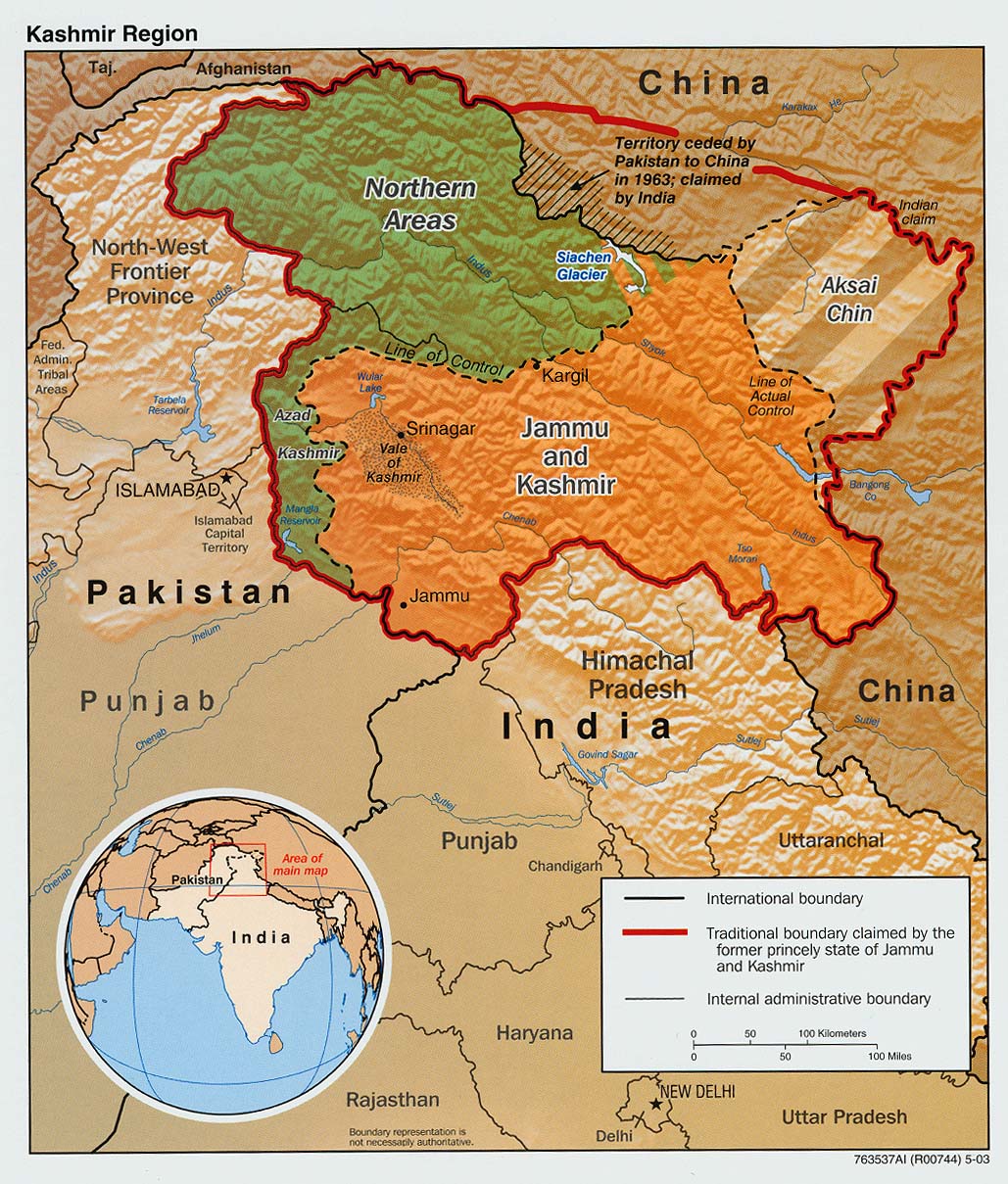
- The Disputed Area of Kashmir 2002 (350K)
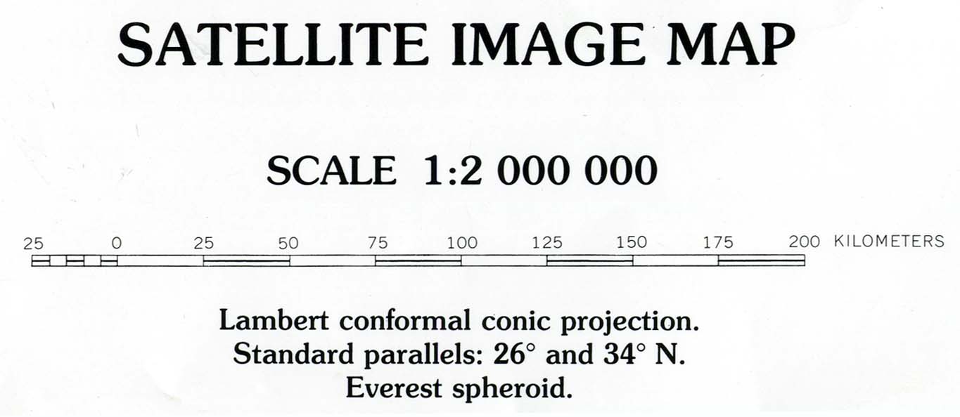
- [Kashmir and Northern Areas] Eastern Section (satellite image map) Original scale 1:2,000,000 Portion of "Pakistan: Satellite Image Map", U.S. Geological Survey Map I-2587-A, 1997 (702K)
- [Kashmir and Northern Areas] Western Section (satellite image map) Original scale 1:2,000,000 Portion of "Pakistan: Satellite Image Map", U.S. Geological Survey Map I-2587-A, 1997 (1MB)
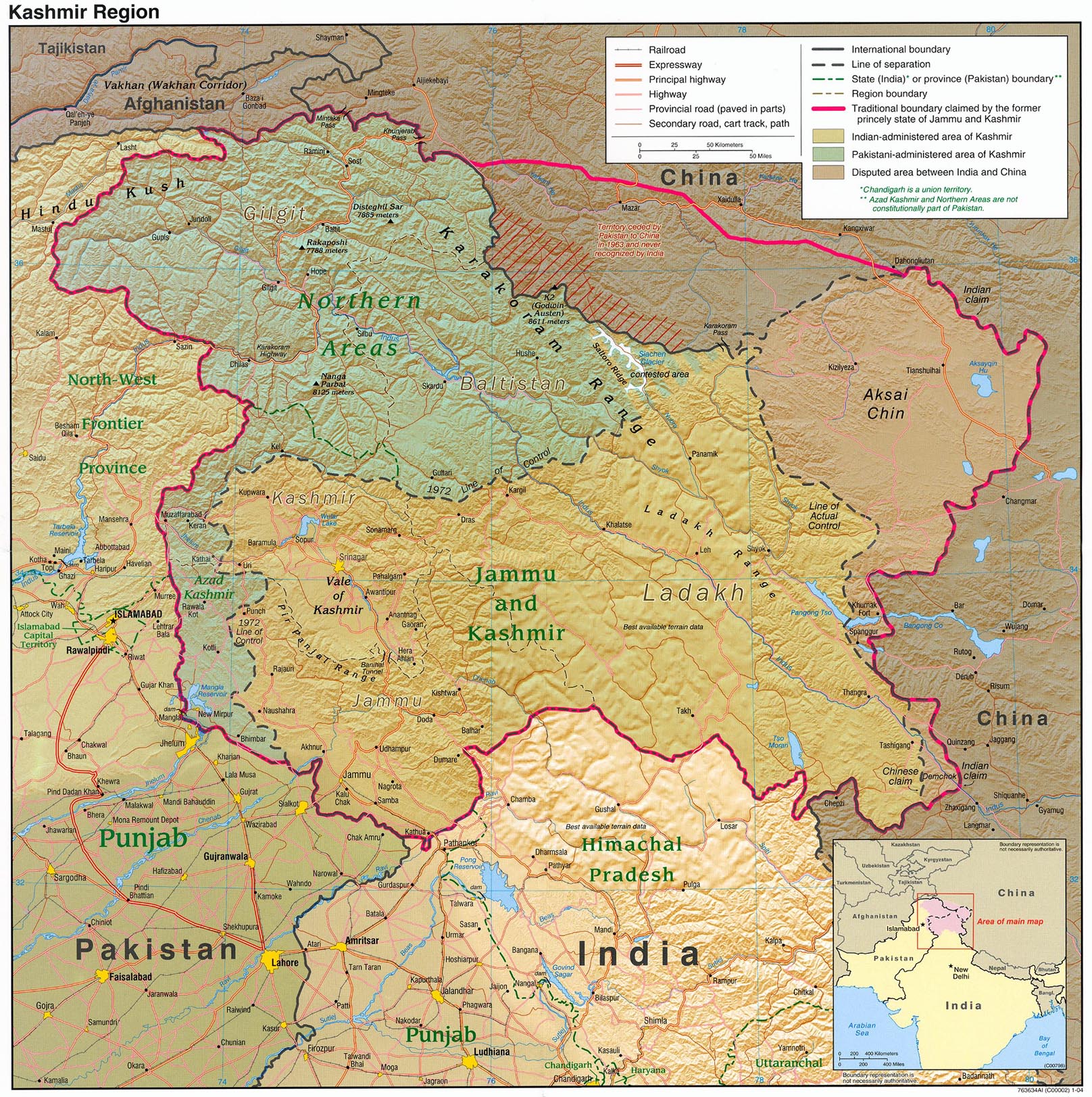
- Kashmir Region 2004 (789K) and pdf format (592K)
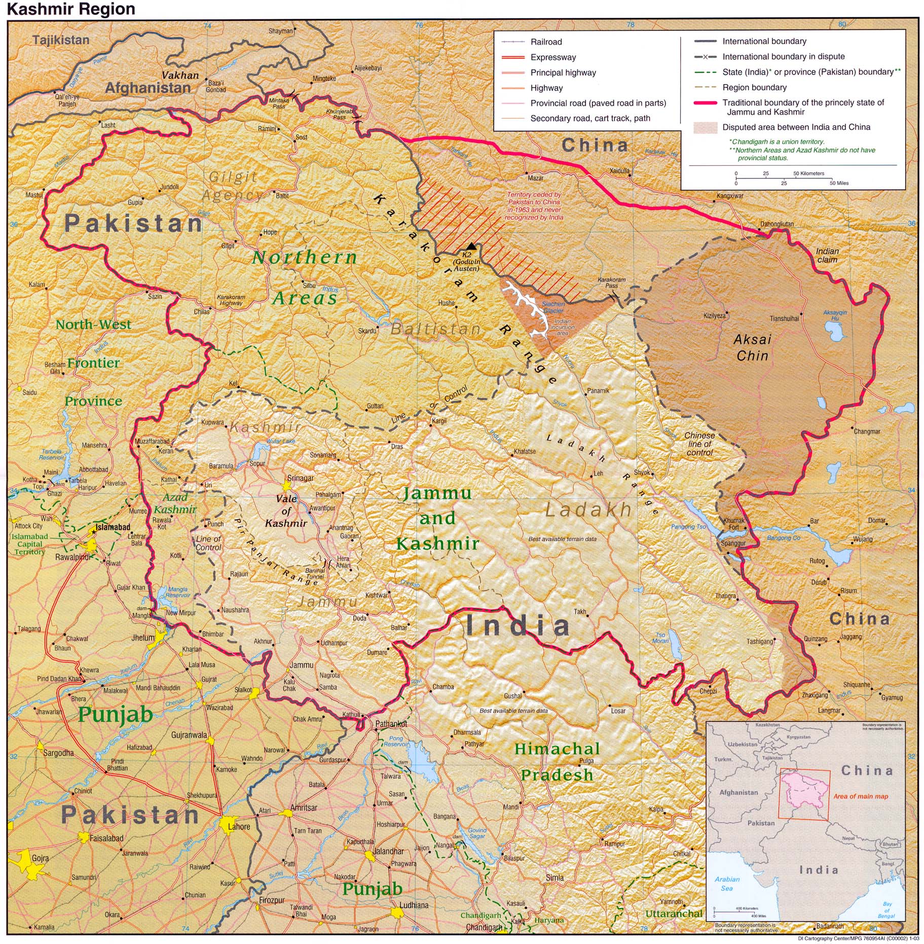
- Kashmir Region 2003 (783K)
- Kashmir Region 1990 (929K)
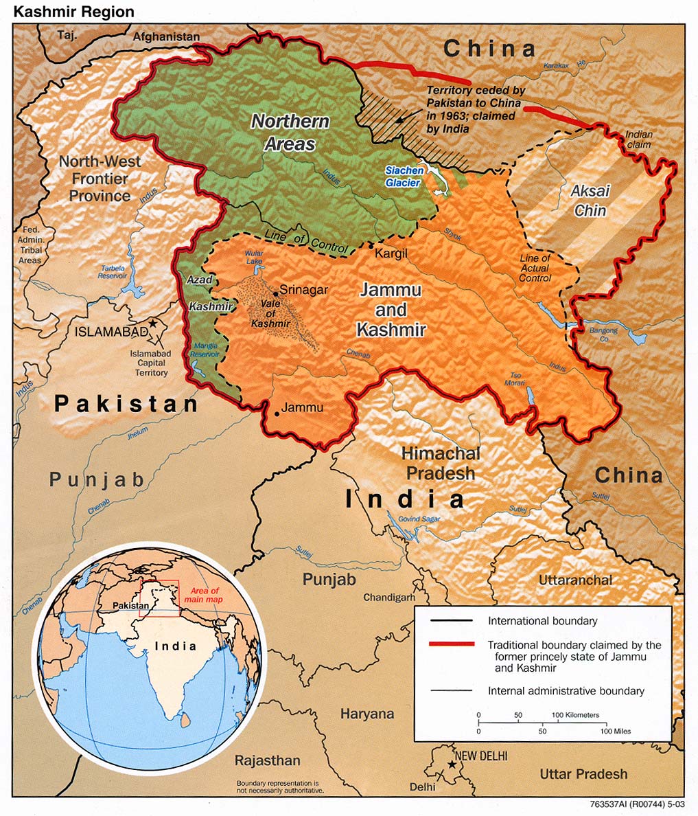
- Kashmir Region (Shaded Relief) 2003 (317K)
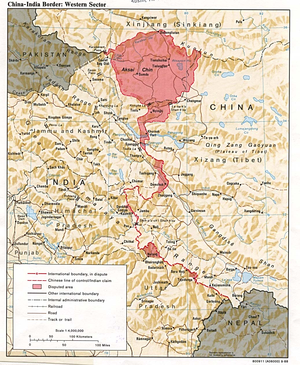
- China-India Border: Western Sector 1988 (319K)
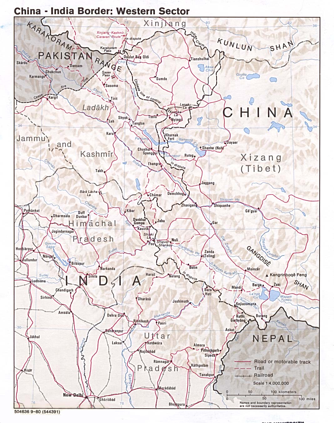
- China-India Border: Western Sector 1980 (297K)
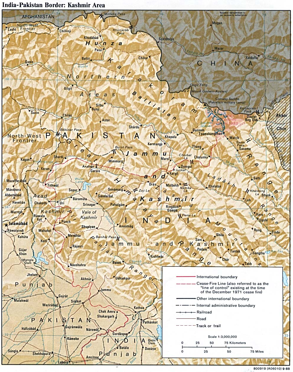
- India-Pakistan Border: Kashmir Area 1988 (350K)
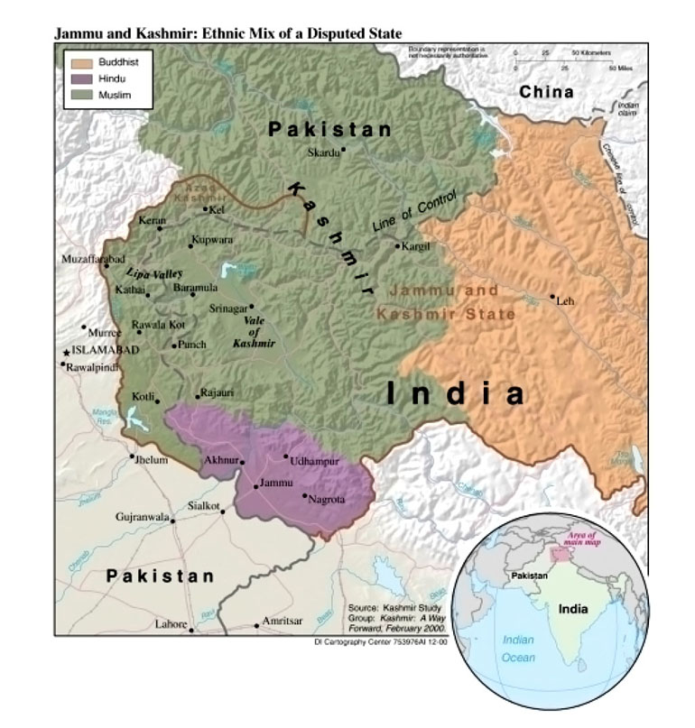
- Jammu and Kashmir: Ethnic Mix of a Disputed State from Global Trends 2015: A Dialogue About the Future With Nongovernment Experts [page 73], National Intelligence Council, 2000 (173K)
![[Kashmir and Northern Areas] Eastern Section (satellite image map)](middle_east_and_asia/kashmir_east_1997.jpg)
![[Kashmir and Northern Areas] Western Section (satellite image map)](middle_east_and_asia/kashmir_west_1997.jpg)
- Leh (topographic map) Original scale 1:250,000 Portion of U.S. Army Map Service Series U502, Sheet NI 43-8, 1955 (217K)
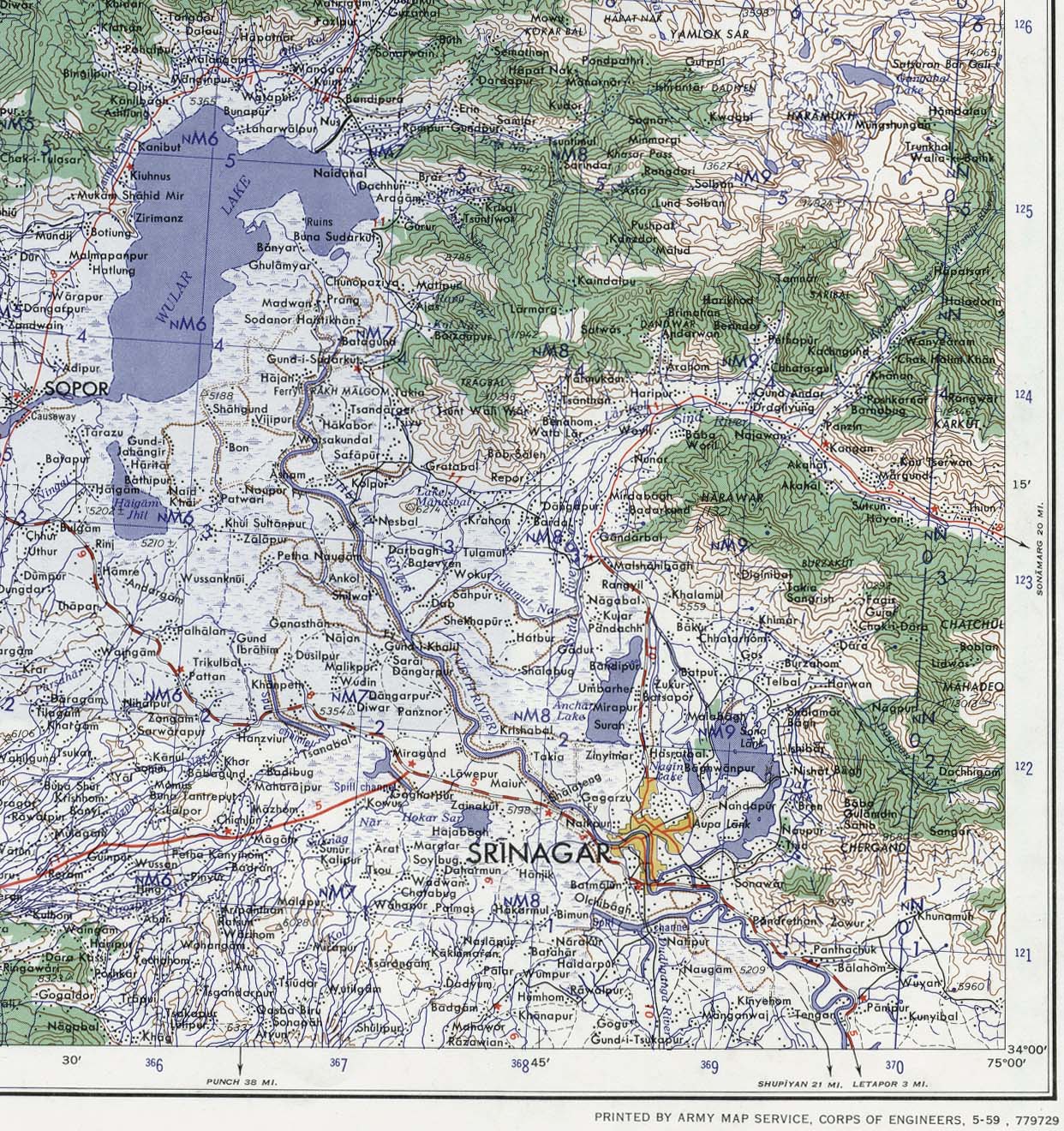
- Srinagar Area Portion of sheet NI 43-6 Srinagar. Edition May 1959. Original scale 1:250,000 Compiled in 1954 from Survey of India. Published by the U.S. Army Map Service, July 1959 (520K) Not for navigational use
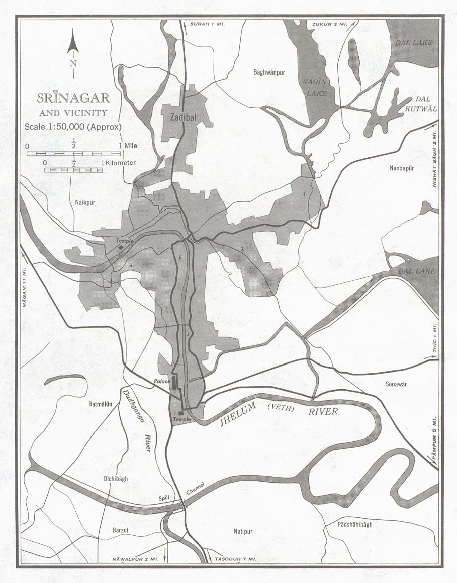
- Srinagar and Vicinty (town plan) Portion of sheet NI 43-6 Srinagar. Edition May 1959. Original scale 1:50,000 Compiled in 1954 from Survey of India. Published by the U.S. Army Map Service, July 1959 (146K) Not for navigational use
- 1:1,000,000 - Operational Navigation Chart, Sheet G-7 U.S. National Imagery and Mapping Agency. This sheet includes Kashmir. Not for navigational use
- 1:1,000,000 - International Map of the World This series includes Kashmir. Clickable Index Map
- Muzaffarabad Border Region Original scale 1:500,000 Portion of Defense Mapping Agency TPC G-6C 1992 (1.2MB) Not for navigational use
- Srinagar Border Region Original scale 1:500,000 Portion of Defense Mapping Agency TPC G-7D 1995 (1.1MB) Not for navigational use
- Srinagar to Kargil Original scale 1:500,000 Portion of Defense Mapping Agency TPC G-7D 1995 (1.1MB) Not for navigational use
- 1:250,000 - Joint Operations Graphic Series U.S. National Imagery and Mapping Agency. This series includes most of Kashmir. Not for navigational use
Maps on Other Web Sites