Perry-Castañeda Library
Map Collection
Latvia Maps
The following maps were produced by the U.S. Central Intelligence Agency, unless otherwise indicated.
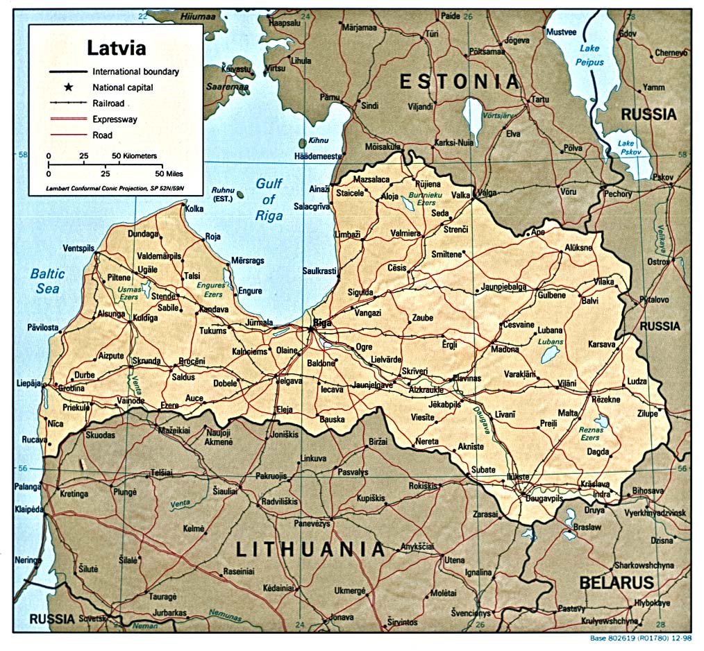
Country Maps- Latvia (Political) 1998 (387K) and pdf format (314K)
- Latvia (Political) 1991 (232K)
- Latvia (Shaded Relief) 1998 (387K) and pdf format (301K)
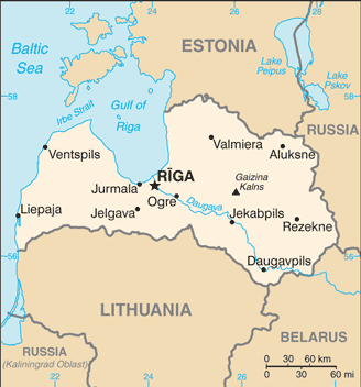
- Latvia (Small Map) 2016 (17.8K)
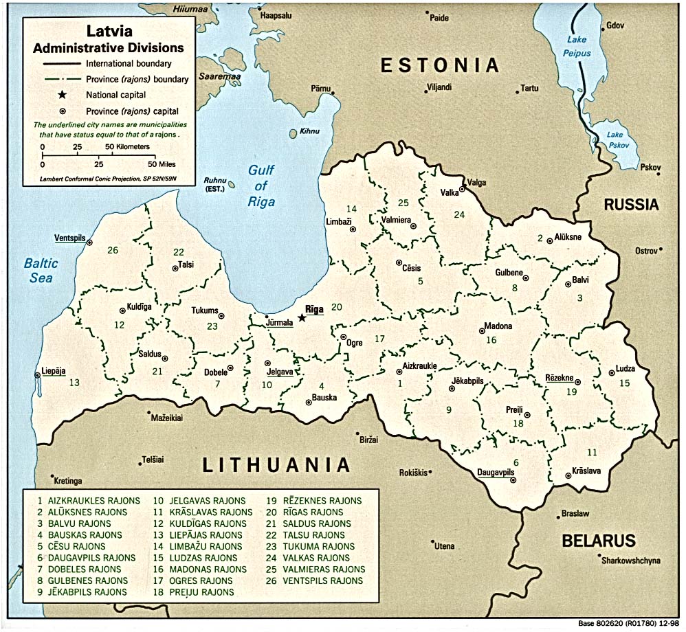
- Latvia: Administrative Divisions 1998 (387K)
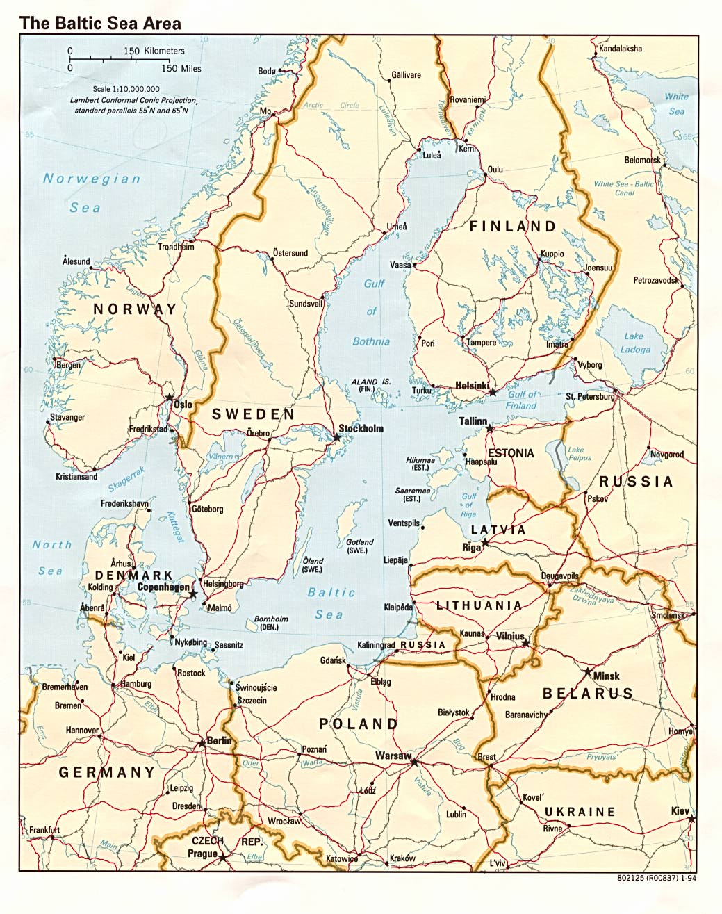
- Baltic Sea Area (Political) 1994 (276K)
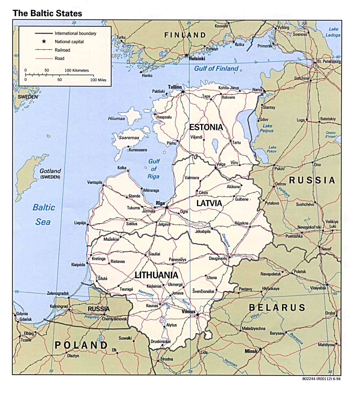
- Baltic States (Political) 1994 (200K)
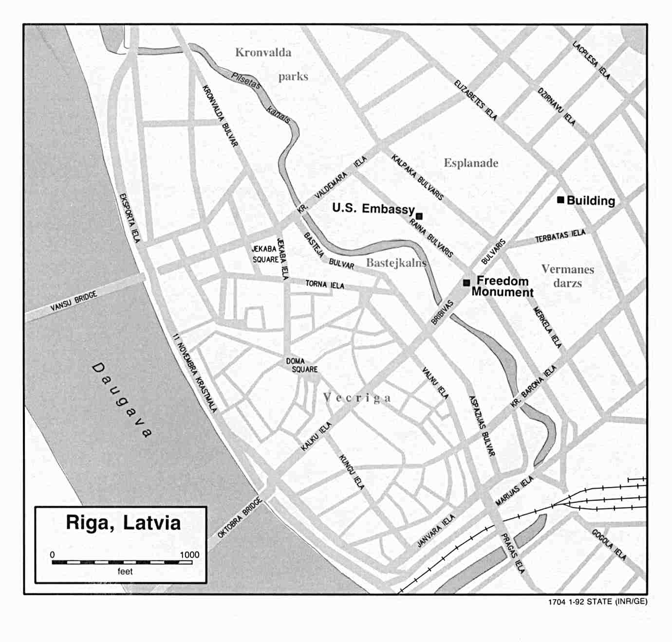
- Riga U.S. Dept. of State 1992 (76K)
- Baltic Lands Circa 1000 A.D. - 1809 A.D. (12 Maps)
- From the Atlas to Freeman's Historical Geography, Edited by J.B. Bury, Longmans Green and Co. Third Edition 1903
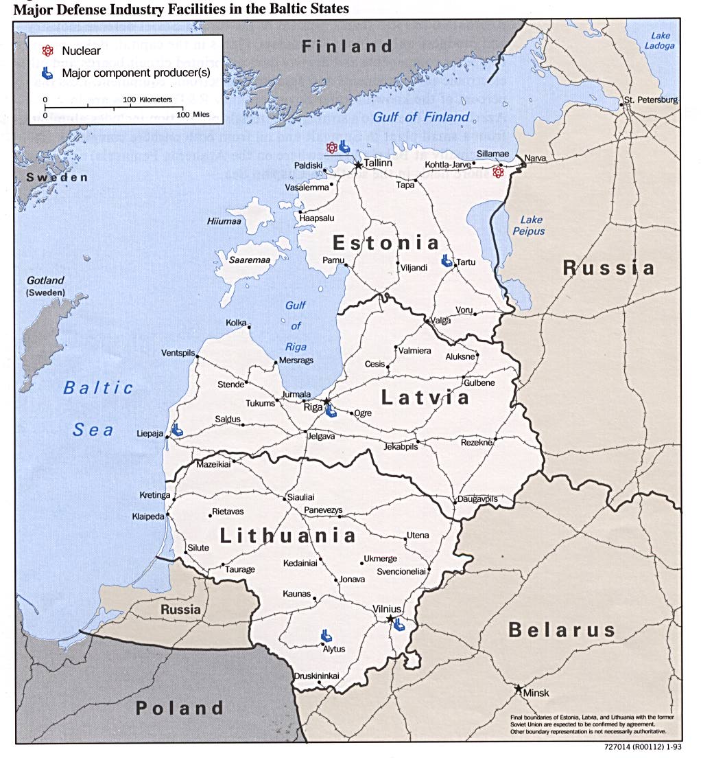
- Major Defense Industry Facilities in the Baltic States from Defense Industries of the Newly Independent States of Eurasia. 1993 (196K)
- 1:1,000,000 - Operational Navigation Chart U.S. Defense Mapping Agency Aerospace Center, 1973
- This series includes Latvia
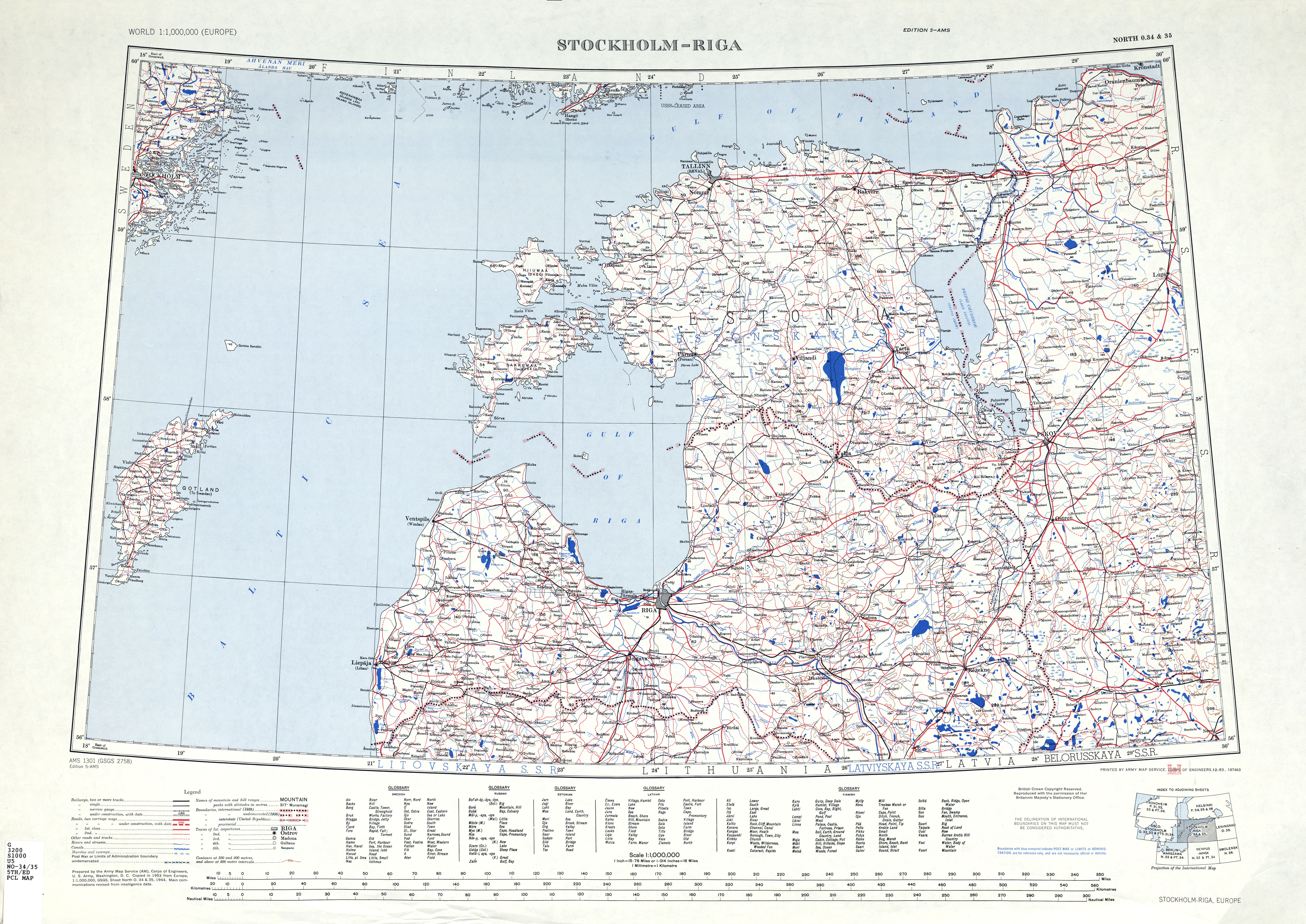
- 1:1,000,000 - International Map of the World, Stockholm-Riga Sheet U.S. Army Map Service, 1953
- This map includes Latvia
- 1:500,000 - Europe Series M404 (4072), Great Britain War Office, 1942-
- This series covers all of Latvia
- 1:500,000 - Tactical Pilotage Charts U.S. National Imagery and Mapping Agency. Not for navigational use
- This series covers Latvia
- 1:500,000 - World Series 1404, Great Britain. War Office and Air Ministry. 1958-
- This series covers all of Latvia
- 1:250,000 - Eastern Europe [Topographic Maps] Series N501, U.S. Army Map Service, 1954
- This series includes Latvia
- This series includes Latvia
Maps on Other Web Sites