Perry-Castañeda Library
Map Collection
Malawi Maps
The following maps were produced by the U.S. Central Intelligence Agency, unless otherwise indicated.
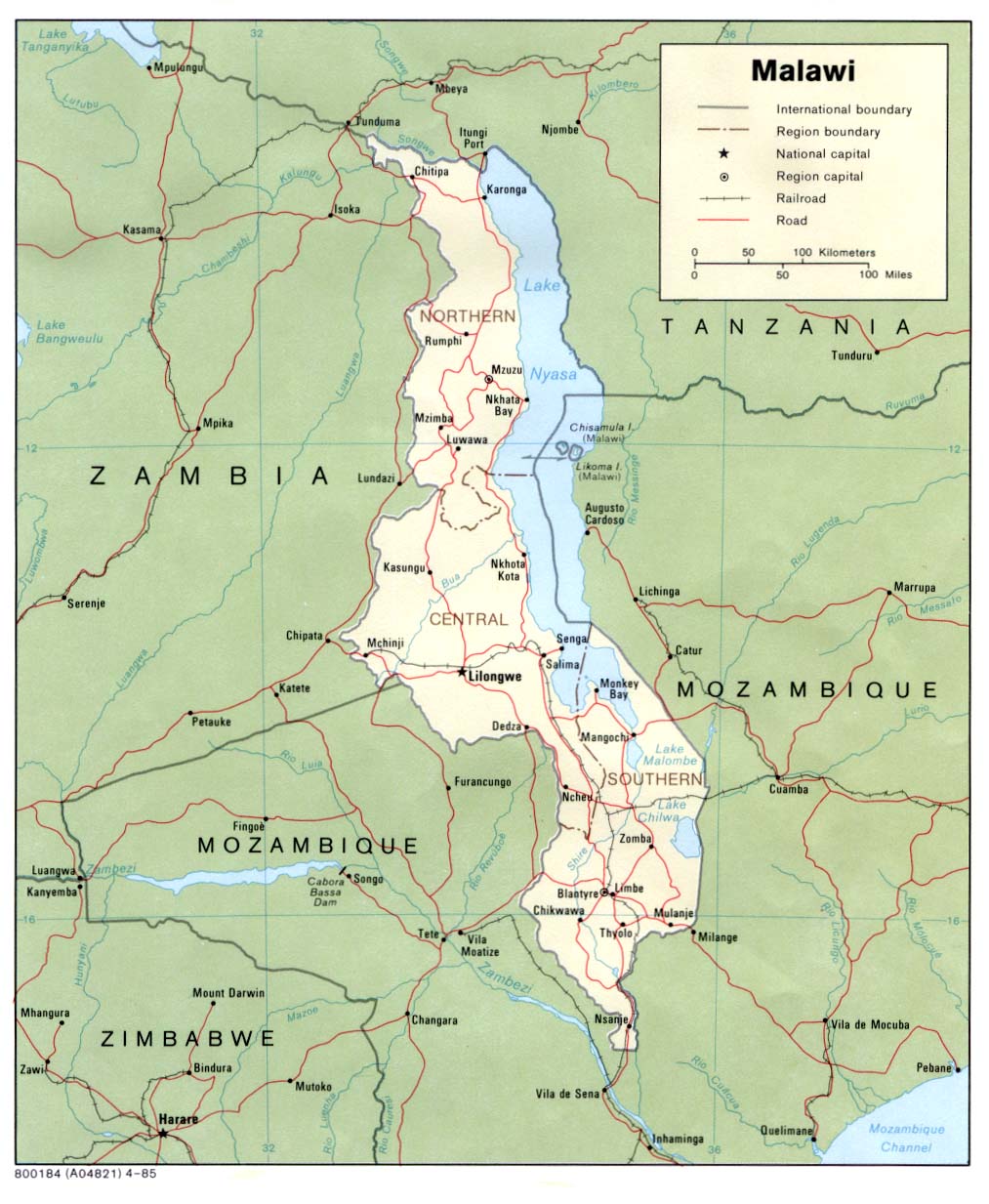
Country Maps- Malawi (Political) 1985 (172K) and pdf format (178K)
- Malawi (Shaded Relief) 1985 (197K) and pdf format (200K)
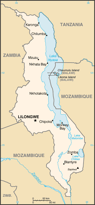
- Malawi (Small Map) 2016 (18.3K)
- 1:2,000,000 - Africa Topographic Maps U.S. Army Map Service
- Sheets 28 and 31 cover Malawi
- 1:1,000,000 - International Map of the World U.S. Army Map Service
- Sheets SC-36, SD-36 and SE-36 cover Malawi (former Nyasaland)
- 1:1,000,000 - Operational Navigation Chart U.S. Defense Mapping Agency Aerospace Center. Not for navigational use
- Sheets N-5, P-5 cover all of Malawi
- 1:500,000 - Tactical Pilotage Charts U.S. National Imagery and Mapping Agency. Not for navigational use
- This series covers most of Malawi
- 1:500,000 - East Africa Topographic Maps Series Y401 (GSGS 4335), U.S. Army Map Service, 1958-
- This series covers parts of Malawi
- Sheets 28 and 31 cover Malawi