Perry-Castañeda Library
Map Collection
Mauritania Maps
The following maps were produced by the U.S. Central Intelligence Agency, unless otherwise indicated.
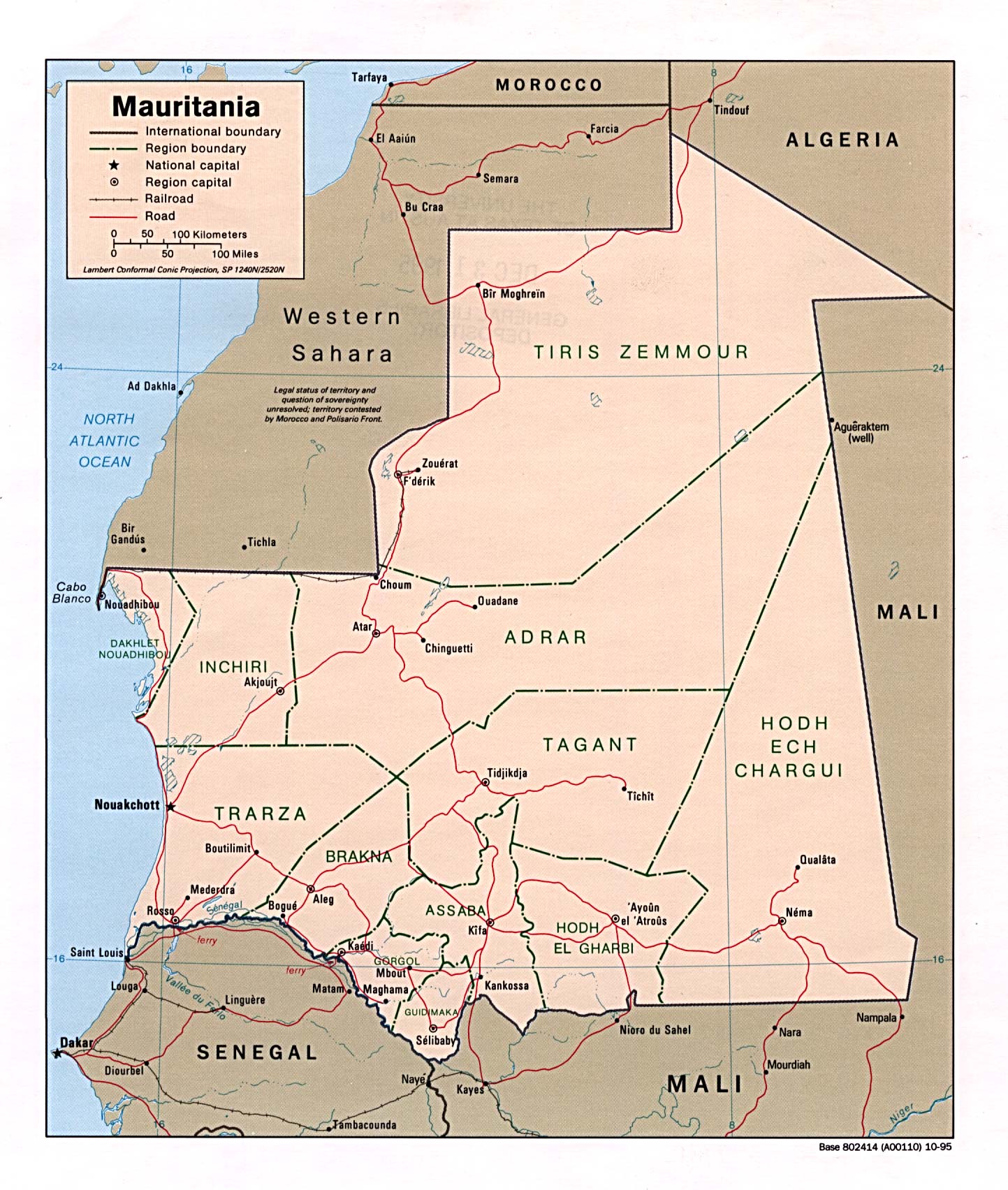
Country Maps- Mauritania (Political) 1995 (396K) and pdf format (399K)
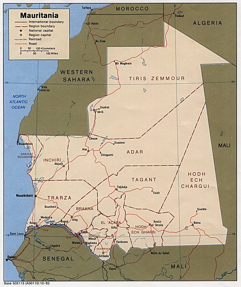
- Mauritania (Political) 1982 (218K) and pdf format (222K)
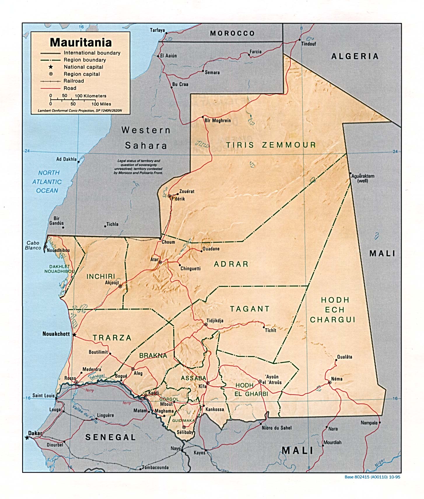
- Mauritania (Shaded Relief) 1995 (436K) and pdf format (440K)
- Mauritania (Small Map) 2016 (19K)
- Nouakchott U.S. Dept. of State 1984 (106K)
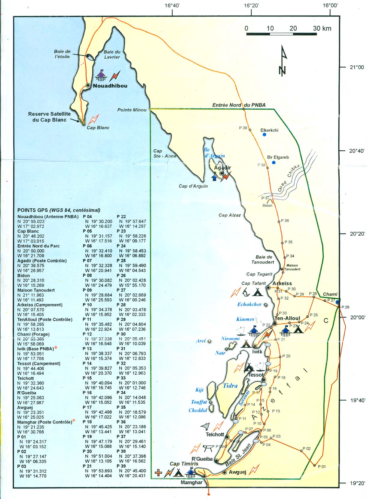
- Parc National du Banc d'Arguin (249K) and Map Legend (315K) (PNBA)
- 1:2,000,000 - Africa Topographic Maps U.S. Army Map Service, Series 2201
- Sheets 6, 7, 11 and 12 cover all of Mauritania
- 1:1,000,000 - International Map of the World U.S. Army Map Service.
- This series covers much of Mauritania. Clickable map
- 1:1,000,000 - Operational Navigation Chart Series U.S. Defense Mapping Agency Aerospace Center
- This series includes all of Mauritania. Not for navigational use
- 1:500,000 - Tactical Pilotage Charts U.S. National Imagery and Mapping Agency. Not for navigational use
- This series covers the northern part of Mauritania
- 1:250,000 - West Africa Topographic Maps U.S. Army Map Service, Series N504
- This series includes coastal Mauritania
- Sheets 6, 7, 11 and 12 cover all of Mauritania
Maps on Other Web Sites