Perry-Castañeda Library
Map Collection
Morocco Maps
The following maps were produced by the U.S. Central Intelligence Agency, unless otherwise indicated.
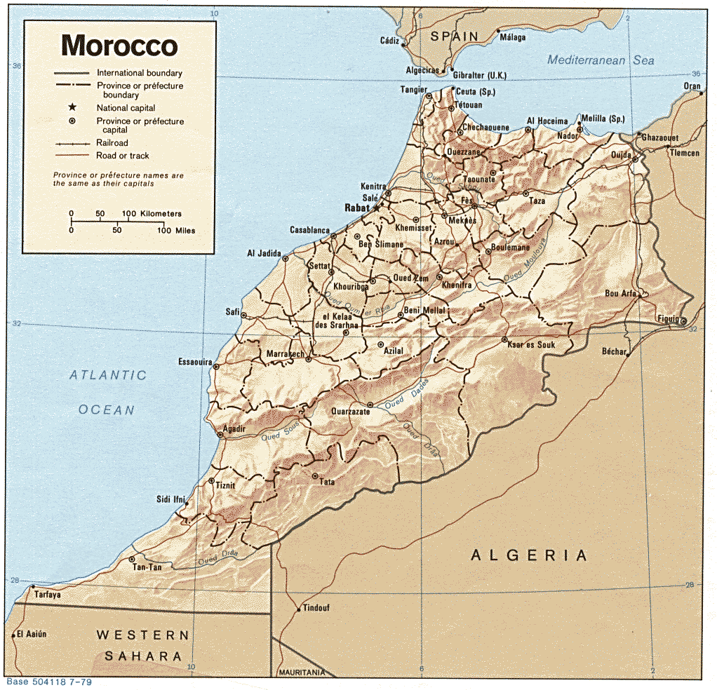
Country Maps- Morocco (Shaded Relief) 1979 (207K) and pdf format (226K)
- Morocco (Small Map) 2016 (17.5K)
- Morocco - West (760K) and map key and scale (401K)
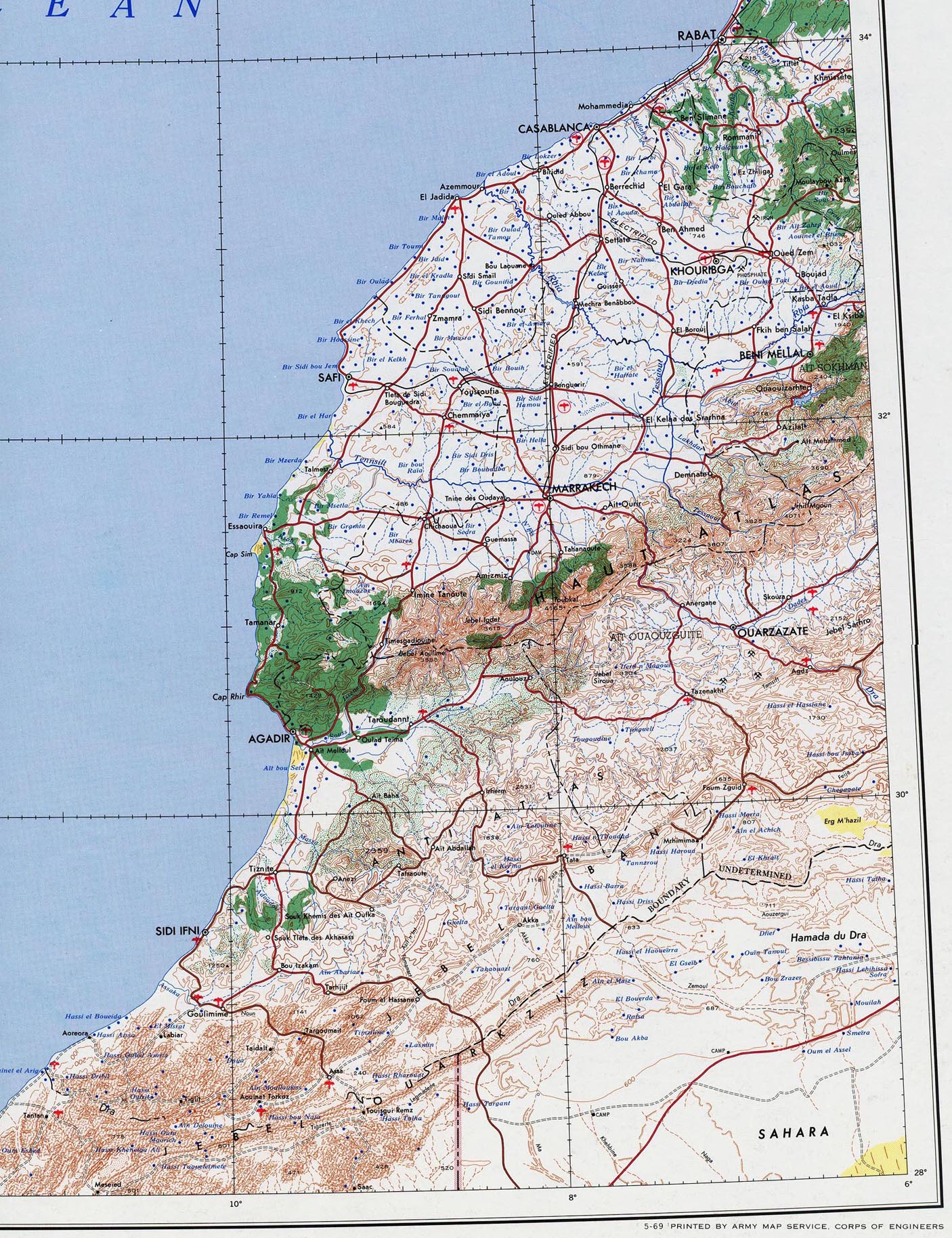
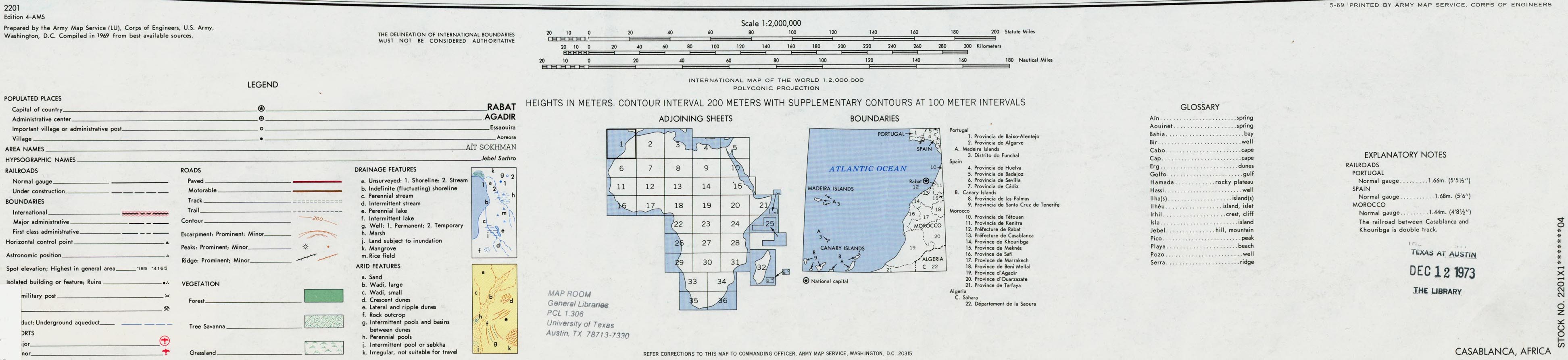
- Portion of AMS Series 2201, Sheet 1 "Casablanca" original scale 1:2,000,000. Published by the U.S. Army Map Service, 1969. Area covered includes the cities of Agadir, Casablanca, Marrakech, Rabat and adjacent areas of Spain, Portugal, Madeira and Canary Islands.
- 1:2,000,000 - Africa Topographic Maps U.S. Army Map Service, Series 2201
- This series covers all of Morocco. Clickable map
- 1:1,000,000 - Operational Navigation Chart Series U.S. Defense Mapping Agency Aerospace Center. Not for navigational use
- This series covers all of Morocco. Clickable map
- 1:1,000,000 - International Map of the World U.S. Army Map Service
- This series covers most of Morocco. Clickable map
- 1:500,000 - Tactical Pilotage Charts U.S. National Imagery and Mapping Agency. Not for navigational use
- This series covers Morocco
- 1:500,000 - World Series 1404, Great Britain. War Office and Air Ministry. 1958-
- This series covers parts of Morocco
- 1:250,000 - North Africa Topographic Maps U.S. Army Map Service, Series P502
- This series covers most of Morocco, excluding the far south
- 1:250,000 - North Africa Joint Operations Graphic Aeronautical charts. U.S. National Imagery and Mapping Agency. Not for navigational use
- This series covers parts of Morocco and Western Sahara. Clickable map
- 1:200,000 - Morocco Topographic Maps U.S. Army Map Service, Series P531, 1941-
- This series covers all of Morocco.
- 1:125,000 - Southern Morocco Topographic Maps U.S. Army Map Service, Series P632
- Clickable map
- 1:50,000 - Morocco Topographic Maps U.S. Army Map Service reprint of a British War Office series, based on earlier French maps
- 1941-
- This series covers all of Morocco. Clickable map
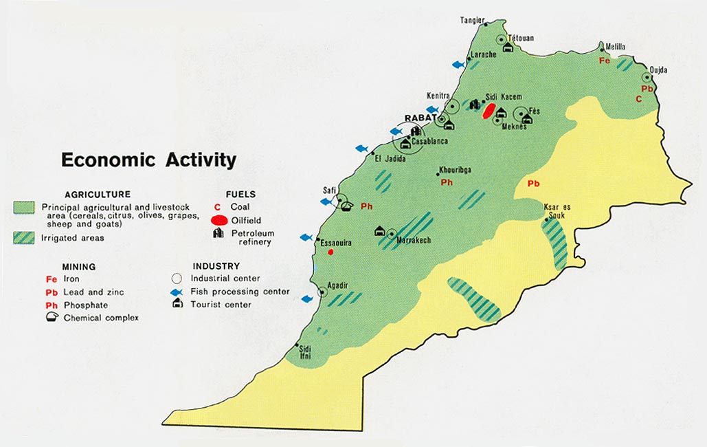
- Morocco - Economic Activity from Map No. 500977 1973 (106K)
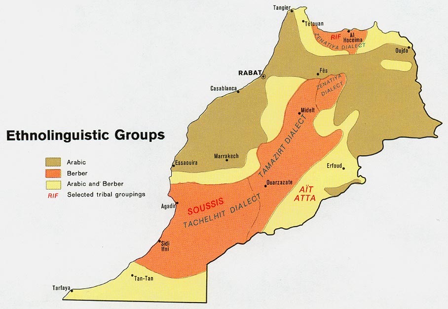
- Morocco - Ethnolinguistic Groups from Map No. 500977 1973 (104K)
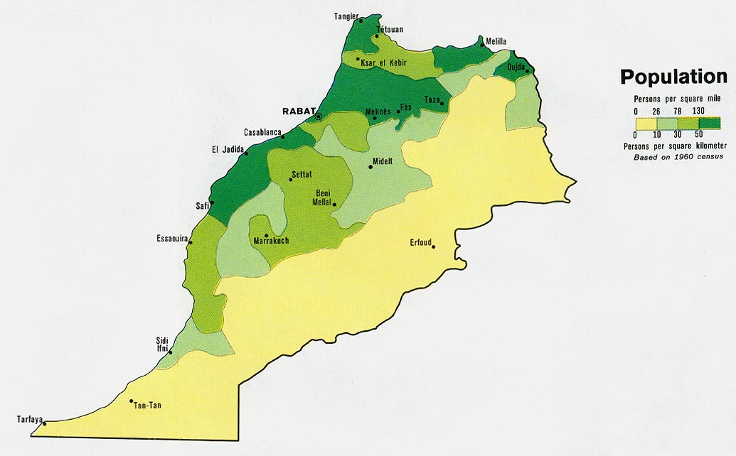
- Morocco - Population from Map No. 500977 1973 (95K)
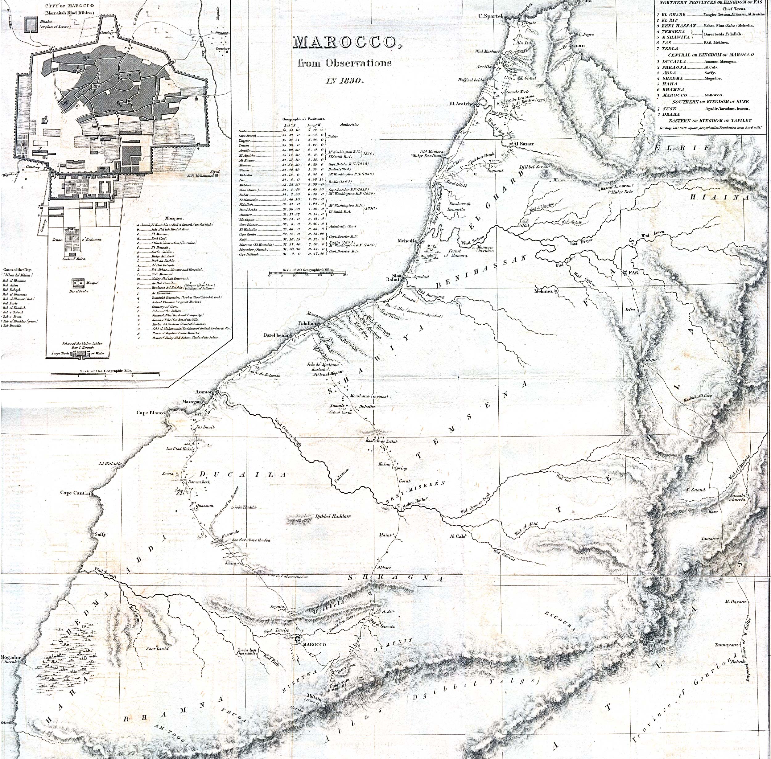
- Morocco 1830 (1MB) "Marocco from Observations In 1830" with inset map of "City of Marocco (Marraksh Blad Kibira)" [Marrakech] from the Journal of the Royal Geographical Society, Volume 1, 1832 to accompany "Geographical Notice of the Empire of Marocco. By Lieutenant Washington, R.N."
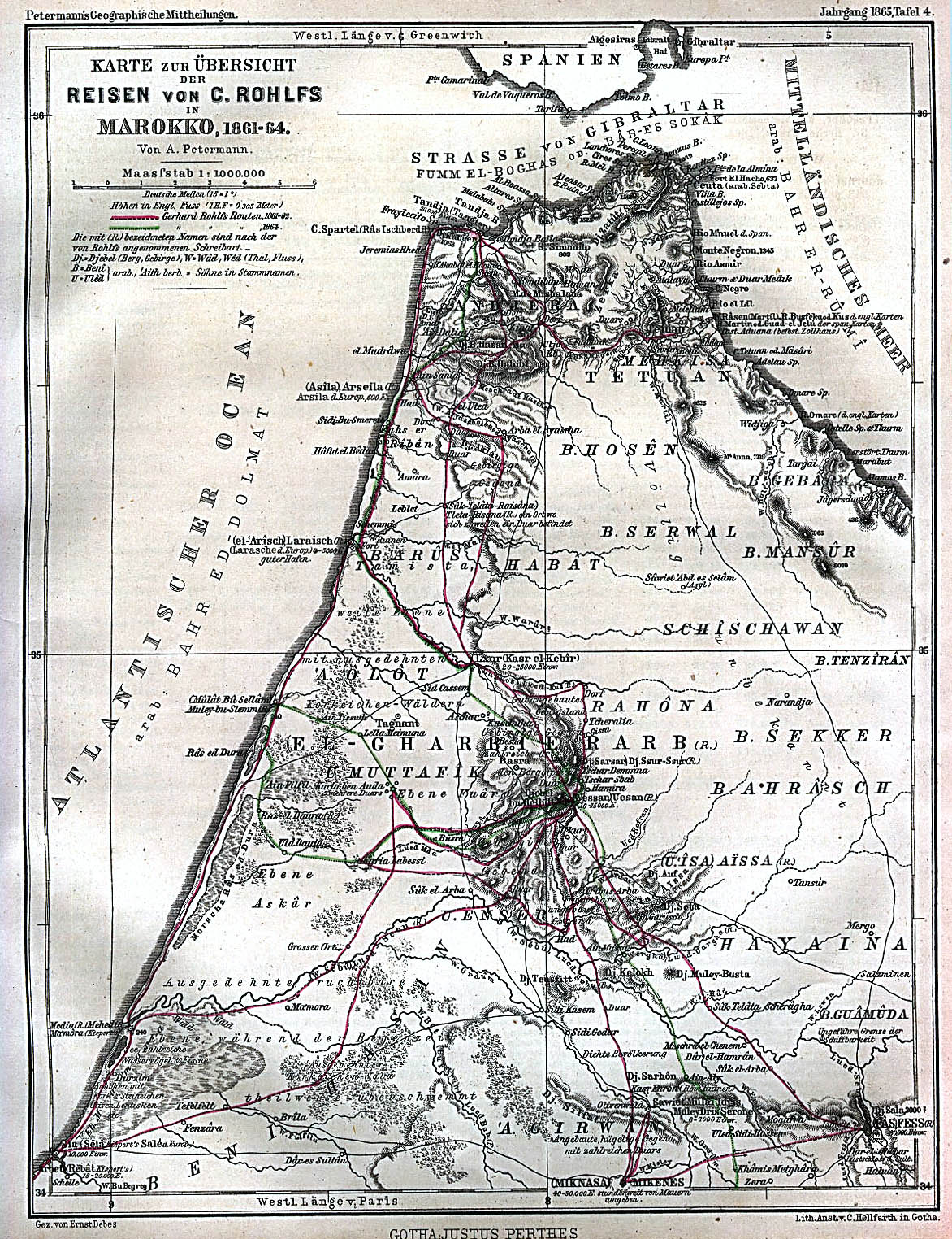
- Morocco 1861-1864 (636K) "Karte zur Übersicht der Reisen von C. Rolhfs in Marokko 1861-64" From Mittheilungen aus Justus Perthes' Geographischer Anstalt uber Wichtige Neue Erforschungen auf dem Gesammtgebiete der Geographie von Dr. A. Petermann. Tafel 4, 1865.
- Morocco City Plans U.S. Army Map Service, 1942-1947
- North Africa, Series P502 (Topographic Maps) 1:250,000, U.S. Army Map Service, 1954-
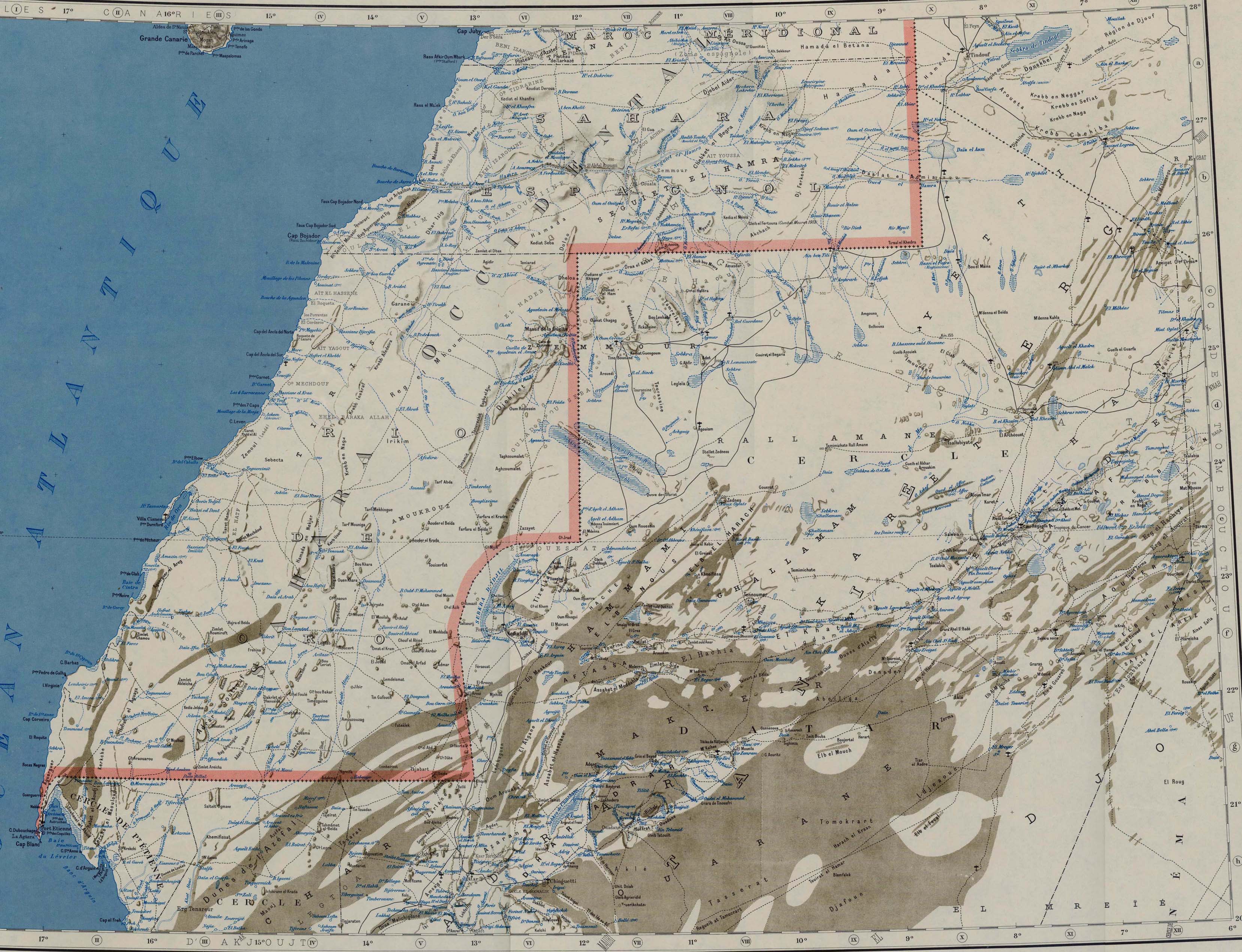
- Western Sahara and Northern Mauritania 1958 (1.1MB) and map key and scale (592K) Portion of Series 2201, Sheet NG 28-29/NF 28-29 "Mauritanie" Edition 3-IGNF, original scale 1:2,000,000. Published by U.S. Army Map Service, 1958. This map includes the territories of Sahara Espagnol and Rio de Oro.
Maps at Other Web Sites