Perry-Castañeda Library
Map Collection
Mozambique Maps
The following maps were produced by the U.S. Central Intelligence Agency, unless otherwise indicated.
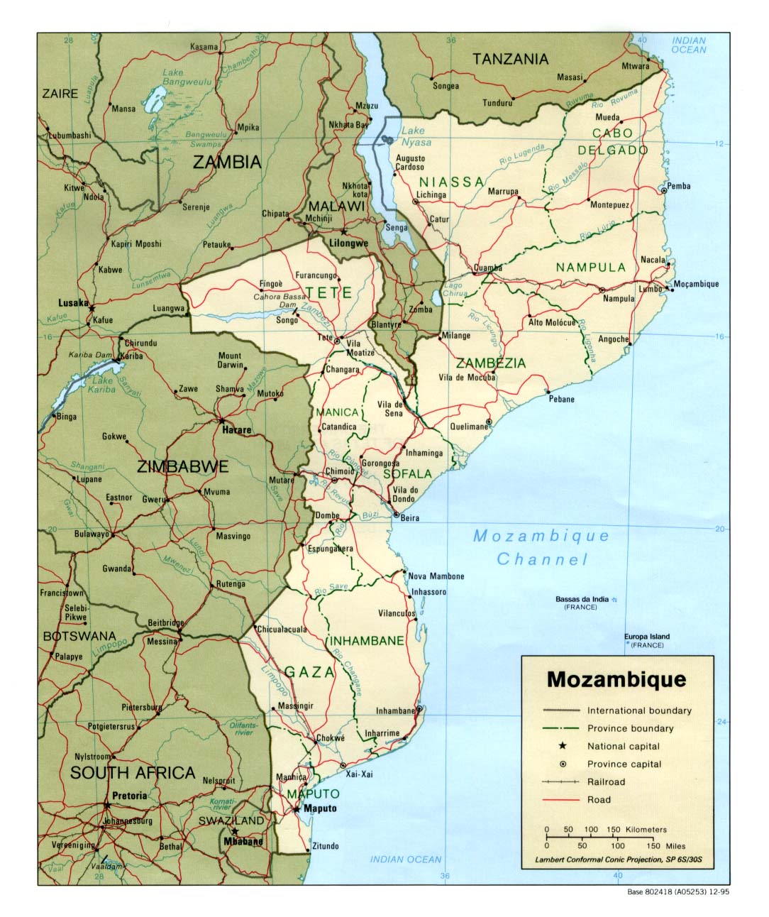
Country Maps- Mozambique (Political) 1995 (228K) and pdf format (248K)
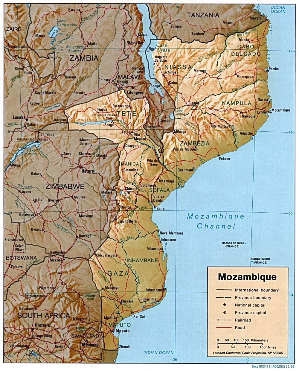
- Mozambique (Shaded Relief) 1995 (324K) and pdf format (370K)
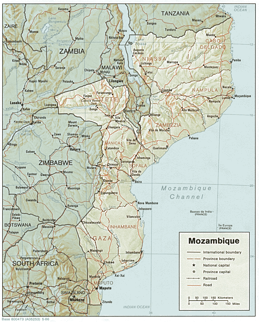
- Mozambique (Shaded Relief) 1986 (340K) and pdf format (355K)
- Mozambique (Small Map) 2016 (24.9K)
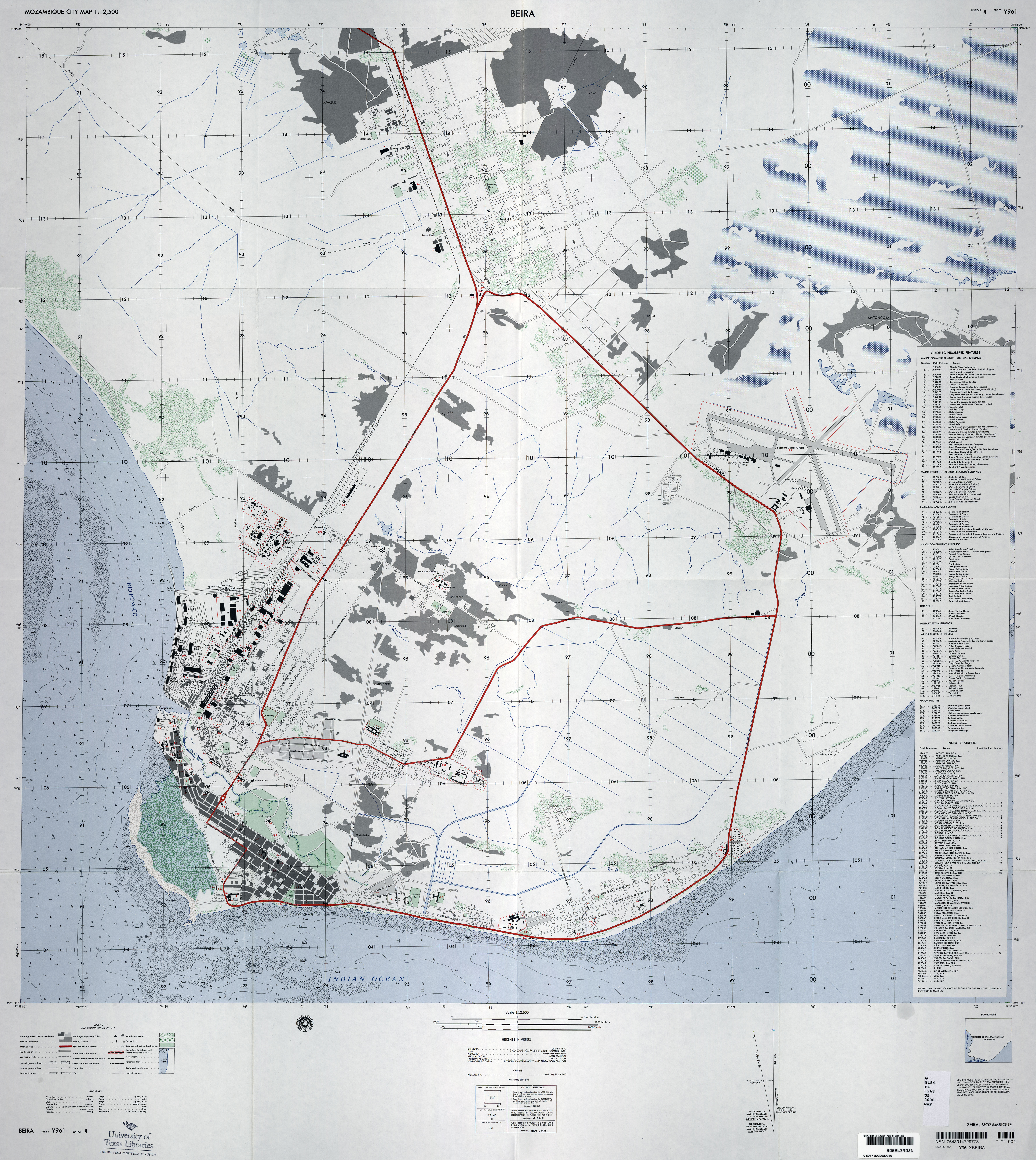
- Beira original scale 1:12,500, Edition 4, Series Y961. National Imagery and Mapping Agency, 1967. (8.9MB)
- Maputo original scale 1:12,500, Edition 3-NIMA, Series Y961. National Imagery and Mapping Agency, 1995. (11.8MB)
- Nacala original scale 1:12,500, Edition 2, Series Y961. National Imagery and Mapping Agency, 1967. (13.3MB)
- 1:2,000,000 - Africa Topographic Maps U.S. Army Map Service, Series 2201
- Sheets 28, 31 and 34 cover all of Mozambique
- 1:1,000,000 - Operational Navigation Chart, N-5 with Malawi, Mozambique, Tanzania, Zaire, Zambia, Zimbabwe, 1:1,000,000, U.S. Defense Mapping Agency [Not for Navigational Use] (15.2MB)
- 1:1,000,000 - Operational Navigation Chart, P-5 with Botswana, Malawi, Mozambique, Republic of South Africa, Zimbabwe, Zambia, 1:1,000,000, U.S. Defense Mapping Agency [Not for Navigational Use] (12.1MB)
- 1:1,000,000 - Beira to the Zimbabwe Border (Detail from ONC P-5) Operational Navigation Chart, Portion of Defense Mapping Agency ONC P-5 1983 [Not for navigational use] (308K)
Note: Mutare, Zimbabwe is shown on this map with the old name of Umtali.- 1:1,000,000 - Operational Navigation Chart, Q-5 with Botswana, Lesotho, Mozambique, Republic of South Africa, Swaziland, 1:1,000,000, U.S. Defense Mapping Agency [Not for Navigational Use] (13.2MB)
- 1:1,000,000 - International Map of the World U.S. Army Map Service
- Clickable map. This series covers Mozambique except for the far north. The two maps below are excerpts from this series
- 1:1,000,000 - Southern Mozambique - Northern Section (Detail from SF 36) U.S. Army Map Service 1958
- Portion of Inhambane Sheet, Series 1301 (International Map of the World), SF 36 (794K)
- 1:1,000,000 - Southern Mozambique - Southern Section (Detail from SG 36) U.S. Army Map Service 1963
- Portion of Lourenco Marques Sheet (International Map of the World), Series 1301, SG 36 (825K) Note: Maputo is shown on this map with the old name of Lourenco Marques.
- 1:500,000 - Tactical Pilotage Charts U.S. National Imagery and Mapping Agency. Not for navigational use
- This series covers parts of Mozambique
- 1:500,000 - East Africa Topographic Maps Series Y401 (GSGS 4335), U.S. Army Map Service, 1958-
- This series covers most of Mozambique
- 1:250,000 - Joint Operations Graphic U.S. National Imagery and Mapping Agency [Not for navigational use]
- This series covers parts of Mozambique
- 1:250,000 - Joint Operations Graphic, Valadim, Mozambique
- National Imagery and Mapping Agency. Sheet SD 37-1 (does not appear on the index map for the series) [Not for navigational use]
- 1:250,000 - East Africa Series Y502, U.S. Army Map Service. Not for navigational use
- Sheets 28, 31 and 34 cover all of Mozambique
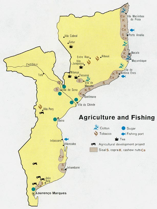
- Mozambique - Agriculture and Fishing from Map No. 501370 1973 (102K)
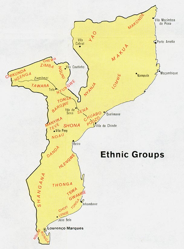
- Mozambique - Ethnic Groups from Map No. 501370 1973 (91K)
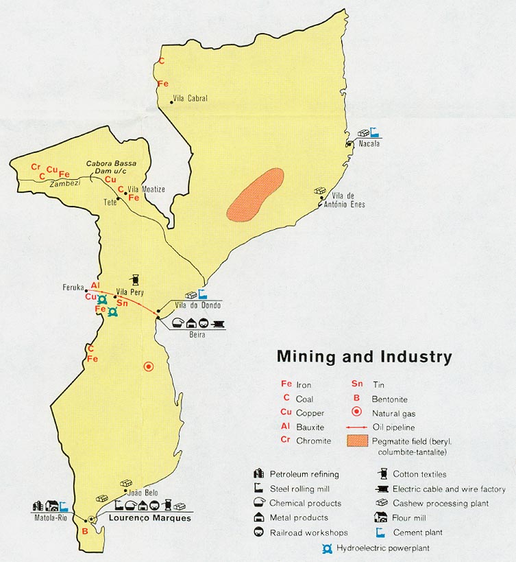
- Mozambique - Mining and Industry from Map No. 501370 1973 (113K)
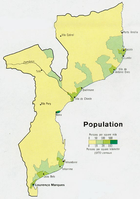
- Mozambique - Population from Map No. 501370 1973 (82K)
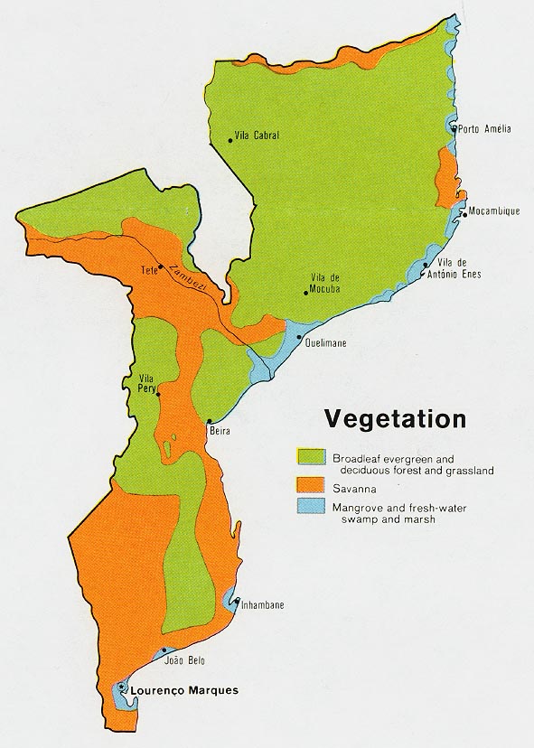
- Mozambique - Vegetation from Map No. 501370 1973 (108K)
Maps on Other Web Sites