Perry-Castañeda Library
Map Collection
Namibia Maps
The following maps were produced by the U.S. Central Intelligence Agency unless otherwise indicated.
Country Maps
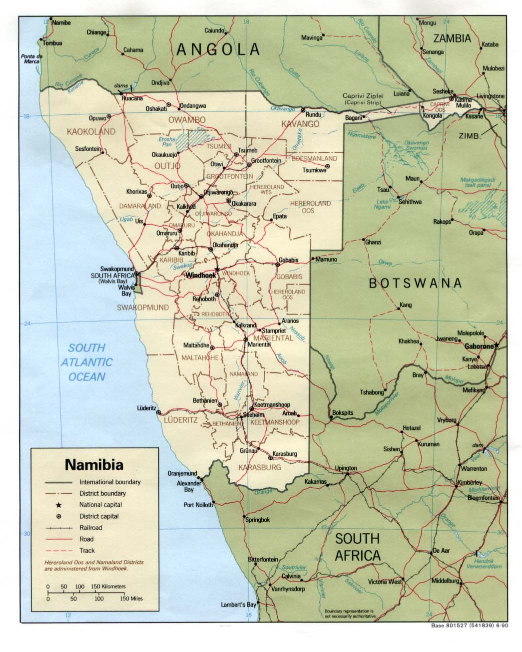
- Namibia (Political) 1990 (168K) and pdf format (174K)
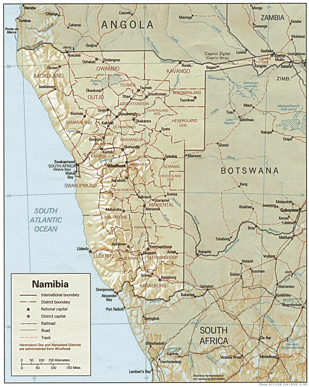
- Namibia (Shaded Relief) 1990 (332K) and pdf format (343K)
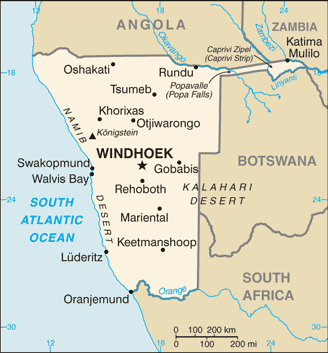
- Namibia (Small Map) 2016 (21.1K)
- 1:2,000,000 - Africa Topographic Maps U.S. Army Map Service, Series 2201
- Sheets 29, 30, 33 and 35 cover all of Namibia
- 1:1,000,000 - Operational Navigation Chart Series U.S. Defense Mapping Agency Aerospace Center. Not for navigational use
- This series covers all of Namibia
- 1:1,000,000 - International Map of the World U.S. Army Map Service
- Sheets SH 33 and SH 34 cover only the extreme south of Namibia. Clickable map
- 1:500,000 - Tactical Pilotage Charts U.S. National Imagery and Mapping Agency. Not for navigational use
- This series covers the northwestern part of Namibia
- 1:250,000 - South Africa Topographic Maps U.S. Army Map Service, Series Z501
- This series covers only the extreme south of Namibia
- Sheets 29, 30, 33 and 35 cover all of Namibia
Historical Maps
- South West Africa [Namibia] Central Coast (1.1MB) and Legend (524K) Original scale 1:2,000,000. Portion of U.S. Army Map Service Series 2201, Windhoek Sheet, 1970
- Namibia [Homelands] 1978 (552K)
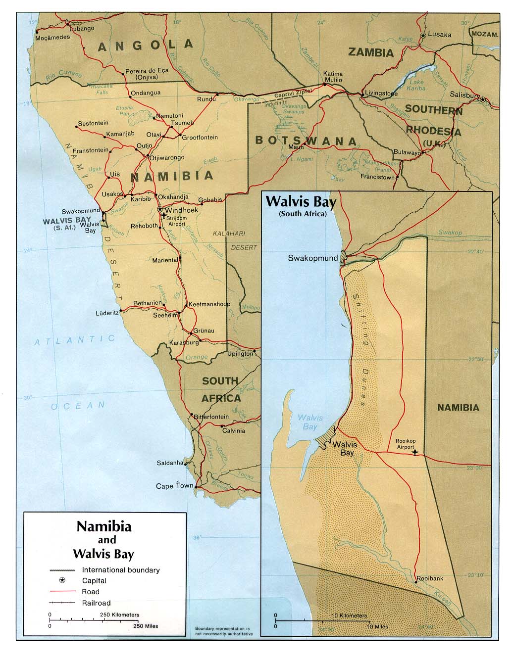
- Namibia and Walvis Bay (Political) 1978 (188K)
![South West Africa [Namibia] Central Coast](africa/windhoek_1970.jpg)
![Namibia [Homelands]](africa/namibia_homelands_78.jpg)
Maps on Other Web Sites