Perry-Castañeda Library
Map Collection
New Mexico Maps
State Maps
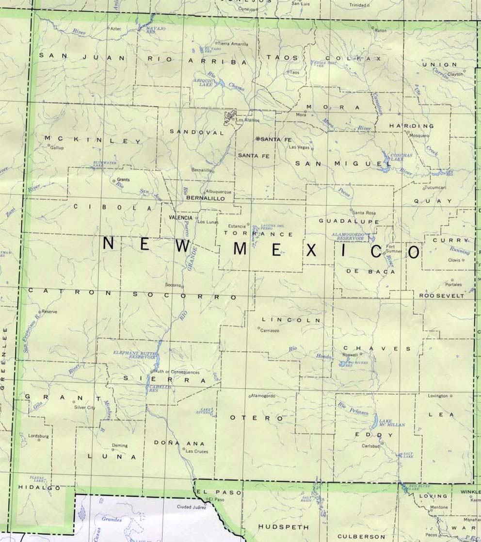
- New Mexico (base map) JPEG format (195K) County boundaries and names, county seats, rivers. Original scale 1:2,500,000 U.S. Geological Survey, 1972 limited update 1990
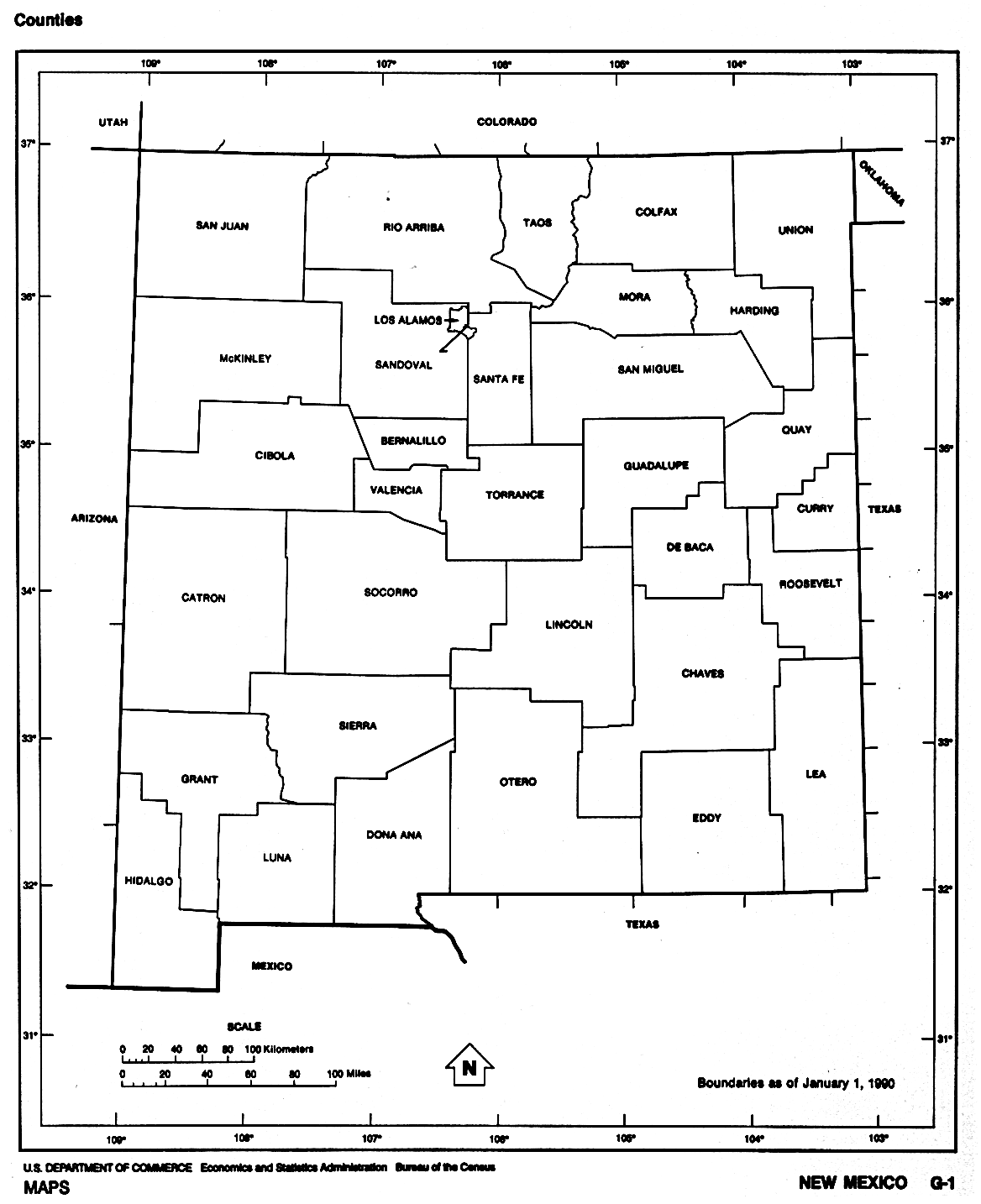
- New Mexico (outline map) JPEG format (71K) County boundaries and names. U.S. Bureau of the Census, 1990
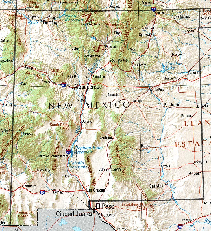
- New Mexico (reference map) JPEG format (346K) Shaded relief map with state boundaries, forest cover, place names, major highways. Portion of "The National Atlas of the United States of America. General Reference", compiled by U.S. Geological Survey 2001, printed 2002
- New Mexico (reference map) PDF format (349K) Shaded relief map with state boundaries, forest cover, place names, major highways. Portion of "The National Atlas of the United States of America. General Reference", compiled by U.S. Geological Survey 2001, printed 2002
- New Mexico - Federal Lands and Indian Reservations PDF format (971K) The National Atlas of the United States of America, U.S. Geological Survey, 2003
City Maps
- Alamogordo (topographic) Scale 1:24,000 U.S.G.S. 1981 (378K)
- Roswell (topographic) Scale 1:24,000 U.S.G.S. 1962, photorevised 1985 (442K)
Historical City Maps
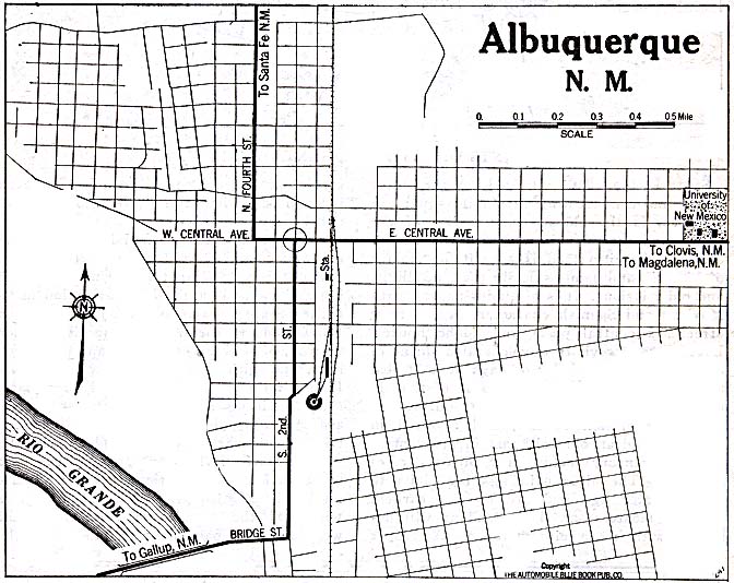
- Albuquerque 1920 Automobile Blue Book (137K)
Historical Topographic Maps
- New Mexico Historical Topographic Maps (U.S. Geological Survey)
- Pre-1945 maps, scales from 1:12,000 to 1:250,000
Maps of National Parks, Monuments, Historic Sites and National Laboratories
- Aztec Ruins National Monument (Area Map) 1999 (65K) (PDF Format)
- Aztec Ruins National Monument (Park Map) 1994 (291K)
- Aztec Ruins National Monument (Location Map) 1994 (23K)
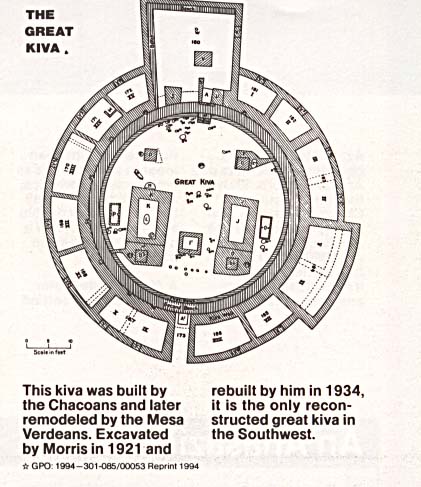
- Aztec Ruins National Monument - Kiva (Schematic Map) 1994 (54K)
- Bandelier National Monument (Park Map) 1997 (258K) (PDF Format)
- Capulin Volcano National Monument (Area Map) 1997 (129K) (PDF Format)
- Capulin Volcano National Monument (Park Map) 1996 (129K) (PDF Format)
- Carlsbad Caverns National Park (Park Map) 1995 (324K)
- Carlsbad Caverns National Park (Park Map) 1997 (65K) (PDF Format)
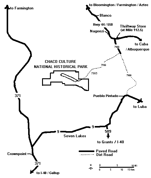
- Chaco Culture National Historic Park (Area Road Map) (65K)
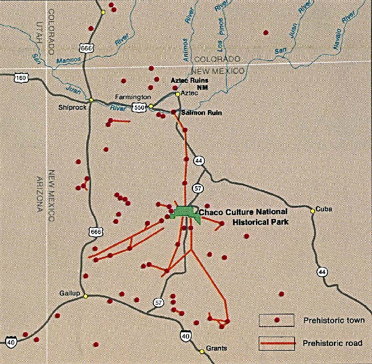
- Chaco Culture National Historic Park (Location Map) 1995 (230K)
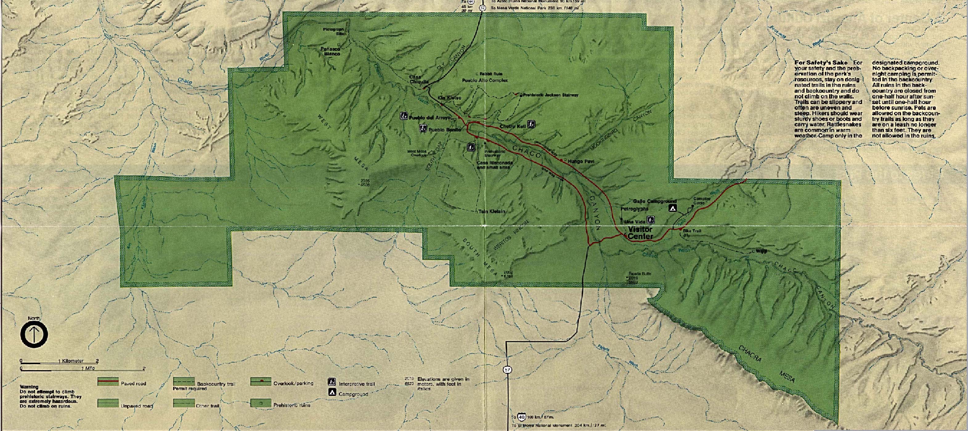
- Chaco Culture National Historic Park (Park Map) 1997 (194K) (PDF Format)
- Chaco Culture National Historic Park (Park Map) 1995 (1MB)
- El Malpais National Monument (Park Map) 1999 (323K) (PDF Format)
- Los Alamos National Laboratory Visitor's Guide 1998 (267K) (PDF Format)
Maps on Other Web Sites