Perry-Castañeda Library
Map Collection
New Zealand Maps
The following maps were produced by the U.S. Central Intelligence Agency, unless otherwise indicated.
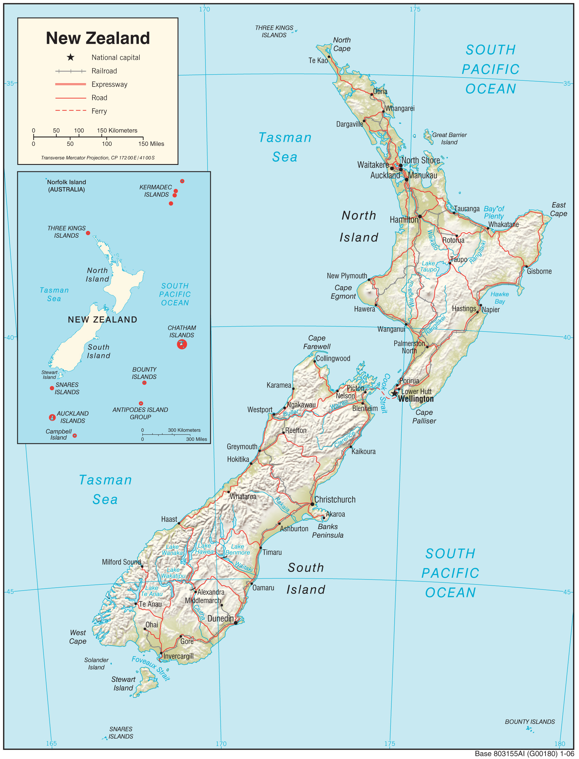
Country Maps- New Zealand (Physiography) 2006 (1.0MB) and pdf format (842K)
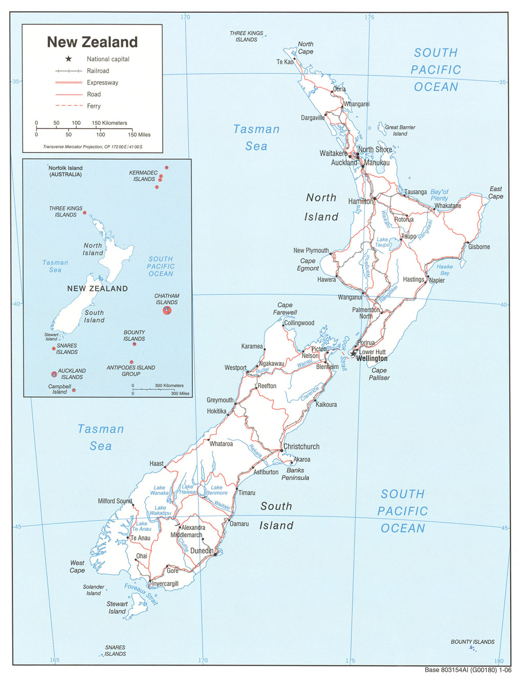
- New Zealand (Political) 2006 (295K)
- New Zealand (Political) U.S. Department of State 1977 (250K)
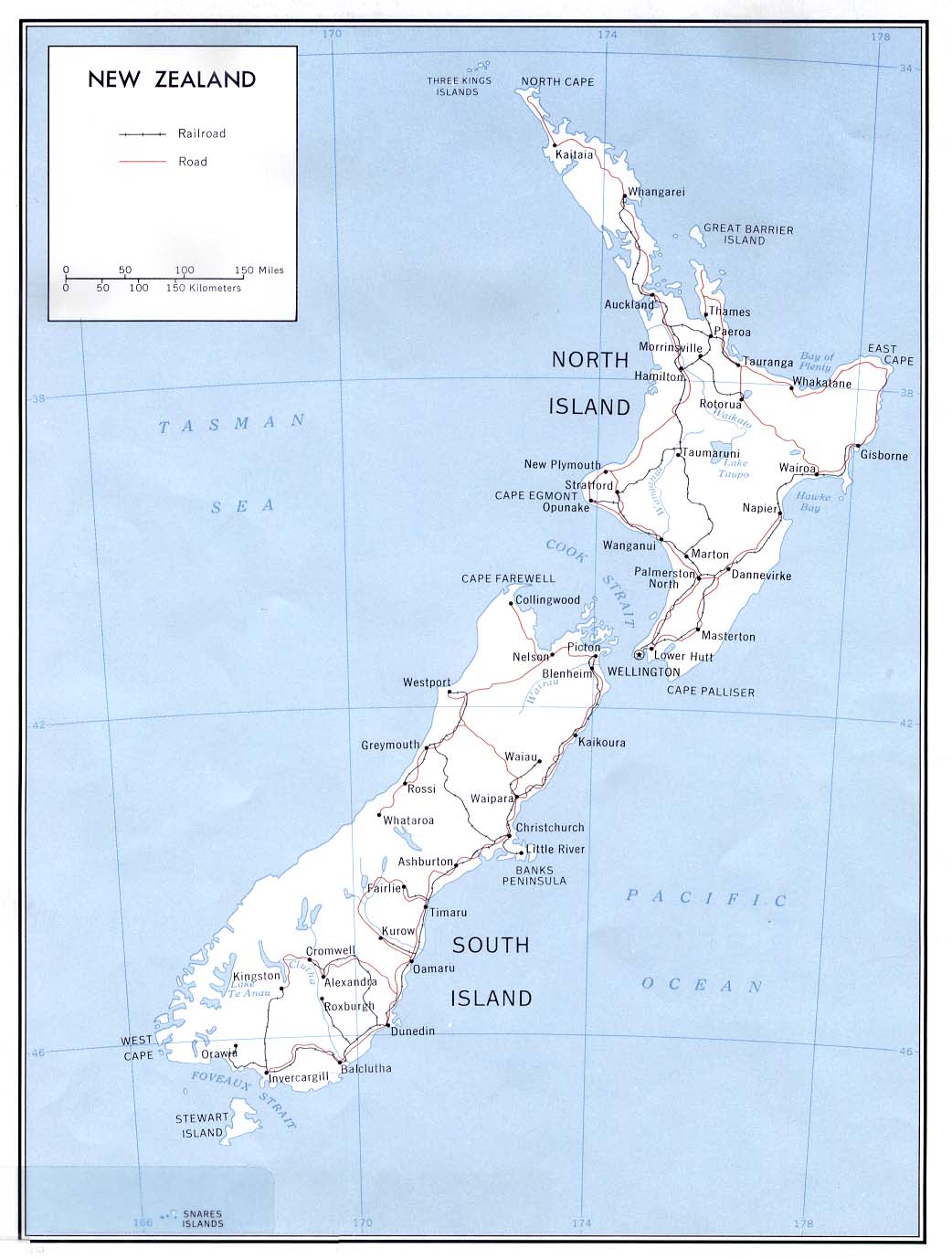
- New Zealand (Political) 1970 (139K) and pdf format (145K)
- New Zealand (Shaded Relief) 2006 (262K)
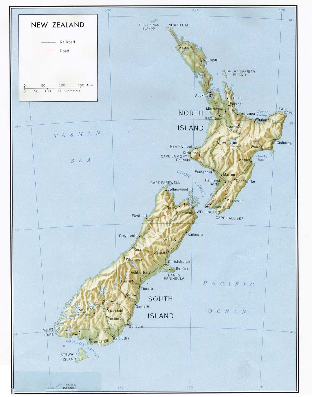
- New Zealand (Shaded Relief) 1981 (140K) and pdf format (150K)
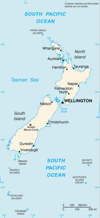
- New Zealand (Small Map) 2016 (16.6K)
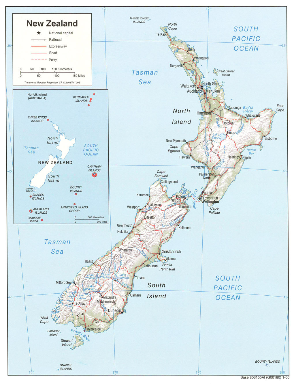
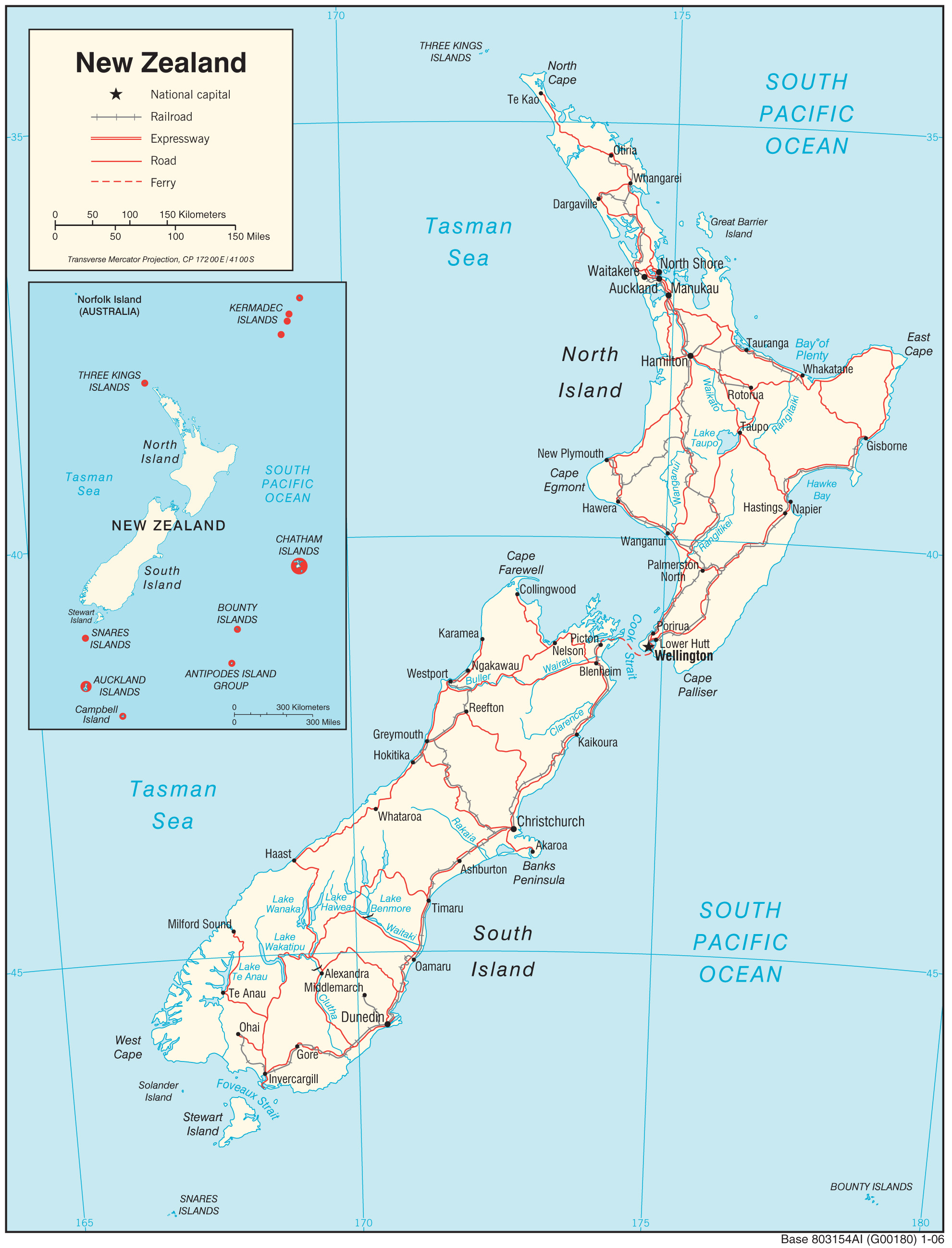
- New Zealand (Transportation) 2006 (974K) and pdf format (397K)
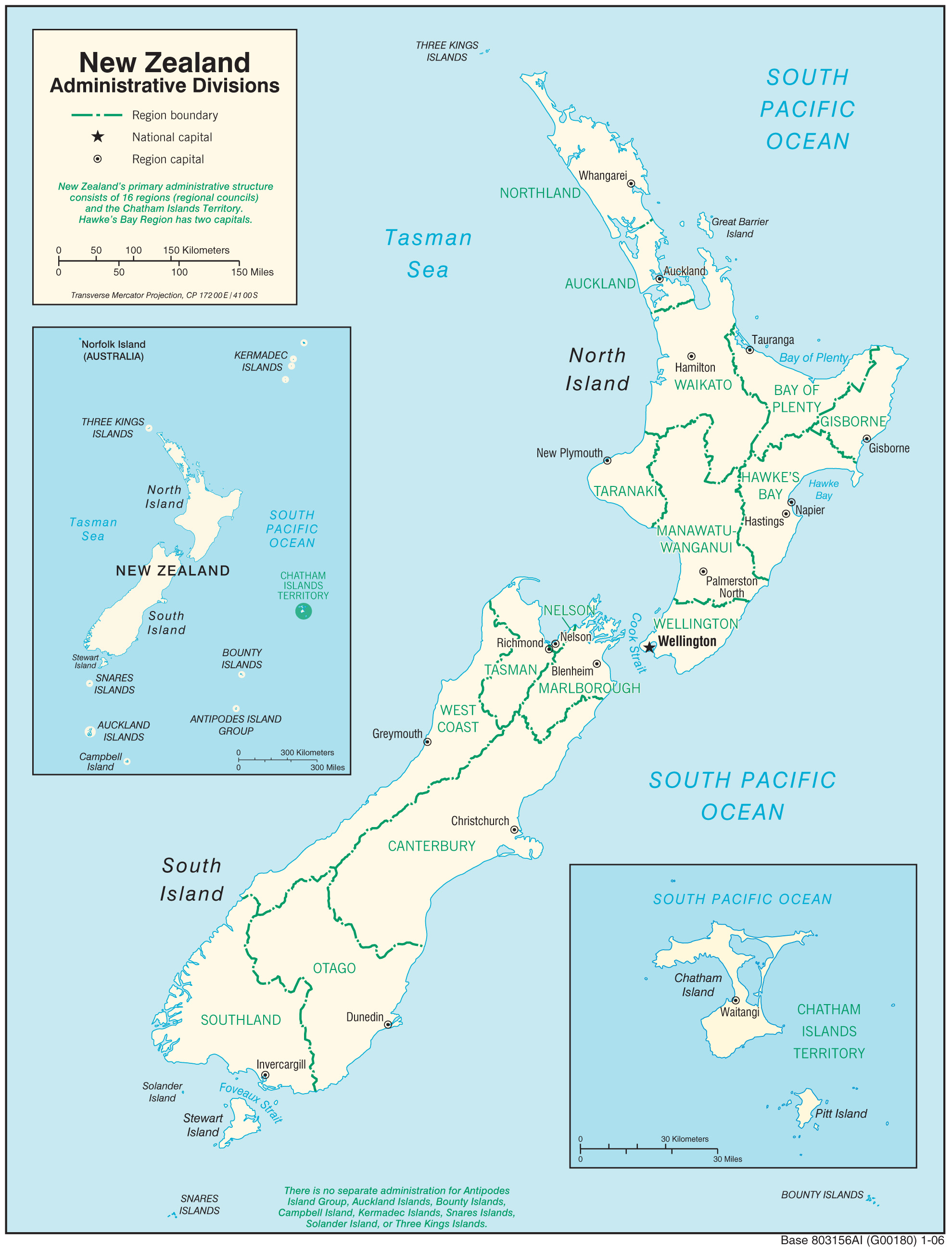
- New Zealand (Administration Division) 2006 (896K) and pdf format (325K)
- Antarctic Region Maps
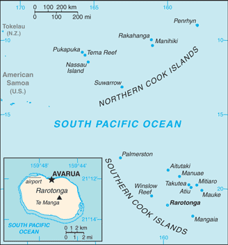
- Cook Islands (Small Map) 2014 (19.3K)
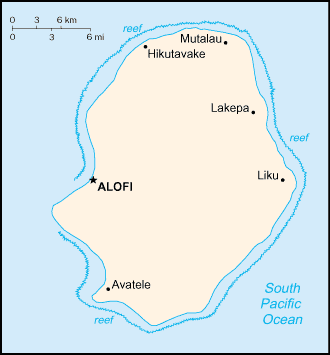
- Niue (Small Map) 2014 (7.2K)
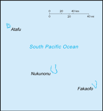
- Tokelau (Small Map) 2014 (3.4K)
- 1:1,000,000 - Operational Navigation Chart Series (Aeronautical Charts) U.S. Defense Mapping Agency Aerospace Center Not for navigational use
- Sheets R-15 and S-13 cover the main islands, sheets Q-17, S-14 and T-11 cover the territories
- 1:1,000,000 - International Map of the World
- Sheets SJ 60 and SK SL 59 cover the main islands
- Sheets R-15 and S-13 cover the main islands, sheets Q-17, S-14 and T-11 cover the territories
Maps on Other Web Sites