Perry-Castañeda Library
Map Collection
Niger Maps
The following maps were produced by the U.S. Central Intelligence Agency, unless otherwise indicated.
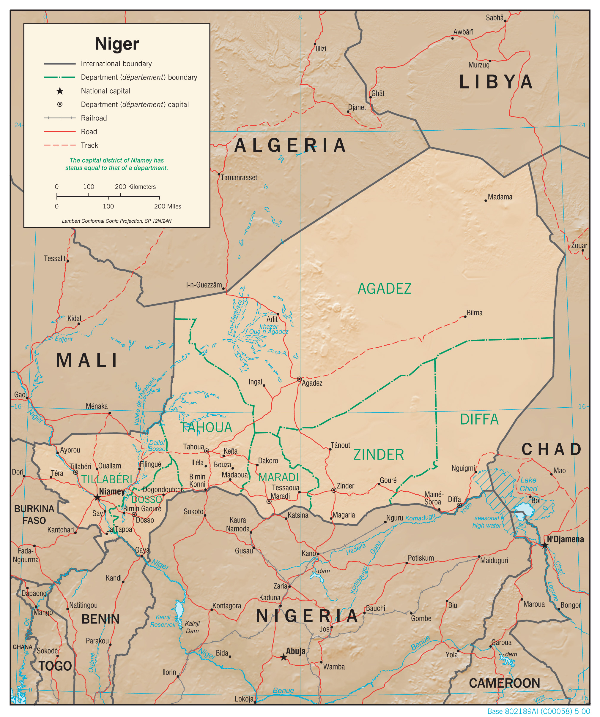
Country Maps- Niger (Physiography) 2000 (1.3MB) and pdf format (1.2MB)
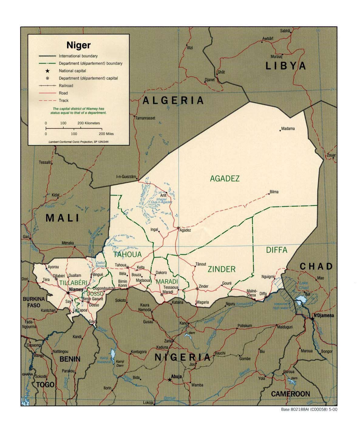
- Niger (Political) 2000 (387K) and pdf format (253K)
- Niger (Political) 1979 (171K) and pdf format (175K)
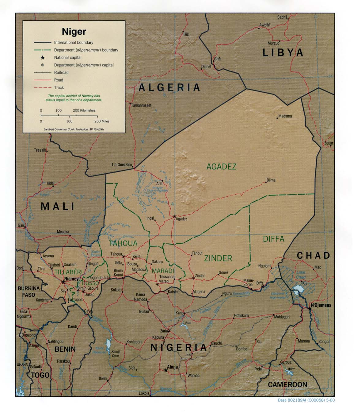
- Niger (Shaded Relief) 2000 (323K) and pdf format (237K)
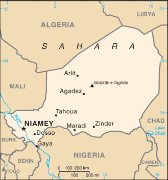
- Niger (Small Map) 2016 (18.3K)
- Niger (Transportation) 2000 (1.1MB) and pdf format (596K)
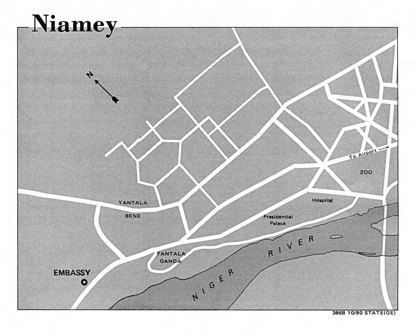
- Niamey U.S. Dept. of State 1980 (89K)
- 1:2,000,000 - Africa Topographic Maps U.S. Army Map Service, Series 2201
- This series covers all of Niger
- 1:1,000,000 - Operational Navigation Chart Series U.S. Defense Mapping Agency Aerospace Center. Not for navigational use
- This series covers all of Niger
- 1:1,000,000 - International Map of the World U.S. Army Map Service
- This series covers southeast Niger
- 1:500,000 - Tactical Pilotage Charts U.S. National Imagery and Mapping Agency. Not for navigational use
- This series covers most of Niger
- 1:250,000 - Passe de Salvador U.S. National Imagery and Mapping Agency, Joint Operations Graphic, Sheet NF 33-1 Passe de Salvador, Niger; Libya [GeoPDF] (9.5MB) [Not for navigational use]
- This series covers all of Niger
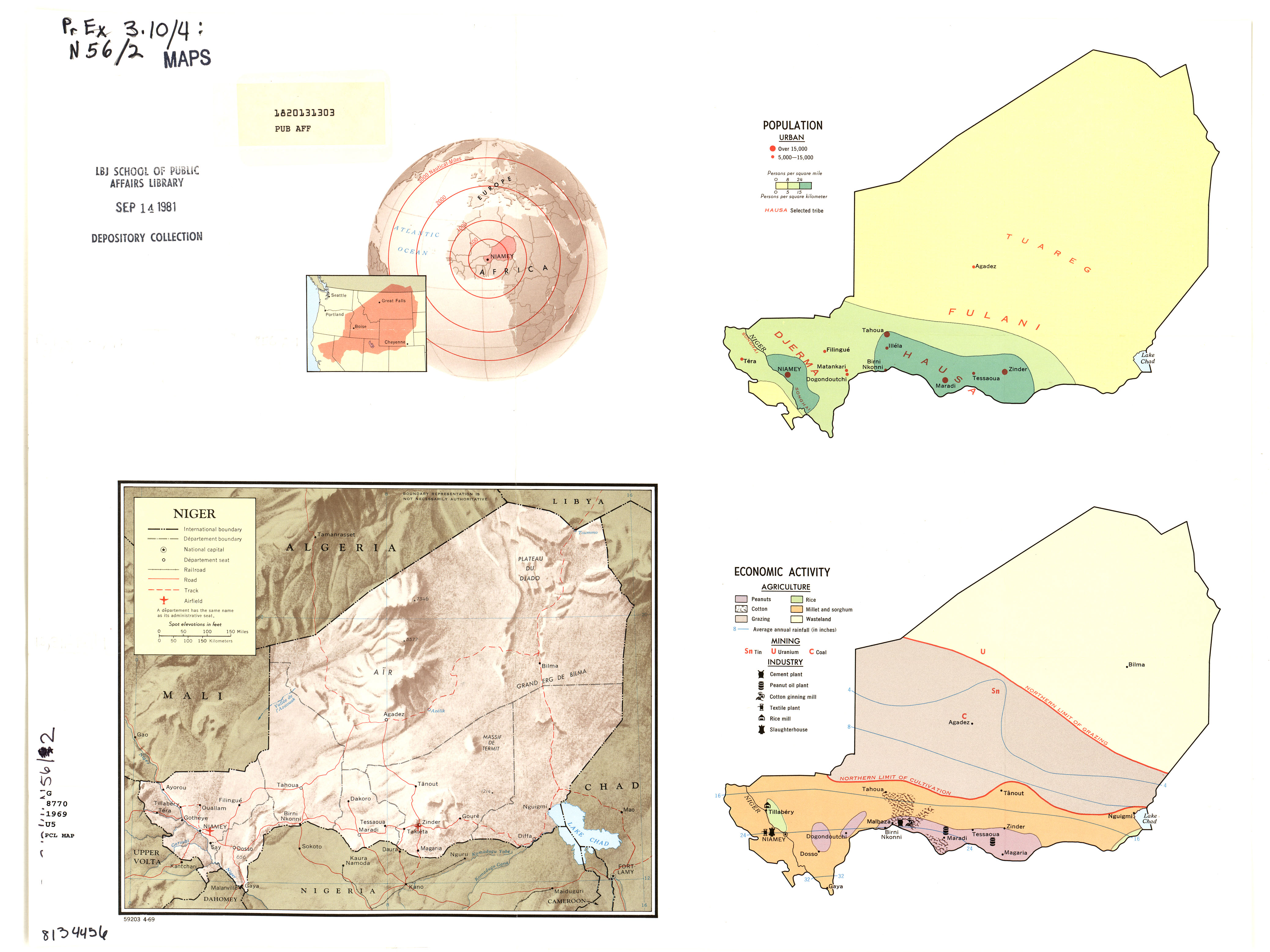
- Niger Niger Map No. 59203 - Complete Map 1969 (1.6MB)
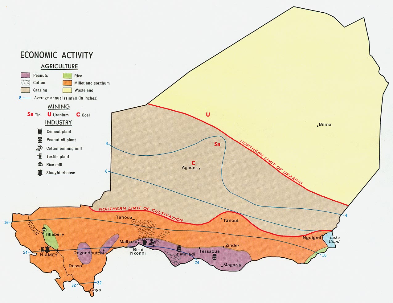
- Niger - Economic Activity from Map No. 59203 1969 (202K)
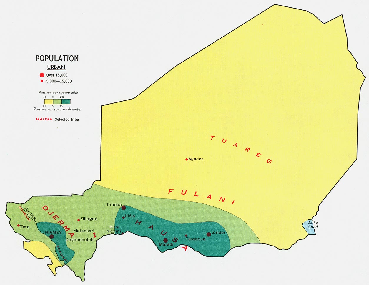
- Niger - Population from Map No. 59203 1969 (138K)
Maps on Other Web Sites