Perry-Castañeda Library
Map Collection
Republic of Palau Maps
Country Maps
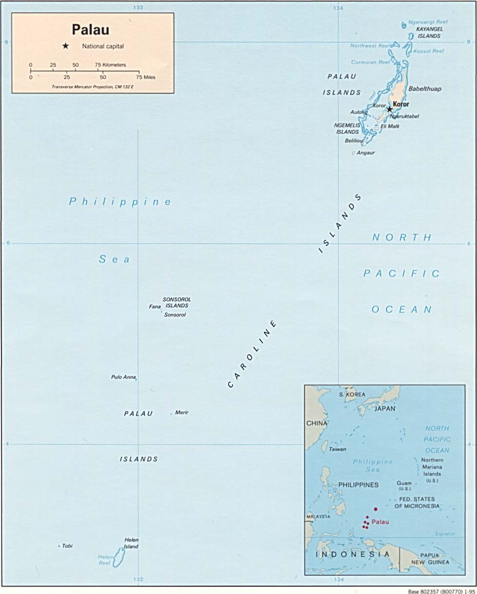
- Palau (Political) CIA 1995 (85K) and pdf format (90K)
- Palau (Small Map) CIA 2016 (10.5K)
- Palau From the U.S. National Atlas 1970 (110K)
- Republic of Palau (Outline Map) U.S. Bureau of the Census 1990 (232K)
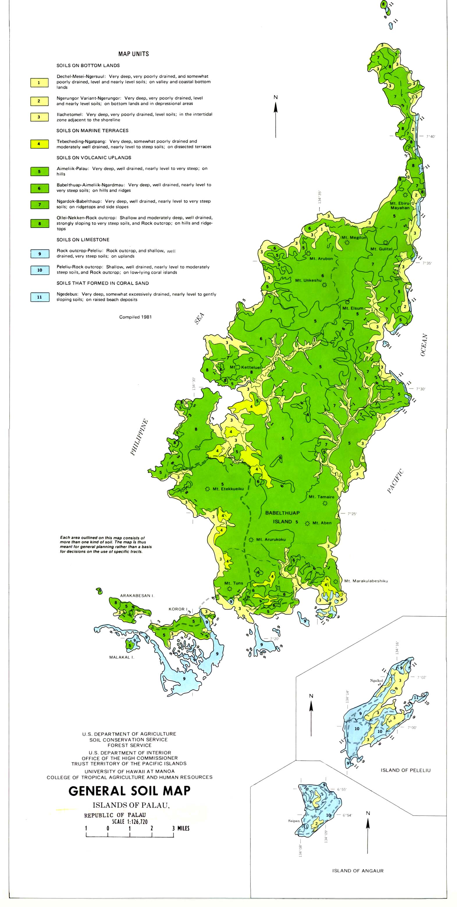
- Palau - General Soil Map From Soil Survey of Islands of Palau Republic of Palau, United States Department of Agriculture, Soil Conservation Service. 1983 (355K)
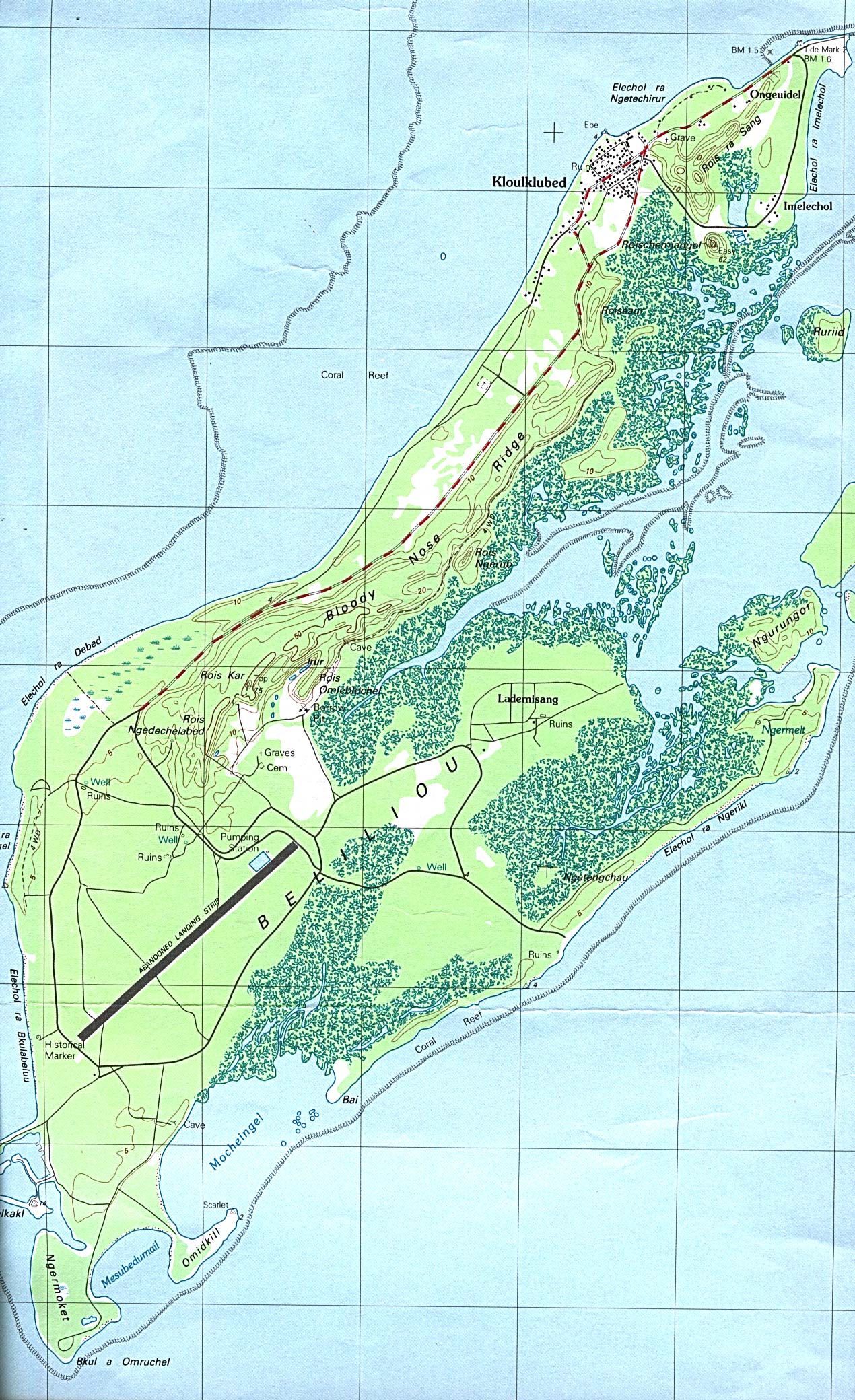
- Palau - Peleliu (Beliliou) Island (topographic) 1:25,000. Portion of Beliliou sheet, U.S. Geological Survey, 1984 (695K)
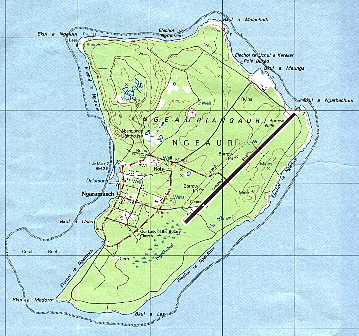
- Palau - Angaur (Ngeaur) Island (topographic) 1:25,000. Portion of Beliliou sheet, U.S. Geological Survey, 1984 (351K)
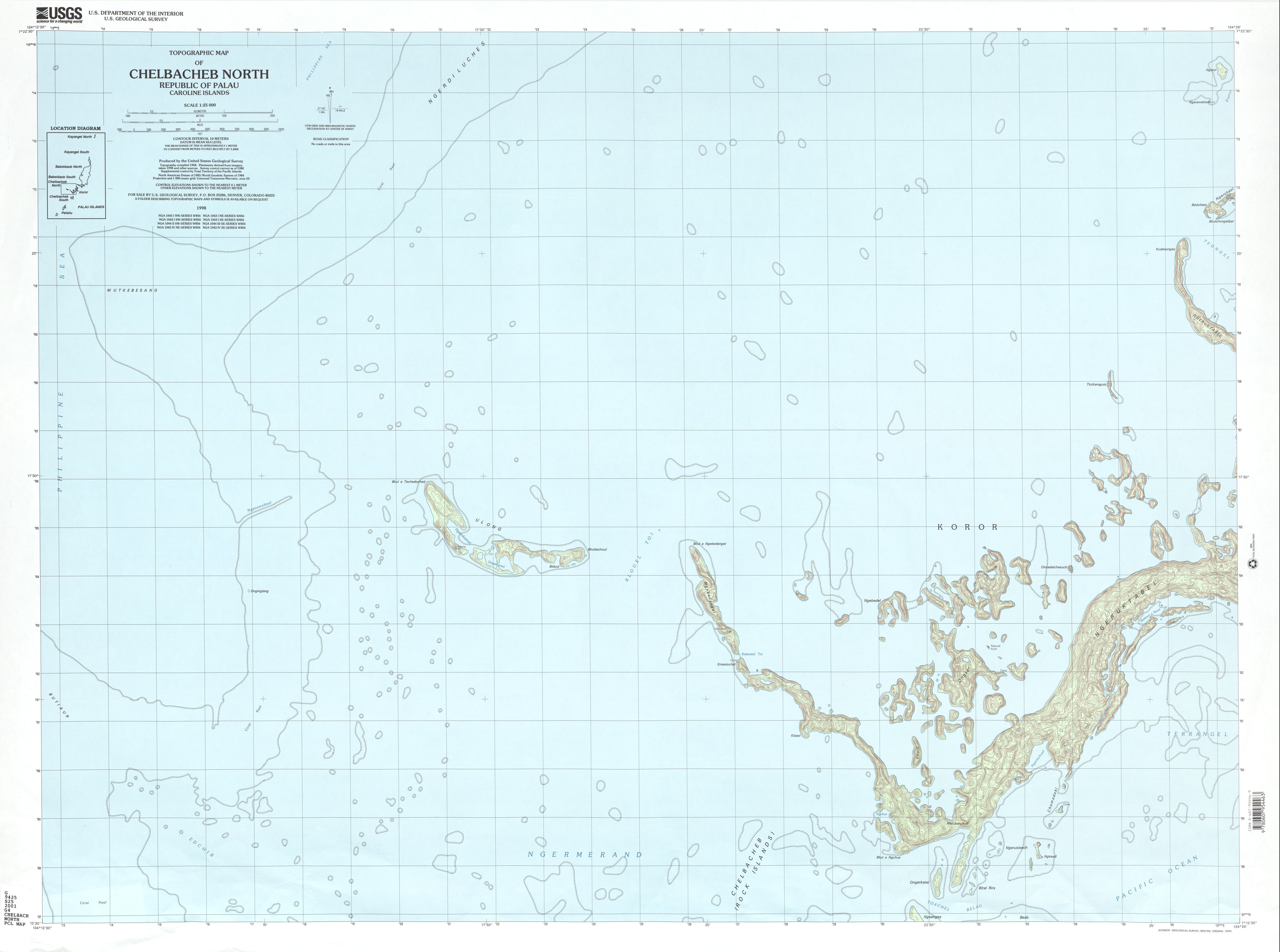
- Chelbacheb North (topographic) 1:25,000 U.S. Geological Survey, 2001 (1.8 MB)
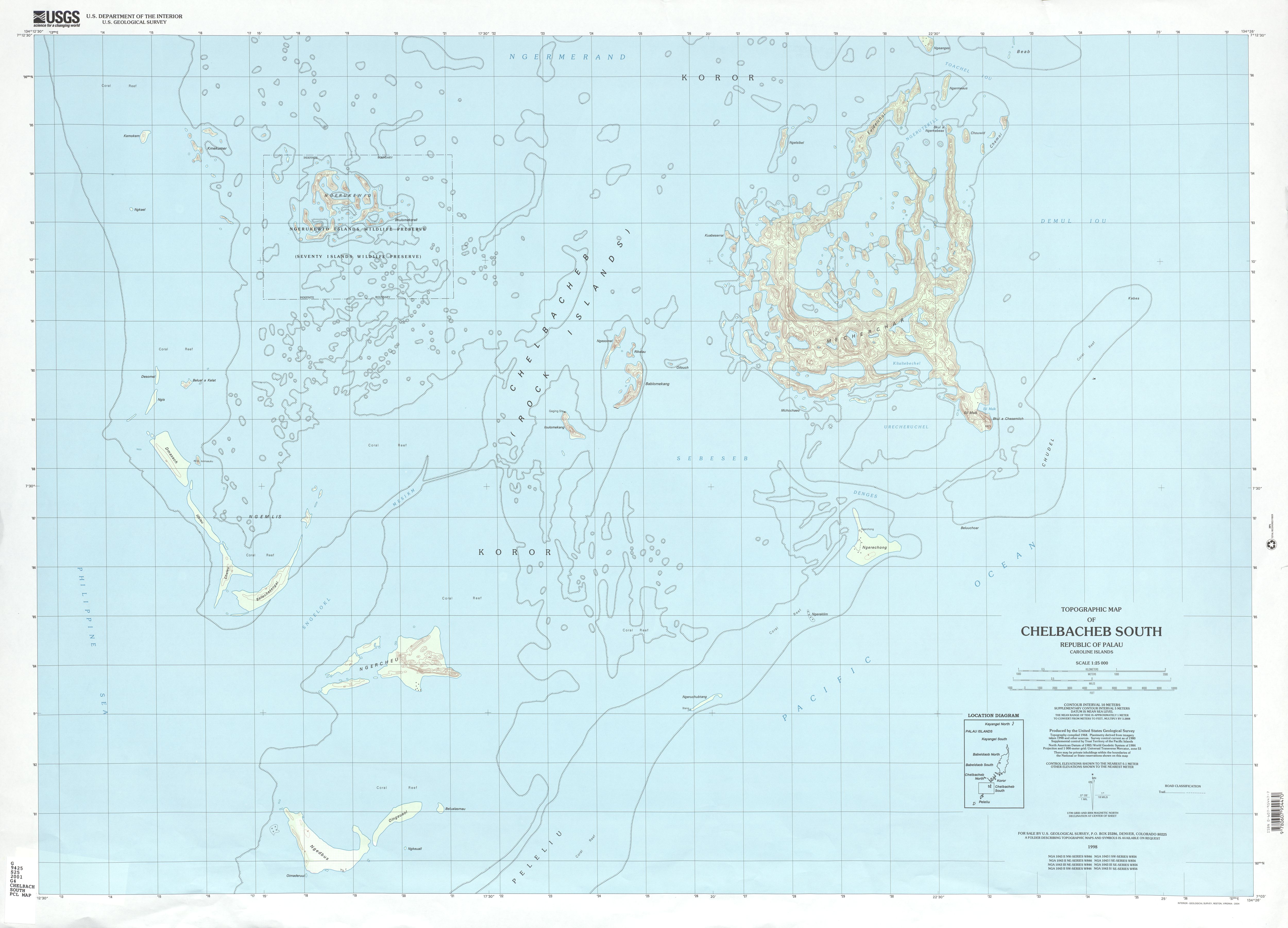
- Chelbacheb South (topographic) 1:25,000 U.S. Geological Survey, 2001 (2.0 MB)
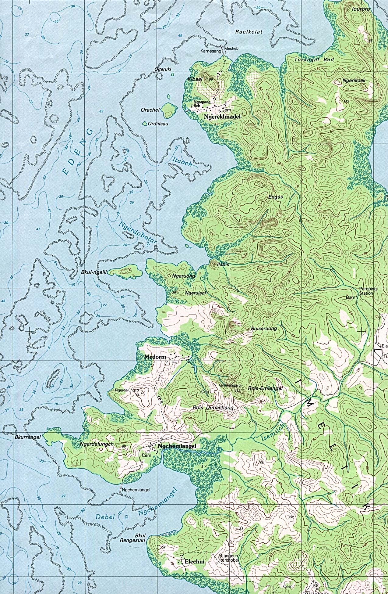
- Palau - Aimeliik (Imeliik), Babeldaob Island (topographic) 1:25,000. Portion of Chelbacheb sheet, U.S. Geological Survey, 1983 (816K)
- Palau - Mecherchar Island [Eil Malk Island] (topographic)1:25,000. Portion of Chelbacheb sheet, U.S. Geological Survey, 1984 (515K)
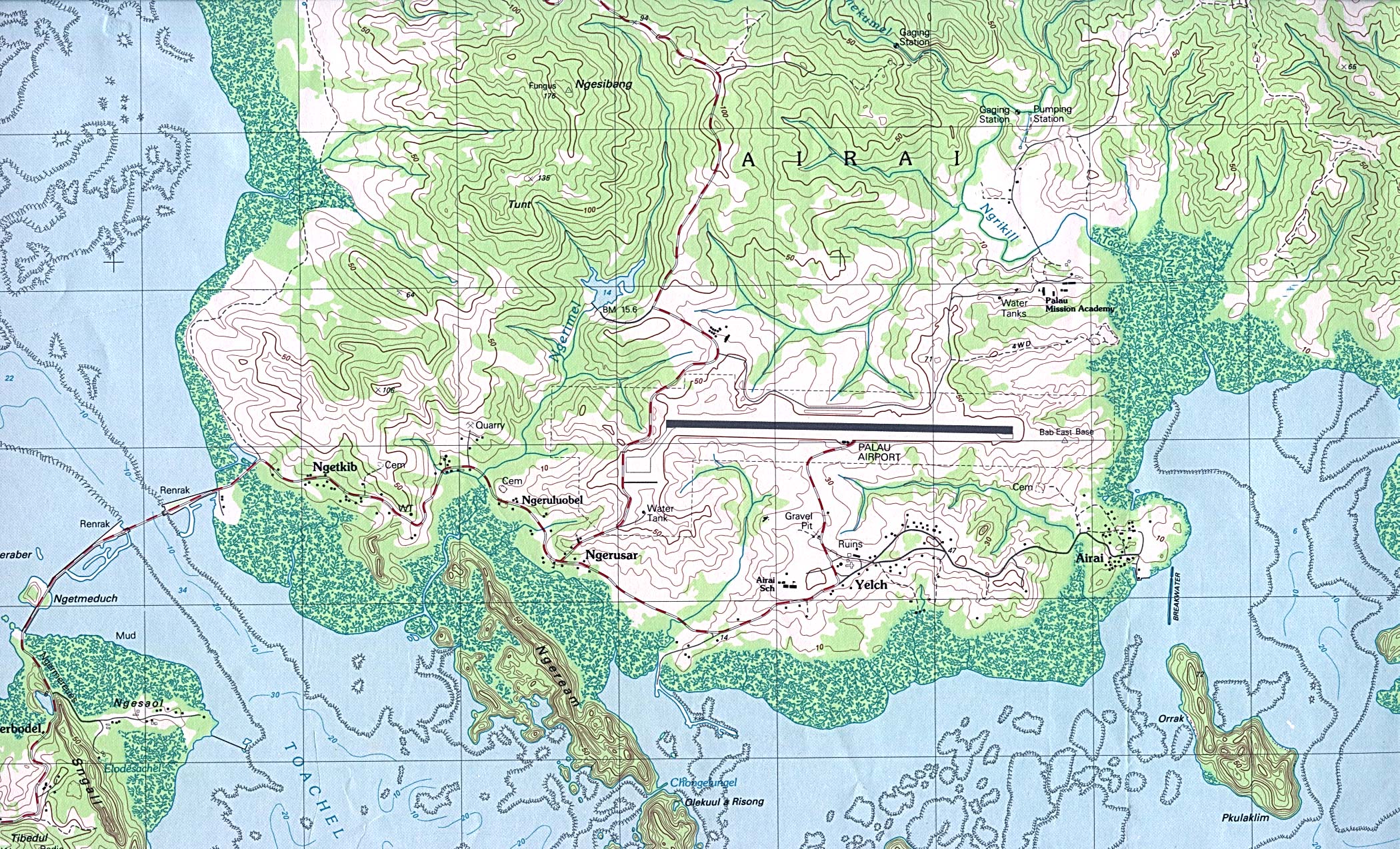
- Palau - Palau Airport, Babeldaob Island (topographic)1:25,000. Portion of Chelbacheb sheet, U.S. Geological Survey, 1983 (933K)
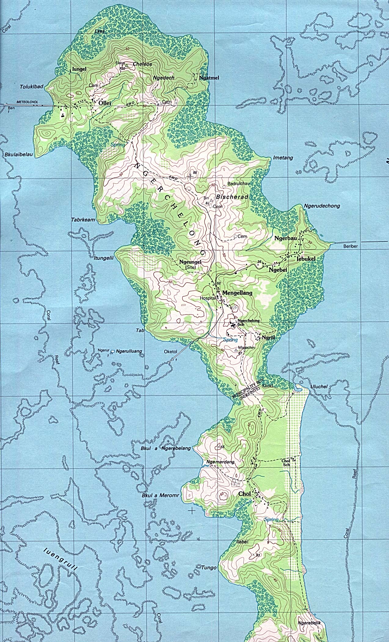
- Palau - Ngarchelong (Ngerchelong), Babeldaob Island (topographic)1:25,000. Portion of Ngermetengel sheet, U.S. Geological Survey, 1983 (755K)
- Palau - Ngeremlengui (Ngermetengel), Babeldaob Island (topographic) 1:25,000. Portion of Ngermetengel sheet, U.S. Geological Survey, 1983 (819K)
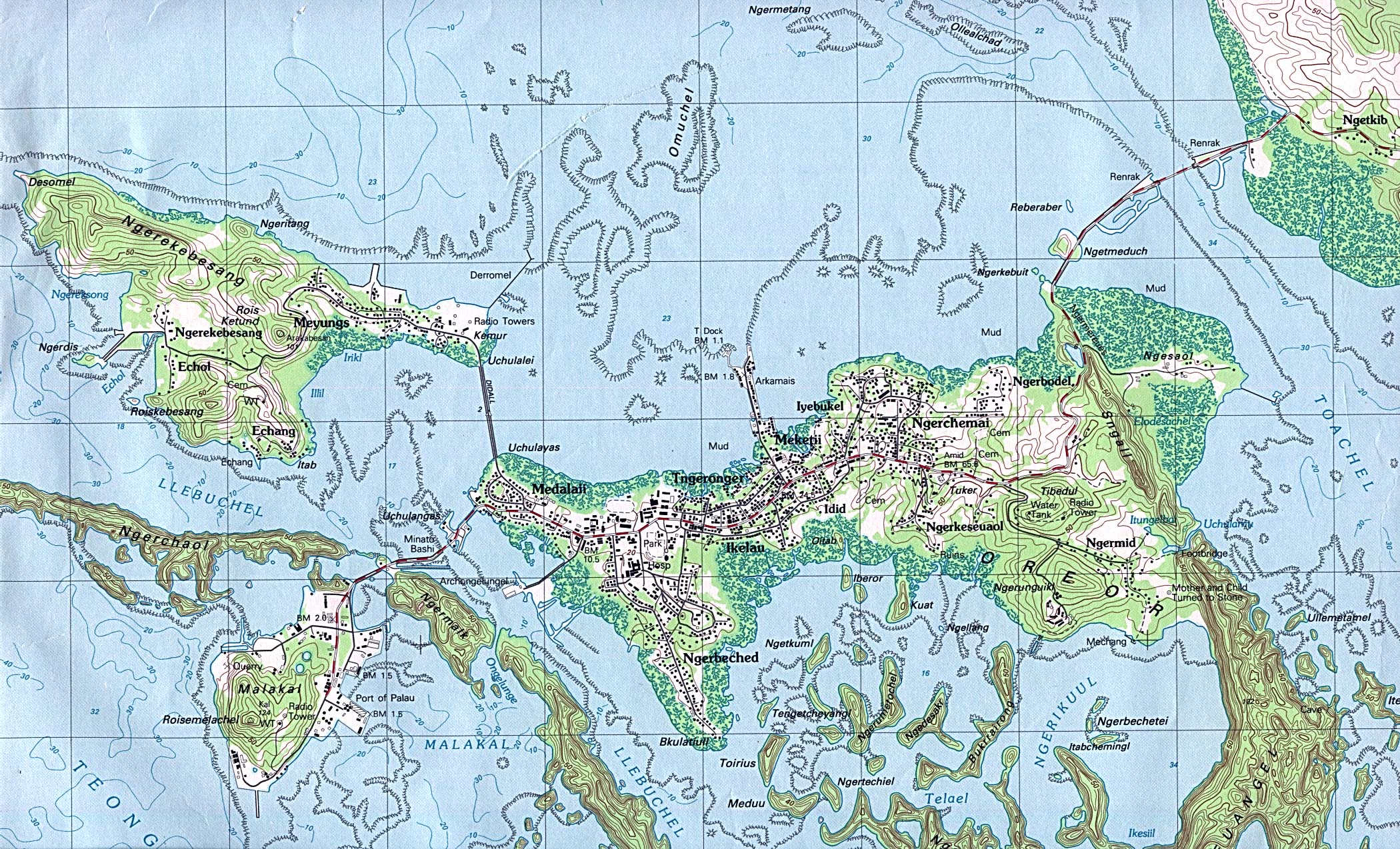
- Palau - Koror, Oreor Island (topographic) 1:25,000. Portion of Oreor sheet, U.S. Geological Survey, 1983 (906K) The capital city
![Palau - Mecherchar Island [Eil Malk Island]](australia/mecherchar_84.jpg)
- 1:1,000,000 - Operational Navigation Chart Series (Aeronautical Charts) U.S. Defense Mapping Agency Aerospace Center Not for navigational use
- Sheets K-13, L-12 and L-13 include Palau
- 1:500,000 - Tactical Pilotage Charts U.S. National Imagery and Mapping Agency. Not for navigational use
- This series covers Palau
- Sheets K-13, L-12 and L-13 include Palau
- Palau Islands, Series W854, 1:12,500, U.S. Army Map Service, 1946- [5 sheets] Clickable map.
- Palau Islands, Series W752, 1:40,00, U.S. Army Map Service, 1943- [10 sheets]
- Palau - Mecherchar Island [Eil Malk Island] 1943 (topographic) original scale 1:40,000. Portion of Eil Malk I map, A.M.S. W752, second edition, U.S. Army Map Service 1943 (199K)
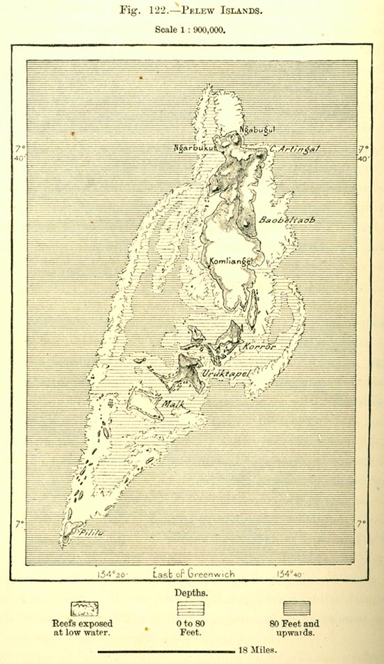
- Pelew Islands 1890 From "The Earth and Its Inhabitants, Oceania" by Elisee Reclus, Edited by A.H. Keane, New York: D. Appleton and Company, 1890. (144K)
![Palau - Mecherchar Island [Eil Malk Island] 1943](australia/eil_malk1_1943.jpg)
Maps on Other Web Sites