Perry-Castañeda Library
Map Collection
Switzerland Maps
The following maps were produced by the U.S. Central Intelligence Agency, unless otherwise indicated.
Country Maps- Switzerland (Physiography) 2000 (1.9MB) and pdf format (1.4MB)
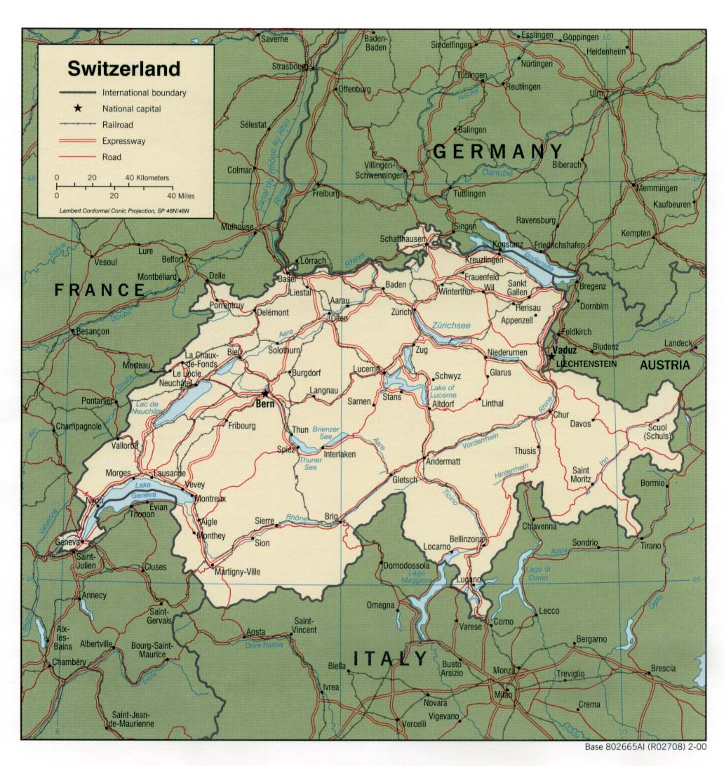
- Switzerland (Political) 2000 (323K) and pdf format (227K)
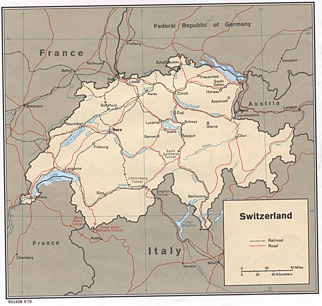
- Switzerland (Political) 1973 (193K)
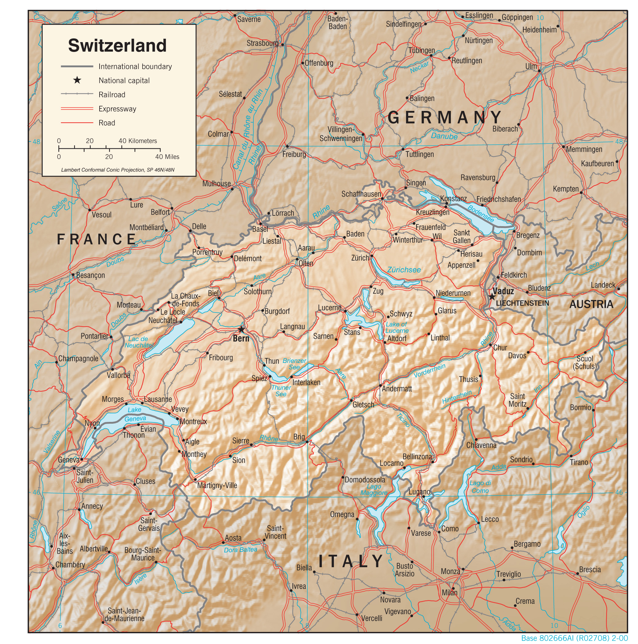
- Switzerland (Shaded Relief) 2000 (323K) and pdf format (266K)
- Switzerland (Small Map) 2016 (17.2K)
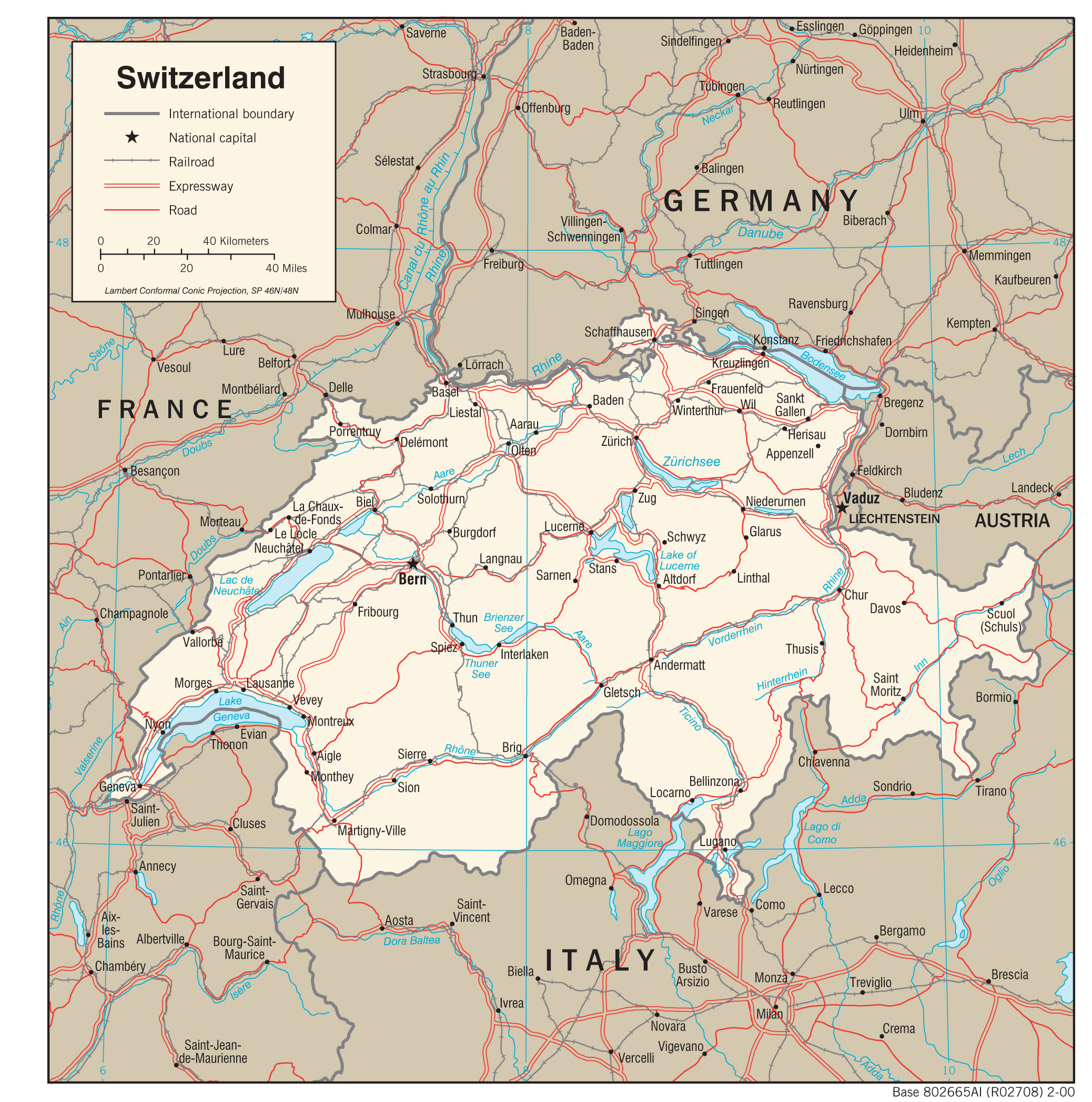
- Switzerland (Transportation) 2000 (1.5MB) and pdf format (300K)
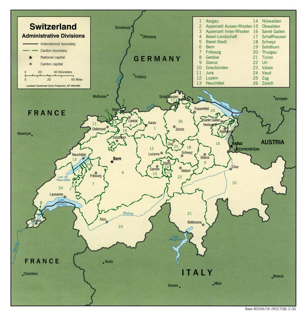
- Switzerland - Administrative Divisions 2000 (323K) and pdf format (205K)
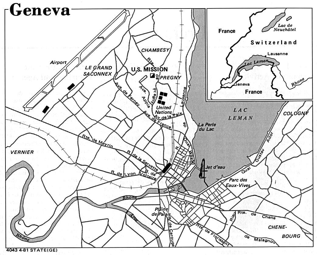
- Geneva U.S. Dept. of State 1981 (171K)
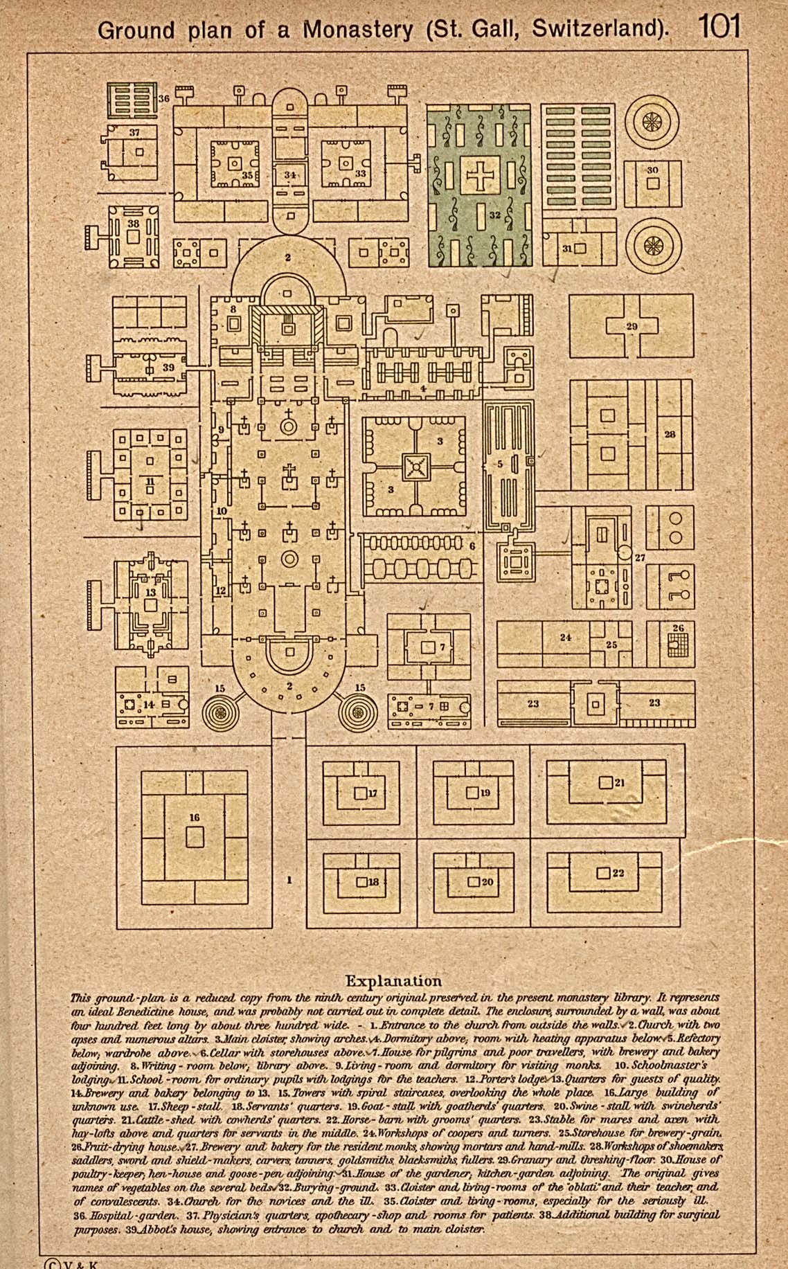
- Ground Plan of a Monastery (St.Gall, Switzerland) Historical Atlas by William R. Shepherd, 1923 (516K)
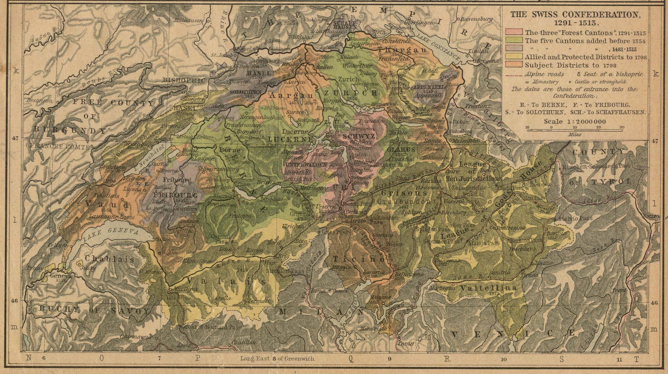
- The Swiss Confederation, 1291-1513 Historical Atlas by William R. Shepherd, 1923 (710K)
- 1:1,000,000 - International Map of the World
- This series covers all of Switzerland. Clickable map
- 1:1,000,000 - Operational Navigation Charts Series U.S. Defense Mapping Agency Aerospace Center Not for navigational use
- This series covers Switzerland on sheet F-2
- 1:500,000 - Europe Series M404 (4072), Great Britain War Office, 1942-
- This series covers all of Switzerland
- 1:500,000 - Tactical Pilotage Charts U.S. National Imagery and Mapping Agency. Not for navigational use
- This series covers Switzerland
- 1:500,000 - World Series 1404, Great Britain. War Office and Air Ministry. 1958-
- This series covers all of Switzerland
- 1:250,000 - Western Europe Series M501, U.S. Army Map Service, 1959-
- This series covers most of Switzerland
- This series covers all of Switzerland. Clickable map
Maps on Other Web Sites