Perry-Castañeda Library
Map Collection
Togo Maps
The following maps were produced by the U.S. Central Intelligence Agency, unless otherwise indicated.
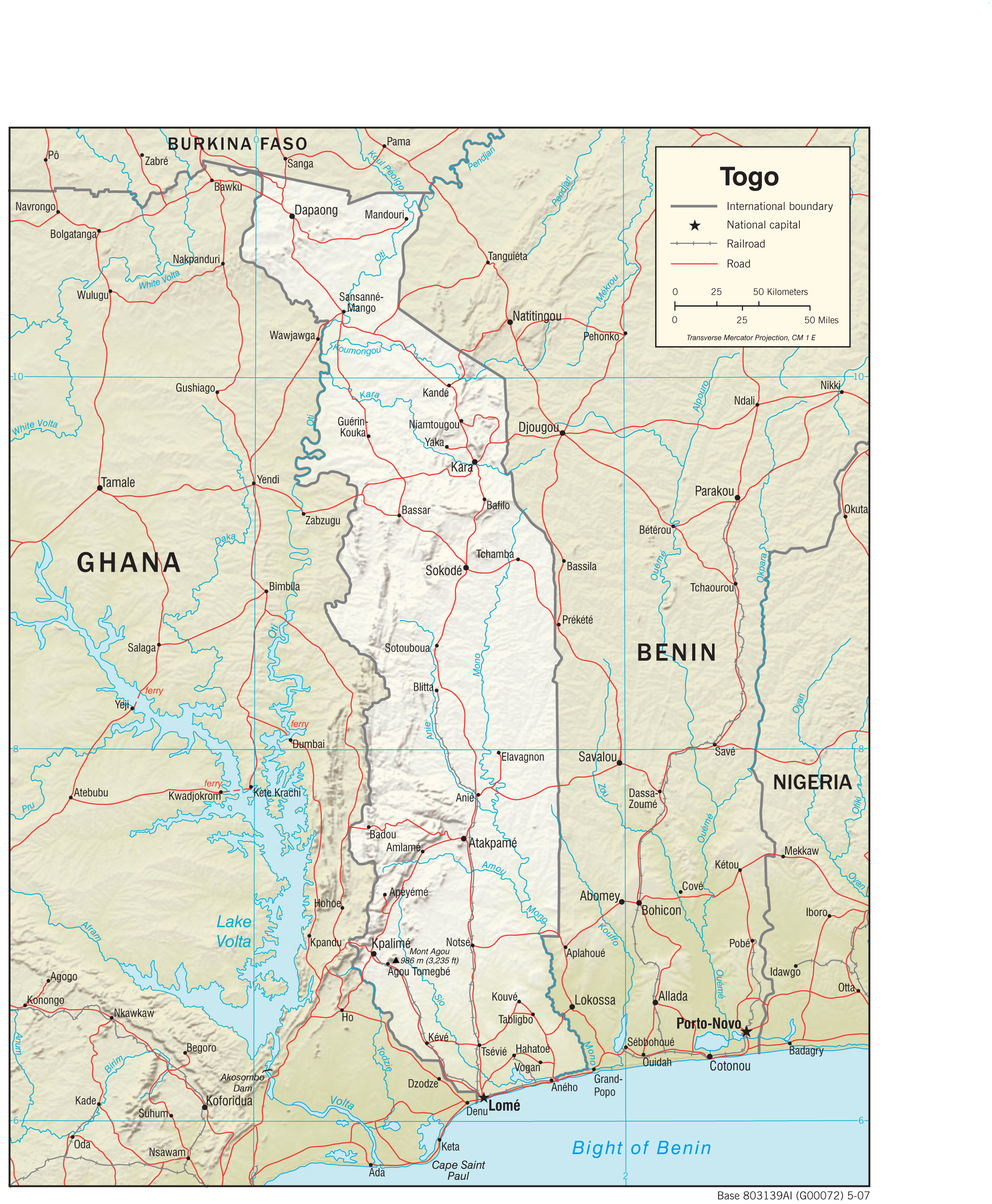
Country Maps- Togo (Physiography) 2007 (1.7MB) and pdf format (394K)
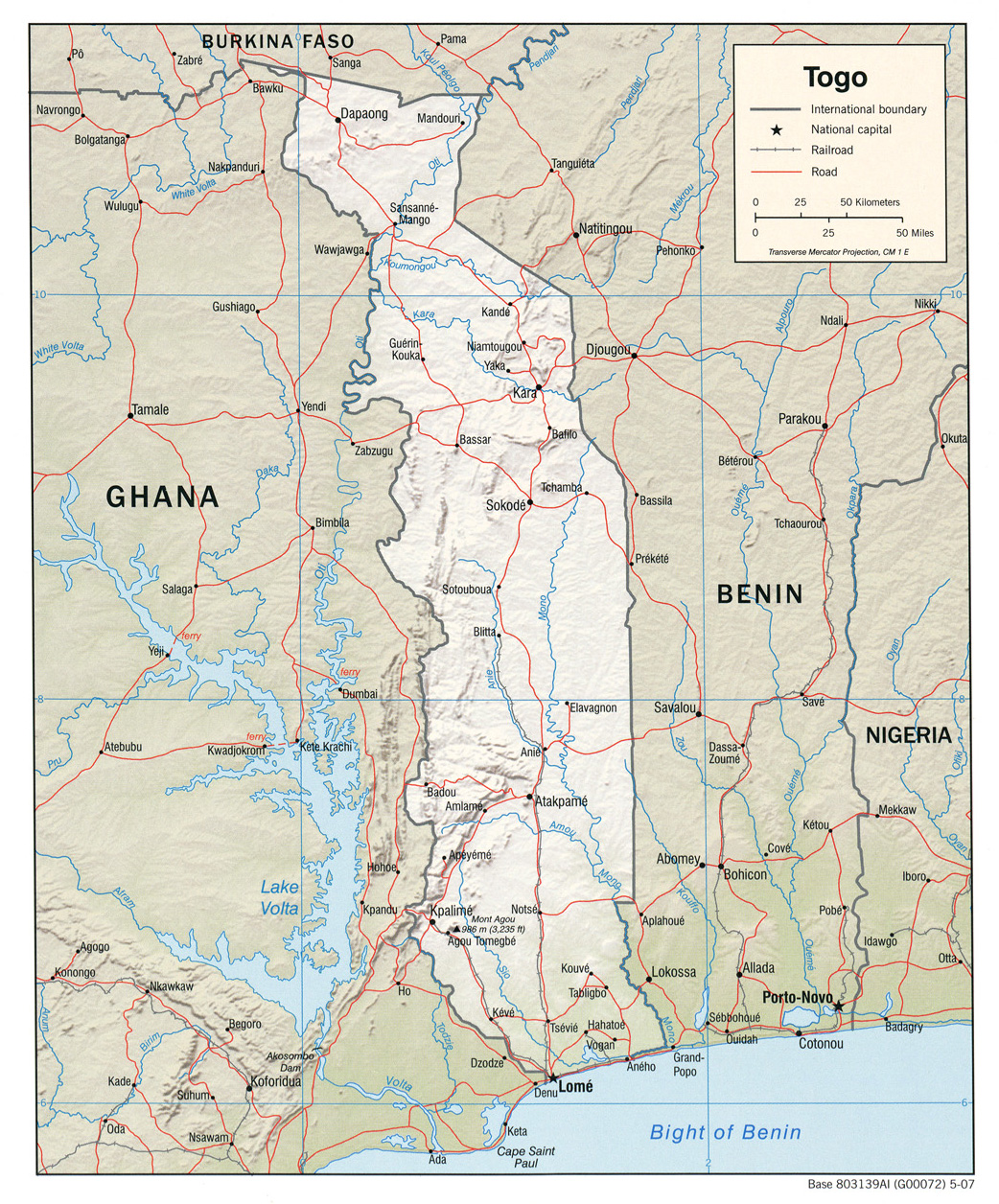
- Togo (Political) 2007 (741K)
- Togo (Shaded Relief) 2007 (805K)
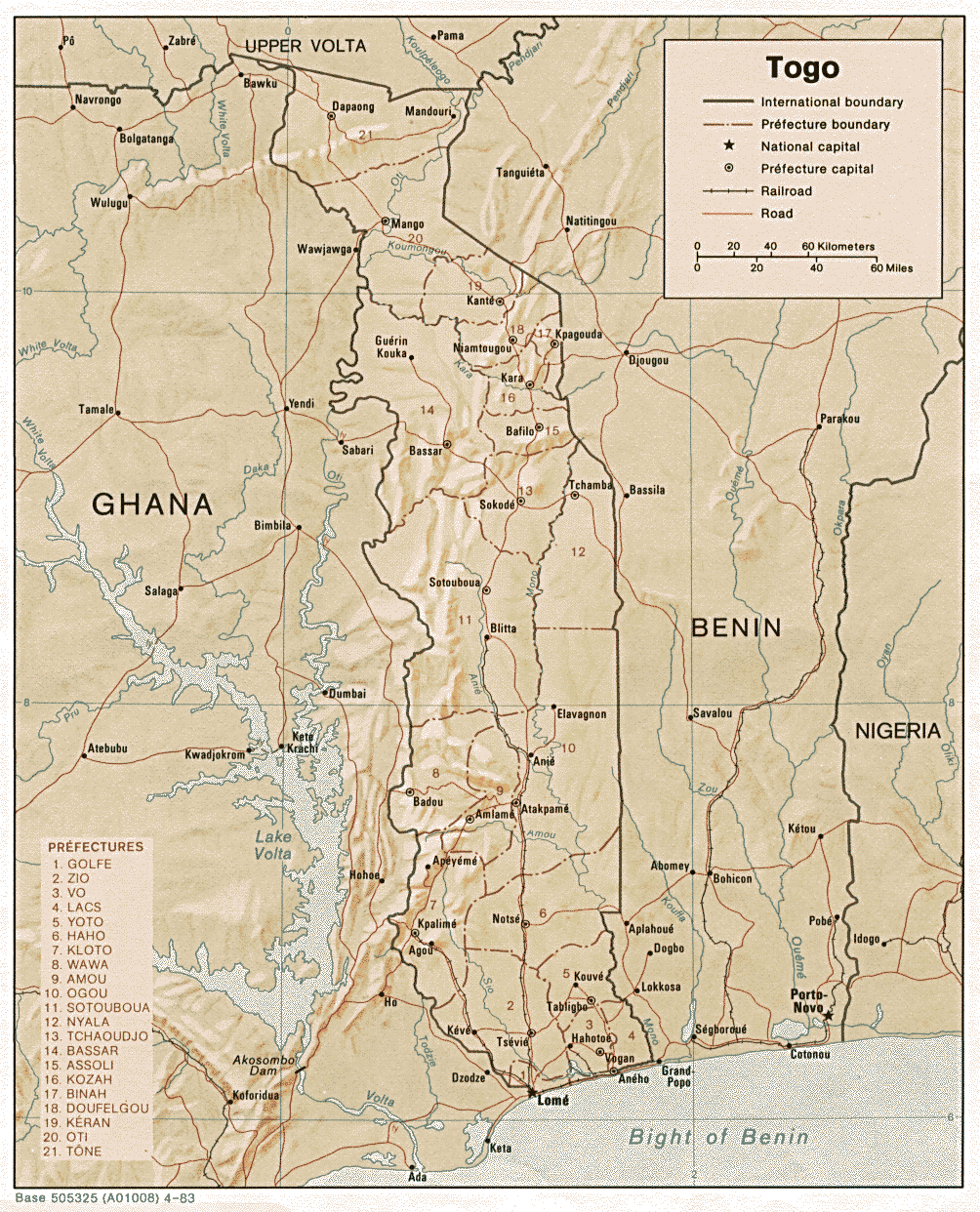
- Togo (Shaded Relief) 1983 (369K) and pdf format (398K)
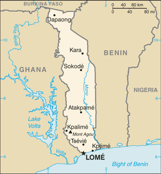
- Togo (Small Map) 2016 (17.1K)
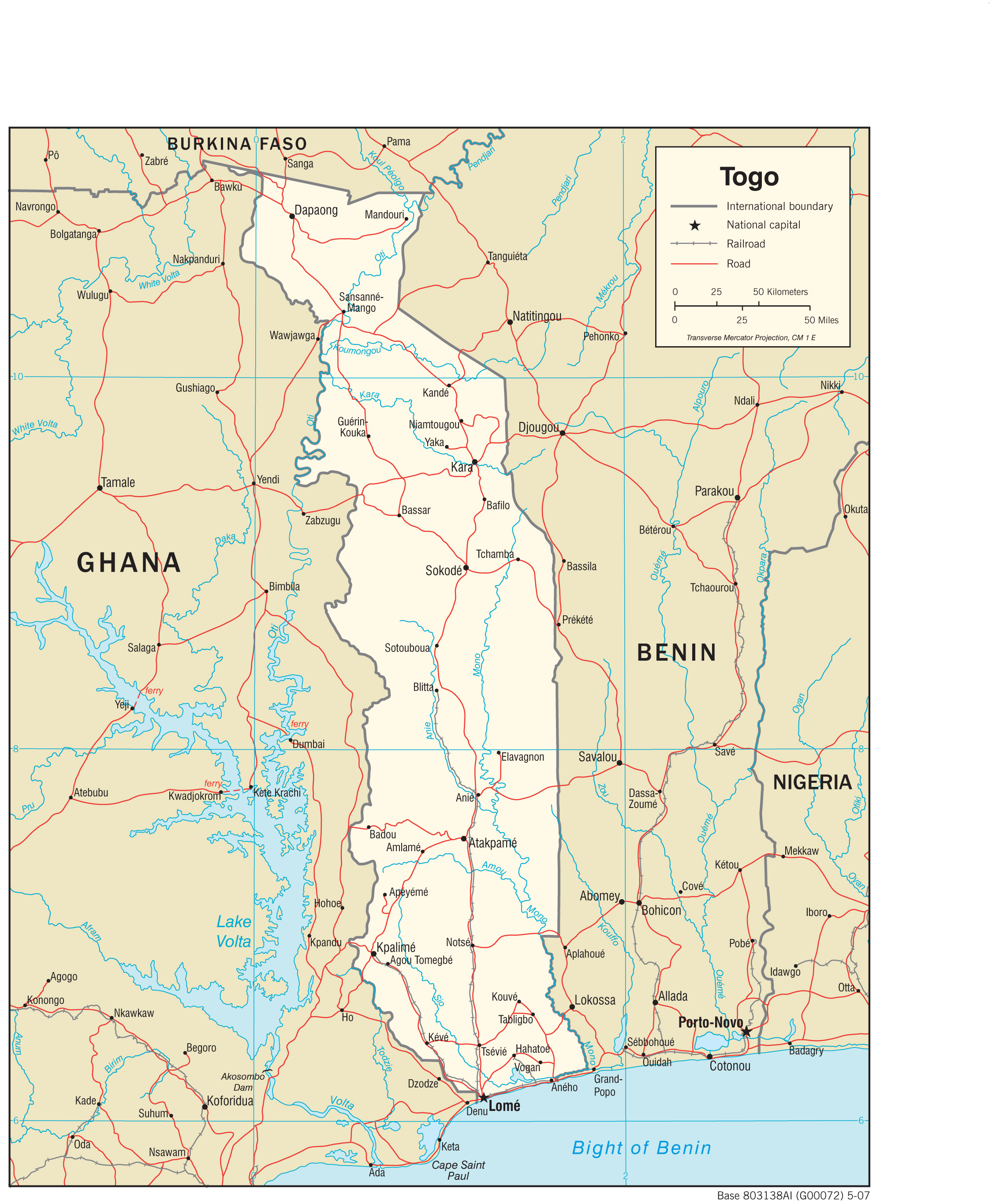
- Togo (Transportation) 2007 (1.4MB) and pdf format (252K)
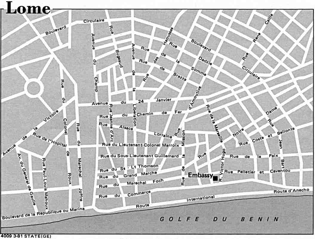
- Lome U.S. Dept. of State 1981 (60K)
- 1:2,000,000 - Africa Topographic Maps U.S. Army Map Service, Series 2201
- Sheet 17 includes Togo
- 1:1,000,000 - International Map of the World U.S. Army Map Service
- This map series covers all of Togo. Clickable map
- 1:1,000,000 - Operational Navigation Chart Series U.S. Defense Mapping Agency Aerospace Center. Not for navigational use
- Sheets K-2 and L-2 include all of Togo
- 1:500,000 - Tactical Pilotage Charts U.S. National Imagery and Mapping Agency. Not for navigational use
- This series covers Togo
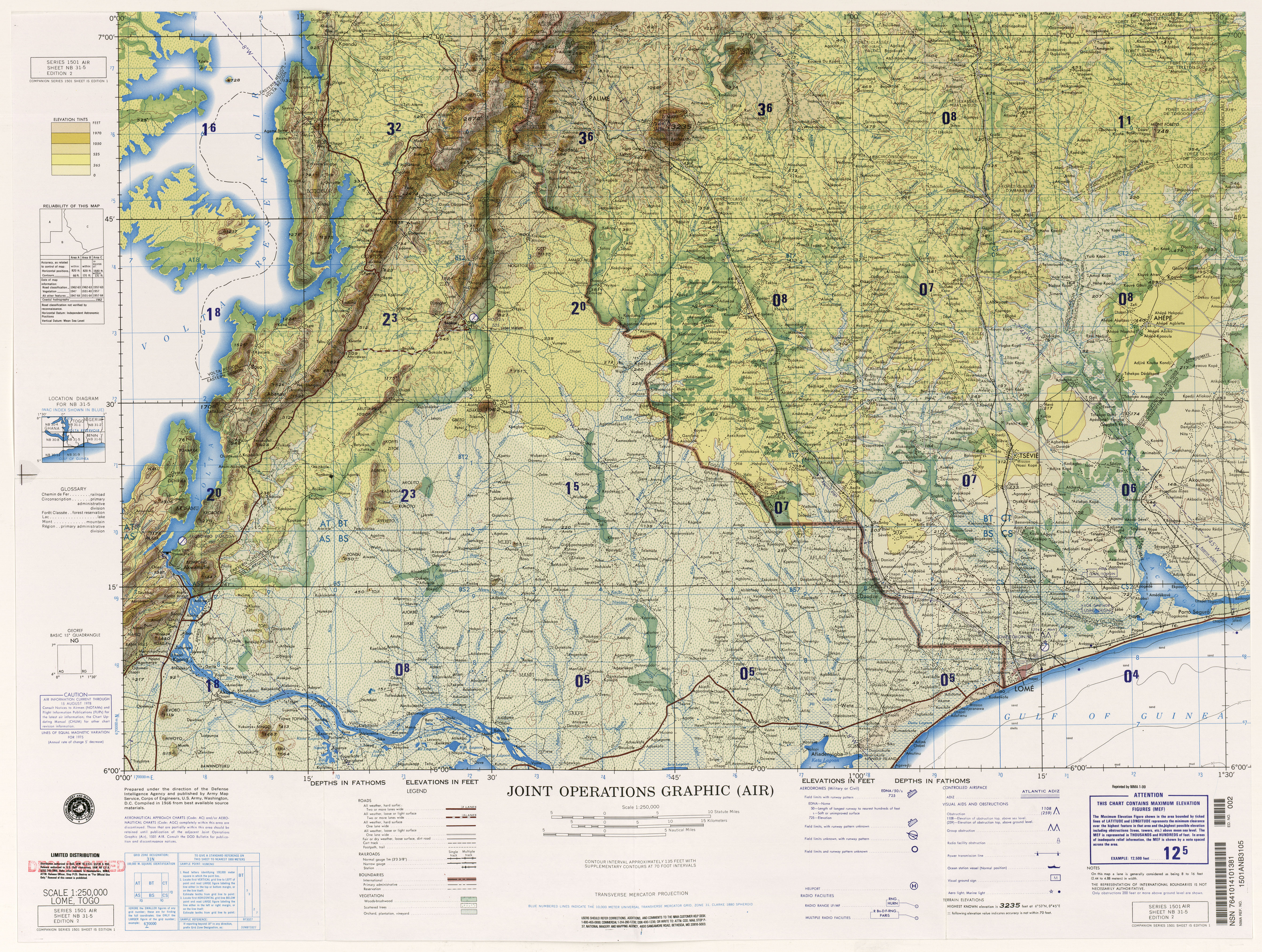
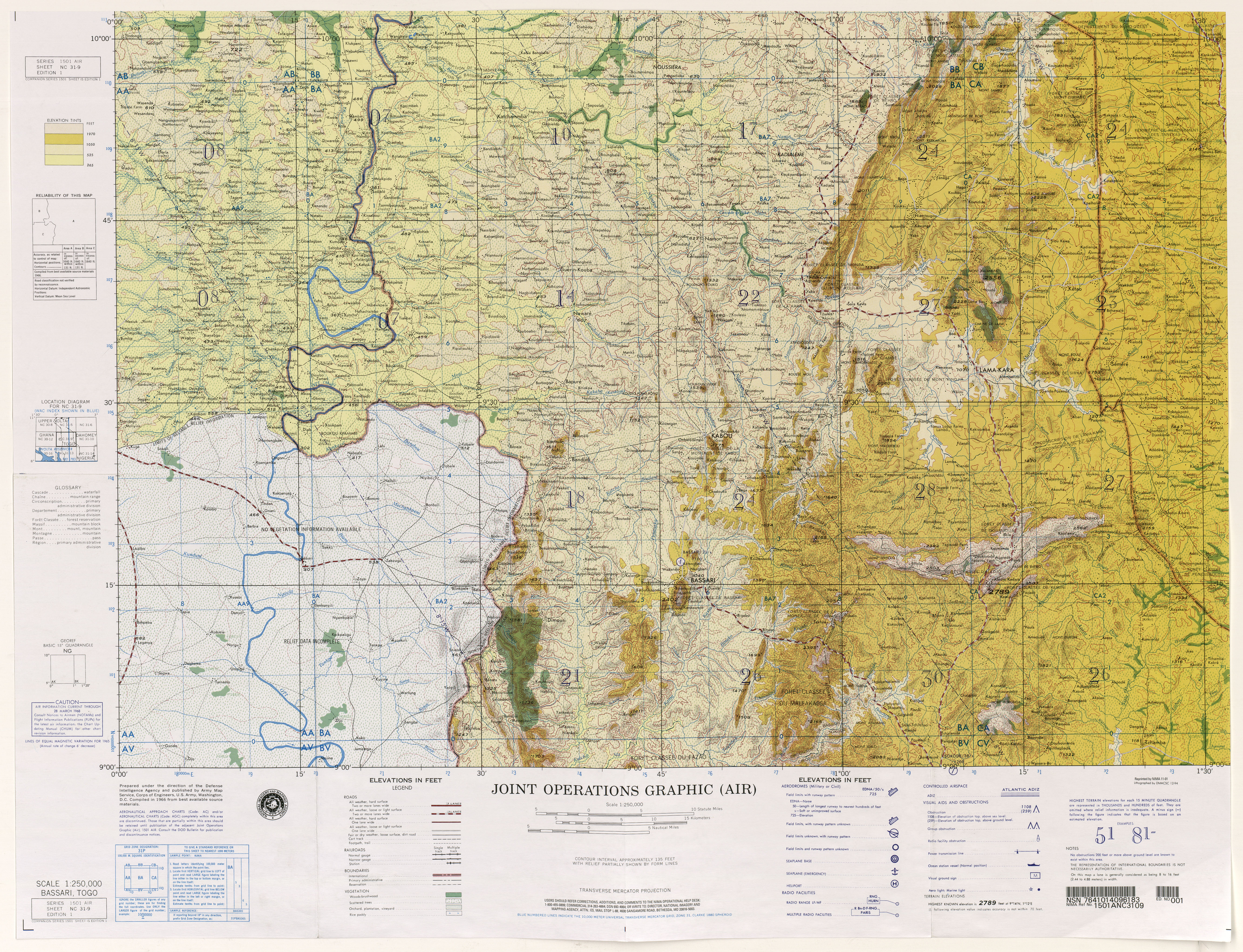
- 1:250,000 - Joint Operations Graphic U.S. National Imagery and Mapping Agency, Series 1501 Air Not for navigational use
- This series covers parts of Togo on sheets NB 31-1, NB 31-5 and NC 31-9
- Sheet 17 includes Togo
Maps on Other Web Sites