Perry-Castañeda Library
Map Collection
Arkansas Maps
State Maps
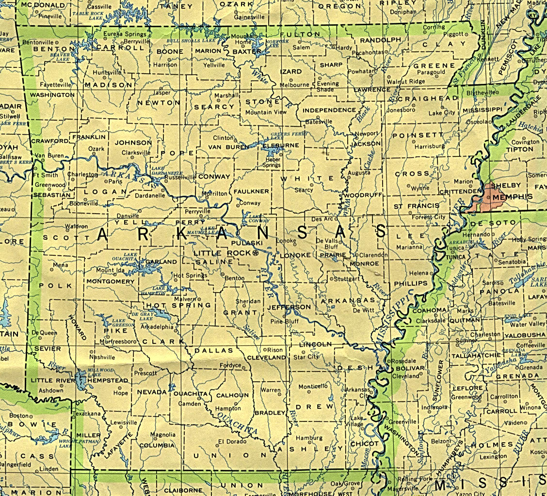
- Arkansas (base map) JPEG format (553K) County boundaries and names, county seats, rivers. Original scale 1:2,500,000 U.S. Geological Survey, 1972 limited update 1990
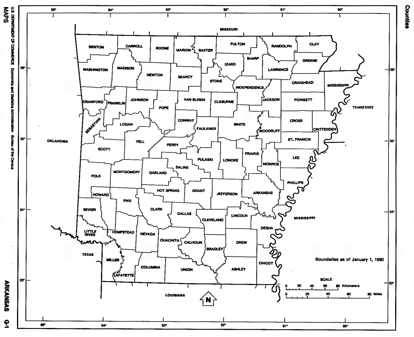
- Arkansas (outline map) JPEG format (252K) County boundaries and names. U.S. Bureau of the Census, 1990
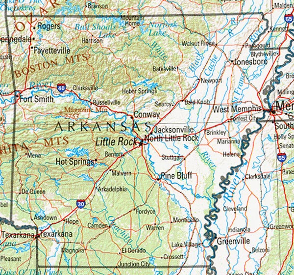
- Arkansas (reference map) JPEG format (272K) Shaded relief map with state boundaries, forest cover, place names, major highways. Portion of "The National Atlas of the United States of America. General Reference", compiled by U.S. Geological Survey 2001, printed 2002
- Arkansas (reference map) PDF format (196K) Shaded relief map with state boundaries, forest cover, place names, major highways. Portion of "The National Atlas of the United States of America. General Reference", compiled by U.S. Geological Survey 2001, printed 2002
- Arkansas - Federal Lands and Indian Reservations PDF format (598K) The National Atlas of the United States of America, U.S. Geological Survey, 2003
City Maps
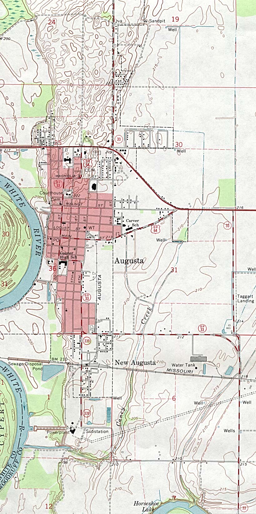
- Augusta (topographic) original scale 1:24,000 U.S.G.S. 1968 minor revision 1993 (383K)
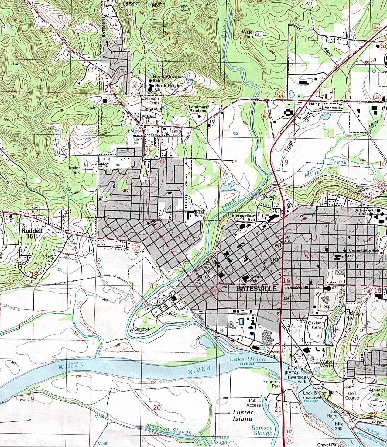
- Batesville (topographic) original scale 1:24,000 U.S.G.S. 1989 (663K)
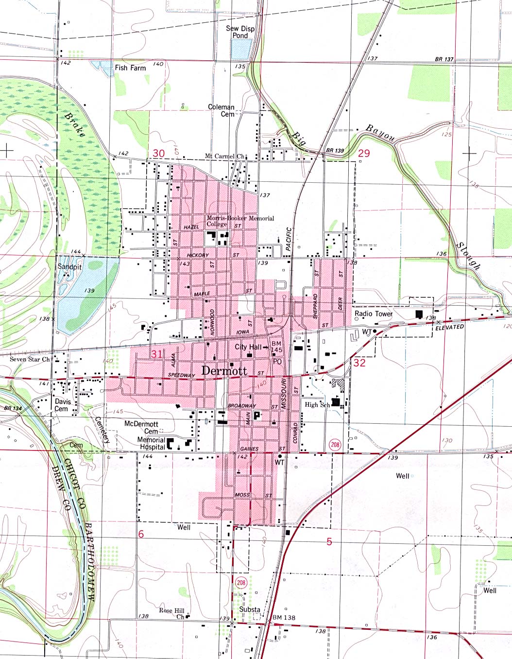
- Dermott (topographic) original scale 1:24,000 U.S.G.S. 1981 (298K)
- Mena (topographic) original scale 1:24,000 U.S.G.S. 1975 (621K)
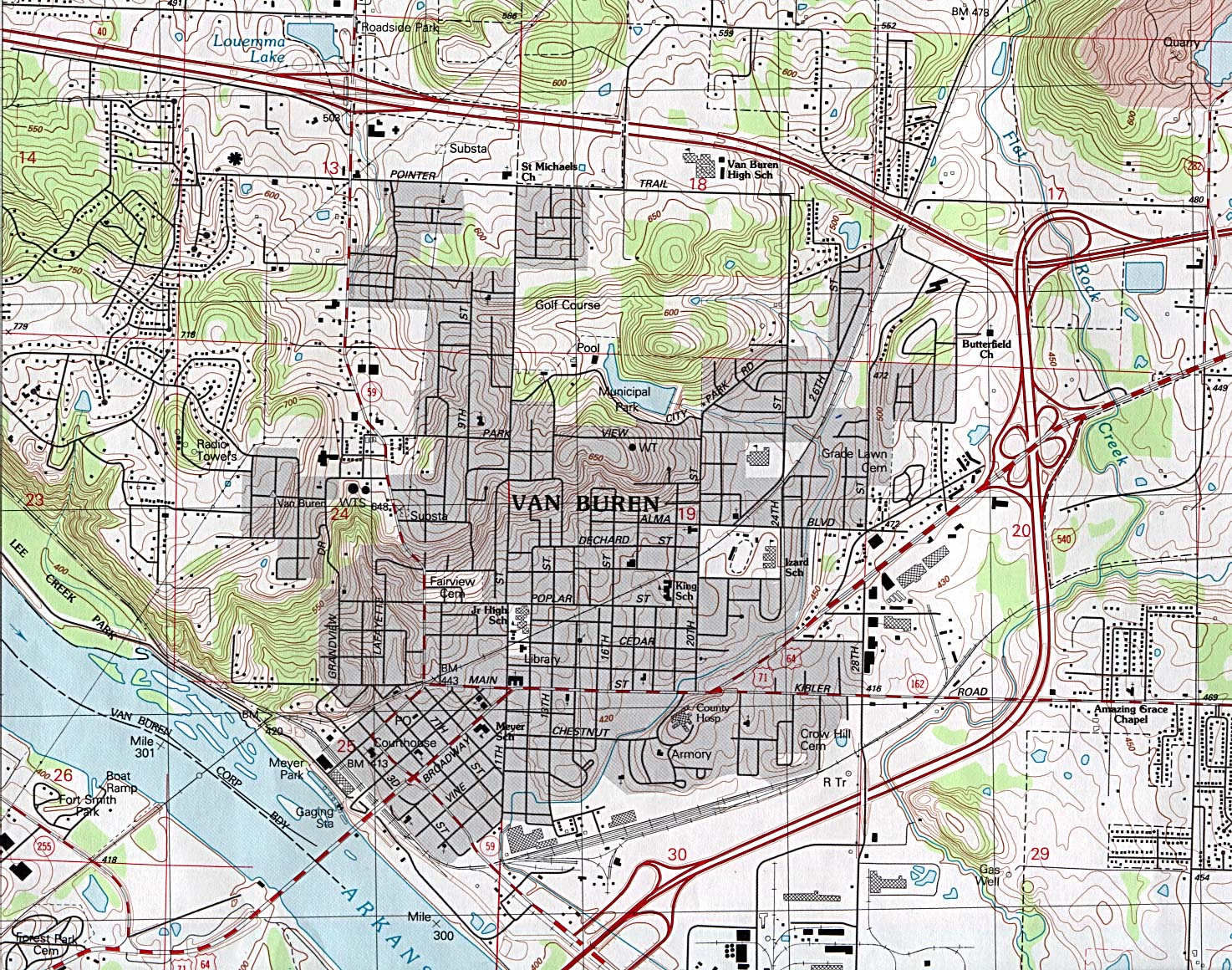
- Van Buren (topographic) original scale 1:24,000 U.S.G.S. 1987 (689K)
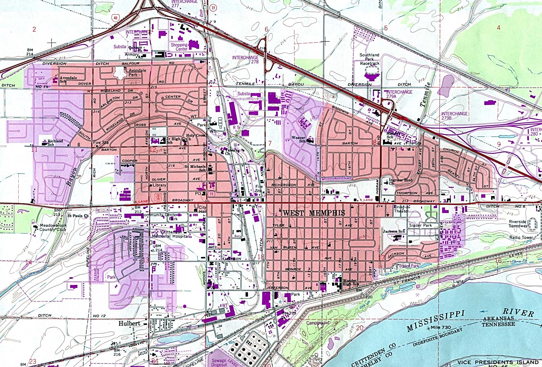
- West Memphis (topographic) original scale 1:24,000 U.S.G.S. 1966 revised 1993 (808K)
Detailed Maps
- Little Rock Region (topographic) Portion of Vicksburg sheet, NI 15. Original Scale 1: 1,000,000. Printed by U.S. Army Map Service, Corps of Engineers, 1962 (124K)
Historical City Maps
- Little Rock 1920 Automobile Blue Book (117K)
Historical Topographic Maps
- Arkansas Historical Topographic Maps (U.S. Geological Survey)
- Pre-1945 maps, scales 1:31,680, 1:62,500, 1:125,000 and special sheets
Maps of National Parks, Monuments, and Historic Sites
The following maps were produced by the U.S. National Park Service unless otherwise noted.
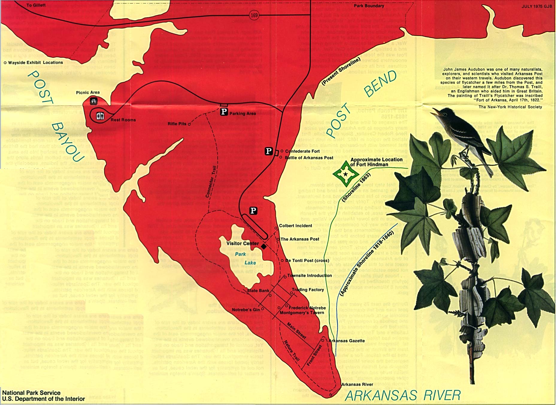
- Arkansas Post National Memorial (Area Map) 1993 (317K)
- Arkansas Post National Memorial (Park Map) 1997 (129K) (PDF Format)
- Buffalo National River (Park Map) 1994 (603K)
- Buffalo National River (Park Map) 1997 (258K) (PDF Format)
- Fort Smith National Historic Site (Area Map) 1987 (1.2MB)
- Fort Smith National Historic Site (Park Map) 1999 (65K) (PDF Format)
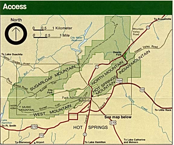
- Hot Springs National Park (Area Map) (72K)
- Hot Springs National Park (Area Map) (62K) (PDF Format)
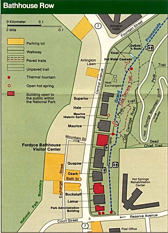
- Hot Springs National Park (Bathhouse Row Map) (110K)
- Hot Springs National Park (Park Map) (352K)
- Hot Springs National Park (Park Map) (129K) (PDF Format)
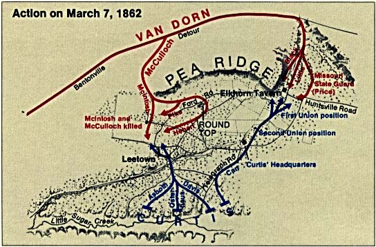
- Pea Ridge National Military Park (Battle Map, March 7 1862) (70K)
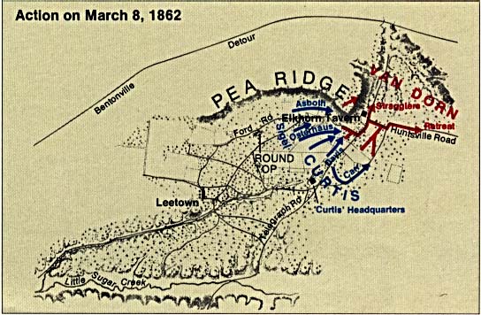
- Pea Ridge National Military Park (Battle Map, March 8 1862) (63K)
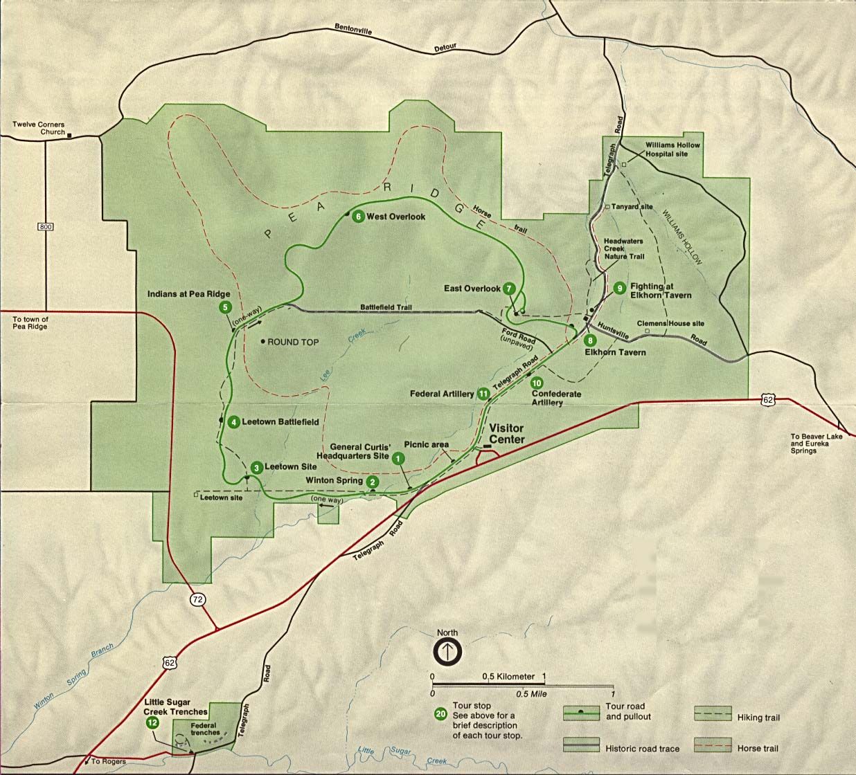
- Pea Ridge National Military Park (Park Map) (223K)
Maps on Other Web Sites