Perry-Castañeda Library
Map Collection
Pacific Islands 1943-1945
The following maps are from "Pacific Islands" [Geographical Handbook Series]. Great Britain. Admiralty. Naval Intelligence Division, 1943-1945.
Volume I: General Survey 1945
Geology and Physical Structure
- Distribution of Rock Types in the Pacific (135K)
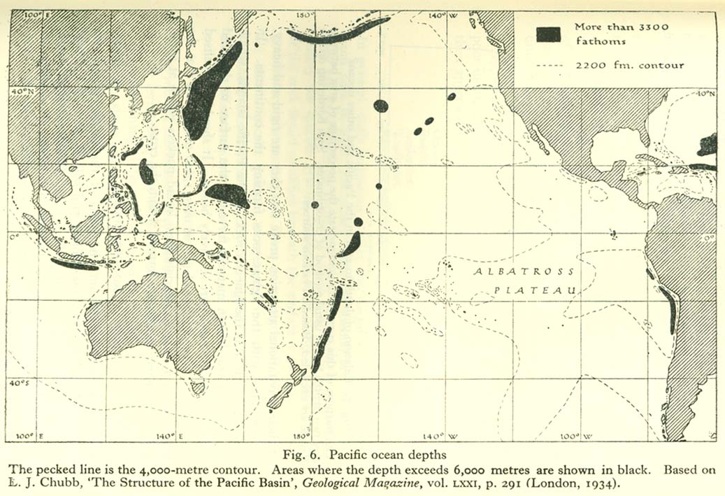
- Pacific Ocean Depths (160K)
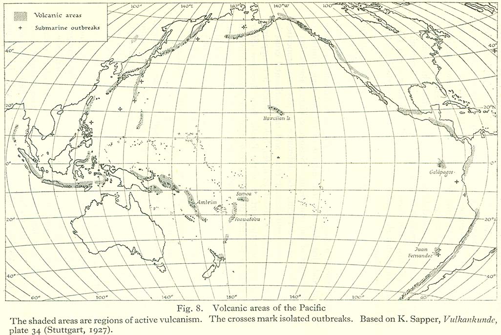
- Volcanic Areas of the Pacific (164K)
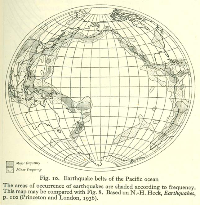
- Earthquake Belts of the Pacific Ocean (123K)
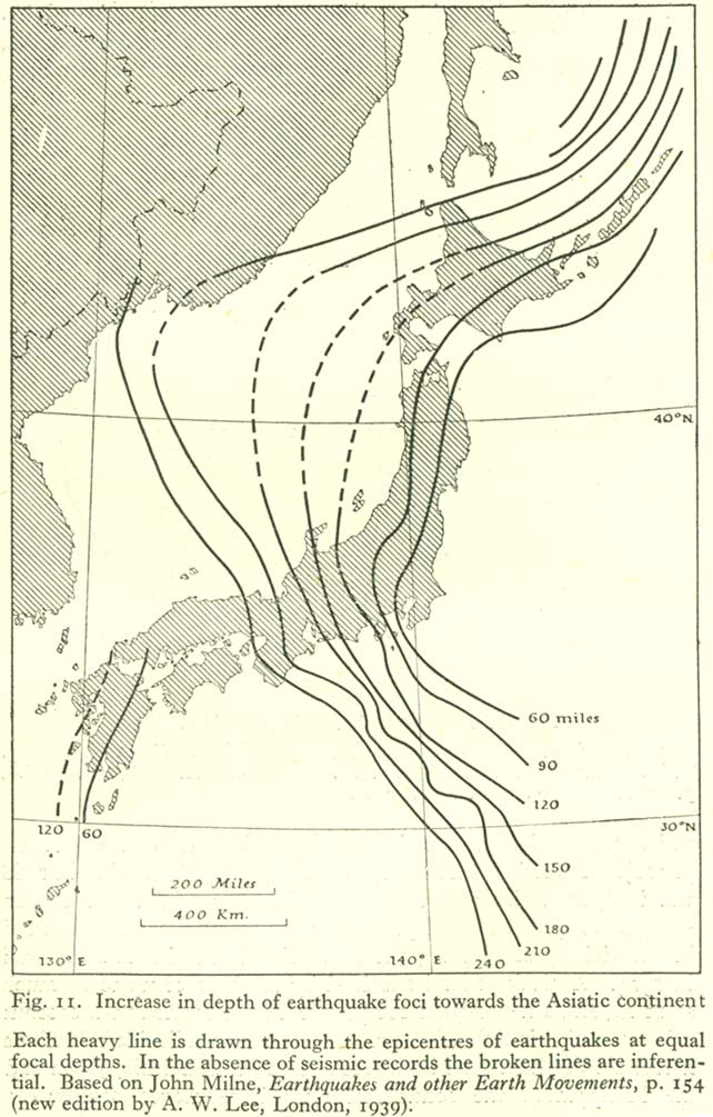
- Increase in Depth of Eartquake Foci Towards the Asiatic Continent (150K)
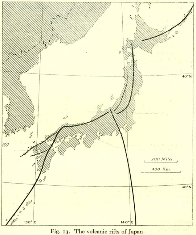
- The Volcanic Rifts of Japan (96K)
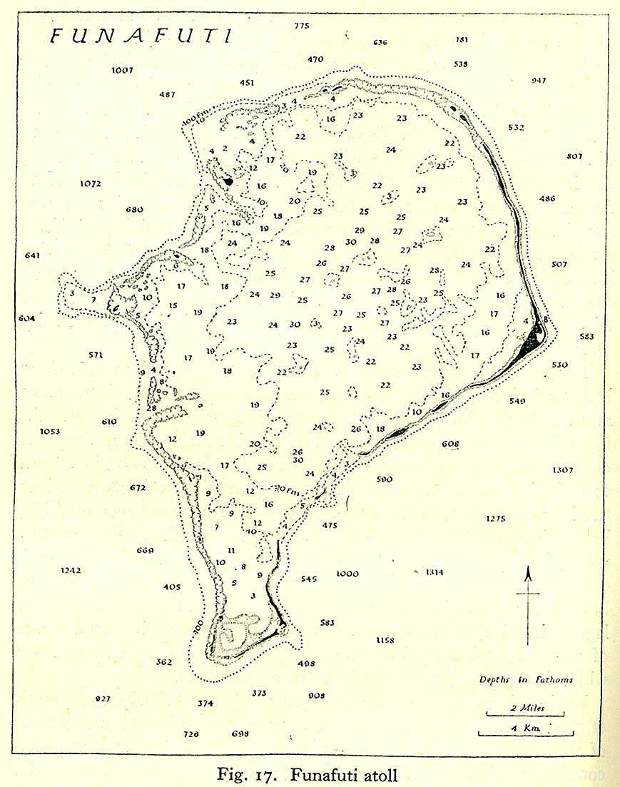
- Funafuti Atoll [Depth measurments] (154K)
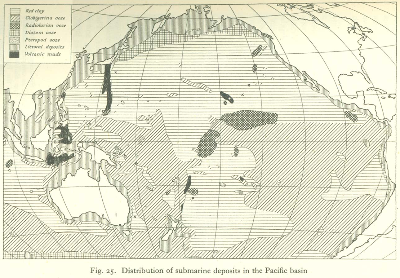
- Distribution of Submarine Deposits in the Pacific Basin (280K)
Climate
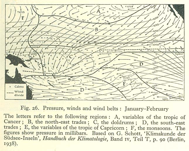
- Pressure, Winds and Wind Belts: January-February (131K)
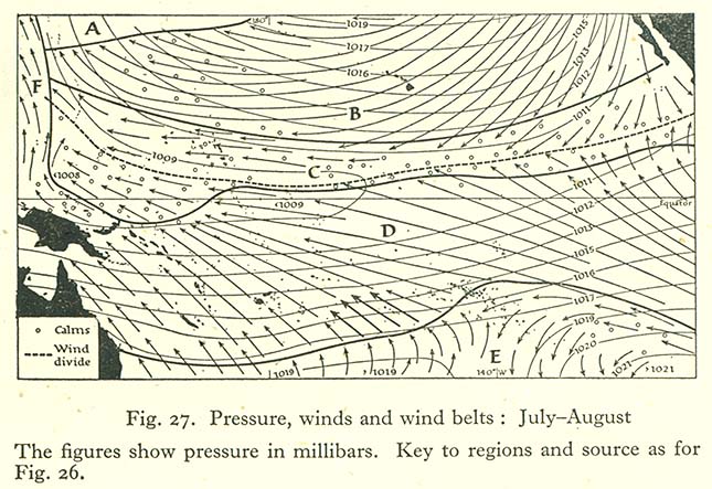
- Pressure, Winds and Wind Belts: July-August (122K)
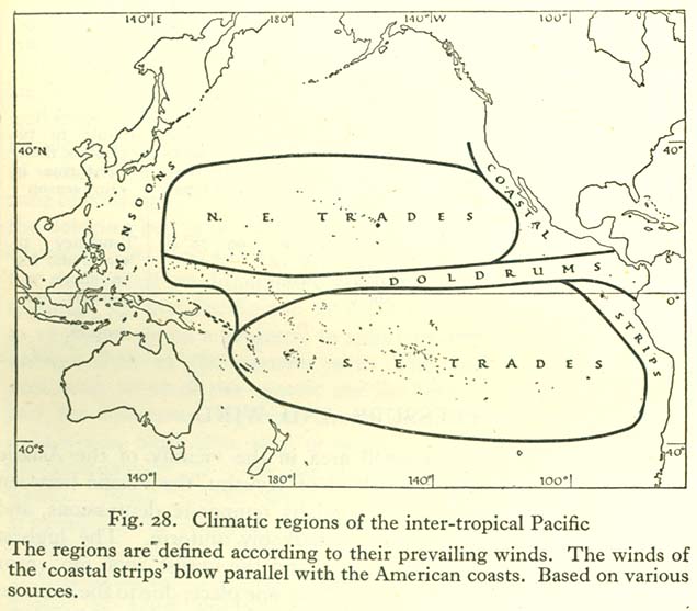
- Climatic Regions of the Inter-tropical Pacific (84K)
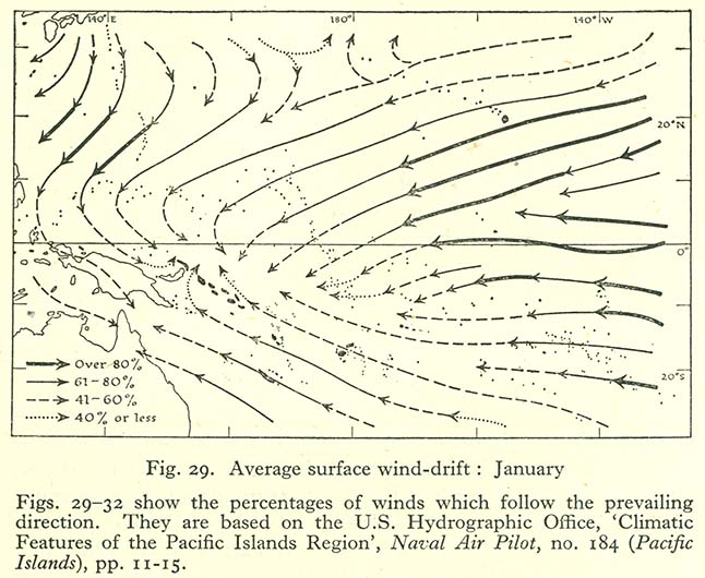
- Average Surface Wind-Drift: January (107K)
- Average Surface Wind-Drift: April (88K)
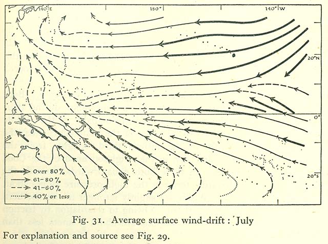
- Average Surface Wind-Drift: July (92K)
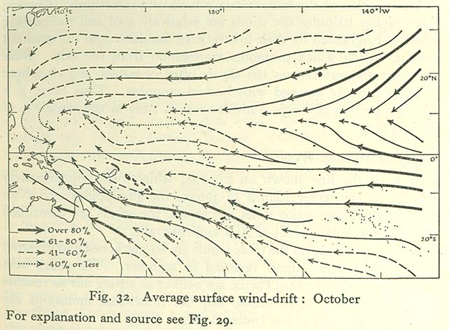
- Average Surface Wind-Drift: October (91K)
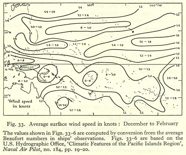
- Average Surface Wind Speed in Knots: December to February (111K)
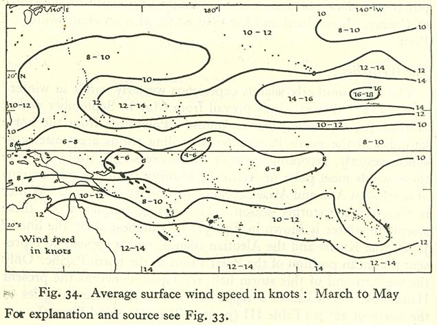
- Average Surface Wind Speed in Knots: March to May (87K)
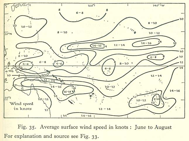
- Average Surface Wind Speed in Knots: June to August (86K)
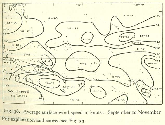
- Average Surface Wind Speed in Knots: September to November (80K)
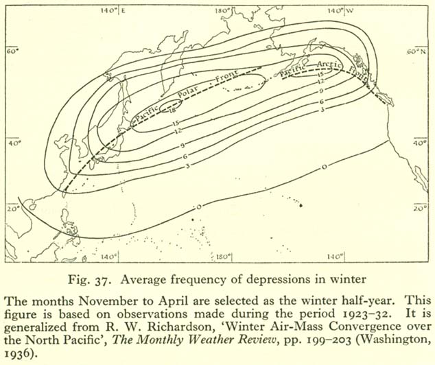
- Average Freqency of Depressions in Winter (85K)
- Average Percentage Frequency of Strong Gales and Hurricanes (107K)
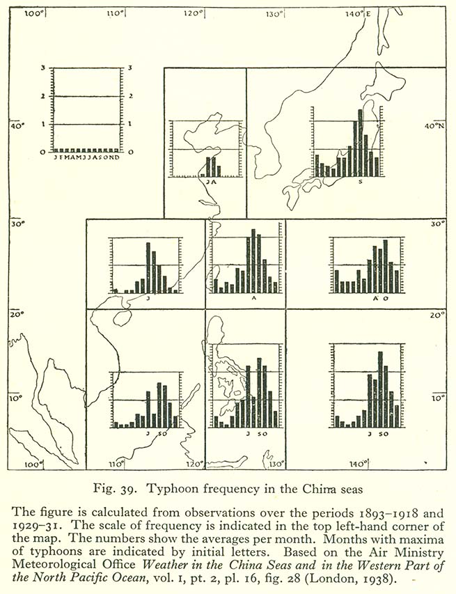
- Typhoon Frequency in the China Seas (127K)
- Typical Tracks of Cyclonic Depressions and Their Monthly Frequency over the China Seas (165K)
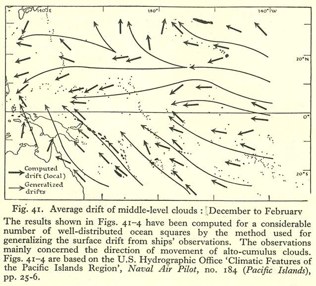
- Average Drift of Middle-Level Clouds: December to February (114K)
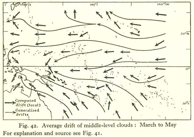
- Average Drift of Middle-Level Clouds: March to May (74K)
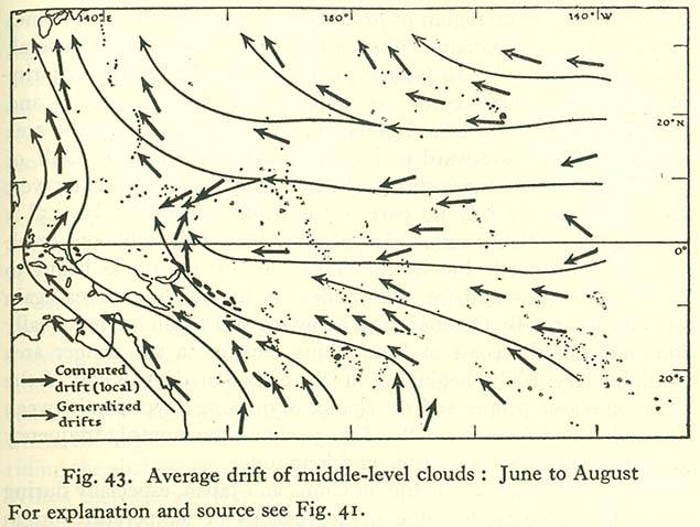
- Average Drift of Middle-Level Clouds: June to August (88K)
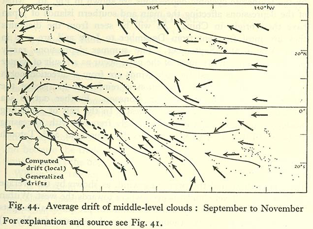
- Average Drift of Middle-Level Clouds: Septmeber to November (87K)
- Air and Surface-water Temperatures: January (107K)
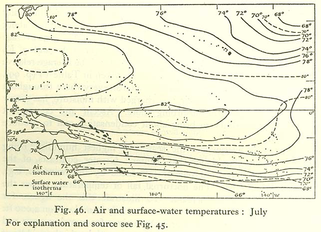
- Air and Surface-water Temperatures: July (92K)
- Average Annual Cloud Amount (93K)
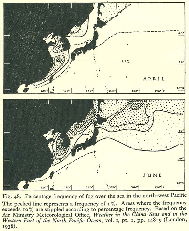
- Percentage Frequency of Fog Over the Sea in the North-West Pacific (137K)
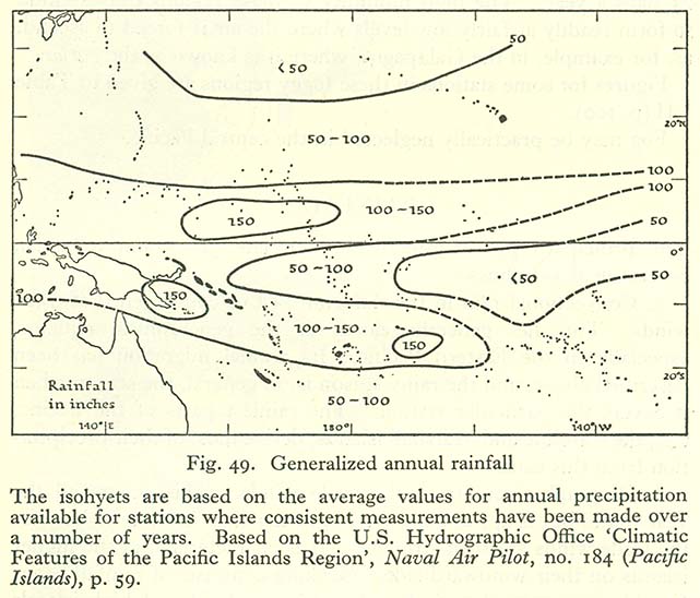
- Generalized Annual Rainfall (96K)
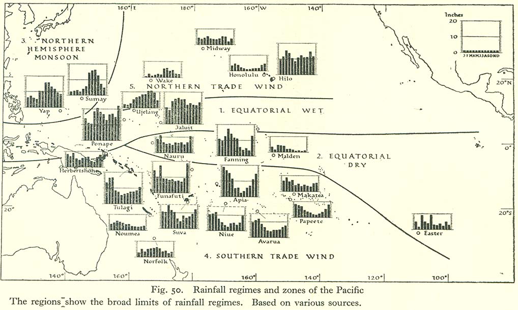
- Rainfall Regimes and Zones of the Pacific (132K)
Soils
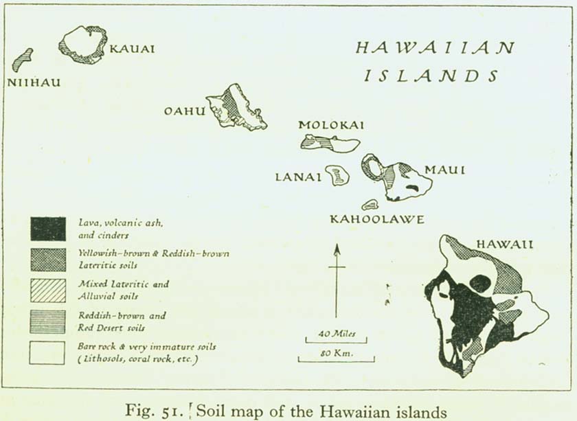
- Soil Map of the Hawaiian Islands (72K)
Fauna of the Pacific Ocean and Its Islands
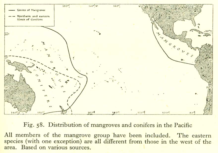
- Distribution of Mangroves and Conifers in the Pacific (97K)
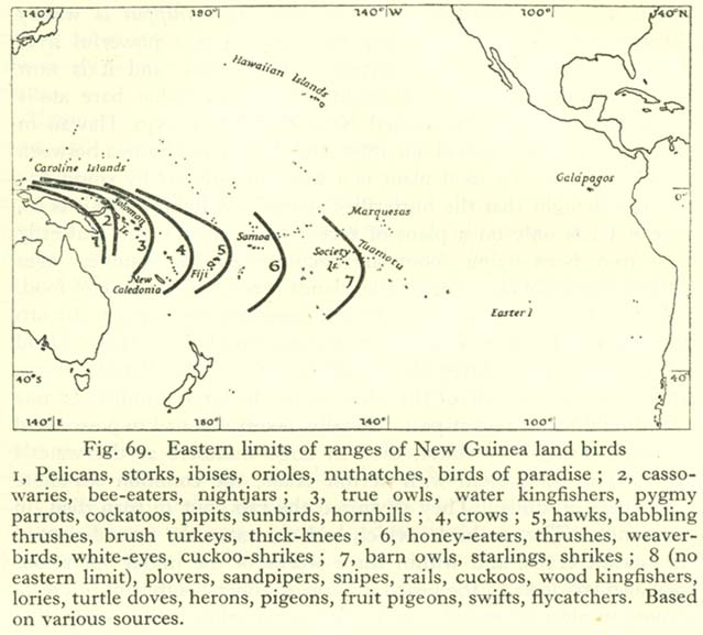
- Eastern Limits of Ranges of New Guinea Land Birds (86K)
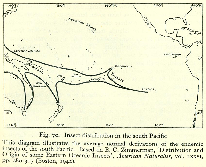
- Insect Distribution in the South Pacific (133K)
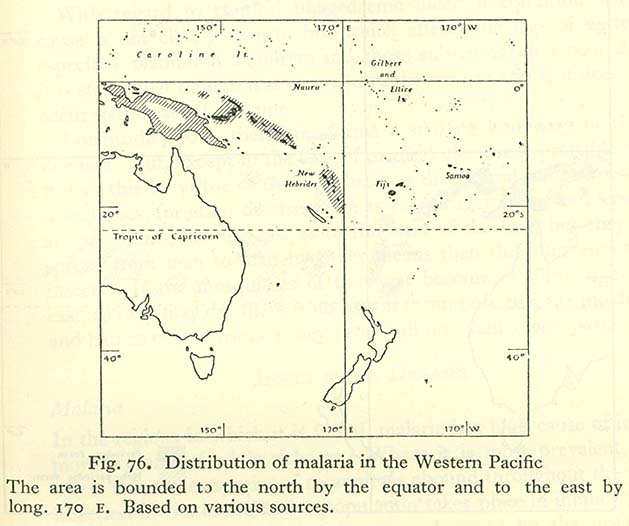
- Distribution of Malaria in the Western Pacific (68K)
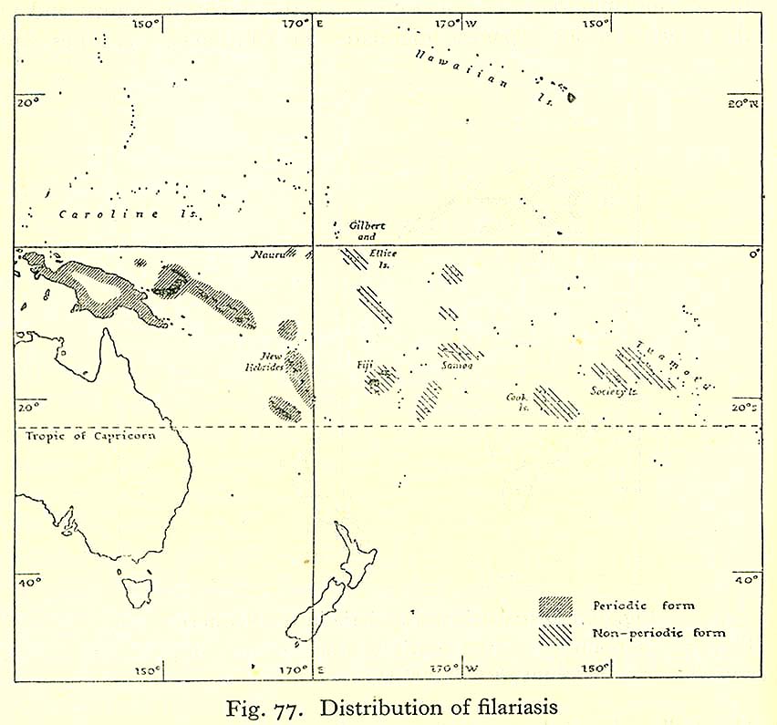
- Distribution of Filariasis (101K)
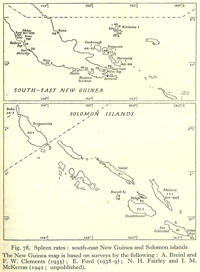
- Spleen Rates: South-East New Guinea and Solomon Islands (100K)
History, 1513-1843
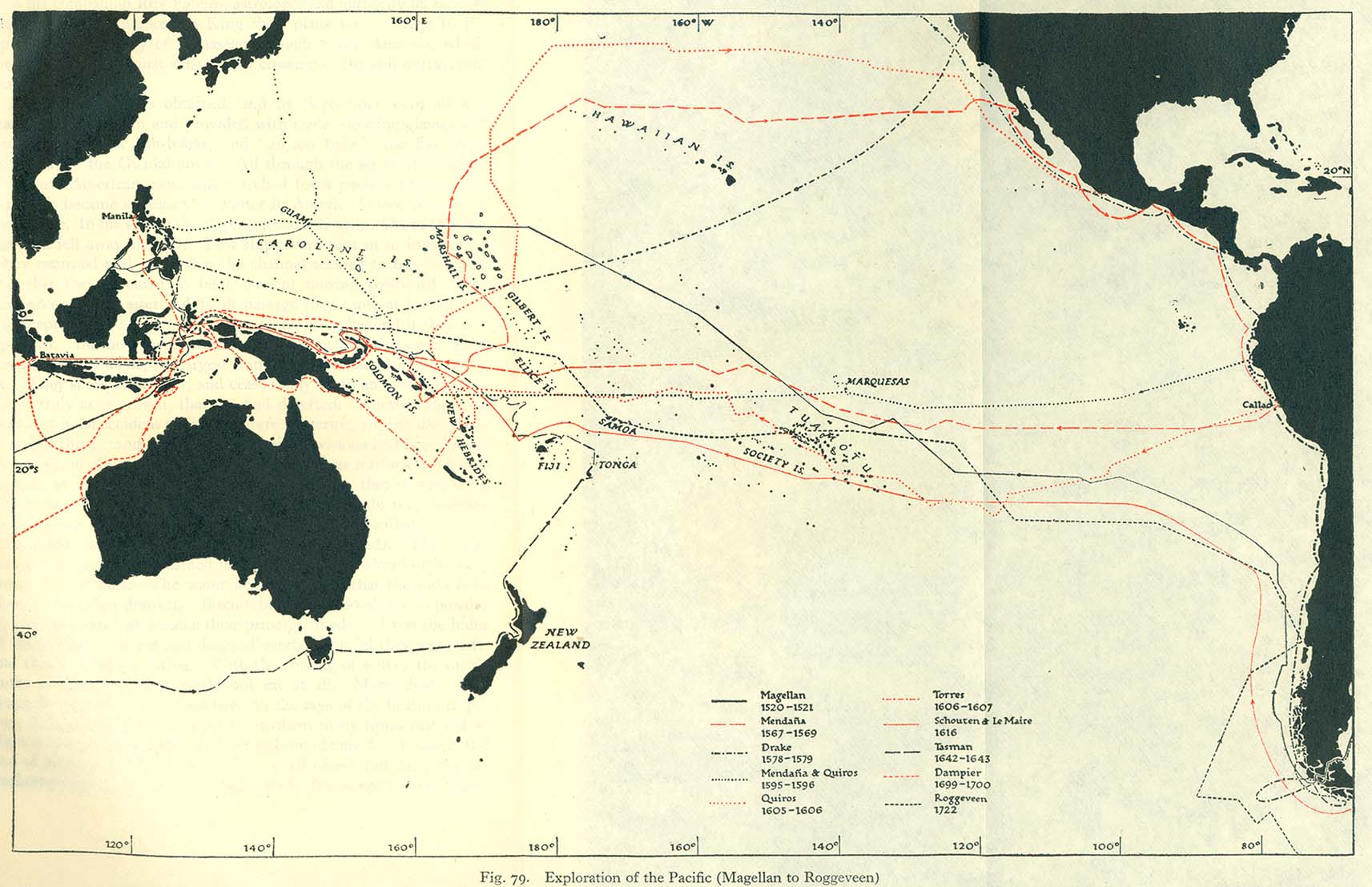
- Exploration of the Pacific (Magellan to Roggeveen) (221K)
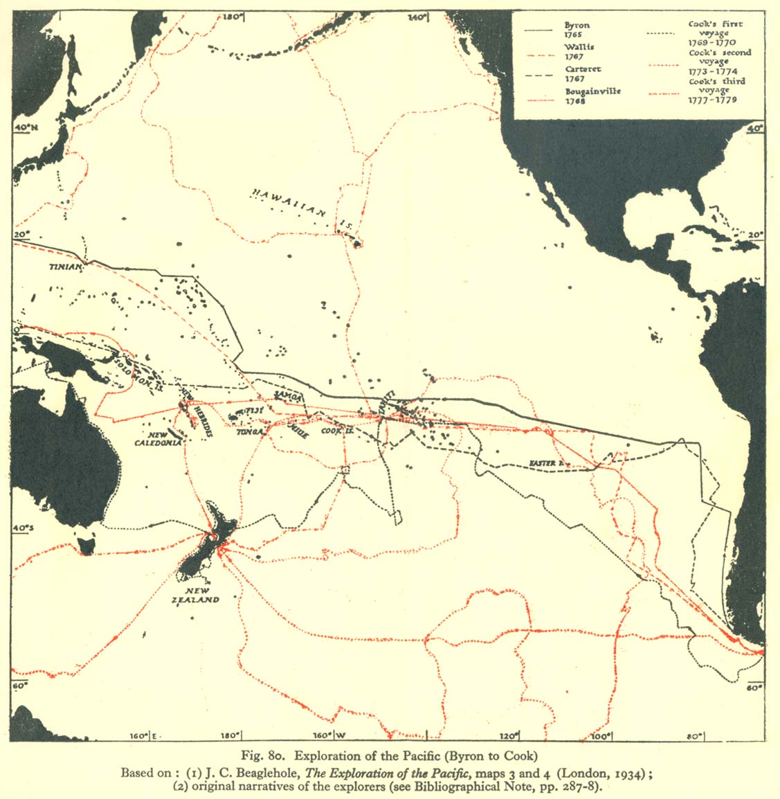
- Exploration of the Pacific (Byron to Cook) (169K)
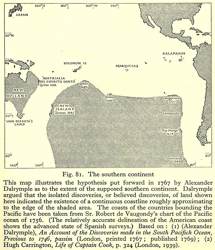
- The Southern Continent (318K)
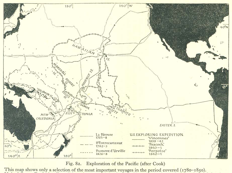
- Exploration of the Pacific (after Cook) (116K)
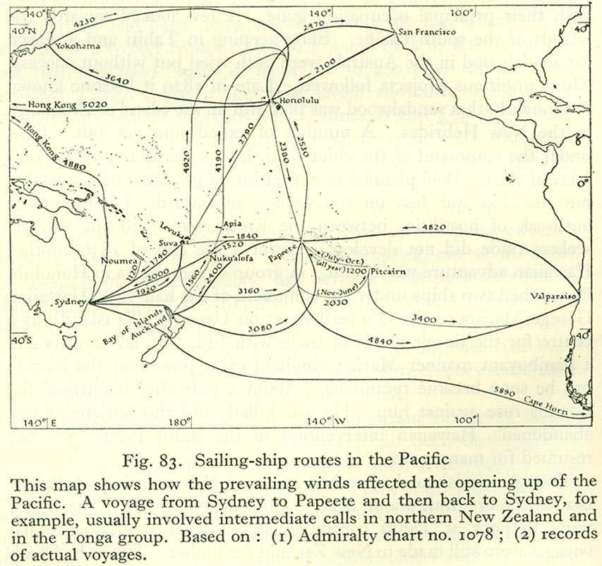
- Sailing-ship Routes in the Pacific (171K)
- Fiji, as Shown on Arrowsmith's chart of 1814 (294K)
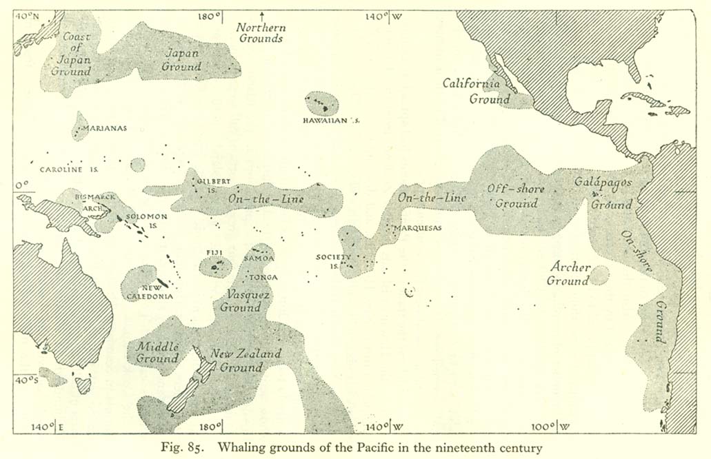
- Whaling Grounds of the Pacific in the Nineteenth Century (115K)
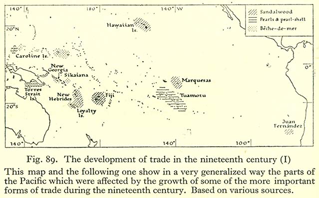
- The Development of Trade in the Nineteenth Century (I) (75K)
- The Development of Trade in the Nineteenth Century (II) (50K)
- Pacific Islands Labor Flow (118K)
- A German View of Political Control in the Pacific Area in 1859 (119K)
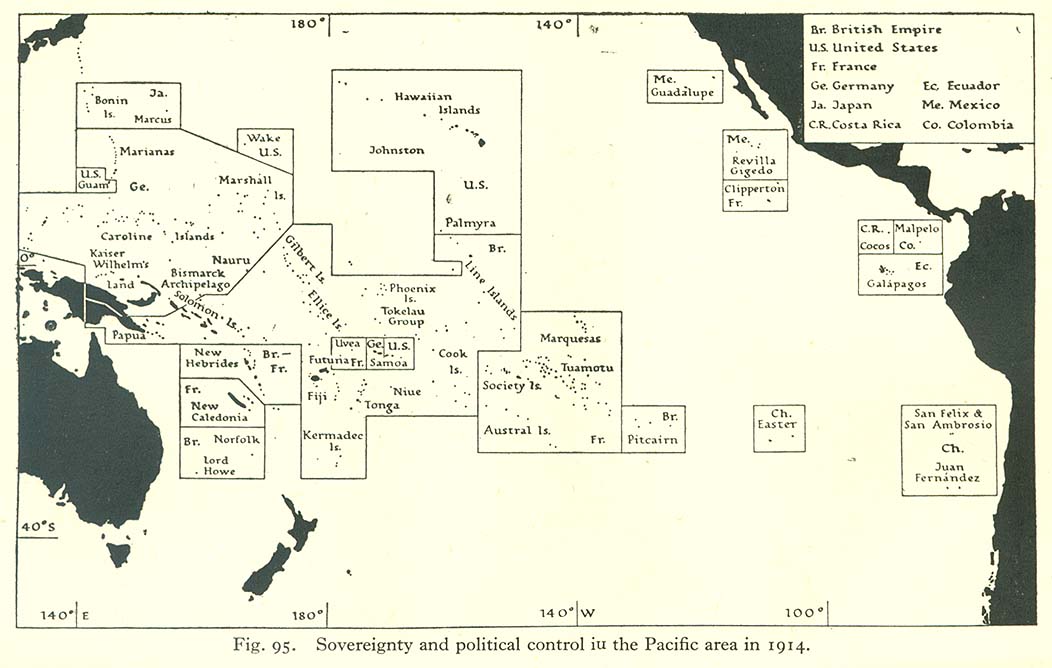
- Sovereignty and Political Control in the Pacific Area in 1914 (124K)
Population
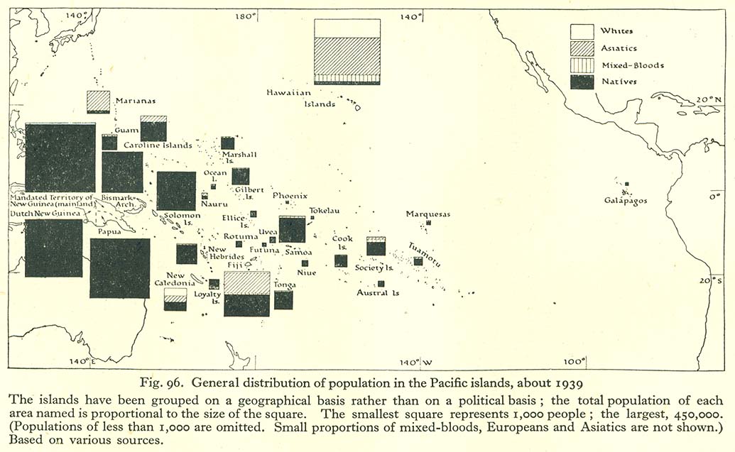
- General Distribution of Population in the Pacific Islands, about 1939 (126K)
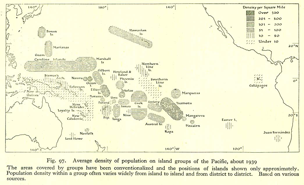
- Average Density of Population on Island Groups of the Pacific, About 1939 (131K)
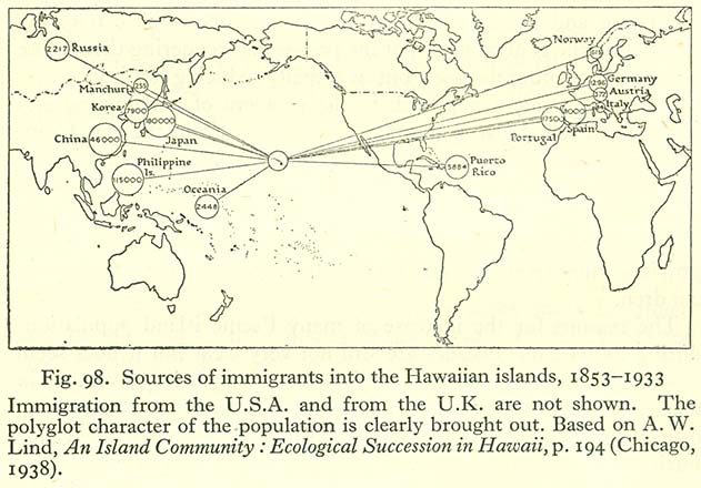
- Sources of Immigrants Into the Hawaiian Islands, 1853-1933 (89K)
Peoples : General Characteristics
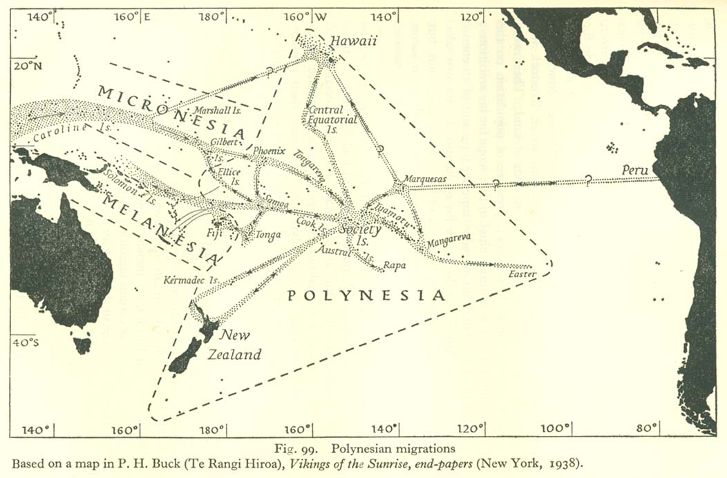
- Polynesian Migrations (119K)
Trade
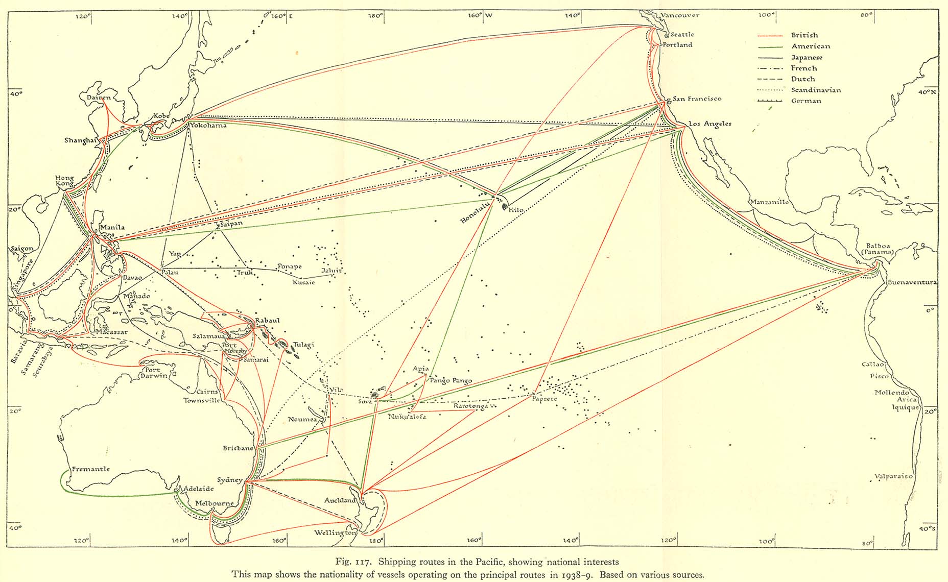
- Shipping Routes in the Pacific Showing National Interests (255K)
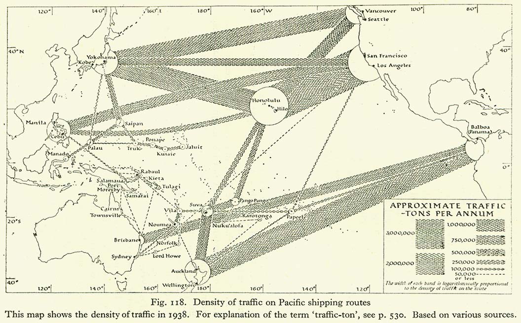
- Density of Traffic on Pacific Shipping Routes (183K)
Communications
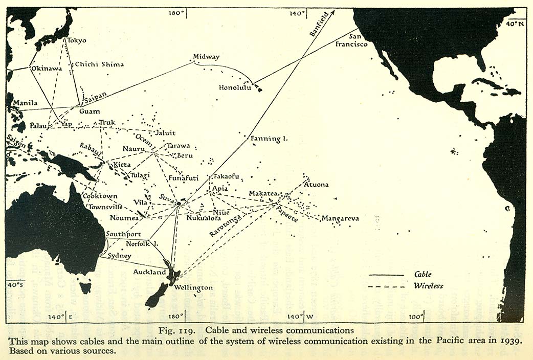
- Cable and Wireless Communications (145K)
Pacific Ocean Currents
- Ocean Circulation: Northern Summer (August to September) (262K)
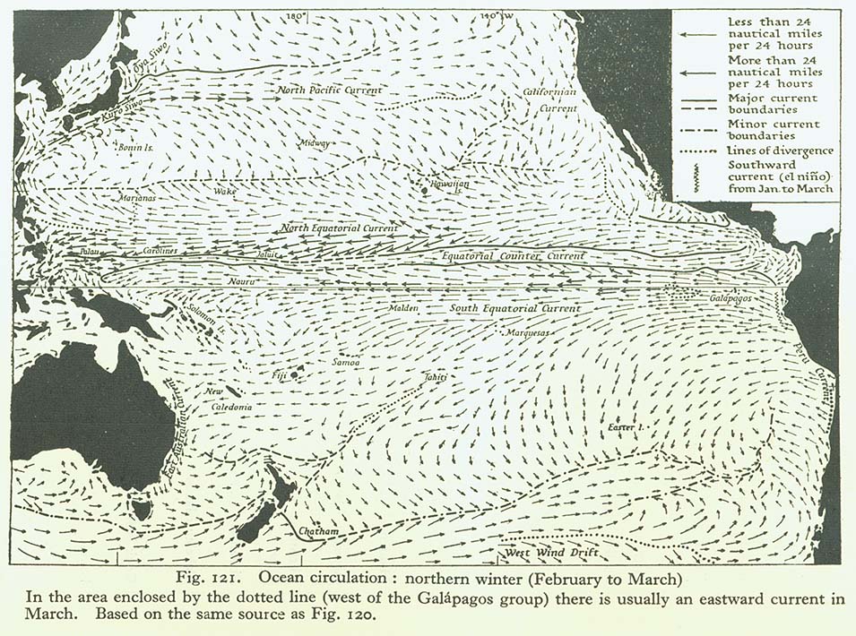
- Ocean Circulation: Northern Winter (February to March) (233K)
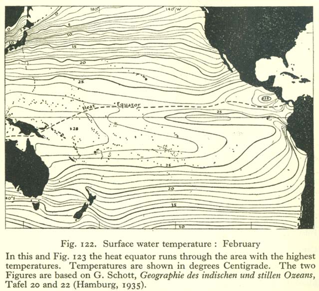
- Surface Water Temperature: February (116K)
- Surface Water Temperature: August (104K)
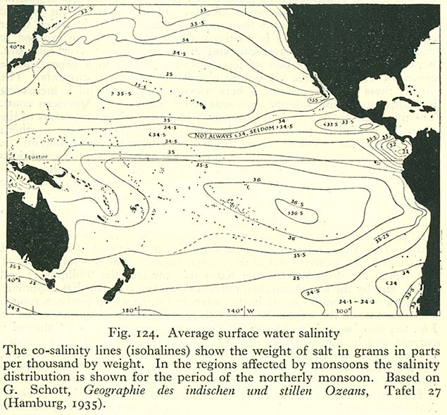
- Average Surface Water Salinity (120K)
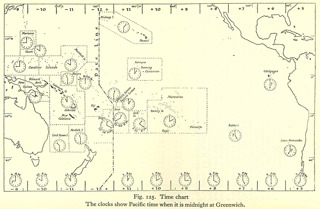
- Time Chart (134K)
Vol. II: Eastern Pacific 1943
Introduction
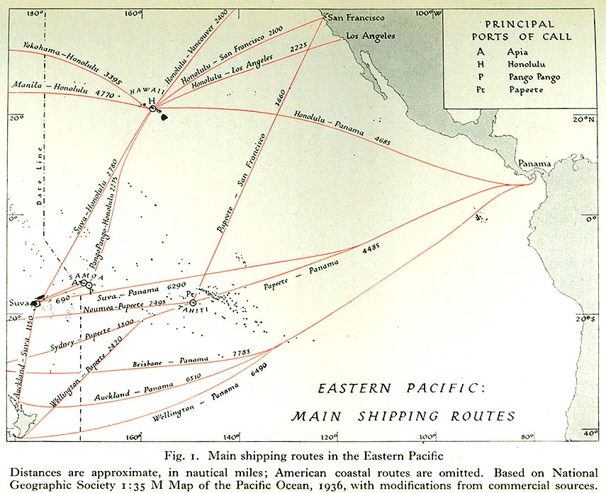
- Eastern Pacific: Main Shipping Routes 1936 (145K)
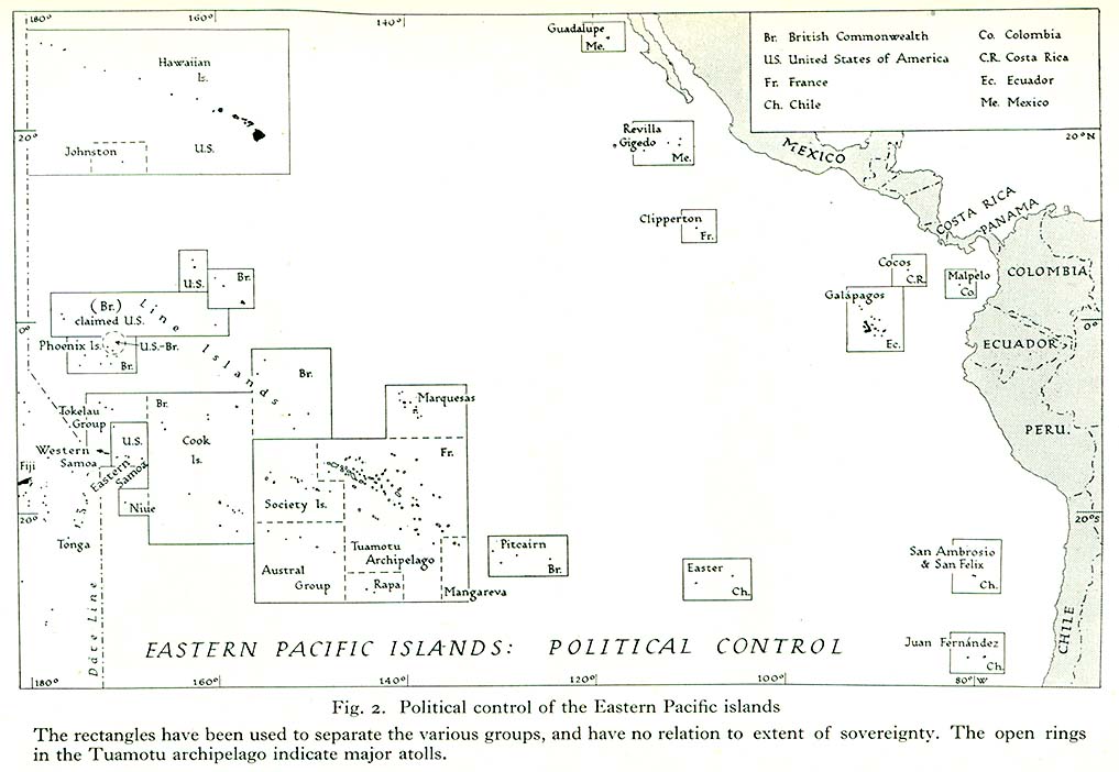
- Eastern Pacific: Political Control (124K)
The Outlying Islands (East of Long. 130°W)
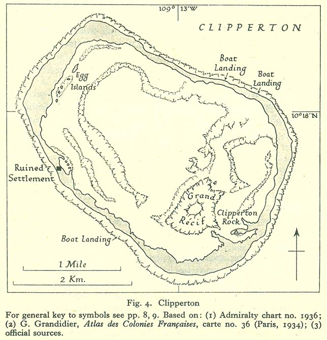
- Clipperton (110K)
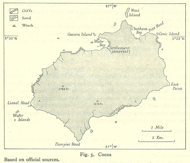
- Cocos (77K)
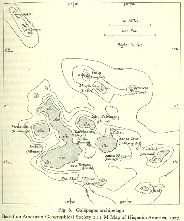
- Galápagos Archipelago (105K)
- Currents and Sea Temperatures, Garúa Season (105K)
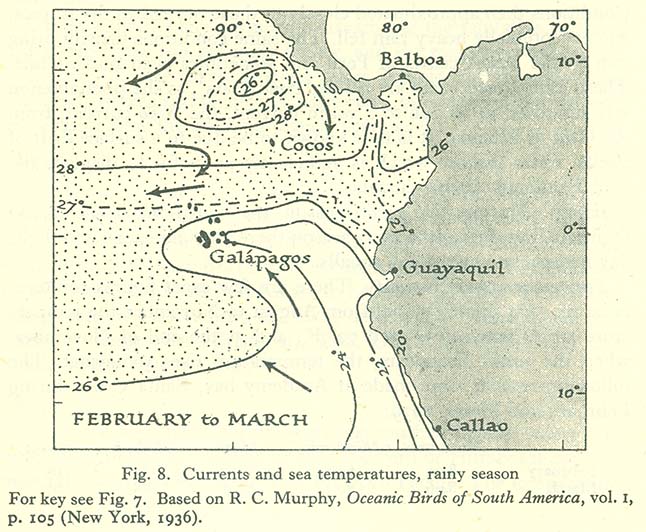
- Currents and Sea Temperatures, Rainy Season (117K)
- Currents and Sea Temperatures in a Niño Year (118K)
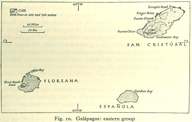
- Galápagos: Eastern Group (54K)
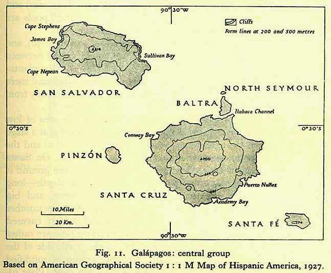
- Galápagos: Central Group (62K)
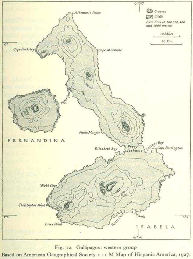
- Galápagos: Western Group (94K)
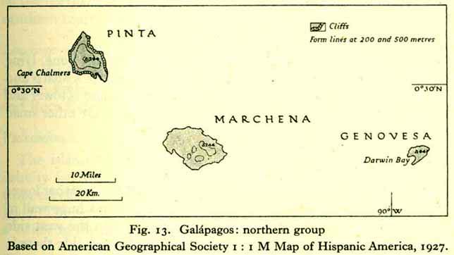
- Galápagos: Northern Group (41K)
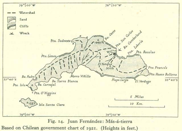
- Juan Fernández: Más-á-tierra (59K)
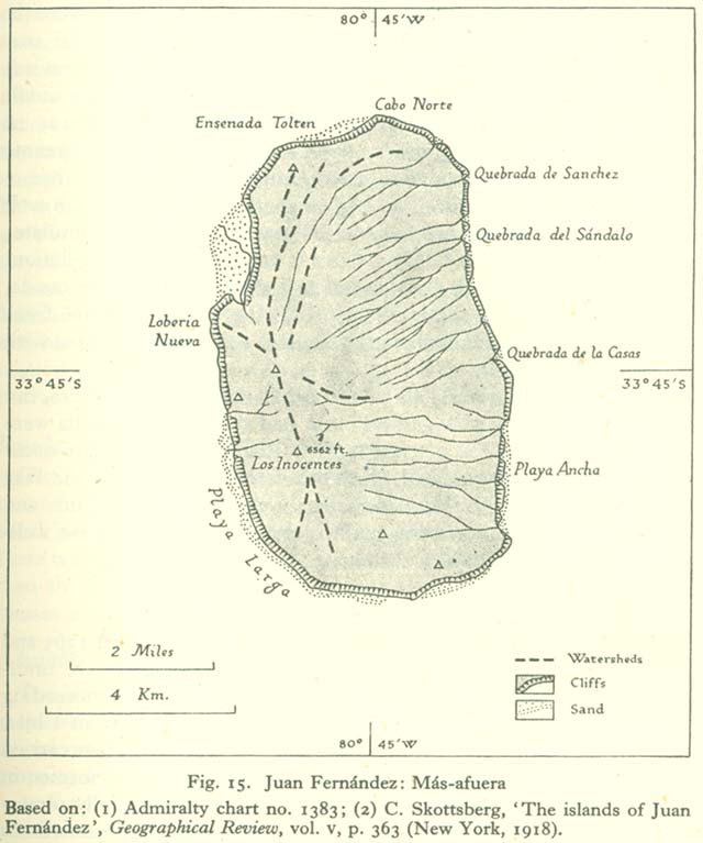
- Juan Fernández: Más-afuera (78K)
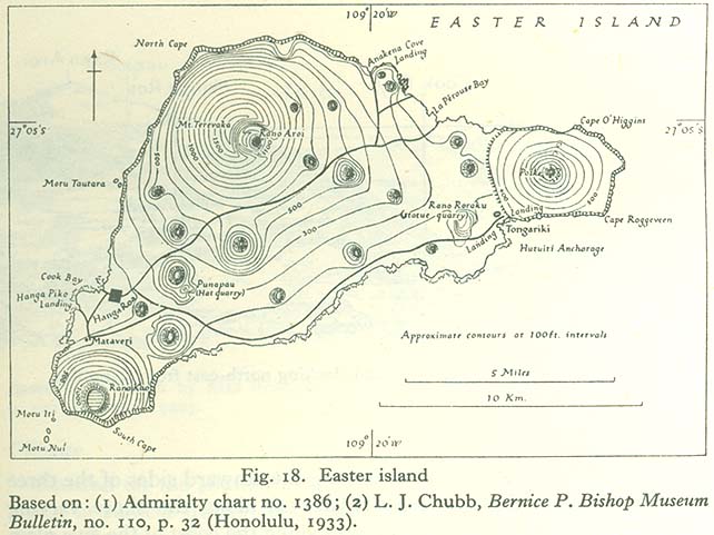
- Easter Island (84K)
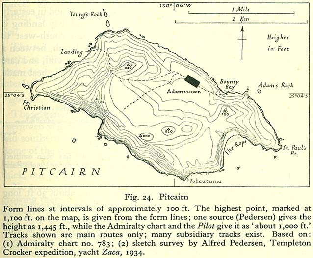
- Pitcairn (109K)
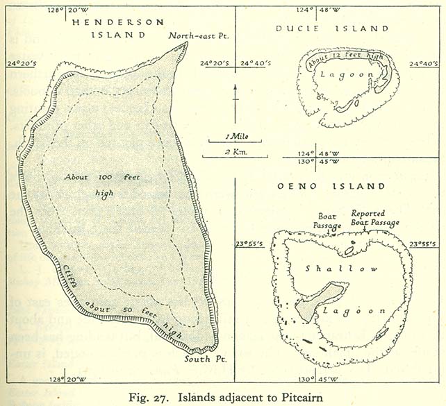
- Islands Adjacent to Pitcairn: Henderson Island, Ducie Island, Oeno Island (96K)
The Society Islands and Associated Groups
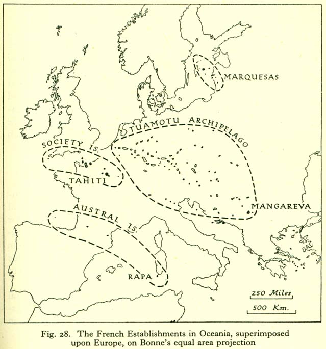
- The French Establishments in Oceania Superimposed upon Europe, on Bonne's Equal Area Projection (92K)
The Society Islands
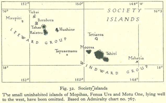
- The Society Islands (52K)
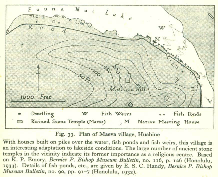
- Plan of Maeva Village, Huahine (183K)
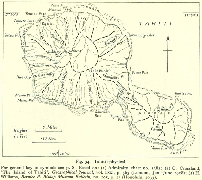
- Tahiti: Physical Map (121K)
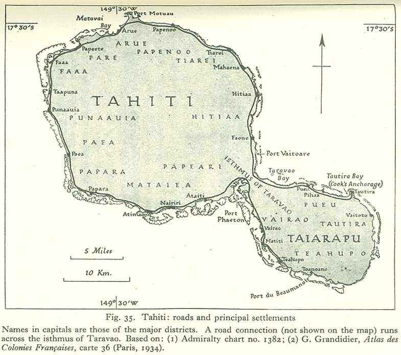
- Tahiti: Roads and Pricipal Settlements (102K)
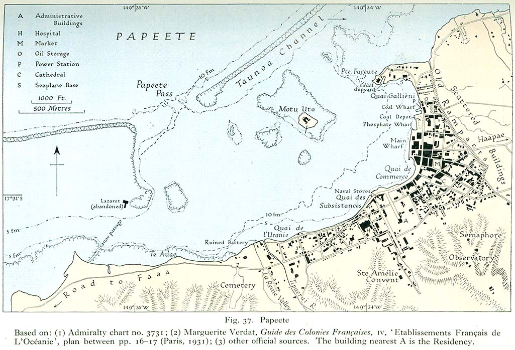
- Papeete (190K)
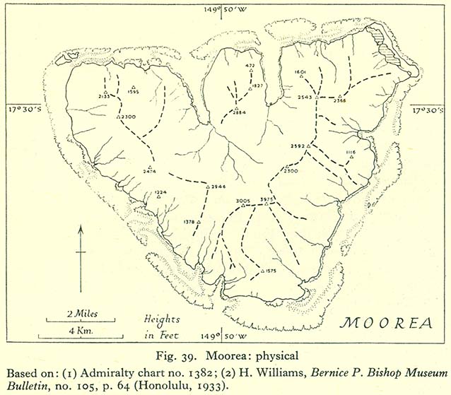
- Moorea: Physical Map (90K)
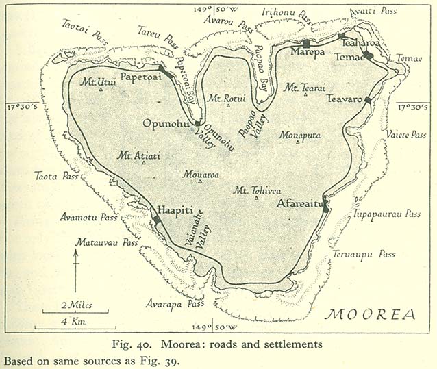
- Moorea: Roads and Settlements (121K)
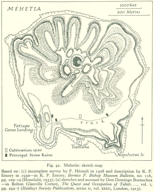
- Mahetia: Sketch Map (142K)
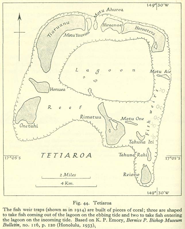
- Tetiaroa (92K)
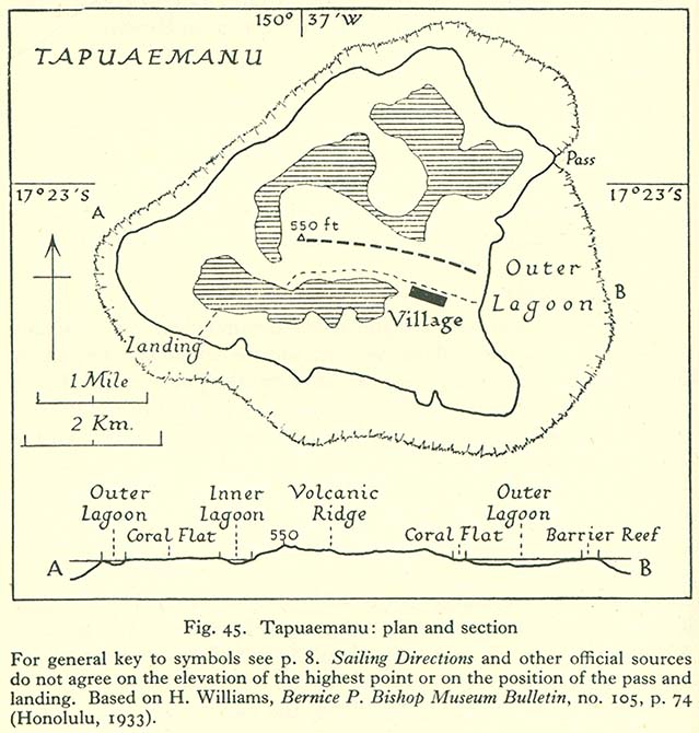
- Tapuaemanu: Plan and Section (107K)
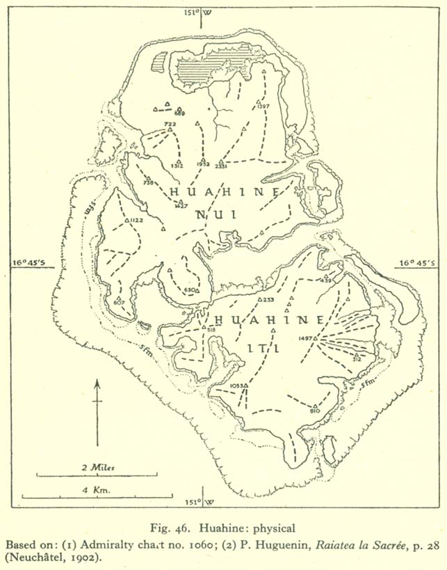
- Huahine: Physical Map (96K)
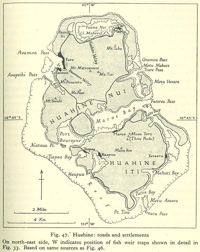
- Huahine: Roads and Settlements (138K)
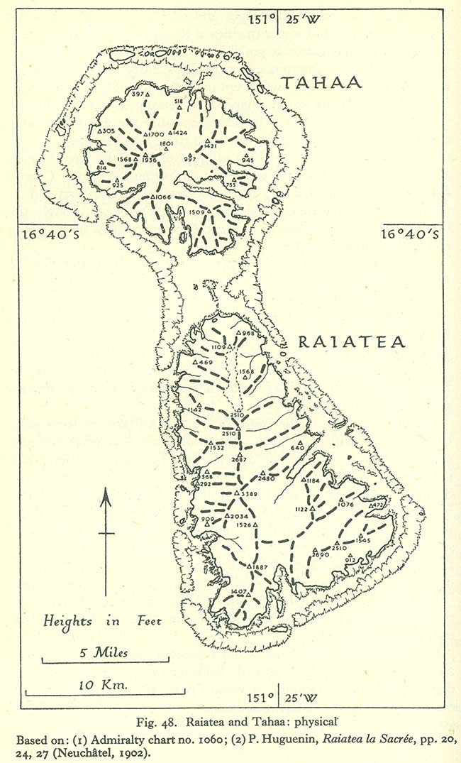
- Raiatea and Tahaa: Physical Map (140K)
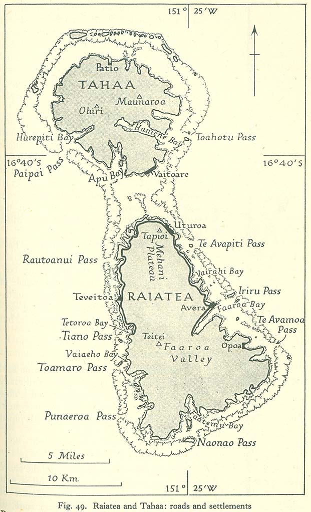
- Raiatea and Tahaa: Roads and Settlements (142K)
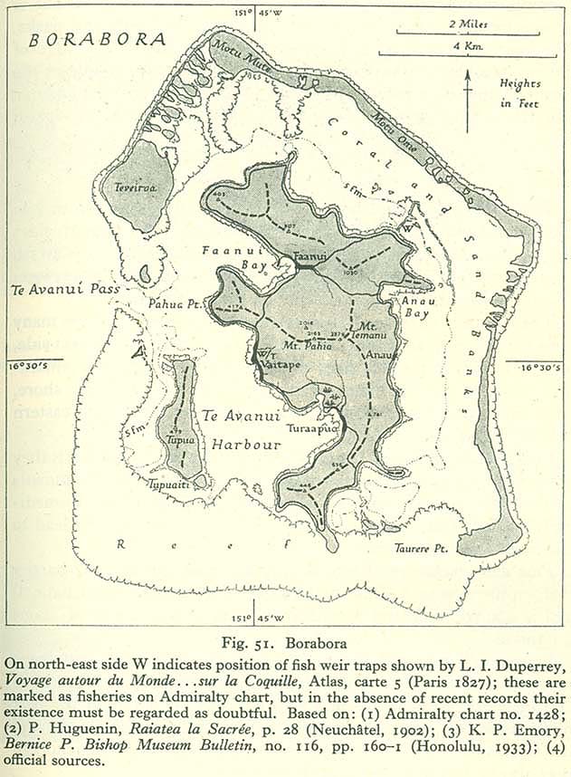
- Borabora (130K)
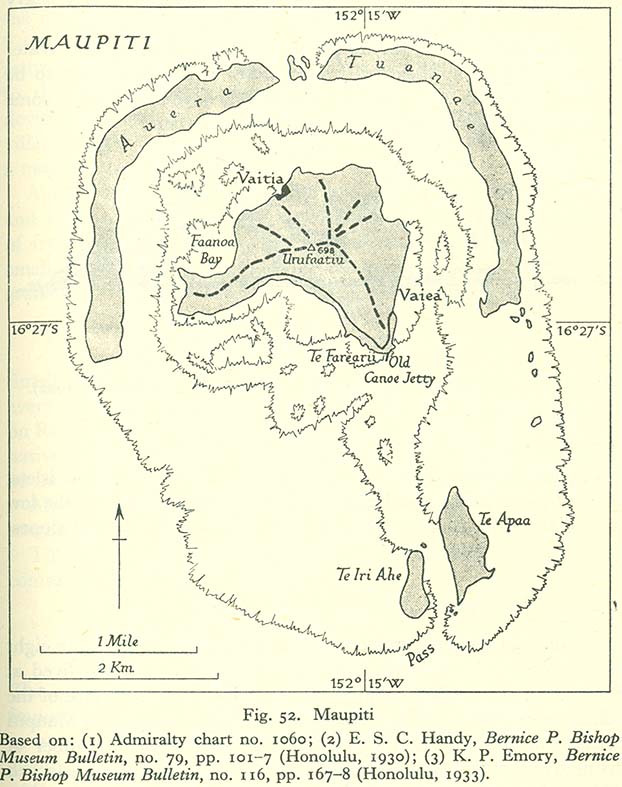
- Maupiti (112K)
The Tuamotu Archipelago
- Tuamotu Archipelago (K)
- Makatea (129K)
- Fakarava (63K)
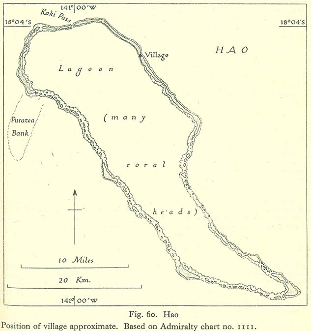
- Hao (70K)
The Mangareva Group, The Austral Islands and Rapa
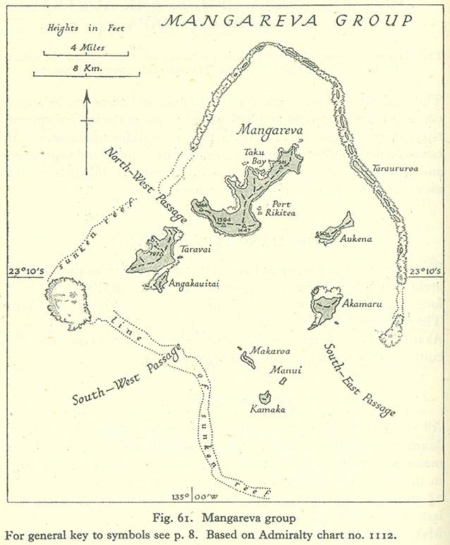
- Mangareva Group (88K)
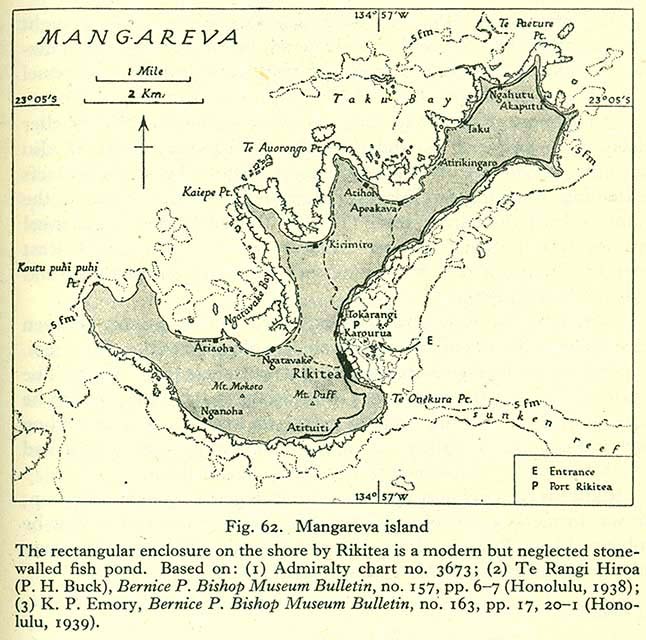
- Mangareva Island (121K)
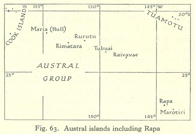
- Austral Islands Including Rapa (50K)
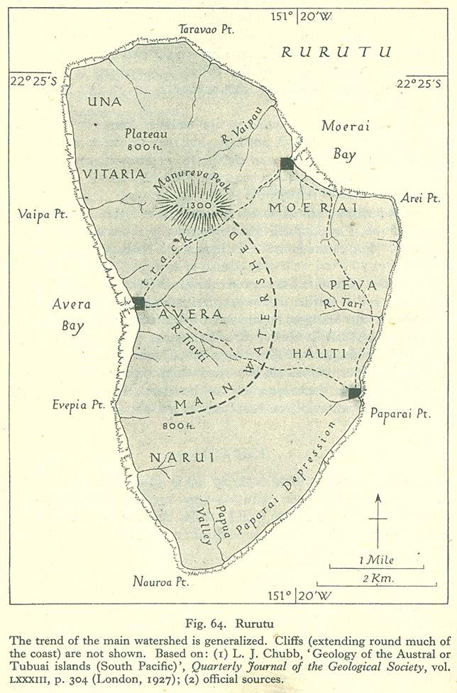
- Rurutu (149K)
- Tubuai (147K)
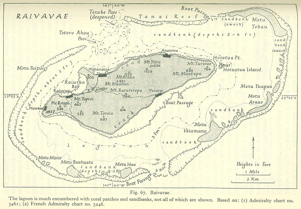
- Raivavae (171K)
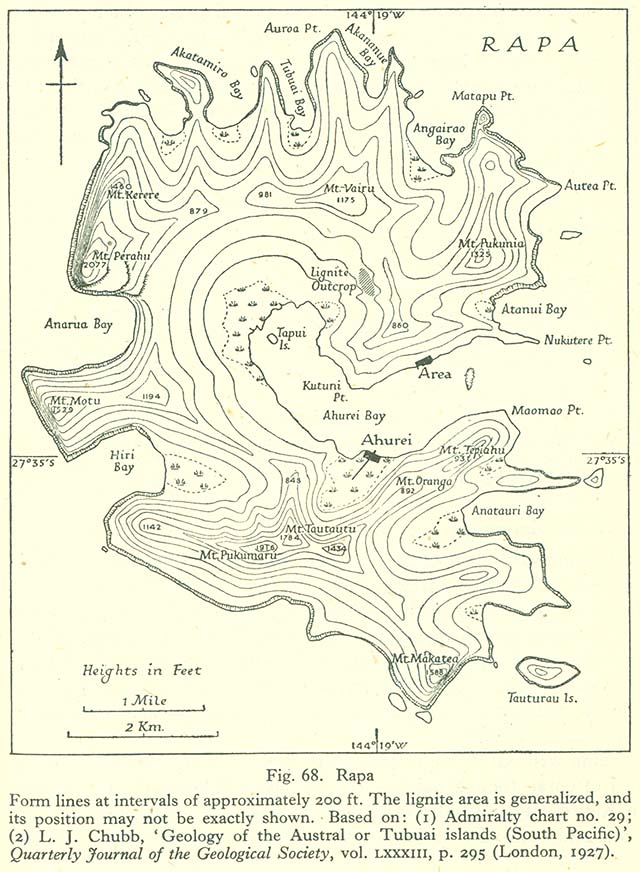
- Rapa (146K)
The Marquesas
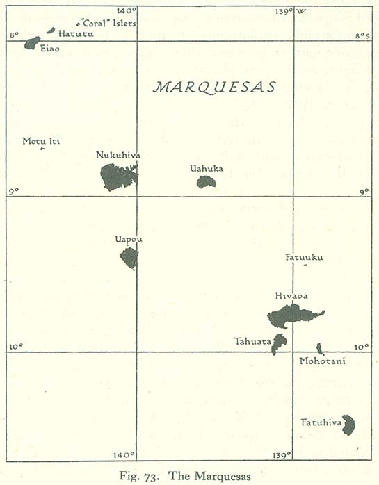
- Marquesas (52K)
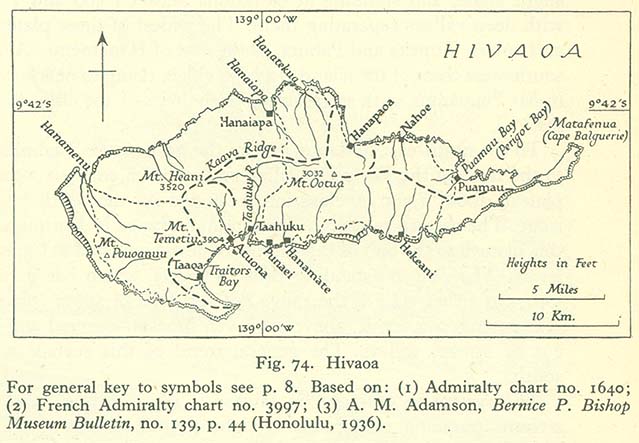
- Hivaoa (79K)
- Tahuata (86K)
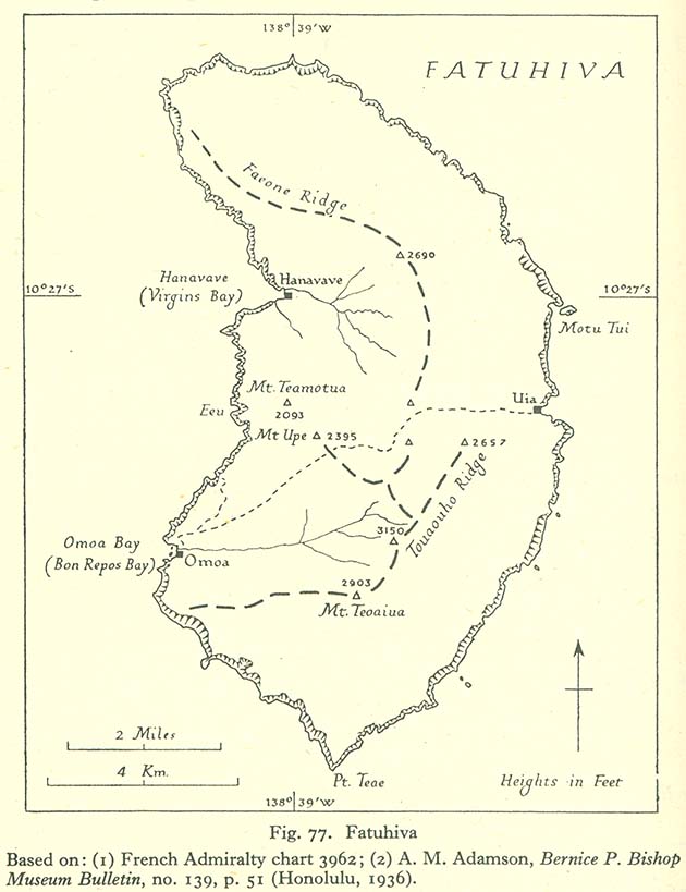
- Fatuhiva (85K)
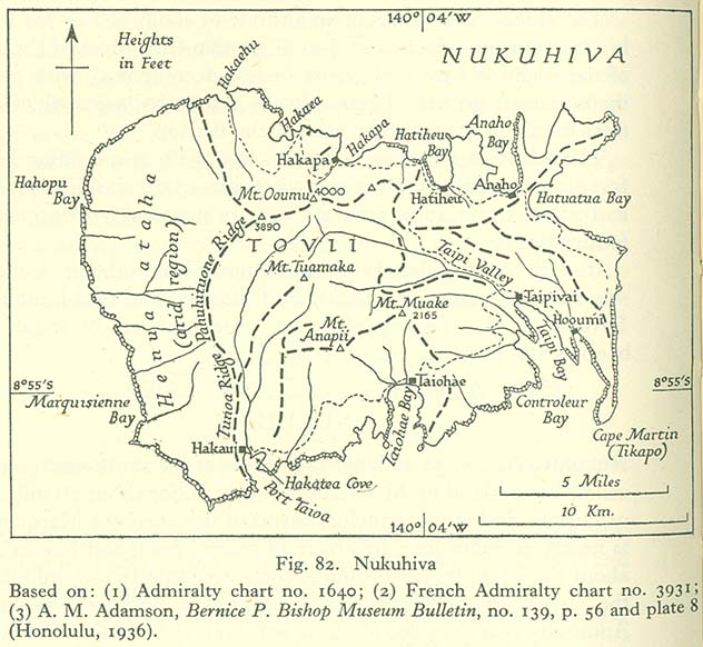
- Nukuhiva (105K)
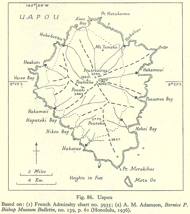
- Uapou (95K)
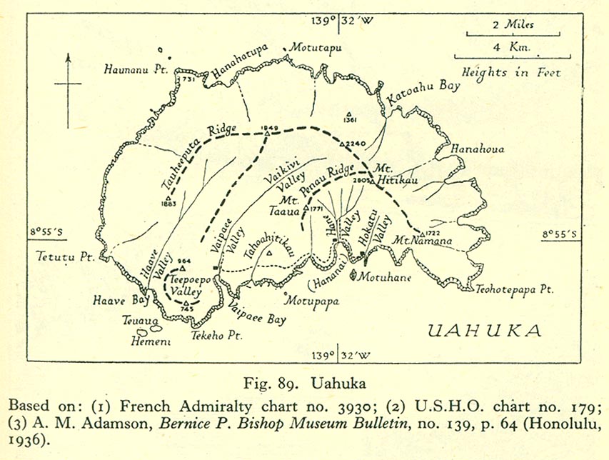
- Uahuka (79K)
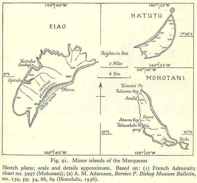
- Minor Islands of the Marquesas (89K)
General Review of the Hawaiian Group
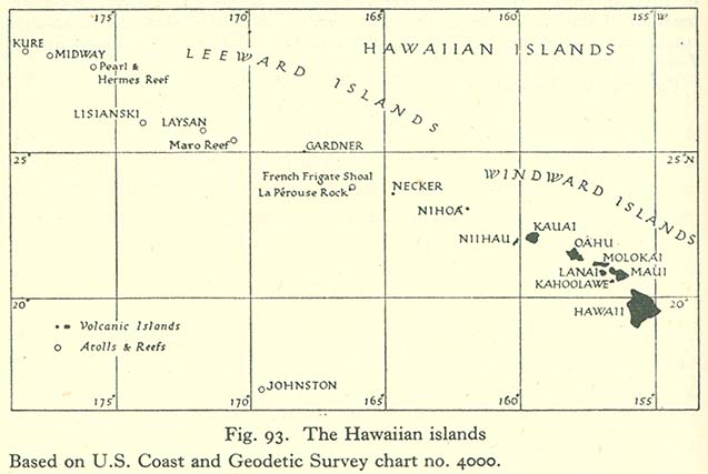
- The Hawaiian Islands (58K)
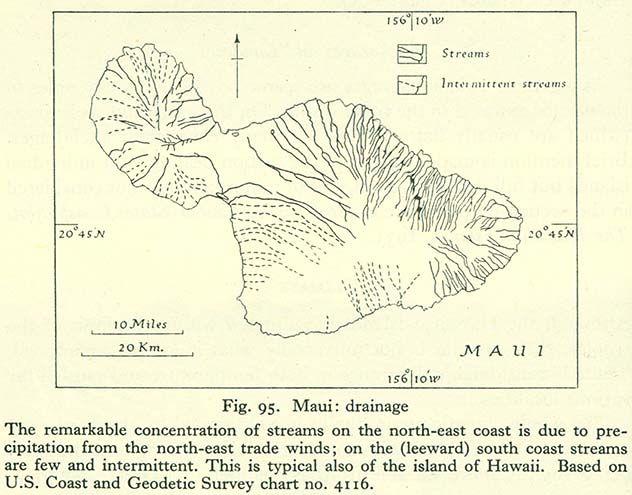
- Maui: Drainage (83K)
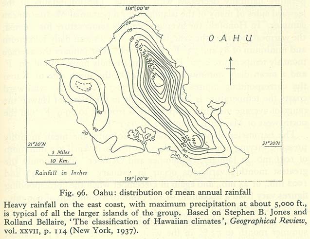
- Oahu: Distribution of Mean Annual Rainfall (58K)
- Artificial Irrigation in the Hawaiian Islands (67K)
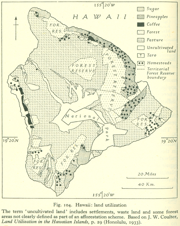
- Hawaii: Land Utilitzation (363K)
- Maui: Land Utilization (331K)
- Molokai: Land Utilization (234K)
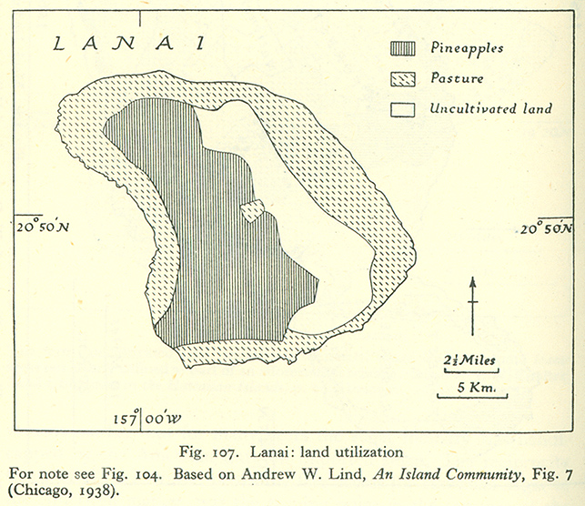
- Lanai: Land Utilization (262K)
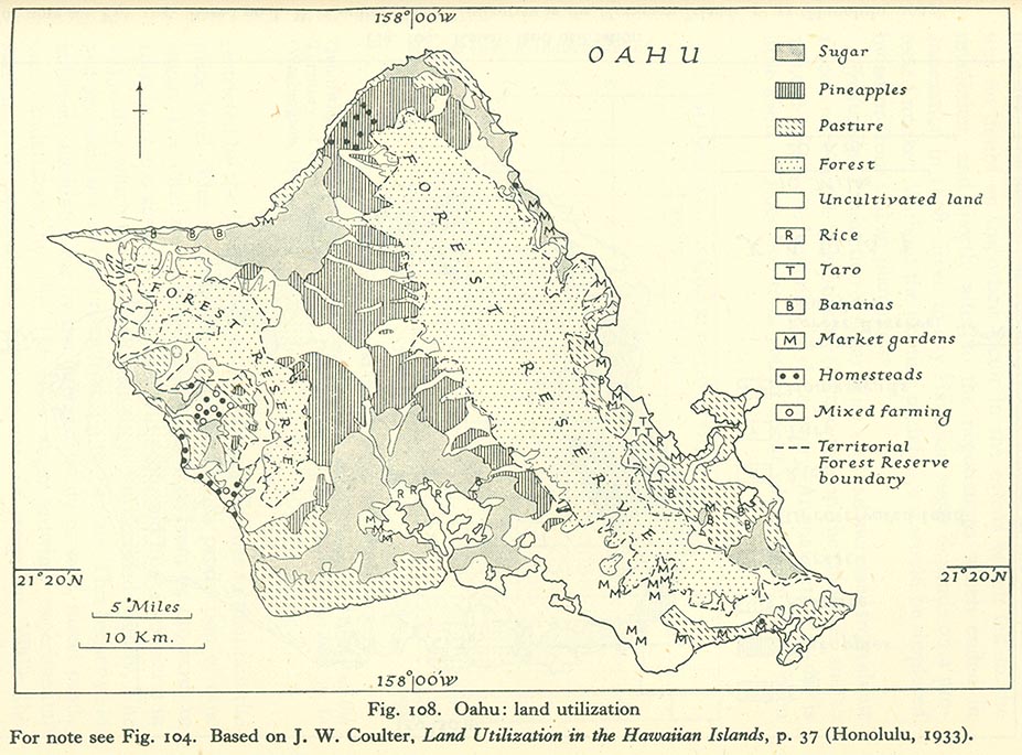
- Oahu: Land Utilization (171K)
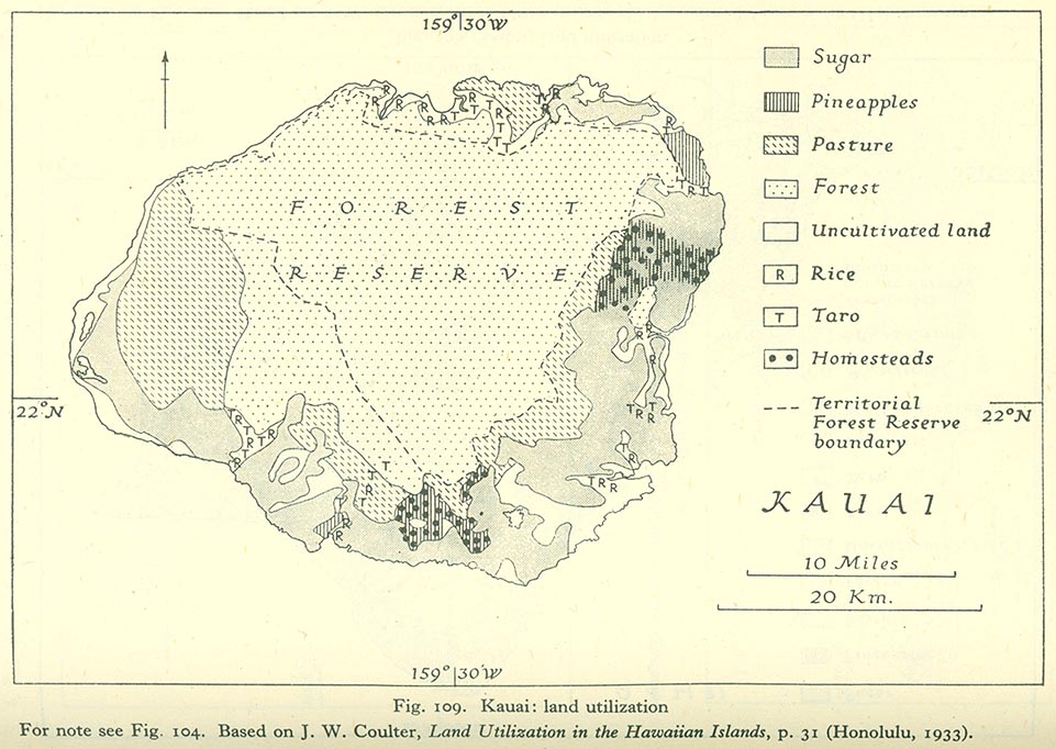
- Kauai: Land Utilization (158K)
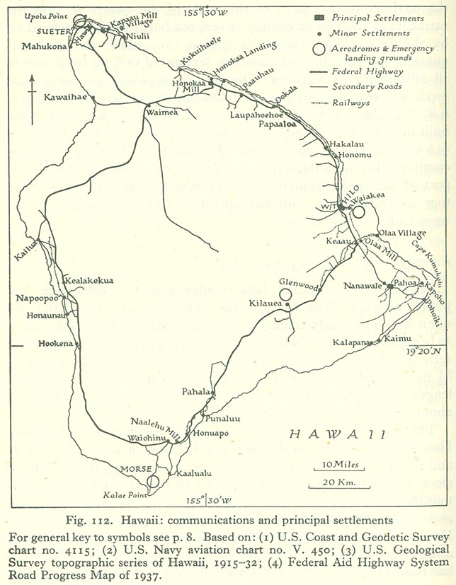
- Hawaii: Communications and Principal Settlements (121K)
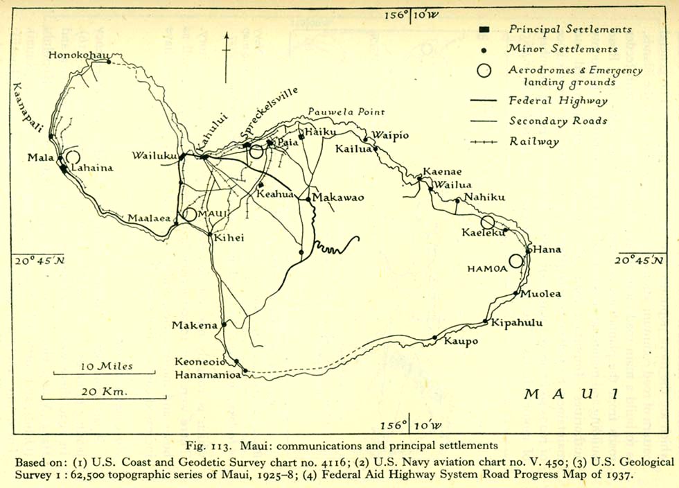
- Maui: Communications and Principal Settlements (115K)
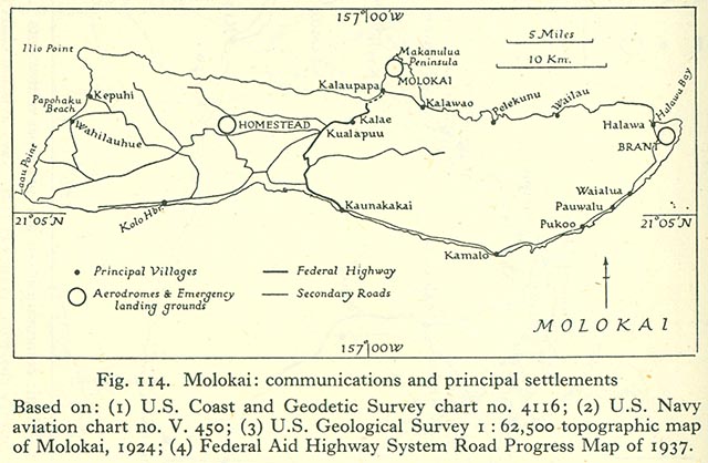
- Molokai: Communications and Principal Settlements (87K)
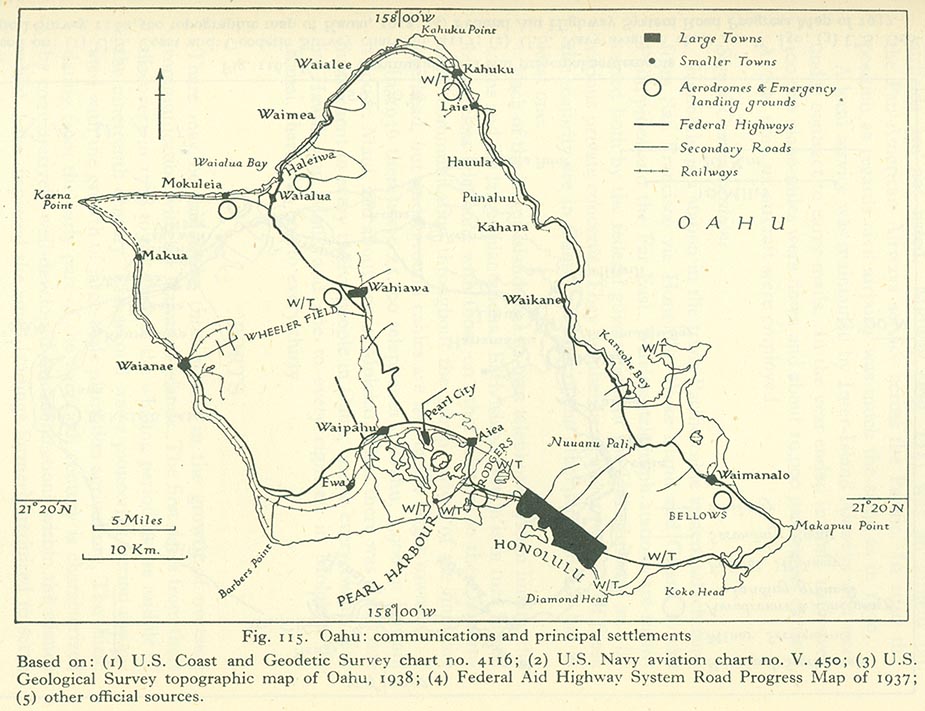
- Oahu: Communications and Principal Settlements (158K)
- Kauai: Communications and Principal Settlements (136K)
- Principal Ports and Landings in the Hawaiian Islands (87K)
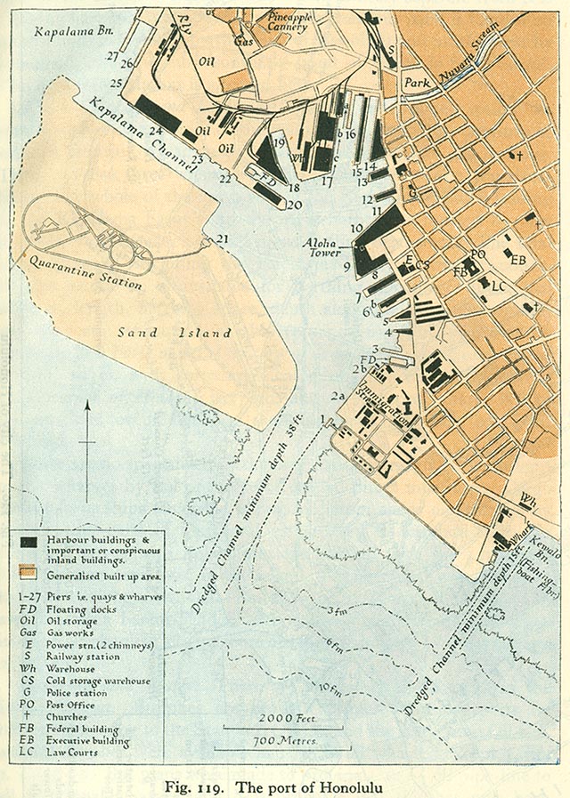
- The Port of Honolulu (223K)
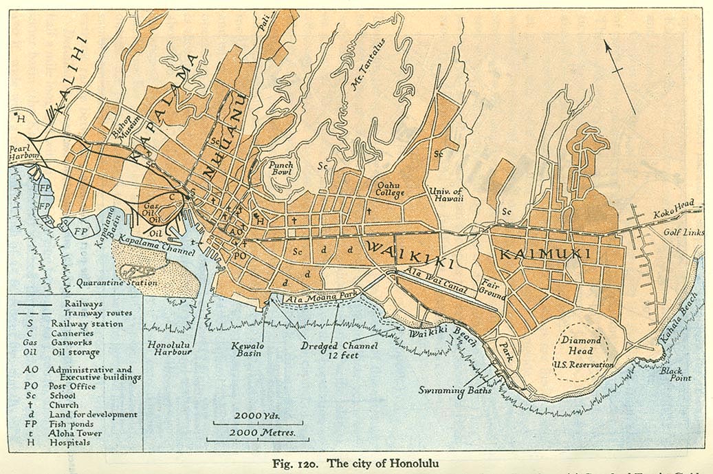
- The City of Honolulu (238K)
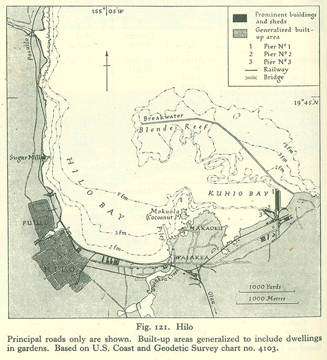
- Hilo (147K)
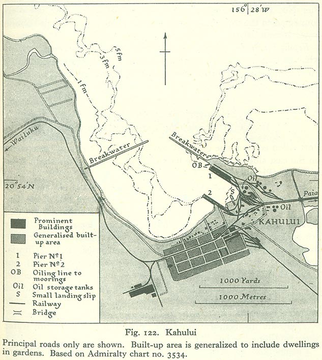
- Kahului (146K)
Individual Islands of the Hawaiian Group, and Johnston Island
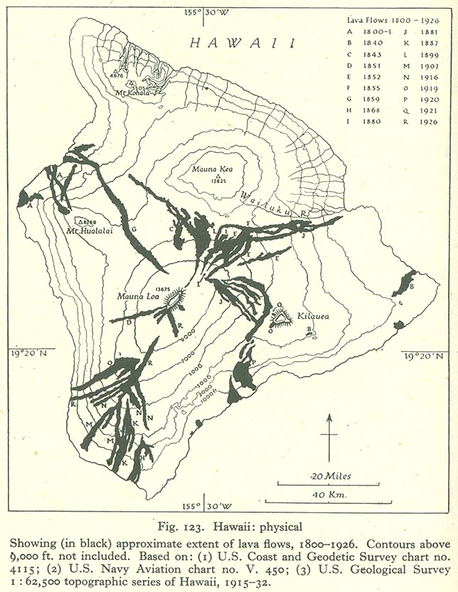
- Hawaii: Physical Map (145K)
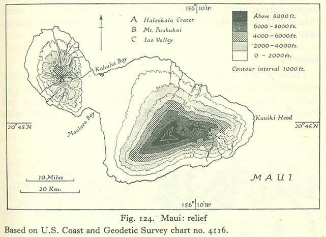
- Maui: Relief Map (86K)
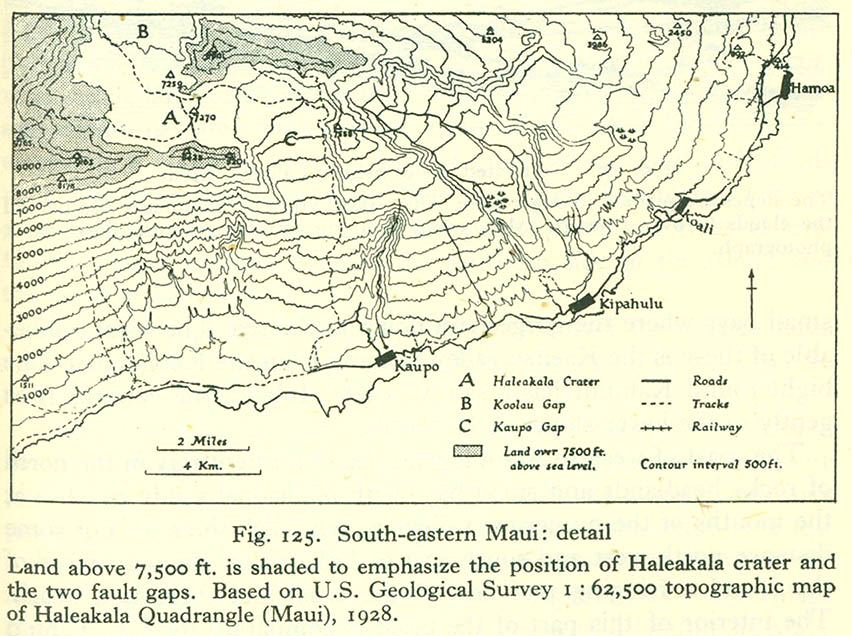
- South-Eastern Maui: Detail (121K)
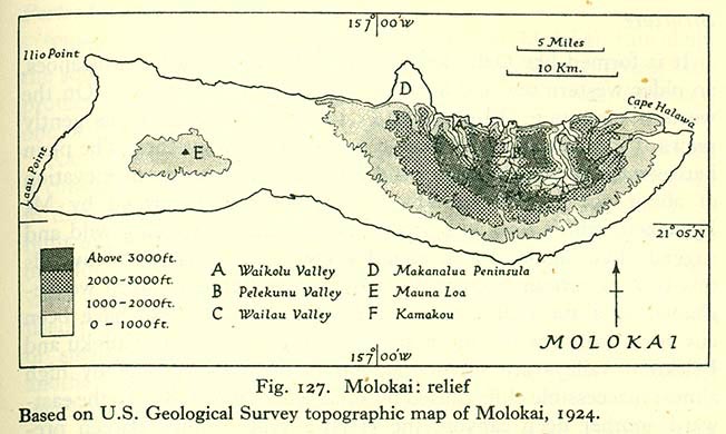
- Molokai: Relief Map (75K)
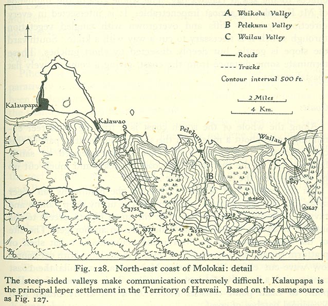
- North-East Coast of Molokai: Detail (138K)
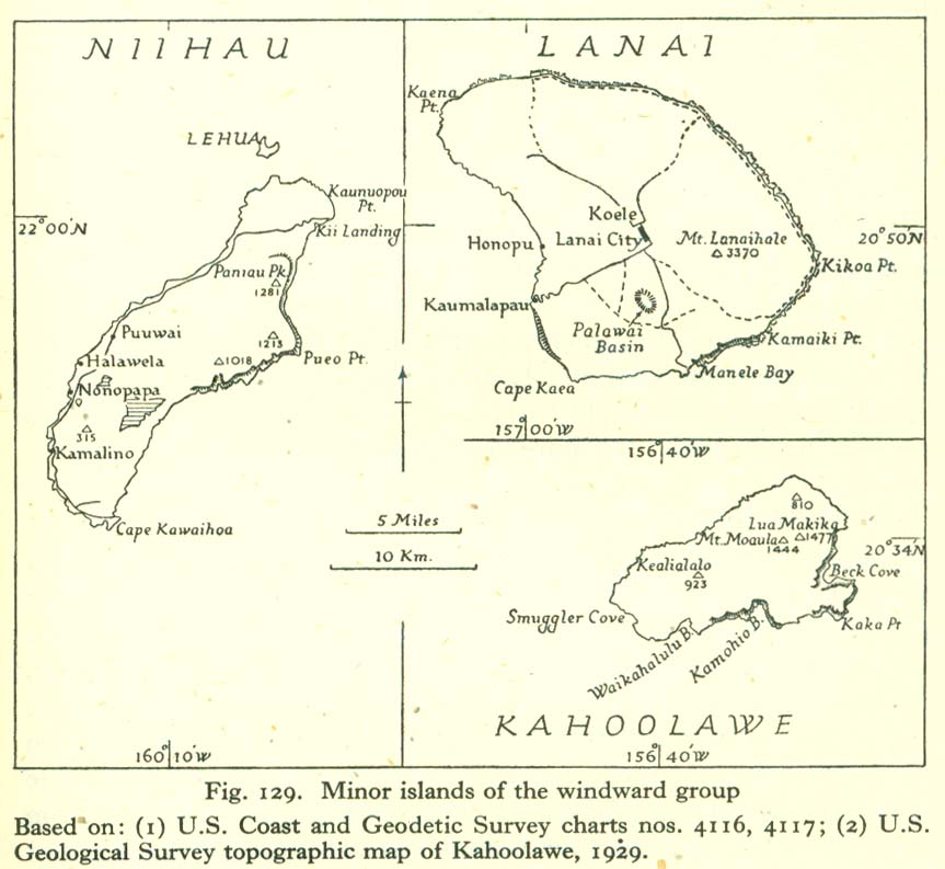
- Minor Islands of the Windward Group (100K)
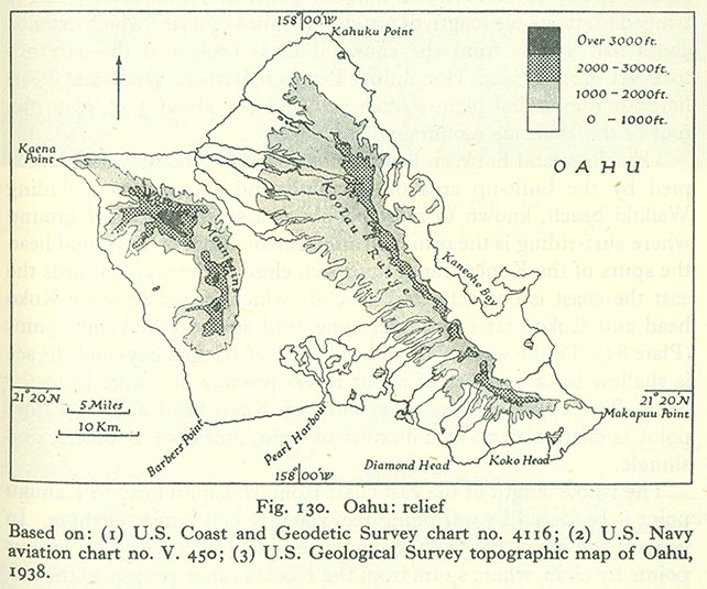
- Oahu: Relief Map (108K)
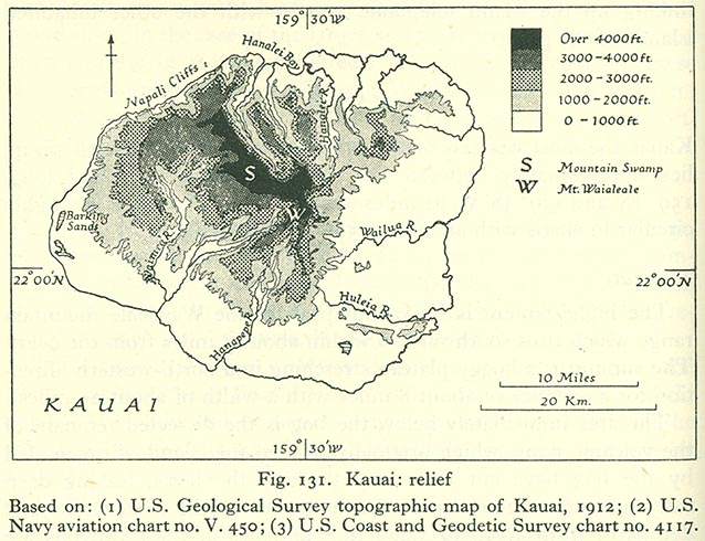
- Kauai: Relief Map (106K)
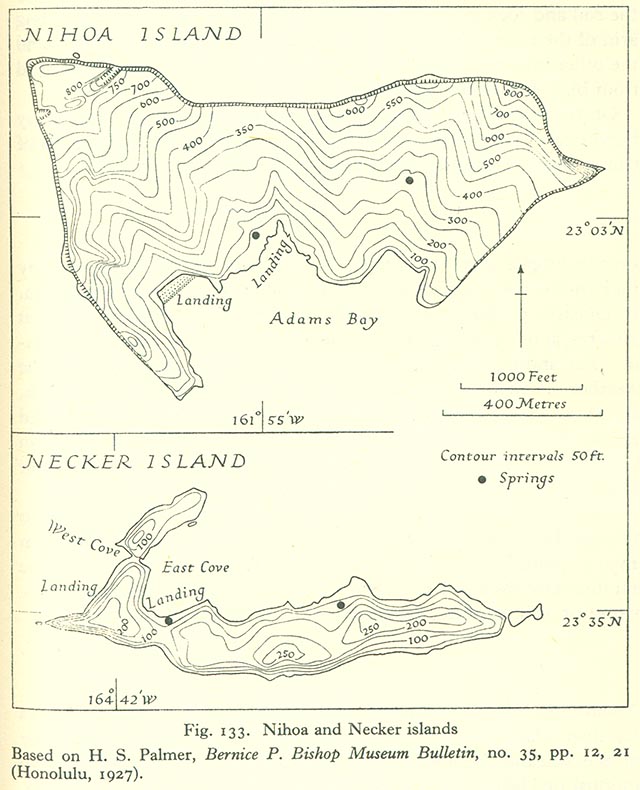
- Nihoa and Necker Islands (116K)
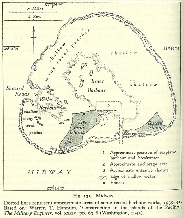
- Midway (138K)
The Central Equatorial Islands
- Central Equatorial Islands and Adjacent Groups (84K)
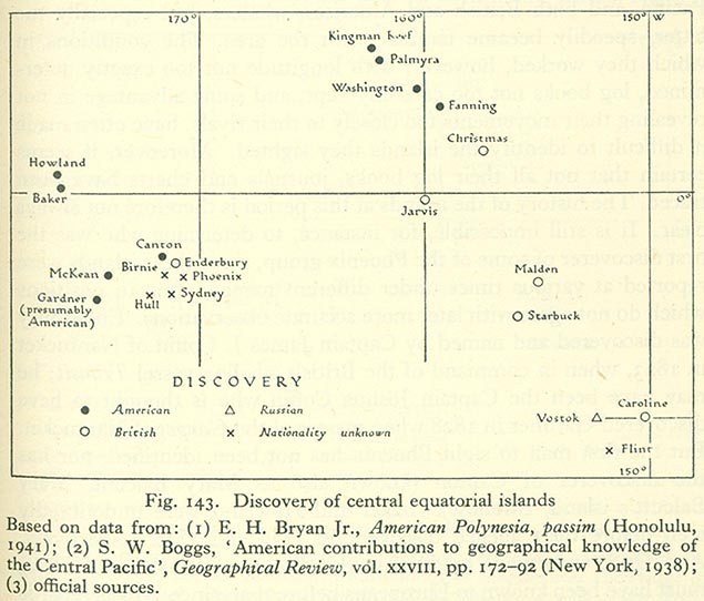
- Discovery of Central Equatorial Islands (84K)
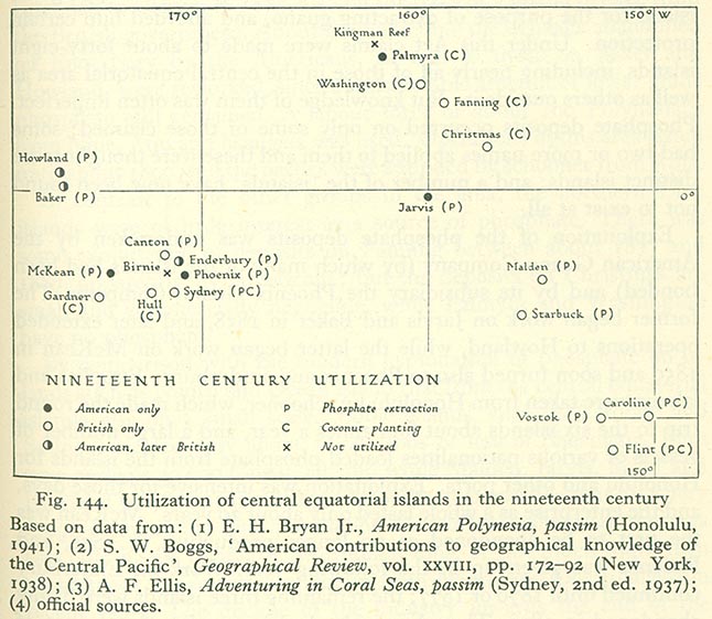
- Utilization of Central Equatorial Islands in the Nineteenth Century (100K)
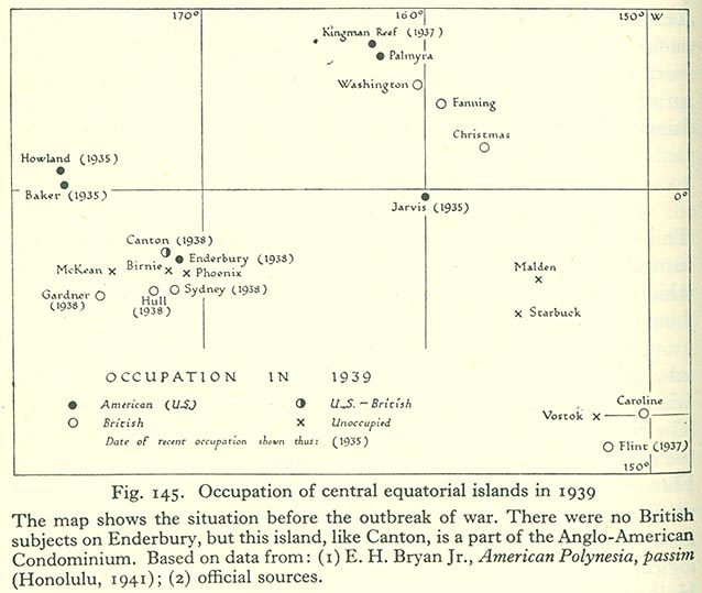
- Occupation of Central Equatorial Islands in 1939 (82K)
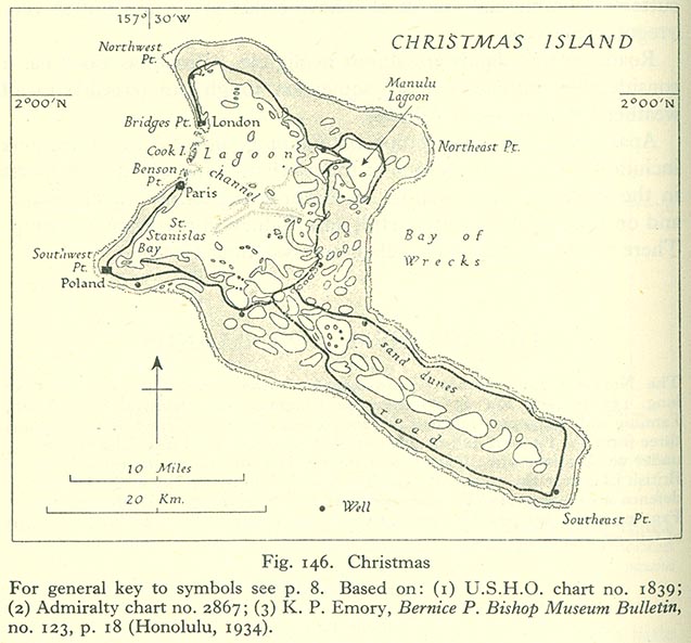
- Christmas Island (101K)
- Fanning Island (98K)
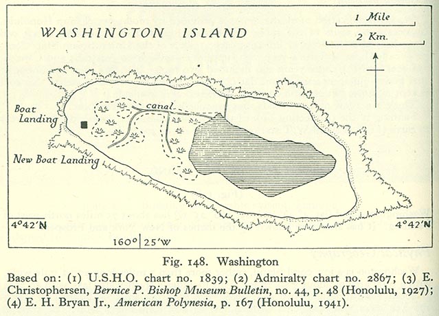
- Washington Island (92K)
- Malden (119K)
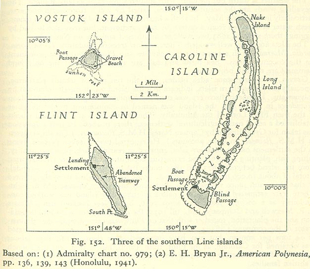
- Three of the Southern Line Islands: Caroline, Flint, Vostok (92K)
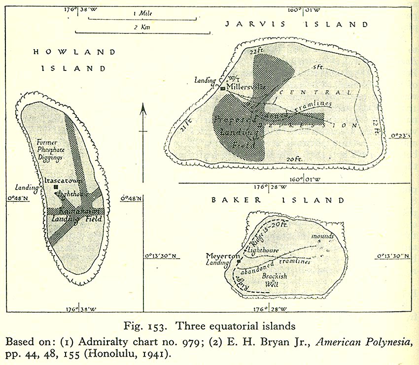
- Three Equitorial Islands: Howland, Jervis, Baker (97K)
- Canton Island (110K)
- Four Islands of the Phoenix Island Group: Enderbury, Gardner, Hull, Sydney (126K)
The Tokelau Gropu, The Cook Islands and Niue
- The Tokelaou Group: Atafu, Fakaofu, Nukunono (109K)
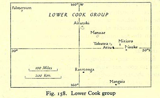
- Lower Cook Group (46K)
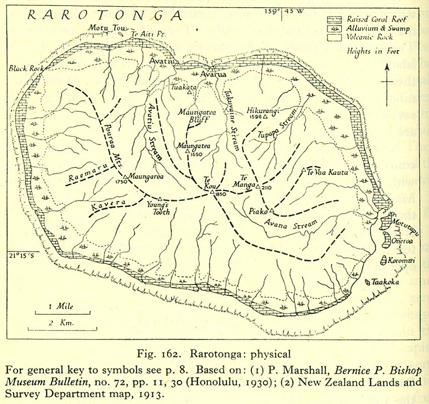
- Rarotonga: Physical (125K)
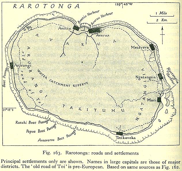
- Rarotonga: Roads and Settlements (135K)
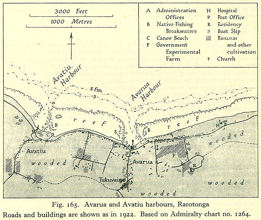
- Avarua and Avatiu Harbours, Rarotonga (119K)
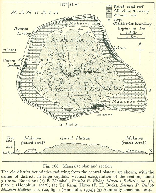
- Mangaia: Plan and Section (177K)
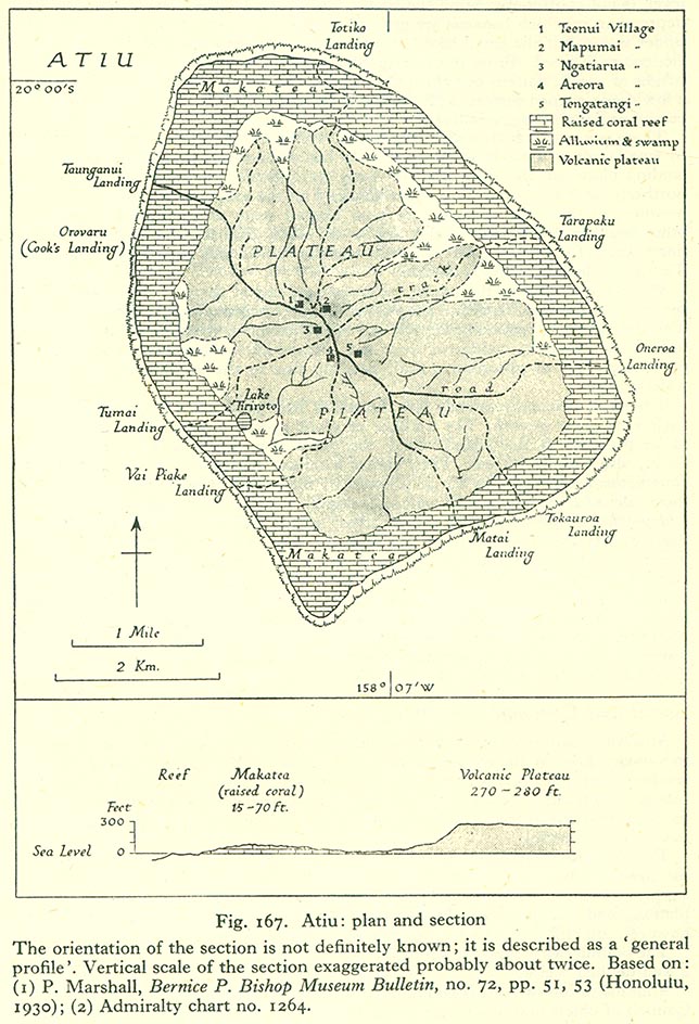
- Atiu: Plan and Section (171K)
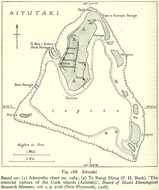
- Aitutaki (124K)
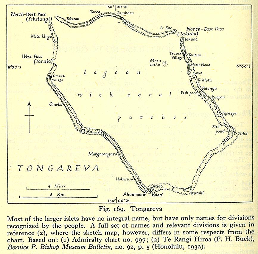
- Tongareva (101K)
- Manihiki (98K)
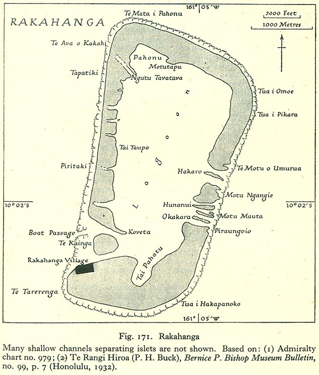
- Rakahanga (131K)
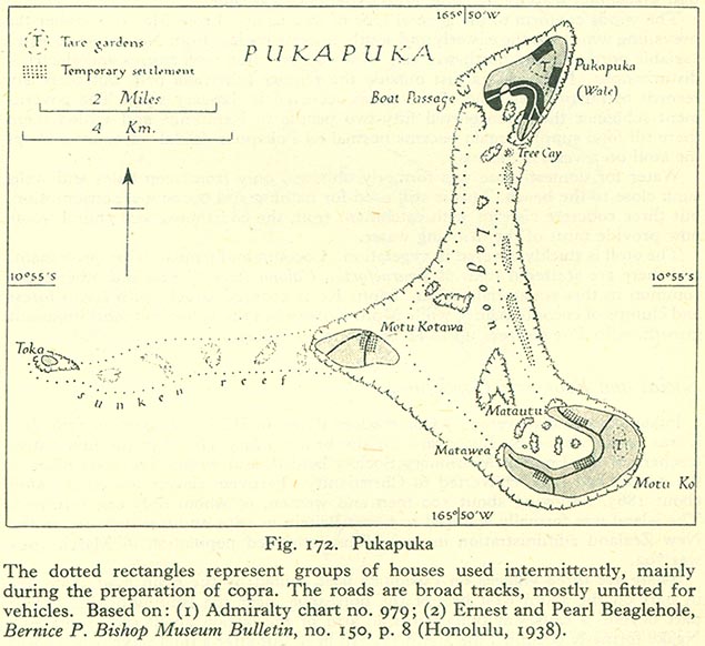
- Pukapuka (101K)
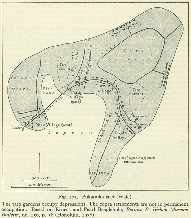
- Pukapuka Islet (Wale) (137K)
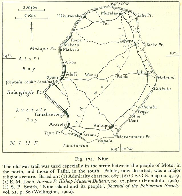
- Niue (123K)
General Review of the Samoa Group
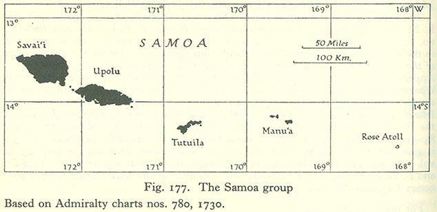
- The Samoa Group (49K)
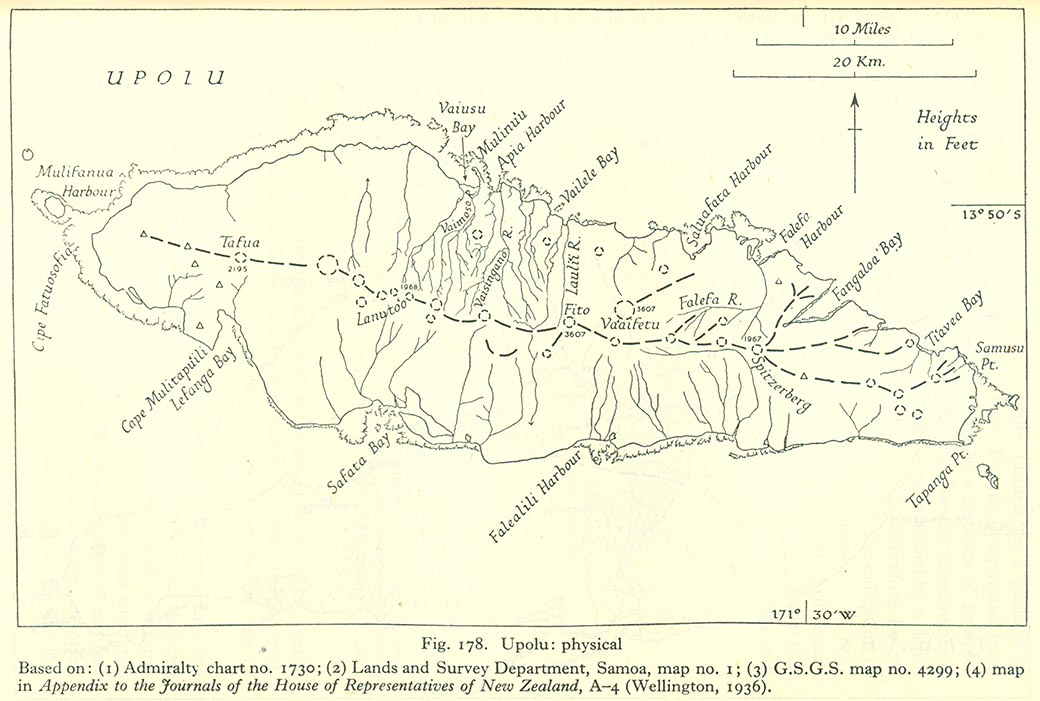
- Upolu: Physical Map (141K)
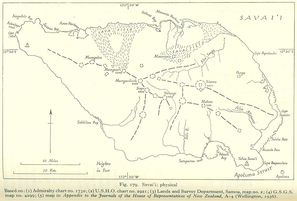
- Savaiˁi: Physical Map (133K)
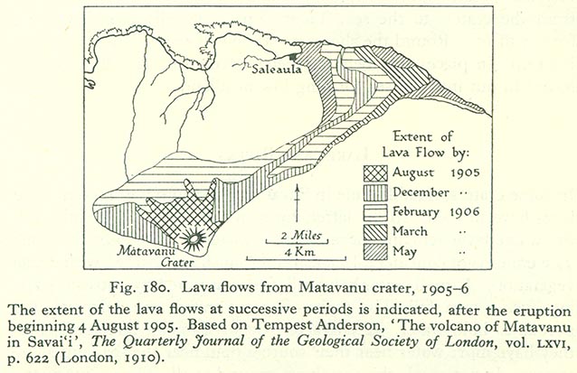
- Lava Flows from Matavanu Crater, 1905-1906 (83K)
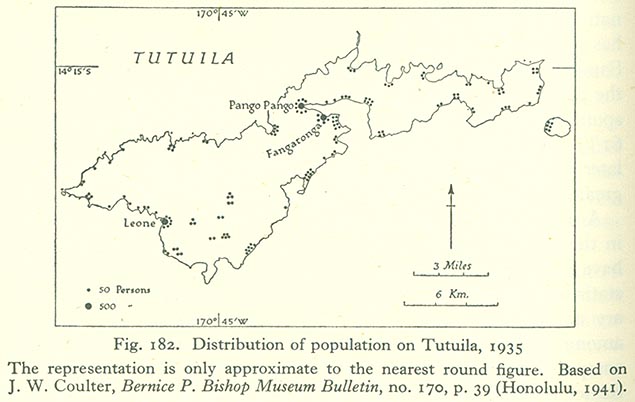
- Distribution of population on Tutuila, 1935 (62K)
The Samoa Group
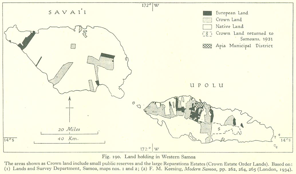
- Land Holding in Western Samoa (103K)
- Apia (411K)
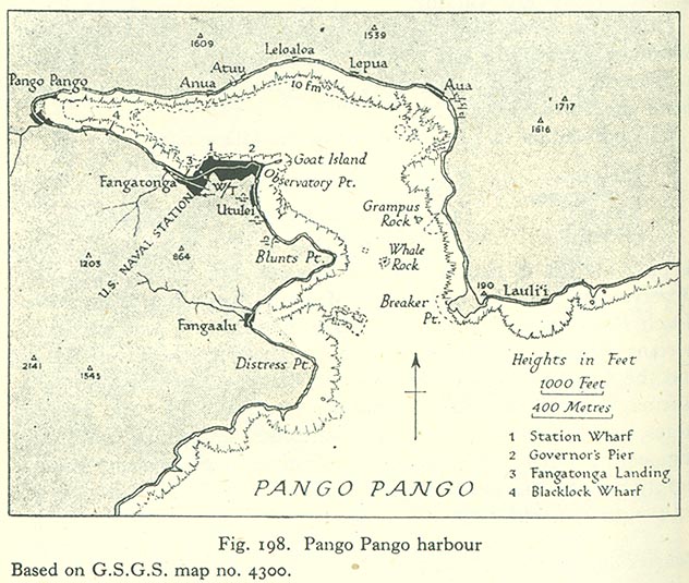
- Pango Pango Harbour (121K)
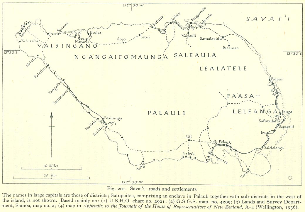
- Savaiˁi: Roads and Settlments (132K)
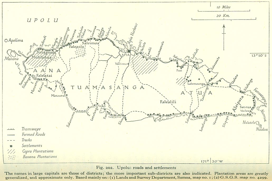
- Upolu: Roads and Settlements (137K)
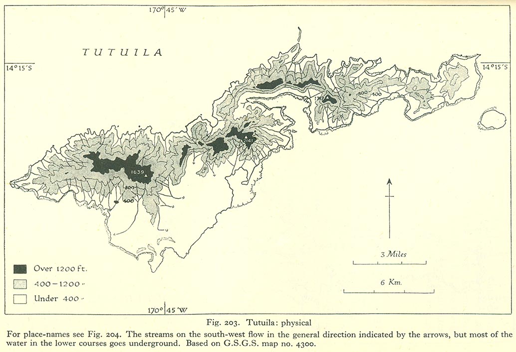
- Tutuila: Physical Map (142K)
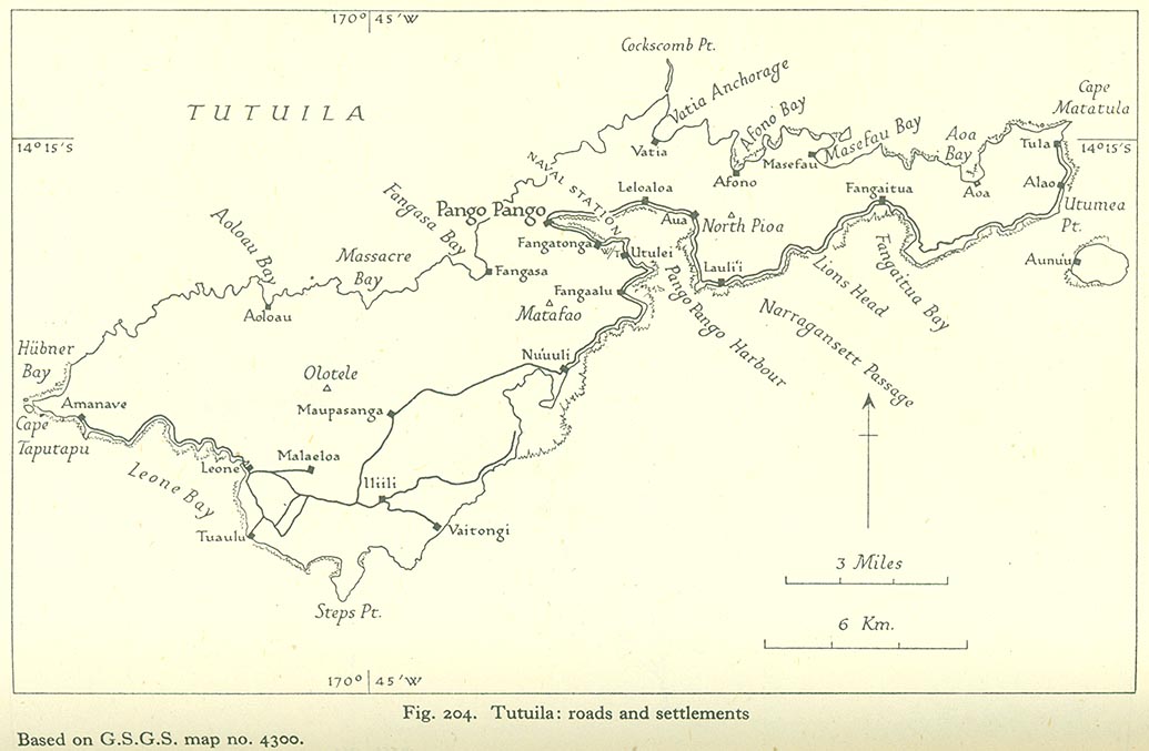
- Tutuila: Roads and Settlments (110K)
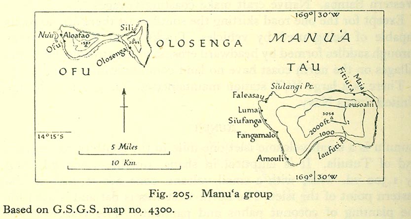
- Manuˁa Group (79K)
Volume III : Western Pacific (Tonga to Solomon Islands) 1944
Introduction
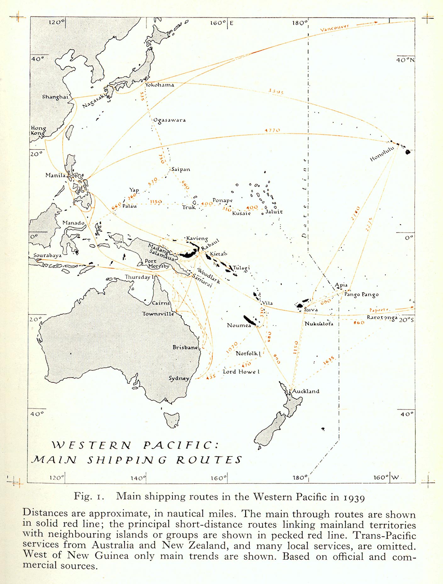
- Main Shipping Routes in the Western Pacific in 1939 (369K)
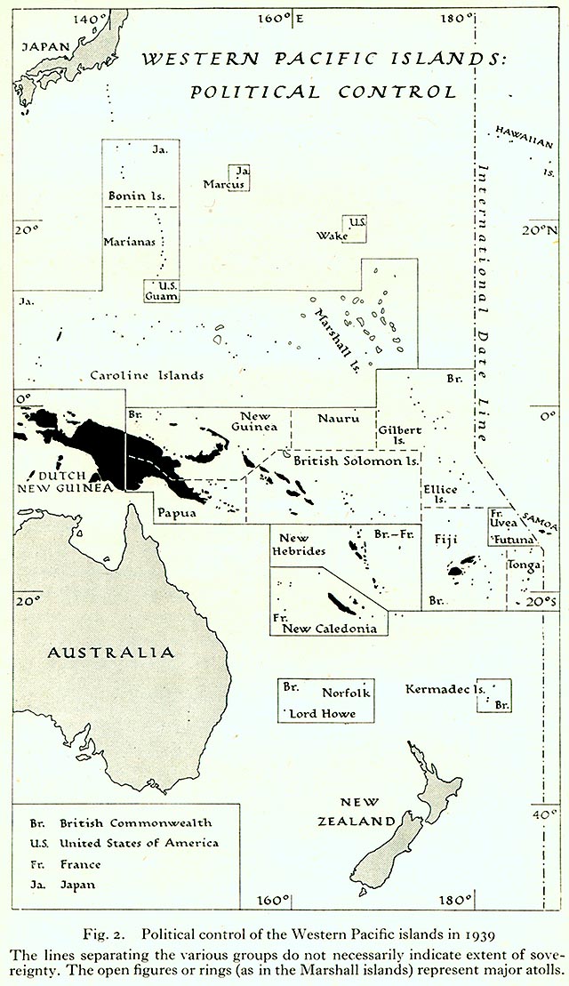
- Political Control of the Western Pacific Islands in 1939 (167K)
Tonga
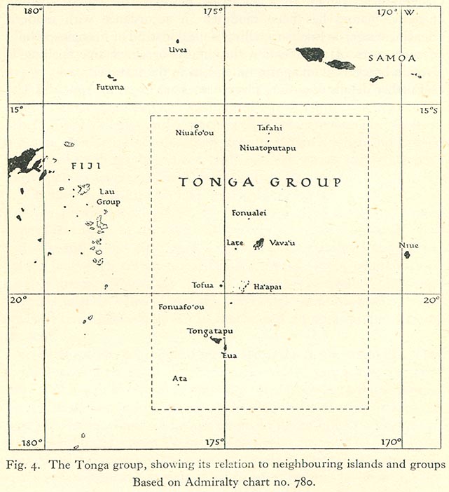
- The Tonga Group "showing its relation to neighbouring islands and groups" (92K)
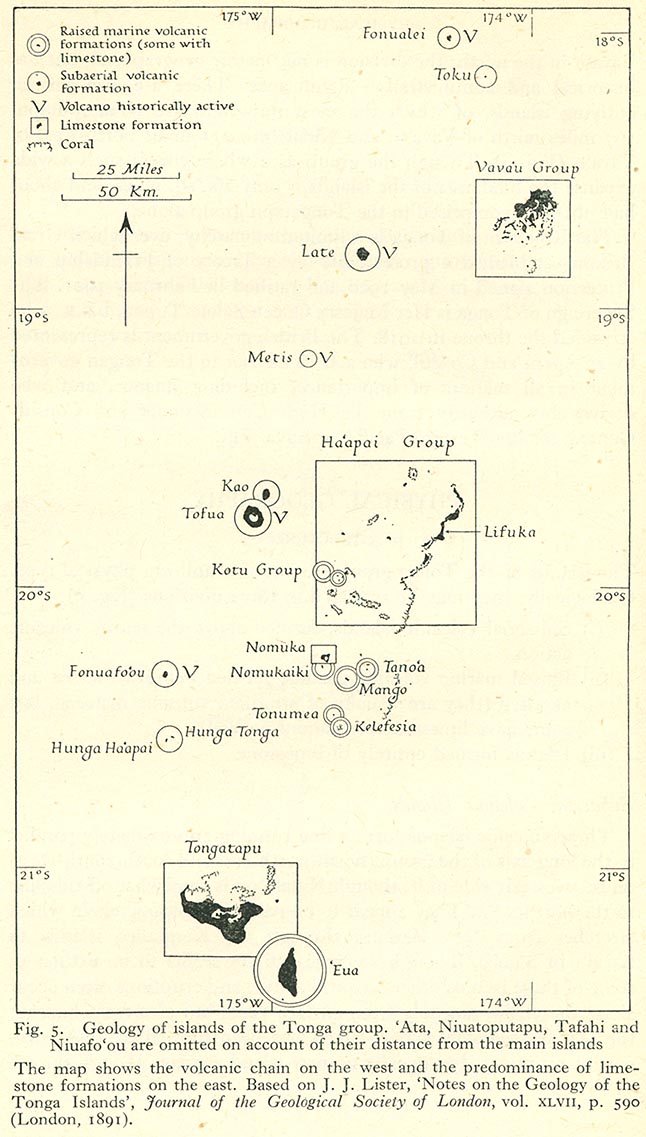
- Geology of islands of the Tonga group. ˁAta, Niuatoputapu, Tafahi and Niuafo'o are omitted on account of their distance from the main islands. (142K)
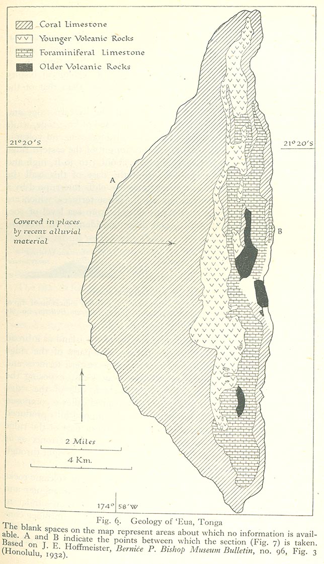
- Geology of ˁEua, Tonga (183K)
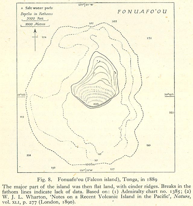
- Fonuafoˁou (Falcon Island), Tonga, in 1889 (105K)
- Fonuafoˁou (Falcon Island), Tonga, in 1928 (100K)
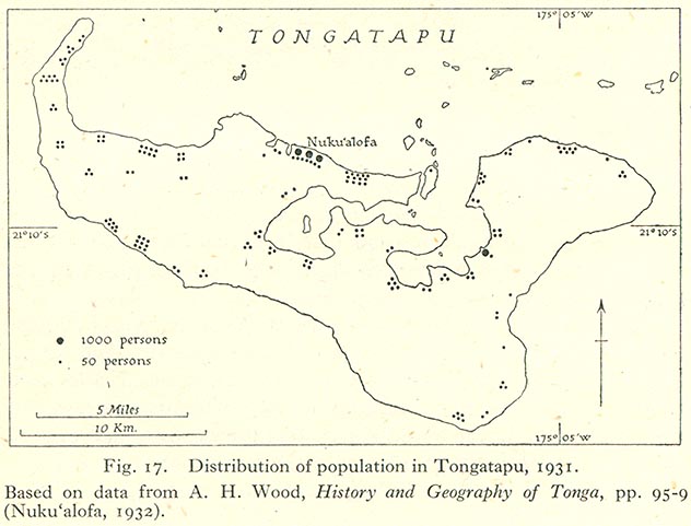
- Distribution of Population in Tongatapu, 1931 (73K)
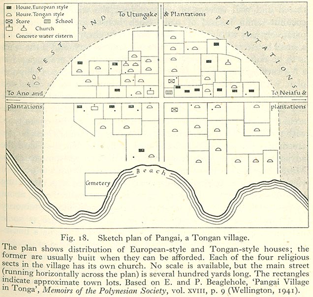
- Sketch plan on Pangai, a Tongan Village. (134K)
- Estates in Togatapu (108K)
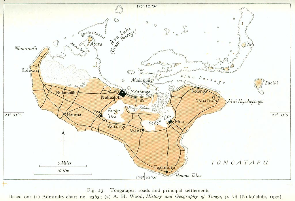
- Tongatapu: Roads and Principal Settlements (166K)
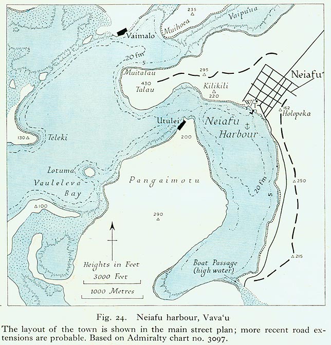
- Neiafu Harbor, Vavaˁu (145K)
- 'Eua,Tonga: relief and settlement (121K)
- Haapai: Major Islands of the Northern Group (128K)
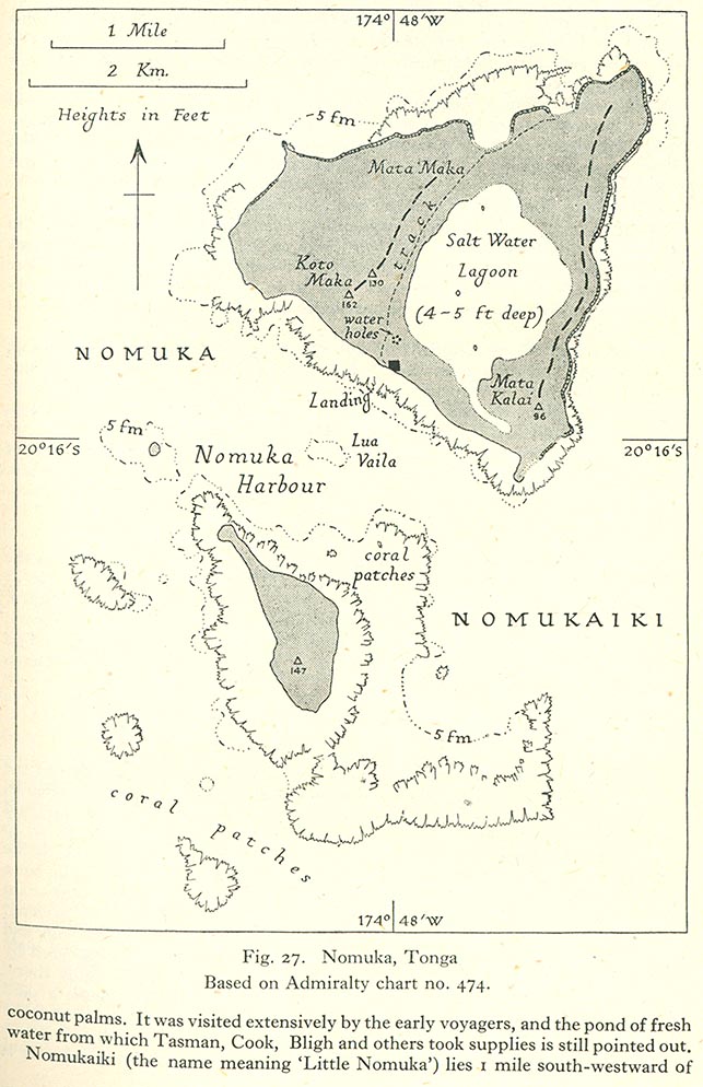
- Nomuka, Tonga (153K)
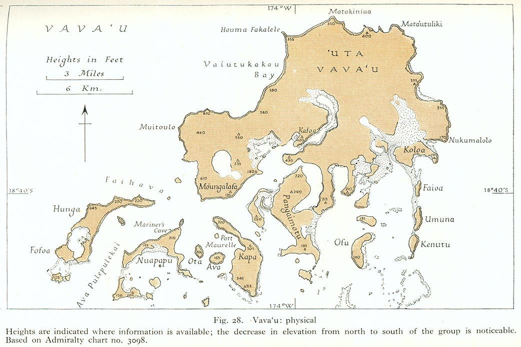
- Vavaˁu: Physical (178K)
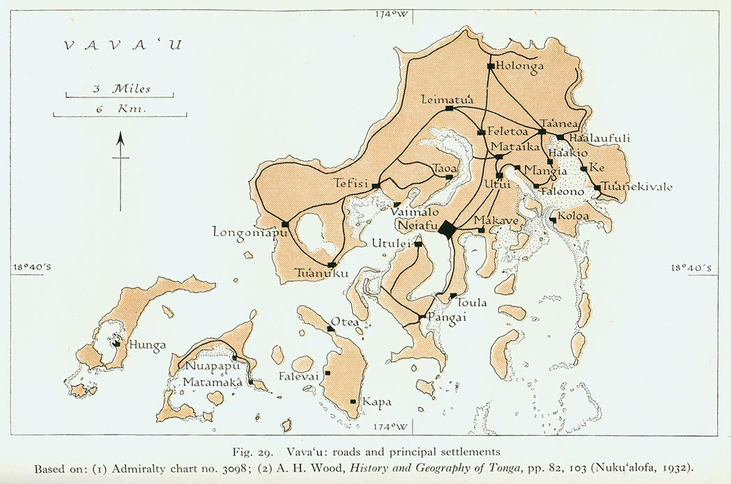
- Vavaˁu: Roads and Principal Settlements (178K)
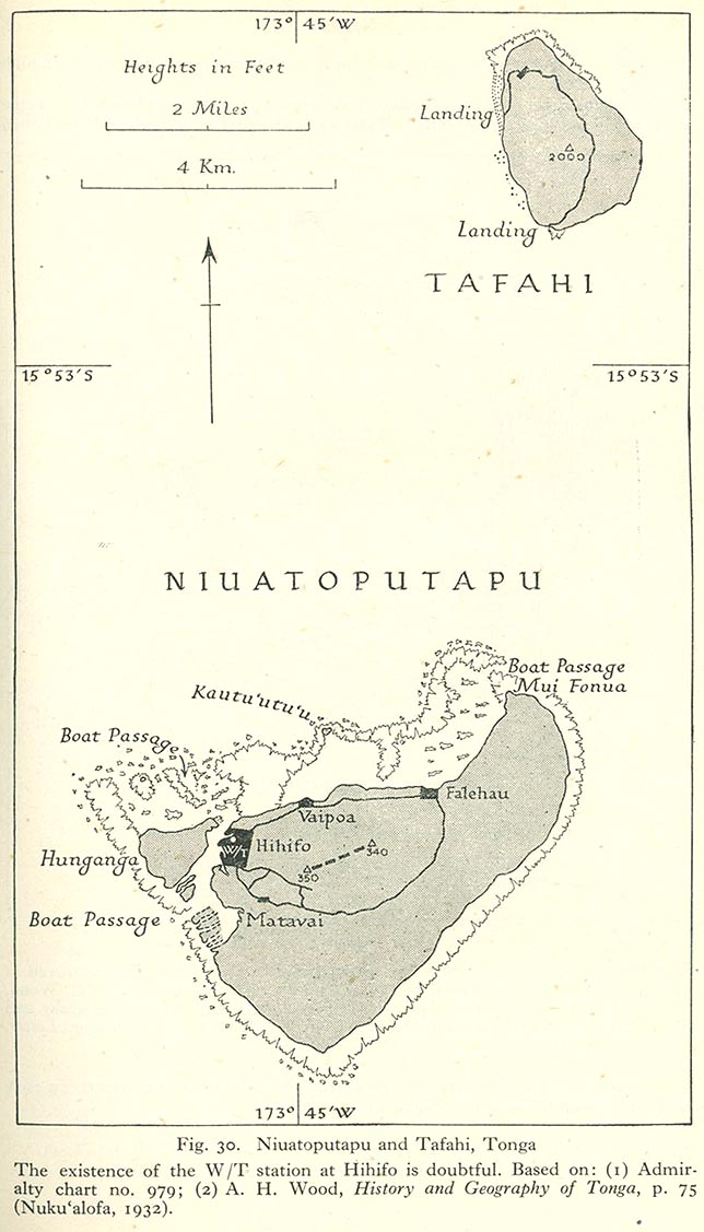
- Niuatoputapu and Tafahi, Tonga (134K)
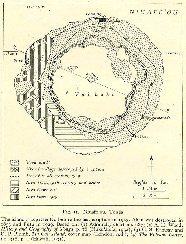
- Niuafoˁou, Tonga (172K)
General Review of the Fiji Group
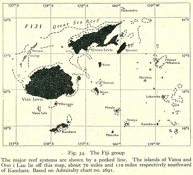
- The Fiji Group (110K)
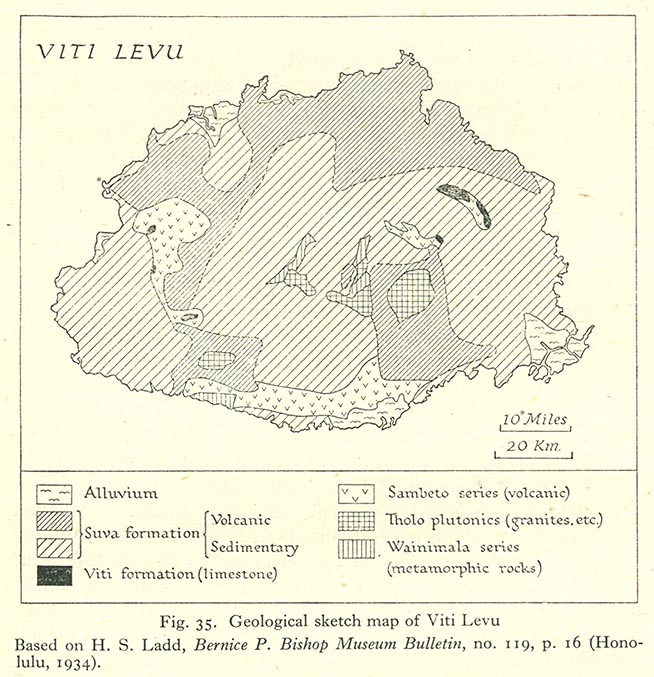
- Geological Sketch of Map of Viti Levu (146K)
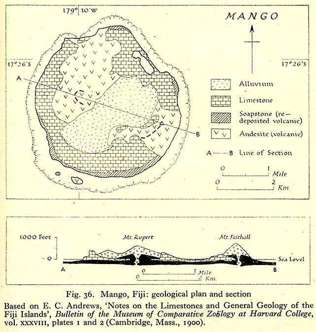
- Mango Fiji: Geological Plan and Section (132K)
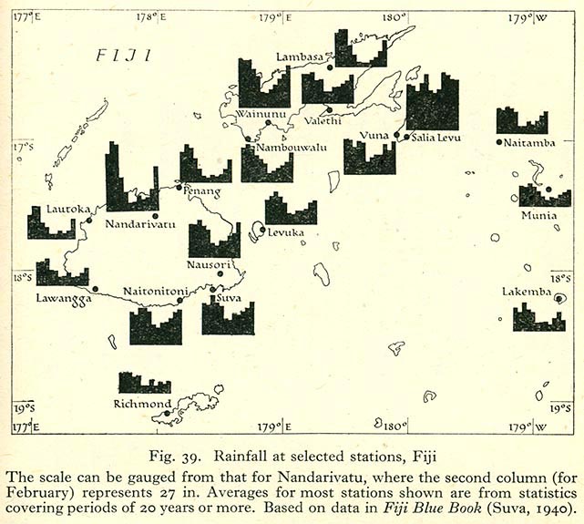
- Rainfall at Selected Stations, Fiji (105K)
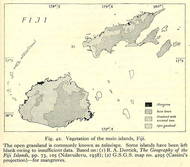
- Vegetation of the Main Islands, Fiji (146K)
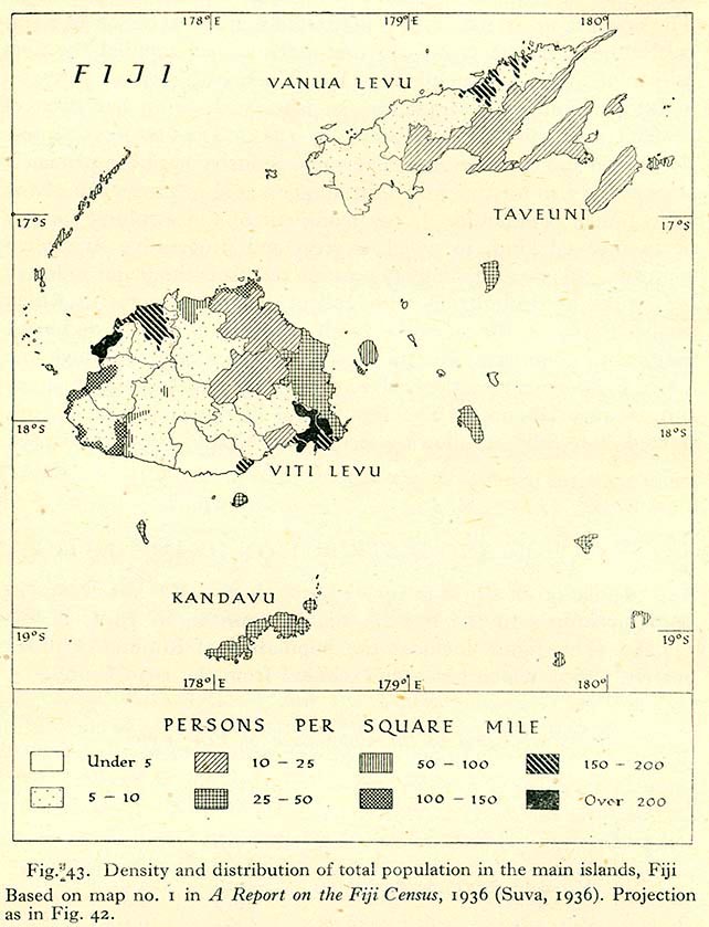
- Density and Distribution of Total Population in the Main Islands (119K)
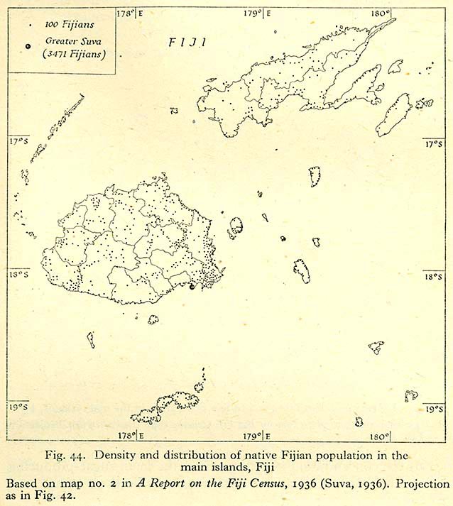
- Density and Distribution of Native Fijian Population in the Main Islands, Fiji (104K)
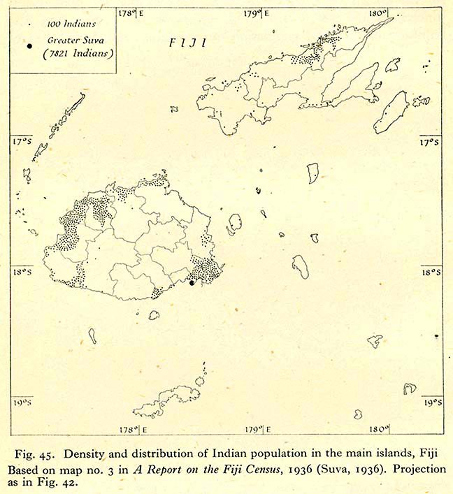
- Density and Distribution of Indian Population in the Main Islands, Fiji (100K)
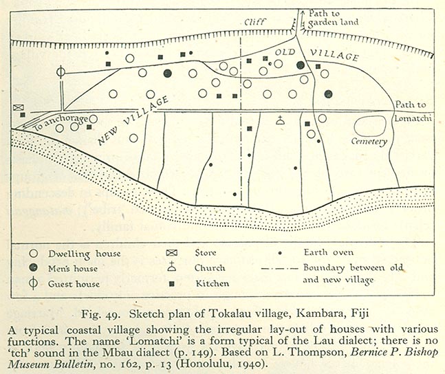
- Sketch Plan of Tokalau Village, Kambara, Fiji (115K)
- Fiji: District Boundaries (before September 1938) (118K)
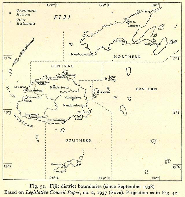
- Fiji: District Boundaries (since September 1938) (110K)
- Fiji: Provinces (106K)
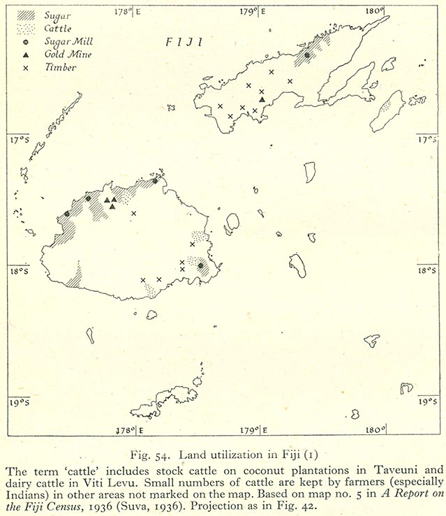
- Land Utilization in Fiji (I) (98K)
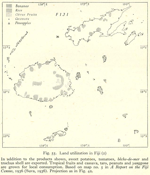
- Land Utilization in Fiji (II) (97K)
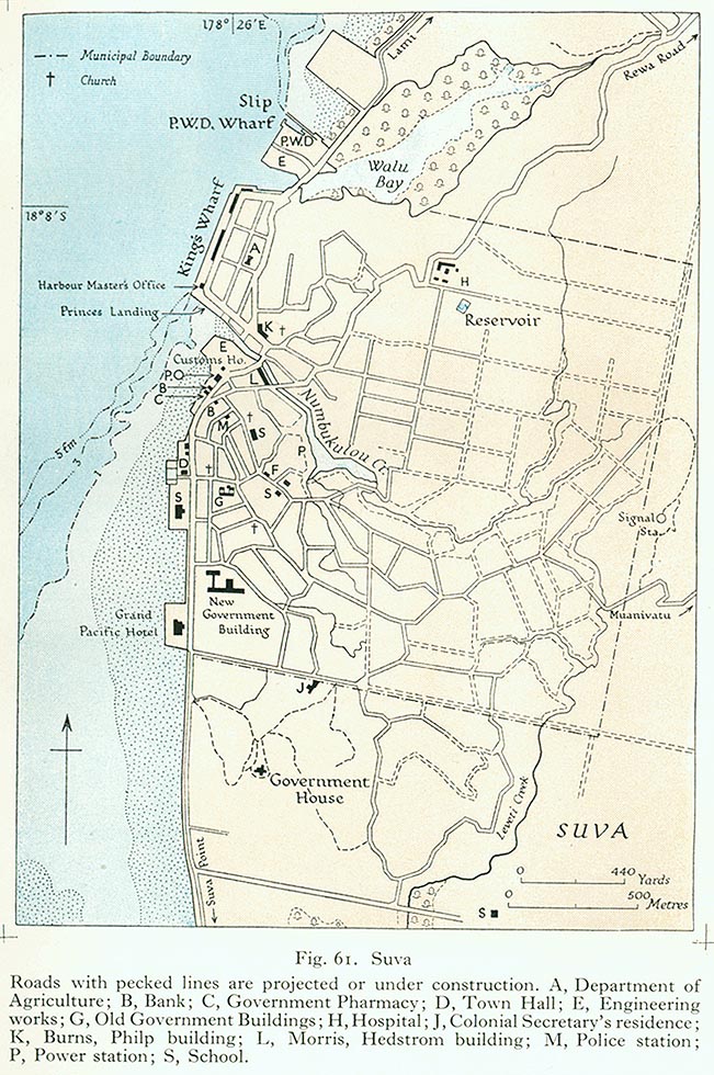
- Suva (219K)
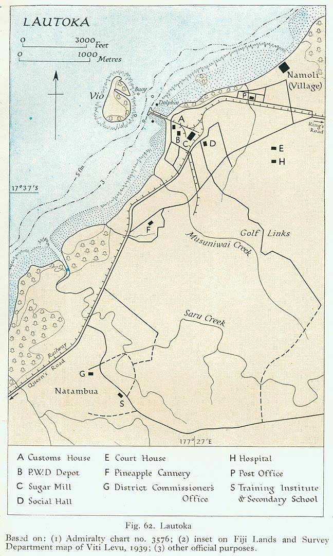
- Lautoka (229K)
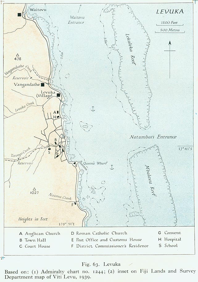
- Levuka (165K)
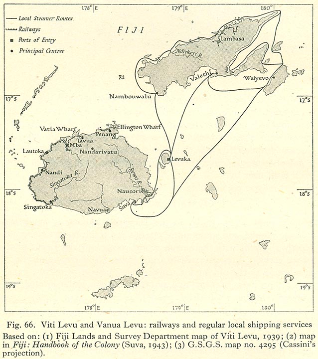
- Viti Levu and Vanua Levu: Railways and Regular Local Shipping Services (124K)
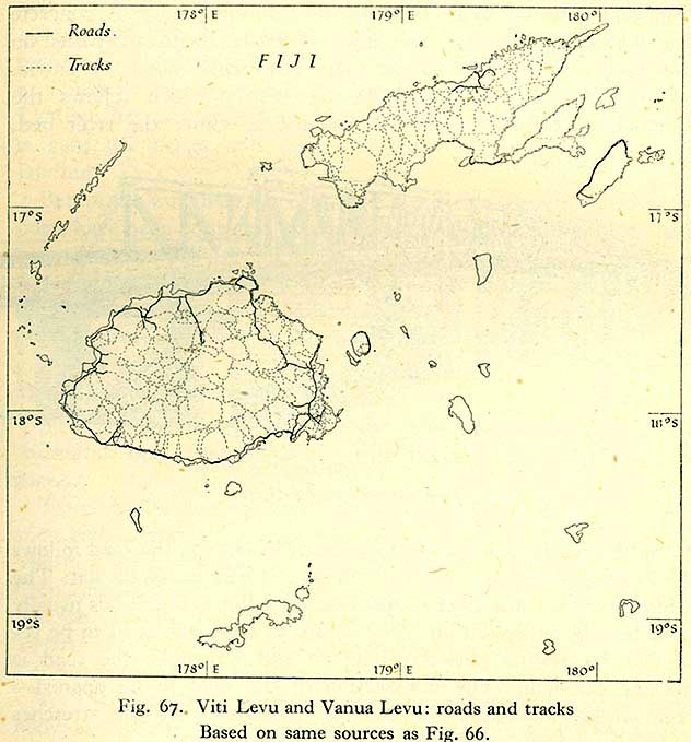
- Viti Levu and Vanua Levu: Roads and Tracks (102K)
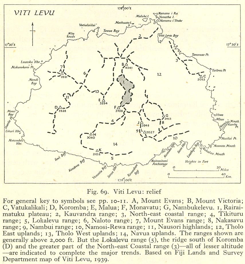
- Viti Levu: Relief (195K)
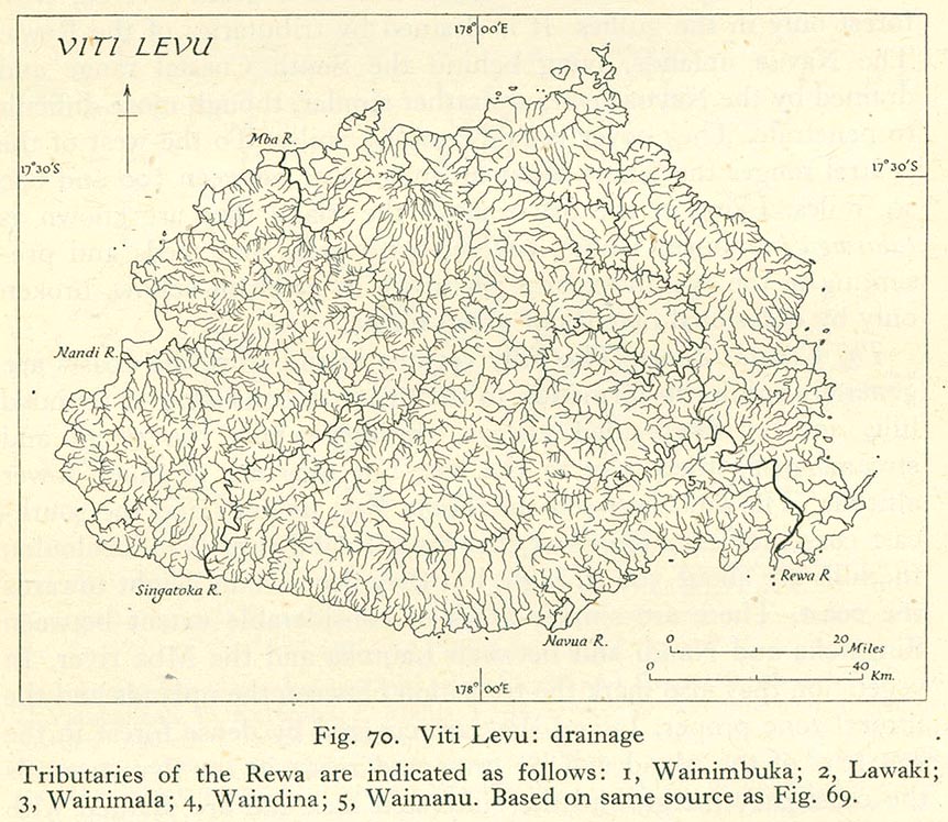
- Viti Levu: Drainage (207K)
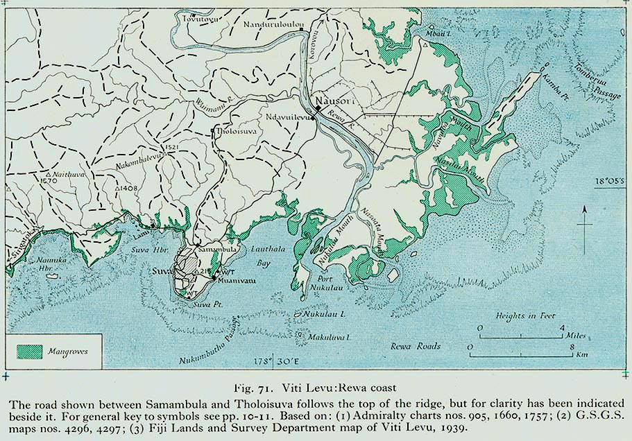
- Viti Levu: Rewa Coast (223K)
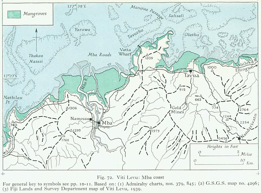
- Viti Levu: Mba Coast (207K)
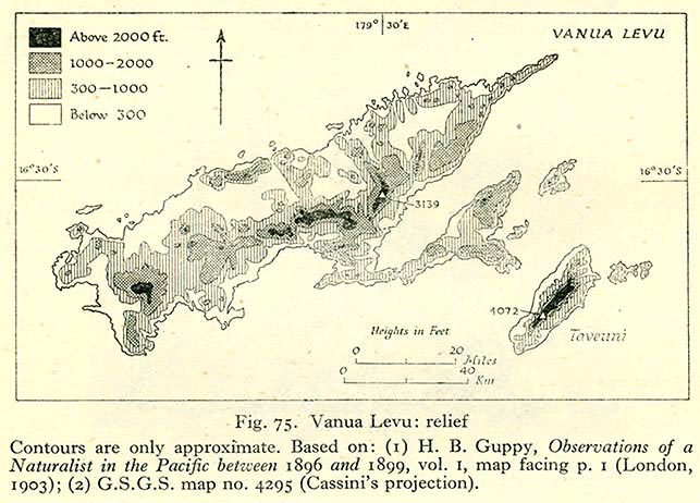
- Vanua Levu: Relief (98K)
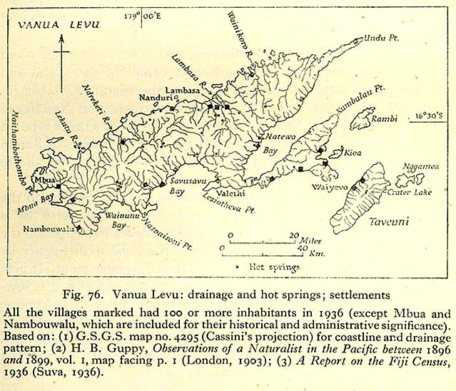
- Vanua Levu: Drainage and Hot Springs; Settlements (139K)
- Kandavu (116K)
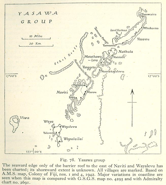
- Yasawa Group (114K)
- Lau Group: Geology (135K)
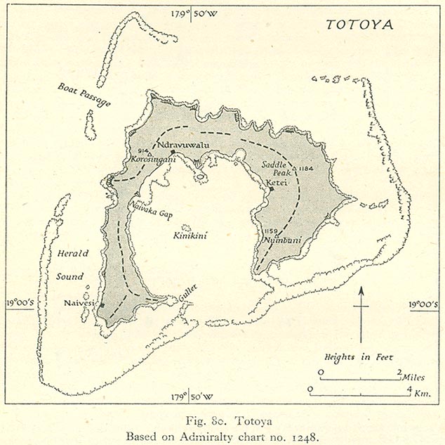
- Totoya (107K)
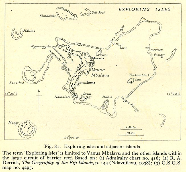
- Exploring Isles and Adjacent Islands (117K)
Rotuma, Uvea and Futuna
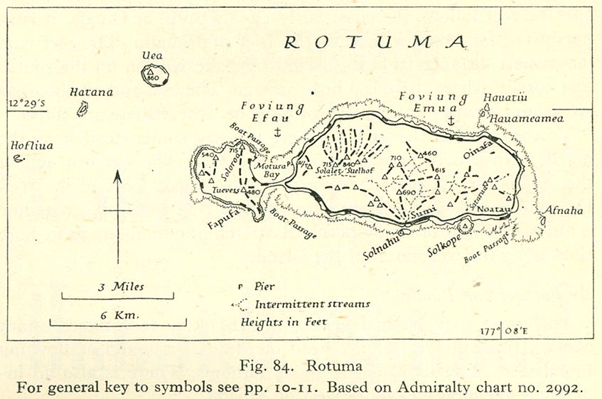
- Rotuma (107K)
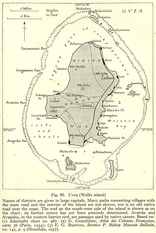
- Uvea (Wallis Island) (188K)
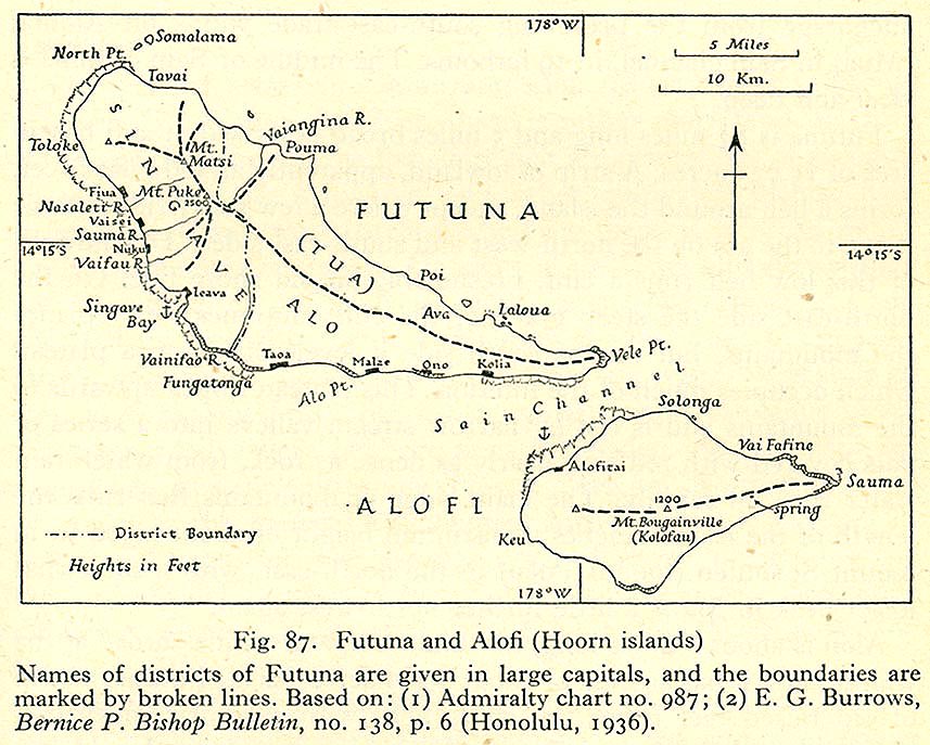
- Futuna and Alofi (Hoorn islands) (163K)
Gilbert Islands, Ellice Islands, Ocean Island and Nauru
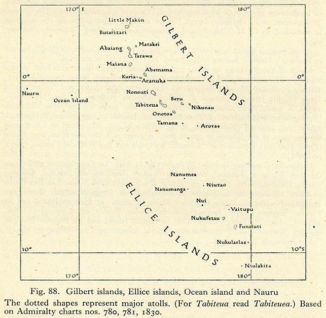
- Gilbert Islands, Ellice Islands, Ocean island and Nauru (102K)
- Nauru: Phyiscal (186K)
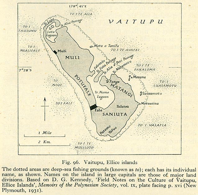
- Vaitupu, Ellice Islands (144K)
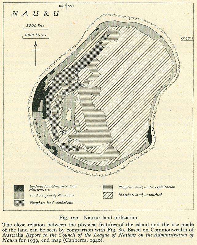
- Nauru: Land Utilization (183K)
- Nauru: Communications and Settlements (183K)
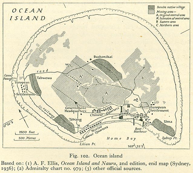
- Ocean Island (145K)
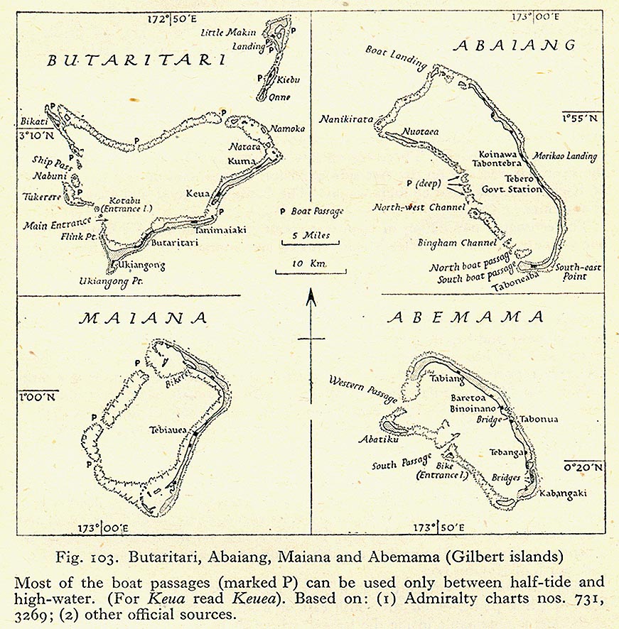
- Butaritari, Abaiang, Maiana, Abemama (Gilbert Islands) (232K)
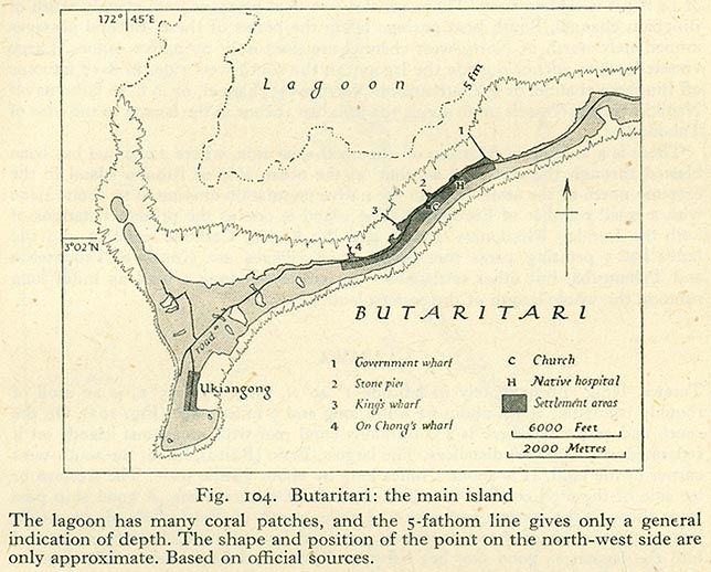
- Butaritari: The Main Island (106K)
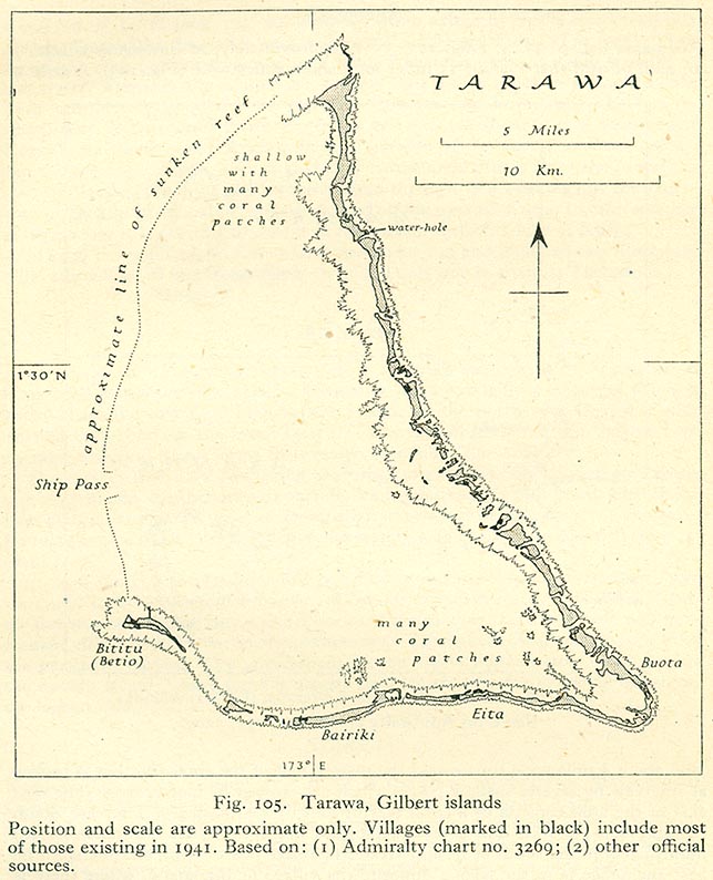
- Tarawa, Gilbert Islands (122K)
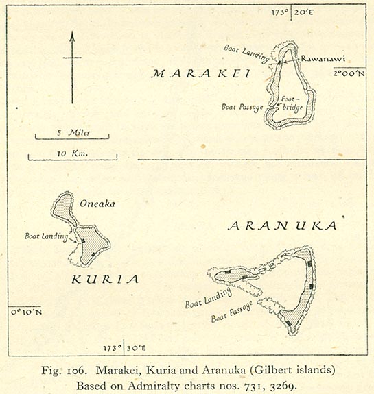
- Marakei, Kuria,and Aranuka (Gilbert Islands) (82K)
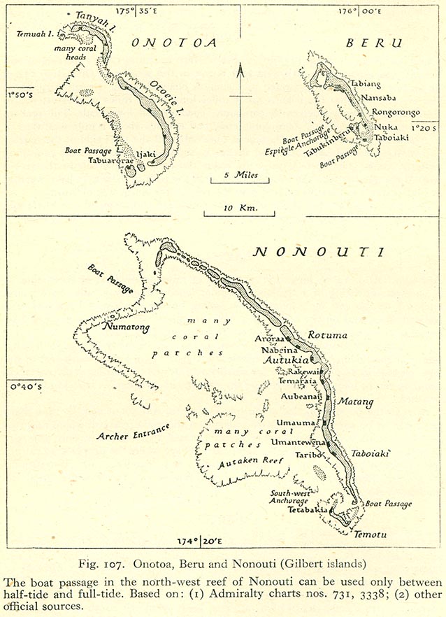
- Onotoa, Beru and Nonouti (Gilbert Islands) (140K)