Perry-Castañeda Library
Map Collection
Historical Maps of the United States
| Early Inhabitants | Exploration and Settlement | Territorial Growth | Military History | Later Historical Maps | Other Historical Map Sites |
|---|
- Historical Maps of U.S. Cities
- Historical Maps of Texas
- Historical Maps of Texas Cities
- Maps of National Historic Parks, Memorials, Military Parks and Battlefields
- National Atlas of the United States of America (1970)
- Pre-1945 Topographic Maps of the United States
- U.S. Historical Maps on Other Web Sites
- Historical Maps of Texas
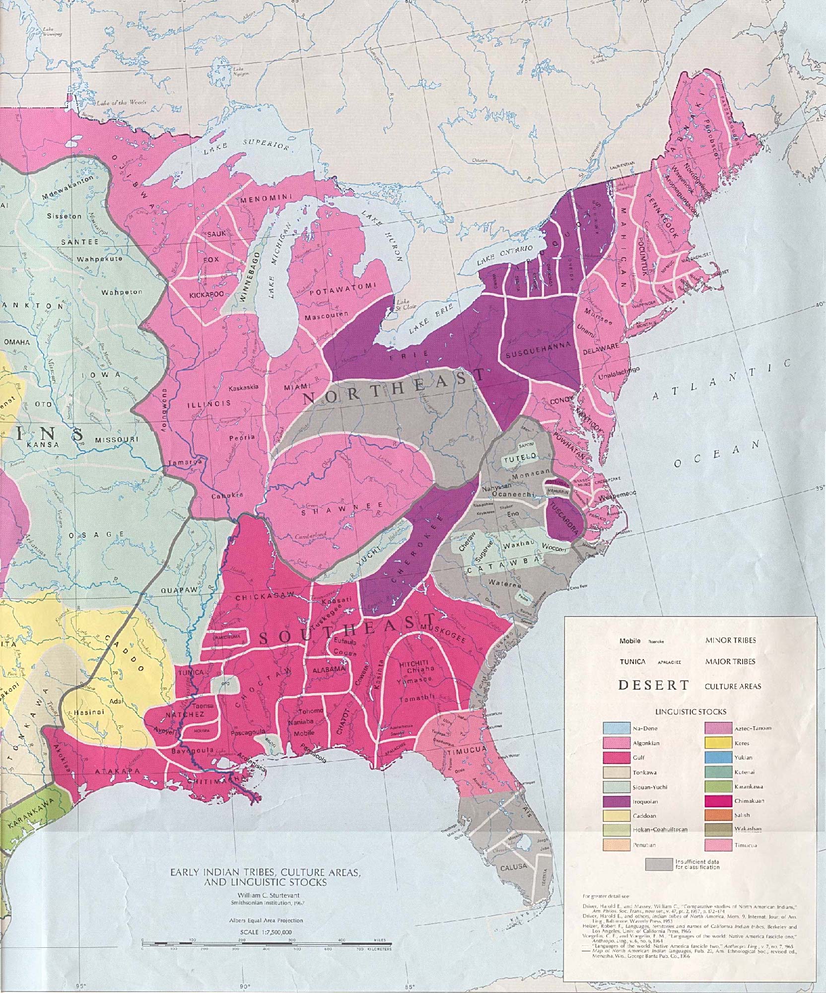
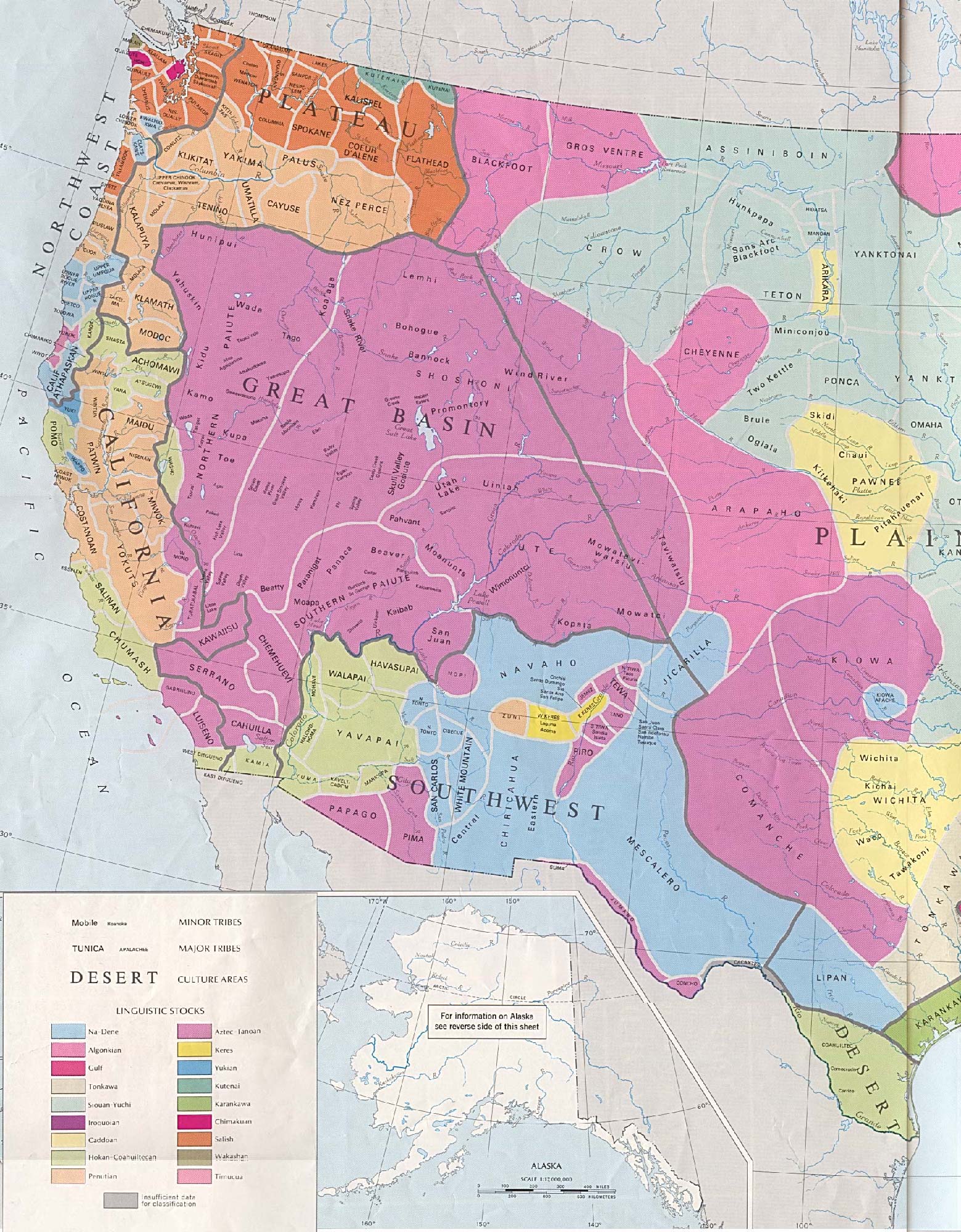
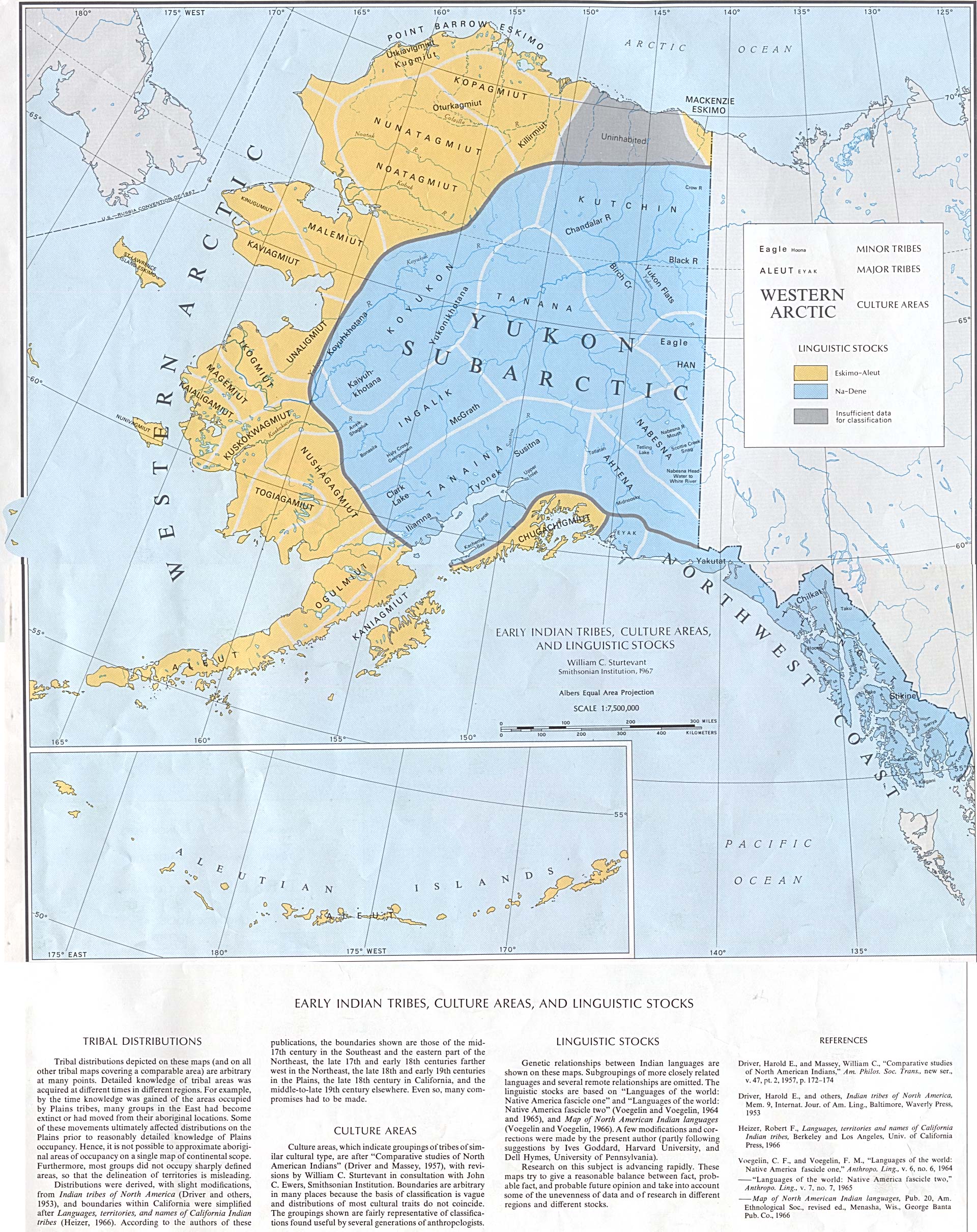
Early Inhabitants (From The National Atlas of the United States of America (Arch C. Gerlach, editor). Washington, D.C.: U.S. Dept. of the Interior, Geological Survey, 1970)
Exploration and Settlement (Except as noted, from The National Atlas of the United States of America (Arch C. Gerlach, editor). Washington, D.C.: U.S. Dept. of the Interior, Geological Survey, 1970)
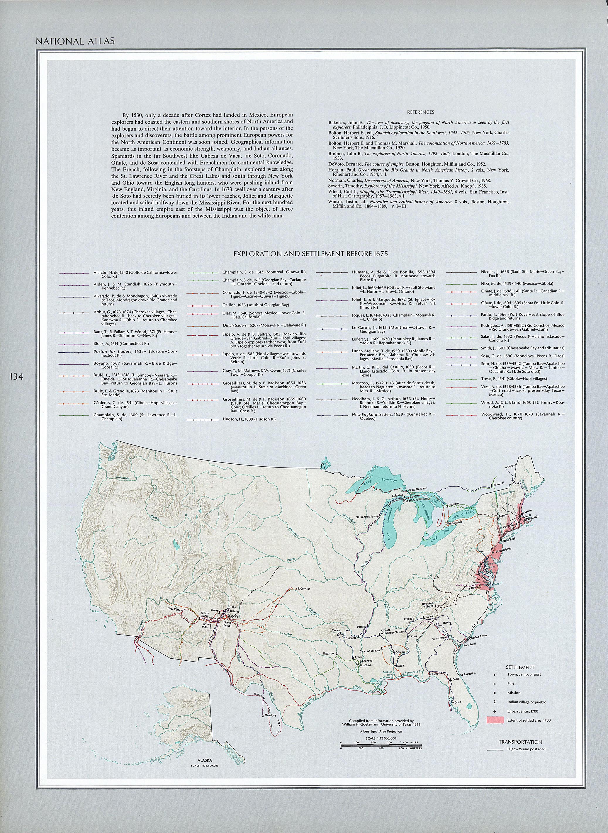
- Exploration and Settlement Before 1675 (1.13MB)
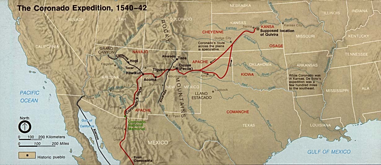
- The Coronado Expedition 1540-1542 (135K) U.S. National Park Service, 1974.
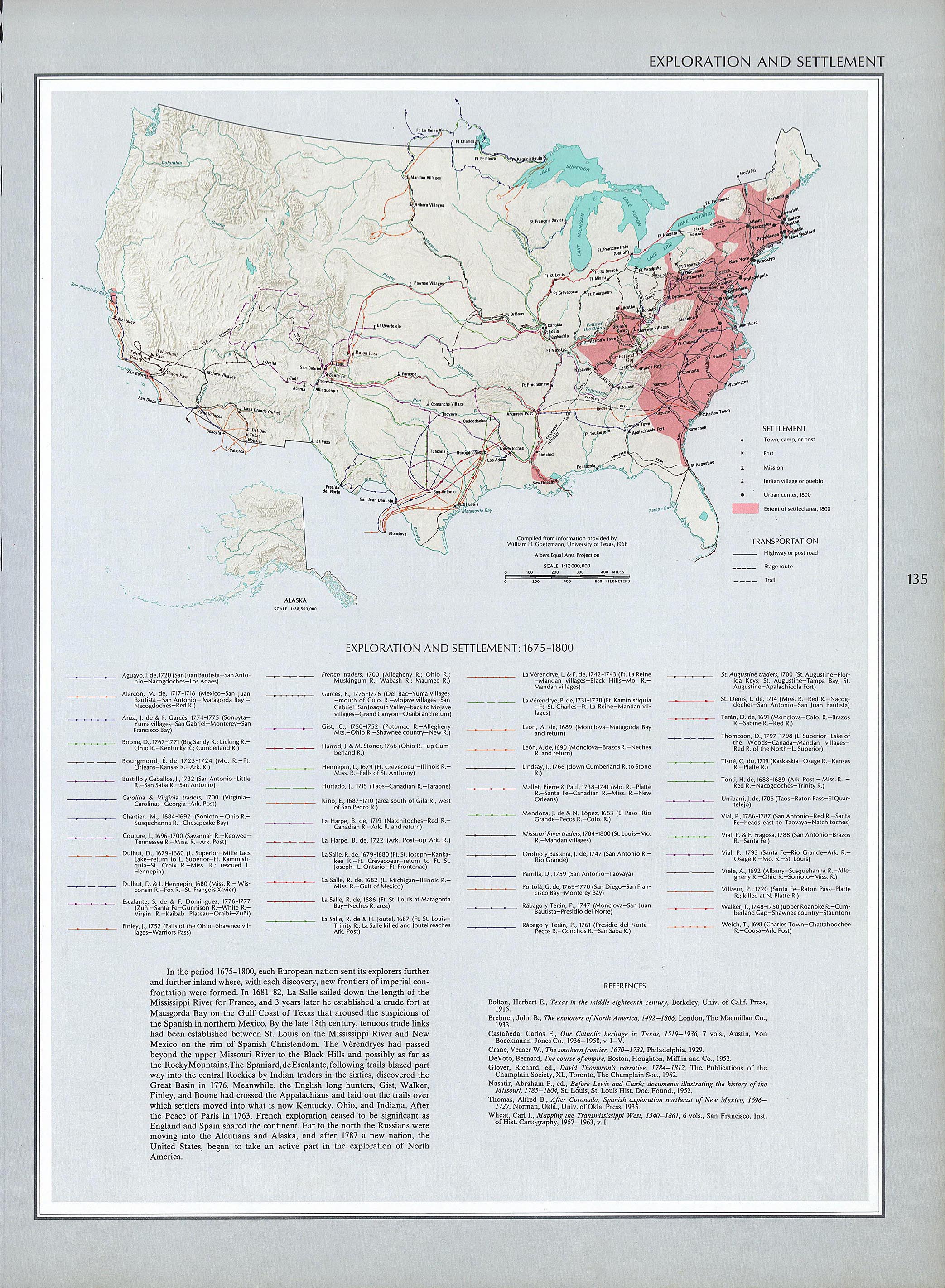
- Exploration and Settlement 1675-1800 (1.17MB)
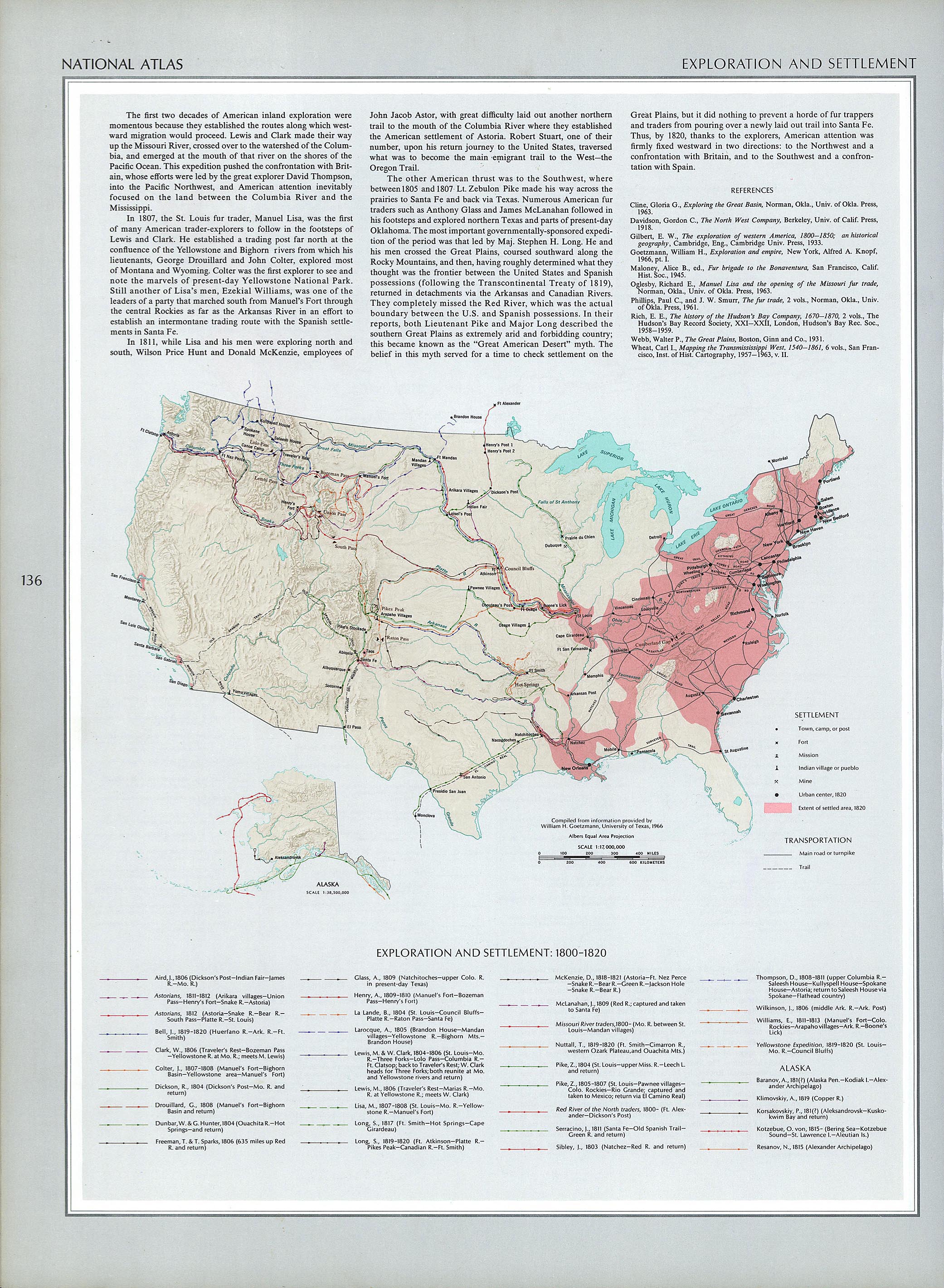
- Exploration and Settlement 1800-1820 (1.11MB)
- Westward Expansion and Exploration 1803-1807
- The Coronado Expedition 1540-1542 (135K) U.S. National Park Service, 1974.
- From American Military History, United States Army Center of Military History, 1989 (194K)
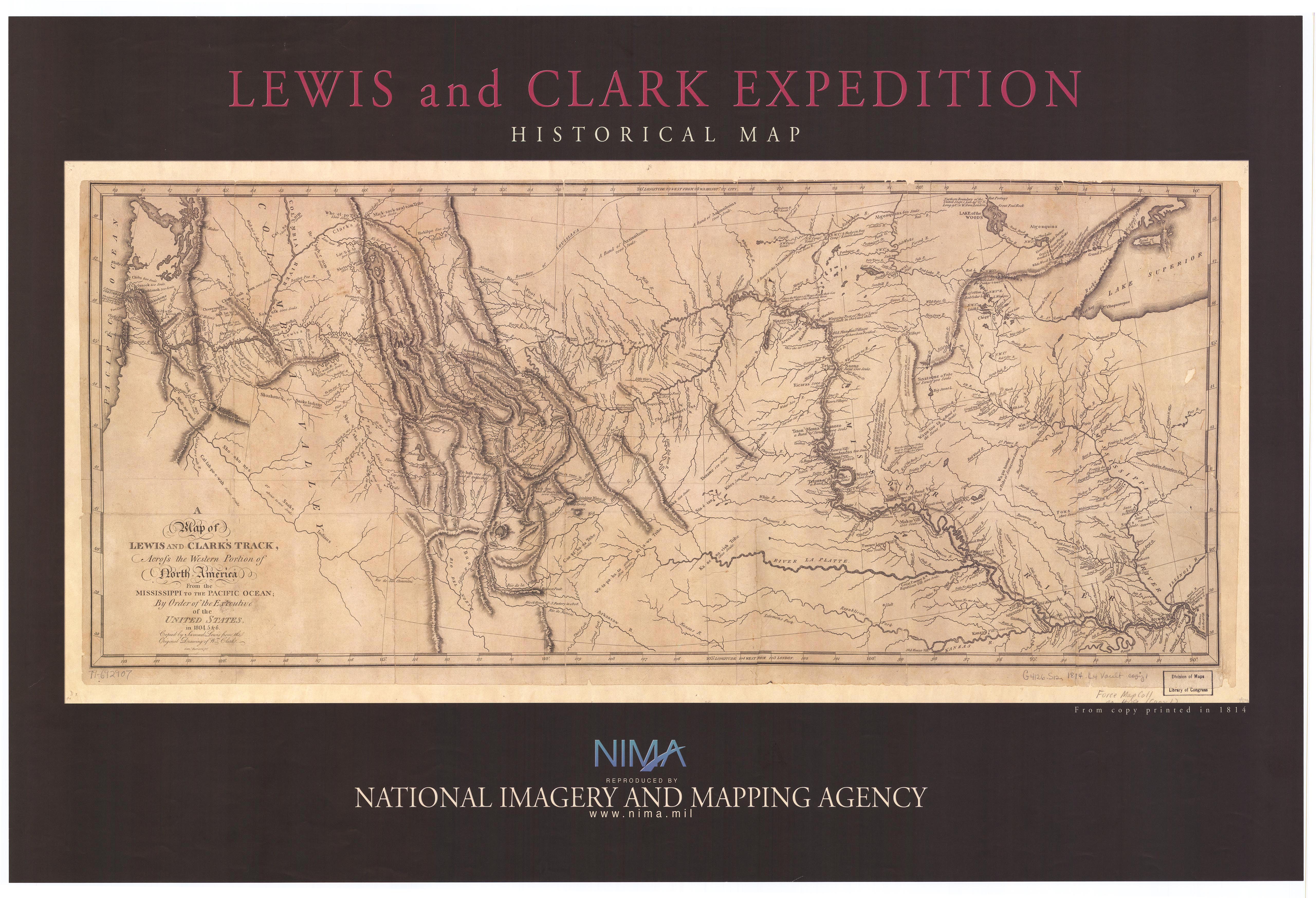
- Lewis and Clark Expedition 1804-1806
- "Lewis and Clark Expedition Historical Map" [poster] National Imagery and Mapping Agency, ca. 2003. Facsimile of "Lewis and Clark's Track Across the Western Portion of North America from the Mississippi to the Pacific Ocean: by order of the executive of the United States in 1804, 5 & 6, copied by Samuel Lewis from the original drawing of Wm. Clark; Saml. Harrison, fct." 1814 (2.1MB)
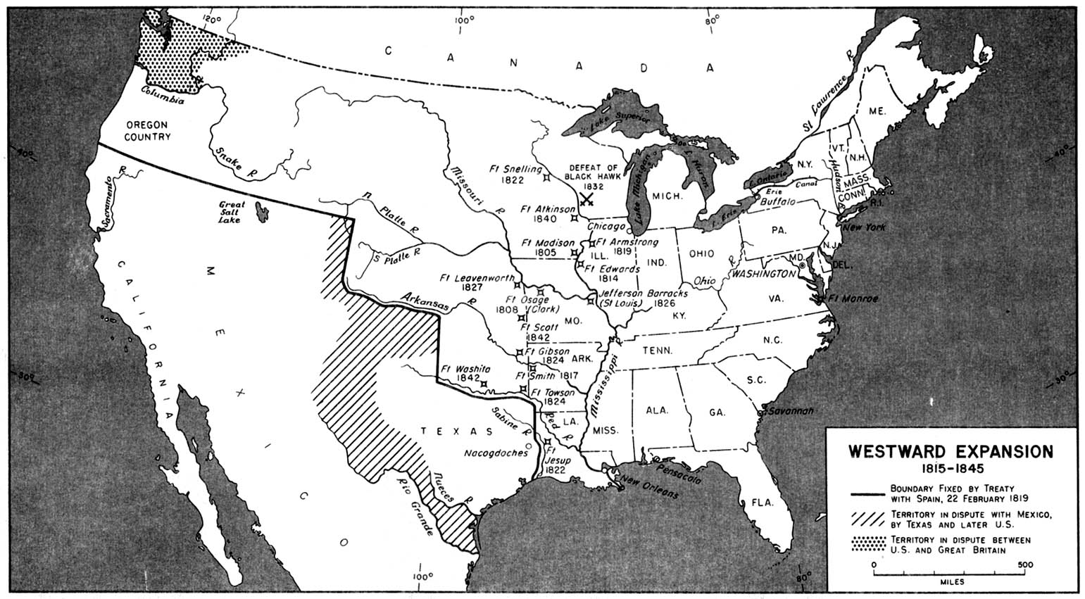
- Westward Expansion 1815-1845
- From American Military History, United States Army Center of Military History, 1989 (258K)
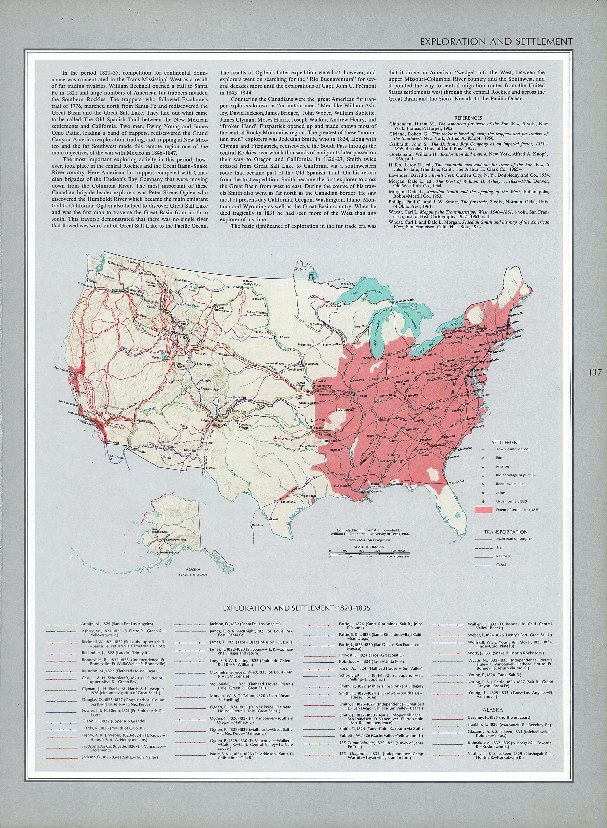
- Exploration and Settlement 1820-1835 (1.15MB)
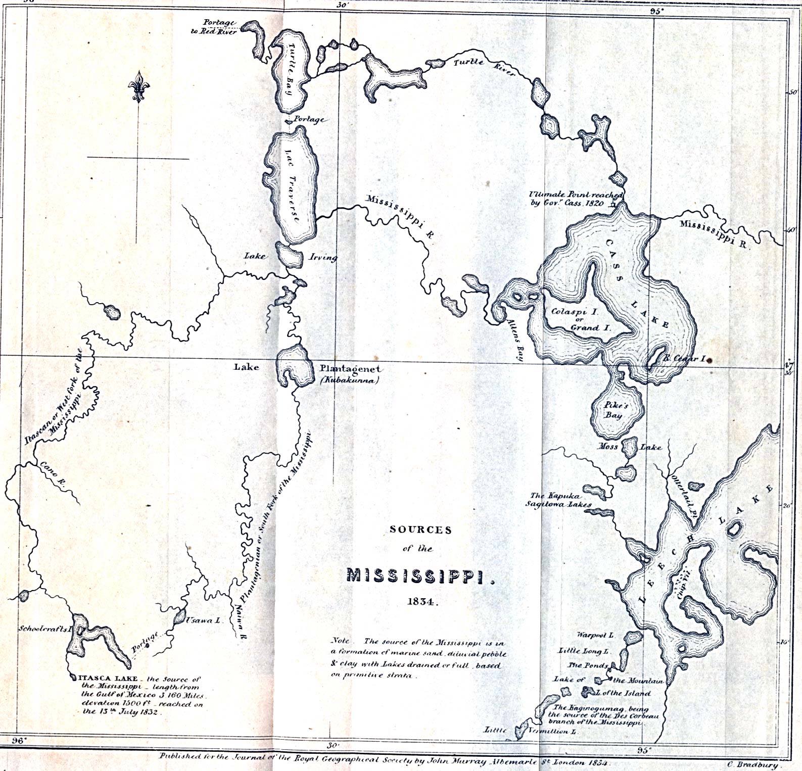
- Sources of the Mississippi River 1834 (414K)
- From The Journal of the Royal Geographical Society, Volume 4, 1834 to accompany "Narrative of an Expedition through the Upper Mississippi to Itasca Lake, the actual Source of this River; embracing an Exploratory Trip through the St. Croix and Burntwood (or Broule) Rivers; in 1832. Under the direction of Henry R. Schoolcraft. New York. 1834."
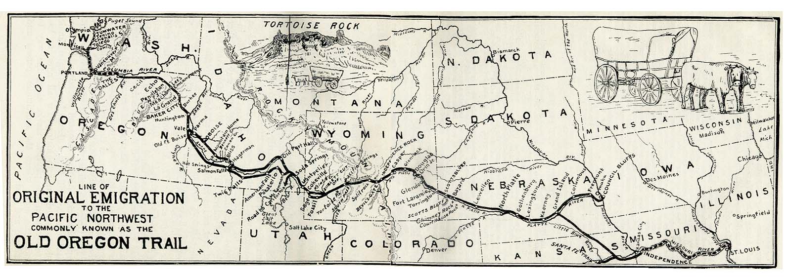
- Oregon Trail (199K)
- "Line of Original Emigration to the Pacific Northwest Commonly Known as the Old Oregon Trail" from The Ox Team or the Old Oregon Trail 1852-1906 by Ezra Meeker. Fourth Edition 1907.
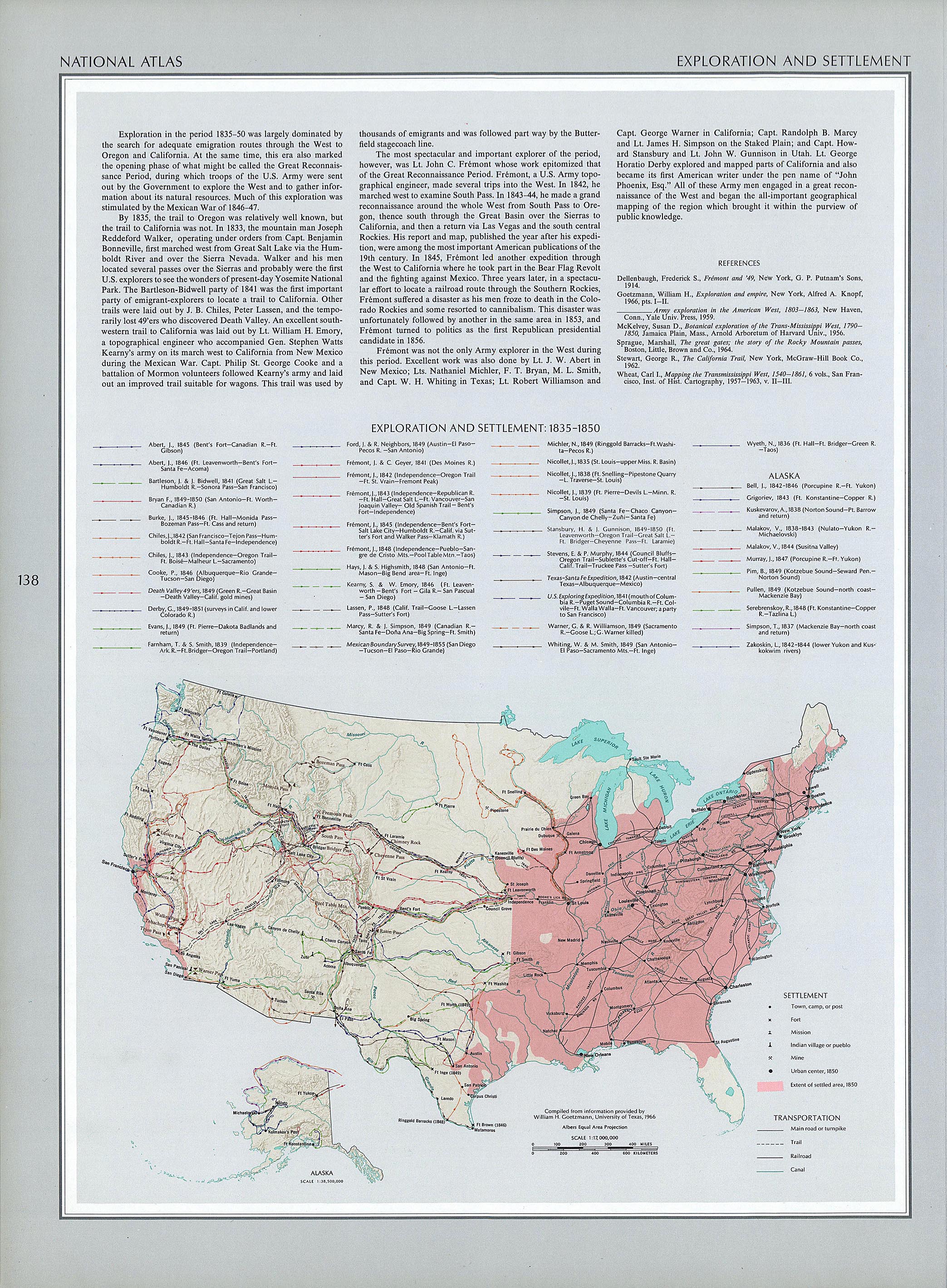
- Exploration and Settlement 1835-1850 (1.29MB)
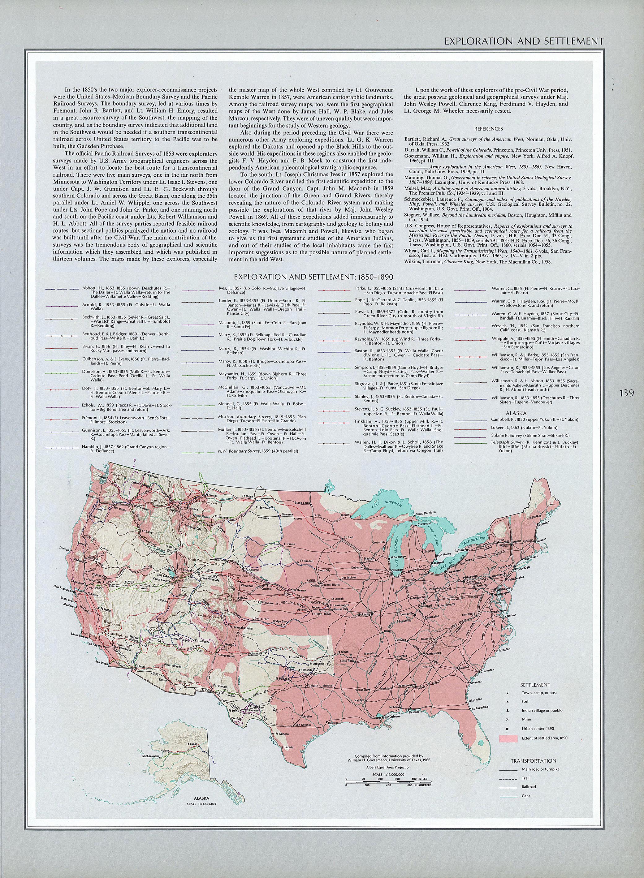
- Exploration and Settlement 1850-1890 (1.36MB)
- Captain Marcy's route though Texas 1854 (612K)
- Exploration and Settlement 1850-1890 (1.36MB)
- From Petermann's Mittheilungen, 1895.
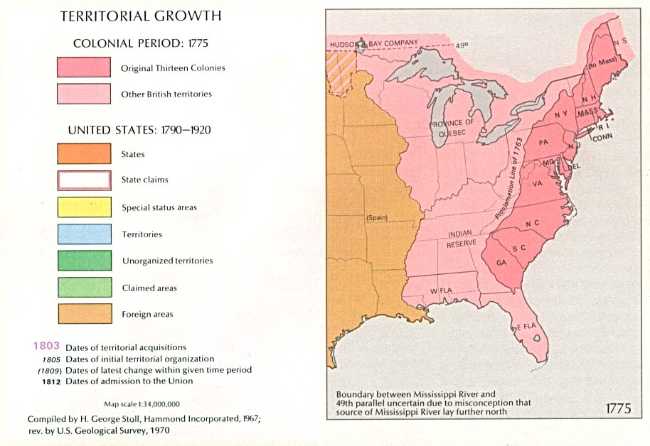
- Territorial Growth 1775 (84K)
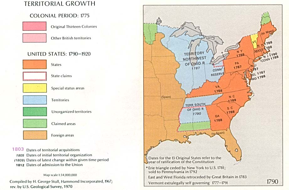
- Territorial Growth 1790 (90K)
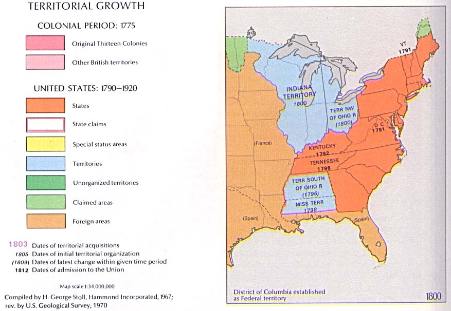
- Territorial Growth 1800 (84K)
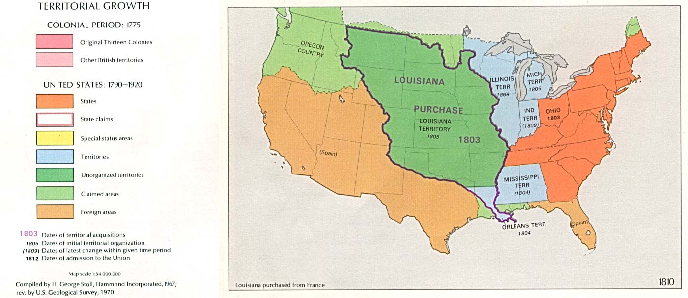
- Territorial Growth 1810 (122K)
- Territorial Growth 1820 (126K)
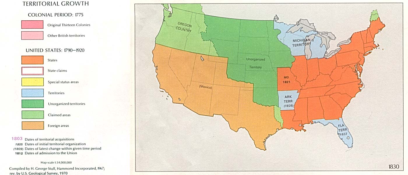
- Territorial Growth 1830 (114K)
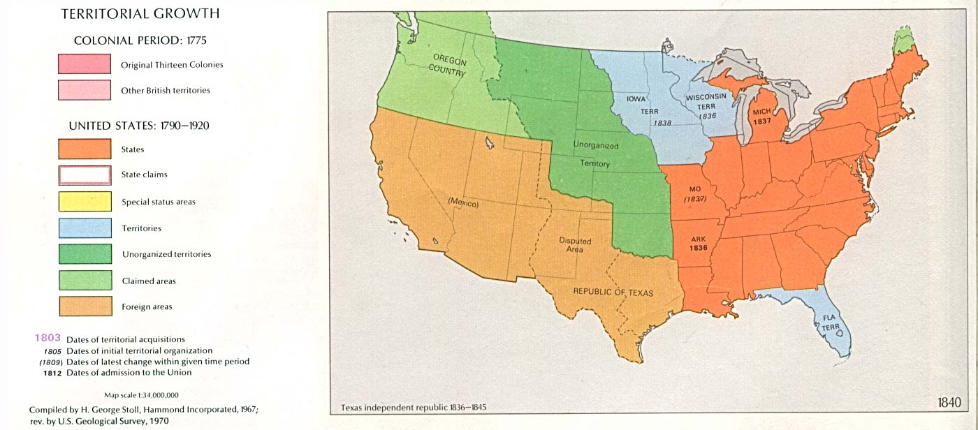
- Territorial Growth 1840 (118K)
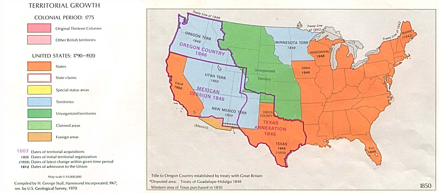
- Territorial Growth 1850 (126K)
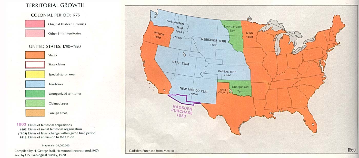
- Territorial Growth 1860 (119K)
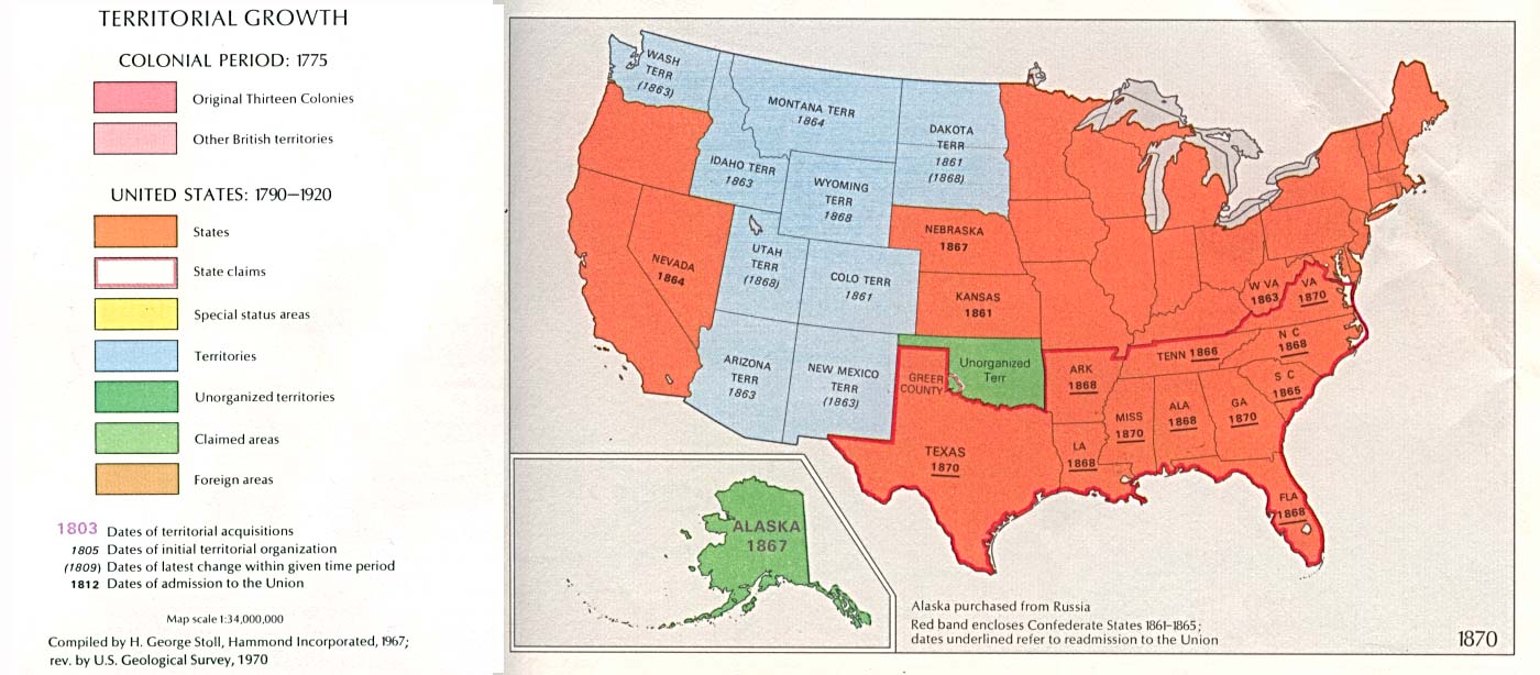
- Territorial Growth 1870 (133K)
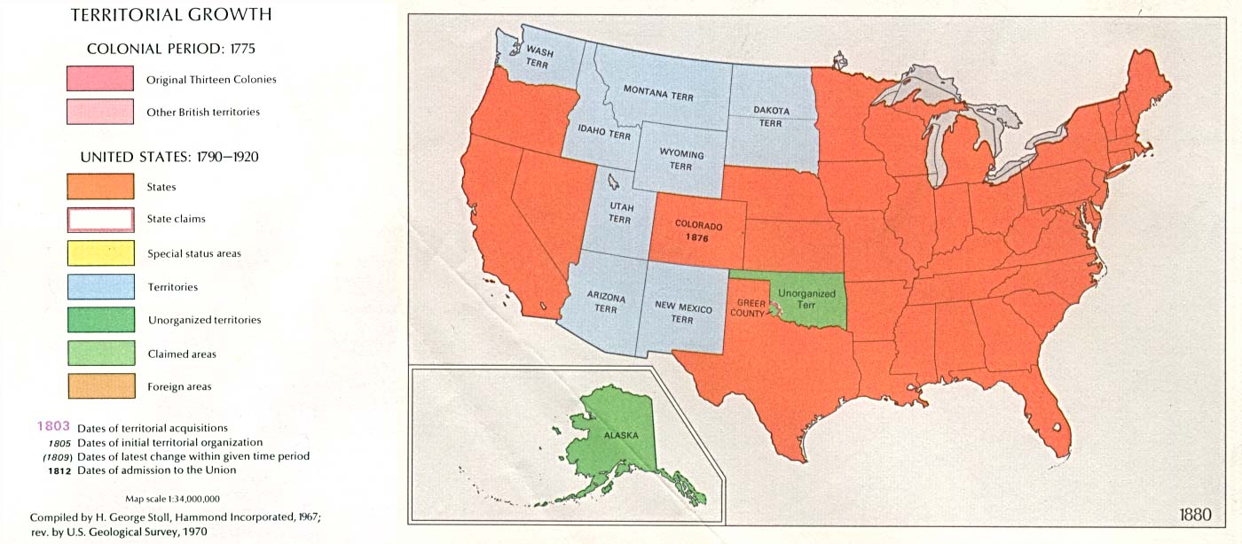
- Territorial Growth 1880 (120K)
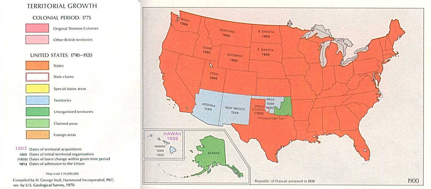
- Territorial Growth 1900 (124K)
- Territorial Growth 1920 (117K)
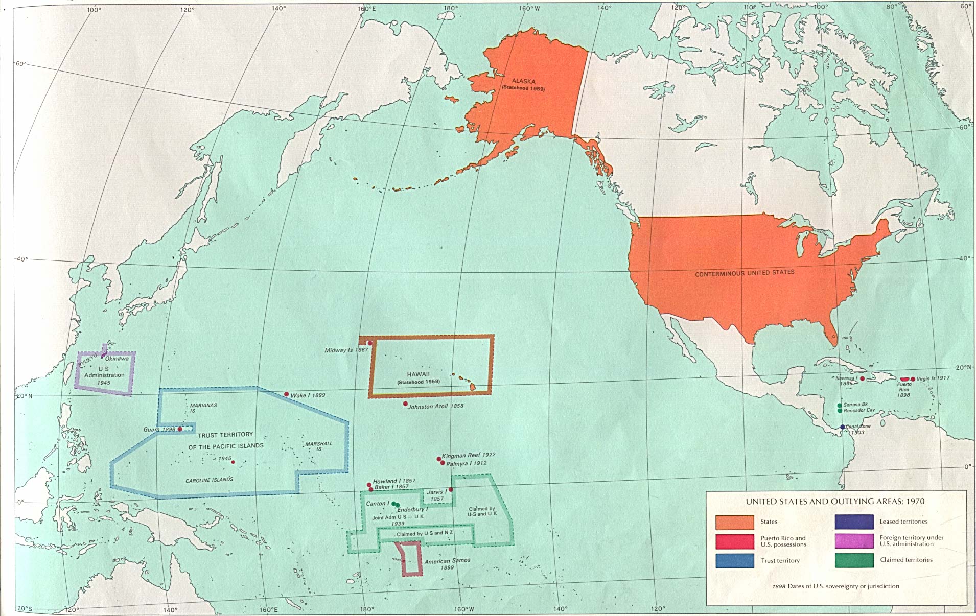
- U.S. and Outlying Areas 1970 (353K)
- Territorial Growth 1790 (90K)
- The maps above are from The National Atlas of the United States of America (Arch C. Gerlach, editor). Washington, D.C.: U.S. Dept. of the Interior, Geological Survey, 1970
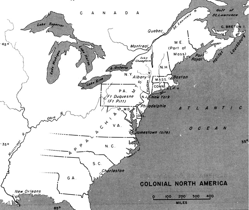
- Colonial North America (129K)
- From American Military History, United States Army Center of Military History, 1989
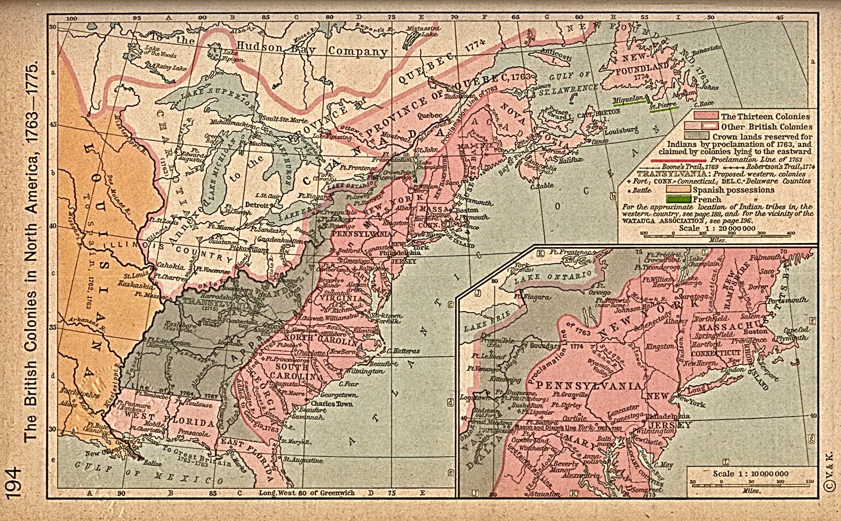
- The British Colonies in North America, 1763-1775 (581K)
- Inset: Middle Colonies. From The Historical Atlas by William R. Shepherd, 1923.
- The United States, 1783-1803 (581K)
- Insets: The State of Franklin, 1784-1788. Early distribution of the Public Lands (Ohio). From The Historical Atlas by William R. Shepherd, 1923.
- The Organization of Territories in the United States since 1803 (1MB)
- I.1803-1810, II.1810-1835, III.1835-1855, IV.Since 1855. From The Historical Atlas by William R. Shepherd, 1923.
- Admission of States and Territorial Acquistion U.S. Bureau of the Census (341K)
Military History Maps (Except as noted, from American Military History, United States Army Center of Military History, 1989)
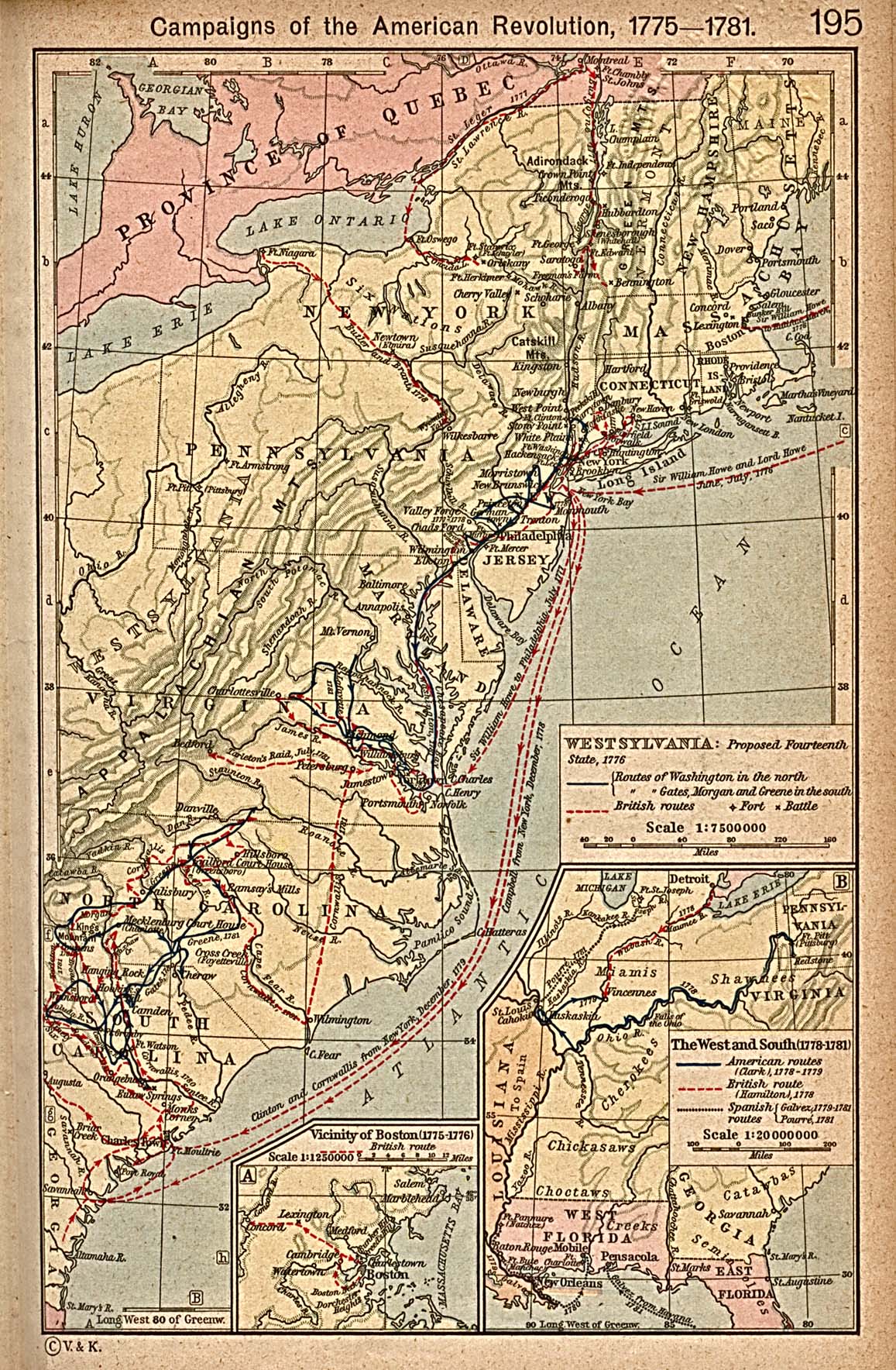
- Campaigns of the American Revolution, 1775-1781 (645K)
- Inset:The West and South, 1778-1781. From The Historical Atlas by William R. Shepherd, 1923.
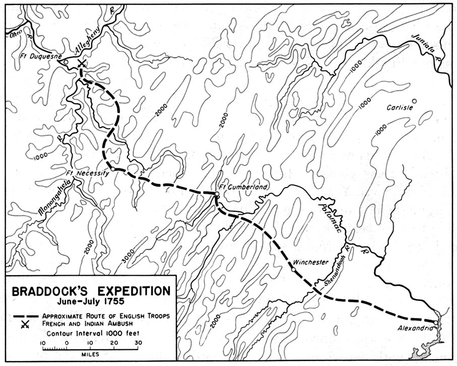
- 1755 - Braddock's Expedition June-July 1755 (194K)
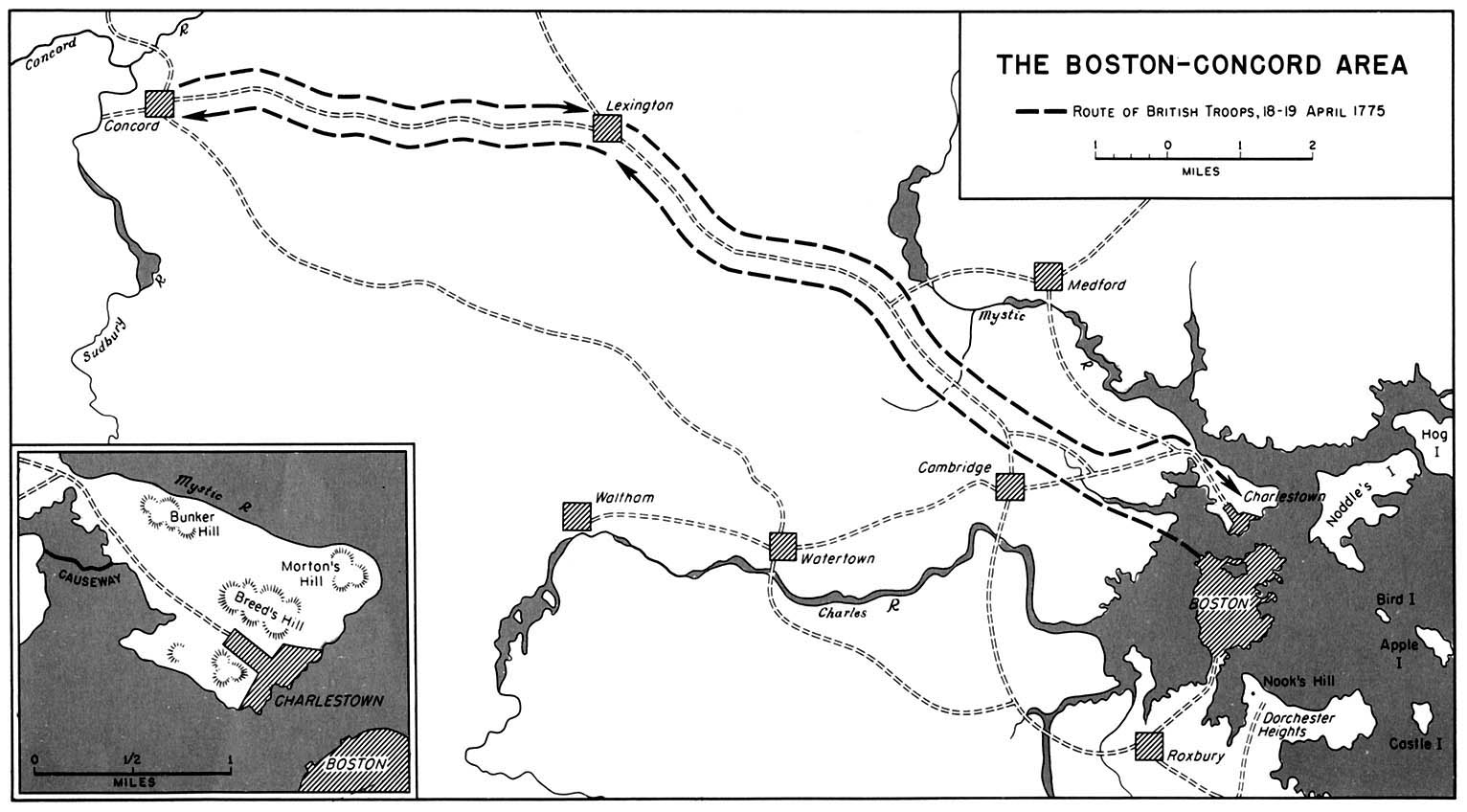
- 1775 - Boston - Concord Area, Route of British Troops April 1775 (194K)
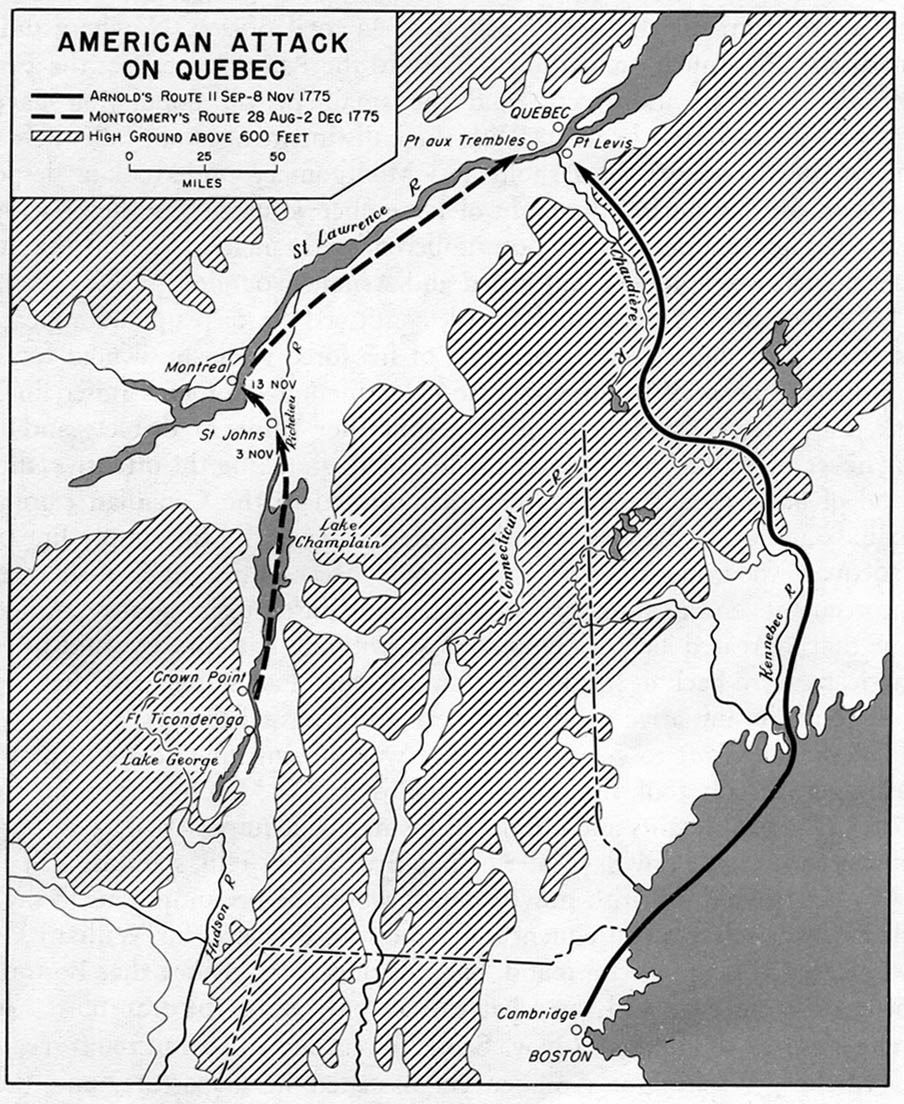
- 1775 - American Attack on Quebec (323K)
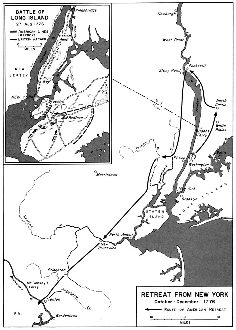
- 1776 - Retreat from New York October-December 1776 (194K)
- 1775 - Boston - Concord Area, Route of British Troops April 1775 (194K)
- Inset: Battle of Long Island 27 August 1776
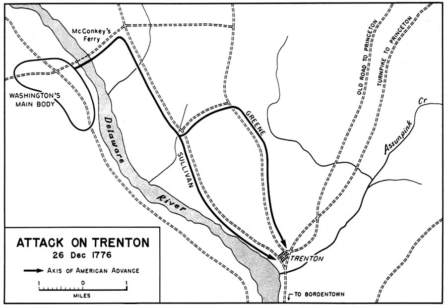
- 1776 - Attack on Trenton 26 December 1776 (129K)
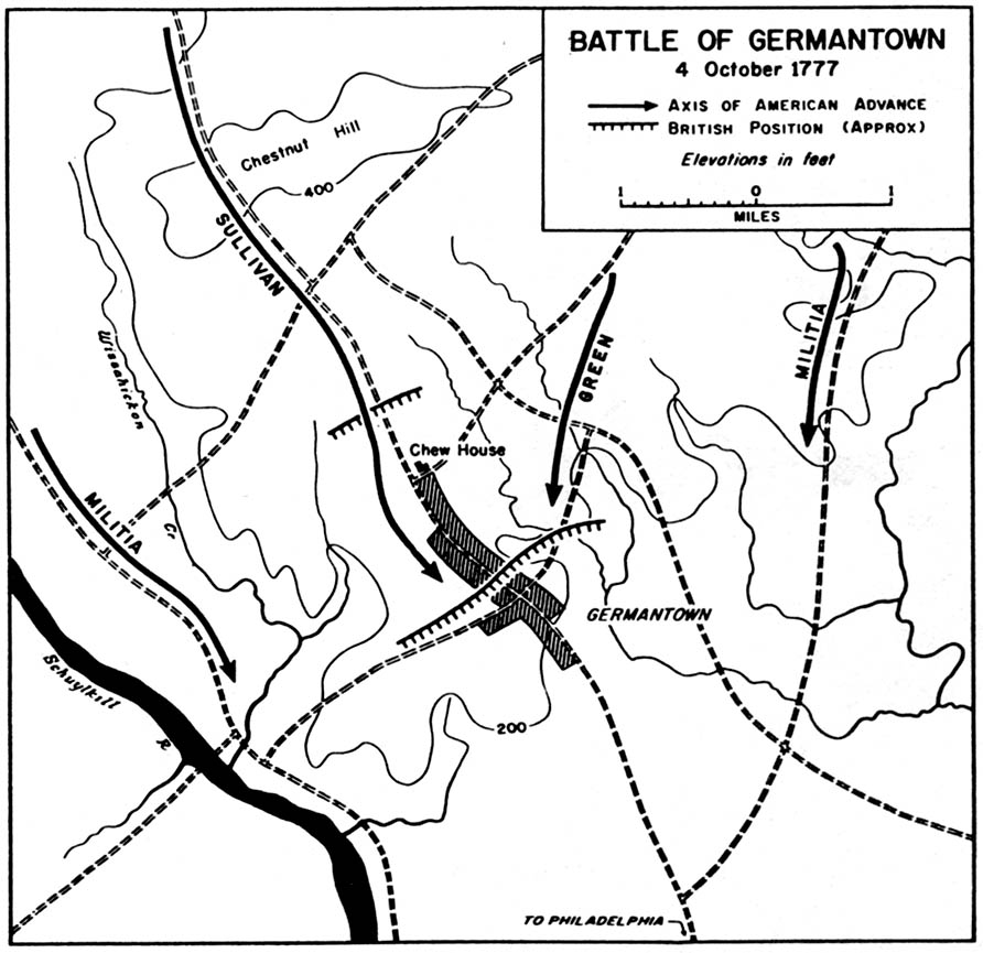
- 1777 - Battle of Germantown 4 October 1777 (129K)
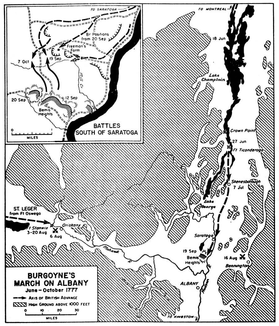
- 1777 - Burgoyne's March on Albany June-October 1777 (323K)
- 1777 - Battle of Germantown 4 October 1777 (129K)
- Inset: Battles South of Saratoga
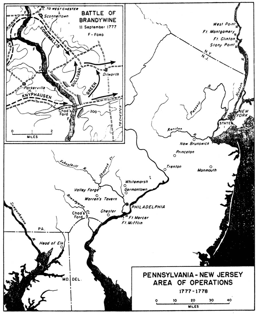
- 1777-1778 - Pennsylvania-New Jersey Area of Operations 1777-1778 (194K)
- Inset: The Battle of Brandywine 11 September 1777
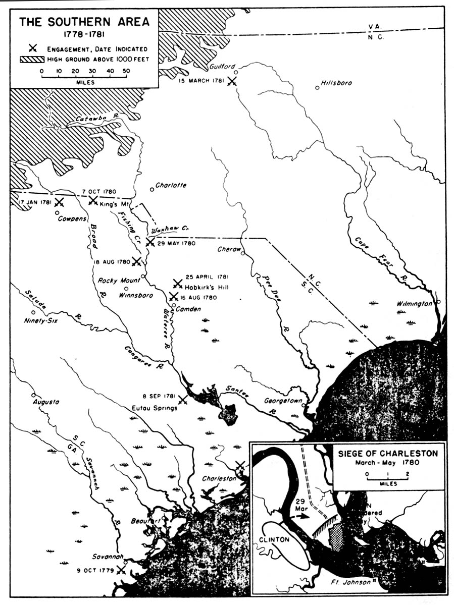
- 1778-1781 - The Southern Area 1778-1781 (258K)
- Inset: The Siege of Charleston March-May 1780
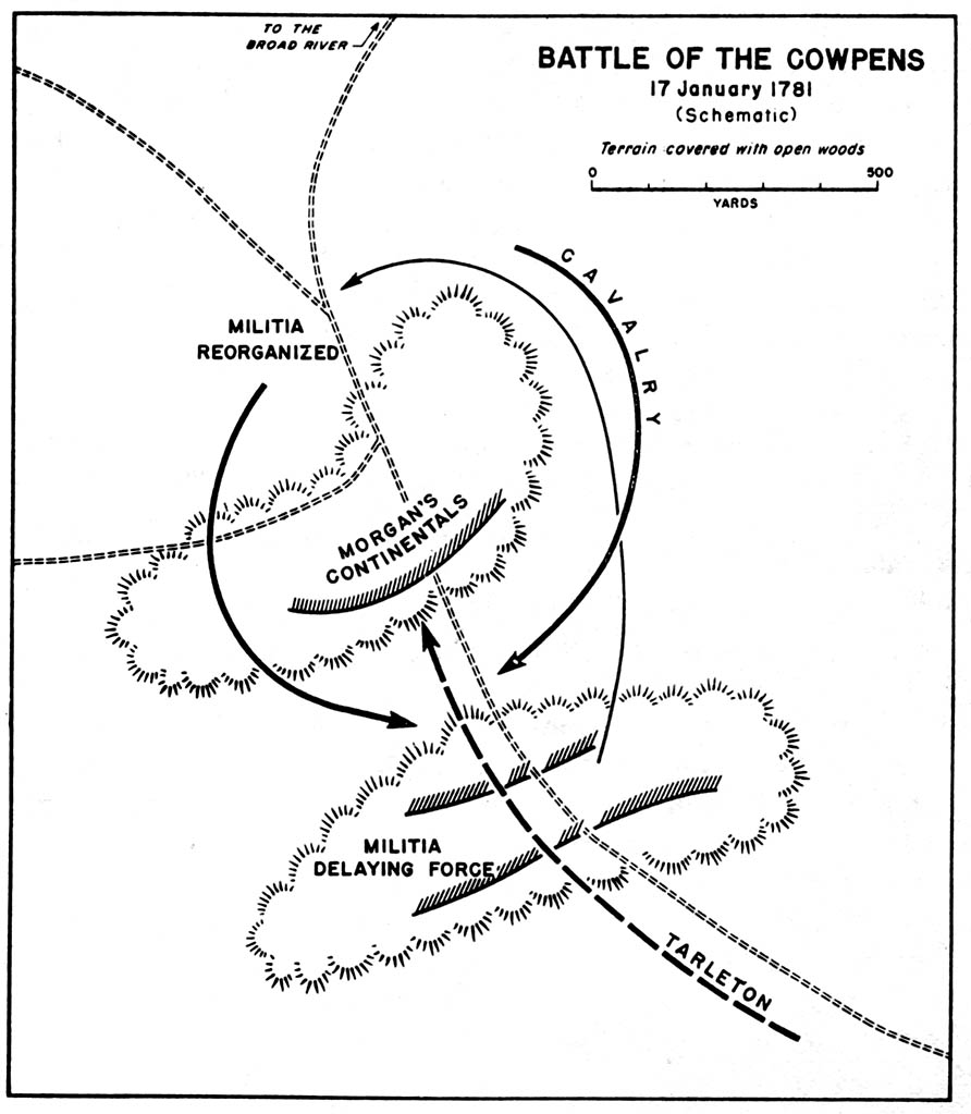
- 1781 - Battle of Cowpens 17 January 1781 (Schematic) (129K)
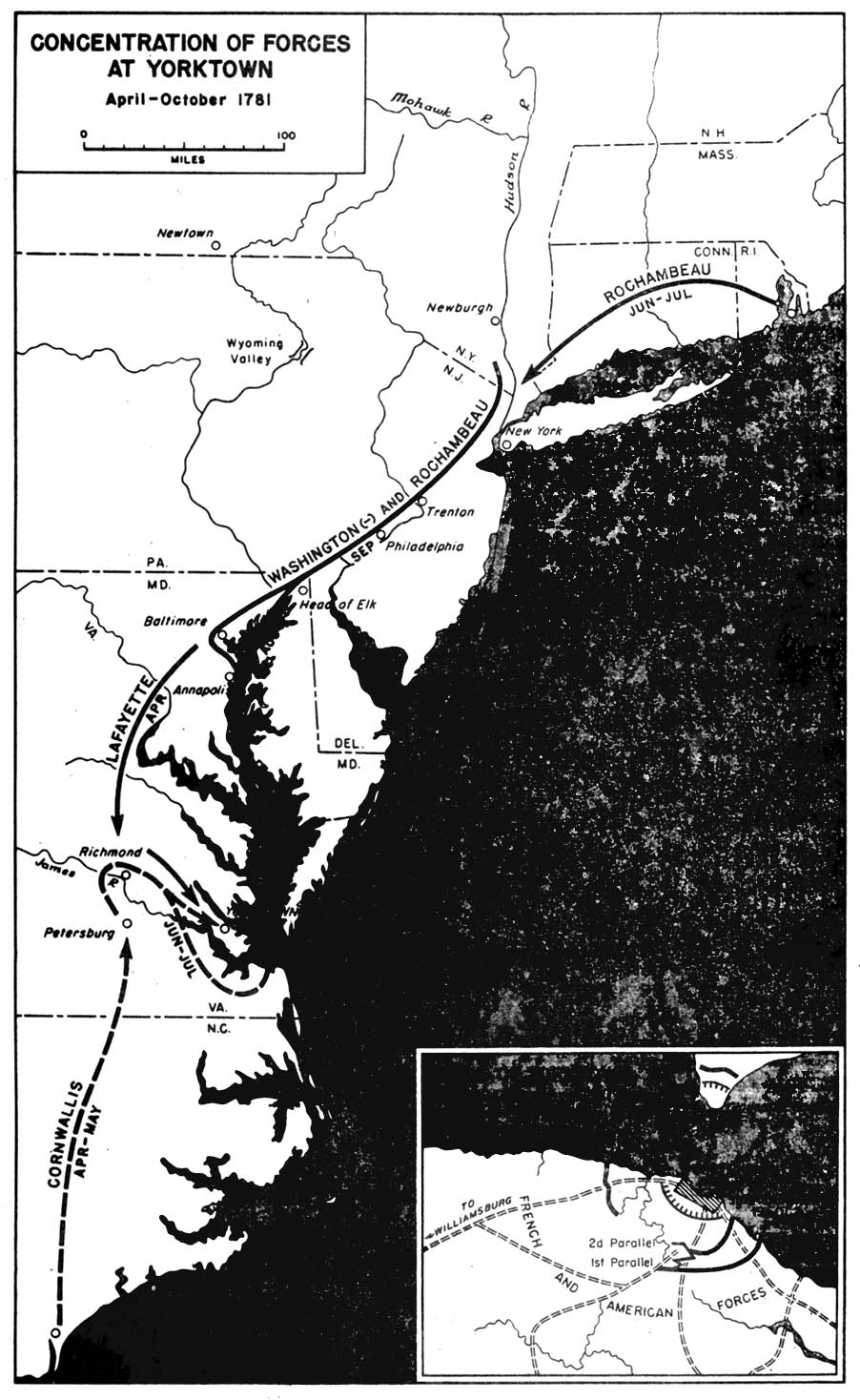
- 1781 - Concentration of Forces at Yorktown April-October 1781 (258K)
- 1783-1812 - Northern Frontier 1783-1812 (129K)
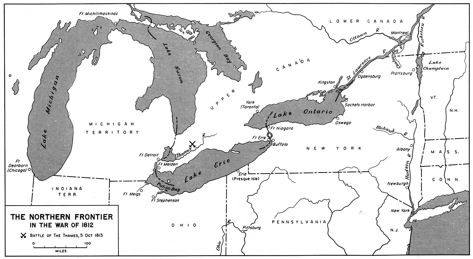
- 1812-1814 - The Northern Frontier In the War of 1812 (194K)
- 1812 - Niagara River Area, War of 1812 (194K)
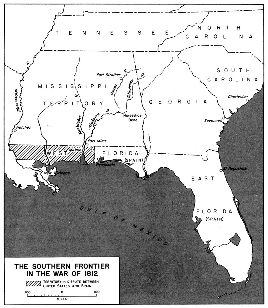
- 1812 - Southern Frontier in the War of 1812 (194K)
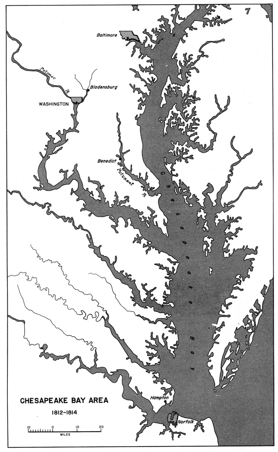
- 1812-1814 - Chesapeake Bay Area 1812-1814 (194K)
- 1846-1847 - The Mexican War 1846-1847 (194K)
- 1854-1890 - Atlas of the Sioux Wars, Part 1 by Charles D. Collins Jr., Combat Studies Institute/Combined Arms Research Library, 2006 (6MB)
- 1854-1890 - Atlas of the Sioux Wars, Part 2 by Charles D. Collins Jr., Combat Studies Institute/Combined Arms Research Library, 2006 (7.8MB)
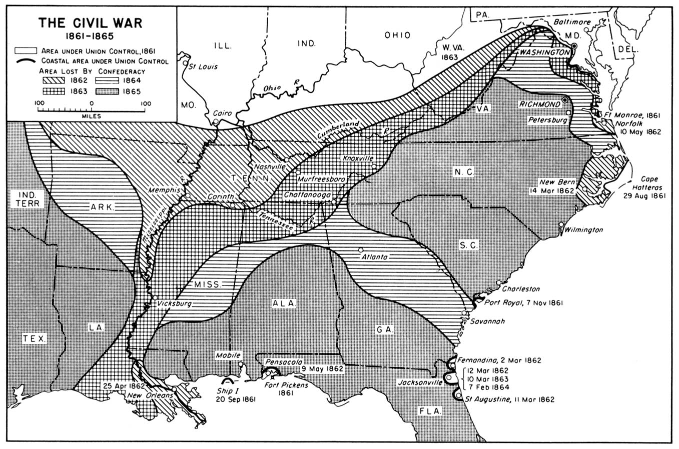
- 1861-1865 - The Civil War 1861-1865 (323K)
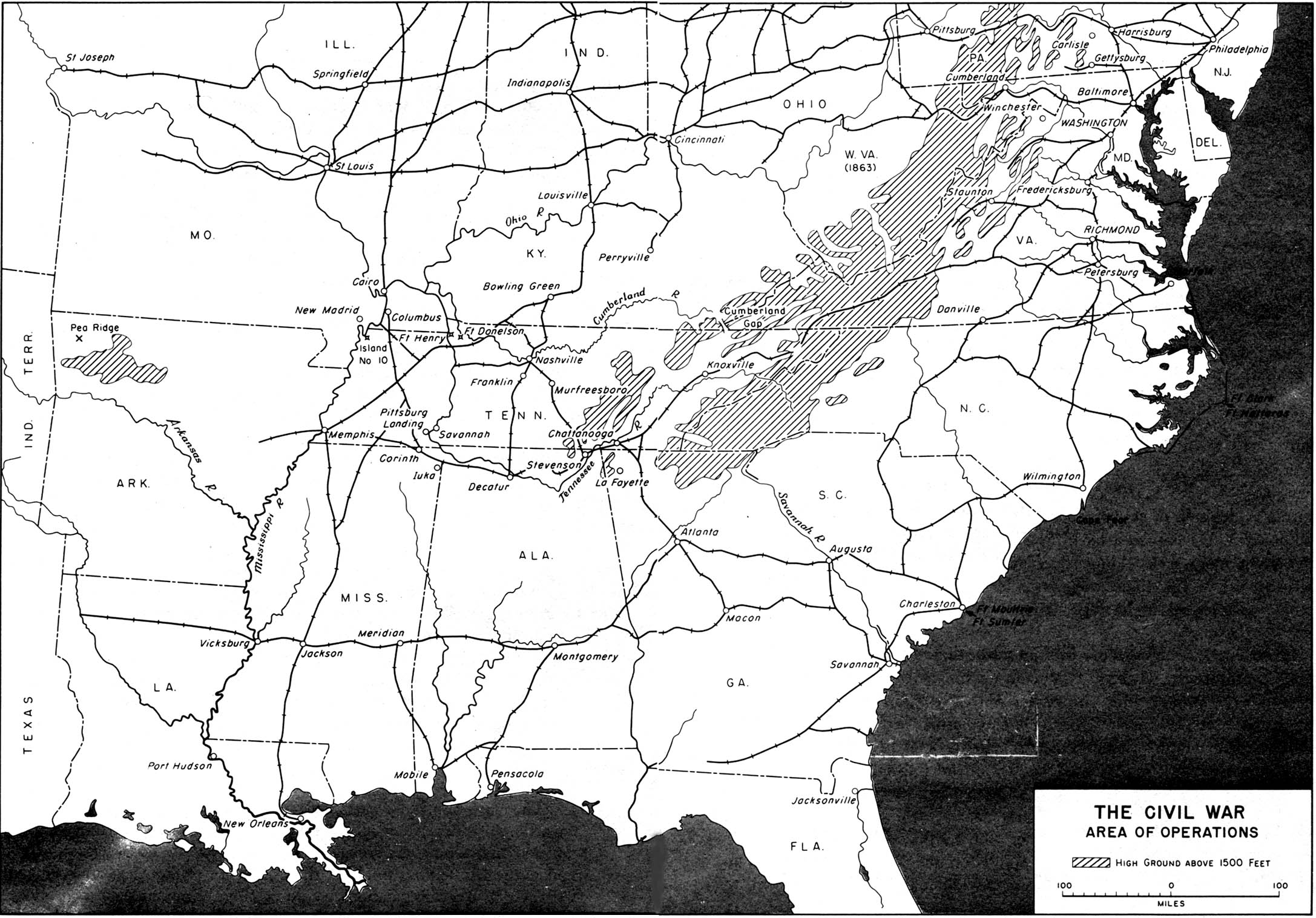
- 1861-1865 - The Civil War Area of Operations (516K)
- 1861-1865 - Seat of the Civil War, 1861-1865 (645K)
- 1781 - Concentration of Forces at Yorktown April-October 1781 (258K)
- Inset: Vicinity of Gettysburg. From The Historical Atlas by William R. Shepherd, 1923.
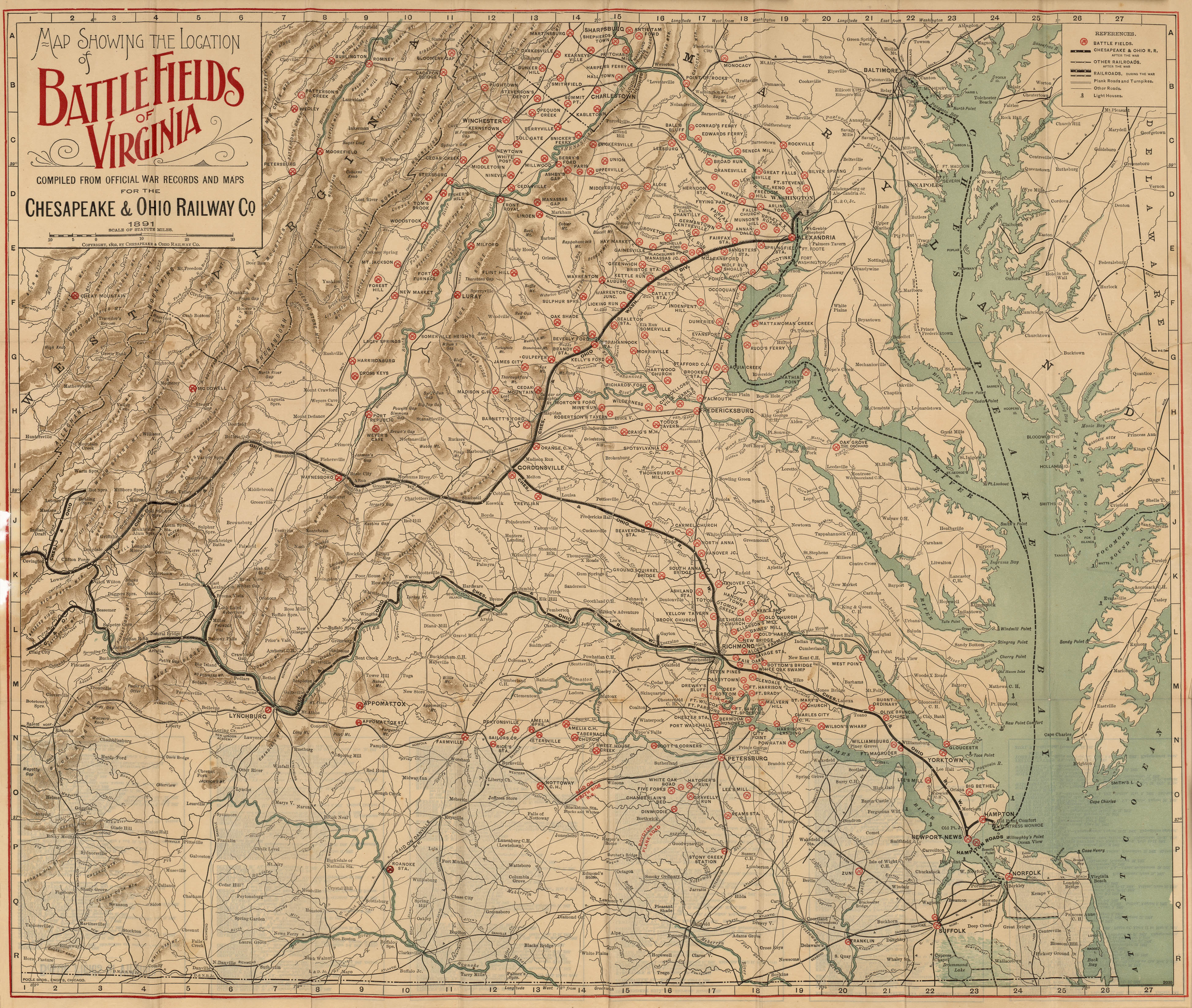
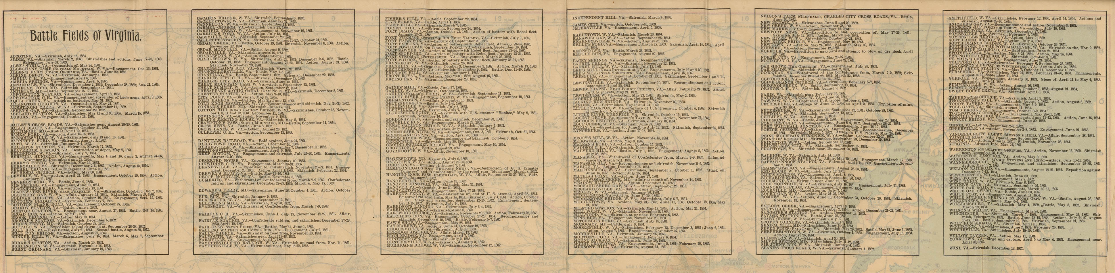
- 1861-1865 - Battle Fields of Virginia (2.9 MB)
- "Map Showing the Location of Battle Fields of Virginia 1891" by Chesapeake and Ohio Railway Company, 1892. Map shows: "Battle Fields", "Chesapeake & Ohio R.R. after the war", "Other railroads after the war", "Railroads during the war", "Plank roads and turnpikes", "Other roads", "Light houses", rivers, towns, and relief by hachures. Verso: List of "Battle Fields of Virginia" with dates of actions. (852K)
- 1861-1865 - The Eastern Theater 1861-1865 (516K)
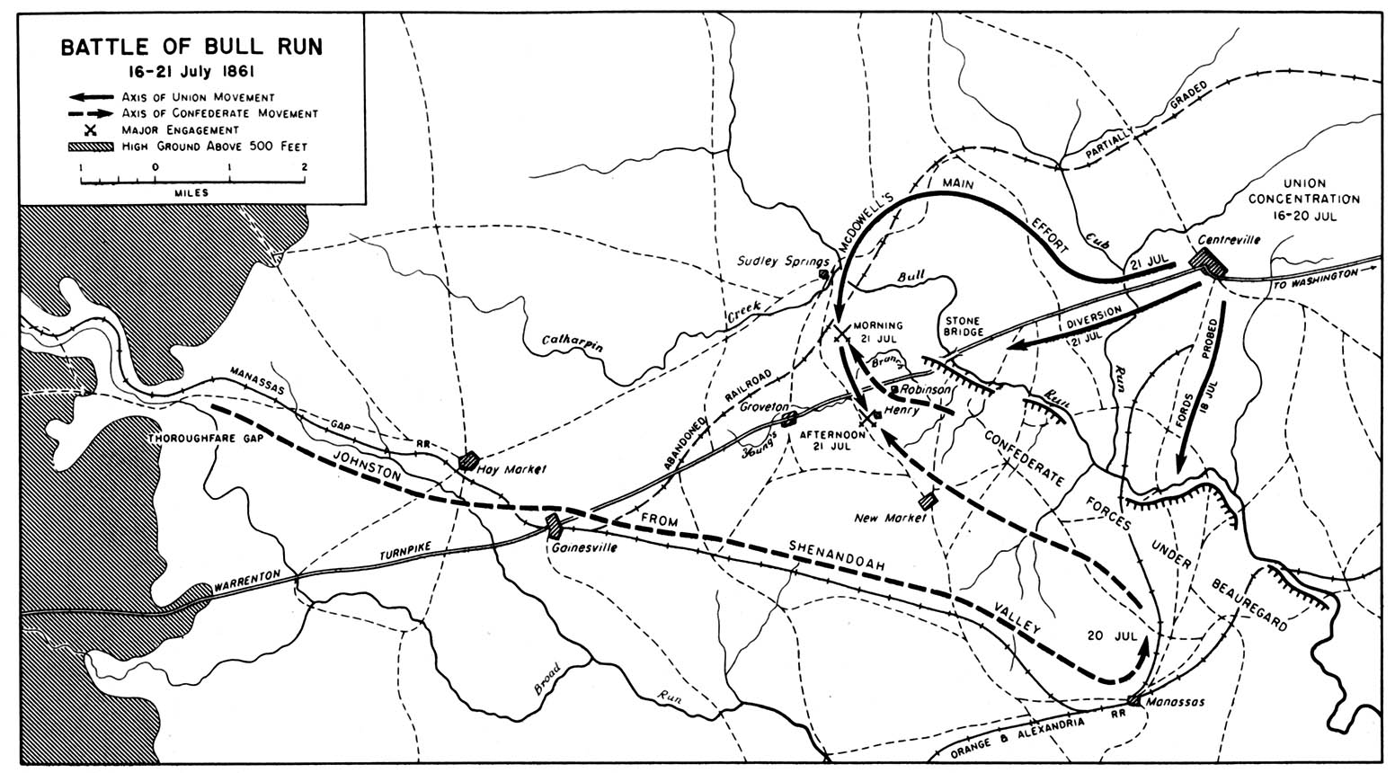
- 1861 - Battle of Bull Run 16-21 July 1861 (258K)
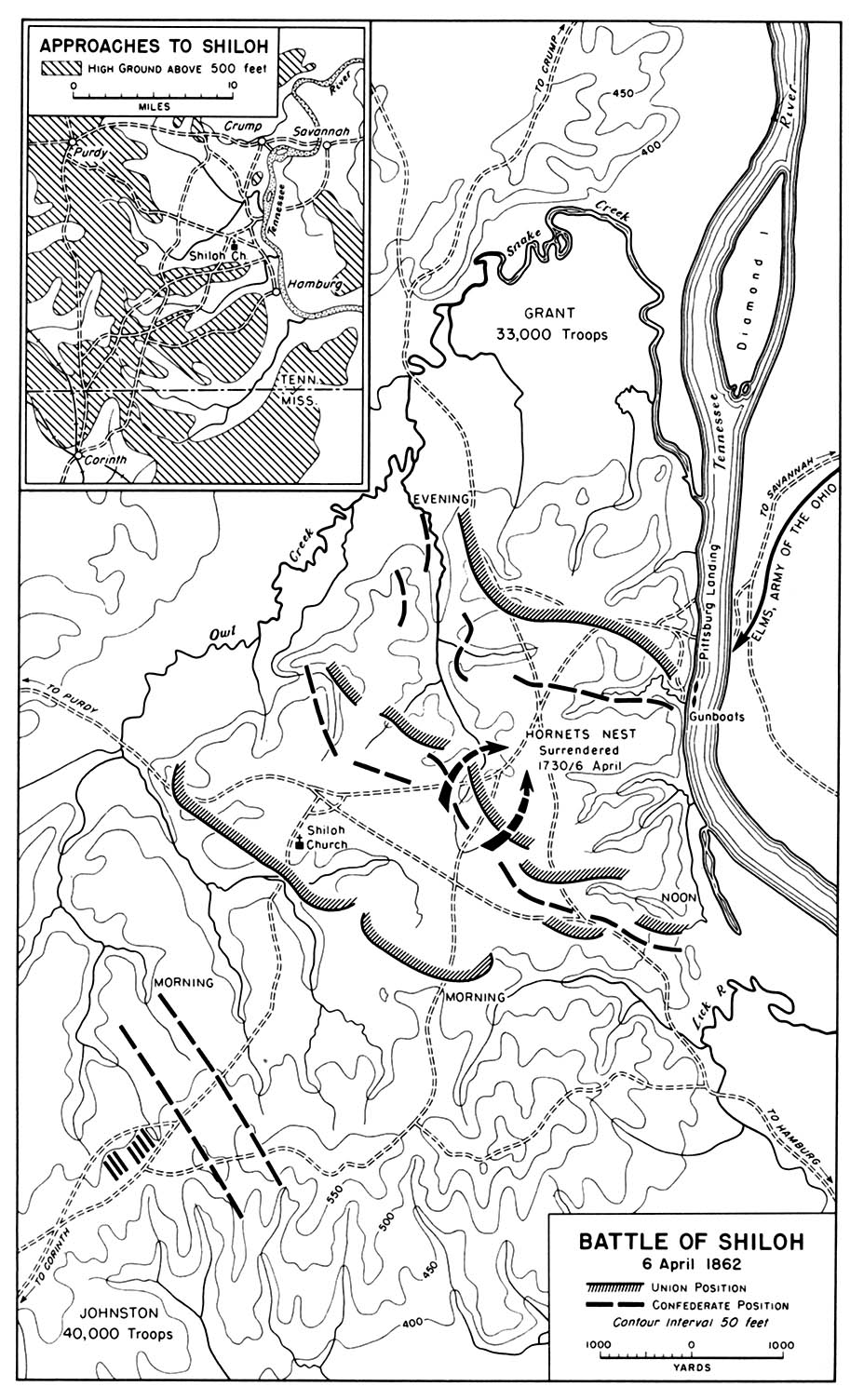
- 1862 - Battle of Shiloh 6 April 1862 (323K)
- 1861 - Battle of Bull Run 16-21 July 1861 (258K)
- Inset: Approaches to Shiloh
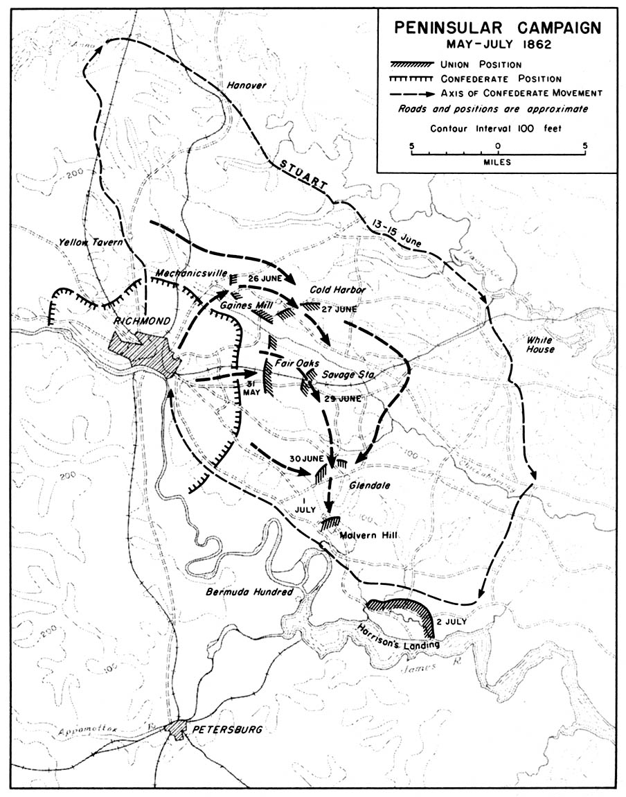
- 1862 - Peninsular Campaign May-July 1862 (194K)
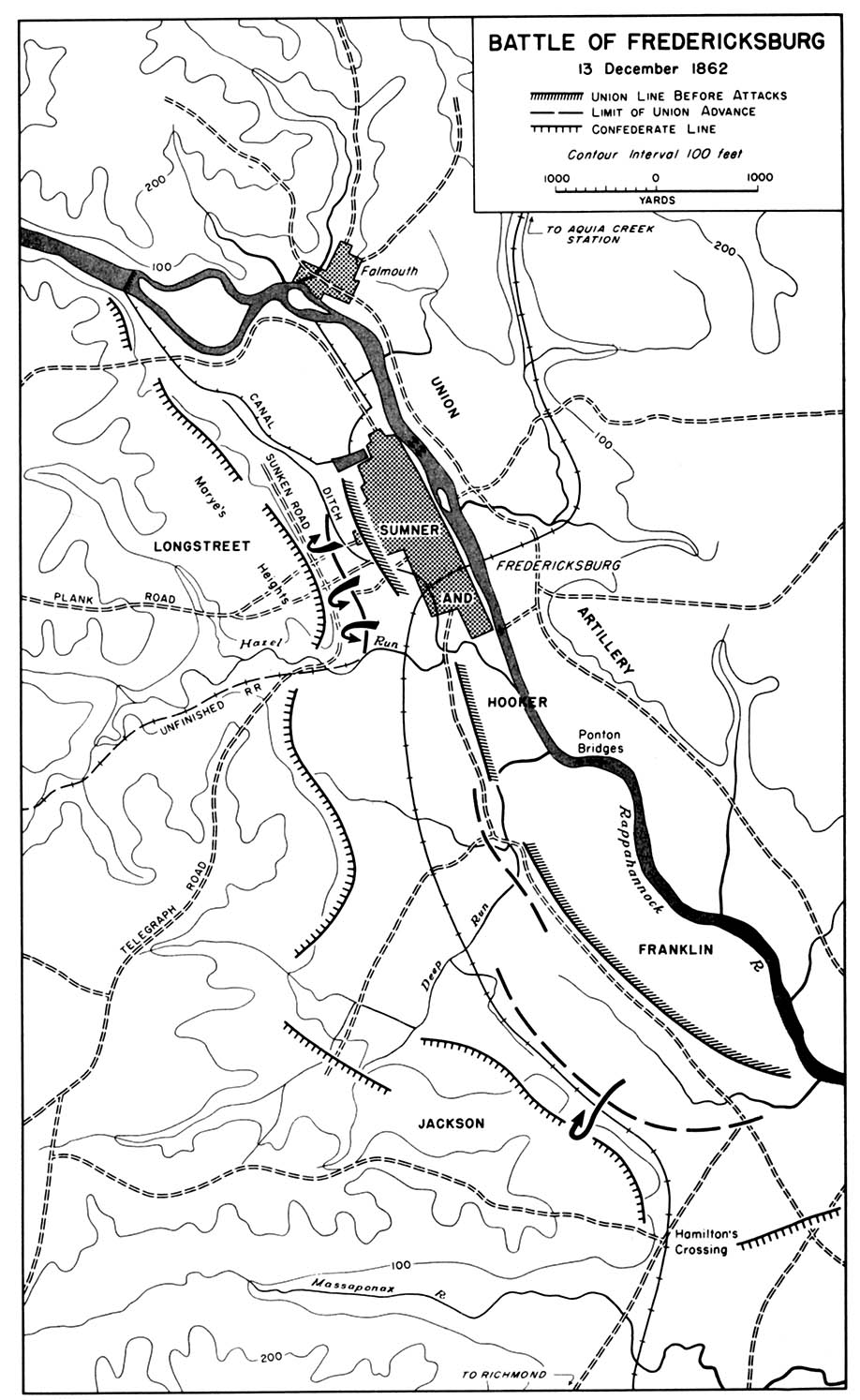
- 1862 - Battle of Fredericksburg 13 December 1862 (268K)
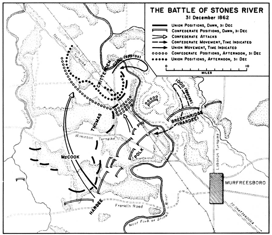
- 1862 - Battle of Stones River 31 December 1862 (194K)
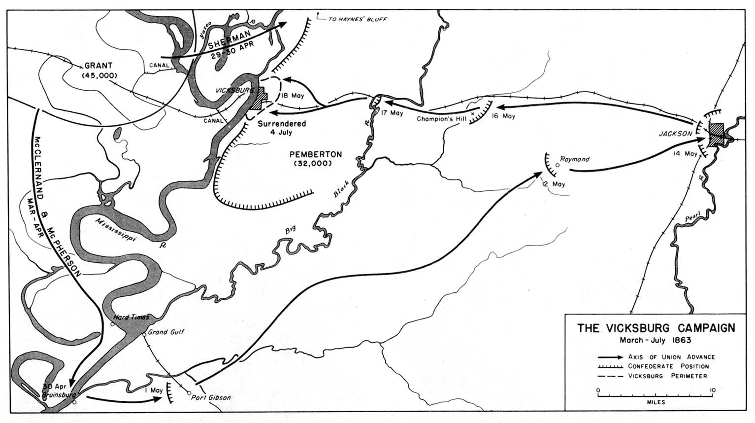
- 1863 - Vicksburg Campaign March-July 1863 (194K)
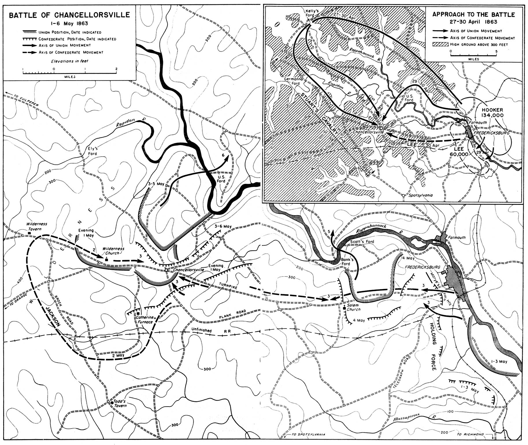
- 1863 - Battle of Chancellorsville 1-6 May 1863 (581K)
- 1862 - Battle of Fredericksburg 13 December 1862 (268K)
- Inset: Approaches to the Battle 27-30 April 1863
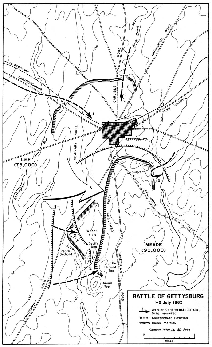
- 1863 - Battle of Gettysburg 1-3 July 1863 (258K)
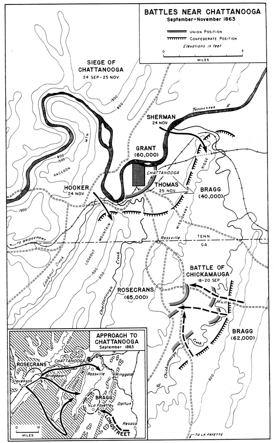
- 1863 - Battles near Chattanooga September-November 1863 (258K)
- Inset: Approach to Chattanooga September 1863
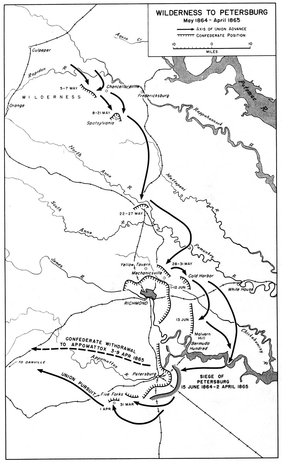
- 1864-1865 - Wilderness to Petersburg May 1864-April 1865 (194K)
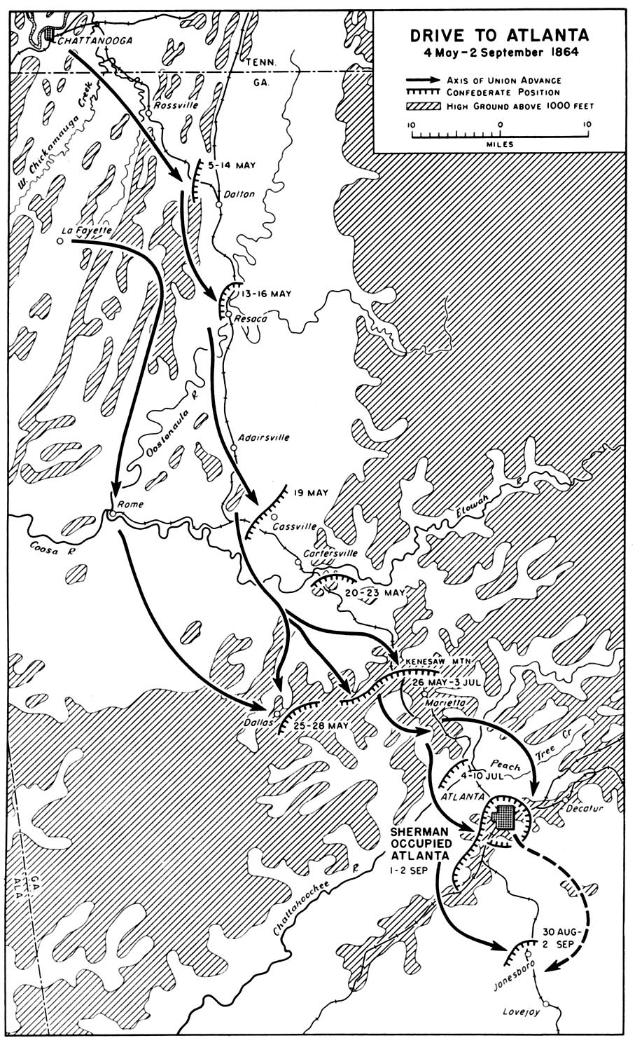
- 1864 - Drive to Atlanta 4 May-2 September 1864 (452K)
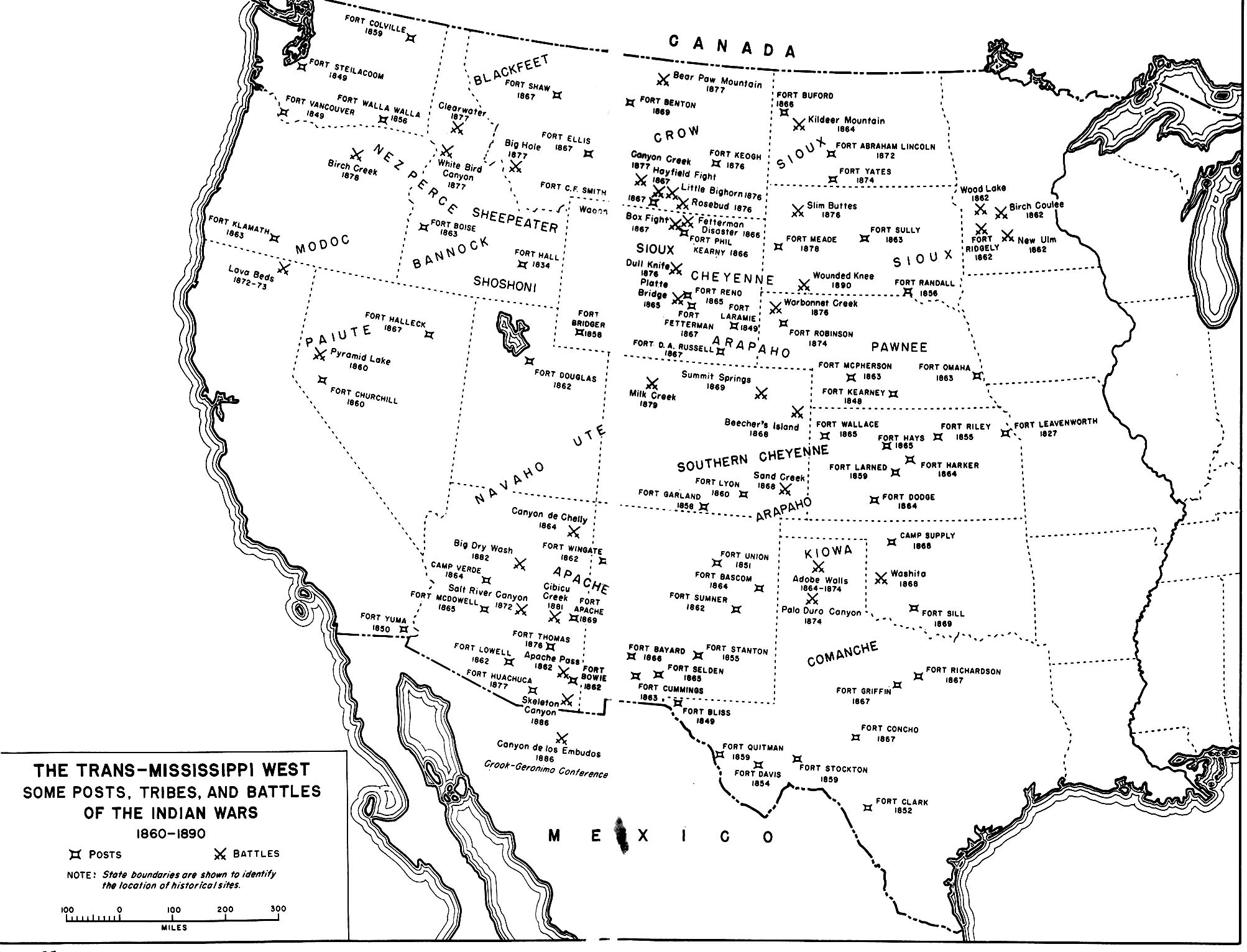
- 1860-1890 - The Trans-Mississippi West Some Posts, Tribes, and Battles of the Indian Wars (452K)
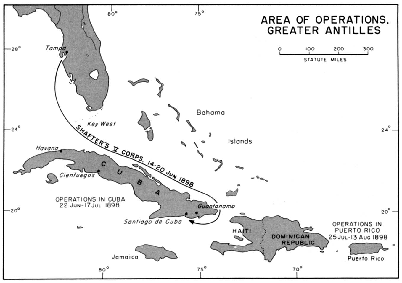
- 1898 - Greater Antilles Area of Operations (129K)
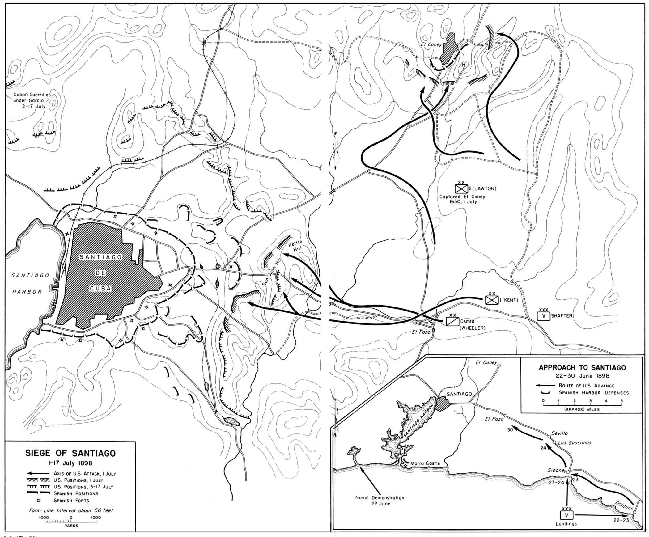
- 1898 - Siege of Santiago 1-17 July 1898 (452K)
- 1864 - Drive to Atlanta 4 May-2 September 1864 (452K)
- Inset: Approach to Santiago 22-30 June 1898
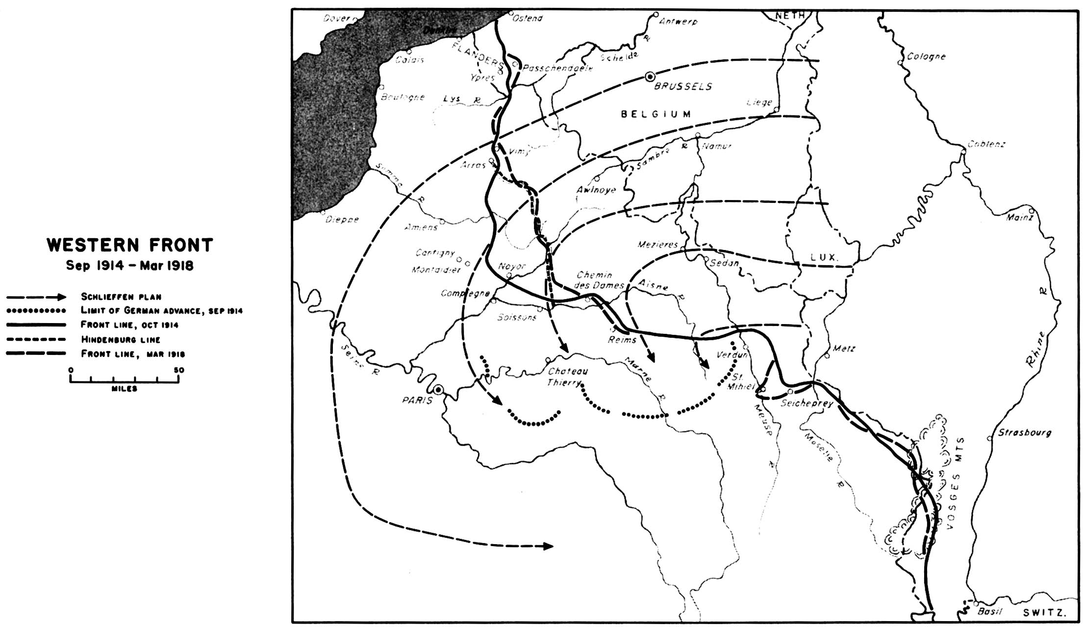
- 1918 - Western Front September 1914 - March 1918 (258K)
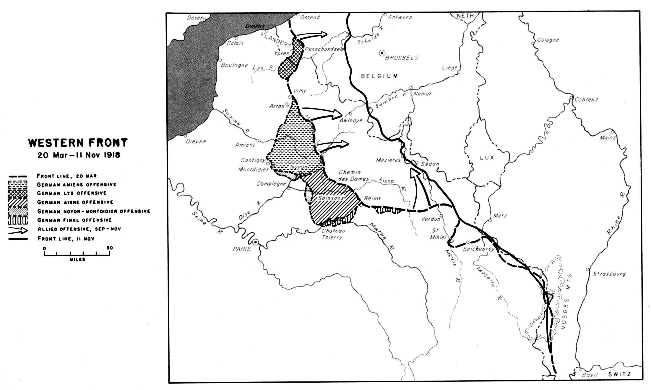
- 1918 - Western Front 20 March - 11 November 1918 (258K)
- World War II Maps (51 Maps)
- 1950-1951 - The Korean Conflict 1950-1951 (258K)
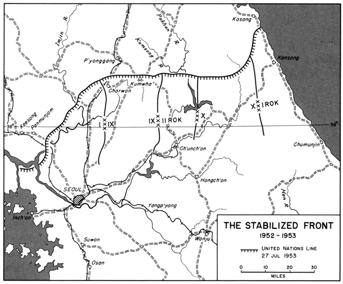
- 1952-1953 - The Stabilized Front 1952-1953 (194K)
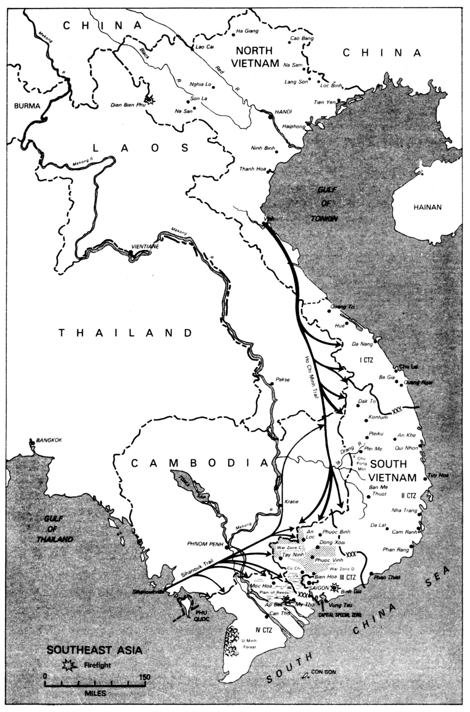
- Southeast Asia (387K)
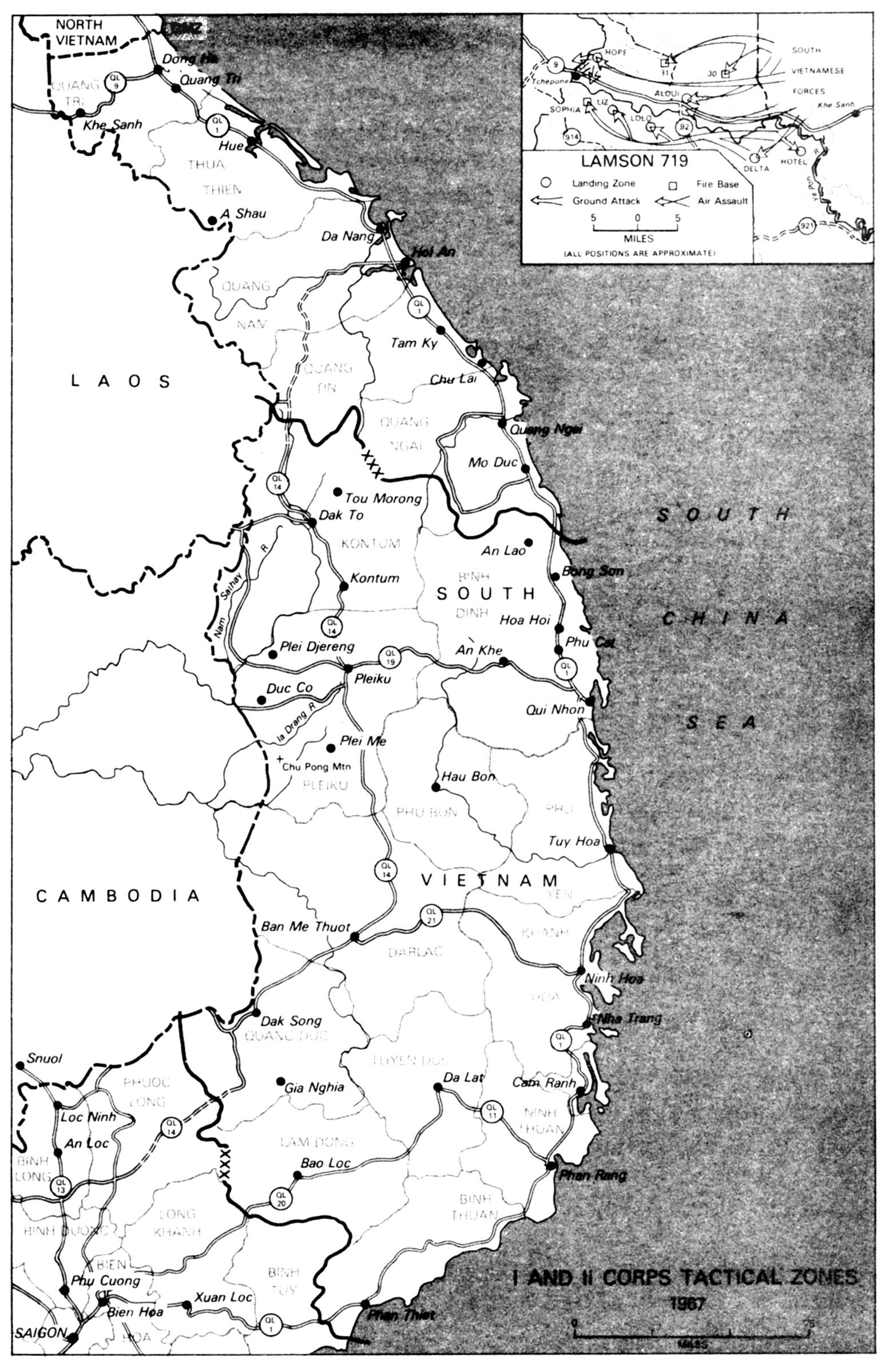
- 1967 - 1 and 2 Corps Tactical Zones 1967 (452K)
- 1918 - Western Front 20 March - 11 November 1918 (258K)
- Inset: Lamson 719
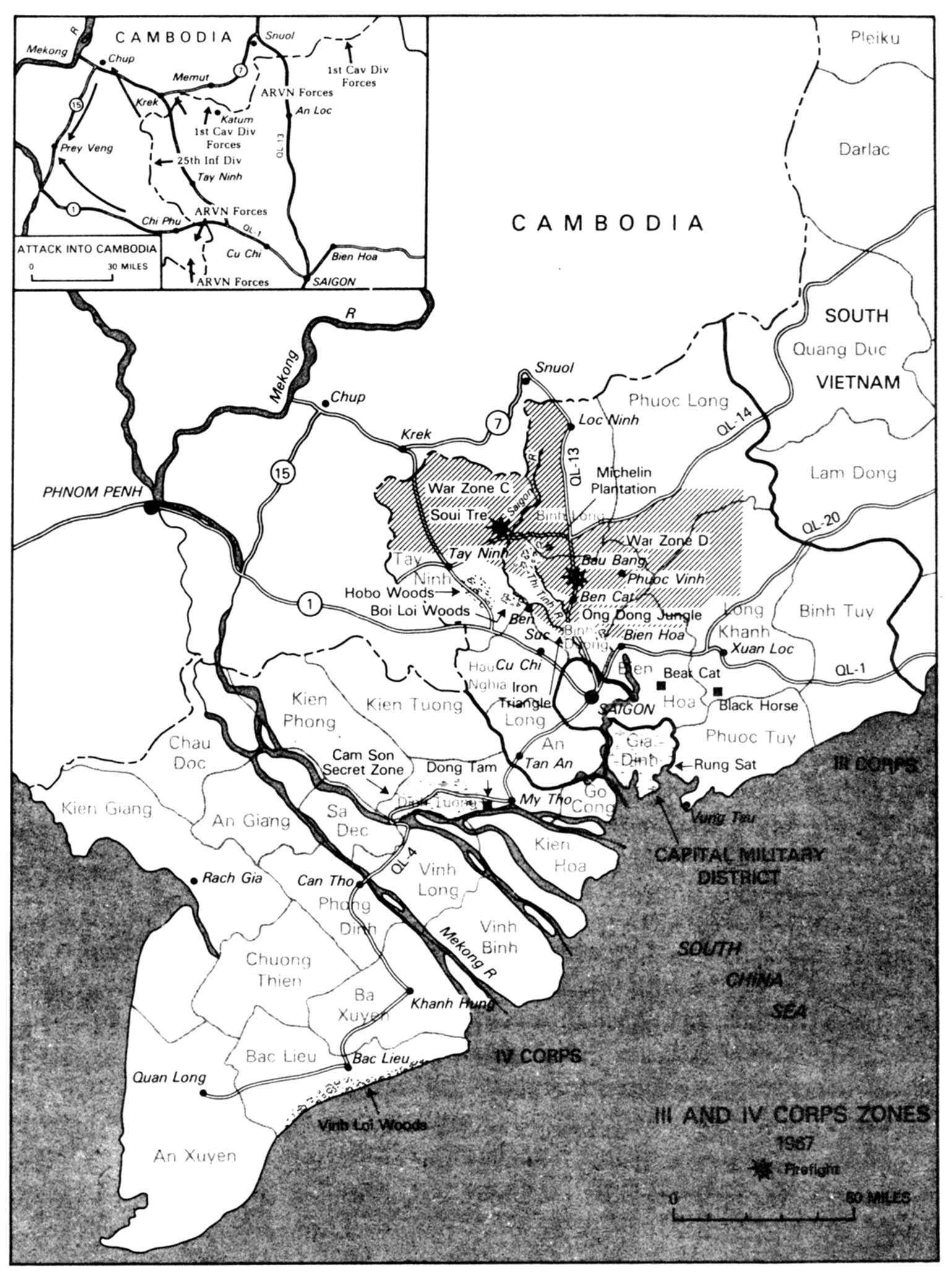
- 1967 - 3 and 4 Corps Zones 1967 (387K)
- Inset: Attack into Cambodia
- Historical Maps of U.S. Cities
- Historical Maps of U.S. Metropolitan Areas (National Atlas, 1970)
- Historical Maps of Texas
- Historical Maps of Texas Cities
- Maps of National Historic Parks, Memorials, Military Parks and Battlefields
- U.S. Historical Maps on Other Web Sites
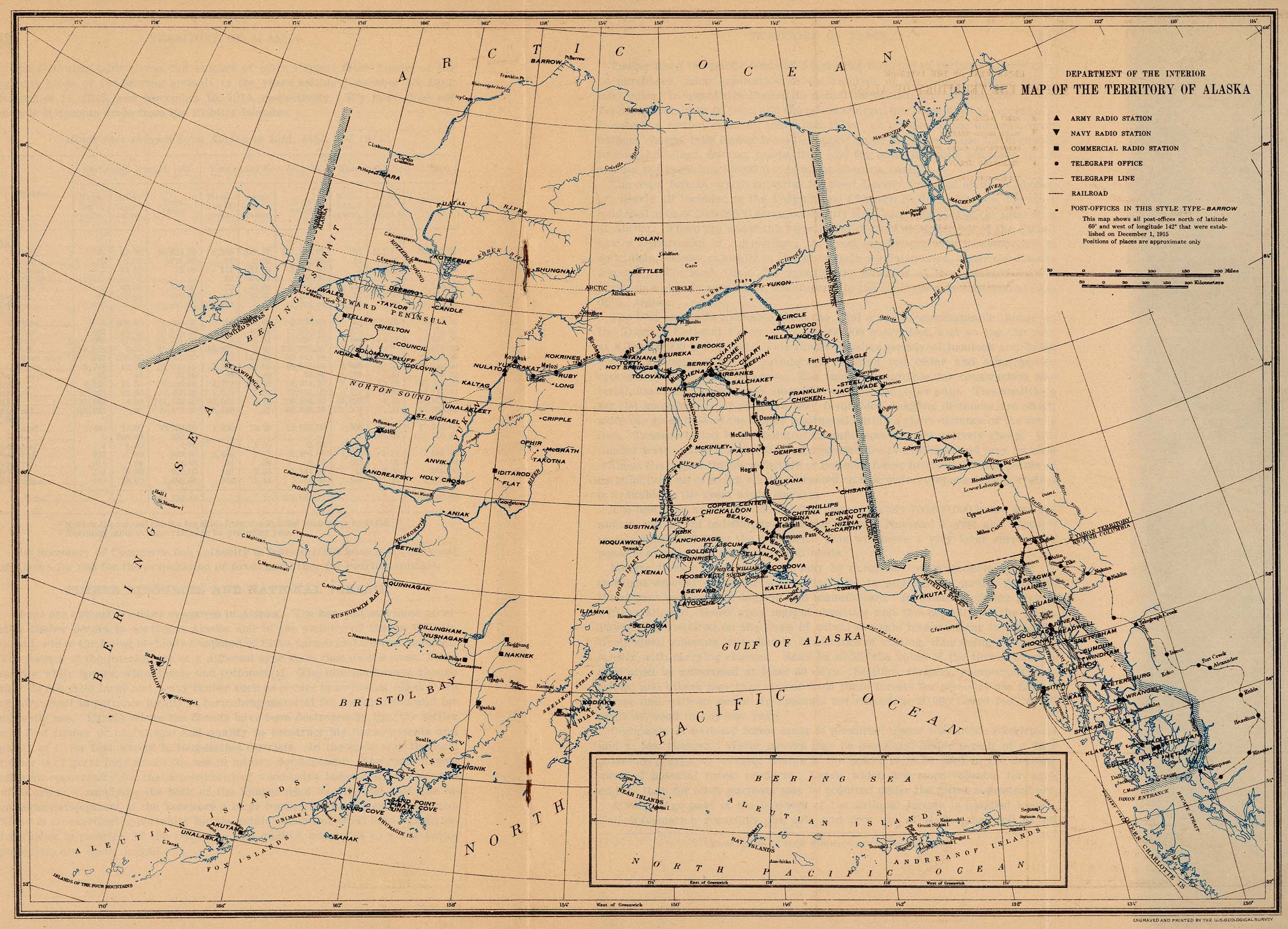
- Alaska Territory 1915 (679K)
- Historical Maps of U.S. Metropolitan Areas (National Atlas, 1970)
- "Map of the Territory of Alaska" from General Information Regarding the Territory of Alaska, Department of the Interior, Office of the Secretary. January 1916. The map shows locations of Army, Navy and commercial radio stations, telegraph offices and lines, railroads and post-offices.
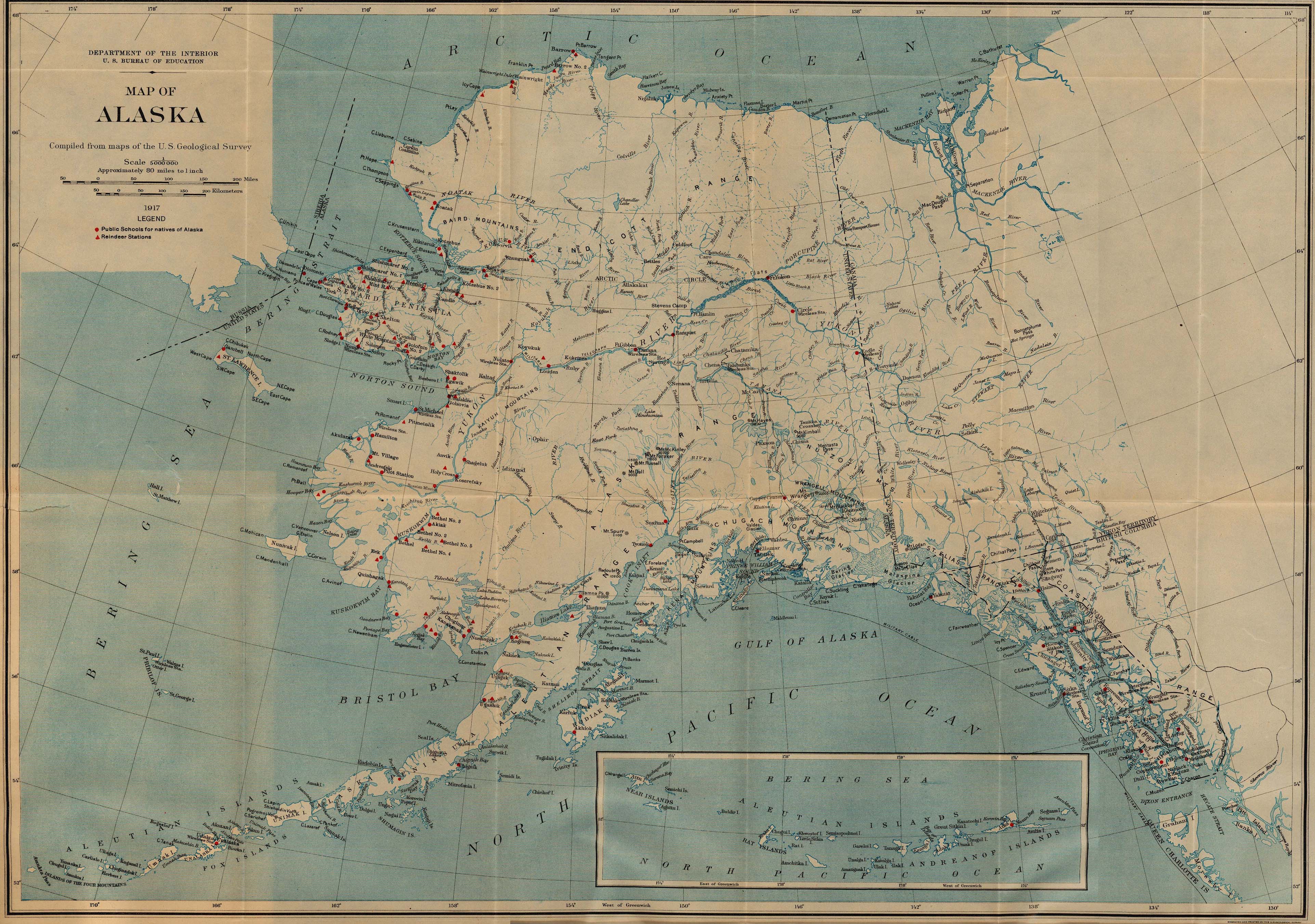
- Alaska 1917 (1,806K)
- "Map of Alaska" from Work of the Bureau of Education for the Natives of Alaska, 1916-17, Department of the Interior. U.S. Bureau of Education Bulletin, 1918, No. 5. The map shows locations of public schools for natives of Alaska and reindeer stations.
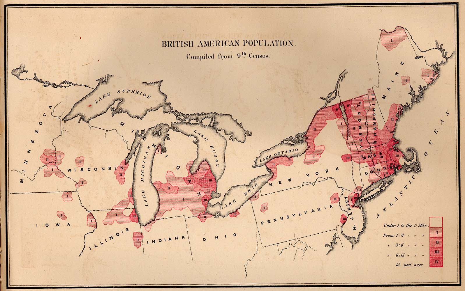
- British American Population 1872 (229K)
- From The Statistics of the Population of the United States, Compiled from the Original Returns of the Ninth Census, 1872.
- Boston 1842 (341K)
- "Boston" from Tanner, H.S. The American Traveller; or Guide Through the United States. Eighth Edition. New York, 1842.
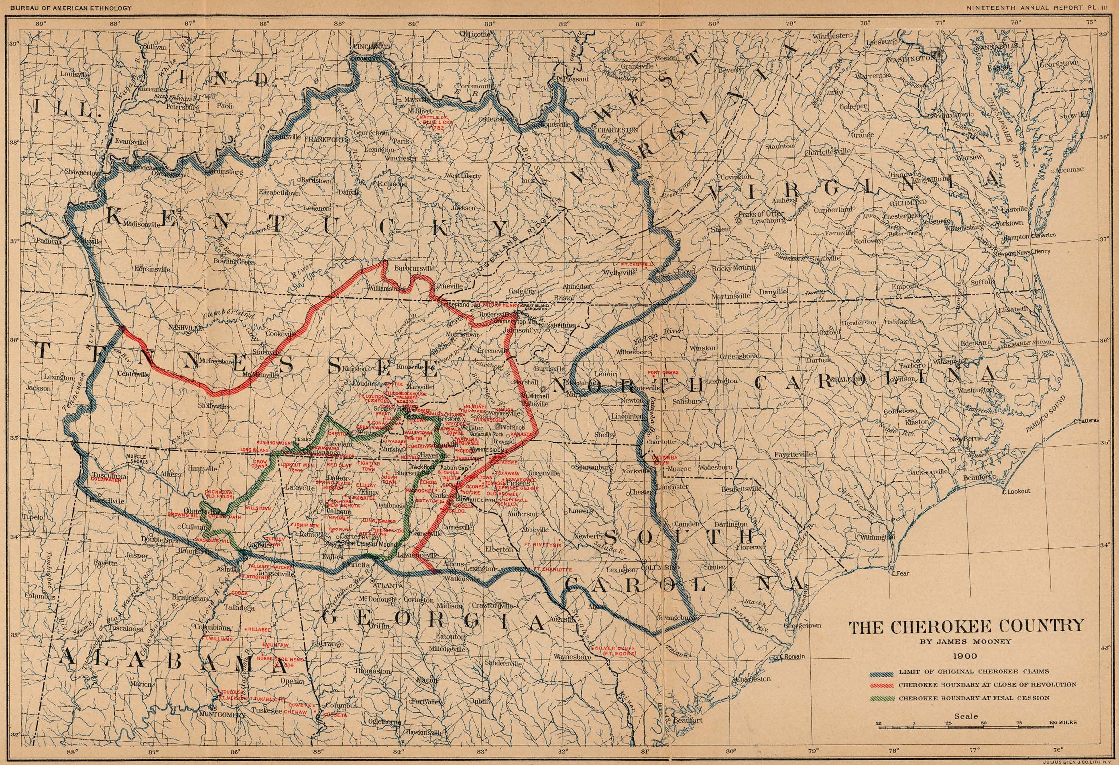
- The Cherokee Country (932K)
- "The Cherokee Country by James Mooney 1900" from Nineteenth Annual Report of The Bureau of American Ethnology 1897-98, published 1900.
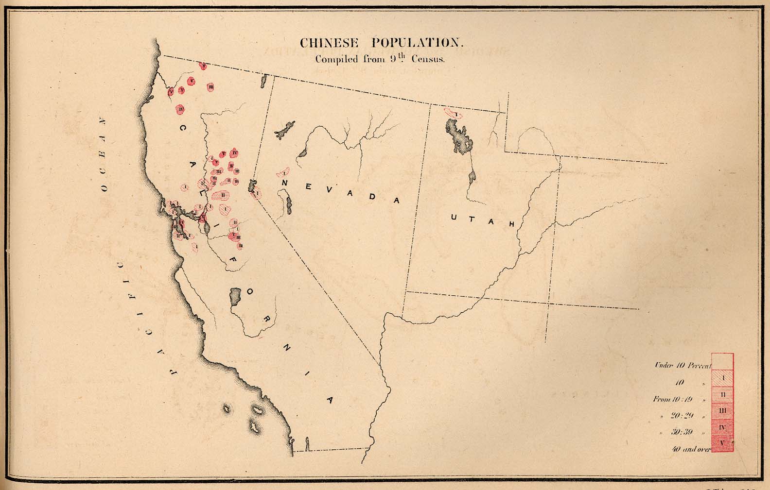
- Chinese Population 1872 (155K)
- From The Statistics of the Population of the United States, Compiled from the Original Returns of the Ninth Census, 1872.
- Connecticut 1796 (5.0MB)
- "The State of Connecticut" from Heads of Families First Census of the United States - State of Connecticut, 1908.
- Eastern United States 1906 (308K)
- U.S. Geological Survey 1906.
- Electric Railway Maps 1898-1913
- McGraw Electric Railway Manual Maps / American Street Railway Maps (Street Railway Journal) [1898, 1901, 1902, 1903, 1913]
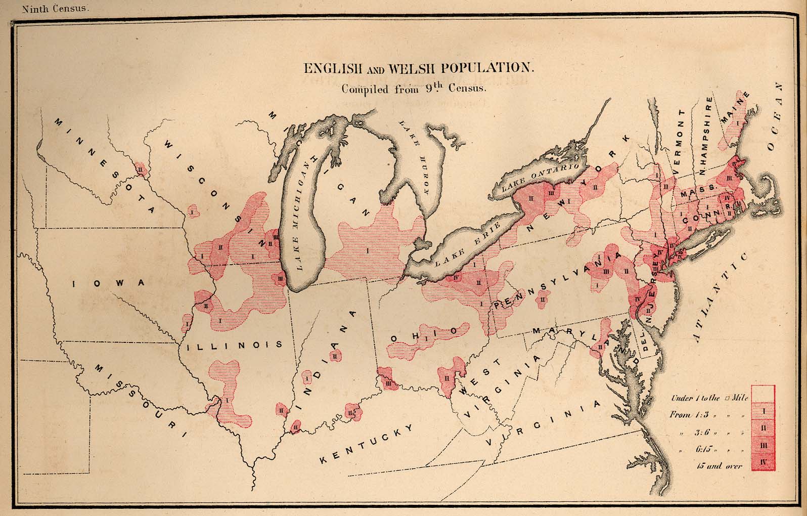
- English and Welsh Population 1872 (244K)
- From The Statistics of the Population of the United States, Compiled from the Original Returns of the Ninth Census, 1872.
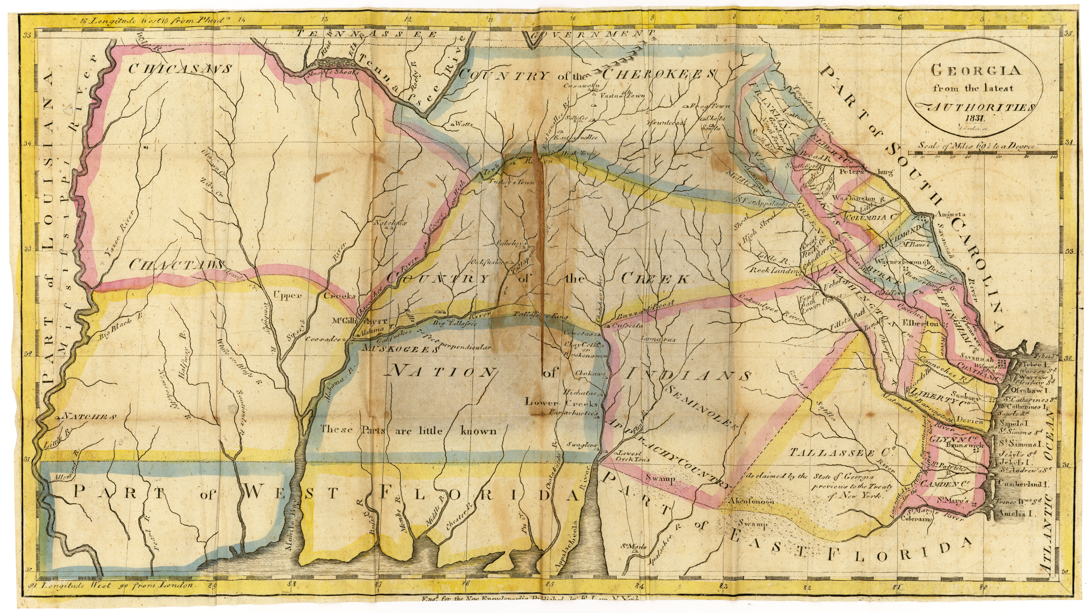
- Georgia 1831
- Georgia from the latest Authorities 1831 by Esther Low (publisher). Map courtesy Dorothy Sloan-Rare Books, Austin, Texas
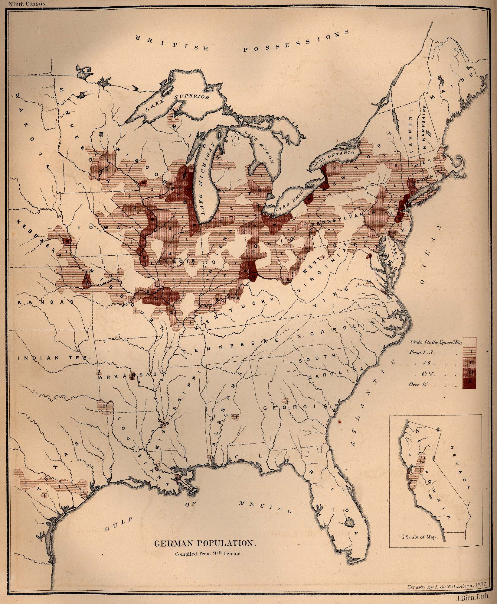
- German Population 1872 (603K)
- From The Statistics of the Population of the United States, Compiled from the Original Returns of the Ninth Census, 1872.
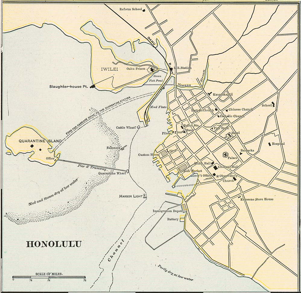
- Honolulu 1901 (175K)
- From Cram's Modern Atlas, 1901.
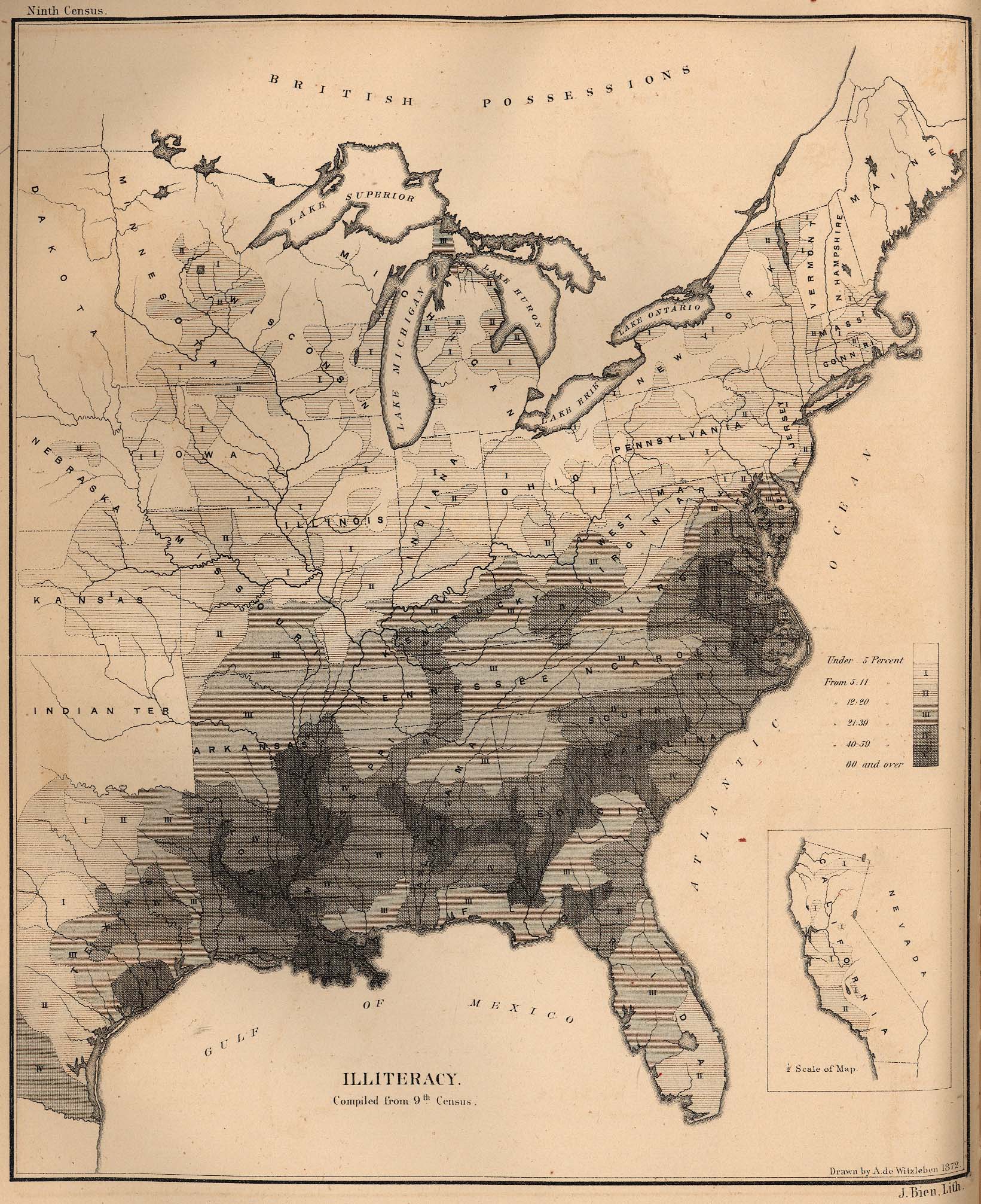
- Illiteracy in the United States 1872 (728K)
- From The Statistics of the Population of the United States, Compiled from the Original Returns of the Ninth Census, 1872.
- Indian Territory [Oklahoma] 1857 (967K)
- Excerpt of "Territory of Kansas. and Indian Territory..." from Atlas of the United States of North America... by Henry Darwin Rogers & A[lexander] Keith Johnston, London: Edward Stanford, 1857. Map courtesy Dorothy Sloan-Rare Books, Austin, Texas
- Indian Territory [Oklahoma] 1884 (1MB)
- From Hardesty's Historical and Geographical Encyclopedia 1884.
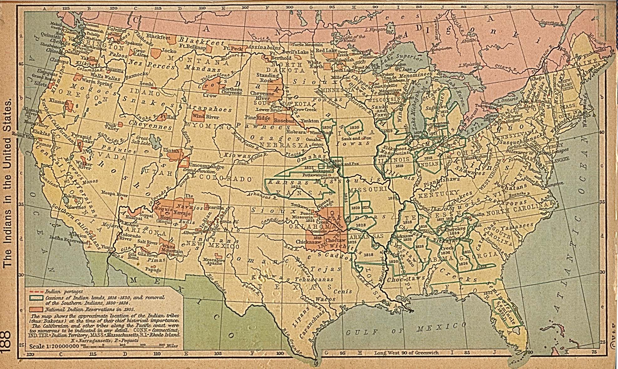
- The Indians in the United States (645K)
- From The Historical Atlas by William R. Shepherd, 1923.
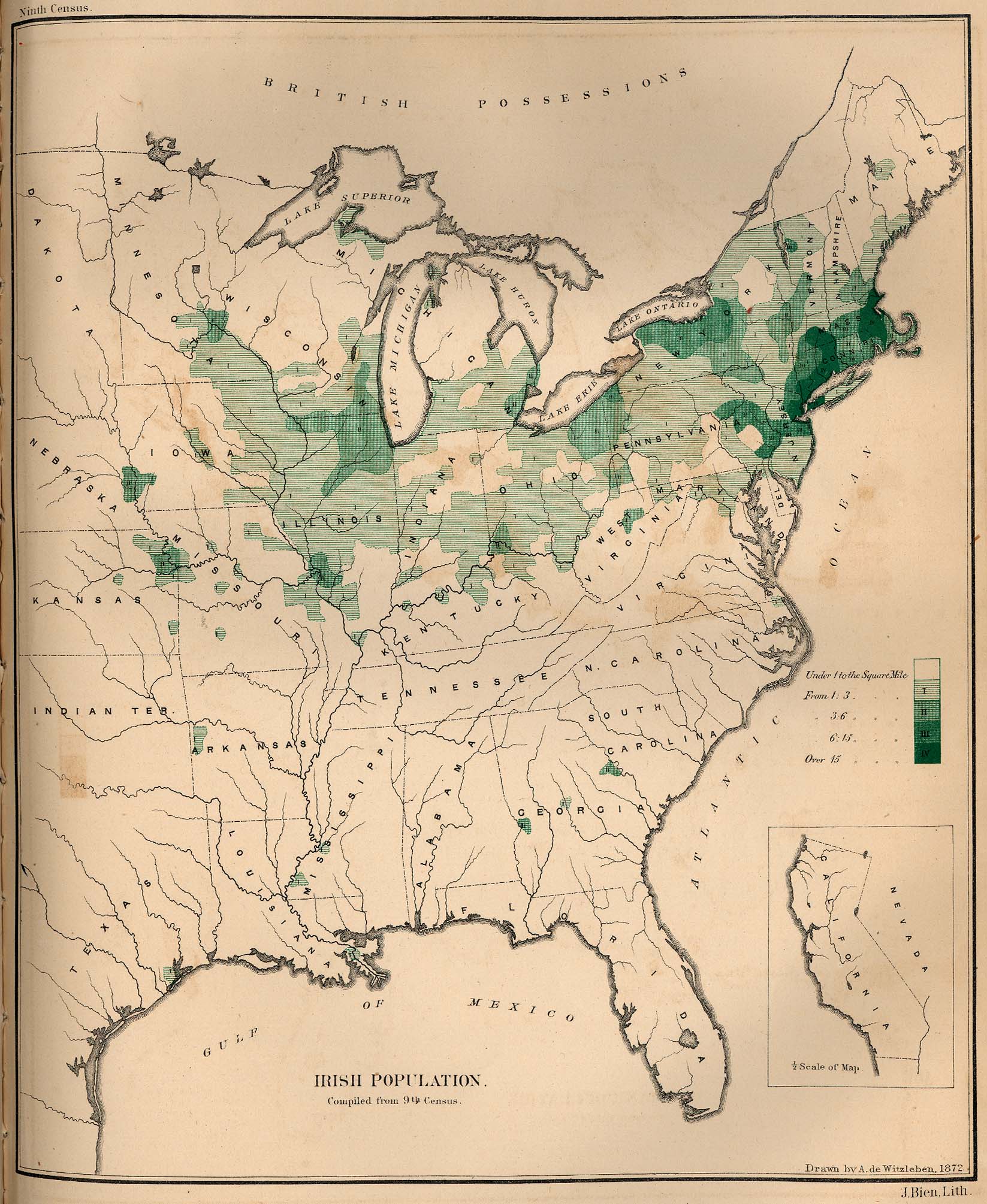
- Irish Population 1872 (505K)
- From The Statistics of the Population of the United States, Compiled from the Original Returns of the Ninth Census, 1872.
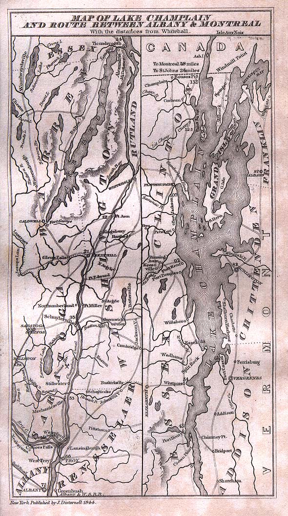
- Lake Champlain and Routes Between Albany and Montreal 1844 (387K)
- "Map of Lake Champlain and Route Between Albany and Monteal" from The Picturesque Tourist: Being a Guide Through Northern and Eastern States edited by Orville L. Holley, 1844.
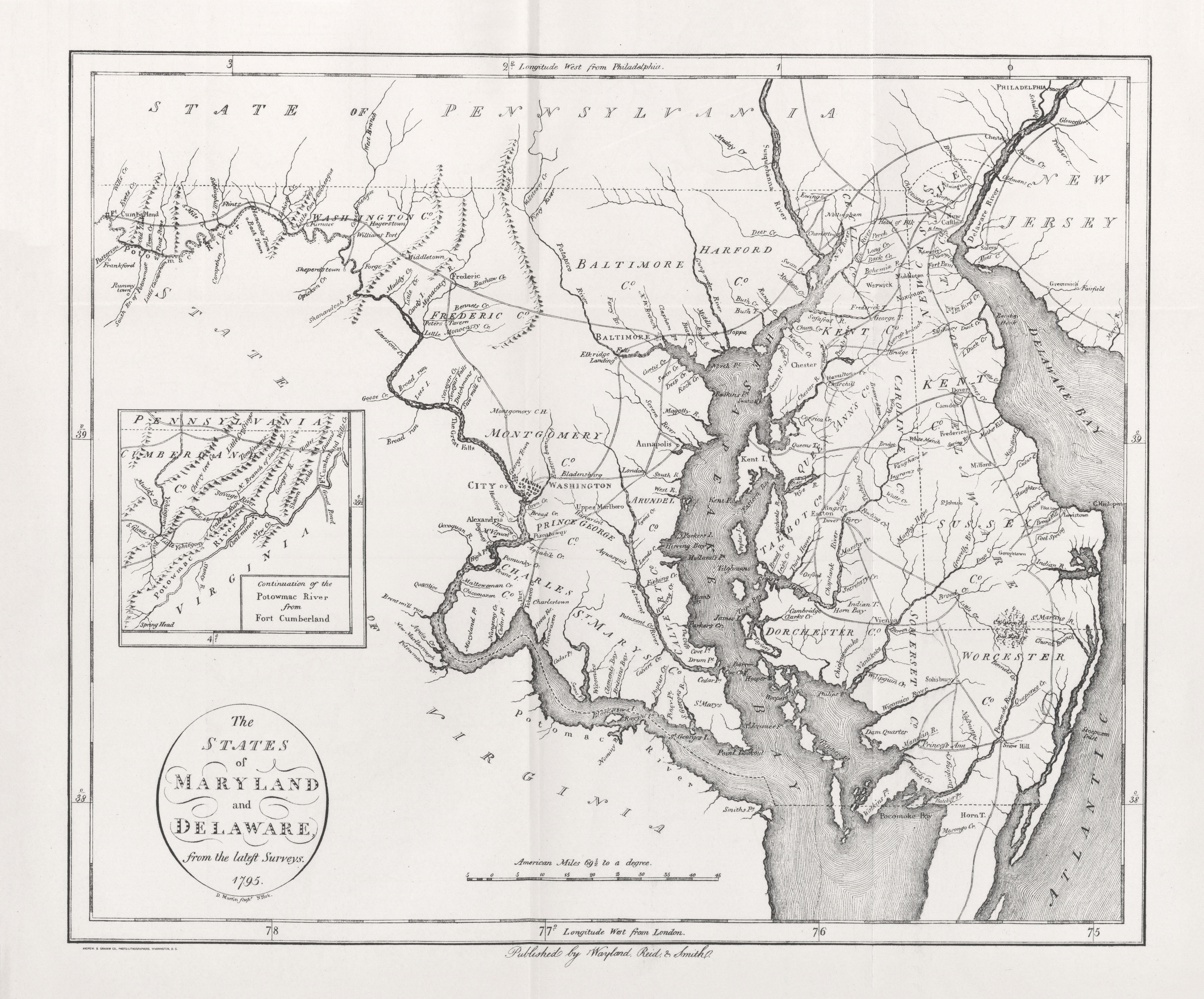
- Maryland and Delaware 1795 (5.7MB)
- "The States of Maryland and Delaware" from Heads of Families First Census of the United States - State of Maryland, 1908.
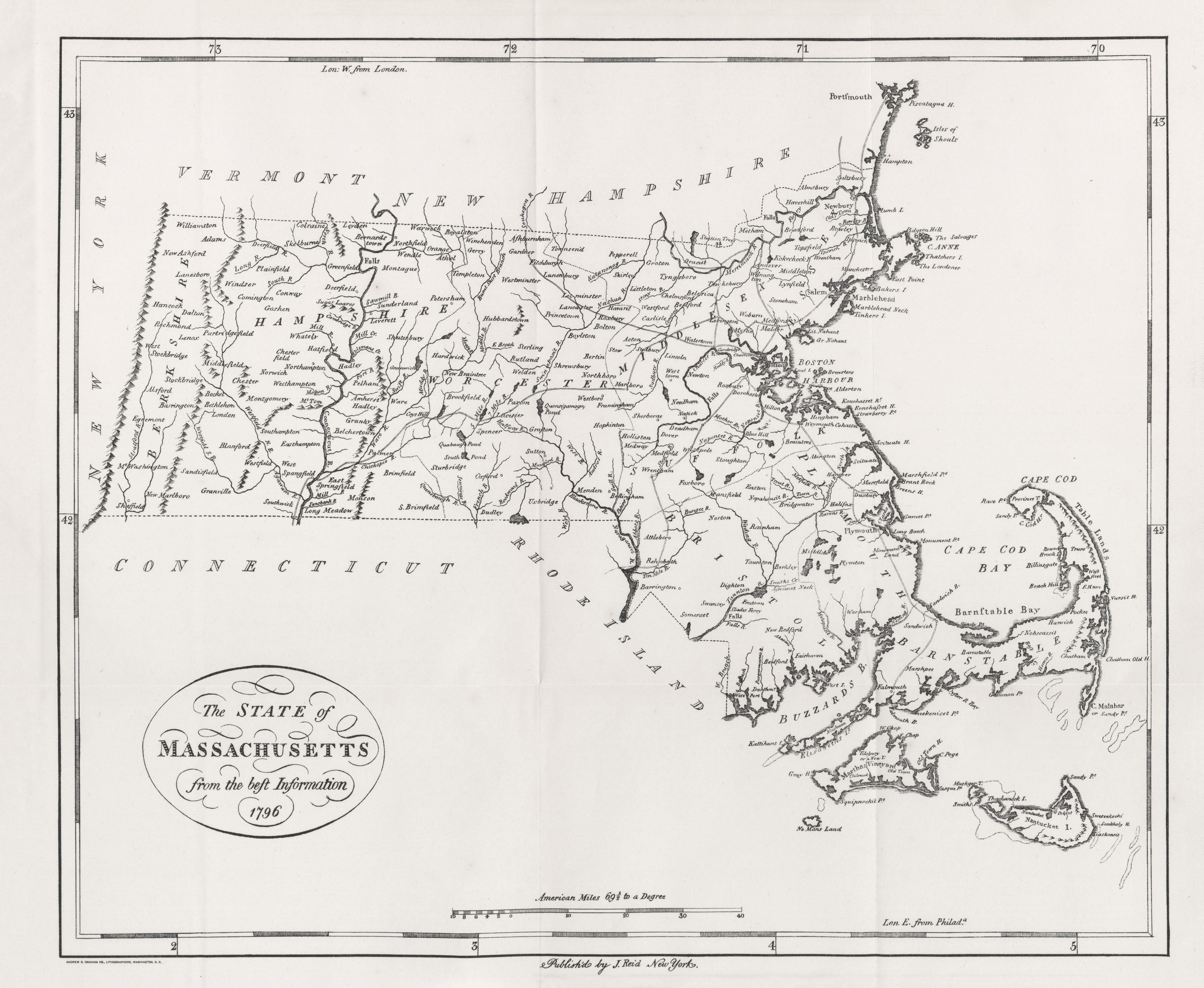
- Massachusetts 1796 (4.7MB)
- "The State of Massachusetts" from Heads of Families First Census of the United States - State of Massachusetts, 1908.
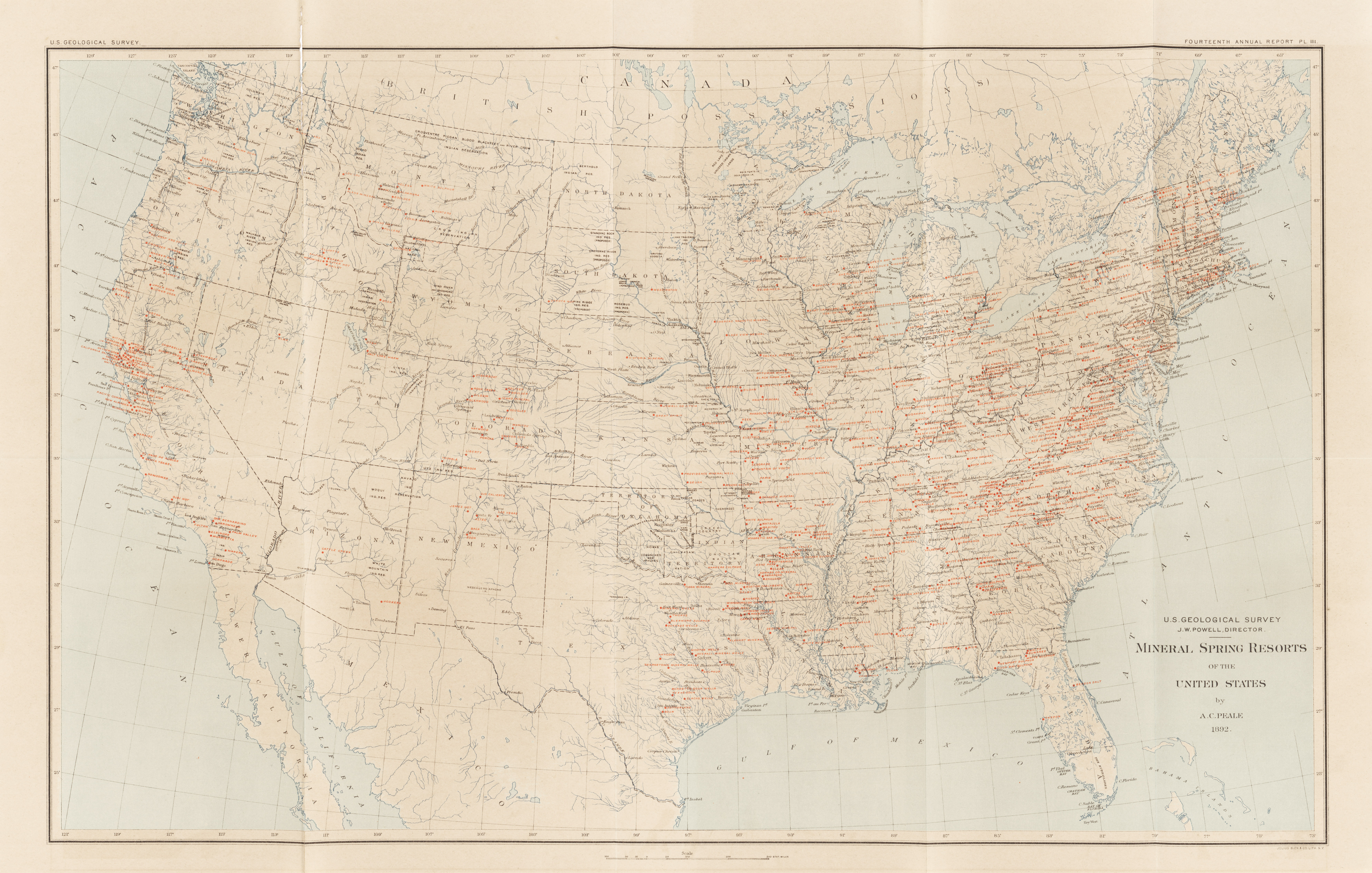
- Mineral Spring Resorts of the United States (6.3MB)
- U.S. Geological Survey, 14th Annual Report, Plate III. A.C. Peale, 1892.
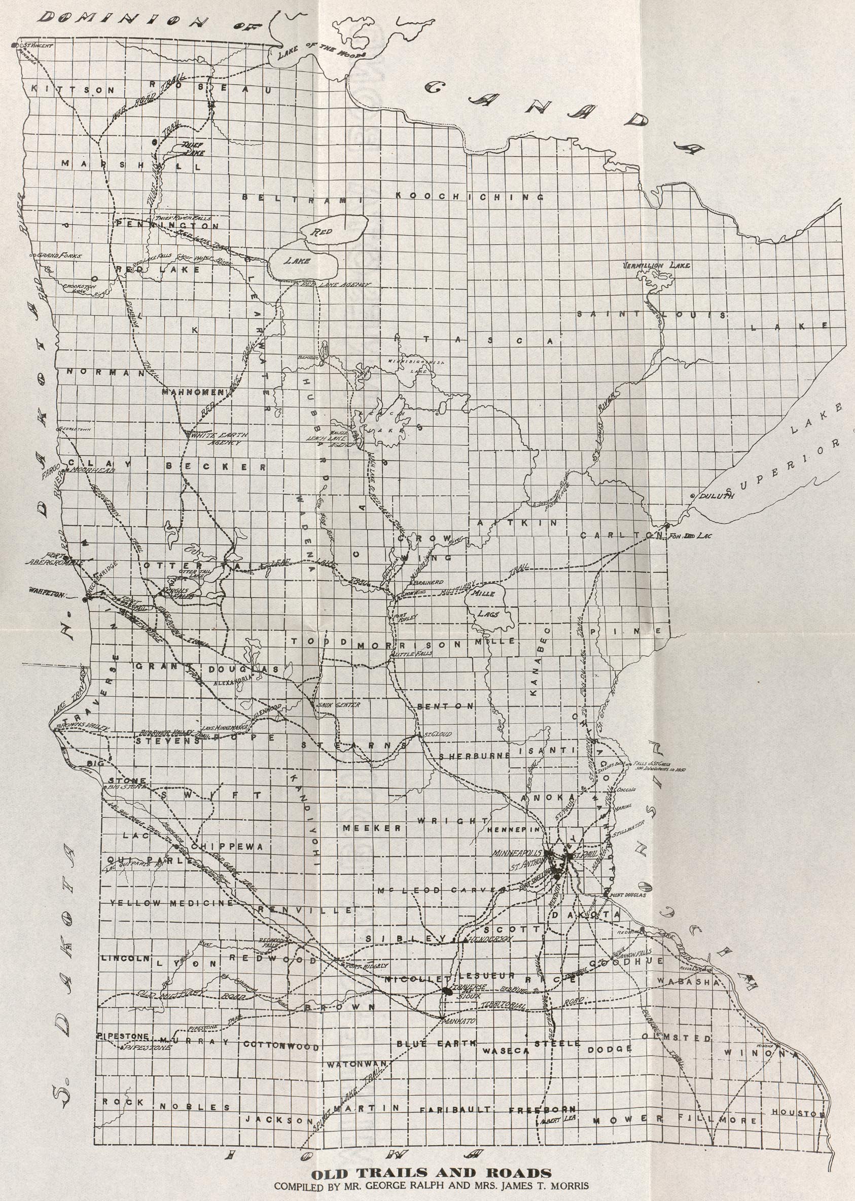
- Minnesota - Old Trails and Roads (769K)
- From Old Rail Fence Corners edited by Lucy Leavenworth Wilder Morris, F.H. McCulloch Print. Co., 1914.
- Monarch Standard Atlas of the Commercial, Geographical, and Historical World by J. Martin Miller (1906)
- Includes U.S. state maps
- Nevada Mining Camps 1905 (2.7MB)
- "Map of South-Western Nevada Showing location of principal mining camps" from San Francisco Call, May 23 1905 (Chronicling of America) [pdf format]
- New Encylopedic Atlas and Gazetter of the World 1911
- Maps from the "New Encylopedic Atlas and Gazetter of the World" by William Patte and James E. Homans: P.F. Collier, New York, 1911
- New Hampshire 1796 (5.9MB)
- "The State of New Hampshire" from Heads of Families First Census of the United States - State of New Hampshire, 1908.
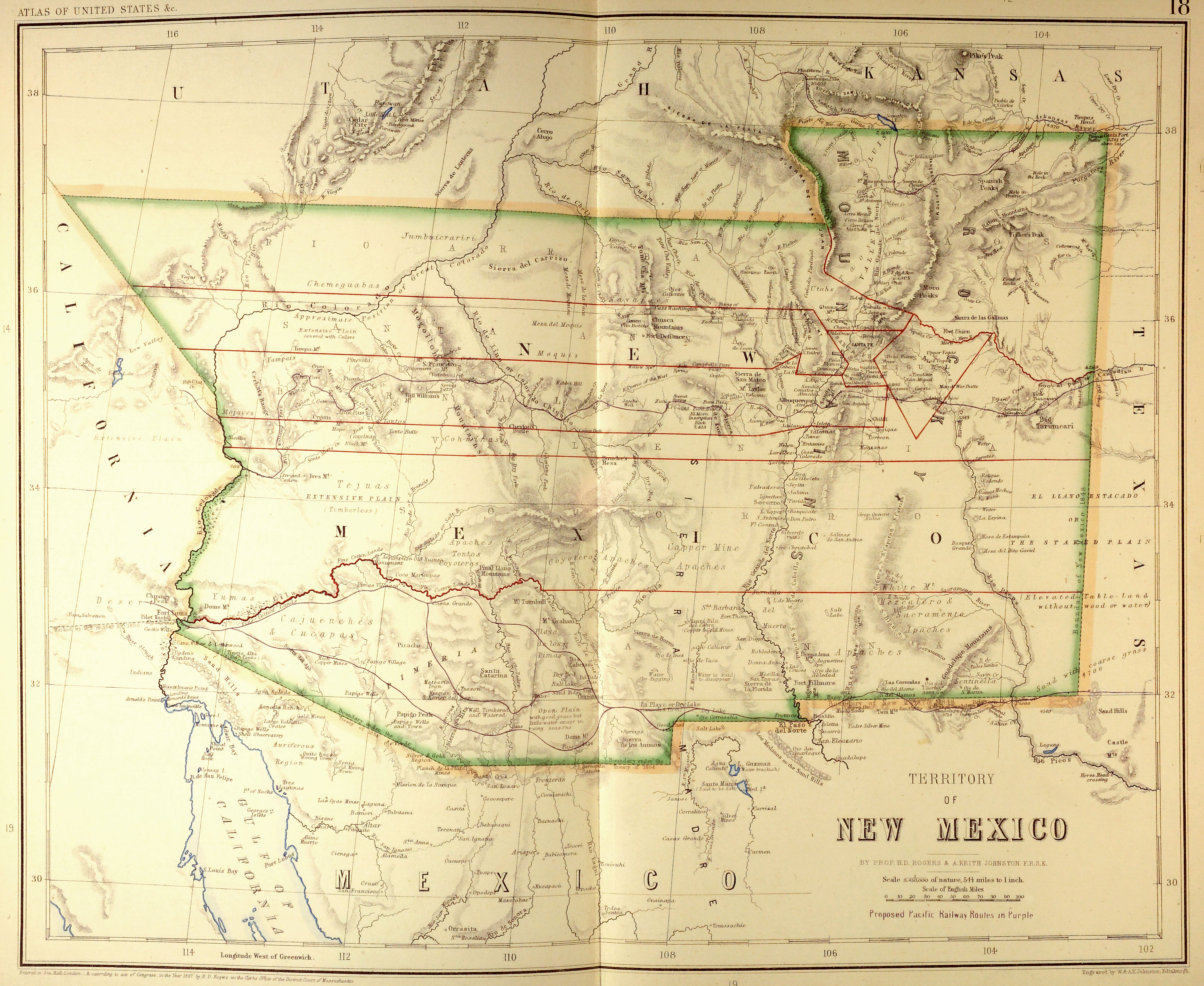
- New Mexico Territory 1857 (2.3MB)
- Territory of New Mexico from Atlas of the United States of North America... by Henry Darwin Rogers & A[lexander] Keith Johnston, London: Edward Stanford, 1857. Map courtesy Dorothy Sloan-Rare Books, Austin, Texas
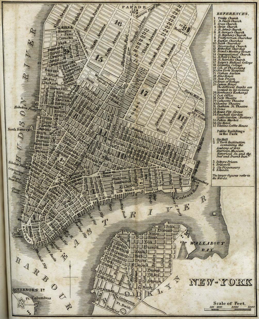
- New York 1842 (396K)
- "New-York" from Tanner, H.S. The American Traveller; or Guide Through the United States. Eighth Edition. New York, 1842.
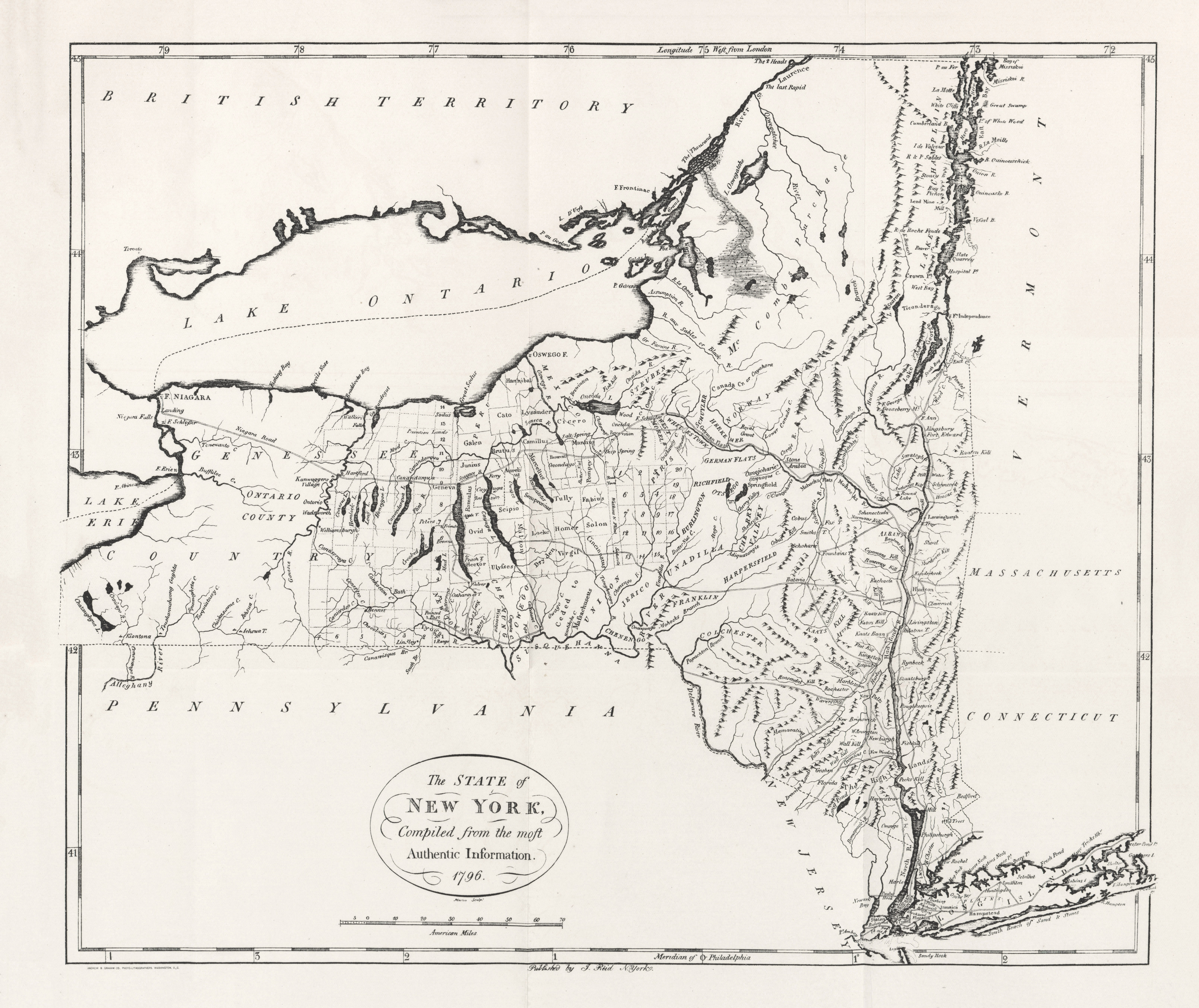
- New York 1796 (5.4MB)
- "The State of New York" from Heads of Families First Census of the United States - State of New York, 1908.
- Niagara Falls 1844 (258K)
- "Chart of Niagara Falls the Shores and Islands 1844" from The Picturesque Tourist: Being a Guide Through Northern and Eastern States edited by Orville L. Holley, 1844.
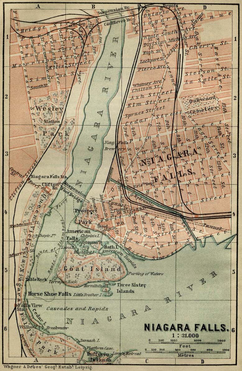
- Niagara Falls 1894 (281K)
- "Niagara Falls" from Baedeker, Karl. The Dominion of Canada with Newfoundland and an Excursion to Alaska. Leipsic, 1894.
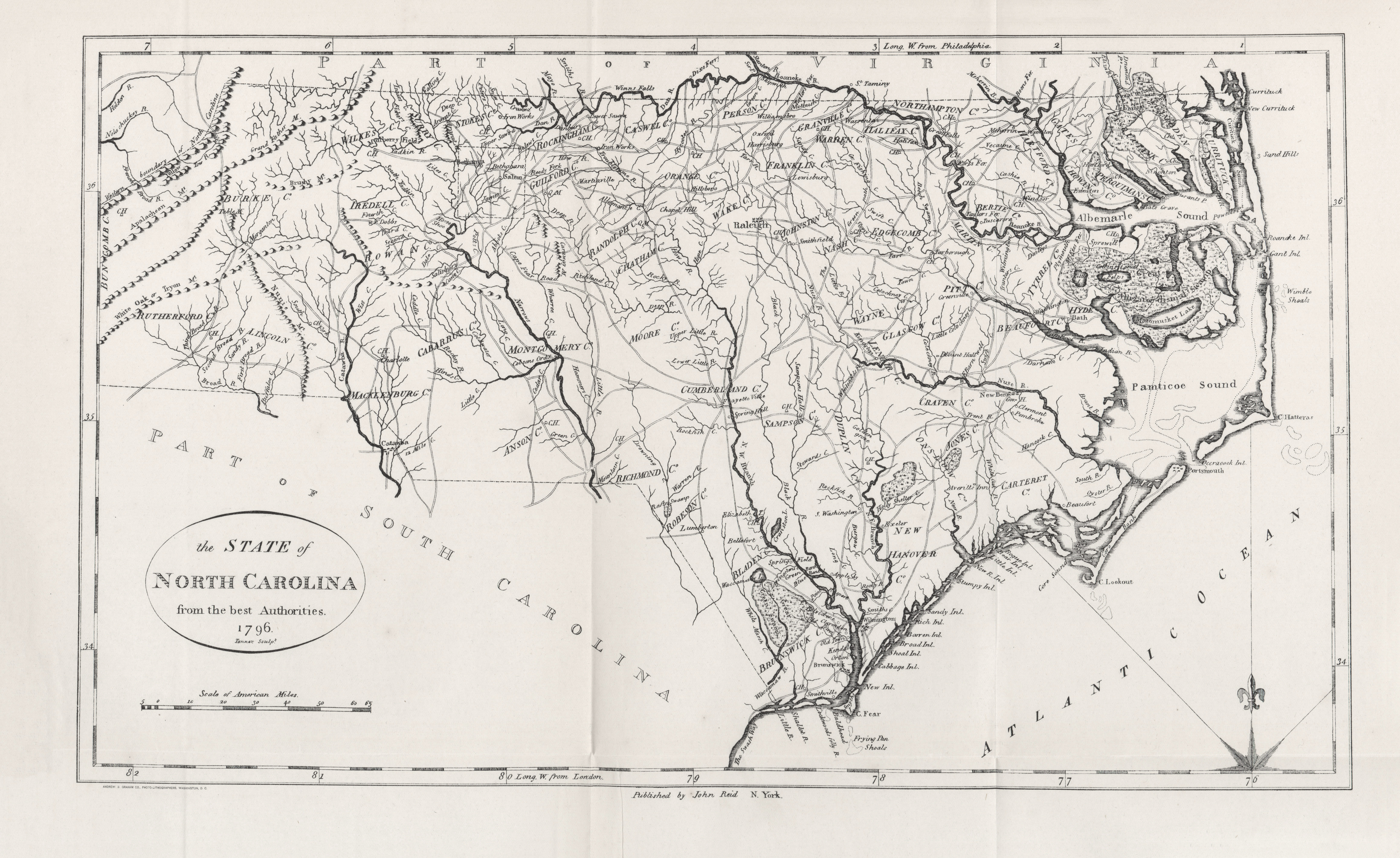
- North Carolina 1796 (4.8MB)
- "The State of North Carolina" from Heads of Families First Census of the United States - State of North Carolina, 1908.
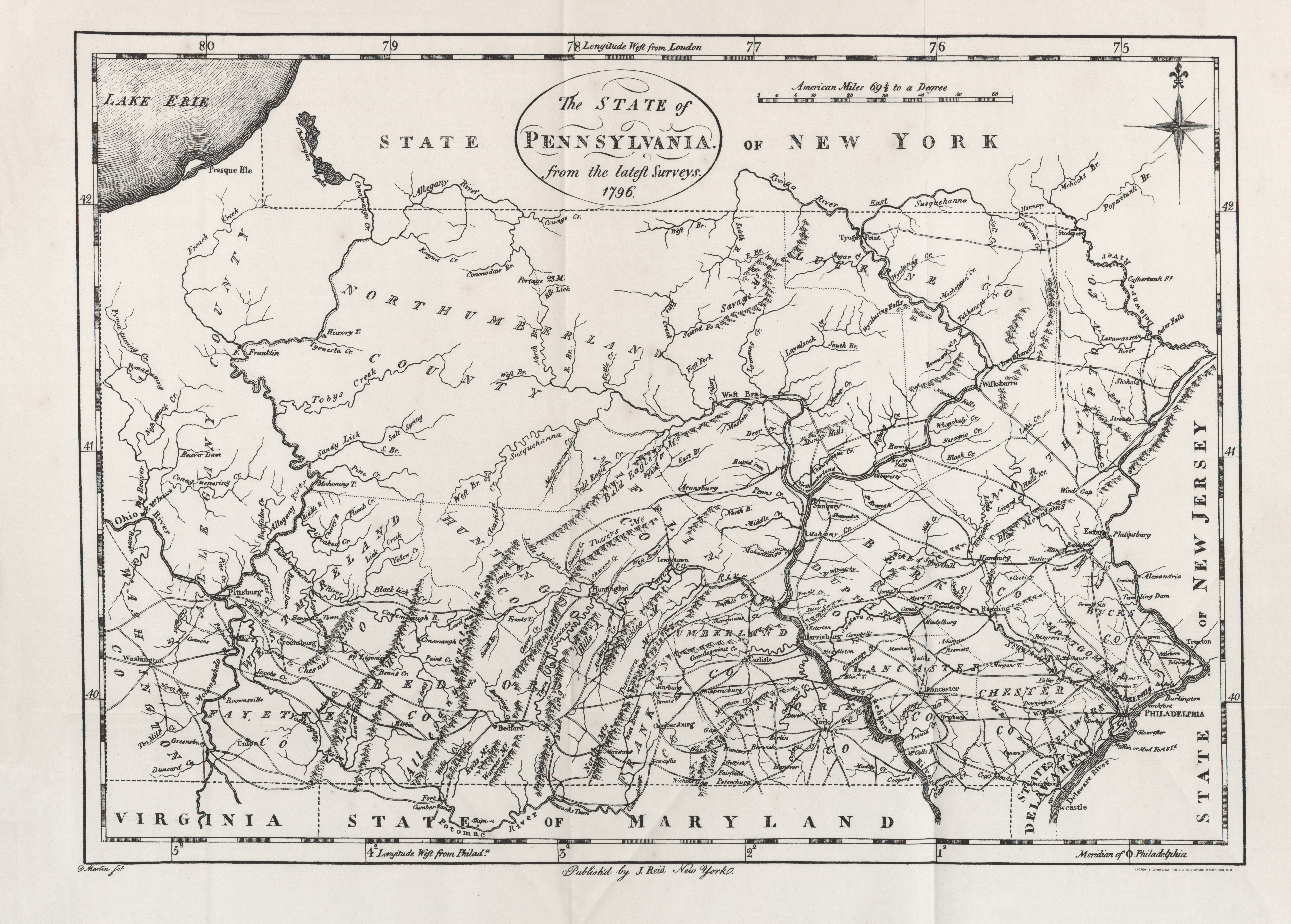
- Pennsylvania 1796 (5.7MB)
- "The State of Pennsylvania" from Heads of Families First Census of the United States - State of Pennsylvania, 1908.
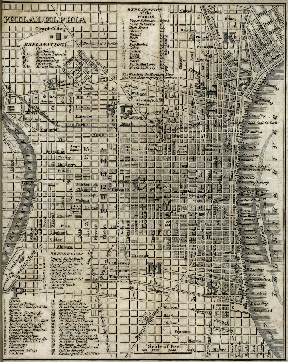
- Philadelphia 1842 (341K)
- "Philadelphia" from Tanner, H.S. The American Traveller; or Guide Through the United States. Eighth Edition. New York, 1842.
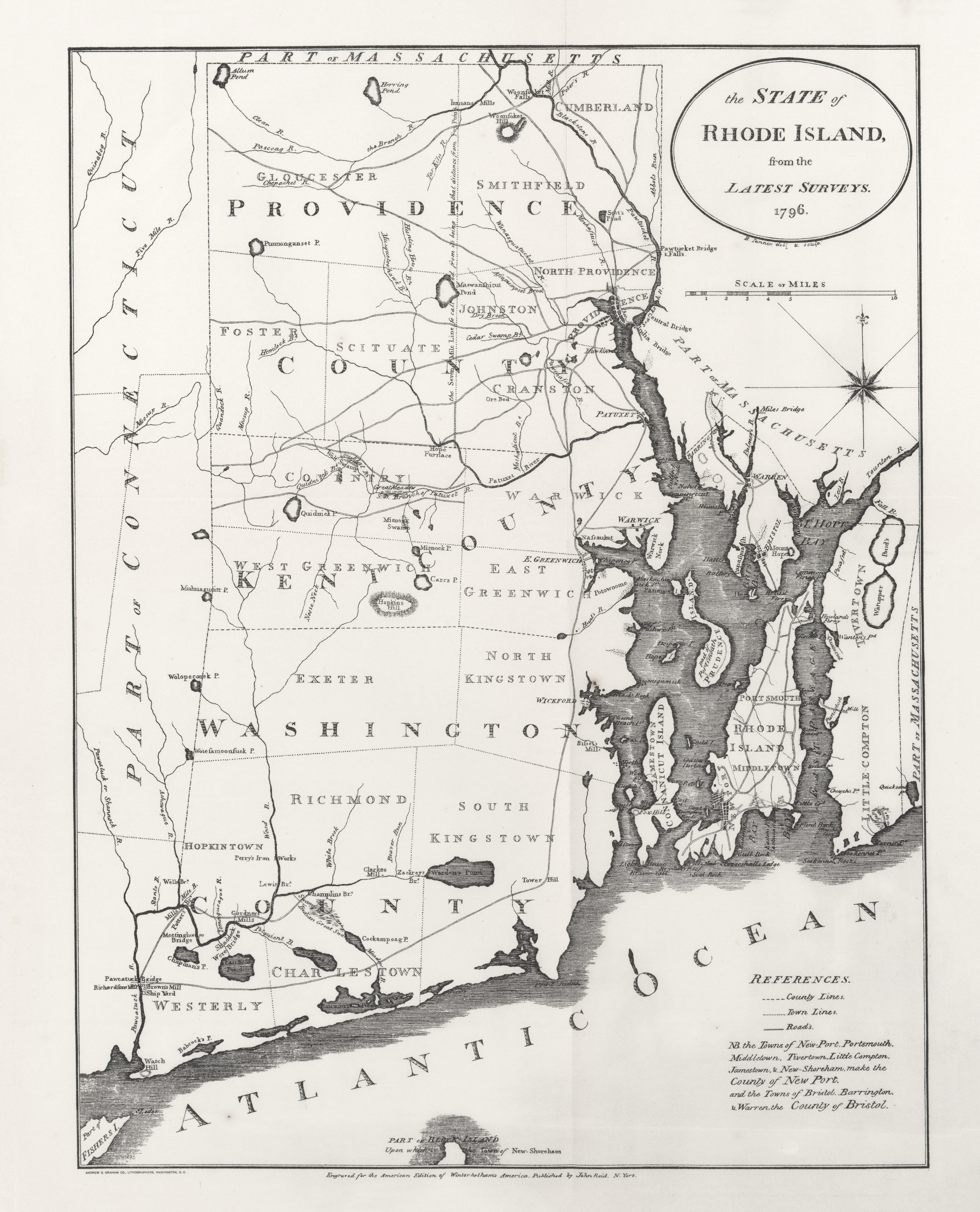
- Rhode Island 1796 (4.4MB)
- "The State of Rhode Island" from Heads of Families First Census of the United States - State of Rhode Island, 1908.
- Selected maps from A Century of Population Growth, 1909
- From the First Census of the United States 1790-1900, Washington: Bureau of the Census.
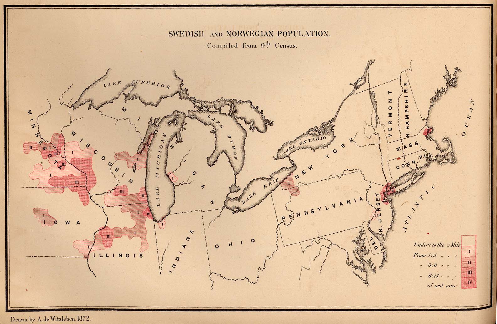
- Swedish and Norwegian Population 1872 (226K)
- From The Statistics of the Population of the United States, Compiled from the Original Returns of the Ninth Census, 1872.
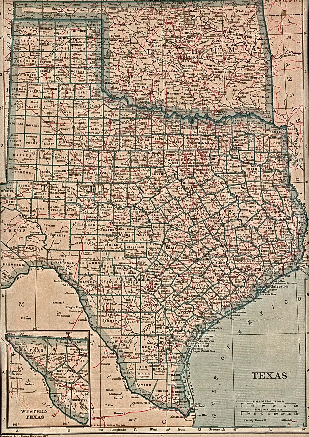
- Texas 1917 (774K)
- From The New Encyclopedic Atlas and Gazetteer of the World. Edited and Revised by Francis J. Reynolds, 1917.
- United States Air Navigation Maps 1923-1933 U. S. Army. Corps of Engineers.
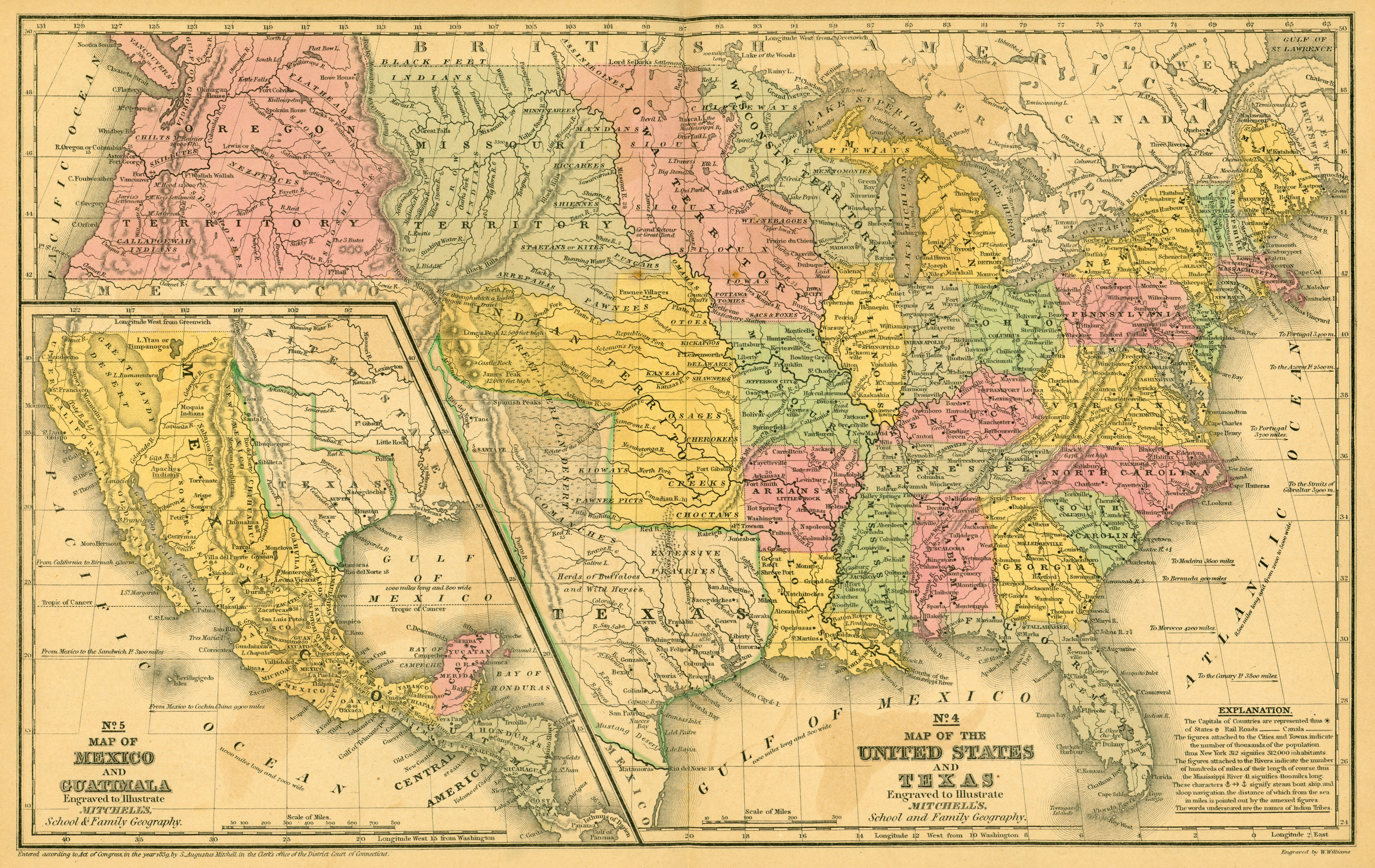
- United States and Texas 1839 (3.2MB)
- Map of the United States and Texas Engraved to Illustrate Mitchell�s School and Family Geography [with] Map of Mexico and Guatimala Engraved to Illustrate Mitchell�s School and Family Geography. From Mitchell�s School Atlas. Philadelphia: Thomas, Cowperthwait & Company, [1844], by S. Augustus Mitchell. Map courtesy Dorothy Sloan-Rare Books, Austin, Texas
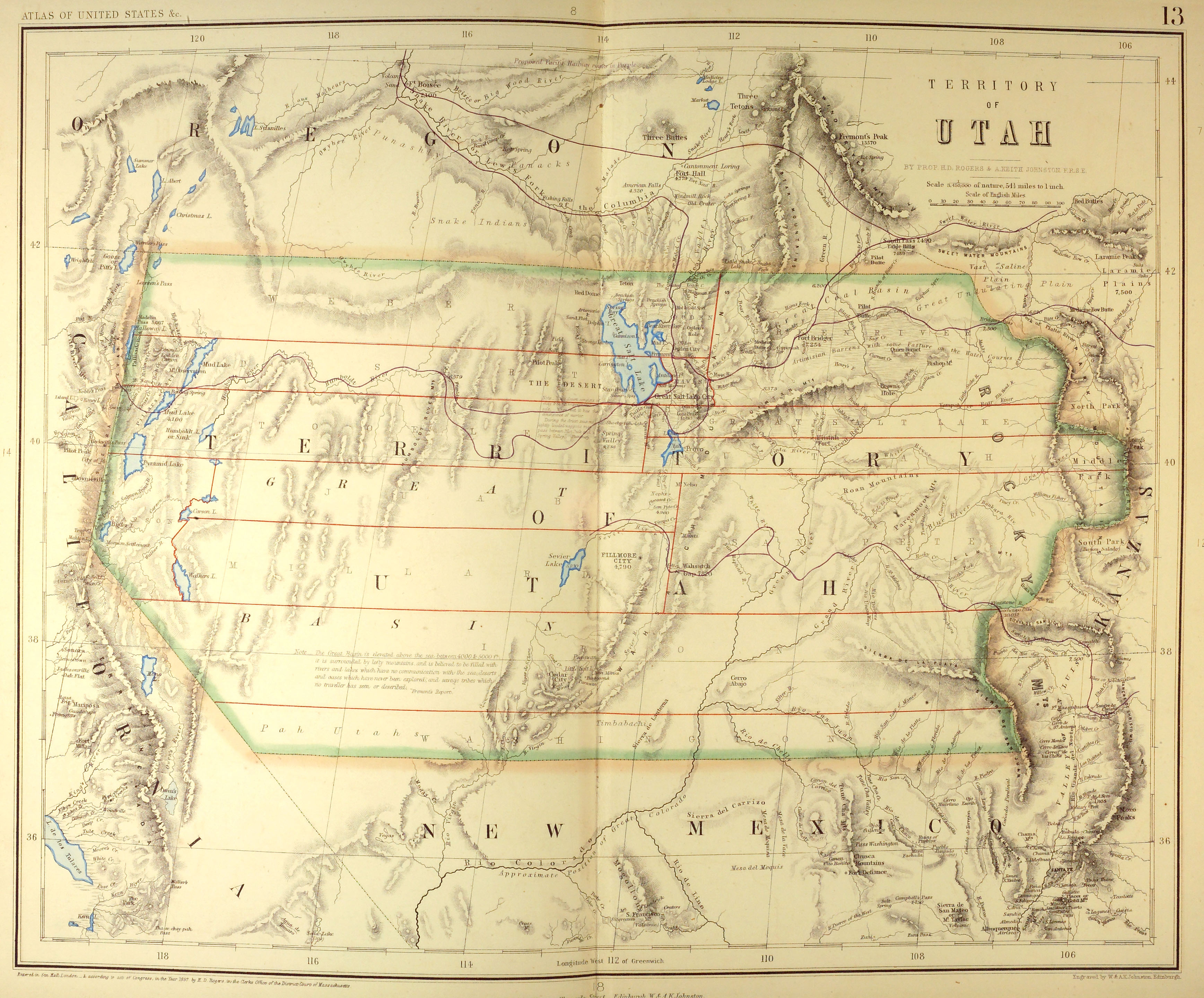
- Utah Territory 1857 (2.1 MB)
- Territory of Utah from Atlas of the United States of North America... by Henry Darwin Rogers & A[lexander] Keith Johnston, London: Edward Stanford, 1857. Map courtesy Dorothy Sloan-Rare Books, Austin, Texas
- United States - 1929-1947
- Maps from Congressional Hearings on Communications [Radio, Radiotelegraph and Cable], Airlines and Utilities
- United States - 1951
- Maps from Annual Report of the Civil Aeronautics Board 1950, United States Government Printing Office, Washington 1951
- United States - CCC Camps 1934-1942 Map showing location of Civilian Conservation Corps (CCC) camps, 1934-1942 (120K)
- U.S. Department of Agriculture, Natural Resources Conservation Service
- United States 1948 11 Maps
- U.S. Army Areas, 1:1,000,000. U.S. Army Map Service, 1948. These maps depict cities and towns, major federal and state highways, railways, commercial and military airports and military installations.
- United States 1980 (34.3MB)
- "Major Army, Navy and Air Force Installations in the United States as of January 1, 1980", U.S. Defense Mapping Agency, 1980
- Virginia 1796 (5.7MB)
- "The State of Virginia" from Heads of Families First Census of the United States - State Enumerations of Virginia, 1908.
- Wealth in the United States 1872 (581K)
- From The Statistics of the Population of the United States, Compiled from the Original Returns of the Ninth Census, 1872.
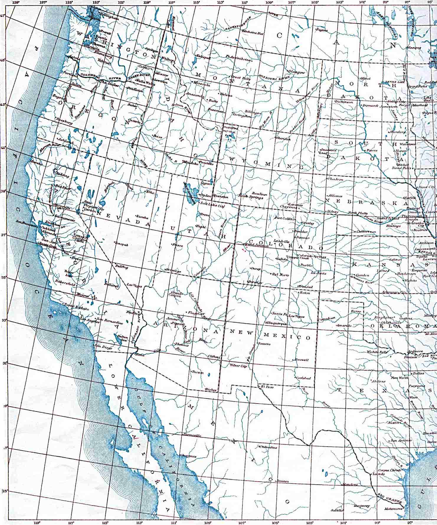
- Western United States 1906 (281K)
- U.S. Geological Survey 1906.
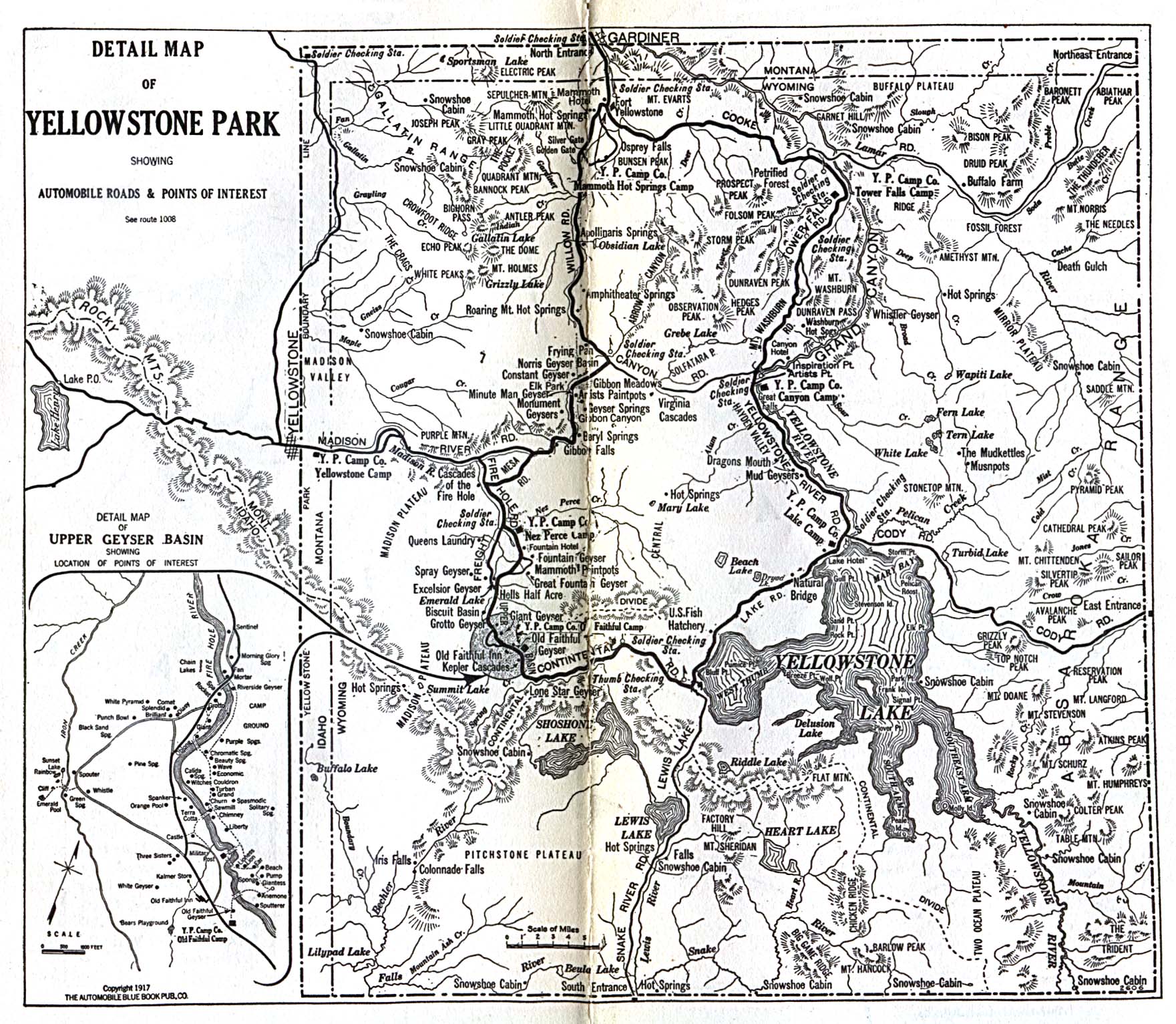
- Yellowstone National Park 1917 (645K)
- "Detail Map of Yellowstone Park Showing Automobile Roads & Points of Interest". From Automobile Blue Book 1917
![Indian Territory [Oklahoma] 1857](historical/indian_territory-1857-atlas-rogers.jpg)
![Indian Territory [Oklahoma] 1884](historical/ok_indian_territory_1884.jpg)