Perry-Castañeda Library
Map Collection
Papua New Guinea Maps
The following maps were produced by the U.S. Central Intelligence Agency, unless otherwise indicated.
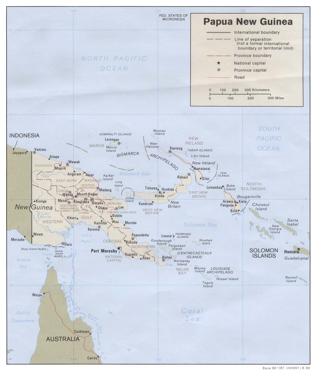
Country Maps- Papua New Guinea (Political) 1989 (131K) and pdf format (131K)
- Papua New Guinea (Shaded Relief) 1989 (275K) and pdf format (300K)
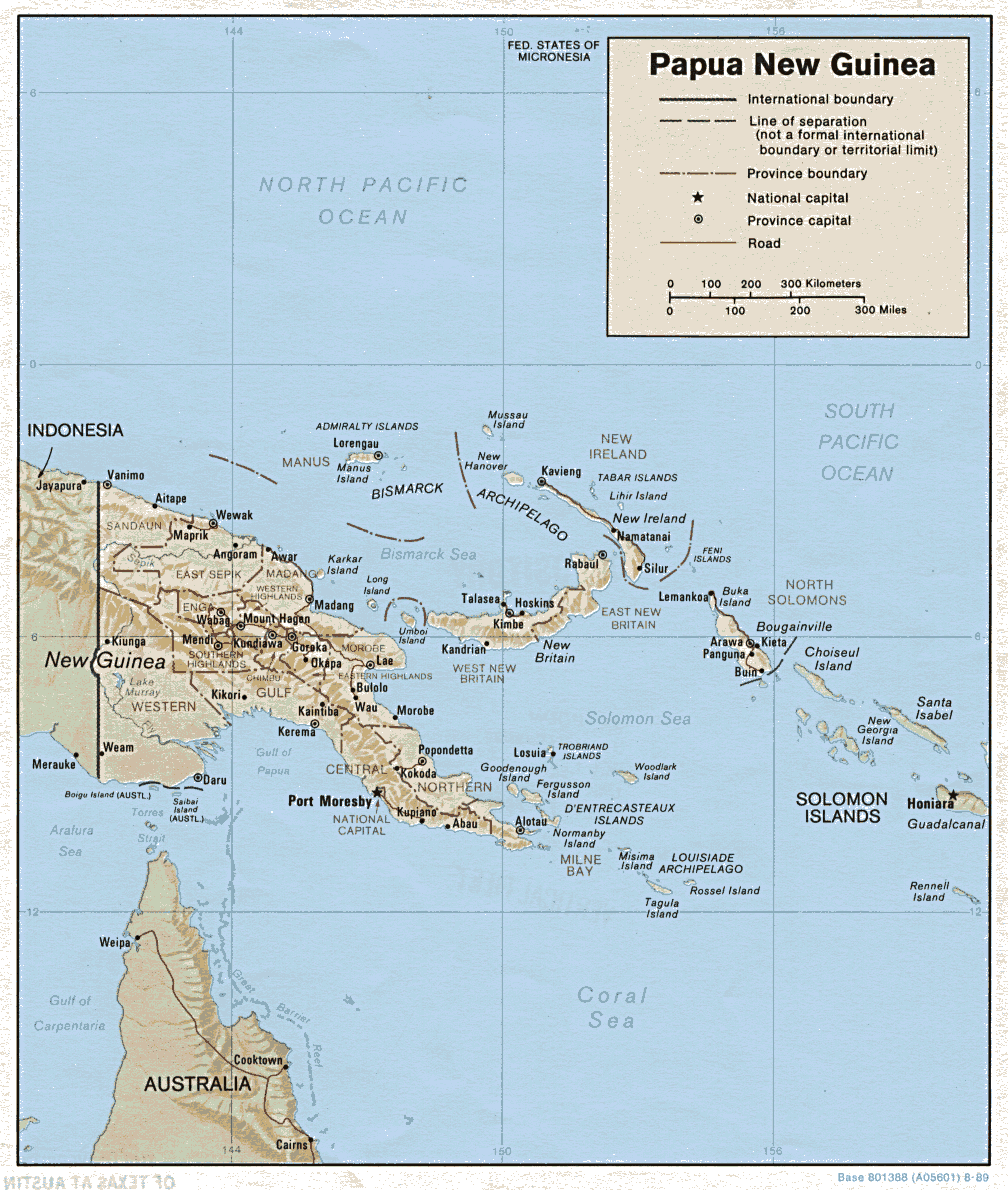
- Papua New Guinea (Shaded Relief) 1987 (172K) and pdf format (175K)
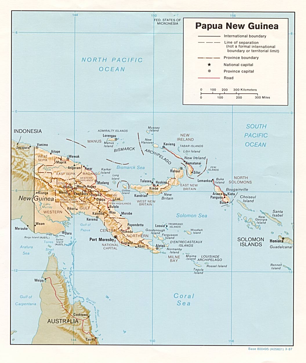
- Papua New Guinea (Shaded Relief) 1985 (251K) and pdf format (254K)
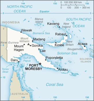
- Papua New Guinea (Small Map) 2016 (29.1K)
- 1:1,000,000 - Operational Navigation Chart Series (Aeronautical Charts) U.S. Defense Mapping Agency Aerospace Center, [1980s] Not for navigational use
- Sheets M-13, M-14, M-15, N-14 and N-15 include all of Papua New Guinea
- 1:500,000 - New Guinea - Topographic Maps U.S. Army Map Service, Series T401
- This series from 1942 includes almost all of what is now Papua New Guinea
- 1:500,000 - Tactical Pilotage Charts U.S. National Imagery and Mapping Agency. Not for navigational use
- This series covers Papua New Guinea
- 1:250,000 - New Guinea - Topographic Maps U.S. Army Map Service, Series T504
- This series, published in the 1960s, includes most of what is now Papua New Guinea
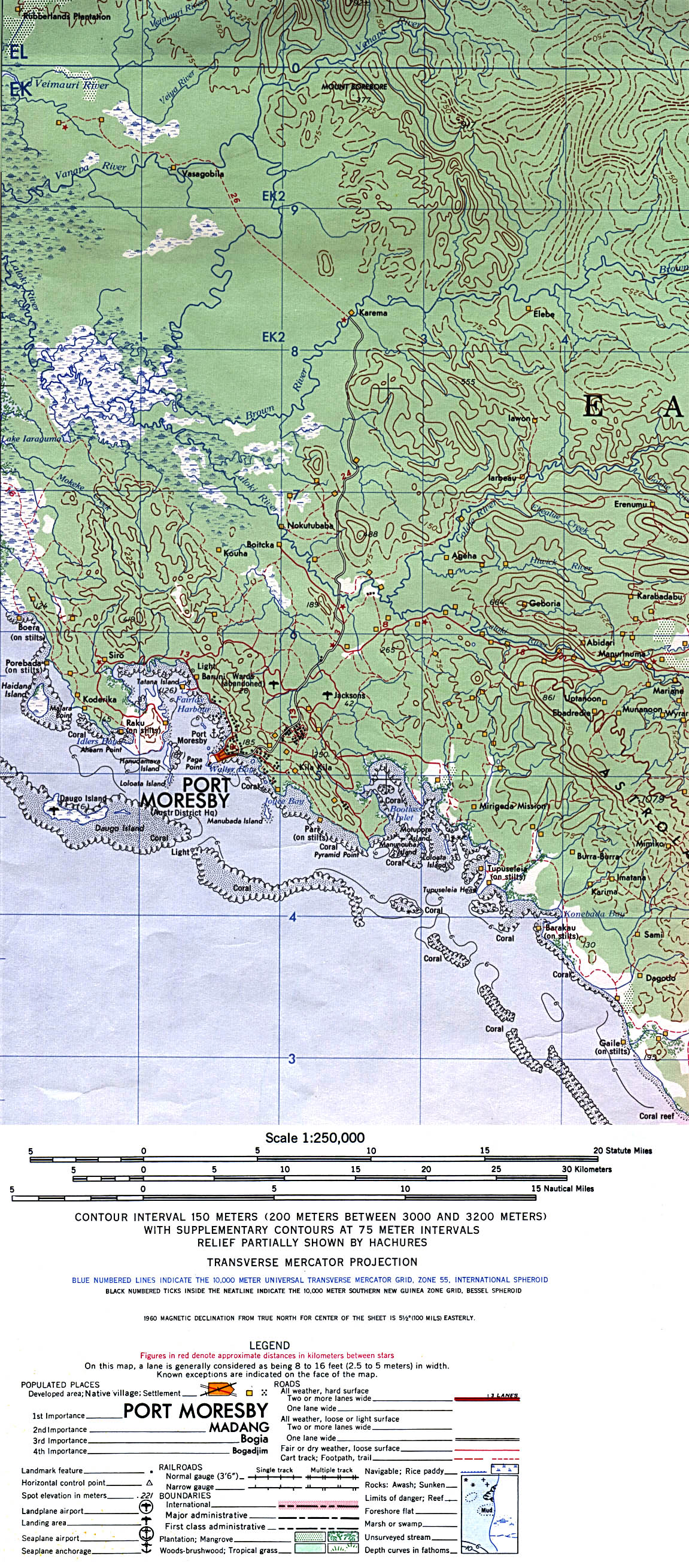
- 1:250,000 - Port Moresby - Topographic Map Portion of U.S. Army Map Service, Sheet SC 55-7, Series T504, 1965 (689K)
- 1:250,000 - Joint Operations Graphic, Cape Nelson U.S. National Imagery and Mapping Agency, Sheet SC 55-4 (4.0MB) Not for navigational use
- Sheets M-13, M-14, M-15, N-14 and N-15 include all of Papua New Guinea
- Pacific Islands 1943-1945
- Maps from "Pacific Islands" [Geographical Handbook Series]. Great Britain. Admiralty. Naval Intelligence Division, 1943-1945. Volume IV includes many New Guinea maps
Maps on Other Web Sites