Perry-Castañeda Library
Map Collection
Romania Maps
The following maps were produced by the U.S. Central Intelligence Agency, unless otherwise indicated.
Country Maps- Romania (Political) 1996 (348K) and pdf format (351K)
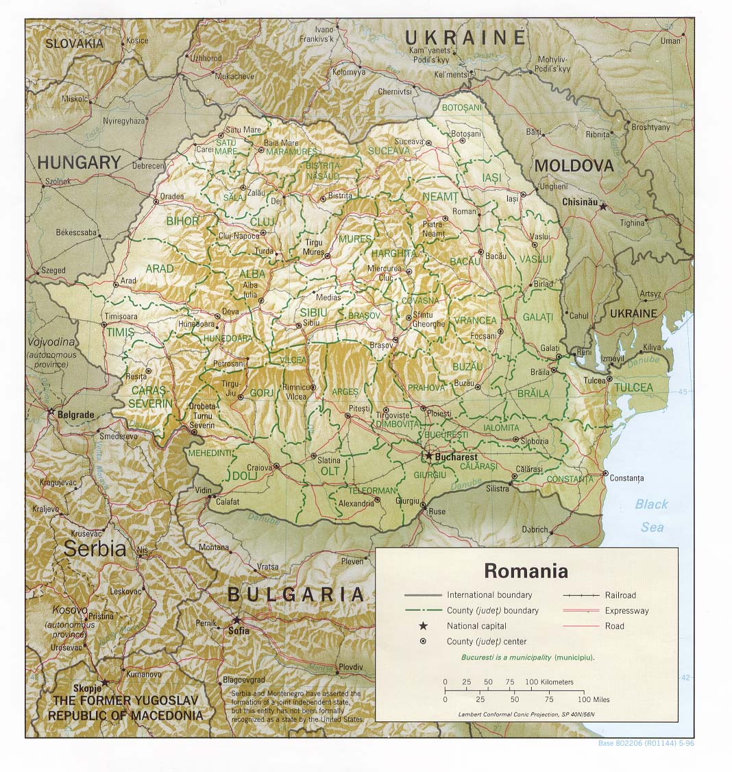
- Romania (Shaded Relief) 1996 (296K) and pdf format (305K)
- Romania (Shaded Relief) 1982 (326K) and pdf format (344K)
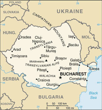
- Romania (Small Map) 2016 (21.4K)
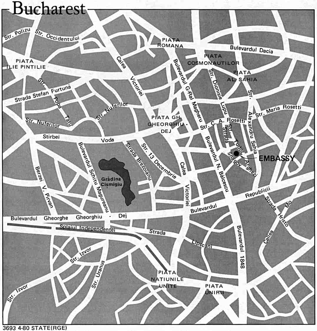
- Bucharest U.S. Dept. of State 1980 (86K)
- Romania - Basic Resources and Processing from Map No. 76858 1970 (143K)
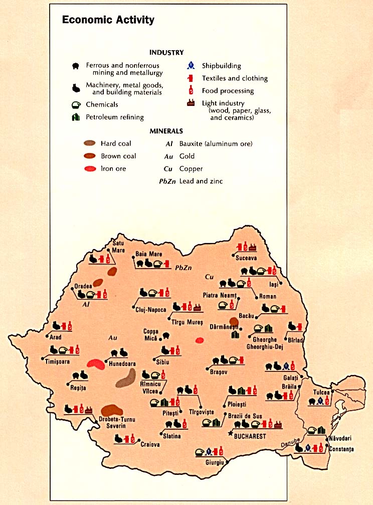
- Romania - Economic Activity from the CIA Atlas of Eastern Europe 1990 (127K)
- Romania - Industrial Centers from Map No. 76858 1970 (172K)
- Romania - Land Use from the CIA Atlas of Eastern Europe 1990 (135K)
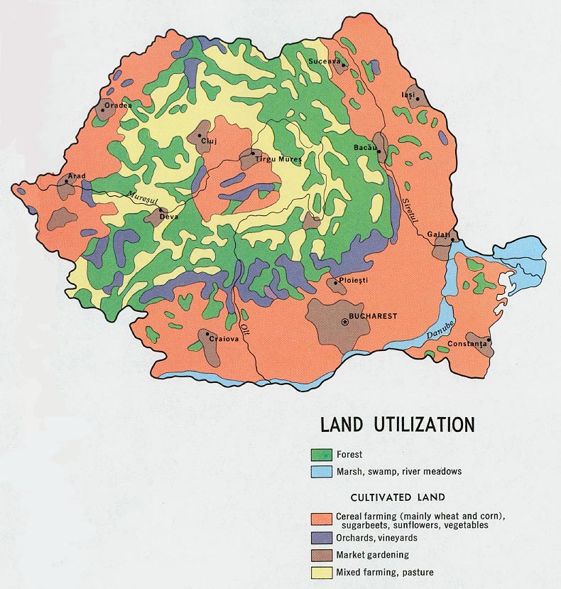
- Romania - Land Utilization from Map No. 76858 1970 (174K)
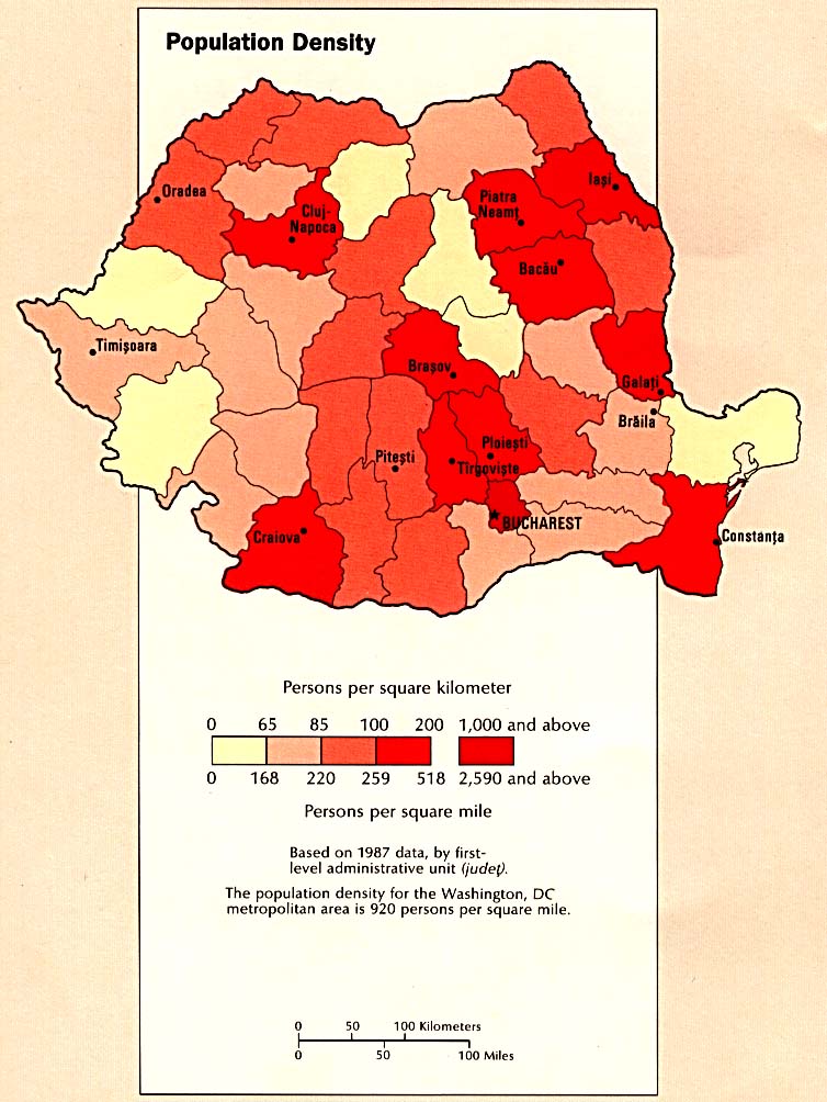
- Romania - Population Density from the CIA Atlas of Eastern Europe 1990 (116K)
- Romania - Population from Map No. 76858 1970 (180K)
- 1:1,000,000 - Operational Navigation Chart Series U.S. Defense Mapping Agency Aerospace Center.
- This series covers all of Romania. Not for navigational use
- 1:500,000 - Europe Series M404 (4072), Great Britain War Office, 1942-
- This series covers parts of Romania
- 1:500,000 - Tactical Pilotage Charts U.S. National Imagery and Mapping Agency. Not for navigational use
- This series covers Romania
- 1:500,000 - World Series 1404, Great Britain. War Office and Air Ministry. 1958-
- This series covers all of Romania
- 1:250,000 - Russia - Joint Operations Graphic U.S. National Imagery and Mapping Agency.
- This series covers parts of Romania. Not for navigational use
- 1:250,000 - Eastern Europe, Series N501 U.S. Army Map Service, 1948-
- This historical series covers part of northeast Romania
- 1:250,000 - Balkans Series M506, U.S. Army Map Service, 1948-
- 1:100,000 - Middle Danube, Series M671 U.S. Army Map Service, 1943-
- This series covers all of Romania. Not for navigational use
- Romania (7 Maps) Published by the CIA August 1990
Maps on Other Web Sites