Perry-Castañeda Library
Map Collection
Rwanda Maps
The following maps were produced by the U.S. Central Intelligence Agency, unless otherwise indicated.
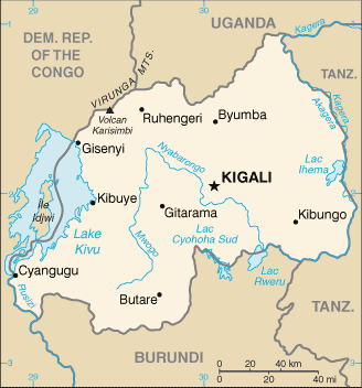
Country Maps- Rwanda (Small Map) 2016 (15.6K)
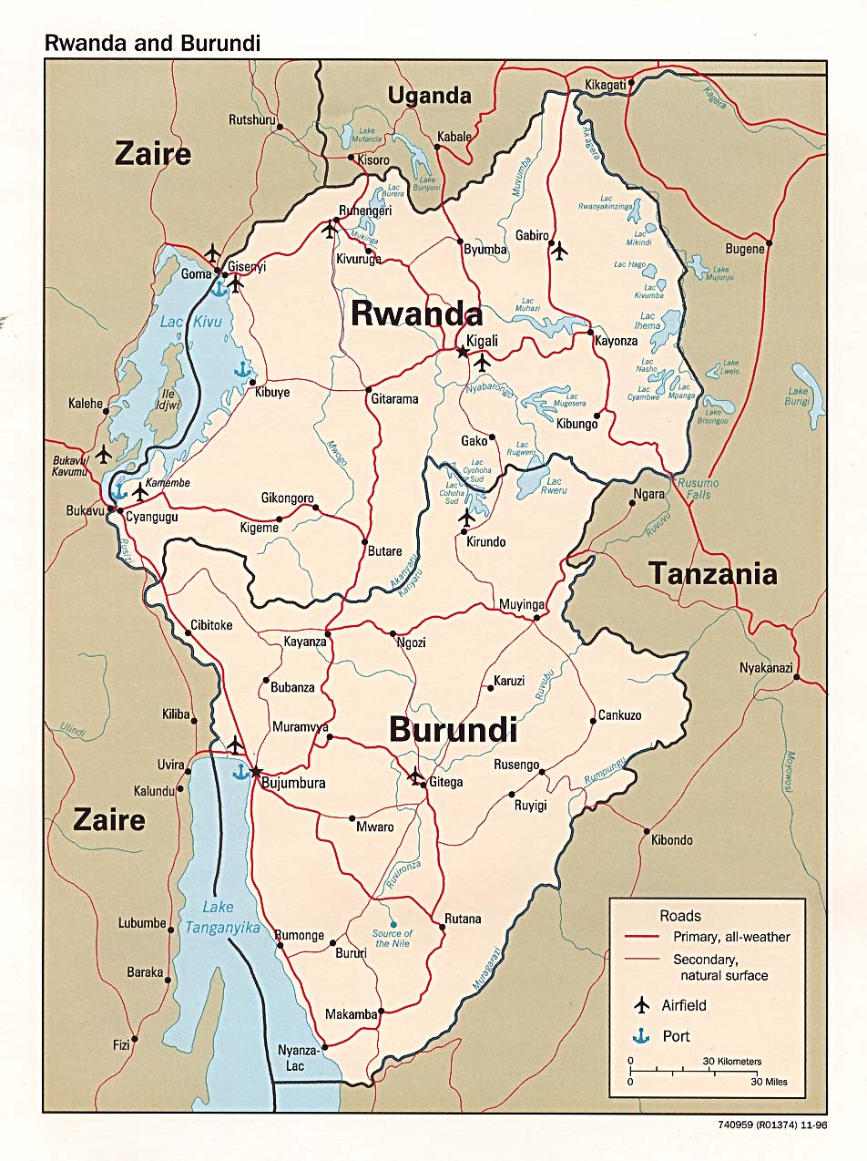
- Rwanda and Burundi (Political) 1996 (254K) and pdf format (238K)
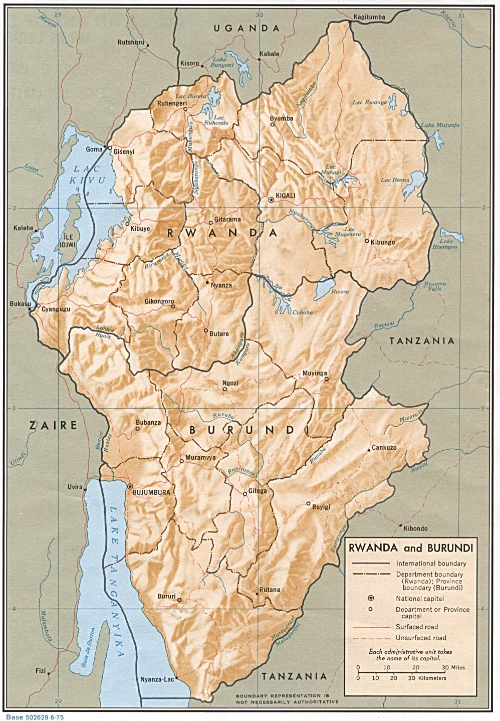
- Rwanda and Burundi (Political) 1975 (311K) and pdf format (343K)
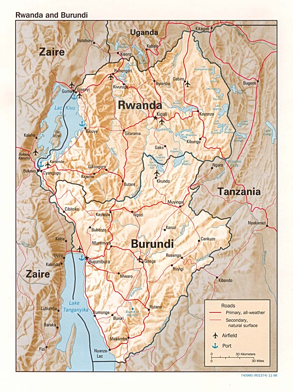
- Rwanda and Burundi (Shaded Relief) 1996 (293K) and pdf format (271K)
- Rwanda and Burundi (Shaded Relief) 1975 (288K)
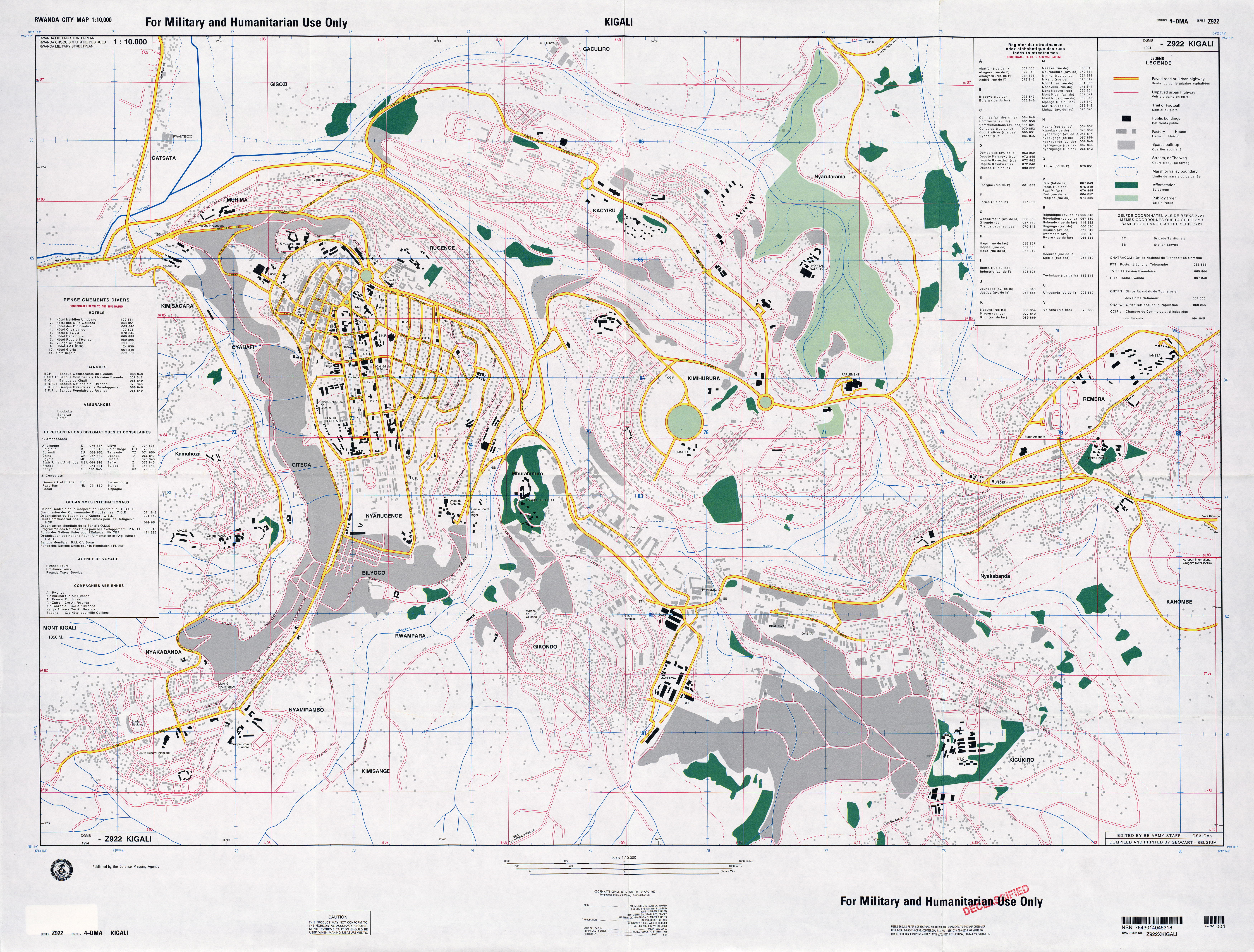
- Kigali original scale 1:10,000, Edition 4-DMA, Series Z922. U.S. Defense Mapping Agency, 1994. (8.4MB)
- 1:2,000,000 - Africa Topographic Maps U.S. Army Map Service, Series 2201
- Sheets 23 and 24 include all of Rwanda
- 1:1,000,000 - International Map of the World U.S. Army Map Service
- This series covers all of Rwanda. Clickable map
- 1:500,000 - Tactical Pilotage Charts U.S. National Imagery and Mapping Agency. Not for navigational use
- This series covers Rwanda
- 1:250,000 - Joint Operations Graphic (Air) Series 1501, U.S. Defense Intelligence Agency Not for navigational use
- Sheets SA 35-8 and SA 35-12 cover western and central Rwanda. Courtesy of T. R. Smith Map Collection, University of Kansas Libraries
- 1:200,000 - Ruanda-Urundi Topographic Maps U.S. Army Map Service, Series Z522, 1942
- 1:100,000 - Ruanda-Urundi Topographic Maps U.S. Army Map Service, Series Z621, 1942
- Sheets 23 and 24 include all of Rwanda
Maps on Other Web Sites