Perry-Castañeda Library
Map Collection
Texas Maps
Texas State and Thematic Maps
A, B, C, D,
E, F, G, H,
I, J, K, L,
M, N, O, P,
Q, R, S, T,
U, V, W, X,
Y, Z
Updated 4/6/2021
- Texas - Shaded Relief Map
- Portion of National Atlas of the United States of America, General Reference Map. U.S. Geological Survey, 2001 (838K) (University of Texas Map Collection)
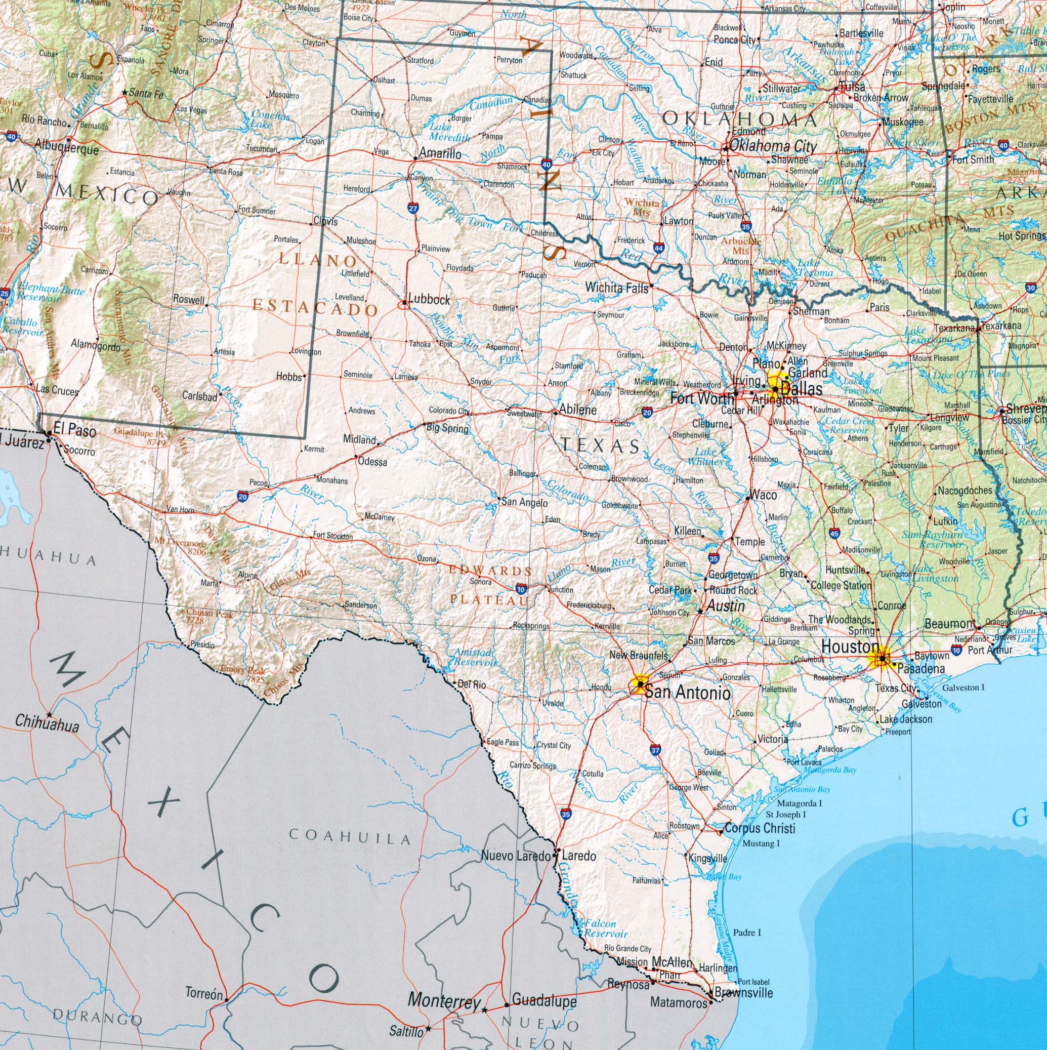
- Texas
- 1:2,500,000 U.S.G.S. 1972 limited update 1990 (1.3MB)
State and county boundaries, county names and county seats, rivers and lakes. Also available in sections
as Texas (Eastern) (672K) and
Texas (Western) (680K) (University of Texas Map Collection)
- Texas (Geology.com)
- Texas (World Sites Atlas)
- Texas - Airports (Texas-Map.org)
- Texas - Airports [NPIAS] (Federal Aviation Administration)
- Texas - Archeology - Texas Beyond History (Texas Archeological Research Laboratory)
- Texas - Area Codes Map (NANPA)
- Texas - Atlas of Texas 1976 (University of Texas at Austin, Bureau of Business Research)
- Texas - Austin Maps (University of Texas Map Collection and external links)
- Texas - BBQ Map (Google Maps/A. Cao)
- Texas BBQ Map, 2013 (Texas Monthly)
- Texas - Biotic Provinces [pdf format] (Texas Parks and Wildlife)
- Texas - Birds - Hummingbird Range Maps [pdf format] (Texas Parks and Wildlife Department)
- Texas - Border Fence [2009] (Americanpatrol.com)
- Texas - Border Fence - Environmental Impact Statements and Maps [Click on Sector Name to view Environmental Impact Statements and Maps] (U.S. Army Corps of Engineers/U.S. Customs and Border Protection/U.S. Border Patrol)
- Texas - Border Wall (proposed) - Rio Grande Valley [August 10, 2017] (Austin American Statesman)
- Texas - Border Wall (proposed) - Rio Grande Valley [November 10, 2017) (Texas Observer)
- Texas - Census Forecast Maps (Texas Demographic Center)
- Texas - Census Enumeration District Maps, 1940
- Texas - Census Interactive Map, 2000 and 2010 (U.S. Bureau of the Census)
- Texas City Maps (University of Texas Map Collection and external links)
- Texas City Maps, Historical (University of Texas Map Collection)
- Texas - Climatic Atlas of Texas, 1983 [pdf format] (Texas Water Development Board formerly Texas Department of Water Resources)
- Texas - Cold Hardiness Zones (Aggie Horticulture Network)
- Texas - Colonias (UWEC)
- Texas Commission on Environmental Quality - Maps
- Texas - Congressional Districts - Maps (Texas Legislative Council)
- Texas - Congressional Districts, Red Viewer (Texas Legislative Council)
- Texas - County Highway Maps (2012) (Texas Department of Transportation)
- Texas - County Highway Maps (1993-1996) (Texas Department of Transportation/University of Texas Map Collection)
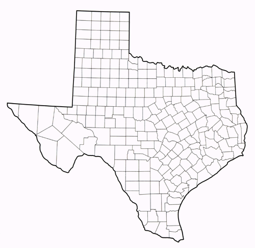
- Texas - County Outline Map, with county names [pdf format] (U.S. Bureau of the Census / PCL Map Collection)
- Texas - County Outline Map, with county names [pdf format] (Texas Parks and Wildlife)
- Texas - County Outline Map, with county names, latitude and longitude [pdf format] (U.S. Bureau of the Census / University of Texas Map Collection)
- Texas - County Outline Map, with county names [jpeg format] (U.S. Bureau of the Census / University of Texas Map Collection)
- Texas - County Outline Map, without county names [pdf format] (Texas Parks and Wildlife)
- Texas Department of State Health Services - Maps (Texas Department of State Health Services, Infectious Disease Control Unit)
- Texas Department of Transportation - Maps
- Texas Department of Transportation - Statewide Planning Map (Texas Department of Transportation)
- Texas - Digital Sanborn Maps (UT Austin users)
- Texas - Digital Sanborn Maps (TexShare library users) Contact your participating library for more information
- Texas - Drought Maps (TCEQ)
- Texas - Economic Development Maps (Texas Economic Development and Tourism)
- Texas - Ecoregions [pdf format] (Texas Parks and Wildlife)
- Texas - Ecoregions (Gould Ecoregions) [pdf format] (Texas Parks and Wildlife)
- Texas - Ecoregions (Level III Ecoregions) (Purdue University)
- Texas - Ecoregions (Level III Ecoregions) [pdf format] (Texas Parks and Wildlife)
- Texas - Edwards Aquifer Map (Edwards Aquifer Authority)
- Texas - Edwards Aquifer (Balcones Fault Zone) Region (Walter Geology Library, University of Texas)
- Texas - Edwards Aquifer, Geologic Map (USGS)
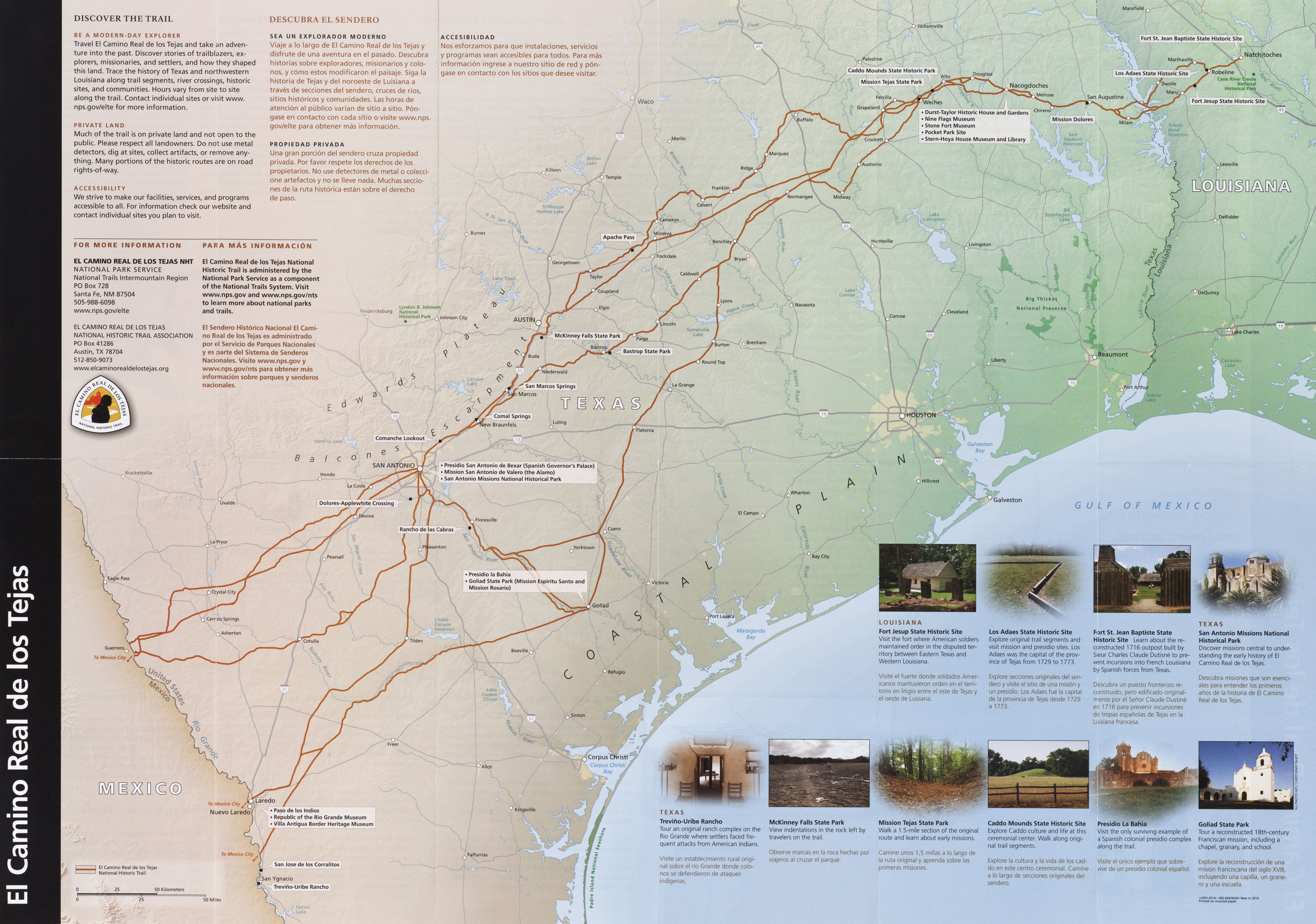
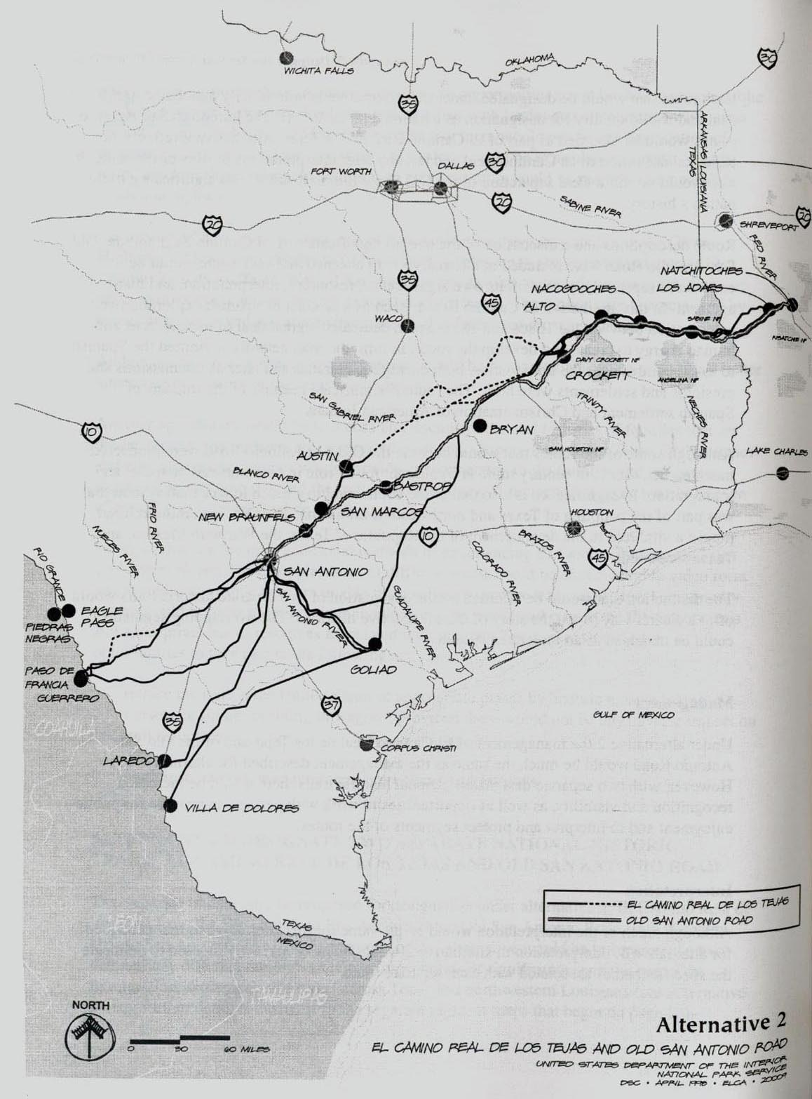
- Texas - El Camino Real de los Tejas National Park Service, U.S. Department of the Interior (6.7MB)
- Texas - El Camino Real de los Tejas National Historic Trail (El Camino Real de los Tejas)
- Texas - El Camino Real de los Tejas (Dept. of Interior) From National Historic Trail Feasibility Study and Environmental Assessment July 1998
- Texas - Electric Generating Plants added 1995-2010 (Public Utility Commission of Texas)
- Texas - Electric Maps (Public Utility Commission of Texas)
- Texas - Electricity - Texas Reliability Council Boundaries Map (Public Utility Commission of Texas)
- Texas - Federal Lands and Indian Reservations 2003 [pdf format] (552K) (The National Atlas of the United States of America, U.S. Geological Survey) (University of Texas Map Collection)
- Texas - Frost Free Period (PlantMaps)
- Texas - Geology Map (USGS)
- Texas - GIS Data (North Central Texas Council of Governments)
- Texas - GIS Data (University of Texas at Austin, School of Architecture)
- Texas General Land Office - GIS Map Viewer (Texas General Land Office)
- Texas - Hazard Mitigation Package - Data Layers and Map Viewer (Texas Geographic Society)
- Texas - High Plains Aquifer (U.S. Geological Survey)
- Texas - Highway Map - 2015 [pdf format] (12.3 MB) (Texas Department of Transportation)
- Texas - Highway Map - 2008 [pdf format] (5.1 MB) (Texas Department of Transportation)
- Texas - Highway Map - 2006 [pdf format] (5.3 MB) (Texas Department of Transportation)
- Texas - Highway Map - 2005 [jpeg format] (8.5 MB) (Texas Department of Transportation)
- Texas - Historical Maps Our collections and links to others
- Texas - Historical Maps (Texas General Land Office)
- Texas - Historical Maps (University of Alabama Historical Map Archive)
- Texas - Historical Maps - Bird's-Eye Views of Texas Cities (Amon Carter Museum)
- Texas - Historical Maps - Texas Beyond History (University of Texas at Austin, College of Liberal Arts)
- Texas - Historical Maps - Texas Historic Sites Atlas (Texas Historical Commission)
- Texas - Historical Maps - Texas Historical City Maps (PCL Map Collection)
- Texas - Historical Maps - Texas Sanborn Fire Insurance Maps (Pre-1923) (PCL Map Collection)
- Texas - Historical Maps - Texas State Library Map Search (Texas State Library and Archives Commission)
- Texas - Historical Maps - Texas Topographic Maps (PCL Map Collection)
- Texas - Hurricane Rita Maps [2005]
- Texas - Infectious Disease Maps (Texas Department of State Health Services)
- Texas - Lake Travis (Highland Lakes Recreational Guide)
- Texas - Lakes - Clickable Map (Texas Parks and Wildlife)
- Texas - Land Survey (Earth Point)
- Texas - LATA Boundary Map (Public Utility Commission of Texas)
- Texas - Legislature, House and Senate Districts (Texas Legislative Council)
- Texas - Low-Lying Areas (2008) (3.7 MB) U.S. Geological Survey
- Texas - Lower Colorado River Authority - Maps (Lower Colorado River Authority)
- Texas - Make Your Own Color Coded Maps (Diymaps.net)
- Texas - Map Collections - Texas State Library and Archives
- Texas - Map Collections - University of Texas Libraries (Austin)
- Texas Map Society
- Texas - Mexico Border - Color Image Map Series, 1979-1983 (University of Texas Map Collection)
- Texas - Mileage Finder (Wild Texas)
- Texas - Natural Regions [pdf format] (Texas Parks and Wildlife)
- Texas - Natural Regions, Numerical, in Black and White [pdf format] (Texas Parks and Wildlife)
- Texas - Natural Regions, Numerical, in Color [pdf format] (Texas Parks and Wildlife)
- Texas - Natural Regions with County Outlines [pdf format] (Texas Parks and Wildlife)
- Texas - Natural Regions with County Outlines and Names [pdf format] (Texas Parks and Wildlife)
- Texas Natural Resources Information System (TNRIS)
- Texas - Natural Subregions, Black and White [pdf format] (Texas Parks and Wildlife)
- Texas - Natural Subregions, Color [pdf format] (Texas Parks and Wildlife)
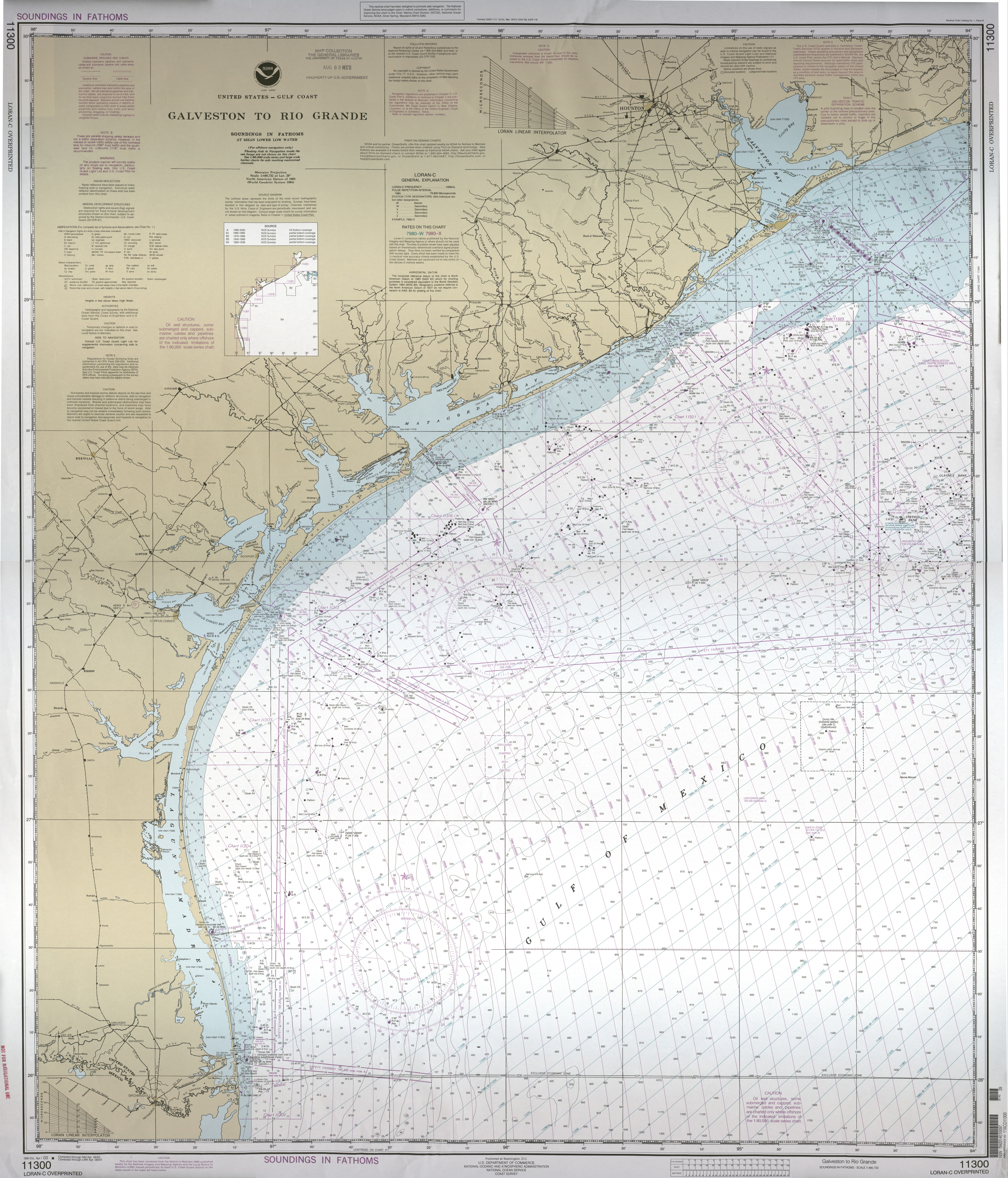
- Texas - Nautical Chart - Rio Grande to High Island Not for Navigational Use (8.1MB) (NOAA/NOS)
- Texas - Nautical Charts (Non-Current) (NOAA)
- Texas - Outdoor Burn Bans and Local Disaster Declarations (Texas Forest Service)
- Texas - Outline Map, blank (Enchanted Learning)
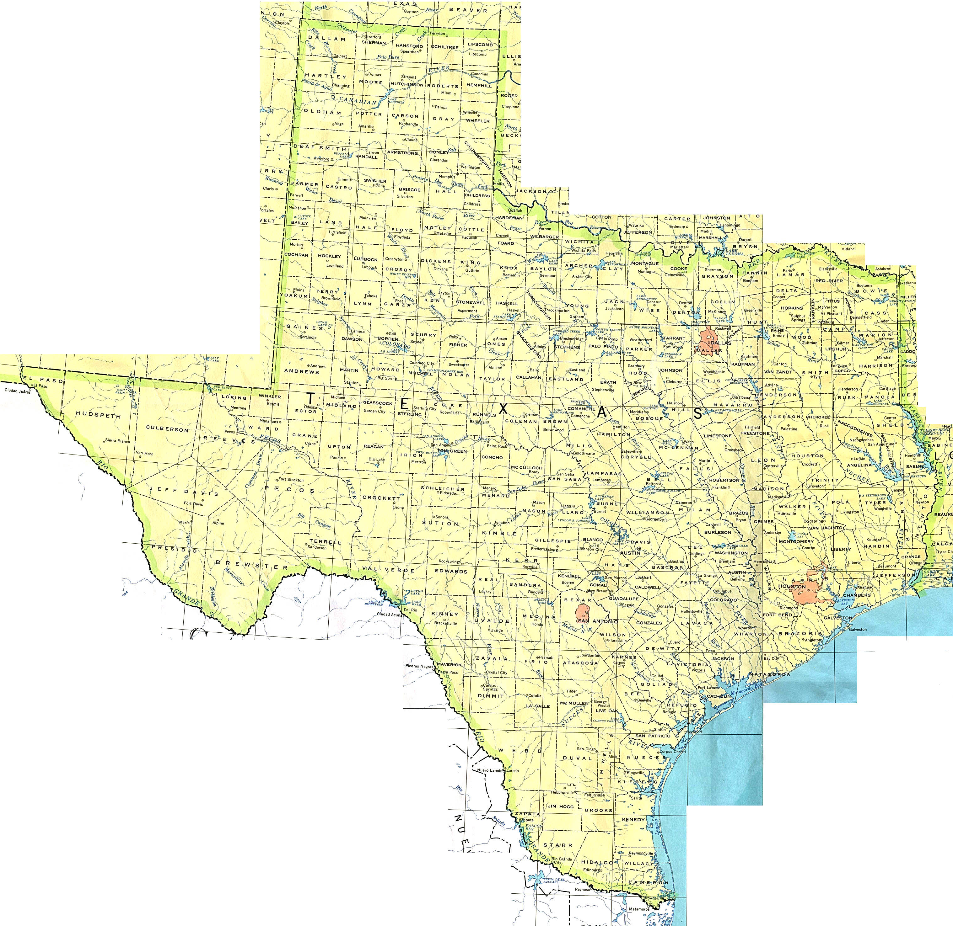
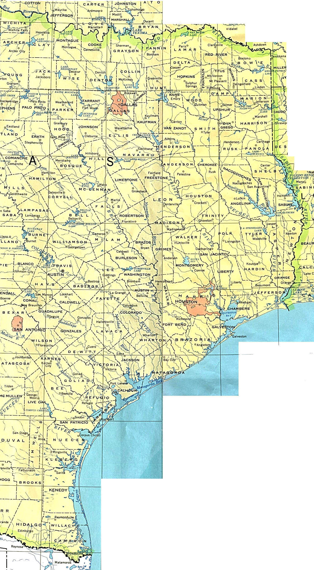
- Texas - Outline Map, with county names [jpeg format] (200K) (University of Texas Map Collection)
- Texas - Outline Map, without county names (39K) (University of Texas Map Collection)
- Texas - Outline Map, with dots for cities (50states.com)
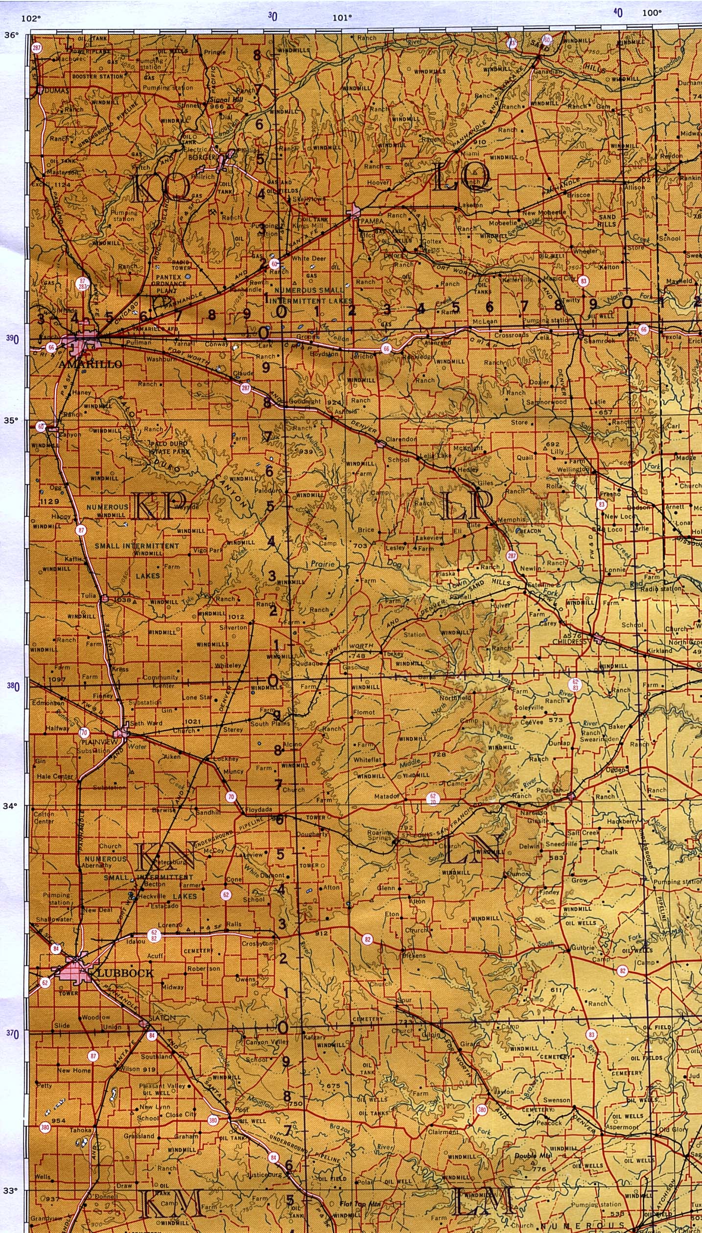
- Texas - Panhandle - Amarillo, Lubbock and the Eastern Panhandle original scale 1:1,000,000 Portion of International Map of the World, sheet NI 14, U.S. Army Map Service, 1961 (968K) (University of Texas Map Collection)
- Texas - Park Maps (University of Texas Map Collection and external links)
- Texas - Plant Hardiness Zones (Purdue University)
- Texas - Plant Taxa [pdf format] (Texas Parks and Wildlife)
- Texas - Precipitation [pdf format] (Texas Parks and Wildlife)
- Texas - Prehistoric Texas (Texas Beyond History)
- Texas - Railroad Commission Maps (Railroad Commission of Texas)
- Texas - Railroads (Web Archive/Railroad Commission of Texas)
- Texas - Redistricting - Dictrict Viewer (Texas Legislative Council) [Redistricting Maps]
- Texas - Redistricting - Federal Judges Propose Maps for Texas Legislative Races, November 17, 2011 - Maps at end of page (Texas Tribune)
- Texas - Redistricting - Texas Senate Approved Map, June 3, 2011 (Texas Tribune)
- Texas - Redistricting - Texas Congressional Districts - August 4, 2006 [PDF format] (Texas Legislative Council/University of Texas Map Collection)
- Texas - Redistricting - Texas Congressional Districts - November 14, 2001 [PDF format] (Texas Legislative Council/University of Texas Map Collection)
- Texas - Rio Grande Valley Map (Rio Grande Valley Partnership)
- Texas - Rio Grande Valley Map (TheRioGrande Valley.com)
- Texas - River Authorities and Special Law Districts [pdf format] (Texas Water Development Board)
- Texas - River Basins and Major Bays, in Color [pdf format] (Texas Parks and Wildlife)
- Texas - River Basins and Major Bays, in Color, with County Names [pdf format] (Texas Parks and Wildlife)
- Texas - River Basins, Major Bays and Streams [pdf format] (Texas Parks and Wildlife)
- Texas - River Basins, Outline Map [pdf format] (Texas Parks and Wildlife)
- Texas - Rivers, Reservoirs [pdf format] (Texas Parks and Wildlife)
- Texas - Rivers, Reservoirs and Major Bays [pdf format] (Texas Parks and Wildlife)
- Texas - Safety Rest Areas Map (Texas Department of Transportation)
- Texas - Sanborn Fire Insurance Maps (University of Texas Map Collection) Open Access
- Texas - Sanborn Fire Insurance Maps (UT Austin users)
- Texas - Satellite Image (Geology.com)
- Texas - Shaded Relief Map (838K) Portion of National Atlas of the United States of America, General Reference Map, 2001
- Texas - Shaded Relief Map (Purdue University)
- Texas - Shelter Facilities - Federal Children's Shelters in Texas (Texas Tribune)
- Texas - Soil Map (USDA, Natural Resources Conservation Service/PCL Map Collection)
- Texas - Soil Map - General Soil Map of Texas, 1973 and Map Verso (Texas Agricultural Experiment Station)
- Texas - Soil Surveys (USDA, Natural Resources Conservation Service)
- Texas - South Texas Interactive Map (Texmaps)
- Texas - SpaceX Texas Launch Site (Wikipedia)
- Texas State Library Map Collection Search
- Texas - State Plane Zones [pdf format] (Texas Parks and Wildlife)
- Texas - Telephone Local Access Transport Areas (LATA) Boundary Map (Public Utility Commission of Texas)
- Texas - TNRIS - Texas Natural Resources Information System
- Texas State Library and Archives - Map Collection Search
- Texas - Topographic Maps (Libre Map Project)
- Texas - Topographic Maps (University of Texas Map Collection)
- Texas and U.S. - Topographic Maps - 1:250,000 Scale Series (University of Texas Map Collection)
- Texas - Truck Freight Flow Map (Combined Domestic and International), 1998 (U.S. Federal Highway Administration)
- Texas - Truck Freight Flow Maps (U.S. Federal Highway Administration)
- Texas - UTM Zones [pdf format] (Texas Parks and Wildlife)
- Texas - Vacation Planning Maps (Action Travel Group)
- Texas - Vegetation Types [pdf format] (Texas Parks and Wildlife)
- Texas - Vegetation Types, With Counties and Roads [pdf format] (Texas Parks and Wildlife)
- Texas Water Development Board - GIS Data
- Texas Water Development Board - Maps
- Texas - Water - Groundwater Conservation Districts (TCEQ) [pdf format]
- Texas - Water - Hydrography Maps and Data (TCEQ)
- Texas - Water Use Restrictions Map (TCEQ)
- Texas - Wildlife Refuges (U.S. Fish and Wildlife Service/Internet Archive)
- Texas - Zoonosis Maps (Texas Department of State Health Services, Infectious Disease Control Unit)
![Texas - County Outline Map, with county names [jpeg format]](states/texas.jpg)
![Texas - Highway Map - 2005 [jpeg format]](texas/texas_whole.jpg)