Perry-Castañeda Library
Map Collection
Zambia Maps
The following maps were produced by the U.S. Central Intelligence Agency, unless otherwise indicated.
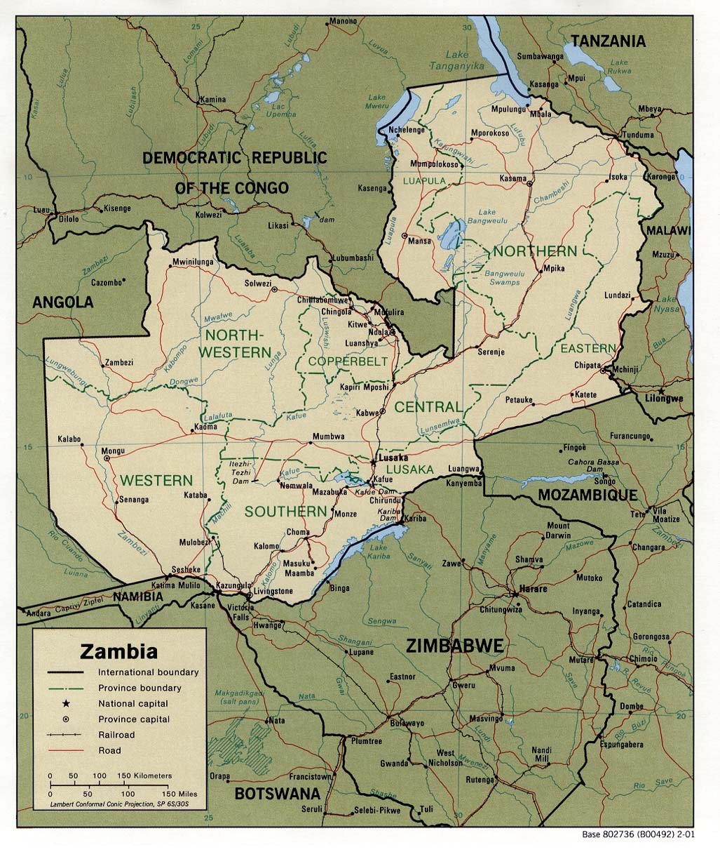
Country Maps- Zambia (Political) 2001 (275K) and pdf format (286K)
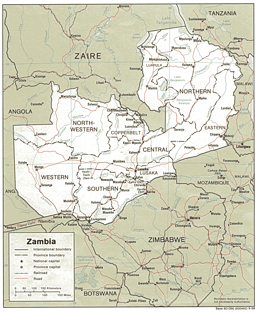
- Zambia (Political) 1988 (257K) and pdf format (280K)
- Zambia (Shaded Relief) 2001 (314K) and pdf format (321K)
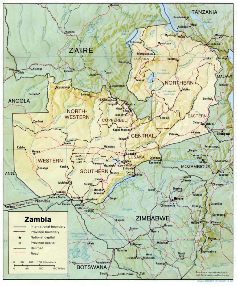
- Zambia (Shaded Relief) 1988 (255K) and pdf format (233K)
- Zambia (Small Map) 2016 (15.5K)
- 1:2,000,000 - Africa Topographic Maps U.S. Army Map Service, Series 2201
- Sheets 27, 28, 30 and 31 cover Zambia
- 1:1,000,000 - Operational Navigation Chart Series U.S. Defense Mapping Agency Aerospace Center. Not for navigational use
- This series includes all of Zambia
- 1:1,000,000 - International Map of the World U.S. Army Map Service.
- Includes most of Northern Rhodesia (now Zambia). Clickable index map
- 1:500,000 - Tactical Pilotage Charts U.S. National Imagery and Mapping Agency. Not for navigational use
- This series covers most of Zambia
- 1:250,000 - Joint Operations Graphic (Air) Series 1501, U.S. Defense Intelligence Agency Not for navigational use
- Covers parts of Zambia neighboring Katanga, Democratic Republic of Congo. Courtesy of T. R. Smith Map Collection, University of Kansas Libraries
- 1:250,000 - East Africa Series Y502, U.S. Army Map Service. Not for navigational use
- Sheets 27, 28, 30 and 31 cover Zambia
Related Maps on Other Web Sites